- Page 1 and 2:
INTERNATIONAL BIBLIOGRAPHY OF VEGET
- Page 3 and 4:
INTERNATIONAL BIBLIOGRAPHY OF VEGET
- Page 5 and 6:
Copyright 1970 by the University of
- Page 7 and 8:
Contents AFRICA A. W. Kiichler 1 Ea
- Page 9 and 10:
AFRICA AFRICA by A. W. KÜCHLER 187
- Page 11 and 12:
AFRICA PASSARGE, S. 1908 "Die natü
- Page 13 and 14:
AFRICA IL Tall grass 12. Acacia-des
- Page 15 and 16:
AFRICA 3. Savanne 11. Busch der sü
- Page 17 and 18:
AFRICA LEGEND 1. Forêt ombrophile
- Page 19 and 20:
6. Coniferous enclaves Grassland 7.
- Page 21 and 22:
AFRICA c. Forests of Mayombé, Bas
- Page 23 and 24:
AFRICA C. High montane communities
- Page 25 and 26:
AFRICA 8. Forest-savanna mosaic 9.
- Page 27 and 28:
AFRICA PHILLIPS, JOHN 1959 Agricult
- Page 29 and 30:
AFRICA 8. Forêts denses humides se
- Page 31 and 32:
AFRICA 19. Diplorhynchus shrub sava
- Page 33 and 34:
1964 AFRIKA: RASTITEI/NOST' (VEGETA
- Page 35 and 36:
AFRICA schimperi, Buxus hildebrandt
- Page 37 and 38:
AFRICA 73. Afro-Alpine vegetation o
- Page 39 and 40:
EAST AFRICA EAST AFRICA by A. W. K
- Page 41 and 42:
EAST AFRICA 4. Subdesert shrub and
- Page 43 and 44:
c. Shrub desert 8. Desert 9. Swamp
- Page 45 and 46:
EQUATORIAL AFRICA LEGEND 1. Foret v
- Page 47 and 48:
NORTH AND NORTHEAST AFRICA NORTH AN
- Page 49 and 50:
NORTH AND NORTHEAST AFRICA 7. Zizyp
- Page 51 and 52:
NORTH AND NORTHEAST AFRICA 1961 "TY
- Page 53 and 54:
SOUTH AFRICA WILD, H. 1953 "Vegetat
- Page 55 and 56:
SOUTH AFRICA 1963 "SOUTHERN AFRICA:
- Page 57 and 58:
11. Acajou (Khaya divers, Entandrop
- Page 59 and 60:
WEST AFRICA 1933 "CARTE GEOBOTANIQU
- Page 61 and 62:
WEST AFRICA ANONYMOUS 1943 Trench W
- Page 63 and 64:
30. Euphorbiaie en brousse, hauteur
- Page 65 and 66:
WEST AFRICA 140. Savane-parc, plate
- Page 67 and 68:
WEST AFRICA BAKER, H. G. 1962 "The
- Page 69 and 70:
ALGERIA ALGERIA by A. W. KÜCHLER 1
- Page 71 and 72:
ALGERIA g. Faciès à chêne kermè
- Page 73 and 74:
OZENDA, P. and J. KERAUDREN ALGERIA
- Page 75 and 76:
e. Marais salants f. Halipèdes g.
- Page 77 and 78:
ANGOLA ANGOLA by ANTONIO N. TELES 1
- Page 79 and 80:
ANGOLA 35. Savanas de Andropogoneae
- Page 81 and 82:
ANGOLA 1957 "CARTA FITOGEOGRAFICA D
- Page 83 and 84:
23. Delta grassland 24. Fringing pa
- Page 85 and 86:
6. Savanes boisées à Acacia carnp
- Page 87 and 88:
CAMEROON CAMEROON by JEAN-LOUIS TRO
- Page 89 and 90:
CAMEROON 1958 "BAMENDA, S. CAMEROON
- Page 91 and 92:
CANARY ISLANDS LEGEND 1. Lorbeer "v
- Page 93 and 94:
CAPE VERDE ISLANDS CAPE VERDE ISLAN
- Page 95 and 96:
CAPE VERDE ISLANDS TEIXEIRA, A. J.
- Page 97 and 98:
CHAD CHAD by JEAN-LOUIS TROCHAIN 19
- Page 99 and 100:
CHAD Panicum spp., Sporobolus jesti
- Page 101 and 102:
CONGO (BRAZZAVILLE) CONGO (BRAZZAVI
- Page 103 and 104:
CONGO (KINSHASA) 1923 "LA FORET ÉQ
- Page 105 and 106:
3. Id., faciès à Cynometra Alexan
- Page 107 and 108:
CONGO (KINSHASA) 8. Formation subal
- Page 109 and 110:
CONGO (KINSHASA) DELEVOY, G. 1946 I
- Page 111 and 112:
CONGO (KINSHASA) 1. Sociation à Pe
- Page 113 and 114:
CONGO (KINSHASA) 8. Déserts sud-af
- Page 115 and 116:
CONGO (KINSHASA) 1923-1952 "KATANGA
- Page 117 and 118:
CONGO (KINSHASA) 2. Parasoleraie (M
- Page 119 and 120:
CONGO (KINSHASA) 17. Forêts semi-c
- Page 121 and 122:
CONGO (KINSHASA) LEGEND L Marais à
- Page 123 and 124:
CONGO (KINSHASA) 7. Végétation de
- Page 125 and 126:
CONGO (KINSHASA) 44. Savane à Cymb
- Page 127 and 128:
CONGO (KINSHASA) LEGEND A. Forêt B
- Page 129 and 130:
EGYPT 12. Association of Zygophyllu
- Page 131 and 132:
EQUATORIAL GUINEA LEGEND 1. Litori
- Page 133 and 134:
ETHIOPIA NEGRI, G. 1937 "Il Paesagg
- Page 135 and 136:
GHANA GHANA J. F. HARRISON, MARTIN
- Page 137 and 138:
GHANA LEGEND 1. Reserved forest 2.
- Page 139 and 140:
GHANA AHN, P. N. 1961 Soils of the
- Page 141 and 142:
GUINEA b. Pita c. Labe 5. Prairie
- Page 143 and 144:
IVORY COAST MANGENOT, GEORGES and J
- Page 145 and 146:
IVORY COAST 10. Forêt sur plateau
- Page 147 and 148:
9. Desert scrub 10. Desert grass an
- Page 149 and 150:
KENYA 1960 "DETAILED DIANI BEACH KW
- Page 151 and 152:
KENYA a. Marginal Crotón scarp typ
- Page 153 and 154:
a. Acacia thicket with Capparidacea
- Page 155 and 156:
KENYA 26. Open evergreen and semi-d
- Page 157 and 158:
LESOTO LESOTO J. F. HARRISON, MARTI
- Page 159 and 160:
LIBYA LIBYA by A. W. KÜCHLER 1914
- Page 161 and 162:
LIBYA Egypt with special reference
- Page 163 and 164:
MADAGASCAR LEGEND 1. Forêts 3. Vé
- Page 165 and 166:
MADAGASCAR LEGEND 1. Bush à xérop
- Page 167 and 168:
MADAGASCAR LEANDRI, JACQUES 193 7 "
- Page 169 and 170:
MADAGASCAR 12. Taches de Melinis mi
- Page 171 and 172:
MADAGASCAR 1953 "CARTE D'UTILISATIO
- Page 173 and 174:
RIQUIER, JEAN MADAGASCAR 1954 [Sepa
- Page 175 and 176:
MADAGASCAR 1954-1955 "CARTE D'UTILI
- Page 177 and 178:
LEGEND MADAGASCAR 1. Terres sous cu
- Page 179 and 180:
1955 "CARTE D'UTILISATION DES SOLS:
- Page 181 and 182:
16. Peuplement mixte Acacia-Eucalyp
- Page 183 and 184:
. Savane boisée c. Savane d. Faci
- Page 185 and 186:
MALAWI ANONYMOUS 1959 Nyasaland, sh
- Page 187 and 188:
MALI 5. Transition de l'Afrosaltus
- Page 189 and 190:
18. Eleusine indica 19. Oryza-Acroc
- Page 191 and 192:
MAURITIUS MAURITIUS by J. F. HARRIS
- Page 193 and 194:
MOROCCO MOROCCO by A. W. KÜCHLER A
- Page 195 and 196:
MOROCCO Artemisia Herba aîba; au M
- Page 197 and 198:
MOROCCO b. Faciès à Anabasis aphy
- Page 199 and 200:
MOROCCO 25. Faciès à Cichorium In
- Page 201 and 202:
MOROCCO 24. Groupements à Limonium
- Page 203 and 204:
MOROCCO A. Association à Planiago
- Page 205 and 206:
D. Associations sur sols profonds 6
- Page 207 and 208:
MOROCCO LEGEND A. Groupements Psamm
- Page 209 and 210:
MOROCCO 1958 "CARTE DES GROUPEMENTS
- Page 211 and 212:
MOROCCO 1959 "ÉTAGES DE VEGETATION
- Page 213 and 214:
MOROCCO 24. Milieu halophile à Spe
- Page 215 and 216:
11. Sous-association à Plantago co
- Page 217 and 218:
MOROCCO 15. Erme buissoneux 16. Erm
- Page 219 and 220:
MOZAMBIQUE 1947 "CARTE FITOGEOGRAFI
- Page 221 and 222:
MOZAMBIQUE 1947 "CARTE FITOGEOGRÁF
- Page 223 and 224:
MOZAMBIQUE de Chloris Gay ana, Echi
- Page 225 and 226:
MOZAMBIQUE 1953 "ESBOÇO DOS MAIS I
- Page 227 and 228:
MOZAMBIQUE 38. Zona altimontana de
- Page 229 and 230:
MOZAMBIQUE LEGEND 1. Mixed woodland
- Page 231 and 232:
MOZAMBIQUE LEGEND A. Serra B. Vale
- Page 233 and 234:
NIGER NIGER by JEAN-LOUIS TROCHAIN
- Page 235 and 236:
NIGERIA NIGERIA by J. F. HARRISON,
- Page 237 and 238:
NIGERIA ROSEVEAR, D. R. 1953 Checkl
- Page 239 and 240:
NIGERIA 8. Farmed parkland 9. Flood
- Page 241 and 242: NIGERIA 3. Northern Guinea zone 4.
- Page 243 and 244: NIGERIA LEGEND 1. Anogeissus woodla
- Page 245 and 246: NIGERIA 3. Rain forest-savanna mosa
- Page 247 and 248: PORTUGUESE GUINEA PORTUGUESE GUINEA
- Page 249 and 250: RHODESIA 2. Terminalia tree veld 3.
- Page 251 and 252: RHODESIA LEGEND 1. Terminalia serie
- Page 253 and 254: RODRIGUEZ RODRIGUEZ by J. F. HARRIS
- Page 255 and 256: RWANDA 1956 "DISTRIBUTION DE LA VEG
- Page 257 and 258: SAO TOME and PRINCIPE TENREIRO, F.
- Page 259 and 260: SENEGAL 5. Dunes B. Secteur Lougaie
- Page 261 and 262: SKXEGAÎ, 27. Groupement à Sporobo
- Page 263 and 264: SENEGAL a. Parcours sur terrasses e
- Page 265 and 266: SIERRA LEONE 2. Primary evergreen f
- Page 267 and 268: SIERRA LEONE ANONYMOUS 1960 [Separa
- Page 269 and 270: desert grass and halophitic desert
- Page 271 and 272: SOMALIA 22. Salt flats 23. Sand dun
- Page 273 and 274: SOUTHWEST AFRICA 3. Grassteppe mit
- Page 275 and 276: SUDAN SUDAN by J. F. HARRISON, MART
- Page 277 and 278: SUDAN 4. Acacia—tall grass countr
- Page 279 and 280: SUDAN LEGEND 1. Desert 2. Semi-dese
- Page 281 and 282: 5. Flood region 6. Montane vegetati
- Page 283 and 284: SUDAN mellifera, A. nubica, A. tort
- Page 285 and 286: SWAZILAND SWAZILAND by J. F. HARRIS
- Page 287 and 288: TANZANIA TANZANIA by J. F. HARRISON
- Page 289 and 290: TANZANIA 1912 "SCHEMATISCHE BODEN-
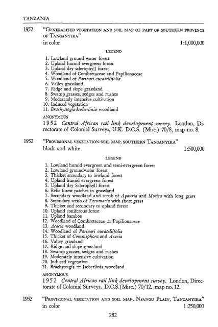
- Page 291: TANZANIA 11. Actively induced veget
- Page 295 and 296: TANZANIA 3. Principally brush or wo
- Page 297 and 298: TANZANIA ANDERSON, G. D. and L. M.
- Page 299 and 300: TUNISIA 1941 "PFLANZENKLEID UND BOD
- Page 301 and 302: TUNISIA 5. Association à Eragrosti
- Page 303 and 304: TUNISIA LEGEND 1. Association à Su
- Page 305 and 306: TUNISIA C. Zone Subdésertique 10.
- Page 307 and 308: TUNISIA 2. Série du Chêne liège
- Page 309 and 310: TUNÍSIA c. Groupement à Thymus ca
- Page 311 and 312: TUNISIA 85. Groupement à Kremeria
- Page 313 and 314: TUNISIA santhemum segetum 150. Grou
- Page 315 and 316: TUNISIA 216. Groupement à Artemisi
- Page 317 and 318: JACQUINET, J. C. and A. SOLER TUNIS
- Page 319 and 320: TUNISIA 58. Sous-association à Glo
- Page 321 and 322: TUNISIA 29. Groupement à Ormenis m
- Page 323 and 324: UGANDA 1946 "UGANDA PROTECTORATE—
- Page 325 and 326: UGANDA 40. Undefined thicket woodla
- Page 327 and 328: UGANDA 94. Hyparrhenia dissoluta-Pa
- Page 329 and 330: UGANDA 25. Herb swamp 26. High mont
- Page 331 and 332: UGANDA 21. Combretum gueinzii—Lou
- Page 333 and 334: 48'. Miscanthidium violaceum consoc
- Page 335 and 336: 3. Undefined thicket woodland UGAND
- Page 337 and 338: UGANDA 8. Cymbopogon afronardus—
- Page 339 and 340: UGANDA 73. Claudium jamaicense—Cy
- Page 341 and 342: UGANDA LEGEND A. Forest dry montane
- Page 343 and 344:
UGANDA ORMASTON, M. A. 19 60 Workin
- Page 345 and 346:
UGANDA b. Temperate mixed forest C.
- Page 347 and 348:
33. Combretum—Hyparrhenia 34. Com
- Page 349 and 350:
UNION OF SOUTH AFRICA UNION OF SOUT
- Page 351 and 352:
UNION OF SOUTH AFRICA 1923 "MAP OF
- Page 353 and 354:
UNION OF SOUTH AFRICA 1937 "THE DIS
- Page 355 and 356:
UNION OF SOUTH AFRICA POLE-EVANS, I
- Page 357 and 358:
9. Lowveld sour bushveld III. Tropi
- Page 359 and 360:
UNION OF SOUTH AFRICA 1. Coastal bu
- Page 361 and 362:
7. Sweetgrass Danthonia karroo veld
- Page 363 and 364:
UNION OF SOUTH AFRICA MARTIN, A. R.
- Page 365 and 366:
UNION OF SOUTH AFRICA WELLS, M. J.
- Page 367 and 368:
ZAMBIA ZAMBIA by J, F. HARRISON, MA
- Page 369 and 370:
9. Brachystegia Hoc\ii woodlands 10
- Page 371 and 372:
ZAMBIA 1960 "NORTHERN RHODESIA, CHA
- Page 373 and 374:
ZAMBIA LEGEND 1. Thicket 4. Savanna
- Page 375 and 376:
SOUTH AMERICA SOUTH AMERICA by A. W
- Page 377 and 378:
SOUTH AMERICA LAMB, W. H. 1916 In Z
- Page 379 and 380:
SOUTH AMERICA 4. Hardwood and conif
- Page 381 and 382:
SOUTH AMERICA LEGEND 1. Tropischer
- Page 383 and 384:
SOUTH AMERICA LEGEND 1. Alpine form
- Page 385 and 386:
SOUTH AMERICA 1932 "GUAYANA" black
- Page 387 and 388:
c. Salzpflanzensteppen 4. Grasflure
- Page 389 and 390:
SOUTH AMERICA 1937 "BEGRENZUNG UND
- Page 391 and 392:
SOUTH AMERICA ANONYMOUS 1942 [Separ
- Page 393 and 394:
UNSTEAD, J. F. and E. G. R. TAYLOR,
- Page 395 and 396:
SOUTH AMERICA V. Alpine A. Puna gra
- Page 397 and 398:
SOUTH AMERICA 1. Mata de Araucarias
- Page 399 and 400:
SOUTH AMERICA Boletín, No. 2, at e
- Page 401 and 402:
33. Grenze weniger gut bekannt Nach
- Page 403 and 404:
SOUTH AMERICA green equatorial fore
- Page 405 and 406:
SOUTH AMERICA tectorum, Mauritia fl
- Page 407 and 408:
SOUTH AMERICA 40°03' S, forests up
- Page 409 and 410:
SOUTH AMERICA Nach Entwiirfen von P
- Page 411 and 412:
ARGENTINA ARGENTINA by EDUARDO CANO
- Page 413 and 414:
ARGENTINA b. Subformación de los p
- Page 415 and 416:
ARGENTINA 1913 "KARTE DES REISEWEGE
- Page 417 and 418:
ARGENTINA 1947, 1:760,000 in Hauman
- Page 419 and 420:
ARGENTINA 1924 "A PART OF NORTHERN
- Page 421 and 422:
ARGENTINA 1:15,200,000 in Kühn, F.
- Page 423 and 424:
ARGENTINA LEGEND 1. Terrenos arenos
- Page 425 and 426:
ARGENTINA KOEHLER, PABLO 1936 "Info
- Page 427 and 428:
ARGENTINA 1938 MAPA FITOGEOGRAFICO
- Page 429 and 430:
ARGENTINA 1941 "DAS WALDGEBIET OSTP
- Page 431 and 432:
ARGENTINA FRENGUELLI, JOAQUIN 1941
- Page 433 and 434:
ARGENTINA la industria forestal." P
- Page 435 and 436:
ARGENTINA DAUS, FEDERICO A. 1945 in
- Page 437 and 438:
ARGENTINA 1949 "TUCUMÁN REGION" bl
- Page 439 and 440:
ARGENTINA LEGEND 1. Bosques skiófi
- Page 441 and 442:
ARGENTINA printed: 1953, 1:870,000
- Page 443 and 444:
ARGENTINA 1954 "REGIONALES AUFTRETE
- Page 445 and 446:
ARGENTINA PAPADAKIS, JUAN 1956 "Inf
- Page 447 and 448:
ARGENTINA LEGEND 1. Flechillar tipi
- Page 449 and 450:
ARGENTINA 1962 "VEGETACIÓN DEL DEL
- Page 451 and 452:
ARGENTINA decorücans-Condalia micr
- Page 453 and 454:
BOLIVIA BOLIVIA by A. W. KÜCHLER 1
- Page 455 and 456:
BOLIVIA JAMES, PRESTON E. 1942 Lati
- Page 457 and 458:
BRAZIL 3. Região litoral 4. Pantan
- Page 459 and 460:
BRAZIL LEGEND 1. Caatinga 6. Borrac
- Page 461 and 462:
BRAZIL B. Raub- und Nutzland 3. Gel
- Page 463 and 464:
BRAZIL LEGEND 1. Rain forest 4. Sav
- Page 465 and 466:
BRAZIL LEGEND 1. Mangues 2. Campos
- Page 467 and 468:
BRAZIL CASTRO SOARES, LÚCIO DE . 1
- Page 469 and 470:
BRAZIL MAACK, REINHARD 1950 [Separa
- Page 471 and 472:
BRAZIL 1952 "PLANTA FITOGEOGRÁFICA
- Page 473 and 474:
BRAZIL LEGEND I. Tropisch dauerndhu
- Page 475 and 476:
BRAZIL 4. Floresta tropical da Serr
- Page 477 and 478:
BRAZIL AZEVEDO, LUIZ GUIMARÃES DE
- Page 479 and 480:
BRAZIL LEGEND 1. Floresta equatoria
- Page 481 and 482:
BRAZIL DUQUE, J. G. 1963 [Separatel
- Page 483 and 484:
BRAZIL LEGEND 1. Mata latifoliada 2
- Page 485 and 486:
CHILE 4. Regenwald 5. Hochgebirge
- Page 487 and 488:
CHILE SCHMITHÜSEN, JOSEF 1956 "Die
- Page 489 and 490:
COLOMBIA LEGEND 1, Paramos au-dessu
- Page 491 and 492:
COLOMBIA 1960 "FOREST ASSOCIATION M
- Page 493 and 494:
COLOMBIA 20. Complex of the Trachyp
- Page 495 and 496:
2. Región andina sub-tropical 3. R
- Page 497 and 498:
1962 "VEGETATIONSFORMEN, ECUADOR" i
- Page 499 and 500:
PARAGUAY PARAGUAY by JUAN ALBERTO L
- Page 501 and 502:
3. Monte 8. Savanna 4. Monte-prairi
- Page 503 and 504:
PARAGUAY 3. Campos, limpios y cerra
- Page 505 and 506:
PERU 10. Makrotherme, regengrüne G
- Page 507 and 508:
PERU 2. Lomas of the coast 3. Dista
- Page 509 and 510:
PERU 3. Bosque espinoso tropical 4.
- Page 511 and 512:
PERU 2. Bosques de los terrazas pla
- Page 513 and 514:
SURINAME SURINAME by A. W. KÜCHLER
- Page 515 and 516:
SURINAME 1953 "WiAwiA FLAT' in colo
- Page 517 and 518:
VENEZUELA VENEZUELA by VALOIS GONZA
- Page 519 and 520:
VENEZUELA 5. Páramos and permanent
- Page 521 and 522:
VENEZUELA b. Sabana. Plano, drenaje
- Page 523 and 524:
VENEZUELA c. Chaparrales. Llanos d.
- Page 525 and 526:
VENEZUELA 1959 "VEGETACIÓN (VENEZU
- Page 527 and 528:
VENEZUELA LEGEND 1. Sabanas de Trac
- Page 529 and 530:
VENEZUELA 21. Bosque de transición
- Page 531 and 532:
WORLD D. Oceanische Inselfloren 24.
- Page 533 and 534:
WORLD DAVTES, J. HUDSON 1915 [Timbe
- Page 535 and 536:
WORLD 12. Tropical savanna III. Des
- Page 537 and 538:
WORLD KOEGEL, LUDWIG 193 2 "Die Wâ
- Page 539 and 540:
WORLD 1949 "ORIGINAL NATURAL VEGETA
- Page 541 and 542:
WORLD F. Mixed vegetation with gras
- Page 543 and 544:
WORLD LEGEND 1. American rain-fores
- Page 545 and 546:
WORLD 1954 "NATURAL VEGETATION REGI
- Page 547 and 548:
WORLD 18. Arid desert shrub 19. Pla
- Page 549 and 550:
WORLD 12. Virginian (mixed deciduou
- Page 551 and 552:
WORLD Wooded Savanna 26. Subhumid w
- Page 553 and 554:
WORLD 1964 "CARTE DES GRANDES FORMA
- Page 555 and 556:
67. Guinean-Sudanian formations 68.
- Page 557 and 558:
WORLD 32. Tropische immergrüne Eic
- Page 559 and 560:
142. Káltewüsten 143. Oaseiwegeta
- Page 561 and 562:
EASTERN HEMISPHERE 1. Tundra 2. Sem
- Page 563 and 564:
EASTERN HEMISPHERE 1956 "BOREAL VEG
- Page 565 and 566:
WESTERN HEMISPHERE WESTERN HEMISPHE
- Page 567 and 568:
WESTERN HEMISPHERE DAVffiS, J. HUDS
- Page 569 and 570:
WESTERN HEMISPHERE LEGEND 1. Humid


