DEFiNitiON, DEScRiPtiON ANd MAPPiNG OF ... - Danube Limes
DEFiNitiON, DEScRiPtiON ANd MAPPiNG OF ... - Danube Limes
DEFiNitiON, DEScRiPtiON ANd MAPPiNG OF ... - Danube Limes

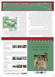
Erfolgreiche ePaper selbst erstellen
Machen Sie aus Ihren PDF Publikationen ein blätterbares Flipbook mit unserer einzigartigen Google optimierten e-Paper Software.
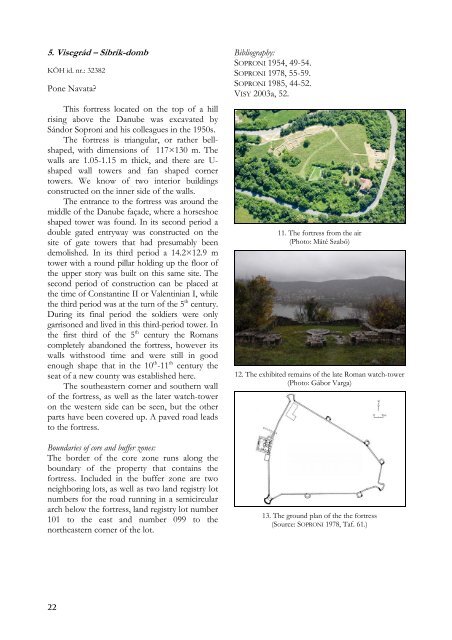
5. Visegrád – Sibrik-domb<br />
KÖH id. nr.: 32382<br />
Pone Navata?<br />
This fortress located on the top of a hill<br />
rising above the <strong>Danube</strong> was excavated by<br />
Sándor Soproni and his colleagues in the 1950s.<br />
The fortress is triangular, or rather bellshaped,<br />
with dimensions of 117×130 m. The<br />
walls are 1.05-1.15 m thick, and there are Ushaped<br />
wall towers and fan shaped corner<br />
towers. We know of two interior buildings<br />
constructed on the inner side of the walls.<br />
The entrance to the fortress was around the<br />
middle of the <strong>Danube</strong> façade, where a horseshoe<br />
shaped tower was found. In its second period a<br />
double gated entryway was constructed on the<br />
site of gate towers that had presumably been<br />
demolished. In its third period a 14.2×12.9 m<br />
tower with a round pillar holding up the floor of<br />
the upper story was built on this same site. The<br />
second period of construction can be placed at<br />
the time of Constantine II or Valentinian I, while<br />
the third period was at the turn of the 5 th century.<br />
During its final period the soldiers were only<br />
garrisoned and lived in this third-period tower. In<br />
the first third of the 5 th century the Romans<br />
completely abandoned the fortress, however its<br />
walls withstood time and were still in good<br />
enough shape that in the 10 th -11 th century the<br />
seat of a new county was established here.<br />
The southeastern corner and southern wall<br />
of the fortress, as well as the later watch-tower<br />
on the western side can be seen, but the other<br />
parts have been covered up. A paved road leads<br />
to the fortress.<br />
Boundaries of core and buffer zones:<br />
The border of the core zone runs along the<br />
boundary of the property that contains the<br />
fortress. Included in the buffer zone are two<br />
neighboring lots, as well as two land registry lot<br />
numbers for the road running in a semicircular<br />
arch below the fortress, land registry lot number<br />
101 to the east and number 099 to the<br />
northeastern corner of the lot.<br />
22<br />
Bibliography:<br />
SOPRONI 1954, 49-54.<br />
SOPRONI 1978, 55-59.<br />
SOPRONI 1985, 44-52.<br />
VISY 2003a, 52.<br />
11. The fortress from the air<br />
(Photo: Máté Szabó)<br />
12. The exhibited remains of the late Roman watch-tower<br />
(Photo: Gábor Varga)<br />
13. The ground plan of the the fortress<br />
(Source: SOPRONI 1978, Taf. 61.)