DEFiNitiON, DEScRiPtiON ANd MAPPiNG OF ... - Danube Limes
DEFiNitiON, DEScRiPtiON ANd MAPPiNG OF ... - Danube Limes
DEFiNitiON, DEScRiPtiON ANd MAPPiNG OF ... - Danube Limes

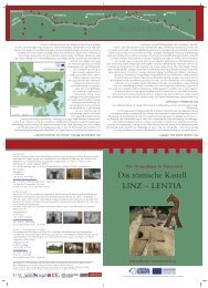
Erfolgreiche ePaper selbst erstellen
Machen Sie aus Ihren PDF Publikationen ein blätterbares Flipbook mit unserer einzigartigen Google optimierten e-Paper Software.
6. Visegrád – Szentgyörgypuszta<br />
KÖH id. nr.: 58667<br />
Burgus Solva – 28<br />
This watch-tower that stands on a hillside<br />
facing the <strong>Danube</strong> was studied by Sándor<br />
Soproni in 1955. He published the ground plan<br />
of the watch-tower on the basis of the results of<br />
test excavations, and according to this the tower<br />
was 10.4×10.2 m, and its walls were 1.05 m<br />
thick.<br />
On the basis of the finds that have been<br />
discovered as well as the Caris trb. and<br />
Frigeridus dux stamped bricks, it was built<br />
during the time of Valentinian I.<br />
The watch-tower cannot be seen today, but<br />
the hill covering the ruins stands out<br />
prominently from the surroundings. At the time<br />
of its excavation there was a clear view of the<br />
<strong>Danube</strong> from this open hillside, but now trees<br />
screen the view and the hill is slowly being<br />
overrun by the forest. The area is accessible<br />
from a paved road and is not fenced off.<br />
Boundaries of core and buffer zones:<br />
The square border of the core zone does not<br />
correspond to the walls of the watch-tower,<br />
because they cannot be surveyed now, but<br />
instead has been determined by points<br />
measured with GPS at the foot of the hill<br />
covering the watch-tower. The buffer zone<br />
comprises the boundaries of the properties<br />
bordering the core zone, and the area of the<br />
road (land registry lot number: 1516) only to the<br />
eastern border of the property with the land<br />
registry lot number 1504.<br />
24<br />
Bibliography:<br />
SOPRONI 1972, 39-43.<br />
SOPRONI 1978, 60.<br />
14. The hill covering the remains of the watch-tower<br />
(Photo: Gábor Varga)<br />
15. The ground plan of the watch-tower<br />
(Digitalization: PTE)