DEFiNitiON, DEScRiPtiON ANd MAPPiNG OF ... - Danube Limes
DEFiNitiON, DEScRiPtiON ANd MAPPiNG OF ... - Danube Limes
DEFiNitiON, DEScRiPtiON ANd MAPPiNG OF ... - Danube Limes

Sie wollen auch ein ePaper? Erhöhen Sie die Reichweite Ihrer Titel.
YUMPU macht aus Druck-PDFs automatisch weboptimierte ePaper, die Google liebt.
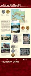
Part 1: Hungary<br />
1. The Ripa Pannonica in Hungary<br />
as a proposed World Heritage site<br />
The exterior border of Pannonia, the<br />
<strong>Danube</strong> River was also a border of the Roman<br />
Empire, and was often the scene of decisive<br />
events during the approximately 450 years of its<br />
existence. During every period, a military<br />
presence of differing character, type and<br />
strength along the ripa Pannonica provided the<br />
security that protected the province from<br />
invasion and acted as a base for Roman<br />
advances during times of war, and in times of<br />
peace ensured the wide ranging economic and<br />
other connections with the inhabitants of<br />
Barbaricum.<br />
Rome took possession of the territory of<br />
Pannonia during the time of Augustus, and it<br />
was also during the time of this emperor that its<br />
significance to the Roman Empire took shape.<br />
This empire was one of the most expansive<br />
states in history, and grew through later<br />
conquests until at the time of its greatest extent<br />
in the 2nd century C.E. it spread over three<br />
continents and had a border that was<br />
approximately 5000 km long. This border, the<br />
limes, relied upon natural obstacles (mountain<br />
ridges, deserts, rivers or seas) for the most part,<br />
but where this was not possible and where the<br />
political circumstances made it necessary, manmade<br />
walls and earthworks were erected. While<br />
we know of many of these (in Britannia,<br />
Germania, Dacia and Africa) the best-known<br />
was Hadrian’s Wall constructed for Britannia,<br />
but there was also the short-lived Antonine<br />
Wall (sod and earth), as well as the limes of<br />
Germania Superior and Raetia, where wooden<br />
palisades and stone walls were built.<br />
The <strong>Danube</strong> formed the exterior border of<br />
Pannonia, functioning as both a transportation<br />
route and as a boundary line and natural<br />
obstacle. A characteristic of Roman river<br />
borders, or ripa, was that no special defensive<br />
boundary (earthworks, walls or palisades) was<br />
constructed. Military camps (castra, castella) that<br />
were erected from ever stronger materials and<br />
Zsolt Visy<br />
in ever more permanent forms, and the road<br />
connecting these (the limes road) were however<br />
constructed, as well as smaller military<br />
structures (fortlets and towers) on the banks of<br />
the <strong>Danube</strong>. According to the characteristic<br />
mode of the linear border defense of Pannonia,<br />
the entire military force of the province was<br />
stationed along this borderline. This was where<br />
the military vici and canabae were built in the<br />
vicinity of the forts, and then later the cities<br />
established a bit further from the legionary<br />
fortresses. The military control extended to the<br />
other side of the <strong>Danube</strong> as well, since Rome<br />
considered the border rivers and their<br />
immediate shorelines – and as has been shown<br />
in certain cases areas even further afield – as its<br />
own. In accordance with this, forts and<br />
bridgeheads were also built in these areas.<br />
The study of Roman history and within<br />
this, research into the Roman limes stretches<br />
back many centuries throughout Europe. The<br />
visible remains of the limes – earthworks and<br />
walls that can be seen for miles, the known and<br />
suspected path of the military roads and the<br />
innumerable fortifications that follow identical<br />
structural principles – drew attention to<br />
themselves early on, and their description, as<br />
well as their recording on maps and in drawings<br />
has continued at an ever greater pace since the<br />
16th-17th century. Regarded as a classic, J.<br />
Collingwood Bruce’s handbook on Hadrian’s<br />
Wall was first published in 1863, compiled on<br />
the basis of the earliest thorough archaeological<br />
work, and is still now considered a standard on<br />
the subject. In Germany, Theodor Mommsen<br />
proposed setting up the Deutsche<br />
Reichslimeskommission, which through its<br />
precise and thorough work that started at the<br />
end of the 19th century and was performed by<br />
numerous archaeologists as well as enthusiastic<br />
and able amateurs, surveyed the section of the<br />
border that connected the Rhine and <strong>Danube</strong><br />
rivers, compiling and publishing a series of<br />
5