

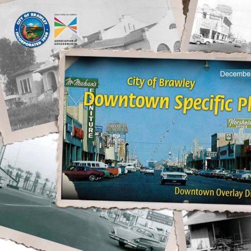
Downtown Specific Plan - Part 1 - City of Brawley
Downtown Specific Plan - Part 1 - City of Brawley
Downtown Specific Plan - Part 1 - City of Brawley

You also want an ePaper? Increase the reach of your titles
YUMPU automatically turns print PDFs into web optimized ePapers that Google loves.
Acknowledgments<br />
2009 grant Funded demonstration Project<br />
This is a project <strong>of</strong> the <strong>City</strong> <strong>of</strong> <strong>Brawley</strong> with funding provided by the<br />
Southern California Association <strong>of</strong> Governments’ (SCAG) Compass Blueprint<br />
Demonstration Project Program. Compass Blueprint assists Southern<br />
California cities and other organizations in evaluating planning options and<br />
stimulating development consistent with the region’s goals.<br />
The preparation <strong>of</strong> this <strong>Specific</strong> <strong>Plan</strong> was funded in part through grants<br />
from the United States Department <strong>of</strong> Transportation (USDOT)—Federal<br />
Highway Administration and Federal Transit Administration, in accordance<br />
with the Metropolitan <strong>Plan</strong>ning Program, Section 104(f) <strong>of</strong> Title 23 <strong>of</strong> the U.S.<br />
Code. Additional assistance was provided by the State <strong>of</strong> California Business,<br />
Transportation and Housing Agency through a California Regional Blueprint<br />
<strong>Plan</strong>ning Grant.<br />
The contents <strong>of</strong> this <strong>Specific</strong> <strong>Plan</strong> reflect the views <strong>of</strong> the author who is<br />
responsible for the facts and accuracy <strong>of</strong> the data presented herein. The<br />
contents do not necessarily reflect the <strong>of</strong>ficial views or policies <strong>of</strong> SCAG,<br />
USDOT or the State <strong>of</strong> California. This report does not constitute a standard,<br />
specification or regulation. SCAG shall not be responsible for the future use<br />
or adaptation <strong>of</strong> the report.<br />
Acknowledgements
This page intentionally left blank.
Acknowledgments<br />
cItY oF BRAwleY<br />
Community <strong>of</strong> <strong>Brawley</strong><br />
<strong>City</strong> Council<br />
Ryan Kelley, Mayor<br />
Don C. Campbell, Mayor Pro Tem<br />
George Nava, Council Member<br />
Miguel Miranda, Council Member<br />
Sam Couchman, Council Member<br />
<strong>Plan</strong>ning Commission<br />
Insert Listing Per Gordon Gaste<br />
<strong>City</strong> Staff<br />
Gary Burroughs, <strong>City</strong> Manager<br />
Dennis Morita, <strong>City</strong> Attorney<br />
Alma Benavides, <strong>City</strong> Clerk<br />
Ruby Walla, Interim Finance Director<br />
Shirley Bonillas, Personnel and Risk Management Administrator<br />
Gordon Gaste, <strong>Plan</strong>ning Director<br />
Mark Gillmore, Chief <strong>of</strong> Police<br />
Frank Contreras, Fire Chief<br />
Francisco Soto, Building Official<br />
Yazmin Arellano, <strong>City</strong> Engineer<br />
Karin Morgan, Parks, Recreation and Community Services Director<br />
Marjo Mello, Library Director<br />
Acknowledgements<br />
Teresa Santiago, Senior Community and Economic Development Analyst<br />
<strong>Brawley</strong> Chamber <strong>of</strong> Commerce<br />
<strong>Brawley</strong> Economic Development Commission<br />
consUltAnt teAm<br />
RBF Consulting | Irvine, California<br />
Urban Design Studio<br />
Transportation Department<br />
Water Resources Department<br />
MR+E | Metropolitan Research and Economics<br />
David Bergman, Economist
This page intentionally left blank.
tABle oF contents<br />
1. Introduction and User’s guide<br />
1.1 Introduction .................................................................1-2<br />
1.1.1 <strong>Specific</strong> <strong>Plan</strong> Overview and Purpose<br />
1.1.2 <strong>Specific</strong> <strong>Plan</strong> Authority<br />
1.1.3 <strong>Specific</strong> <strong>Plan</strong> Statutory Requirements<br />
1.1.4 California Environmental Quality Act (CEQA) Compliance<br />
1.1. Consistency with Applicable <strong>Plan</strong>s and Regulations<br />
1.2 User’s guide .................................................................1-8<br />
1.2.1 <strong>Specific</strong> <strong>Plan</strong> Organization<br />
1.2.2 Applicability <strong>of</strong> Figures and Images<br />
1.2.3 Steps to Using this <strong>Specific</strong> <strong>Plan</strong><br />
2. existing conditions<br />
2.1 Physical setting ............................................................2-2<br />
2.1.1 <strong>Brawley</strong> Bypass<br />
2.1.2 <strong>Specific</strong> <strong>Plan</strong> Location<br />
2.2 downtown overlay district .......................................2-4<br />
2.2.1 Civic Center District (I)<br />
2.2.2 West Village District (II)<br />
2.2.3 East Village District (III)<br />
2.3 existing conditions ......................................................2-6<br />
2.3.1 Existing Land Uses<br />
2.3.2 Parcel Configuration and Ownership<br />
2.3.3 Un-Reinforced Masonry (URM) Structures<br />
2.3.4 Parking Conditions<br />
Table <strong>of</strong> Contents<br />
2.4 economic and market Pr<strong>of</strong>ile ...................................2-16<br />
3. downtown Vision<br />
3.1 community <strong>Part</strong>icipation ...........................................3-2<br />
3.1.1 Outreach<br />
3.1.2 Vision Statement<br />
3.1.3 The Community’s Message<br />
3.2 specific <strong>Plan</strong> goals ......................................................3-6<br />
3.3 Vision <strong>Plan</strong> ..................................................................3-10<br />
3.3.1 Redevelopment Concept<br />
3.3.2 Catalyst Projects<br />
3.3.3 Circulation Concept<br />
3.4 development Intensity .............................................3-24<br />
3.4.1 Existing Land Use Calculations<br />
3.4.2 Maximum Build-Out<br />
4. Regulating code<br />
4.1 Frontage types ............................................................4-2<br />
4.1.1 Civic Center Main Street<br />
4.1.2 Civic Center Neighborhood<br />
i
<strong>Brawley</strong> <strong>Downtown</strong> <strong>Specific</strong> <strong>Plan</strong><br />
i-<br />
4.1.3 West Village Main Street<br />
4.1.4 West Village Neighborhood<br />
4.1. East Village Main Street<br />
4.1. East Village Neighborhood<br />
4.1.7 East Village Enterprise<br />
4.1.8 <strong>Downtown</strong> Civic<br />
4.2 Building Height ..........................................................4-60<br />
4.3 Parking Requirements ...............................................4-62<br />
4.3.1 Surface Parking<br />
4.3.2 Underground Parking<br />
4.3.3 Tuck-Under Parking<br />
4.3.4 Above Ground Structured Parking<br />
4.4 Business Identification signage ................................4-64<br />
4.4.1 General Sign Standards<br />
4.4.2 Awning, Canopy, and Marquee Signs<br />
4.4.3 Building Wall Signs<br />
4.4.4 Window Signs<br />
4.4. Projecting Signs<br />
4.4. Blade/Hanging Signs<br />
4.4.7 Directory Signs<br />
4.4.8 Ground Signs<br />
4.4.9 Temporary Signs<br />
4.4.10 Temporary Location Signs<br />
4.4.11 Prohibited Signs<br />
5. Building Retr<strong>of</strong>it and maintenance<br />
5.1 general maintenance ..................................................5-2<br />
5.2 materials and colors ...................................................5-1<br />
5.3 doors and windows ....................................................5-1<br />
5.4 Projections ...................................................................5-1<br />
5.5 general signage ...........................................................5-3<br />
5.6 lighting .........................................................................5-3<br />
5.7 Additions and Historic craftsmanship ......................5-3<br />
6. Infrastructure<br />
6.1 sustainable Infrastructure ..........................................6-2<br />
6.2 existing land Uses .......................................................6-2<br />
6.3 water and sewer system ...........................................6-2<br />
.3.1 Background<br />
.3.2 Existing Infrastructure<br />
.3.3 System Operating and Design Standards<br />
.3.4 Proposed Infrastructure<br />
6.4 Flooding and storm drainage ....................................6-8<br />
.4.1 Background<br />
.4.2 Hydrologic Parameters<br />
.4.3 Existing Watershed<br />
.4.4 Floodplain Mapping<br />
.4.1 Storm Water Quality<br />
6.5 Public services ...........................................................6-14
7. Implementation Programs<br />
7.1 Redevelopment Project Area.....................................7-2<br />
7.2 Implementation Recommendations ..........................7-2<br />
7.2.1 Main Street Four Point Approach<br />
7.2.2. Land Assembly<br />
7.2.3 Un-Reinforced Masonry (URM) Structures<br />
7.2.4 Parking Management<br />
7.3 Financing mechanisms ................................................7-6<br />
7.3.1 Federal Funding Sources<br />
7.3.2. State Funding Sources<br />
7.3.3 Local Funding Sources<br />
7.3.4 Private and Non-Pr<strong>of</strong>it Funding Sources<br />
8. Administration<br />
8.1 specific <strong>Plan</strong> Implementation ....................................8-2<br />
8.1.1 <strong>Specific</strong> <strong>Plan</strong> Adoption<br />
8.1.2 Required Amendments and Project Entitlements<br />
8.2 site <strong>Plan</strong> Review ..........................................................8-3<br />
8.3 conditional Use Permits and Variances ...................8-3<br />
8.4 non-conforming structures and Uses ......................8-3<br />
8.5 Interpretation and enforcement ...............................8-3<br />
8.6 severability ...................................................................8-3<br />
Table <strong>of</strong> Contents<br />
8.7 specific <strong>Plan</strong> Amendments .........................................8-3<br />
8.7.1 Administrative Amendments<br />
8.7.2 Formal Amendments<br />
9. definitions<br />
9.1 definitions ....................................................................9-1<br />
(Continued)<br />
i-7
<strong>Brawley</strong> <strong>Downtown</strong> <strong>Specific</strong> <strong>Plan</strong><br />
list <strong>of</strong> Figures<br />
i-8<br />
2-1 <strong>Specific</strong> <strong>Plan</strong> Area ...............................................................................................................2-3<br />
2-2 <strong>Downtown</strong> Overlay District ........................................................................................2-<br />
2-3 Key <strong>Downtown</strong> Assets ...................................................................................................2-7<br />
2-4 Existing Land Uses (“On-The-Ground”) ..............................................................2-9<br />
2- Parcel Configuration and Ownership ..................................................................2-10<br />
2- Existing Building Footprints and Heights ............................................................2-11<br />
2-7 URM Building Locations...............................................................................................2-13<br />
2-8 Existing Parking Locations ...........................................................................................2-1<br />
3-1 Opportunities and Constraints <strong>Plan</strong> ........................................................................3-<br />
3-2 <strong>Downtown</strong> <strong>Brawley</strong> Vision <strong>Plan</strong> ................................................................................3-7<br />
3-3 Vacant Parcels and Buildings ......................................................................................3-12<br />
3-4 Potential Opportunity Sites .......................................................................................3-13<br />
3- Proposed Gateways .......................................................................................................3-17<br />
3- Preferred Circulation Alternative ...........................................................................3-19<br />
3-7 Pedestrian Connections ...............................................................................................3-21<br />
3-8 Bicycle Connections .......................................................................................................3-22<br />
3-9 <strong>Plan</strong>ned Transit Connections ....................................................................................3-23<br />
3-10 Vehicular Paths ..................................................................................................................3-2<br />
3-11 Conceptual Parking <strong>Plan</strong> ..............................................................................................3-2<br />
4-1 Frontage Regulating <strong>Plan</strong> ................................................................................................4-3<br />
4-2 Height Regulating <strong>Plan</strong> ..................................................................................................4- 1<br />
-1 Future Water System ....................................................................................................... -<br />
-2 Existing Wastewater System ........................................................................................ -7<br />
7-1 Main Street Four Point Approach ............................................................................7-3<br />
list <strong>of</strong> tables<br />
2-1 URM Buildings ...................................................................................................................2-12<br />
2-2 Existing Parking Counts ................................................................................................2-14<br />
2-3 Market Absorption Forecast .....................................................................................2-1<br />
3-1 Maximum Build-Out ......................................................................................................3-27<br />
-1 Existing Land Uses ............................................................................................................. -2<br />
-2 Water Demand and Wastewater Generation Factors ................................ -4<br />
-3 Estimated Existing Water Demand .......................................................................... -4<br />
-4 Water Storage Capacity ................................................................................................. -<br />
- Estimated Existing Wastewater Generation ....................................................... -7<br />
- Percent Impervious Values ............................................................................................ -9<br />
-7 Existing Area Characteristics ..................................................................................... -10<br />
-8 <strong>Downtown</strong> Public Facilities (Year 2020 Projections) ................................. -14<br />
End <strong>of</strong> Section.
1IntroductIon And uSEr’S GuIdE<br />
This <strong>Specific</strong> <strong>Plan</strong> is intended to guide future development patterns within the <strong>Downtown</strong> <strong>Brawley</strong> and<br />
assist in realizing the vision as described in detail within Chapter 3 (<strong>Downtown</strong> Vision). This Chapter<br />
provides essential information about the components <strong>of</strong> this <strong>Specific</strong> <strong>Plan</strong>, including it’s purpose,<br />
statutory requirements, and general contents <strong>of</strong> each chapter. At the end <strong>of</strong> this Chapter is a user’s<br />
guide. This guide should be used by all interested parties to better understand how to most effectively<br />
use this <strong>Specific</strong> <strong>Plan</strong>.
<strong>Brawley</strong> <strong>Downtown</strong> <strong>Specific</strong> <strong>Plan</strong><br />
1.1 Introduction<br />
1.1.1 <strong>Specific</strong> <strong>Plan</strong> overview and Purpose<br />
This <strong>Specific</strong> <strong>Plan</strong> will guide development and facilitate the redevelopment<br />
<strong>of</strong> approximately 110 acres <strong>of</strong> land within <strong>Downtown</strong> <strong>Brawley</strong> into a more<br />
cohesive central business district generally around Plaza Park and along Main<br />
Street. The overall purpose <strong>of</strong> this <strong>Specific</strong> <strong>Plan</strong> is to:<br />
1-<br />
•<br />
•<br />
•<br />
•<br />
•<br />
•<br />
•<br />
•<br />
•<br />
Manage the transition <strong>of</strong> Main Street ownership from Caltrans back<br />
to the <strong>City</strong> <strong>of</strong> <strong>Brawley</strong> upon completion <strong>of</strong> the <strong>Brawley</strong> Bypass.<br />
Encourage facade rehabilitation, property redevelopment, and new<br />
development within vacant and underutilized properties.<br />
Increase connectivity for pedestrians, bicyclists, motorists and transit<br />
users within <strong>Downtown</strong> and the larger region.<br />
Increase <strong>City</strong> revenues and diversify the <strong>City</strong>’s economic base.<br />
Increase the demand for goods and services within <strong>Downtown</strong> by<br />
increasing its resident and visitor population.<br />
Create opportunities for expansion <strong>of</strong> existing businesses, integration<br />
<strong>of</strong> new businesses, and job growth through destination amenities.<br />
Preserve designated historic buildings.<br />
Provide high quality civic spaces for cultural events, public gatherings,<br />
and recreational uses.<br />
Diversify the <strong>City</strong>’s housing options by providing urban housing<br />
opportunities for a range <strong>of</strong> socio-economic levels.<br />
<strong>Downtown</strong> <strong>Brawley</strong> is located in the heart <strong>of</strong> the <strong>City</strong>. The <strong>Specific</strong> <strong>Plan</strong> area<br />
is illustrated in Figure 1-1 (<strong>Specific</strong> <strong>Plan</strong> Area). The General <strong>Plan</strong> has divided<br />
this <strong>Specific</strong> <strong>Plan</strong> Area into three distinct districts: Civic Center District, West<br />
Village District, and East Village District.<br />
1.1.2 <strong>Specific</strong> <strong>Plan</strong> Authority<br />
The California Government Code (Title 7, Division 1, Chapter 3, Article 8,<br />
Sections 65450 through 65457) provides the authority for a city to adopt<br />
a specific plan by ordinance (as a regulatory plan) or resolution (as a policy<br />
driven plan). This <strong>Specific</strong> <strong>Plan</strong> is both a regulatory and policy document, and<br />
therefore must be adopted by ordinance.<br />
This <strong>Specific</strong> <strong>Plan</strong> includes development standards and guidelines (Chapters<br />
4 and 5), a description <strong>of</strong> future land uses and infrastructure improvements<br />
(Chapter 6), implementation and financing measures (Chapter 7), and a<br />
statement <strong>of</strong> the <strong>Specific</strong> <strong>Plan</strong>’s relationship to the General <strong>Plan</strong> (Chapters<br />
1 and 7). This <strong>Specific</strong> <strong>Plan</strong> document meets the legal requirements for a<br />
<strong>Specific</strong> <strong>Plan</strong>, as established by the California Government Code and the <strong>City</strong><br />
<strong>of</strong> <strong>Brawley</strong> Municipal Code.<br />
1.1.3 <strong>Specific</strong> <strong>Plan</strong> Statutory requirements<br />
Under California Law (Government Code Section 65450 et seq.) cities<br />
and counties may prepare specific plans to develop policies, programs, and<br />
regulations to implement the jurisdictions adopted general plan. A specific<br />
plan frequently serves as a bridge between the general plan and individual<br />
development master plans and planned unit developments, or other large<br />
development projects.<br />
Required Contents<br />
This <strong>Specific</strong> <strong>Plan</strong> has been prepared in accordance with the requirements<br />
<strong>of</strong> California Government Code Section 65451. As prescribed by law, this<br />
<strong>Specific</strong> <strong>Plan</strong> includes text and diagrams that generally describe the following:<br />
•<br />
•<br />
The distribution, location and extent <strong>of</strong> all land uses, including open<br />
space.<br />
The proposed distribution, location, extent and intensity <strong>of</strong> major<br />
components <strong>of</strong> public infrastructure, such as transportation and<br />
drainage systems.
•<br />
•<br />
The standards and criteria by which development will proceed.<br />
A program <strong>of</strong> implementation measures, such as financing measures,<br />
policy and regulations and public works projects.<br />
California law also requires a specific plan to be consistent with a <strong>City</strong>’s<br />
General <strong>Plan</strong>, and that findings regarding consistency be included in the<br />
specific plan itself.<br />
1.1.4 california Environmental Quality Act (cEQA)<br />
compliance<br />
The <strong>Brawley</strong> <strong>Downtown</strong> <strong>Specific</strong> <strong>Plan</strong> has been adopted in compliance<br />
with the requirements <strong>of</strong> the California Environmental Quality Act (CEQA)<br />
(California Public Resources Code, Section 1000 et seq.). Pursuant to<br />
CEQA Guidelines (Title 14, California Code <strong>of</strong> Regulations, Chapter 3,<br />
Section 15000 et seq.), the <strong>City</strong> <strong>of</strong> <strong>Brawley</strong> prepared an Initial Study and<br />
made these documents available to responsible agencies, trustee agencies,<br />
and interested parties for a 30-day public review period. Through the<br />
Initial Study, the <strong>City</strong> determined that the implementation <strong>of</strong> the <strong>Brawley</strong><br />
<strong>Downtown</strong> <strong>Specific</strong> <strong>Plan</strong> could result in less than environmental impacts<br />
with mitigation and that preparation <strong>of</strong> an Mitigated Negative Declaration<br />
(MND) was required.<br />
The <strong>Brawley</strong> <strong>Downtown</strong> <strong>Specific</strong> <strong>Plan</strong> MND is assigned State Clearinghouse<br />
Number 2012101023. Section 15162 <strong>of</strong> the CEQA Guidelines allows an<br />
MND to be prepared for a project area with certain mitigation measures.<br />
The <strong>Brawley</strong> <strong>Downtown</strong> <strong>Specific</strong> <strong>Plan</strong> establishes an overall development<br />
program that can be charaterized as one large project, but its implement-<br />
ation will require a series <strong>of</strong> future discretionary actions (approval <strong>of</strong><br />
specific projects) by the <strong>City</strong> <strong>of</strong> <strong>Brawley</strong>. The <strong>Brawley</strong> <strong>Downtown</strong><br />
<strong>Specific</strong> <strong>Plan</strong> Program MND is intented to serve as the primary<br />
environmental document for all future entitlements (later activities)<br />
ssociated with implementation <strong>of</strong> the <strong>Brawley</strong> <strong>Downtown</strong> <strong>Specific</strong><br />
Introduction and User’s Guide<br />
<strong>Plan</strong>, including all discretionary approvals requested or required to<br />
implement the project.<br />
Pursuant to Section 15162 <strong>of</strong> the CEQA Guidelines, a later activity under the<br />
<strong>Brawley</strong> <strong>Downtown</strong> <strong>Specific</strong> <strong>Plan</strong> development program must be examined<br />
in the light <strong>of</strong> the Final MND to determine whether additional environmental<br />
documentation must be prepared. Each later activity must undergo an<br />
initial study and analysis by the <strong>City</strong> to determine if it is within the scope <strong>of</strong><br />
the Final MND. Given that later activities are not new projects as defined<br />
by CEQA, compliance for each impact category is narrowed to a<br />
determination as to whether the activity would result in: (1) a new<br />
significant impact; ( ) a more severe impact; or (3) no substantial change<br />
from the previous analysis. Based on the results <strong>of</strong> this initial study, the <strong>City</strong><br />
will determine which <strong>of</strong> the following actions is applicable to the later activity:<br />
•<br />
•<br />
The later activity is a component <strong>of</strong> and consistent with the <strong>Brawley</strong><br />
<strong>Downtown</strong> <strong>Specific</strong> <strong>Plan</strong> and has been previously analyzed as a part<br />
<strong>of</strong> the Final MND and findings certified pursuant to the State CEQA<br />
Guidelines. No additional CEQA documentation is required<br />
(CEQA Guidelines Section 15162).<br />
The later activity is a component <strong>of</strong> the <strong>Downtown</strong> <strong>Brawley</strong> <strong>Specific</strong><br />
<strong>Plan</strong> and has been previously analyzed as a part <strong>of</strong> the Final MND<br />
and findings certified pursuant to the State CEQA Guidelines;<br />
however, minor technical changes or additions are needed to make<br />
the previous documentation adequate to cover the project. An<br />
Addendum to the Final MND is required (CEQA Guidelines<br />
Section 15164).<br />
1.1.5 consistency with Applicable <strong>Plan</strong>s and regulations<br />
Findings <strong>of</strong> Consistency with General <strong>Plan</strong><br />
Although a map amendment to the <strong>City</strong>’s General <strong>Plan</strong> will be necessary to<br />
facilities its implementation <strong>of</strong> this <strong>Specific</strong> <strong>Plan</strong>, the recommendations and<br />
objectives <strong>of</strong> the <strong>Brawley</strong> <strong>Downtown</strong> <strong>Specific</strong> <strong>Plan</strong> are consistent with the<br />
goals <strong>of</strong> the <strong>Brawley</strong> General <strong>Plan</strong>.<br />
1-3
<strong>Brawley</strong> <strong>Downtown</strong> <strong>Specific</strong> <strong>Plan</strong><br />
The purpose <strong>of</strong> the <strong>Downtown</strong> Overlay District (corresponds with the<br />
boundary for this <strong>Specific</strong> <strong>Plan</strong>), as stated in the General <strong>Plan</strong>, is to maximize<br />
the area’s potential and provide a more exciting and compatible mix <strong>of</strong> civic,<br />
recreational, retail, <strong>of</strong>fice, light industrial, and residential uses.<br />
The General <strong>Plan</strong> includes various implementation goals and programs to<br />
implement the General <strong>Plan</strong>, including Goal 3: Promote the Revitalization <strong>of</strong><br />
the <strong>City</strong>’s <strong>Downtown</strong> Business and Program 3.1: <strong>Downtown</strong> Revitalization,<br />
which states that the <strong>City</strong> will promote downtown revitalization and business<br />
growth through the following efforts:<br />
1-4<br />
•<br />
•<br />
•<br />
•<br />
•<br />
•<br />
•<br />
Continue the redevelopment <strong>of</strong> downtown with particular emphasis<br />
within the <strong>Downtown</strong> Overlay District.<br />
Consider adopting a specific plan for the <strong>Downtown</strong> Overlay District<br />
following the adoption <strong>of</strong> the update to the General <strong>Plan</strong> in order to<br />
provide greater direction for future developments.<br />
Use signage, landscaping, and public improvements to create a path<br />
and gateway that can draw travelers from the future intersection <strong>of</strong><br />
SR 111/SR 78 into <strong>Downtown</strong> <strong>Brawley</strong> on Main Street. Implement<br />
and update the 1989 <strong>Downtown</strong> Revitalization Guidelines as needed.<br />
Encourage the preservation <strong>of</strong> residential neighborhoods in<br />
close proximity to the <strong>Downtown</strong> business district, along with<br />
rehabilitation <strong>of</strong> older housing and development <strong>of</strong> new housing, to<br />
support the district’s commercial retail and service businesses.<br />
Create incentive programs to assist businesses in storefront<br />
improvements.<br />
Create a <strong>Downtown</strong> marketing program that strives to better<br />
position the <strong>Downtown</strong> Overlay District as a regional shopping and<br />
entertainment center.<br />
Consider creating a parking district to acquire and construct<br />
additional parking spaces.<br />
Consistency with General <strong>Plan</strong><br />
The General <strong>Plan</strong>’s intent for <strong>Downtown</strong> <strong>Brawley</strong> is to encourage the<br />
greatest densities while maintaining a small town “village” in the <strong>Downtown</strong><br />
center, create a strong connection to Main Street and the <strong>Downtown</strong><br />
center with a greater emphasis on residential uses west <strong>of</strong> the <strong>Downtown</strong><br />
center, and emphasize commercial light industrial uses that are compatible<br />
with adjacent residential uses east <strong>of</strong> the <strong>Downtown</strong> center. A series <strong>of</strong><br />
implementing programs are established in the General <strong>Plan</strong>, including:<br />
•<br />
•<br />
•<br />
Incentive programs to assist businesses in storefront improvements;<br />
A marketing program that strives to better position <strong>Downtown</strong><br />
<strong>Brawley</strong> as a regional shopping and entertainment center; and<br />
Parking district to acquire and construct additional parking spaces.<br />
The General <strong>Plan</strong> encourages additional programs as well.<br />
The following are the General <strong>Plan</strong> policies most relevant to <strong>Downtown</strong><br />
<strong>Brawley</strong>. Policies not directly applicable to this <strong>Specific</strong> <strong>Plan</strong> have not been<br />
included. The analysis below provides a statement <strong>of</strong> consistency between<br />
the <strong>City</strong>’s General <strong>Plan</strong> and this <strong>Specific</strong> <strong>Plan</strong>.<br />
Land use Element:<br />
LUE Policy 1.1.1: Preserve the quality <strong>of</strong> <strong>Brawley</strong>’s existing low-density singlefamily<br />
neighborhoods while permitting compatible multi-family development<br />
to meet community housing needs where best suited from the standpoint <strong>of</strong><br />
current development, accessibility, transportation and facilities.<br />
LUE Policy 1.1.3: Provide for and encourage the development <strong>of</strong><br />
neighborhood-serving commercial uses in areas <strong>of</strong> <strong>Brawley</strong> presently underrepresented<br />
by such uses. Encourage the integration <strong>of</strong> retail or service<br />
commercial uses on the street level <strong>of</strong> <strong>of</strong>fice projects. Neighborhood-serving<br />
commercial centers should primarily provide convenience goods and services<br />
and be consistent with the scale <strong>of</strong> the surrounding neighborhood.<br />
LUE Policy 1.1.7: Encourage in-fill <strong>of</strong> vacant parcels in areas already<br />
predominately developed.
LUE Policy 1.1.8: Ensure an adequate supply <strong>of</strong> commercial and industrial<br />
land for potential commercial and industrial expansion and development.<br />
Businesses within a community or neighborhood should provide a range <strong>of</strong><br />
job types.<br />
LUE Policy .1.5: Encourage consolidation <strong>of</strong> parking and reciprocal access<br />
agreements among adjacent businesses.<br />
LUE Policy .1.6: For mixed-use development, ensure that parcels <strong>of</strong><br />
adequate size are used.<br />
LUE Policy . . : Ensure a sensitive transition between commercial or<br />
industrial uses and residential land uses by employing techniques that include<br />
adequate buffering, landscaping and setbacks.<br />
LUE Policy . .3: Where mixed uses are permitted such as in the <strong>Downtown</strong><br />
Overlay Districts, ensure compatible integration with adjacent uses to<br />
minimize potential conflicts, such as aesthetics, noise, and traffic. Compatibility<br />
with existing neighborhoods is important and should be an important<br />
consideration.<br />
LUE Policy . .4: Encourage the elimination <strong>of</strong> non-conforming land uses and<br />
nonconforming buildings.<br />
LUE Policy 3.1.1: Encourage and continue the use <strong>of</strong> redevelopment activities,<br />
including the provision <strong>of</strong> incentives for private development, joint publicprivate<br />
partnerships, and public improvements in the redevelopment project<br />
areas.<br />
LUE Policy 3.1. : Encourage the rehabilitation <strong>of</strong> existing commercial arcades<br />
and signage.<br />
LUE Policy 3.1.3: Continue to provide rehabilitation assistance in targeted<br />
residential neighborhoods to eliminate code violations and enable the<br />
upgrading <strong>of</strong> residential properties.<br />
LUE Policy 3.1.4: Encourage the restoration and rehabilitation <strong>of</strong> properties<br />
in <strong>Brawley</strong> eligible for inclusion on the National Register <strong>of</strong> Historic Places<br />
(NRHP), California Register <strong>of</strong> Historic Resources (CRHR), or potentially<br />
Introduction and User’s Guide<br />
eligible listed buildings, including historically sensitive restoration, as a means<br />
<strong>of</strong> preserving eligible structures.<br />
LUE Policy 3.1.5: Promote vigorous enforcement <strong>of</strong> <strong>City</strong> codes, including<br />
building, zoning, and health and safety, to encourage building and property<br />
maintenance.<br />
LUE Policy 3.1.6: Continue the graffiti removal program to facilitate prompt<br />
removal <strong>of</strong> graffiti on private and public property.<br />
LUE Policy 3.1.7: Establish incentives to improve edge conditions and buffer<br />
areas between residential neighborhoods and adjacent commercial, industrial,<br />
and agricultural uses and highways.<br />
LUE Policy 3.1.8: Re-establish the <strong>Brawley</strong> Central Business District as a major<br />
regional shopping, marketing, and <strong>of</strong>fice/commercial area for north Imperial<br />
County, while maintaining and encouraging a pedestrian friendly downtown<br />
“village” environment.<br />
LUE Policy 3.1.9: Encourage mixed-use <strong>of</strong> commercial, residential, and<br />
institutional uses within the Central Business District. Mixed uses may be<br />
located in the same building footprint or in separate buildings.<br />
LUE Policy 4.1. : Encourage and promote high quality design and physical<br />
appearance in all development projects.<br />
LUE Policy 4.1.4: Preserve and enhance the <strong>City</strong>’s “small town” character.<br />
Neighborhoods should be designed so that housing, jobs, daily needs<br />
and other activities are within easy walking distance <strong>of</strong> each other, while<br />
preserving the aesthetic character <strong>of</strong> the community.<br />
LUE Policy 4.1.5: Preserve historically significant structures and sites, and<br />
encourage the conservation and rehabilitation <strong>of</strong> older buildings, sites and<br />
neighborhoods that contribute to the <strong>City</strong>’s historic character. Establish<br />
a strong architectural theme that represents the character and history <strong>of</strong><br />
<strong>Brawley</strong>.<br />
LUE Policy 4.1.7: Emphasize the <strong>Brawley</strong> Central Business District as the focal<br />
point <strong>of</strong> community, civic, cultural and recreational activities.<br />
1-5
<strong>Brawley</strong> <strong>Downtown</strong> <strong>Specific</strong> <strong>Plan</strong><br />
LUE Policy 4.1.11: Review and revise, as necessary, the <strong>City</strong>’s development<br />
standards to improve the quality <strong>of</strong> new development in the <strong>City</strong> and to<br />
protect the public health and safety.<br />
LUE Policy 4.1.1 : Develop and implement design guidelines for all new<br />
development.<br />
LUE Policy 4.1.13: Develop and implement design guidelines that will<br />
preserve and enhance the character <strong>of</strong> the <strong>City</strong>’s <strong>Brawley</strong> Central Business<br />
District and enhance downtown “village” environment.<br />
LUE Policy 4.1.14: Encourage entertainment opportunities such as restaurants,<br />
c<strong>of</strong>fee shops, movie theatres, civic theatres, art, and water parks.<br />
LUE Policy 4.1.15: Encourage the undergrounding <strong>of</strong> utility lines in the central<br />
business district and urban area.<br />
LUE Policy 4.1.16: Consider the use <strong>of</strong> form-based codes as a useful tool<br />
for achieving certain general plan goals, such as walkable neighborhoods and<br />
integrated land uses. The <strong>City</strong> may choose to establish form-based codes<br />
where such codes would implement General <strong>Plan</strong> policies.<br />
LUE Policy 5. .1: Establish standards for the location <strong>of</strong> industrial areas within<br />
the <strong>City</strong> <strong>of</strong> <strong>Brawley</strong>.<br />
LUE Policy 5. . : Encourage industrial development in areas that have readily<br />
available rail and truck access.<br />
LUE Policy 6.1.9: Concentrate government legislative and administrative<br />
<strong>of</strong>fices in or near the central business district to facilitate public access, public<br />
interaction among <strong>City</strong> agencies, and interaction among agency staff.<br />
Infrastructure Element:<br />
IE Policy 1.1.1 : Minimize pedestrian and vehicular conflicts through street<br />
design and well-marked pedestrian crossings.<br />
IE Policy .1.1: Consolidate parking, where appropriate, to eliminate the<br />
number <strong>of</strong> ingress and egress points onto arterials.<br />
IE Policy .1. : Provide sufficient <strong>of</strong>f-street parking for all land uses.<br />
1-6<br />
IE Policy .1.3: Encourage the efficient use <strong>of</strong> parking facilities, including<br />
provisions for shared use <strong>of</strong> facilities, smaller vehicles and other provisions to<br />
improve the effectiveness <strong>of</strong> <strong>City</strong> codes and ordinances.<br />
IE Policy 3.3. : Encourage the preservation <strong>of</strong> existing development along the<br />
railroad.<br />
IE Policy 4.1.3: Encourage the development <strong>of</strong> additional regional public<br />
transportation services and support facilities including park-and-ride lots.<br />
IE Policy 5.1.5: Encourage the provision <strong>of</strong> safe transit stops.<br />
IE. Policy 5. .1: Promote the safety <strong>of</strong> pedestrians and bicyclists by adhering to<br />
uniform standards and practices, including designation <strong>of</strong> bicycle lanes, proper<br />
signage, and adequate sidewalks, bicycle lanes, and <strong>of</strong>f-road bicycle trails.<br />
IE Policy 5. . : Maintain existing pedestrian facilities and require new<br />
development to provide pedestrian walkways between developments,<br />
schools and public facilities.<br />
IE Policy 5. .9: Provide for a non-vehicular circulation system that encourages<br />
bicycle transportation and pedestrian circulation.<br />
IE Policy 7.1.1: Increase the capacity <strong>of</strong> the water treatment plant and the<br />
water distribution system as needed to provide for new development and<br />
ensure adequate supplies during the summer months.<br />
IE Policy 7.1. : Continue to replace inefficient cast iron pipes with more<br />
efficient pipe.<br />
IE Policy 9.1.3: Consider establishing a program that encourages<br />
undergrounding <strong>of</strong> existing power and telephone lines.<br />
resource Management Element:<br />
RME Policy 1.1.5: Provide commercial areas that are conducive to pedestrian<br />
and bicyclist circulation.<br />
RME Policy 1. .5: For planned high density and mixed use developments,<br />
project proponents should consult with the local transit agency and<br />
incorporate all appropriate and feasible transit amenities into the plans.
RME Policy 1. .6: Encourage non-motorized transportation through the<br />
provision <strong>of</strong> bicycle and pedestrian pathways.<br />
open Space/recreation Element:<br />
OSRE Policy 4.1.1: Preserve public and private open space lands for active<br />
and passive recreational opportunities. Utilize zoning and land use control as<br />
a means to preserve open space lands.<br />
Public Safety and noise Element:<br />
PSNE Policy .1.3: Regulate the structural seismic safety <strong>of</strong> all buildings<br />
located within the <strong>City</strong>, especially un-reinforced masonry buildings built prior<br />
to 1933 and inventory tilt-up industrial buildings built prior to 1974.<br />
PSNE Policy .1.4: Ensure that existing and new structures for human<br />
occupancy, critical structures, and vital emergency facilities are designed to<br />
minimize damage from potential geologic/seismic hazards and avoid functional<br />
impairment.<br />
Economic development Element:<br />
EDE Policy 1.1.1: Maintain and support the <strong>Brawley</strong> Economic Development<br />
Commission and Chamber <strong>of</strong> Commerce and facilitate an aggressive business<br />
marketing and promotion program.<br />
EDE Policy 1.1. : Identify the types <strong>of</strong> industrial, <strong>of</strong>fice and commercial uses<br />
that are desired by the community and assess the market demand for those<br />
types <strong>of</strong> uses.<br />
EDE Policy 1.1.3: Ensure that the land use plan includes sites supporting new<br />
job-creating industrial and commercial development.<br />
EDE Policy 1.1.4: Work with federal and state agencies to develop and<br />
implement programs designed to train the under-educated and unskilled to<br />
increase their opportunities for employment.<br />
EDE Policy 3.1.1: New developments in the <strong>Downtown</strong> Overlay District<br />
(DOD) should be consistent with the vision <strong>of</strong> the DOD’s respective subdistricts<br />
and the 1989 <strong>Downtown</strong> Revitalization Guidelines. Modify and<br />
implement design guidelines for the downtown area as needed.<br />
Introduction and User’s Guide<br />
EDE Policy 3.1. : Promote the development <strong>of</strong> residential, recreational, and<br />
retail opportunities that encourage use and activity beyond the normal hours<br />
<strong>of</strong> the work week.<br />
EDE Policy 3.1.3: Encourage the development <strong>of</strong> a combined governmental<br />
(<strong>City</strong>, state and federal) services complex in downtown <strong>Brawley</strong>.<br />
EDE Policy 3.1.3: Establish a business improvement district in the downtown<br />
area and <strong>of</strong>fer incentives to downtown businesses.<br />
Consistency with Zoning Ordinance<br />
The <strong>City</strong> <strong>of</strong> <strong>Brawley</strong> Zoning Ordinance will need to be amended to facilitate<br />
implementation <strong>of</strong> this <strong>Specific</strong> <strong>Plan</strong>. Article XXII: Mixed-Use Overlay District<br />
<strong>of</strong> the Zoning Ordinance will need to reflect adoption <strong>of</strong> this <strong>Specific</strong> <strong>Plan</strong><br />
and state that the Regulating Code <strong>of</strong> this <strong>Specific</strong> <strong>Plan</strong> will serve as the<br />
zoning for the Mixed-Use Overlay District. The Zoning Map will need to<br />
be amended to reflect the <strong>Brawley</strong> <strong>Downtown</strong> <strong>Specific</strong> <strong>Plan</strong> similar to other<br />
identified specific plans.<br />
Consistency with <strong>Downtown</strong> Revitalization Guidelines<br />
The <strong>City</strong> created <strong>Downtown</strong> Revitalization Guidelines in 1989 in order<br />
to help provide a better framework to guide the character <strong>of</strong> growth and<br />
improvements within the <strong>City</strong>’s redevelopment areas, which include the<br />
<strong>Downtown</strong> Overlay District (DOD). New developments in the DOD shall<br />
be consistent with the <strong>Downtown</strong> Revitalization Guidelines. Any design<br />
guidelines contained within this <strong>Specific</strong> <strong>Plan</strong> are intended to supplement<br />
those already adopted in 1989.<br />
Other <strong>Plan</strong>ning Documents Analyzed<br />
The <strong>City</strong> has a number <strong>of</strong> planning documents and studies that were<br />
evaluated in preparing this <strong>Specific</strong> <strong>Plan</strong>. Findings and/or information from the<br />
following documents may be referenced throughout this <strong>Specific</strong> <strong>Plan</strong>:<br />
1-7
<strong>Brawley</strong> <strong>Downtown</strong> <strong>Specific</strong> <strong>Plan</strong><br />
1-8<br />
•<br />
•<br />
•<br />
•<br />
•<br />
•<br />
•<br />
•<br />
•<br />
•<br />
009 Imperial Valley Enterprise Zone Marketing <strong>Plan</strong><br />
009 <strong>Brawley</strong> Service Area <strong>Plan</strong><br />
008 <strong>Brawley</strong> General <strong>Plan</strong> Update<br />
008 SCAG Regional Transportation <strong>Plan</strong> (Forecast Data)<br />
007 <strong>Brawley</strong> Redevelopment <strong>Plan</strong> Amendment (Project Area 1)<br />
006 <strong>Brawley</strong> Main Street Charrette Study Report<br />
00 <strong>Brawley</strong> Bicycle Master <strong>Plan</strong><br />
001 <strong>Brawley</strong> <strong>Downtown</strong>: Existing Building Footprints (Hand-Drawn)<br />
000 IVAG Non-Motorized Transportation <strong>Plan</strong><br />
1989 <strong>Brawley</strong> Revitalization Master <strong>Plan</strong> (Includes Design Guidelines)<br />
1.2 user’s Guide<br />
1.2.1 <strong>Specific</strong> <strong>Plan</strong> organization<br />
The <strong>Specific</strong> <strong>Plan</strong> is composed <strong>of</strong> nine (9) Chapters, as described below.<br />
Chapter 1: Introduction and User’s Guide<br />
This Chapter describes the <strong>Specific</strong> <strong>Plan</strong> contents. Since the <strong>Specific</strong> <strong>Plan</strong> will<br />
be used by a variety <strong>of</strong> users (such as property owners, <strong>City</strong> staff, business<br />
owners, residents, and elected and appointed <strong>of</strong>ficials), a user’s guide is also<br />
provided in Section 1. <strong>of</strong> this Chapter.<br />
Chapter 2: Existing Conditions<br />
This Chapter provides detailed existing conditions information about the<br />
<strong>Specific</strong> <strong>Plan</strong> area.<br />
Chapter 3: <strong>Downtown</strong> Vision<br />
This Chapter describes the overall vision for <strong>Downtown</strong> <strong>Brawley</strong>, <strong>Specific</strong><br />
<strong>Plan</strong> goals and objectives, and the planning process and rationale that led to<br />
the formation <strong>of</strong> this <strong>Specific</strong> <strong>Plan</strong>. The <strong>Downtown</strong> <strong>Brawley</strong> Vision <strong>Plan</strong> is<br />
included as Figure 3-1 (Vision <strong>Plan</strong>).<br />
Chapter 4: Regulating Code<br />
The Regulating Code provides the development regulations for all new<br />
buildings within <strong>Downtown</strong> <strong>Brawley</strong> and supercedes the provisions <strong>of</strong> the<br />
Zoning Ordinance unless otherwise noted.<br />
Chapter 5: Building Retr<strong>of</strong>it and Maintenance<br />
This Chapter provides design guidance for additions, retr<strong>of</strong>its and<br />
maintenance <strong>of</strong> existing buildings, as well as recommendations for other<br />
related design improvements to those buildings.<br />
Chapter 6: Infrastructure<br />
This Chapter provides a summary <strong>of</strong> the existing infrastructure within<br />
<strong>Downtown</strong> <strong>Brawley</strong> and future improvements in anticipation <strong>of</strong> build-out.<br />
Chapter 7: Implementation Programs<br />
This Chapter provides the process for implementation <strong>of</strong> this <strong>Specific</strong> <strong>Plan</strong>.<br />
Chapter 8: Administration<br />
This Chapter provides a summary <strong>of</strong> the administrative process for<br />
<strong>Specific</strong> <strong>Plan</strong> adoption, amendments, development entitlement processing,<br />
enforcement, and severability.<br />
Chapter 9: Definitions<br />
This Chapter provides definitions for various terms used throughout this<br />
<strong>Specific</strong> <strong>Plan</strong>. Standard dictionary definitions shall be used for words not<br />
contained in this Chapter.
1.2.2 Applicability <strong>of</strong> Figures and Images<br />
Figures and images are used liberally throughout this document, especially<br />
in Chapter 4 (Regulating Code), and Chapter 5 (Design Guidelines). These<br />
figures and images are intended for illustrative purposes only. <strong>Specific</strong><br />
development standards, regulations, and guidelines contained in this<br />
document are the controlling language for the purposes <strong>of</strong> the development<br />
regulation. If a figure or image is in conflict with the controlling regulation,<br />
the regulation shall rule and the diagram shall be updated by the <strong>Plan</strong>ning<br />
Director to prevent future confusion. Such updates do not require a <strong>Specific</strong><br />
<strong>Plan</strong> amendment.<br />
1.2.3 Steps to using this <strong>Specific</strong> <strong>Plan</strong><br />
This <strong>Specific</strong> <strong>Plan</strong> is designed to meet the needs <strong>of</strong> many users, including<br />
property owners, merchants, architects, designers, building contractors, <strong>City</strong><br />
staff, residents, investors, developers, and other interested organizations and<br />
persons in the community. Each <strong>of</strong> these interests plays a vital role in the<br />
future development <strong>of</strong> <strong>Downtown</strong> <strong>Brawley</strong>.<br />
The following steps are recommended for using this <strong>Specific</strong> <strong>Plan</strong>:<br />
Step 1:<br />
Review Chapters 1 and to gain an understanding <strong>of</strong> this <strong>Specific</strong> <strong>Plan</strong> and<br />
existing conditions <strong>of</strong> <strong>Downtown</strong> <strong>Brawley</strong>.<br />
Step 2:<br />
Review Chapter 3 to gain an understanding <strong>of</strong> the vision for <strong>Downtown</strong><br />
<strong>Brawley</strong> and future development projects.<br />
Step 3:<br />
Those interested in developing a specific property or expanding/enhancing<br />
a specific business or building within <strong>Downtown</strong> <strong>Brawley</strong> should review<br />
Chapters 4 and 5 to gain an understanding <strong>of</strong> the development regulations<br />
and design guidelines for the property or business/building.<br />
Step 4:<br />
Introduction and User’s Guide<br />
Review Chapters 6 and 7 to learn about infrastructure needs and the process<br />
by which this <strong>Specific</strong> <strong>Plan</strong> will be implemented.<br />
Step 5:<br />
Schedule a meeting with the <strong>City</strong> <strong>of</strong> <strong>Brawley</strong> <strong>Plan</strong>ing Department to review<br />
concepts, determine project processes and requirements, identify other<br />
agencies that may need to be contacted, and discuss potential issues,<br />
solutions, and approaches.<br />
It is highly recommended that interested property/business owners,<br />
developers, and investors contact the <strong>City</strong> to discuss project proposals before<br />
committing large amounts <strong>of</strong> time and money for plans and drawings.<br />
End <strong>of</strong> Section.<br />
1-9
<strong>Brawley</strong> <strong>Downtown</strong> <strong>Specific</strong> <strong>Plan</strong><br />
This page intentionally left blank.<br />
1-10
2Existing Conditions<br />
The <strong>City</strong> <strong>of</strong> <strong>Brawley</strong> is located in central Imperial County, California in the Imperial Valley. The <strong>City</strong><br />
is located approximately 12 miles southeast <strong>of</strong> the Salton Sea and approximately 10 and 12 miles,<br />
respectively, north <strong>of</strong> the Cities <strong>of</strong> Imperial and El Centro. Regional roadway access to the <strong>City</strong> is<br />
provided by State Routes 78, 86, and 111.<br />
<strong>Downtown</strong> <strong>Brawley</strong> is situated around Plaza Park and generally includes properties along Main Street<br />
(between First Street and Cesar Chavez Street) and several properties one block north and south.<br />
Existing land uses include commercial, <strong>of</strong>fice, service, residential, light industrial, and civic uses. Main<br />
Street generally bisects <strong>Downtown</strong> <strong>Brawley</strong> in an east-west manner and railroad tracks in a north-south<br />
manner. <strong>Downtown</strong> is divided into three districts: West Village, Civic Center, and East Village. Each<br />
district has unique characteristics that differentiate them from the others.
<strong>Brawley</strong> <strong>Downtown</strong> <strong>Specific</strong> <strong>Plan</strong><br />
2.1 Physical setting<br />
The <strong>City</strong> <strong>of</strong> <strong>Brawley</strong> is strategically situated in an important agricultural area <strong>of</strong><br />
the Southwest region. Three state highways intersect in <strong>Brawley</strong>: Highway 86,<br />
Highway 111 and Highway 78, making the <strong>City</strong> an important hub accessible<br />
from the coast, as well as Arizona and further east; to Coachella Valley,<br />
Interstate 10 and other points north. In September 2008, the <strong>City</strong> <strong>of</strong> <strong>Brawley</strong><br />
adopted a new General <strong>Plan</strong>, which includes the addition <strong>of</strong> a <strong>Downtown</strong><br />
Overlay District to encourage the revitalization <strong>of</strong> <strong>Downtown</strong> <strong>Brawley</strong>.<br />
2.1.1 <strong>Brawley</strong> Bypass<br />
The steady increase <strong>of</strong> traffic on Hwy 78 and Hwy 86/Hwy 111, particularly<br />
within the <strong>City</strong> <strong>of</strong> <strong>Brawley</strong>, has resulted in increased traffic congestion, noise<br />
and safety concerns along Main Street. The <strong>City</strong> <strong>of</strong> <strong>Brawley</strong>, the County <strong>of</strong><br />
Imperial and the <strong>Brawley</strong> Chamber <strong>of</strong> Commerce all expressed an urgent<br />
desire to alleviate the traffic congestion within <strong>Downtown</strong> <strong>Brawley</strong>. The<br />
resulting “<strong>Brawley</strong> Bypass” (SR-78/SR-11 Expressway) project initiated by<br />
Caltrans was aimed at reducing traffic impacts located within <strong>Downtown</strong><br />
<strong>Brawley</strong>, and to accommodate increased regional and international<br />
transportation infrastructure needs along the California/Mexico border.<br />
2-2<br />
With the completion <strong>of</strong> the “<strong>Brawley</strong> Bypass” and the ultimate relinquishment<br />
<strong>of</strong> Main Street back to the <strong>City</strong>, there are many changes anticipated in the<br />
<strong>Downtown</strong> and other commercial areas <strong>of</strong> the <strong>City</strong>. To prepare for this<br />
transition, the <strong>City</strong> intends to revitalize <strong>Downtown</strong> through the integration <strong>of</strong><br />
pedestrian and bicycle connections, increased transit access, infill commercial<br />
and residential development, facade rehabilitation <strong>of</strong> existing storefronts, and<br />
active community events. The envisioned efforts will maximize use <strong>of</strong> existing<br />
infrastructure and promote energy efficiencies through new construction and<br />
building retr<strong>of</strong>its. Social gathering spaces, easy access between consolidated<br />
parking areas and businesses, and enhanced streetscapes will promote<br />
interconnectedness throughout the <strong>Downtown</strong> area.<br />
2.1.2 specific <strong>Plan</strong> Location<br />
The <strong>Specific</strong> <strong>Plan</strong> Area (or “<strong>Downtown</strong> <strong>Brawley</strong>”) is located at the core<br />
<strong>of</strong> the <strong>City</strong> and is generally centered along Main Street from First Street to<br />
Cesar Chavez Street (10th Street). Refer to Figure 2-1 (<strong>Specific</strong> <strong>Plan</strong> Area)<br />
for a map <strong>of</strong> <strong>Downtown</strong> <strong>Brawley</strong>. <strong>Downtown</strong> <strong>Brawley</strong> is contained entirely<br />
within the <strong>City</strong>’s Redevelopment Project Area No. 1, which is described in<br />
detail in the 2007 Amendment to the Redevelopment <strong>Plan</strong>.
Figure 2-1: specific <strong>Plan</strong> Area<br />
1st Street<br />
Gonzalez Park<br />
2nd Street<br />
B Street<br />
C Street<br />
D Street<br />
E Street<br />
Main Street<br />
G Street<br />
H Street<br />
I Street<br />
<strong>Downtown</strong> <strong>Brawley</strong> Boundary Map<br />
<strong>Downtown</strong> <strong>Brawley</strong> Boundary<br />
3rd Street<br />
Barbara Worth<br />
Junior High School<br />
Plaza<br />
S Plaza Street<br />
Imperial Avenue<br />
Park<br />
<strong>Brawley</strong><br />
Union<br />
N Plaza Street<br />
5th Street<br />
High<br />
School<br />
7th Street<br />
8th Street<br />
9th Street<br />
Hinosa Park<br />
Existing Conditions<br />
Cesar Chavez Street<br />
N<br />
2-
<strong>Brawley</strong> <strong>Downtown</strong> <strong>Specific</strong> <strong>Plan</strong><br />
2.2 downtown overlay district<br />
In September 2008, the <strong>City</strong> <strong>of</strong> <strong>Brawley</strong> adopted its General <strong>Plan</strong> Update.<br />
One <strong>of</strong> the distinctive changes to the plan was the addition <strong>of</strong> a <strong>Downtown</strong><br />
Overlay District (DOD), which outlines specific policies for revitalizing<br />
<strong>Downtown</strong> <strong>Brawley</strong>. Those policies include the following:<br />
2-<br />
•<br />
•<br />
•<br />
•<br />
Re-establish the <strong>Brawley</strong> Central Business District as a major regional<br />
shopping, marketing, and <strong>of</strong>fice/commercial area for north Imperial<br />
County, while maintaining and encouraging a pedestrian friendly<br />
<strong>Downtown</strong> “village” environment.<br />
Develop and implement design guidelines that will preserve and<br />
enhance the character <strong>of</strong> the <strong>City</strong> <strong>of</strong> <strong>Brawley</strong> Central Business<br />
District and enhance <strong>Downtown</strong> “village” environment.<br />
Encourage specific plans which describe necessary circulation and<br />
infrastructure systems and specific land uses desired within Special<br />
Study areas.<br />
Consider adopting a specific plan for the DOD following the<br />
adoption <strong>of</strong> the update to the General <strong>Plan</strong> in order to provide<br />
greater direction for future developments. As part <strong>of</strong> a Special<br />
Study Area, the DOD would benefit from a <strong>Specific</strong> <strong>Plan</strong> that would<br />
further study and evaluate development options in the District.<br />
The <strong>City</strong>’s DOD includes three sub-districts, each with a different vision.<br />
With the exception <strong>of</strong> areas designated for industrial uses, the DOD may<br />
allow densities and/or a combination <strong>of</strong> uses that would not otherwise be<br />
allowed by a single land use designation anywhere else in the <strong>City</strong>.<br />
Figure 2-2 (<strong>Downtown</strong> Overlay District) graphically represents the three<br />
DOD districts within the <strong>Specific</strong> <strong>Plan</strong> Area, and the following sections<br />
describe the general focus and intent <strong>of</strong> the three DOD districts.<br />
2.2.1 Civic Center district (1)<br />
The Civic Center District is intended to encourage the greatest densities<br />
within the <strong>City</strong>, while maintaining a safe and small town “village” <strong>Downtown</strong><br />
center. This is the heart <strong>of</strong> the <strong>City</strong>, which contains many opportunities for<br />
revitalization. The street network surrounding the <strong>City</strong> Hall, North Plaza<br />
Street and South Plaza Street, resembles a diamond shape and provides a<br />
unique connection to the adjacent and nearby uses. The overlay area will help<br />
to increase the area’s position as the <strong>City</strong>’s cultural, civic, and entertainment<br />
center within a walkable, pedestrian scale village atmosphere.<br />
The Civic Center District, with the exception <strong>of</strong> areas with an industrial<br />
designation, may permit up to 25 dwelling units per net acre <strong>of</strong> land<br />
(including any density bonuses) with a variety <strong>of</strong> residential, retail and <strong>of</strong>fice<br />
commercial, recreational, and civic uses. This District does not provide<br />
any density bonuses for areas with an industrial designation. Residential<br />
developments must include ground floor commercial uses. The maximum<br />
height <strong>of</strong> any future development shall be no greater than five (5) stories.<br />
The Civic Center District also encompasses a few industrial designated<br />
parcels along the Union Pacific Railroad corridor. New developments in this<br />
area must ensure adequate buffers and compatibility between any industrial<br />
and residential properties and other sensitive receptors with regard to but<br />
not limited to the following potential hazards: noise; hazardous and/or toxic<br />
air contaminants; and hazardous and/or toxic substances.<br />
•<br />
•<br />
Maximum DUs/Net Acre = 25 (Includes Density Bonus)<br />
Maximum Building Height = 5 Stories<br />
2.2.2 West Village district (1i)<br />
The West Village District is intended to encourage strong connections to<br />
Main Street and the Center Civic District located to the east, but on a less<br />
intensive scale and with a greater focus on residential uses.
Figure 2-2: downtown overlay district<br />
Existing Conditions<br />
2-5
<strong>Brawley</strong> <strong>Downtown</strong> <strong>Specific</strong> <strong>Plan</strong><br />
The West Village District may permit up to 20 dwelling units per net acre <strong>of</strong><br />
land (including any density bonuses) with a variety <strong>of</strong> residential, retail and<br />
<strong>of</strong>fice commercial, recreational, and civic uses. Residential developments must<br />
include ground floor commercial uses. The maximum height <strong>of</strong> any future<br />
development shall be limited to three ( ) stories.<br />
2-6<br />
•<br />
•<br />
Maximum DUs/Net Acre = 20 (Includes Density Bonus)<br />
Maximum Building Height = Stories<br />
2.2.3 East Village district (iii)<br />
The East Village District is intended to encompass a variety <strong>of</strong> industrial,<br />
commercial, and residential uses. The connection to the Civic Center District<br />
to the west and Main Street are key elements that should be incorporated<br />
into future developments. This area may encourage a stronger orientation <strong>of</strong><br />
retail and <strong>of</strong>fice commercial and light industrial uses but new developments<br />
in the District must ensure adequate buffers and compatibility between any<br />
industrial and residential properties and other sensitive receptors with regard<br />
to but not limited to the following potential hazards: noise; hazardous and/or<br />
toxic air contaminants; and hazardous and/or toxic substances.<br />
The East Village District, with the exception <strong>of</strong> areas with an industrial<br />
designation, may permit up to 18 dwelling units per net acre <strong>of</strong> land (including<br />
any density bonuses) with a variety <strong>of</strong> residential, retail and <strong>of</strong>fice commercial,<br />
light industrial, recreational, and civic uses. The District does not provide<br />
any density bonuses for areas with an industrial designation. Residential<br />
developments must include ground floor commercial and may include ground<br />
floor light manufacturing uses with a retail outlet for the products produced<br />
on-site as long as they are compatible with adjacent and nearby uses. The<br />
maximum height <strong>of</strong> any future development is four ( ) stories.<br />
•<br />
•<br />
Maximum DUs/Net Acre = 18 (Includes Density Bonus)\<br />
Maximum Building Height = Stories<br />
2.3 Existing Conditions<br />
2.3.1 Existing Land Uses<br />
Throughout most <strong>of</strong> <strong>Downtown</strong>, Main Street is lined with one-story civic<br />
(city, county and quasi-public), retail, commercial/<strong>of</strong>fice, service and public<br />
park uses. <strong>Brawley</strong>’s <strong>City</strong> Hall, Council Chambers, Library, Post Office, Police<br />
Station, and Chamber <strong>of</strong> Commerce (among other public facilities) are<br />
located within <strong>Downtown</strong>’s immediate core, on and immediately surrounding<br />
Plaza Park. The Imperial County Courthouse is located to the west along<br />
Main Street, and the County’s Employment Services Center is located to the<br />
east, adjacent to <strong>Brawley</strong>’s Medical Center.<br />
A combination <strong>of</strong> residential, school and park uses have generally developed<br />
within the blocks located just north and south <strong>of</strong> Main Street, <strong>of</strong>fering<br />
strong north/south connections to <strong>Downtown</strong> users. Barbara Worth Junior<br />
High School, <strong>Brawley</strong> Union High School and Gonzalez Park are located<br />
immediately north <strong>of</strong> the <strong>Specific</strong> <strong>Plan</strong> Area, and Hinjosa Park immediately to<br />
the south.<br />
A variety <strong>of</strong> light industrial and general commercial uses are also located<br />
within the eastern portion <strong>of</strong> the <strong>Specific</strong> <strong>Plan</strong> Area, nearest the Railroad.<br />
See Figures 2- (Key <strong>Downtown</strong> Assets) and 2- (Existing Land Uses).<br />
2.3.2 Parcel Configuration and ownership<br />
<strong>Downtown</strong> <strong>Brawley</strong> is approximately 110 acres and is comprised <strong>of</strong><br />
approximately 265 parcels. Several parcels are publicly owned (e.g. <strong>City</strong><br />
<strong>of</strong> <strong>Brawley</strong> and Imperial County) and others are owned by a variety <strong>of</strong><br />
individuals and entities. Parcel sizes range from approximately 2,100 to<br />
156,000 square feet, which is highly influential over the potential for future<br />
development. In order to facilitate larger concentrations <strong>of</strong> development<br />
within <strong>Downtown</strong>, many projects will require the <strong>City</strong>’s assistance with land<br />
assembly. See Figures 2-5 (Parcel Configuration and Ownership) and 2-6<br />
(Existing Building Footprints and Heights).
Figure 2-3: Key downtown Assets<br />
Existing Conditions<br />
2-7
<strong>Brawley</strong> <strong>Downtown</strong> <strong>Specific</strong> <strong>Plan</strong><br />
Historic <strong>Brawley</strong> Theater (Facade Only)<br />
Elks Lodge<br />
<strong>Brawley</strong> Police Station<br />
2-8<br />
Plaza Park and Statue<br />
<strong>Brawley</strong> Post Office<br />
<strong>Brawley</strong> Fire Department<br />
<strong>Brawley</strong> <strong>City</strong> Hall<br />
Tree-Lined Neighborhood Street Connecting into <strong>Downtown</strong>
Figure 2-4: Existing Land Uses (“on-the-ground”)<br />
Existing Conditions<br />
2-
<strong>Brawley</strong> <strong>Downtown</strong> <strong>Specific</strong> <strong>Plan</strong><br />
Figure 2-5: Parcel Configuration and ownership<br />
2-10
Figure 2-6: Existing Building Footprints and Heights<br />
Existing Conditions<br />
2-11
<strong>Brawley</strong> <strong>Downtown</strong> <strong>Specific</strong> <strong>Plan</strong><br />
2.3.3 Un-Reinforced Masonry (URM) structures<br />
Most <strong>of</strong> the existing storefronts located along Main Street in <strong>Downtown</strong> are<br />
constructed <strong>of</strong> brick and hollow concrete block, also known as Un-Reinforced<br />
Masonry (URM). The State <strong>of</strong> California mandates that cities inventory the<br />
number and location <strong>of</strong> URM buildings located within their community. The<br />
<strong>City</strong> <strong>of</strong> <strong>Brawley</strong>’s Building Department has documented a total <strong>of</strong> twentyseven<br />
(27) properties within the <strong>Specific</strong> <strong>Plan</strong> Area that represent a total<br />
<strong>of</strong> forty ( 0) URM buildings. The properties are listed in Table 2-1 (URM<br />
Buildings) and shown in Figure 2-7 (URM Building Locations).<br />
Un-Reinforced masonry (URM) can be generally defined as masonry that<br />
contains no reinforcement (steel or otherwise), which can compromise a<br />
building’s structural integrity during earthquakes. Masonry is comprised <strong>of</strong><br />
earthen materials such as brick, hollow concrete block, hollow clay tile, stone<br />
and adobe. Given its durability, fire resistance and architectural character,<br />
URM has been used quite <strong>of</strong>ten in the construction <strong>of</strong> schools, city halls,<br />
central business district buildings, factories and residential buildings.<br />
URM Buildings (Looking East Along Main Street)<br />
2-12<br />
table 2-1: URM Buildings<br />
Building Address Legal description APn #<br />
157 N Plaza St. Lots -6, Block 7 0 6-21 -10<br />
161 N Plaza St. Lots 1- , Block 7 0 6-21 -11<br />
5 1 E “E” St. Lot 5, Block 70 0 7- 1-08<br />
5 1 E Main St. Lot 18, Block 71 0 7- 2-11<br />
527 E Main St. Lot 15, Block 71 0 7- 2-1<br />
515 E Main St. Lots 11 & 12, Block 71 0 7- 2-15<br />
511 E Main St. Lot 10, Block 71 0 7- 2-16<br />
505 E Main St., 507 E Main St. Portions <strong>of</strong> Lots 8 & , Block 71 0 7- 2-17<br />
501 E Main St., 106 & 112 N<br />
Plaza St.<br />
Lots 7, 8, , Block 71 0 7- 2-18<br />
1 6 N Plaza & 110 N 5th St. Lot 1, Block 71 0 7- 2-21<br />
5 Main St. Lot 20, Block 71 0 7- 2-2<br />
5 7 Main St. Lot 17, Block 71 0 7- 2- 1<br />
5 Main St. Lot 16, Block 71 0 7- 2- 2<br />
625 E Main St. Portion <strong>of</strong> Lot 7, Block 7 0 7- 5-1<br />
62 E Main St. Portion <strong>of</strong> Lot 6, Lot 7, Block 7 0 7- 5-1<br />
67 & 61 E Main St. Lot 7, Block 108 0 7- 5 -28<br />
516 E Main St. Lots 10, 11, 12, Portion <strong>of</strong> Lot 1 0 -021-02<br />
522 E Main St. Portion <strong>of</strong> Lot 1 , Block 72 0 -021-0<br />
526 E Main St. Lot 1 , Block 72 0 -021-0<br />
5 0 E Main St. Lots 15 & 16, Block 72 0 -021-05<br />
5 6, 5 8, 5 0 E Main St. Lot 17, Block 72 0 -021-06<br />
5 2 E Main St. Lots 18 & 1 , Block 72 0 -021-07<br />
550 E Main St. Lots 20 & 21, Block 72 0 -021-08<br />
558 E Main St. Lot 22, Block 72 0 -021-0<br />
580 Main St., 111, 115, 11 ,<br />
12 , 125 S. Sixth St.<br />
Lots 2 & 2 , Block 72 0 -021-10<br />
6 2 & 6 8 E Main St. Lots 1 , 15 & 16, Block 78 0 -02 -05<br />
5 E “G” St. Lot 6, Block 10 0 -0 1-20
Figure 2-7: URM Building Locations<br />
Existing Conditions<br />
2-1
<strong>Brawley</strong> <strong>Downtown</strong> <strong>Specific</strong> <strong>Plan</strong><br />
2.3.4 Parking Conditions<br />
Automobile parking is a highly debated planning topic for many communities,<br />
especially throughout Southern California where cities have become<br />
increasingly auto-centric. Parking heavily influences the walkability <strong>of</strong> planning<br />
districts, as well as the feasibility <strong>of</strong> potential development projects.<br />
For several years, the community <strong>of</strong> <strong>Brawley</strong> has been discussing existing<br />
parking conditions within <strong>Downtown</strong> and exploring potential parking<br />
management options for the future. Through a series <strong>of</strong> Main Street<br />
Charrette workshops conducted with stakeholders prior to preparation <strong>of</strong><br />
this <strong>Specific</strong> <strong>Plan</strong>, the <strong>City</strong> initiated a re-striping effort for much <strong>of</strong> the parking<br />
located around Plaza Park. Like many streets within <strong>Downtown</strong>, Plaza Park<br />
Street is a wide “sea” <strong>of</strong> asphalt, leaving pedestrians, bicyclists and motorists<br />
confused as to where they can move safely through the right-<strong>of</strong>-way.<br />
Currently, all parking within <strong>Downtown</strong> is free-<strong>of</strong>-charge and located on<br />
surface. As shown in Table 2-2 (Existing Parking Counts), on-street parallel<br />
parking is more prevalent throughout <strong>Downtown</strong> than angled. Parking is<br />
also limited to two-hour use within certain segments along Main Street.<br />
Some consolidated surface parking lots are located at the rear <strong>of</strong> Main Street<br />
businesses, but suffer from pothole and flooding, as well as illegal dumping<br />
maintenance issues. See Figure 2-8 (Existing Parking Locations).<br />
As future development occurs, business owners throughout <strong>Downtown</strong> have<br />
expressed a strong desire to see parallel parking transition to angled parking<br />
along Main Street and other areas where it does not already exist.<br />
table 2-2: Existing Parking Counts<br />
Existing downtown Parking spaces (Estimated, June 2010)<br />
On-Street Parallel Parking Spaces = 8 5<br />
On-Street Angled Parking Spaces = 70<br />
Off-Street Parking Lot Spaces = 160<br />
totAL PARKing sPACEs = 1,075<br />
2-1<br />
NOTE: Total Parking Spaces Count Subject to Field Verification<br />
Source: Google Earth (Looking North Towards Plaza Park) West Side <strong>of</strong> Main Street<br />
Existing Parking Around Plaza Park Directional Sign to Rear Parking Lot<br />
Parking at Rear Suffering from Disinvestment Parallel Parking on Side Street <strong>of</strong>f Main
Figure 2-8: Existing Parking Locations<br />
Existing Conditions<br />
2-15
<strong>Brawley</strong> <strong>Downtown</strong> <strong>Specific</strong> <strong>Plan</strong><br />
2.4 Economic and Market Pr<strong>of</strong>ile<br />
Over the last decade, the <strong>City</strong> <strong>of</strong> <strong>Brawley</strong> has trailed the population growth<br />
rate <strong>of</strong> Imperial County. The distribution <strong>of</strong> age groups and racial/ethnic<br />
groups in the <strong>City</strong> are similar to other communities in Imperial County.<br />
Average household size in the <strong>City</strong> is similar to the county, and within the<br />
<strong>Specific</strong> <strong>Plan</strong> Area, average household size is larger than Imperial County.<br />
<strong>Brawley</strong> has added new dwelling units at a lower rate than the County over<br />
the last decade, and like many communities in Imperial County, has seen<br />
a significant increase in the percentage growth <strong>of</strong> housing units entering<br />
foreclosure.<br />
Imperial County has historically suffered from structural rates <strong>of</strong><br />
unemployment, which has worsened in the most recent economic recession.<br />
Median household income in <strong>Downtown</strong> <strong>Brawley</strong> is higher than the County,<br />
but the entire <strong>City</strong>’s median household income ($ 0,000) is lower than that<br />
<strong>of</strong> Imperial County.<br />
Presently, <strong>Brawley</strong> is a net retail sales exporter and growth in taxable sales<br />
within the <strong>City</strong> has lagged behind other communities within Imperial County.<br />
The low per square foot sales price <strong>of</strong> commercial real estate indicates that<br />
there is currently a low demand for this type <strong>of</strong> product throughout the<br />
County, and that existing inventories must be absorbed by the market before<br />
new development can take place in a consistent manner.<br />
As shown in Table 2- (Market Absorption Forecast), retail demand in<br />
<strong>Downtown</strong> <strong>Brawley</strong> can be separated into three categories: (1) spending<br />
generated by household in the <strong>City</strong> <strong>of</strong> <strong>Brawley</strong>; (2) spending by household in<br />
the rest <strong>of</strong> Imperial County; and ( ) spending generated by cross border retail<br />
trade, which is an important component <strong>of</strong> the area’s economy. As with the<br />
rest <strong>of</strong> the County, as the population grows, the amount <strong>of</strong> supportable retail<br />
space in <strong>Brawley</strong> can be expected to grow as well. Based on this analysis,<br />
existing retail consists <strong>of</strong> approximately 182,000 square feet, and new retail<br />
supported in <strong>Downtown</strong> <strong>Brawley</strong> over the next 25 years is approximately<br />
188,000 square feet.<br />
2-16<br />
Comparatively, a forecast for demand <strong>of</strong> residential space was based on the<br />
existing proportional share <strong>of</strong> households currently located and by applying<br />
the same population growth rates anticipated for the <strong>City</strong>. Total demand for<br />
residential dwelling units within the <strong>Downtown</strong> area is anticipated to grow to<br />
21 dwelling units by 20 5. Excluding the estimated 172 dwelling units that<br />
already exist, the projected demand is approximately 150 new residential<br />
dwelling units over the next 25 years.<br />
Based on an industry standard <strong>of</strong> 00 square feet per employee, the<br />
<strong>Downtown</strong> <strong>Specific</strong> <strong>Plan</strong> Area is estimated to account for 10. % <strong>of</strong><br />
total employment space within the <strong>City</strong> <strong>of</strong> <strong>Brawley</strong>. Using the current<br />
employment density estimate, <strong>Downtown</strong> <strong>Brawley</strong>’s employment space<br />
(non-retail) square footage can be expected to grow from approximately<br />
272,000 square feet to over 50 ,000 square feet by 20 5, an increase <strong>of</strong><br />
approximately 2 2,000 square feet.<br />
table 2-3: Market Absorption Forecast<br />
Source: Metropolitan Research + Economics, 2010<br />
End <strong>of</strong> Section.
This page intentionally left blank.<br />
Existing Conditions<br />
2-17
3<strong>Downtown</strong> Vision<br />
“<strong>Downtown</strong> is the civic and cultural heart <strong>of</strong> <strong>Brawley</strong>. The community is proud <strong>of</strong> the “small town” feel,<br />
historic charm, distinct architecture and dynamic events. Main Street is bustling seven days a week with<br />
a range <strong>of</strong> retail, entertainment and restaurant activities that serve local residents, civic employees and<br />
traveling visitors. As your bus crosses through the attractive gateway at 3rd Street, you know you’ve<br />
arrived even before reaching the depot. Amidst the warm breeze, you are greeted by the sounds <strong>of</strong> a<br />
lively street scene. Business owners are actively preparing for tonight’s market in Plaza Park; families are<br />
seen taking a leisurely stroll down the arcade-covered walkways, while others cross about the streets<br />
in uniquely paved crosswalks. You see two friends immersed in conversation at your favorite outdoor<br />
dining spot while their children play happily amidst the water fountain’s cooling mist. Once empty lots<br />
are now filled with rich, mixed-use architecture that respect the community’s heritage and values; and as<br />
you relax in this clean, safe and magnetic civic center<br />
. . . you remember why you love <strong>Downtown</strong> <strong>Brawley</strong>!”<br />
- Community-Supported Vision Statement
<strong>Brawley</strong> <strong>Downtown</strong> <strong>Specific</strong> <strong>Plan</strong><br />
3.1 Community <strong>Part</strong>icipation<br />
3.1.1 outreach<br />
<strong>Brawley</strong> business owners, residents, elected <strong>of</strong>ficials, <strong>City</strong> Staff, and local<br />
organization representatives actively participated in a series <strong>of</strong> outreach<br />
activities related to developing the vision for <strong>Downtown</strong> <strong>Brawley</strong>. Outreach<br />
included one-on-one stakeholder interviews, a <strong>Downtown</strong> walking tour,<br />
community workshops, a joint study session with <strong>Plan</strong>ning Commission and<br />
<strong>City</strong> Council members, and the use <strong>of</strong> comment cards.<br />
3-<br />
•<br />
•<br />
•<br />
•<br />
•<br />
•<br />
•<br />
(10) In-Person Stakeholder Interviews -- January 13, 009<br />
<strong>Downtown</strong> Walking Tour -- February 13, 010<br />
Community Workshop No. 1 -- February 13, 010<br />
(4) By Phone Stakeholder Interviews -- Week <strong>of</strong> March 18, 010<br />
Joint Study Session -- June 1, 010<br />
Community Workshop No. -- June 9, 010<br />
Comment Cards (English and Spanish) -- Throughout Entire Project<br />
A great deal <strong>of</strong> feedback was received from <strong>Downtown</strong> stakeholders during<br />
Community Workshop No. 1, which integrated a Post-It-Note Visioning<br />
Exercise (i.e. treasures, challenges and visions), Visual Design Preference<br />
Survey using electronic handheld voting devices, and Small Group Vision <strong>Plan</strong>s<br />
during which each workshop participant was given an opportunity to map out<br />
and present their ideas related to land uses, public gathering plazas, “sense <strong>of</strong><br />
place” design features, etc.<br />
3.1.2 Vision statement<br />
In addition to integrating stakeholders’ comments on the vision plan, the<br />
community’s ideas were used in preparing the community-supported vision<br />
statement located on the section cover <strong>of</strong> this Chapter.
3.1.3 the Community’s Message<br />
All <strong>of</strong> the outreach efforts proved successful in allowing the community <strong>of</strong><br />
<strong>Brawley</strong> to provide input on the future <strong>of</strong> <strong>Downtown</strong> <strong>Brawley</strong>. Following are<br />
the major themes that arose from the combined outreach:<br />
Post-It-Note Treasures<br />
•<br />
•<br />
•<br />
•<br />
•<br />
•<br />
•<br />
•<br />
Challenges<br />
•<br />
•<br />
•<br />
•<br />
•<br />
•<br />
•<br />
“Small Town” Feel<br />
Plaza Park, Fountain and Cowboy Statue<br />
Concentration <strong>of</strong> Civic Uses<br />
Walkability<br />
Distinct and Historic Architecture<br />
<strong>Brawley</strong> Theater Facade<br />
Community Events<br />
Friendliness <strong>of</strong> Long-Time Local Businesses<br />
<strong>City</strong> Code Enforcement (i.e. Signs and URM Building Retr<strong>of</strong>its)<br />
High Vacancy Rates and Absentee Landlords<br />
Hot Weather (Influences Design Options for Shaded Sidewalks)<br />
Funding for Facade Rehabilitation Programs<br />
Un-Reinforced Masonry Buildings<br />
Local Support and <strong>Part</strong>icipation in Redevelopment Efforts<br />
Alley Maintenance and Illegal Dumping<br />
Visions<br />
•<br />
•<br />
•<br />
•<br />
•<br />
•<br />
•<br />
•<br />
Gateways, Entry Anchors and a “Sense <strong>of</strong> Arrival”<br />
Streetscape Amenities:<br />
o Public Art and/or Art Tiles on Streetscape Furniture<br />
o Distinctive Lighting<br />
o Street Trees (Consistent Shade Canopy)<br />
o <strong>City</strong>-Supported Sidewalk Sale Opportunities<br />
Vibrant Mix <strong>of</strong> Uses:<br />
<strong>Downtown</strong> Vision<br />
o Specialty Retail (Ground Floor), Dining and Entertainment<br />
o Live/Work (Residential and Personal Office)<br />
o Pr<strong>of</strong>essional Office and Medical<br />
Consolidated Surface Parking Lots at Rear <strong>of</strong> Main Street Businesses<br />
Safe Pedestrian Crossings<br />
A “Convertible Street” for Lively and Frequent Community Events<br />
Expanded Transit Service Connections<br />
Revenue Generation for Economic Stability<br />
3-3
<strong>Brawley</strong> <strong>Downtown</strong> <strong>Specific</strong> <strong>Plan</strong><br />
Strong Design Preference “Likes”<br />
3-4<br />
•<br />
•<br />
•<br />
•<br />
•<br />
•<br />
•<br />
•<br />
•<br />
•<br />
•<br />
Iconic Gateways<br />
Spanish Colonial, Art Deco and Mission Style Architecture<br />
Courtyard-Style Public Gathering Plazas<br />
Water Fountains or Other Water Features<br />
Covered Arcades and Tree Canopies<br />
In-Set and Decorative Crosswalk Pavers<br />
Corner Bulbouts for Pedestrian Safety<br />
Angled Parking Wherever Possible<br />
Attractive Paseos Connecting to Well-Lit Rear Parking Lots<br />
Creative 3-D Projecting Wall Signs (Business Identification)<br />
Painted Murals and Public Art<br />
Strong Design Preference “Dislikes”<br />
•<br />
•<br />
•<br />
Pueblo, Desert/Mid-Century Modern and Western Style Architecture<br />
Parallel and Back-In Parking<br />
Wall-Mounted Illuminated Can Signs (Business Identification)<br />
The community’s extensive input on treasures, challenges and visions,<br />
as well as design preferences, was combined with the opportunities and<br />
constraints analysis to prepare a set <strong>of</strong> <strong>Specific</strong> <strong>Plan</strong> goals to guide the future<br />
development <strong>of</strong> <strong>Downtown</strong> <strong>Brawley</strong>. These goals are described in the next<br />
section. See Figure 3-1 (Opportunities and Constraints <strong>Plan</strong>).
Figure 3-1: opportunities and Constraints <strong>Plan</strong><br />
<strong>Downtown</strong> Vision<br />
3-
<strong>Brawley</strong> <strong>Downtown</strong> <strong>Specific</strong> <strong>Plan</strong><br />
3.2 specific <strong>Plan</strong> Goals<br />
The <strong>Brawley</strong> <strong>Downtown</strong> <strong>Specific</strong> <strong>Plan</strong> has aligned its goals with the four (4)<br />
Southern California Association <strong>of</strong> Government’s (SCAG) Compass Blueprint<br />
principles <strong>of</strong> livability, mobility, prosperity and sustainability. All revitalization<br />
efforts are encouraged to embrace and embody these principles.<br />
Livability<br />
The <strong>Downtown</strong> Overlay District (DOD) allows for mixed use and increased<br />
residential density, two land use changes that typically spark renewed interest<br />
in redevelopment project areas. This <strong>Specific</strong> <strong>Plan</strong> encourages property<br />
owners to re-purpose existing vacant and underutilized properties as mixeduse<br />
(retail and <strong>of</strong>fice), live/work and recreational uses, thereby eliminating<br />
blight and facilitating the re-birth <strong>of</strong> <strong>Downtown</strong>. Encouraging the retention,<br />
expansion and recruitment <strong>of</strong> <strong>of</strong>fice pr<strong>of</strong>essional and medical uses compatible<br />
with the existing <strong>City</strong> and County uses will also elevate the livability index<br />
<strong>of</strong> <strong>Downtown</strong> for prospective residents. <strong>Downtown</strong> will become the<br />
concentrated “live, work and play” lifestyle center within the <strong>City</strong>.<br />
Mobility<br />
With Caltrans’ relinquishment <strong>of</strong> <strong>Downtown</strong> <strong>Brawley</strong>’s Main Street,<br />
concurrent with completion <strong>of</strong> the <strong>Brawley</strong> Bypass, positive circulation<br />
changes will occur in <strong>Downtown</strong> and other areas in the <strong>City</strong>. Main Street<br />
will no longer be saturated with ominous semi-trucks and unsafe pedestrian<br />
crossings. Instead, <strong>Downtown</strong> will revert back to a walkable and bikable<br />
community <strong>of</strong>fering convenient vehicular parking areas along Main Street<br />
and within consolidated parking lots at the rear <strong>of</strong> businesses. The alleys<br />
that exist within <strong>Downtown</strong>’s strong street grid network will be activated by<br />
the addition <strong>of</strong> rear business entrances, new pedestrian paseos, parking lot<br />
lighting, climate appropriate landscaping, trash enclosure improvements, and<br />
the undergrounding <strong>of</strong> overhead utility lines. From a regional perspective, the<br />
new bus depot adjacent to Plaza Park will provide opportunities to access<br />
<strong>Downtown</strong> using public transportation, and the multi-purpose trail along the<br />
railroad will connect to neighboring areas <strong>of</strong> the <strong>City</strong>.<br />
3-<br />
Prosperity<br />
The success <strong>of</strong> <strong>Downtown</strong> <strong>Brawley</strong>’s redevelopment will rely most on<br />
the unification <strong>of</strong> residents, business merchants, local organizations, and<br />
city representatives. Through efforts to assemble land and create new<br />
development opportunities, rehabilitate existing Main Street storefront<br />
facades, retr<strong>of</strong>it <strong>of</strong> un-reinforced masonry buildings, and engage crowds<br />
at frequent community events, <strong>Downtown</strong> <strong>Brawley</strong> will emerge from this<br />
economic downtown as “the place to be” within the Imperial Valley. Small<br />
businesses will benefit from the enhanced presence <strong>of</strong> civic uses, increased<br />
residential and new bus depot, while residents will benefit from the<br />
employment opportunities, variety <strong>of</strong> vibrant destination amenities, lively<br />
activities and general ambience. The synergy <strong>of</strong> these activities will generate<br />
a newfound “sense <strong>of</strong> identity” and community pride, as well as prove<br />
economically prosperous for the <strong>City</strong> <strong>of</strong> <strong>Brawley</strong>.<br />
Sustainability<br />
<strong>Downtown</strong> <strong>Brawley</strong> is rich in parks and historic treasures. This <strong>Specific</strong><br />
<strong>Plan</strong> calls for the preservation and enhancement <strong>of</strong> existing open space, as<br />
well as the integration <strong>of</strong> public gathering plazas in all new developments.<br />
Public space is important in bringing the community together for events<br />
such as farmers markets, during which fresh fruits and vegetables can be<br />
sold. The proposed multi-purpose trail connection along the railroad is yet<br />
another opportunity to expand the recreational opportunities for <strong>Brawley</strong><br />
residents. From a health perspective, it can include exercise stations and<br />
from an environmental perspective, it can boast <strong>of</strong> climate-sensitive, waterefficient<br />
and low maintenance cost plants. Most importantly, revitalization<br />
<strong>of</strong> <strong>Downtown</strong> encourages infill development that improves existing<br />
infrastructure. Infill is a sustainable alternative to suburban development<br />
that occurs at the outskirts <strong>of</strong> many cities and consumes agricultural lands or<br />
natural habitat and open space.
Figure 3-2: <strong>Downtown</strong> <strong>Brawley</strong> Vision <strong>Plan</strong><br />
<strong>Downtown</strong> Vision<br />
3-
<strong>Brawley</strong> <strong>Downtown</strong> <strong>Specific</strong> <strong>Plan</strong><br />
3-8<br />
Perspective Looking East Along Main street
Perspective Looking northeast Along 8th street<br />
<strong>Downtown</strong> Vision<br />
3-9
<strong>Brawley</strong> <strong>Downtown</strong> <strong>Specific</strong> <strong>Plan</strong><br />
3.3 Vision <strong>Plan</strong><br />
This vision plan provides a look into the future <strong>of</strong> <strong>Downtown</strong> <strong>Brawley</strong>.<br />
It <strong>of</strong>fers the <strong>City</strong> and community stakeholders an illustration <strong>of</strong> one<br />
potential scenario for redevelopment within <strong>Downtown</strong>. It is possible that<br />
redevelopment could occur in different locations within the <strong>Specific</strong> <strong>Plan</strong><br />
Area, and/or with alternative building configurations and uses. The illustration<br />
contained within Figure 3- (<strong>Downtown</strong> <strong>Brawley</strong> Vision <strong>Plan</strong>) should not<br />
be viewed as an absolute plan or form <strong>of</strong> regulation. There are many<br />
unforeseen conditions, opportunities and/or constraints that may arise in the<br />
future. Instead, this vision should serve as an initial guide for where and how<br />
future development within <strong>Downtown</strong> may occur.<br />
3.3.1 Redevelopment Concept<br />
Land Use Mix<br />
The redevelopment concept for <strong>Downtown</strong> <strong>Brawley</strong> looks to build upon the<br />
strong mix <strong>of</strong> civic and other destination amenities that already exist. Within<br />
the <strong>Downtown</strong> core around Plaza Park and along Main Street (approximately<br />
two blocks east and west <strong>of</strong> Plaza Park), developments should include ground<br />
floor retail, as well as upper story <strong>of</strong>fice and/or residential uses compatible<br />
with the civic uses (i.e. <strong>City</strong> Hall, Library, Post Office, County Courthouse,<br />
etc.). Uses in this area should also focus on activating the street and Plaza<br />
Park during weekdays, weeknights and weekends.<br />
Developments east <strong>of</strong> the railroad should include light industrial, general and<br />
medical <strong>of</strong>fices that build upon the County’s Employment Services Center<br />
and <strong>Brawley</strong>’s Medical Center.<br />
Refer to Chapter 4 (Regulating Code) for more detailed information on the<br />
location and mix <strong>of</strong> potential land uses.<br />
3-10<br />
Land Assembly<br />
Through this <strong>Specific</strong> <strong>Plan</strong>, successful redevelopment within <strong>Downtown</strong><br />
<strong>Brawley</strong> calls for aggressive land assembly by the <strong>City</strong>’s Redevelopment<br />
Agency and/or development community, where and when financially feasible<br />
as well as community-supported. Refer to Chapter (Implementation<br />
Programs) for more detailed recommendations.<br />
Land assembly involves joining contiguous parcels to make one larger parcel<br />
<strong>of</strong> developable land. Acquiring and developing land one parcel at a time<br />
can be very expensive for developers, resulting in a lack <strong>of</strong> redevelopment<br />
interest in a community.<br />
As shown in Figure 3-3 (Vacant Parcels and Buildings), there are a number<br />
<strong>of</strong> parcels scattered throughout <strong>Downtown</strong> that are either vacant or contain<br />
empty buildings. Several <strong>of</strong> these parcels exist around Plaza Park, on the<br />
north side <strong>of</strong> Main Street (east <strong>of</strong> Plaza Park), as well as on both sides <strong>of</strong> G<br />
Street (east <strong>of</strong> Plaza Park).<br />
Many parcels in <strong>Downtown</strong> are long and narrow, limiting their individual<br />
redevelopment potential. When considering the building footprint to lot<br />
dimension ratio, as well as need for on-site parking, many <strong>of</strong> these parcels are<br />
limited in their ability to <strong>of</strong>fer larger magnitude projects. For example, if the<br />
owner <strong>of</strong> a long and narrow property wanted to independently develop their<br />
parcel, the project would likely result in a 1 to story building. If multiple<br />
contiguous, long and narrow properties were consolidated through the land<br />
assembly process, a new development has potential <strong>of</strong> being constructed at 3<br />
to stories while still providing for on-site parking.<br />
Figure 3-4 (Potential Opportunity Sites) shows parcels suffering from<br />
vacancies within <strong>Downtown</strong> that, when consolidated with adjoining<br />
properties, become key redevelopment opportunity sites. This illustration<br />
is solely intended to graphically represent potential project areas, not to<br />
specifically identify parcels to be acquired.
3.3.2 Catalyst Projects<br />
Based on discussions during the community workshops and with <strong>City</strong><br />
Staff, several potential catalyst projects were identified within <strong>Downtown</strong>.<br />
Catalysts are progressive and promising projects that, when implemented,<br />
have strong potential <strong>of</strong> influencing the initiation <strong>of</strong> other redevelopment<br />
efforts within the immediate vicinity. In effect, catalyst projects are strategic<br />
in helping a community to see change and gain momentum behind a larger<br />
redevelopment vision.<br />
Civic Center District (I)<br />
•1<br />
•2<br />
•3<br />
•4<br />
•5<br />
<strong>City</strong> Hall and Library Expansion -- As population growth demands<br />
it, expansion <strong>of</strong> these public facilities will serve as iconic buildings<br />
representing the <strong>Brawley</strong>’s civic core and as the architectural backdrop<br />
for community events to be held in the Main Street Plaza.<br />
“Convertible Street” (Main Street Plaza) -- Install decorative in-set<br />
crosswalk/public gathering area pavers within the core segment<br />
<strong>of</strong> Main Street that connects <strong>City</strong> Hall and Library to the Post<br />
Office and Council Chambers. Allow for temporary closure <strong>of</strong> the<br />
Main Street segment between the proposed roundabouts at each<br />
intersection with Plaza Street for frequent community events.<br />
Historic <strong>Brawley</strong> Theater Renovation (Existing Vacant Building) --<br />
Reuse the historic theater facade in redeveloping this property as a<br />
small-scale cinema with adjoining retail and dining uses.<br />
<strong>Plan</strong>ned Imperial Valley Bus Depot (Existing Vacant Site) -- Construct<br />
a modern and architecturally iconic bus depot with 3 to 4 bus<br />
covered bus bays, a ticket kiosk and adjoining retail uses.<br />
New Street-Fronting Retail and Office (Existing Police Station) -- As<br />
population growth demands expansion and possible relocation <strong>of</strong> the<br />
existing Police Station, this site becomes a prime location for iconic<br />
gateway buildings that include ground floor retail and upper level<br />
<strong>of</strong>fice/pr<strong>of</strong>essional and/or residential uses.<br />
•6<br />
•7<br />
•8<br />
5<br />
3<br />
8 8<br />
2<br />
<strong>Downtown</strong> Vision<br />
New Community Valley Bank (Existing Vacant Site) -- This site<br />
includes a development approval for a future Community Valley<br />
Bank. While the approved site plan includes street-fronting parking<br />
and buildings to the rear <strong>of</strong> the site, a preferred alternative includes<br />
“flip-flopping” those uses should the plan be abandoned. This site is<br />
also a prime location for iconic gateway buildings with street-fronting<br />
uses that activate sidewalks and enhance the pedestrian experience.<br />
Public Facility Expansion (i.e. Elks Lodge and Boys & Girls Club) --<br />
Future expansion and adaptive reuse <strong>of</strong> these existing public facilities.<br />
Facade Rehabilitation Program (Existing Main Street Storefronts) --<br />
Retain and seismically retr<strong>of</strong>it these historically-significant storefronts.<br />
1<br />
6<br />
4<br />
6<br />
7<br />
3-11
<strong>Brawley</strong> <strong>Downtown</strong> <strong>Specific</strong> <strong>Plan</strong><br />
Figure 3-3: Vacant Parcels and Buildings (Based on Visual Walking Survey in June 2010)<br />
3-1
Figure 3-4: Potential opportunity sites (Assuming Land Assembly is Feasible)<br />
<strong>Downtown</strong> Vision<br />
3-13
<strong>Brawley</strong> <strong>Downtown</strong> <strong>Specific</strong> <strong>Plan</strong><br />
West Village District (II)<br />
9<br />
3-14<br />
•9<br />
New Street-Fronting Retail and Office (Existing Dollar Tree Site)<br />
-- This site is located on the northwest corner <strong>of</strong> 3rd Street and Main<br />
Street. Pedestrians walking along Main Street are greeted by a large<br />
surface parking lot and minimal landscape buffer along the sidewalk.<br />
During hot summer days, this segment <strong>of</strong> Main Street is a not<br />
conducive to pedestrian activity. Mid-size retail anchors are located<br />
at the rear <strong>of</strong> the site, with no distinct pedestrian connection.<br />
In order to activate the sidewalk and connectivity <strong>of</strong> uses along all <strong>of</strong><br />
Main Street, future redevelopment <strong>of</strong> this site should include street-<br />
adjacent buildings comprised <strong>of</strong> ground floor retail or <strong>of</strong>fice uses<br />
compatible with the County Courthouse located directly across the<br />
street (to the south). A consolidated surface parking lot should be<br />
provided at the rear <strong>of</strong> the project site.<br />
Existing Dollar Tree Site (Northwest Corner <strong>of</strong> 3rd Street and Main Street)<br />
Perspective Looking west Along Main street<br />
Existing View Looking West Along Main Street (Note Vacant Parcel on Right Side <strong>of</strong> Image)
14<br />
East Village District (III)<br />
•10<br />
•11<br />
•12<br />
10<br />
14<br />
14<br />
11<br />
New Street-Fronting Retail and Residential (Existing Vacant Site)<br />
-- The site is encouraged to redevelop with a mixed-use residential<br />
component that is compatible with the adjacent Ciudad Apartments.<br />
Parking for both may be located in a rear consolidate parking lot.<br />
“Tops Cocktails’ Historic Building Renovation -- Preserve and<br />
renovate, or adaptively reuse this historic building, which houses one<br />
<strong>of</strong> the community’s most long-standing businesses. The building will<br />
require a significant amount <strong>of</strong> retr<strong>of</strong>it work, but is well-designed with<br />
street-fronting uses and covered arcades that wrap the street corner.<br />
New Multi-Purpose Recreational Trail Along Railroad -- Convert the<br />
expansive vacant land along the railroad tracks to a decomposed<br />
granite multi-purpose trail that connects <strong>Downtown</strong> to northern<br />
and southern parts <strong>of</strong> the <strong>City</strong>. This trail can be used by walkers,<br />
12<br />
12<br />
12<br />
13<br />
14<br />
13 •<br />
14 •<br />
13<br />
13<br />
13<br />
Looking North Along Railroad Tracks<br />
<strong>Downtown</strong> Vision<br />
runners, bicyclists, and also include exercise stations at various<br />
points. Landscaping should include California natives and be climatesensitive,<br />
water-efficient as well as low-maintenance. Tall vegetation<br />
and colorful shrubs will buffer the railroad and beautify this area.<br />
County Employment and Medical Services Expansion -- As demand<br />
for employment and medical services grow, the vacant parcels<br />
located along G Street should redevelop with commercial buildings<br />
to expand the County’s adjacent Employment Services Center and<br />
<strong>Brawley</strong>’s Medical Center. A strong pedestrian connection and plaza<br />
between the activity <strong>of</strong> these two blocks (straddling 9th Street) will<br />
unify the project and the parking lot accessed from G Street.<br />
Public Gathering Plazas -- Streetscape, public plaza and rear alley<br />
enhancements should occur as part <strong>of</strong> all redevelopment projects.<br />
3-1
<strong>Brawley</strong> <strong>Downtown</strong> <strong>Specific</strong> <strong>Plan</strong><br />
Undertaking implementation <strong>of</strong> the catalyst projects described will require<br />
time for planning and design, financial feasibility analysis, and a significant<br />
amount <strong>of</strong> coordination between the public (e.g. <strong>City</strong>, County, Water<br />
District, other agencies, etc.) and private sectors (e.g. developers, citizen<br />
stakeholders, etc.). There is no preferred phasing approach, and moreover,<br />
catalyst projects are not limited to only those described.<br />
Gateways<br />
Gateways are important visual cues that help visitors <strong>of</strong> a <strong>Downtown</strong> know<br />
“when they’ve arrived!” Gateways can include iconic building architecture,<br />
enhanced landscaping and lighting, as well as signage.<br />
As shown in Figure 3- (Proposed Gateways), there are four (4) different<br />
types <strong>of</strong> gateways proposed within <strong>Downtown</strong> <strong>Brawley</strong>. Entry monuments<br />
and special landscape treatments are most important at the following<br />
intersections:<br />
3-1<br />
•<br />
•<br />
•<br />
•<br />
Main Street and 1st Street<br />
Main Street and 10th Street (Cesar Chavez Street)<br />
8th Street and D Street<br />
8th Street and Alley Immediately North <strong>of</strong> H Street<br />
Core <strong>Downtown</strong> gateway and landscape treatments are secondary<br />
entry signs that distinguish the boundaries <strong>of</strong> the Main Street core within<br />
<strong>Downtown</strong>. These signs are most important at the following intersections:<br />
•<br />
•<br />
•<br />
Main Street and 3rd Street<br />
Main Street and Plaza Street (4 Locations)<br />
Main Street and 8th Street<br />
Way-finding signage for vehicles and pedestrians will vary in size and location.<br />
As shown, these signs are scattered throughout key intersection and midblock<br />
segment locations along Main Street and around Plaza Park. The<br />
pedestrian-oriented signs are also located at the main alley access points.
Figure 3-5: Proposed Gateways<br />
Gateway Identification<br />
General <strong>Downtown</strong> Entry Monument and Landscape Treatment<br />
Core <strong>Downtown</strong> Gateway and Landscape Treatment<br />
Way-Finding Signage (Vehicular-Oriented)<br />
Way-Finding Signage (Pedestrian-Oriented)<br />
<strong>Downtown</strong> Vision<br />
3-1
<strong>Brawley</strong> <strong>Downtown</strong> <strong>Specific</strong> <strong>Plan</strong><br />
3.3.3 Circulation Concept<br />
Improved circulation and accessibility for all users in <strong>Brawley</strong> is very important<br />
to ensuring the social and economic success <strong>of</strong> <strong>Downtown</strong>. As discussion in<br />
Chapter (Existing Conditions), completion <strong>of</strong> the <strong>Brawley</strong> Bypass will result<br />
in the relinquishment <strong>of</strong> Main Street from Caltrans, transitioning enforcement<br />
<strong>of</strong> standards for the street’s configuration, use and care back to the <strong>City</strong>.<br />
During community workshops, merchants and <strong>Brawley</strong> residents expressed<br />
concern about the economic impacts to <strong>Downtown</strong> based on the<br />
anticipated reduction in vehicle trips along Main Street following completion<br />
<strong>of</strong> the Bypass. Fortunately, it is expected that semi-trucks and other large<br />
transport vehicles will comprise the group <strong>of</strong> trips using the new Bypass.<br />
Currently, Main Street is heavily traveled by regional users who pass through<br />
<strong>Downtown</strong>, but rarely stop due to time constraints and physical parking<br />
limitations. Those who do not stop, also do not <strong>of</strong>fer any economic support.<br />
Instead, their use <strong>of</strong> Main Street simply adds to its cost <strong>of</strong> maintenance.<br />
Main Street is currently is a four (4) lane divided roadway with parallel onstreet<br />
parking. The roadway division between eastbound and westbound<br />
traffic is provided via an approximate 10-foot wide buffer that varies between<br />
a raised median, a painted median, and left-turn lanes at intersections.<br />
The circulation concept shown in Figure 3- (Preferred Circulation<br />
Alternative) has been evaluated from a capacity standpoint, considering a<br />
reduction from four (4) to two ( ) travel lanes in the Main Street segment<br />
between 3rd Street and th Street. Other considerations include the<br />
addition <strong>of</strong> angled parking in the Main Street Core and a stronger pedestrian<br />
focus through crosswalks and bulbouts.<br />
Livability and Mobility<br />
Consideration <strong>of</strong> Main Street travel within <strong>Downtown</strong> <strong>Brawley</strong> cannot focus<br />
solely on performance in facilitating vehicular traffic flow, but should also<br />
include increased opportunities for human interaction, comfort, convenience,<br />
and safety. Through linkages between commerce and the community,<br />
stakeholders can further build pride in a well-designed and livable <strong>Downtown</strong>.<br />
3-18<br />
Balancing mobility and livability metrics provides a wide-ranging set <strong>of</strong> criteria<br />
for review <strong>of</strong> street design within <strong>Downtown</strong>. Enhanced community design<br />
and focus on access for all users will support residents, visitors, and businesses<br />
alike. The balance between vehicular and non-vehicular needs helps increase<br />
accessibility to workplaces, homes, community activities, and destination<br />
amenities within <strong>Downtown</strong>.<br />
A high level <strong>of</strong> walkability is important to providing a livable Main Street and<br />
is supported by the following goals:<br />
•<br />
•<br />
•<br />
•<br />
Safe, comfortable and attractive pedestrian environments<br />
Walkable distances between <strong>Downtown</strong> and nearby neighborhoods,<br />
schools, parks and open space<br />
Integration <strong>of</strong> neighborhoods currently bisected by Main Street<br />
Access to transit stops and a <strong>Downtown</strong> bus depot<br />
Broadened Circulation Objectives<br />
In order to support livability within <strong>Downtown</strong>, circulation objectives for<br />
Main Street need to be broadened beyond the typical aim <strong>of</strong> reducing travel<br />
delay and accommodation <strong>of</strong> through traffic. Typical evaluation <strong>of</strong> the system<br />
performance focuses solely on improving vehicular traffic, which typically<br />
results in a street network hostile to pedestrians, bicyclists, and transit users.<br />
In order to create a pedestrian-friendly <strong>Downtown</strong>, this circulation concept<br />
aims to slow traffic through a progressive reduction in travel lanes, integration<br />
<strong>of</strong> crosswalk bulbouts, and roundabouts in strategic locations.<br />
Accessibility as an objective within <strong>Downtown</strong> results in a multi-modal,<br />
human scale design that supports “sense <strong>of</strong> place” and active commerce.<br />
Enhanced accessibility provides the opportunity for users to access all <strong>of</strong> the<br />
civic, destination, and recreational amenities <strong>of</strong>fered in <strong>Downtown</strong> through an<br />
attractive, safe, and comfortable environment.<br />
A more livable and accessible <strong>Downtown</strong> will ultimately strengthen the social<br />
experience, diversity <strong>of</strong> amenities, and economic vibrancy.
Figure 3-6: Preferred Circulation Alternative<br />
Reduced Travel Lanes / Maximum Angled Parking / Pedestrian Orientation<br />
This alternative transitions from four travel lanes along Main Street to two lanes in the core and has one travel lane<br />
along Plaza Street. A roundabout would be provided at both intersection <strong>of</strong> Main Street and Plaza Street. Segment<br />
locations are identified in the map to the right. Descriptions <strong>of</strong> each segment are provided below. Section and plan<br />
view graphics for each segment are located along the bottom <strong>of</strong> this sheet.<br />
Main Street<br />
Two lanes in each direction with bike lanes, planted median, parallel parking, street lights, planters, and street trees.<br />
The existing median would be narrowed to accommodate the bike lanes. A dedicated left-turn lane could be<br />
provided at intersections by removing a few adjacent parking spaces, adjusting lanes, and narrowing the median.<br />
Main Street Core<br />
One lane in each direction with bike lanes, angled parking, street lights, planters, and street trees (proposed only for<br />
segment between 3rd St./Plaza St. and Plaza St./8th St.) The existing median would be removed to accommodate<br />
the bike lanes and angled parking. A dedicated left-turn lane could be provided at intersections by removing parking.<br />
Plaza Street<br />
One lane with bike lane, angled parking, street lights, planters, and street trees.<br />
Main Street within Plaza<br />
One lane in each direction, angled parking, planted center median, street lights, planters, and street trees. This street<br />
segment may be temporarily closed for special events.<br />
Proposed Roundabouts<br />
Serves as traffic calming, iconic gatgeway, and critical design feature to clearly define traffic flow.<br />
Main Street<br />
1st St<br />
2nd St<br />
D St<br />
E St<br />
Main St<br />
G St<br />
H St<br />
Main Street Core Main Street within Plaza Plaza Street<br />
3rd St<br />
S Plaza St<br />
Imperial Av<br />
N Plaza St<br />
5th St<br />
6th St<br />
8th St<br />
<strong>Downtown</strong> Vision<br />
9th St<br />
N<br />
Cesar Chavez St<br />
3-19
<strong>Brawley</strong> <strong>Downtown</strong> <strong>Specific</strong> <strong>Plan</strong><br />
Traffic Volumes<br />
From 199 to 00 , traffic volumes on Main Street decreased slightly from<br />
, 00 vehicles daily to 3,900 vehicles daily. Data collection measured in<br />
February 010 shows roughly a 0 percent decrease in traffic volumes to<br />
approximately 19,000 vehicles daily.<br />
The State Routes 8/111 <strong>Brawley</strong> Bypass EIS/EIR (Caltrans, May 001) cited<br />
the high level <strong>of</strong> pedestrian traffic crossing Main Street, due in large part to<br />
the high school and middle school located immediately north <strong>of</strong> the <strong>Specific</strong><br />
<strong>Plan</strong> Area. The State Route and associated regional and truck traffic negatively<br />
impacts the inherent “people resource” provided to <strong>Downtown</strong> by students<br />
traveling to and from the local schools.<br />
The <strong>Brawley</strong> Bypass EIS/EIR was forecasted to reduce long-range year 0 0<br />
traffic volumes on Main Street to approximately ,000 vehicles daily. The<br />
Bypass analysis indicated a decrease in long-range traffic volumes on Main<br />
Street by approximately 18,000 vehicles daily. While the Bypass has not yet<br />
been completed, its schedule for completion is expected in the next few<br />
years, allowing the community to regain control <strong>of</strong> the treasured Main Street.<br />
Assuming continued community growth, the 008 General <strong>Plan</strong> traffic analysis<br />
indicated the Bypass was forecasted to reduce long-range year 0 traffic<br />
volumes on Main Street to approximately 1 ,300 vehicles daily. Following<br />
this progression, the updated analysis would then forecast a reduction in<br />
long-range year 0 traffic volumes to approximately 1 ,1 4 vehicles daily.<br />
According to the functional classification system <strong>of</strong> the <strong>City</strong>’s General <strong>Plan</strong><br />
Circulation Element, a demand <strong>of</strong> 1 ,1 4 vehicles daily on Main Street in<br />
<strong>Downtown</strong> would theoretically require a four (4) lane Collector Roadway<br />
with a design speed <strong>of</strong> miles per hour. A street design <strong>of</strong> this nature is<br />
does not support the principles <strong>of</strong> livability and mobility in a <strong>Downtown</strong>.<br />
Fortunately, provisions for a slower speed Main Street serving all users,<br />
and which compliments adjacent land uses, is consistent with many <strong>of</strong> the<br />
policies identified in the Circulation Element. These policies emphasize a<br />
circulation system that preserves community values and character. Based on<br />
consideration <strong>of</strong> the transportation and land use needs in <strong>Downtown</strong>, the<br />
3- 0<br />
following circulation recommendations are provided:<br />
•<br />
•<br />
•<br />
Upon construction <strong>of</strong> the <strong>Brawley</strong> Bypass, retr<strong>of</strong>it <strong>Downtown</strong>’s<br />
Main Street from a four (4) lane roadway to a two ( ) lane roadway<br />
between 3rd Street and th Street<br />
Modify the General <strong>Plan</strong> Circulation Element to include a modified<br />
Level <strong>of</strong> Service (LOS) target for the Main Street segment with the<br />
reduced cross-section<br />
Consider opportunities to enhance or provide additional east-west<br />
capacity within <strong>Downtown</strong> to balance vehicular traffic demand over<br />
multiple roadways<br />
Overall Connectivity<br />
The community-supported desire for livability and mobility requires a<br />
circulation concept that is context sensitive and multi-faceted. <strong>Downtown</strong>’s<br />
overall connectivity will require special design enhancements for pedestrians,<br />
bicyclists, transit users, motorists and parking. Following are brief descriptions<br />
<strong>of</strong> the plans contained within the next several pages:<br />
•<br />
•<br />
Pedestrian Connections -- See Figure 3- (Pedestrian Connections).<br />
Walkability throughout <strong>Downtown</strong> should focus primarily on the<br />
north/south connections to residential neighborhoods, schools and<br />
parks. Streetscape enhancements will be especially important along<br />
Main Street, 3rd Street, Imperial Avenue, th Street, th Street, 8th<br />
Street, 9th Street, 10th Street, D Street, E Street G Street and alleys.<br />
Bicycle Connections -- See Figure 3-8 (Bicycle Connections).<br />
Fragmented bicycle routes only exist along segments <strong>of</strong> Imperial<br />
Avenue, th Street and B Street. In order to complete the network,<br />
dedicated bicycle lanes should be integrated along Main Street and<br />
Plaza Street (all four sides). Without dedicated lanes, bicycle routes<br />
should be encouraged along 3rd Street, th Street, 8th Street, 10th<br />
Street, C Street, D Street and G Street.
Figure 3-7: Pedestrian Connections<br />
1st Street<br />
Gonzalez Park<br />
2nd Street<br />
B Street<br />
C Street<br />
D Street<br />
E Street<br />
Main Street<br />
G Street<br />
Conceptual <strong>Plan</strong>: Pedestrian Circulation<br />
Primary Pedestiran Access<br />
3rd Street<br />
Barbara Worth<br />
Junior High School<br />
Streets with Pedestrian Improvements<br />
Proposed Connections (Locations may<br />
Vary), Alley Improvements, and Rail Trail<br />
Improved Pedestrian Crossing<br />
Plaza<br />
S Plaza Street<br />
Imperial Avenue<br />
Park<br />
<strong>Brawley</strong><br />
Union<br />
N Plaza Street<br />
H Street<br />
I Street<br />
5th Street<br />
High<br />
School<br />
7th Street<br />
8th Street<br />
9th Street<br />
Hinosa Park<br />
<strong>Downtown</strong> Vision<br />
Cesar Chavez Street<br />
N<br />
3- 1
<strong>Brawley</strong> <strong>Downtown</strong> <strong>Specific</strong> <strong>Plan</strong><br />
Figure 3-8: Bicycle Connections<br />
3-<br />
1st Street<br />
Gonzalez Park<br />
2nd Street<br />
B Street<br />
C Street<br />
D Street<br />
E Street<br />
Main Street<br />
G Street<br />
Conceptual <strong>Plan</strong>: Bicycle Circulation<br />
Proposed Bike Trail<br />
Existing Bike Lane<br />
Proposed Bike Lane<br />
Proposed Bike Route<br />
Source: 2002 <strong>City</strong> <strong>of</strong> <strong>Brawley</strong> Bicycle Master <strong>Plan</strong><br />
3rd Street<br />
Barbara Worth<br />
Junior High School<br />
Plaza<br />
S Plaza Street<br />
Imperial Avenue<br />
Park<br />
<strong>Brawley</strong><br />
Union<br />
N Plaza Street<br />
H Street<br />
I Street<br />
5th Street<br />
High<br />
School<br />
7th Street<br />
8th Street<br />
9th Street<br />
Hinosa Park<br />
Cesar Chavez Street<br />
N
Figure 3-9: <strong>Plan</strong>ned transit Connections<br />
1st Street<br />
Gonzalez Park<br />
2nd Street<br />
B Street<br />
C Street<br />
D Street<br />
E Street<br />
Main Street<br />
G Street<br />
Conceptual <strong>Plan</strong>: Transit Circulation<br />
Imperial Valley Transit Bus Route<br />
3rd Street<br />
Westbound Route Alternative and<br />
Proposed Route for Bus Depot<br />
Proposed Bus Depot (Time Point)<br />
Bus Stop<br />
Source: 2010 Imperial County Transit Website<br />
Barbara Worth<br />
Junior High School<br />
Plaza<br />
S Plaza Street<br />
Imperial Avenue<br />
Park<br />
<strong>Brawley</strong><br />
Union<br />
N Plaza Street<br />
H Street<br />
I Street<br />
5th Street<br />
High<br />
School<br />
7th Street<br />
Proposed Route for Westbound<br />
Buses that Stop at Bus Depot<br />
8th Street<br />
9th Street<br />
Hinosa Park<br />
<strong>Downtown</strong> Vision<br />
Cesar Chavez Street<br />
N<br />
3- 3
<strong>Brawley</strong> <strong>Downtown</strong> <strong>Specific</strong> <strong>Plan</strong><br />
3- 4<br />
•<br />
•<br />
•<br />
Transit Connections -- See Figure 3-9 (<strong>Plan</strong>ned Transit Connections).<br />
Main Street is the only Imperial Valley Transit corridor within<br />
<strong>Downtown</strong> <strong>Brawley</strong>. Five ( ) bus stops exist along Main Street,<br />
located at the intersections <strong>of</strong> nd Street (southeast corner), 3rd<br />
Street (northwest corner), Plaza Street (northeast corner), and 10th<br />
Street (both the northeast and southwest corners). A new “time<br />
point” bus depot is strategically planned on a vacant parcel located at<br />
the southwest corner <strong>of</strong> th Street and Plaza Street, right within the<br />
heart <strong>of</strong> <strong>Downtown</strong>. The site will contain approximately 3 to 4 bus<br />
bays with more frequent service during the weekday and weekends.<br />
Vehicular Paths -- See Figure 3-10 (Vehicular Paths). While the<br />
circulation concept emphasizes pedestrian, bicycle and transit<br />
user connections, it also considers the street network accessible<br />
to motorists. Main Street, Plaza Streets and Imperial Avenue are<br />
the primary streets accessing <strong>Downtown</strong> from surrounding parts<br />
<strong>of</strong> the <strong>City</strong>, but special design considerations should be given to<br />
traffic calming where motorists interface most with pedestrians<br />
and bicyclists. This analysis is also important in understanding the<br />
preferred locations for parking within <strong>Downtown</strong>.<br />
Parking Options -- See Figure 3-11 (Conceptual Parking <strong>Plan</strong>). The<br />
circulation concept presented provides diverse opportunities for<br />
surface parking in <strong>Downtown</strong>. Options include a combination <strong>of</strong> onstreet<br />
parallel and angled parking spaces, as well as <strong>of</strong>f-street parking<br />
spaces located in consolidated lots at the rear <strong>of</strong> buildings along<br />
Main Street. An estimated increase <strong>of</strong> 80 total parking spaces can<br />
be accommodated through a combination <strong>of</strong> these options. Special<br />
design considerations should be geared toward provided safe, well-lit<br />
and attractive paseos or alleys leading to rear parking lots, as well as<br />
to including some larger parking spaces throughout <strong>Downtown</strong> for<br />
travelers passing through <strong>Brawley</strong> with campers, th Wheels, etc.<br />
3.4 Development intensity<br />
3.4.1 Existing Land Use Calculations<br />
<strong>Downtown</strong> <strong>Brawley</strong> consists <strong>of</strong> approximately 110 acres, parcels and a<br />
little over one (1) million square feet <strong>of</strong> existing civic, commercial, institutional<br />
and industrial uses. Approximately 1 0 dwelling units also exist within the<br />
<strong>Specific</strong> <strong>Plan</strong> Area, represented by a mixture <strong>of</strong> single-family residential and<br />
multi-family homes.<br />
3.4.2 Maximum Build-out<br />
Table 3-1 (Maximum Build-Out) summarizes the maximum build-out<br />
calculations for the Civic Center, West Village and East Village Districts.<br />
These calculations factor in the market absorption study projected for the<br />
next years, as well as the catalyst projects identified in the vision plan.<br />
The total build-out projections for each land use account for an overage<br />
buffer, allowing for the possibility <strong>of</strong> more rapid redevelopment growth than<br />
anticipated in the market absorption study.
Figure 3-10: Vehicular Paths<br />
1st Street<br />
Gonzalez Park<br />
2nd Street<br />
B Street<br />
C Street<br />
D Street<br />
E Street<br />
Main Street<br />
G Street<br />
H Street<br />
Conceptual <strong>Plan</strong>: Vehicular Circulation<br />
Street<br />
Alley<br />
3rd Street<br />
Barbara Worth<br />
Junior High School<br />
Imperial Avenue<br />
Plaza<br />
S Plaza Street<br />
N Plaza Street<br />
Park<br />
<strong>Brawley</strong><br />
Union<br />
I Street<br />
5th Street<br />
High<br />
School<br />
7th Street<br />
8th Street<br />
9th Street<br />
Hinosa Park<br />
<strong>Downtown</strong> Vision<br />
Cesar Chavez Street<br />
N<br />
3-
<strong>Brawley</strong> <strong>Downtown</strong> <strong>Specific</strong> <strong>Plan</strong><br />
Figure 3-11: Conceptual Parking <strong>Plan</strong><br />
3-<br />
1st Street<br />
Gonzalez Park<br />
2nd Street<br />
B Street<br />
C Street<br />
D Street<br />
E Street<br />
Main Street<br />
G Street<br />
3rd Street<br />
Barbara Worth<br />
Junior High School<br />
Plaza<br />
S Plaza Street<br />
Imperial Avenue<br />
Park<br />
<strong>Brawley</strong><br />
Union<br />
N Plaza Street<br />
Conceptual <strong>Plan</strong>: Public Parking<br />
On-Street Angled Parking<br />
Off-Street Parking Lot<br />
On-Street Parallel Parking<br />
(may be considered for<br />
Approximate On-Street Parking Supply<br />
future parking structure)<br />
Parallel<br />
Angled<br />
Total<br />
Existing<br />
845<br />
70<br />
915<br />
Proposed<br />
765<br />
370<br />
1135<br />
Difference<br />
-80<br />
+300<br />
+220<br />
Approximate Off-Street Parking Supply<br />
Existing Proposed Difference<br />
Total 160 520 +360<br />
Note: Number <strong>of</strong> spaces provided based on rough estimate; subject to verification<br />
5th Street<br />
High<br />
School<br />
H Street<br />
I Street<br />
7th Street<br />
8th Street<br />
9th Street<br />
Hinosa Park<br />
Cesar Chavez Street<br />
N
table 3-1: Maximum Build-out<br />
Total Acres<br />
(Acres) 1<br />
Maximum Build-out (Pursuant to Vision <strong>Plan</strong>)<br />
Land Use<br />
Designation<br />
Civic Center District (I)<br />
3 .8<br />
Permitted<br />
Dwelling Units<br />
Per Acre (DU)<br />
Maximum # <strong>of</strong><br />
Dwelling Units<br />
Per District<br />
(DU) 3<br />
Maximum<br />
Build-Out<br />
Per District<br />
(SF)<br />
Residential<br />
--<br />
Live/Work 1 0<br />
40,000 4<br />
Retail (Mixed-Use) 100,000 4<br />
General Office -- -- 1 0,000<br />
Medical Office -- -- 1 ,000<br />
Institutional -- -- 0,000<br />
Civic -- -- 0,000<br />
Parking -- -- 0,000<br />
Open Space -- -- 11 ,000<br />
West Village District (II)<br />
1 . 4<br />
Residential<br />
--<br />
Live/Work 0 0<br />
10,000 4<br />
Retail (Mixed-Use) 0,000 4<br />
General Office -- -- 100,000<br />
Medical Office -- -- ,000<br />
Institutional -- -- ,000<br />
Civic -- -- 1 ,000<br />
Parking -- -- 1 ,000<br />
Open Space -- -- ,000<br />
Total Acres<br />
(Acres) 1<br />
Land Use<br />
Designation<br />
East Village District (III)<br />
1 .03<br />
Permitted<br />
Dwelling Units<br />
Per Acre (DU)<br />
Maximum # <strong>of</strong><br />
Dwelling Units<br />
Per District<br />
(DU) 3<br />
<strong>Downtown</strong> Vision<br />
Maximum<br />
Build-Out<br />
Per District<br />
(SF)<br />
Residential<br />
--<br />
Live/Work 18 30<br />
1 ,000 4<br />
Retail (Mixed-Use) 0,000 4<br />
General Office -- -- 100,000<br />
Medical Office -- -- 100,000<br />
Institutional -- -- ,000<br />
Civic -- -- ,000<br />
Parking -- -- 3 ,000<br />
Open Space -- -- 100,000<br />
Combined Totals (Districts I, II and III)<br />
.44<br />
Residential<br />
--<br />
Live/Work N/A 00<br />
,000 4<br />
Retail (Mixed-Use) 00,000 4<br />
General Office -- -- 3 0,000<br />
Medical Office -- -- 1 0,000<br />
Institutional -- -- 0,000<br />
Civic -- -- 1 0,000<br />
Parking -- -- 3 0,000<br />
Open Space -- -- 0,000<br />
1. Total Acres does not include public right-<strong>of</strong>-way (i.e. sidewalks, streets, alleys) or railroad right-<strong>of</strong>-way<br />
2. Permitted Dwelling Units Per Acre (Acre) includes residential density bonuses<br />
3. Maximum # <strong>of</strong> Dwelling Units (DU) has been determined based on total combined acres <strong>of</strong> parcels<br />
designated by one <strong>of</strong> the “Neighborhood” frontage types; The Market Absorption analysis prepared by<br />
MR+E estimates that approximately 150 dwelling units can be built in the <strong>Specific</strong> <strong>Plan</strong> Area between 2010<br />
and 2035, based upon <strong>Brawley</strong>’s current socio-economic structure, demographic and market trends<br />
4. The square footages contained within the Maximum Square Feet Per District (SF) column and within the<br />
“Live/Work” and “Mixed-Use” land use designations represent retail and <strong>of</strong>fice/commercial uses only<br />
5. Open Space shall not be limited to a maximum build-out square-footage within each District<br />
3-
<strong>Brawley</strong> <strong>Downtown</strong> <strong>Specific</strong> <strong>Plan</strong><br />
This page intentionally left blank.<br />
3- 8<br />
End <strong>of</strong> Section.
4Regulating code<br />
This Chapter provides standards for the design and layout <strong>of</strong> new buildings within <strong>Downtown</strong> <strong>Brawley</strong>.<br />
Property owners who want to update existing buildings and building facades should refer to Chapter<br />
5 (Building Retr<strong>of</strong>it and Maintenance). Standards within this Chapter address a variety <strong>of</strong> factors such<br />
as building uses, architectural site design, building height and mass, facade design and projections,<br />
streetscape and public spaces, as well as parking and signage.
<strong>Brawley</strong> <strong>Downtown</strong> <strong>Specific</strong> <strong>Plan</strong><br />
4.1 Frontage types<br />
This Regulating Code regulates the development <strong>of</strong> properties based on the<br />
desired type <strong>of</strong> building frontage for the property. Figure 4-1 establishes the<br />
following eight (8) frontage types within <strong>Downtown</strong>, as well as development<br />
and design standards:<br />
4-<br />
•<br />
•<br />
•<br />
•<br />
•<br />
•<br />
•<br />
•<br />
4.1.1 Civic Center Main Street<br />
4.1. Civic Center Neighborhood<br />
4.1.3 West Village Main Street<br />
4.1.4 West Village Neighborhood<br />
4.1.5 East Village Main Street<br />
4.1.6 East Village Neighborhood<br />
4.1.7 East Village Enterprise<br />
4.1.8 <strong>Downtown</strong> Civic<br />
To identify the frontage type applicable to the subject property, locate the<br />
property on Figure 4-1 (Frontage Regulating <strong>Plan</strong>) and then identify the color<br />
shown along the property’s street adjacent lot lines. This color corresponds<br />
to a frontage type noted within the legend.<br />
For example, the property at the northeast corner <strong>of</strong> Main Street and 1st<br />
Street has a dark red line along the property’s street adjacent lot line, which<br />
means that the property is regulated by the standards for the West Village<br />
Main Street.<br />
In addition to the frontage standards, the property is also regulated by design<br />
and development standards that apply to all properties in the <strong>Downtown</strong>.<br />
These standards follow this section.
Figure 4-1: Frontage Regulating <strong>Plan</strong><br />
Regulating Code<br />
4-3
<strong>Brawley</strong> <strong>Downtown</strong> <strong>Specific</strong> <strong>Plan</strong><br />
4.1.1 civic center Main Street Frontage<br />
Description<br />
The Civic Center Main Street Frontage contains commercial storefronts<br />
that are within an arcade frontage. If provided, upper floors may contain<br />
residential and commercial uses.<br />
The following page contains images <strong>of</strong> example projects similar to this<br />
frontage type.<br />
4-4<br />
Reference: Building Frontage Types
Regulating Code<br />
4-5
<strong>Brawley</strong> <strong>Downtown</strong> <strong>Specific</strong> <strong>Plan</strong><br />
Design Options<br />
A<br />
B<br />
C<br />
D<br />
4-6<br />
Single story building with parapet over arcade<br />
Multi-story building with habitable space over arcade<br />
Multi-story building with covered balconies and/or habitable space<br />
over arcade<br />
Multi-story building with open balcony over arcade<br />
A B<br />
C D
Building Placement<br />
E<br />
Build to Line: A storefront facade is required at a 0’ setback along<br />
the entire length <strong>of</strong> the lot’s front lot line(s) (lot lines along both<br />
Main Street and Plaza Street) . Storefront/building entrances may be<br />
recessed into the storefront facade.<br />
Exception: To create a publicly accessible paseo that links the<br />
sidewalk to a rear parking facility, the <strong>Plan</strong>ning Director may allow a<br />
1 ’ to 0’ wide segment <strong>of</strong> the lot’s front property line to be open<br />
or unoccupied by a storefront facade.<br />
F Side yard setbacks: not required.<br />
G Rear yard setback: not required.<br />
H<br />
I<br />
J<br />
The elevation <strong>of</strong> the ground floor shall be near the elevation <strong>of</strong> the<br />
adjacent sidewalk to minimize the need for external stairs and ramps<br />
at building entrances.<br />
A continuous arcade is required along all facades that are adjacent to<br />
a street. The arcade shall extend over the sidewalk to the back <strong>of</strong><br />
the existing curb.<br />
Arcade supports shall be located along the outer edge <strong>of</strong> the<br />
sidewalk adjacent to the back <strong>of</strong> curb.<br />
Front Lot Line<br />
E<br />
Sidewalk<br />
I<br />
H<br />
J<br />
J<br />
Regulating Code<br />
Back <strong>of</strong> Curb<br />
4-7
<strong>Brawley</strong> <strong>Downtown</strong> <strong>Specific</strong> <strong>Plan</strong><br />
Arcade Standards<br />
K<br />
L<br />
M<br />
N<br />
O<br />
4-8<br />
Depth <strong>of</strong> arcade supports (as measured from back <strong>of</strong> curb): 10”<br />
minimum and 1 ” maximum<br />
Width <strong>of</strong> arcade supports: 10” minimum and 4” maximum.<br />
Height <strong>of</strong> arcade support: 1 ’ minimum and 14’ maximum<br />
The space between arcade supports shall be at least 8’ and no more<br />
than twice the height <strong>of</strong> the arcade support.<br />
Arcade supports shall create square or rectangular openings as<br />
viewed along the front facade. Arched openings are prohibited.<br />
P Arcade supports shall have a square or rectangular shape (as viewed<br />
in plan view).<br />
Q<br />
Arcade Ceiling Height: 1 ’ minimum<br />
M<br />
N<br />
O<br />
E<br />
E<br />
Sidewalk<br />
L<br />
Q<br />
K<br />
Back <strong>of</strong> Curb
Heights<br />
R<br />
S<br />
T<br />
T<br />
Ground Floor Ceiling Height: 1 ’ minimum (as measured from floor<br />
plate to floor plate)<br />
Minimum Building Height: 18’ minimum (as measured from the top<br />
<strong>of</strong> curb to the top <strong>of</strong> arcade parapet wall).<br />
Maximum Height: 5 stories maximum; however the fifth story facade<br />
shall not project past the property line maximum (refer to Figure 4- :<br />
Height Regulating <strong>Plan</strong>).<br />
Fifth Floor at<br />
Property Line<br />
Property Line Property Line<br />
Fifth Floor at<br />
Property Line<br />
R<br />
Arcade Parapet Wall<br />
Regulating Code<br />
S<br />
4-
<strong>Brawley</strong> <strong>Downtown</strong> <strong>Specific</strong> <strong>Plan</strong><br />
Facade Standards<br />
U Entrances: All ground floor uses that have street frontage shall have<br />
an individual storefront entrance.<br />
V Ground Floor Windows: Windows shall occupy at least 65% <strong>of</strong> the<br />
area <strong>of</strong> the facade between 3’ and 8’ above the ground level’s floor<br />
plate.<br />
W<br />
4-10<br />
7’<br />
3’<br />
0’<br />
8’<br />
3’<br />
0’<br />
Upper Floors Windows: Windows shall occupy at least 35% <strong>of</strong> the<br />
area <strong>of</strong> the facade between 3’ and 7’ above each upper level’s floor<br />
plate.<br />
Floor Plate<br />
U<br />
Floor Plate<br />
U<br />
W<br />
35% glass<br />
(minimum)<br />
V<br />
65% glass<br />
(minimum)<br />
Building Uses<br />
X Permitted by Right:<br />
o<br />
o<br />
o<br />
o<br />
o<br />
Retail<br />
Dining (including alcohol-serving restaurants)<br />
Service<br />
Pr<strong>of</strong>essional <strong>of</strong>fice<br />
Similar uses as determined by the <strong>Plan</strong>ning Director<br />
Y Permitted by Right in Certain Locations:<br />
o<br />
o<br />
Attached Single-Family and Multi-Family Residential Units:<br />
residential units are only allowed on upper floors or within<br />
ground floor locations that do not have street frontage.<br />
Lodging: sleeping rooms are only allowed on upper floors or<br />
within ground floor locations that do not have street frontage<br />
Z Permitted with <strong>Plan</strong>ning Director Conditional Use Permit<br />
o<br />
o<br />
o<br />
o<br />
o<br />
o<br />
o<br />
o<br />
o<br />
o<br />
Child care centers<br />
Automobile sales/rentals (new/used)<br />
Entertainment (movie theaters, arcades, bowling alleys, live<br />
performances, comedy clubs, etc.)<br />
Tattoo parlors<br />
Pawn shops<br />
Liquor/convenience stores<br />
Self-service laundries<br />
Medical/Veterinarian services<br />
Outdoor dining<br />
Sidewalk dining
Z Permitted with <strong>Plan</strong>ning Director Conditional Use Permit (continued)<br />
o Temporary outdoor sales, events, and festivals<br />
o Other similar uses as determined by the <strong>Plan</strong>ning Director<br />
AA Permitted with <strong>Plan</strong>ning Commission Conditional Use Permits<br />
o<br />
o<br />
o<br />
o<br />
o<br />
BB Prohibited:<br />
o<br />
o<br />
o<br />
o<br />
o<br />
o<br />
o<br />
o<br />
o<br />
o<br />
Bars and cocktail lounges<br />
Smoke house, cigar lounge, hookah lounge<br />
Places <strong>of</strong> assembly<br />
Kennels/animal hotels<br />
Other similar uses as determined by the <strong>Plan</strong>ning Director<br />
Adult businesses<br />
Medical marijuana dispensaries<br />
Mini-storage and indoor/outdoor storage<br />
Automobile repair/service stations, car washes<br />
Industrial/manufacturing<br />
Convalescent care/hospitals<br />
Shooting galleries<br />
Drive-thrus<br />
Warehousing<br />
Other similar uses as determined by the <strong>Plan</strong>ning Director<br />
Residential Density Standards<br />
CC Base Residential Density: 18.5 units per acre<br />
Regulating Code<br />
DD Density Bonus: Density bonuses <strong>of</strong> up to 35% (maximum <strong>of</strong> 5 units<br />
per acre) are allowed per the requirements <strong>of</strong> Article XXI (Density<br />
Bonus Program) <strong>of</strong> the Zoning Ordinance.<br />
Parking Standards<br />
EE The following parking options are allowed:<br />
o Surface parking (to rear <strong>of</strong> buildings)<br />
o Underground parking<br />
o Tuck-under parking<br />
o Above ground structured parking<br />
Standards for the above parking option are provided in Section 4.3.<br />
FF Off-street parking shall be provided at the following ratios:<br />
o<br />
o<br />
A minimum <strong>of</strong> 1.5 spaces per residential unit<br />
Commercial: Parking District<br />
4-11
<strong>Brawley</strong> <strong>Downtown</strong> <strong>Specific</strong> <strong>Plan</strong><br />
4.1.2 civic center neighborhood Frontage<br />
Description<br />
The Civic Center Neighborhood Frontage contains residential and live-work,<br />
fronts.<br />
The following page contains images <strong>of</strong> example projects similar to this<br />
frontage type.<br />
4-1<br />
Reference: Building Frontage Types
Regulating Code<br />
4-13
<strong>Brawley</strong> <strong>Downtown</strong> <strong>Specific</strong> <strong>Plan</strong><br />
Design Options<br />
A<br />
B<br />
C<br />
4-14<br />
Single or multi-story building with stoop or front porch<br />
Multi-story building with bay windows<br />
Multi-story building with projecting or recessed balconies<br />
B<br />
A<br />
C
Building Placement<br />
D<br />
Build to Line: A front facade is required at a 5’ to 15’ setback along<br />
the entire length <strong>of</strong> the lot’s front lot line(s) (lot lines along a street,<br />
but not an alley) . Individual and common unit entrances may be<br />
recessed into the facade.<br />
Exception: To provide additional parking, the <strong>Plan</strong>ning Director may<br />
allow a parcel to be developed with public parking if adjacent to an<br />
alley that also serves parcels with Civic Center Main Street frontage.<br />
Exception: A side yard may be provided on either side <strong>of</strong> the<br />
building; however, the total width <strong>of</strong> the side yard shall not exceed<br />
10% <strong>of</strong> the lot width.<br />
E Side yard setbacks: not required; maximum 10% <strong>of</strong> lot width.<br />
F Rear yard setback: not required.<br />
G<br />
The elevation <strong>of</strong> the ground floor shall not be more than 6’ above<br />
the grade <strong>of</strong> the adjacent sidewalk.<br />
Min. Setback<br />
Max. Setback<br />
5’<br />
D<br />
Front Lot Line<br />
D<br />
15’<br />
Sidewalk<br />
G<br />
Sidewalk<br />
Front Lot Line<br />
Regulating Code<br />
4-15
<strong>Brawley</strong> <strong>Downtown</strong> <strong>Specific</strong> <strong>Plan</strong><br />
Projection Standards<br />
H<br />
I<br />
J<br />
4-16<br />
Stoops and front porches may project up to 5’ from the facade and<br />
into the setback; however, stoops and front porches may not project<br />
onto or over sidewalks.<br />
Bay Windows may project up to 3’ from the facade and into<br />
setbacks; however, bay windows may not project over sidewalks.<br />
Balconies may project up to 4’ from the facade and into the setback;<br />
however, balconies may not project over sidewalks.<br />
I<br />
Sidewalk<br />
Sidewalk Sidewalk<br />
J<br />
H
Heights<br />
K<br />
L<br />
Ground Floor Ceiling Height: 10’ minimum (as measured from floor<br />
plate to floor plate)<br />
Minimum Building Height: 45’ maximum (as measured from the top<br />
<strong>of</strong> curb to the top <strong>of</strong> ro<strong>of</strong> or parapet wall).<br />
M Maximum Height: 4 stories maximum (refer to Figure 4- : Height<br />
Regulating <strong>Plan</strong>).<br />
K<br />
Top <strong>of</strong> Ro<strong>of</strong><br />
Regulating Code<br />
L<br />
4-17
<strong>Brawley</strong> <strong>Downtown</strong> <strong>Specific</strong> <strong>Plan</strong><br />
Facade Standards<br />
N Entrances: Ground floor units may include individual unit entrances<br />
or may be served from a common entrance along the front facade.<br />
Upper floor units shall be served by a common entrance (which may<br />
also serve ground floor units) along the front facade.<br />
O<br />
P<br />
7’<br />
3’<br />
Floor Plate<br />
0’<br />
7’<br />
3’<br />
0’<br />
4-18<br />
Ground Floor Windows: Windows shall occupy at least 45% <strong>of</strong> the<br />
area <strong>of</strong> the facade between 3’ and 7’ above each building level’s floor<br />
plate.<br />
Upper Floor Windows: Windows shall occupy at least 35% <strong>of</strong> the<br />
area <strong>of</strong> the facade between 3’ and 7’ above each building level’s<br />
floor plate.<br />
Floor Plate<br />
N N<br />
P<br />
35% glass<br />
(minimum)<br />
O<br />
45% glass<br />
(minimum)<br />
Building Uses<br />
Q Permitted by Right:<br />
o Attached Single-Family and Multi-Family Residential Units<br />
o Service<br />
o Pr<strong>of</strong>essional <strong>of</strong>fice<br />
o Similar uses as determined by the <strong>Plan</strong>ning Director<br />
R Permitted with <strong>Plan</strong>ning Director Conditional Use Permit<br />
o<br />
o<br />
o<br />
o<br />
o<br />
o<br />
o<br />
o<br />
o<br />
o<br />
o<br />
o<br />
o<br />
o<br />
o<br />
o<br />
o<br />
Retail<br />
Dining (excluding alcohol-serving restaurants)<br />
Lodging<br />
Child care centers<br />
Automobile sales/rentals (new/used)<br />
Entertainment (movie theaters, arcades, bowling alleys, live<br />
performances, comedy clubs, etc.)<br />
Tattoo parlors<br />
Pawn shops<br />
Liquor/convenience stores<br />
Self-service laundries<br />
Medical services<br />
Veterinarian services<br />
Outdoor dining<br />
Sidewalk dining<br />
Temporary outdoor sales<br />
Events and festivals<br />
Other similar uses as determined by the <strong>Plan</strong>ning Director
S Permitted with <strong>Plan</strong>ning Commission Conditional Use Permits<br />
o Smoke house, cigar lounge, hookah lounge<br />
o Places <strong>of</strong> assembly<br />
o Other similar uses as determined by the <strong>Plan</strong>ning Director<br />
T Prohibited:<br />
o<br />
o<br />
o<br />
o<br />
o<br />
o<br />
o<br />
o<br />
o<br />
o<br />
o<br />
o<br />
Kennels/animal hotels<br />
Drive-thrus<br />
Bars and cocktail lounges<br />
Adult businesses<br />
Medical marijuana dispensaries<br />
Mini-storage and indoor/outdoor storage<br />
Automobile repair/service stations, car washes<br />
Industrial/manufacturing<br />
Convalescent care/hospitals<br />
Shooting galleries<br />
Warehousing<br />
Other similar uses as determined by the <strong>Plan</strong>ning Director<br />
Regulating Code<br />
Residential Density Standards<br />
U Base Residential Density: 5 units per acre<br />
V Density Bonus: Density bonuses <strong>of</strong> up to 35% (maximum <strong>of</strong> 34 units<br />
per acre) are allowed per the requirements <strong>of</strong> Article XXI (Density<br />
Bonus Program) <strong>of</strong> the Zoning Ordinance.<br />
Parking Standards<br />
W The following parking options are allowed:<br />
o Surface parking (to rear <strong>of</strong> buildings)<br />
o Underground parking<br />
o Tuck-under parking<br />
Standards for the above parking option are provided in Section 4.3.<br />
X Off-street parking shall be provided at the following ratios:<br />
o<br />
A minimum <strong>of</strong> 1.5 spaces per residential or live-work unit<br />
4-1
<strong>Brawley</strong> <strong>Downtown</strong> <strong>Specific</strong> <strong>Plan</strong><br />
4.1.3 West Village Main Street Frontage<br />
The West Village Main Street Frontage contains commercial storefronts that<br />
are located near the public sidewalk. If provided, upper floors may contain<br />
residential and commercial uses.<br />
The following page contains images <strong>of</strong> example projects similar to this<br />
frontage type.<br />
4- 0<br />
Reference: Building Frontage Types
Regulating Code<br />
4- 1
<strong>Brawley</strong> <strong>Downtown</strong> <strong>Specific</strong> <strong>Plan</strong><br />
Design Options<br />
A<br />
B<br />
C<br />
D<br />
4-<br />
Single story building with awnings/marquees<br />
Multi-story building with awnings/marquees<br />
Multi-story building with bay windows<br />
Multi-story building with projecting or recessed balconies<br />
A B<br />
C D
Building Placement<br />
E<br />
Build to Line: A storefront facade is required at a 0’ to 5’ setback<br />
along the entire length <strong>of</strong> the lot’s front lot line (lot line along Main<br />
Street). Storefront/building entrances may be recessed into the<br />
storefront facade.<br />
Exception: To create a publicly accessible paseo that links the<br />
sidewalk to a rear parking facility, the <strong>Plan</strong>ning Director may allow<br />
a 10’ wide segment <strong>of</strong> the lot’s front property line to be open or<br />
unoccupied by a storefront facade.<br />
Exception: To create a driveway that links Main Street to a rear<br />
parking facility, the <strong>Plan</strong>ning Director may allow a 30’ wide segment<br />
<strong>of</strong> the lot’s front property line to be open or unoccupied by a<br />
storefront facade. Shared driveways are encouraged to minimize<br />
curb cuts along Main Street.<br />
F Side yard setbacks: not required.<br />
G Rear yard setback: not required.<br />
H. H<br />
The elevation <strong>of</strong> the ground floor shall be near the elevation <strong>of</strong> the<br />
adjacent sidewalk to minimize the need for external stairs and ramps<br />
at building entrances.<br />
Front Lot Line<br />
Max. Setback<br />
5’<br />
E<br />
E<br />
Front Lot Line<br />
H<br />
Sidewalk<br />
Sidewalk<br />
Regulating Code<br />
4- 3
<strong>Brawley</strong> <strong>Downtown</strong> <strong>Specific</strong> <strong>Plan</strong><br />
Projection Standards<br />
I<br />
J<br />
K<br />
4- 4<br />
Awnings/Marquees may project up to 6’ from the facade provided<br />
that at least 8’ <strong>of</strong> vertical clearance is provided between the sidewalk<br />
and the lowest point <strong>of</strong> the awning/marquee.<br />
Balconies may project up to 4’ from the facade provided that at least<br />
10’ <strong>of</strong> vertical clearance is provided between the sidewalk and the<br />
lowest point <strong>of</strong> the bay window.<br />
Bay Windows may project up to 3’ from the facade provided that at<br />
least 10’ <strong>of</strong> vertical clearance is provided between the sidewalk and<br />
the lowest point <strong>of</strong> the bay window.<br />
J<br />
J<br />
Sidewalk<br />
Sidewalk Sidewalk<br />
K<br />
K<br />
I<br />
I
Heights<br />
L<br />
M<br />
Ground Floor Ceiling Height: 1 ’ minimum (as measured from floor<br />
plate to floor plate)<br />
Minimum Building Height: 18’ minimum (as measured from the top<br />
<strong>of</strong> curb to the top <strong>of</strong> parapet wall).<br />
T Maximum Height: 3 stories maximum (refer to Figure 4- : Height<br />
Regulating <strong>Plan</strong>).<br />
Parapet Wall<br />
L<br />
Regulating Code<br />
M<br />
4- 5