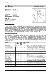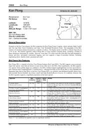
The Biodiversity of Bac Huong Hoa Nature Reserve - Birdlife ...
The Biodiversity of Bac Huong Hoa Nature Reserve - Birdlife ...
The Biodiversity of Bac Huong Hoa Nature Reserve - Birdlife ...

You also want an ePaper? Increase the reach of your titles
YUMPU automatically turns print PDFs into web optimized ePapers that Google loves.
2.6 Physical characteristics <strong>of</strong> <strong>Bac</strong> <strong>Huong</strong> <strong>Hoa</strong> <strong>Nature</strong> <strong>Reserve</strong><br />
2.6.1 Topography<br />
BHH NR encompasses low lying land to the south <strong>of</strong> the northern section <strong>of</strong> the Annamite<br />
Range, and a ridge <strong>of</strong> 1,000 m which runs in a northwest-southeast direction along the boundary<br />
between the provinces <strong>of</strong> Quang Binh and Quang Tri (Anon 2005). <strong>The</strong> forest on the Quang Binh<br />
side <strong>of</strong> this ridge is dominated by low lying areas with slopes <strong>of</strong> 15 to 25 degrees, although there<br />
are some steeper areas. On the other side <strong>of</strong> the ridge in BHH NR, low-lying land and a number<br />
<strong>of</strong> limestone peaks are present, such as Sa Mu Cave at 1,550 m and Lying-down Elephant<br />
Mountain, so named due to its shape, at 1,771 m. Although predominately low in elevation, the<br />
land is hilly and slopes are steep. Another limestone ridge runs in a west-east direction, on the<br />
boundary between <strong>Huong</strong> Lap and <strong>Huong</strong> Viet communes and near the center <strong>of</strong> <strong>Huong</strong> Viet<br />
Commune and a further runs in a south-north direction.<br />
2.6.2 Soils<br />
BHH NR is characterised by the following soil types (taken from Anon 2005):<br />
• On hills and low mountains there is yellow-brown feralite. This soil is composed <strong>of</strong> broken<br />
down rock, in particular mica-schist, which gives it a silky texture.<br />
• Other hills are dominated by a yellowish feralite soil. It is similar to yellow-brown feralite but<br />
has a higher sand content and consequently a coarse texture.<br />
• On small and medium-sized mountains there is red-yellow humus feralite. Like yellow-brown<br />
feralite, this soil has a silky texture but contains more organic matter.<br />
• Riverine areas are characterized by alluvial deposits.<br />
2.6.3 Hydrology<br />
Rivers in BHH NR are mostly short and relatively steep. <strong>The</strong>y flow from the Central Annamites<br />
to the South China Sea in an east or northeast direction. <strong>The</strong> following are the main rivers <strong>of</strong> the<br />
area:<br />
• <strong>The</strong> Ben Hai river is located in the northeast <strong>of</strong> BHH NR from where it flows into the sea at<br />
the Cua Tung estuary. All streams which have their origins in the eastern side <strong>of</strong> the nature<br />
reserve flow into the Ben Hai river.<br />
• In the north-east and south <strong>of</strong> the nature reserve is the Xe Pang Hieng river. It flows into Laos<br />
and down to the Mekong river.<br />
• <strong>The</strong> Cam Lo river has its source on the northern slope <strong>of</strong> Lying-down Elephant Mountain. It<br />
flows into the sea at the Cua Viet estuary;<br />
• <strong>The</strong> Rao Quan river flows from the southern part <strong>of</strong> the nature reserve out to the Thach Han<br />
river (Anon 2005). A hydropower plant is being constructed on the Rao Quan river.<br />
2.6.4 Meteorology<br />
BHH NR is located in a region with a tropical monsoon climate (Anon 2005). It is hot in summer<br />
and cooler in winter. Since the central Annamite range which runs along the western edge <strong>of</strong><br />
BHH NR is relatively high and orientated almost perpendicular to the north-east and south-west<br />
15