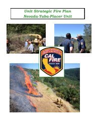
Lassen – Modoc Unit - Board of Forestry and Fire Protection - State ...
Lassen – Modoc Unit - Board of Forestry and Fire Protection - State ...
Lassen – Modoc Unit - Board of Forestry and Fire Protection - State ...

You also want an ePaper? Increase the reach of your titles
YUMPU automatically turns print PDFs into web optimized ePapers that Google loves.
FIRE MANAGEMENT PLAN 2008<br />
<strong>Lassen</strong>-<strong>Modoc</strong> <strong>Unit</strong><br />
<strong>Fire</strong> Risk Mitigation Strategies <strong>–</strong> This section is divided into four areas <strong>of</strong><br />
focus. Mitigation strategies are prioritized by zone, with the highest priority being<br />
the structure ignition zone <strong>and</strong> working outward to the Extended Wildl<strong>and</strong> Urban<br />
Interface (WUI). There are numerous factors which contribute to homes <strong>and</strong><br />
communities being at risk to loss from wildfires, including hazardous fuel conditions.<br />
Many factors are under the control <strong>of</strong> the resident, property owner, community, or<br />
County.<br />
Mitigation strategies areas <strong>of</strong> focus:<br />
A. Information, Education, <strong>and</strong> Planning<br />
B. Reducing Structure Ignitability<br />
C. Enhancing Suppression Capabilities <strong>and</strong> Public Safety<br />
1. <strong>Fire</strong> <strong>Protection</strong><br />
2. Access & Signage<br />
3. Water Systems<br />
D. Hazardous Fuel Reduction<br />
Mitigation strategies prioritization by zone:<br />
1. Home Ignition Zone <strong>–</strong> 0-150 feet<br />
Home Zone 0-6 feet<br />
Yard Zone 6-30 feet<br />
Screen Zone 30-75 feet<br />
Forest Zone 75-150 feet<br />
2. Community at Risk Zone <strong>–</strong> (Plumas County Communities at Risk<br />
map)<br />
3. Adjacent Wildl<strong>and</strong> Urban Interface (WUI) Zone - .5 mile around<br />
Community (Plumas County Communities Adjacent WUI map)<br />
4. Extended Wildl<strong>and</strong> Urban Interface (WUI) Zone- 1 mile around<br />
adjacent WUI. (Plumas County Extended WUI map)<br />
The goal <strong>of</strong> this section is to:<br />
Identify situations <strong>and</strong> factors which place residences or communities at risk<br />
from wildfire, <strong>and</strong> suggest appropriate mitigation measure(s) to reduce that<br />
risk.<br />
The objectives <strong>of</strong> this section are to:<br />
Identify mitigation measures by focus area <strong>and</strong> prioritize by zone. Focus is on<br />
public safety, firefighter safety, reducing structure ignitability, <strong>and</strong> reducing<br />
damage to other manmade <strong>and</strong> natural resources.<br />
Identify areas where collaborative efforts <strong>of</strong> local, state, <strong>and</strong> federal agencies<br />
can mitigate risks <strong>of</strong> structure ignitability, reduce hazardous fuels, <strong>and</strong><br />
wildfire threats to communities.<br />
Support efforts <strong>of</strong> Plumas County, the County <strong>Fire</strong> Warden, county fire chiefs,<br />
county fire safe councils, California Department <strong>of</strong> <strong>Forestry</strong> & <strong>Fire</strong> <strong>Protection</strong><br />
(CDF), US Forest Service, <strong>and</strong> other agencies to collaboratively implement<br />
mitigation measures <strong>and</strong> obtain funding assistance.<br />
158