

Kilcullen Local Area Plan 2008 (pdf) - Kildare.ie
Kilcullen Local Area Plan 2008 (pdf) - Kildare.ie
Kilcullen Local Area Plan 2008 (pdf) - Kildare.ie

Create successful ePaper yourself
Turn your PDF publications into a flip-book with our unique Google optimized e-Paper software.
<strong>Kildare</strong> County Council<br />
Áras Chill Dara,<br />
Devoy Park, Naas, Co <strong>Kildare</strong><br />
Telephone (045) 980200<br />
Fax (045) 980240<br />
Email: secretar@kildarecoco.<strong>ie</strong><br />
www.kildare.<strong>ie</strong>/countycouncil<br />
<strong>Kildare</strong> County Council<br />
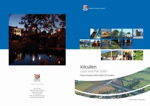
<strong>Kilcullen</strong><br />
<strong>Local</strong> <strong>Area</strong> <strong>Plan</strong> <strong>2008</strong><br />
Plean Cheantar Áitiúil <strong>2008</strong> Cill Chuillinn<br />
Adoption Date: 7th May <strong>2008</strong>
Contents<br />
TABLE OF CONTENTS PAGE<br />
Chapter 1 Background 5<br />
1.1 Introduction 5<br />
1.2 Purpose of the <strong>Plan</strong> 5<br />
1.3 <strong>Plan</strong>ning <strong>Area</strong> 5<br />
1.4 Strategic Environmental Assessment (SEA) 5<br />
Chapter 2 Rev<strong>ie</strong>w Context 7<br />
2.1 Legal Context 7<br />
2.2 Historic Development of <strong>Kilcullen</strong> 7<br />
2.3 <strong>Plan</strong>ning Policy Context 7<br />
2.4 Population Trends 10<br />
2.5 Future Population 10<br />
2.6 Future Zoning Demands 11<br />
2.7 Development Vision 11<br />
Chapter 3 Sectoral Polic<strong>ie</strong>s & Objectives 13<br />
3.1 Housing 13<br />
3.2 Economic Development / Industry 17<br />
and Enterprise<br />
3.3 Community, Educational 18<br />
and Cultural Facilit<strong>ie</strong>s<br />
3.4 Childcare Facilit<strong>ie</strong>s 19<br />
3.5 Public Utilit<strong>ie</strong>s 19<br />
3.6 Transportation 23<br />
3.7 Amenity and Recreation 26<br />
3.8 Town Centre / Retail Development 26<br />
3.9 Re-Use and Regeneration of 29<br />
Derelict Sites and Buildings<br />
3.10 Heritage 29<br />
3.11 The Environment 34<br />
3.12 The River Liffey 37<br />
3.13 Tourism 39<br />
Chapter 4 <strong>Plan</strong>ning Strategy 41<br />
4.1 Statement of Strategy 41<br />
4.2 Land use Zonings 41<br />
4.3 Zoning Matrix 45<br />
4.4 Application of Zoning Policy 45<br />
Chapter 5 Development Control Standards 49<br />
5.1 Background 49<br />
5.2 Development Control Standards – 49<br />
Design and Layout<br />
5.3 Residential Development 53<br />
5.4 Landscaping 59<br />
5.5 Naming of New Developments 59<br />
5.6 Street Lighting and Public Utilit<strong>ie</strong>s 60<br />
TABLE OF CONTENTS PAGE<br />
5.7 Access to Land 60<br />
5.8 Childcare Facilit<strong>ie</strong>s 60<br />
5.9 Industrial Development 61<br />
5.10 Retail Development 61<br />
5.11 Environment 65<br />
5.12 Development in <strong>Area</strong>s of 65<br />
Archaeological Potential<br />
5.13 Development in Architectural 66<br />
Conservation <strong>Area</strong>s<br />
5.14 Development in relation to 66<br />
Protected Structures<br />
5.15 Agricultural Developments 67<br />
5.16 Extractive Industry 67<br />
5.17 Temporary Dwellings, Caravans 68<br />
5.18 Automatic Teller Machines (ATMs) 68<br />
5.19 Enterprise/ Employment Development 69<br />
5.20 Telecommunications Infrastructure 69<br />
5.21 Bonding to Secure Completion 69<br />
of Development<br />
5.22 Development Contributions 69<br />
5.23 Future Publications, Standards 69<br />
and Guidelines<br />
5.24 Digitised <strong>Plan</strong>ning Applications 69<br />
Table of Figures<br />
Table 2.1 Population 10<br />
Table 4.2 Land Use Zoning Objectives 42<br />
Table 4.3 Indicative <strong>Area</strong>s Zoned 44<br />
Table 4.4 Land Use Zoning Matrix 46<br />
Table 5.1 Plot Ratio Standards 50<br />
Table 5.2 Building Line Requirements 51<br />
Table 5.3 Car Parking Standards 52<br />
Table 5.4 Bicycle Parking Standards 52<br />
Table 5.5 Dwelling unit floor areas 55<br />
Table 5.6 Indicative Residential Densit<strong>ie</strong>s 56<br />
Table 5.7 Private open space requirements 57<br />
for individual houses<br />
Table 5.8 Private open space requirements 57<br />
for Apartments/Duplexes<br />
Appendices<br />
Appendix 1 Heritage Items 71<br />
Appendix 2 Structures listed for protection 71<br />
1
2<br />
1.0 Background<br />
1.1 Introduction<br />
This <strong>Local</strong> <strong>Area</strong> <strong>Plan</strong> relates to the town of <strong>Kilcullen</strong>.<br />
The previous <strong>Local</strong> <strong>Area</strong> <strong>Plan</strong>, which was adopted in 2001, sets<br />
out polic<strong>ie</strong>s and objectives for the town, as well as a<br />
Development Boundary.<br />
1.2 Purpose of the <strong>Plan</strong><br />
The aim of this <strong>Plan</strong> is to establish a framework for the<br />
physical, socio-economic, cultural and recreational growth of<br />
<strong>Kilcullen</strong> in a planned, co-ordinated and sustainable manner in<br />
order to conserve and enhance the established tradition and<br />
intrinsic character of the town. It sets out a number of polic<strong>ie</strong>s<br />
and objectives, which will help to ach<strong>ie</strong>ve this aim.<br />
This <strong>Local</strong> <strong>Area</strong> <strong>Plan</strong> (LAP) is prepared under a number of<br />
Chapter headings as follows:<br />
Chapter 1: Sets out the LAP area and the purpose of the <strong>Plan</strong>.<br />
It also refers to the relevant Strategic Environmental<br />
Assessment Regulations.<br />
Chapter 2: Outlines the planning policy context under which<br />
the plan is rev<strong>ie</strong>wed and also the population trends and<br />
development vision.<br />
Chapter 3: Sets out the sectoral polic<strong>ie</strong>s and objectives under<br />
the main headings of – Housing, Industry and Enterprise,<br />
Education, Cultural and Community Facilit<strong>ie</strong>s, Public Utilit<strong>ie</strong>s,<br />
Transportation, Retail, Amenity and Recreation, Heritage,<br />
Tourism and Environment and the River Liffey.<br />
Chapter 4: Land Use and Zoning Objectives. This section<br />
should be read in tandem with the map contained herein.<br />
Chapter 5: Development Control Standards. This section<br />
provides a detailed framework which provides guidance in the<br />
preparation of planning applications and proposals.<br />
1.3 <strong>Plan</strong>ning <strong>Area</strong><br />
<strong>Kilcullen</strong> is located on the river Liffey, 38km from Dublin,<br />
10km from Naas and 6km from Newbridge. The town is<br />
primarily a service and retail centre for south <strong>Kildare</strong> and<br />
increasingly a residential centre within the Greater Dublin <strong>Area</strong>.<br />
1.4 Strategic Environmental Assessment (SEA)<br />
In accordance with Article 13A(4) of the <strong>Plan</strong>ning and<br />
Development (Strategic Environmental Assessment Regulations)<br />
2004, a Screening Assessment was prepared for the <strong>Kilcullen</strong><br />
<strong>Local</strong> <strong>Area</strong> <strong>Plan</strong> and sent to the Environmental Authorit<strong>ie</strong>s<br />
on 8th December 2006 concluding that a Strategic<br />
Environmental Assessment would not be required. This was<br />
sent to the relevant prescribed bod<strong>ie</strong>s, namely The Minister<br />
for the Environment, Heritage and <strong>Local</strong> Government,<br />
The Minister for Communications, Marine and Natural<br />
Resources and the Environmental Protection Agency. Having<br />
regard to the comments received from these prescribed<br />
bod<strong>ie</strong>s, <strong>Kildare</strong> County Council concluded that a Strategic<br />
Environmental Assessment was not required for this<br />
<strong>Local</strong> <strong>Area</strong> <strong>Plan</strong>.<br />
3
4<br />
2.0 Rev<strong>ie</strong>w Context<br />
2.1 Legal Context<br />
This <strong>Local</strong> <strong>Area</strong> <strong>Plan</strong> relates to the town of <strong>Kilcullen</strong>. The<br />
<strong>Kilcullen</strong> <strong>Local</strong> <strong>Area</strong> <strong>Plan</strong> 2001 was the last plan prepared<br />
for the town. This <strong>Plan</strong> shall be titled ‘<strong>Kilcullen</strong> <strong>Local</strong> <strong>Area</strong> <strong>Plan</strong>’.<br />
<strong>Kildare</strong> County Council is the <strong>Plan</strong>ning Authority for the area<br />
of the <strong>Local</strong> <strong>Area</strong> <strong>Plan</strong>.<br />
This <strong>Local</strong> <strong>Area</strong> <strong>Plan</strong> for <strong>Kilcullen</strong> is made in accordance<br />
with the requirements of the <strong>Plan</strong>ning and Development Acts<br />
2000 (as amended) (the Act) and in accordance with the<br />
objectives of the <strong>Kildare</strong> County Development <strong>Plan</strong>, 2005 -<br />
2011. The period of this <strong>Plan</strong> should be taken as six years<br />
(2006-2011) from the date of its adoption by the Council<br />
or until it is var<strong>ie</strong>d or a new <strong>Plan</strong> is made.<br />
2.2 Historic Development of <strong>Kilcullen</strong><br />
<strong>Kilcullen</strong> derives its name from Cill Cuillinn, the Church of the<br />
Holly and was an important crossing point of the river Liffey<br />
from Med<strong>ie</strong>val times. The town developed along the street<br />
leading to the bridge. The town expanded in the latter half of<br />
the 20th Century basically extending the street further north<br />
and south.<br />
The town’s street pattern reflects its historical development.<br />
<strong>Kilcullen</strong> is essentially a single street. The by-pass acts as a<br />
natural barr<strong>ie</strong>r to expansion to the west of the town and<br />
Castlemartin Demesne constrains development to the<br />
northwest. Recent residential development has occurred<br />
to the south west and east of the town.<br />
<strong>Kilcullen</strong> is located within the Eastern Transition Landscape<br />
Character <strong>Area</strong> and is on the River Liffey water corridor<br />
Landscape Character <strong>Area</strong>. These areas are characterised by<br />
undulating topography. The lands are generally of medium<br />
size and regular pattern. Hedgerows are usually well<br />
maintained with scattered trees along the boundar<strong>ie</strong>s.<br />
Pasture is the major land use in this area with patches of nonirrigated<br />
agricultural lands. Pasturelands generally occupy the<br />
Liffeys banks. <strong>Kilcullen</strong> is one of the larger towns in the<br />
Eastern Transition Landscape Character <strong>Area</strong> while there are a<br />
number of larger towns along the river Liffey water corridor<br />
mainly further north.<br />
2.3 <strong>Plan</strong>ning Policy Context<br />
<strong>Plan</strong>ning at this local level must be informed by<br />
prevailing planning polic<strong>ie</strong>s and standards as established<br />
in international and national reports, guidelines and other<br />
documents. A consistent theme in all planning and related<br />
documents is that of ‘sustainable development’ – defined as<br />
‘development that meets the needs of the present without<br />
compromising the ability of future generations to meet their<br />
own needs.’<br />
<strong>Kildare</strong> County Council supports this national policy and<br />
this concept is a major component of the <strong>Kilcullen</strong> <strong>Local</strong><br />
<strong>Area</strong> <strong>Plan</strong>. The <strong>Plan</strong>ning Authority has also had regard<br />
to European Union policy Directives and national policy<br />
guidelines during the preparation of this <strong>Local</strong> <strong>Area</strong> <strong>Plan</strong>.<br />
2.3.1 National Spatial Strategy<br />
The National Spatial Strategy (NSS) was published in<br />
December 2002. The Strategy is a 20-year planning<br />
framework designed to ach<strong>ie</strong>ve a better balance of social,<br />
economic, physical development and population growth<br />
between centres.<br />
The NSS sets out polic<strong>ie</strong>s for <strong>Kilcullen</strong> in the context of its<br />
location within the Dublin and Mid-East Region. The Strategy<br />
for this region is to consolidate the metropolitan area of<br />
Dublin and concentrate development into the ‘Primary<br />
Development Centres’ in the hinterland. <strong>Area</strong>s identif<strong>ie</strong>d as<br />
‘Strategic Rural Assets’ within the Dublin and Mid-East Region<br />
will separate these centres from each other. <strong>Kilcullen</strong> is<br />
designated as a ‘Primary Development Centre’. The Strategy<br />
stipulates that these centres need to aim at a population level<br />
that supports self-sustaining growth, but which does not<br />
undermine the promotion of critical mass in other regions.<br />
Primary Development Centres must take account of wider<br />
considerations for example their relationship with Dublin.<br />
<strong>Kilcullen</strong> is also located on a ‘National Transport Corridor’ as<br />
outlined in the strategy. This corridor runs along the M9. The<br />
strategy makes provision for the unique role of Primary<br />
Development Centres given the close proximity and scale of<br />
Dublin and the need for balance between the city and the<br />
surrounding count<strong>ie</strong>s.<br />
5
6<br />
2.3.2 Regional <strong>Plan</strong>ning Guidelines 2004 – 2016<br />
The Regional <strong>Plan</strong>ning Guidelines (2004-2016) provide a<br />
strategic planning framework for the development of the<br />
Greater Dublin <strong>Area</strong> (GDA), which comprises two regions:<br />
the Mid-East and Dublin Region. The Guidelines introduce the<br />
concept of Primary Dynamic Clusters and Secondary Dynamic<br />
Clusters. These clusters should be developed in a mutually<br />
dependent way so that the amenit<strong>ie</strong>s and econom<strong>ie</strong>s of the<br />
whole are greater than the sum of its parts. They will not<br />
merge into a unitary town in the usually understood sense of<br />
being contiguous, developed, well-serviced urban areas. The<br />
Guidelines are a blueprint for strategic planning within the<br />
GDA.<br />
<strong>Kilcullen</strong> is designated as part of a Primary Dynamic Cluster<br />
and is to be developed as an integrated entity with Naas and<br />
Newbridge. They will form a single entity for development<br />
and marketing purposes. The designation of this cluster<br />
identif<strong>ie</strong>s the intrinsic urban dynamism and relationship<br />
between the towns. The aim of the guidelines is to ensure that<br />
this dynamism is built upon and that the centres develop a<br />
self-suffic<strong>ie</strong>nt critical mass as complementary towns into the<br />
future.<br />
The Draft Regional <strong>Plan</strong>ning Guidelines identify five<br />
classifications of urban centres:<br />
• Metropolitan Consolidation Towns<br />
• Large Growth Towns I & II<br />
• Moderate Growth Towns<br />
• Small Growth Towns<br />
• Villages<br />
These urban centres include different categor<strong>ie</strong>s of towns and<br />
villages based on size and function. <strong>Kilcullen</strong> is in the<br />
Moderate Growth Towns category. It is envisaged that<br />
moderate growth towns will have an interacting and<br />
supporting role to the adjacent large town.<br />
2.3.3 <strong>Kildare</strong> County Development <strong>Plan</strong> 2005-2011<br />
The <strong>Kildare</strong> County Development <strong>Plan</strong> sets the broad<br />
development framework for the county of <strong>Kildare</strong> and<br />
the development areas within its jurisdiction. The strategic<br />
objectives of the <strong>Kildare</strong> County Development <strong>Plan</strong> 2005-2011<br />
are outlined in Section 1.3.0 as:<br />
1. To provide for balanced and sustainable distribution of<br />
economic and social growth across the county<br />
2. To provide infrastructure and transportation in accordance<br />
with the principles of sustainable development<br />
3. To ensure the highest quality living environments, urban<br />
centres and civic spaces as well as open space and<br />
recreational facilit<strong>ie</strong>s accessible to all citizens of <strong>Kildare</strong><br />
4. To sustain traditional rural communit<strong>ie</strong>s, by supporting the<br />
agriculture and bloodstock industr<strong>ie</strong>s and promoting<br />
balanced renewal of rural settlements to cater for the<br />
indigenous population of <strong>Kildare</strong><br />
5. To protect, conserve and enhance the built and natural<br />
heritage of <strong>Kildare</strong> for future generations.<br />
The County Development <strong>Plan</strong> recognises that the proximity<br />
of towns like <strong>Kilcullen</strong> to the Dublin Metropolitan <strong>Area</strong> has<br />
resulted in increasing development due to factors such as<br />
residential preferences, housing supply/demand imbalances<br />
facing those who work in Dublin and increased car mobility.<br />
2.3.4 Newbridge-<strong>Kilcullen</strong> Draft Integrated<br />
Framework <strong>Plan</strong> for Land Use and Transportation<br />
<strong>Kildare</strong> County Council in conjunction with the Dublin<br />
Transportation Office is preparing an ‘Integrated Framework<br />
<strong>Plan</strong> for Land Use and Transportation’ for Newbridge and<br />
<strong>Kilcullen</strong>. This IFPLUT has a time frame to 2020 and will<br />
complement local area plans for the town. This framework<br />
plan will set down the principles for future development,<br />
guiding the level, scale and location of future development<br />
within the wider area of Newbridge and <strong>Kilcullen</strong>, ensuring<br />
a quality living environment. The vision for the plan is to<br />
develop “sustainable and effic<strong>ie</strong>nt urban forms with a<br />
balanced range of functions, facilit<strong>ie</strong>s and amenit<strong>ie</strong>s, building<br />
the areas’ present strengths and meeting the needs of the<br />
people living and working there”. Particular regard has been<br />
given to the designation of Newbridge and <strong>Kilcullen</strong> as a<br />
Primary Dynamic Cluster with Naas.<br />
2.3.5 <strong>Kildare</strong> 2012 – An Economic, Social and Cultural<br />
Strategy<br />
The <strong>Kildare</strong> County Development Board Strategy “<strong>Kildare</strong> 2012<br />
– An Economic, Social and Cultural Strategy” sets the<br />
framework within which <strong>Kildare</strong> County Development Board<br />
will operate for the next 10 years. The vision of this strategy is<br />
to make “<strong>Kildare</strong> – the first choice as a place to live, learn,<br />
work, visit and do business”. The strategy focuses on six key<br />
objectives, which are vital to ensuring this vision.<br />
These are to:<br />
1. Develop transport and communications;<br />
2. Respond to new settlement patterns;<br />
3. Respond to contrasts within the county and towns;<br />
4. Protect the environment;<br />
5. Develop the education, training and capacity building;<br />
6. Develop a sense of place.<br />
It is the policy of <strong>Kildare</strong> County Council to implement and<br />
build upon this strategy.<br />
7
8<br />
2.3.6 <strong>Kildare</strong> County Housing Strategy- Part V –<br />
<strong>Plan</strong>ning and Development Acts 2000-2004<br />
The <strong>Kildare</strong> County Council’s first Housing Strategy 2001-<br />
2006 was adopted on 1st October 2001. The analysis that<br />
underpinned the Strategy suggested that there was a social<br />
and affordable housing requirement in <strong>Kildare</strong> amounting to<br />
29% of all housing. However, legislation provided that the<br />
maximum amount of zoned land that could be reserved for<br />
social and affordable housing was 20%.<br />
A recent rev<strong>ie</strong>w carr<strong>ie</strong>d out by the Housing Department with<br />
the assistance of Jon Blackwell & Associates concluded that<br />
the requirement in this regard remains unchanged. While the<br />
provision of housing units under Part V of the Act has been<br />
limited to date this is expected to change significantly in the<br />
short term. The preferred option for compliance with Part<br />
V is the provision of completed housing units followed by<br />
serviced land or land. Compliance with Part V through the<br />
payment of financial contributions will only be acceptable<br />
in exceptional circumstances.<br />
2.3.7 Residential Density Guidelines 1999<br />
The Residential Density Guidelines 1999 sets out the<br />
Government policy of encouraging more sustainable urban<br />
development by the avoidance of excessive suburbanisation<br />
and the promotion of higher residential densit<strong>ie</strong>s in<br />
appropriate locations.<br />
This will result in:<br />
1. More economic use of existing infrastructure and serviced<br />
land;<br />
2. A reduced need for the development of ‘Greenf<strong>ie</strong>ld’ sites,<br />
urban sprawl and ribbon development;<br />
3. Reduced need for investment in infrastructure;<br />
4. Better access to existing services and facilit<strong>ie</strong>s;<br />
5. More sustainable commuting patterns.<br />
The Council recognises that higher densit<strong>ie</strong>s will not be<br />
appropriate in every circumstance. In ach<strong>ie</strong>ving higher<br />
densit<strong>ie</strong>s the protection of the amenit<strong>ie</strong>s of existing<br />
developments and those of the residents of proposed<br />
developments will be a primary consideration. A high<br />
quality of architecture in the siting and design providing<br />
a good quality living environment is essential if increased<br />
residential densit<strong>ie</strong>s are to be acceptable. The Council<br />
will seek adherence from developers to the densit<strong>ie</strong>s<br />
and standards set out in this <strong>Plan</strong>.<br />
2.4 Population Trends<br />
In 1971 <strong>Kilcullen</strong> had a population of 880 persons.<br />
The population increased steadily up until 1996 when there<br />
was a very slight decrease in population but surprisingly from<br />
1996 to 2002 there was a more significant decrease in<br />
population. Following a lot of residential development the<br />
population increased dramatically from 2002 to 2006.<br />
Table 2.1 Population<br />
Source: CSO.<br />
Year Population Rate of Change<br />
1971 880<br />
1979 1,466 6%<br />
1981 1,537 3%<br />
1986 1,715 2.5%<br />
1991 1,664 -1%<br />
1996 1,604 -1%<br />
2002 1,483 -7.5%<br />
2006 2,985 101.3%<br />
Many factors contributing to the growth of population include<br />
the natural increase in an expanding population, movement<br />
of rural and city dwellers to the town and most importantly,<br />
the close proximity to Dublin.<br />
2.5 Future Population<br />
The most up to date census figures for <strong>Kilcullen</strong> are the<br />
2006 figures, which give <strong>Kilcullen</strong> a population of 2,985<br />
persons. Following a survey of recently granted housing<br />
developments approximately 535 residential units have been<br />
provided in the town since 2002. Some of these have been<br />
constructed and some are still under construction.<br />
At an average household size of 3.0 persons, 535 residential<br />
units would give a future total of 1,605 persons to be added<br />
to the 2002 <strong>Kilcullen</strong> population of 1,483. This would give<br />
<strong>Kilcullen</strong> a possible future population of 3,088 persons if all<br />
the residential units were developed.<br />
2.6 Future Zoning Demands<br />
Taking into consideration the housing units allocations in the<br />
Regional <strong>Plan</strong>ning Guidelines (updated) a total of 818 units<br />
should be provided for in this plan in order to meet these<br />
targets. Currently there are 11.6 Ha (28.6 Acres) of zoned land<br />
in <strong>Kilcullen</strong> that are suitable for development that have<br />
not yet been developed or that are subject to a planning<br />
application.<br />
In order to provide 818 units, 27.3 Ha (67.4 Acres) at 30<br />
units to the Hectare (12 to the acre approx) of zoned land is<br />
required. In addition to the existing 11.6 Ha (28.6), 23.9 Ha (59<br />
acres) of a mixture of medium and low density zoned land will<br />
be required to ensure that the RPG targets are met while also<br />
including a quarter of over zoning consistent with paragraph<br />
7.9 of the Regional <strong>Plan</strong>ning Guidelines.<br />
2.7 Development Vision<br />
The overall vision for <strong>Kilcullen</strong> is for its growth as an important<br />
centre with critical mass suffic<strong>ie</strong>nt to sustain a range of<br />
residential units, employment opportunit<strong>ie</strong>s and services for<br />
a growing local community while protecting and enhancing<br />
the unique physical environment of the town and the river<br />
corridor.<br />
Goals<br />
The specific goals of this plan, as translated into sectoral<br />
objectives and polic<strong>ie</strong>s in Chapter 3, are:<br />
1. To protect and further develop the role of the town centre<br />
as the focal point for economic, cultural and social activity,<br />
2. To ensure the adequate supply of serviced, zoned land is<br />
made available to accommodate future population and<br />
economic expansion,<br />
3. To maximise the potential of the existing public transport<br />
infrastructure and make adequate the provision of safe<br />
and conven<strong>ie</strong>nt circulation around the town, by foot,<br />
bicycle and car,<br />
4. To protect and enhance the unique architectural heritage<br />
of the town,<br />
5. To ensure that adequate recreational facilit<strong>ie</strong>s are available<br />
to the residents of the town.<br />
9
10<br />
3.0 Sectoral Objectives & Polic<strong>ie</strong>s<br />
The following chapter deals with the Sectoral Goals,<br />
Objectives and Polic<strong>ie</strong>s of the Council with regards to<br />
the development of land within the boundary of the <strong>Local</strong><br />
<strong>Area</strong> <strong>Plan</strong>. It is the overarching objective of the Council to<br />
implement all development in accordance with the stated<br />
Goals, Objectives and Polic<strong>ie</strong>s in order to facilitate land<br />
use in a manner that will promote proper and sustainable<br />
development.<br />
3.1 Housing<br />
The Council has statutory obligations to ensure that suffic<strong>ie</strong>nt<br />
land is zoned for all types of housing to meet the projected<br />
housing requirements over the <strong>Plan</strong> period and to ensure that<br />
an undue shortage will not arise. One of the basic aims of any<br />
local authority is to promote the balanced social, physical and<br />
economic development.<br />
The aim of the <strong>Plan</strong> is to ensure that there is adequate land<br />
available in appropriate locations for housing and to have<br />
clear polic<strong>ie</strong>s regarding proposals to build new houses,<br />
whether individual units or schemes. The availability of<br />
housing for a diverse range of housing needs is important for<br />
sustaining communit<strong>ie</strong>s and for enhancing quality of life.<br />
Financial constraints will determine the rate of public sector<br />
house building, whilst, in the private sector, the market<br />
dictates both the demand and supply of new housing<br />
including locational preferences.<br />
The Council does not have any land for council housing<br />
in the town. In the last five or six years a large housing<br />
development has been constructed to the south west of<br />
the town close to the motorway. There has also been some<br />
housing developed closer to the town centre on the north<br />
side of the river and currently there is a large apartment<br />
development under construction on the riverbank.<br />
Strategic Goal<br />
To significantly improve the quality and adequately provide<br />
for the anticipated quantity of residential units in the area,<br />
through the zoning and development of appropriate lands.<br />
Objectives<br />
It is an objective of the Council:<br />
OH 1 To locate and zone lands such as to ensure that<br />
residential development in the area is suitably located,<br />
designed and serviced to enhance the local<br />
environment and prevent any inappropriate or<br />
avoidable impacts on the quality of that environment.<br />
OH 2 To encourage a strong mix of house types, tenure and<br />
size, in order to meet changing household size and<br />
composition and to provide a social and demographic<br />
balance in <strong>Kilcullen</strong>.<br />
OH 3 To ensure that a high standard of design be<br />
incorporated into housing developments through<br />
careful consideration of the layout to facilitate<br />
pedestrian safety and restrict vehicular traffic speeds.<br />
OH 4 To promote energy conservation and renewable<br />
energy technolog<strong>ie</strong>s, outlined under Section 3.11<br />
of this Chapter in all developments. Such measures<br />
should be consistent with other polic<strong>ie</strong>s in the plan.<br />
OH 5 To encourage the development of a strong town centre<br />
and strong frontages onto the main thoroughfares<br />
thereby creating definite building lines and continuity<br />
of the town structure.<br />
OH 6 To take action as may be necessary to acquire land<br />
needed to enable the implementation of housing<br />
programmes for the provision of social and affordable<br />
homes.<br />
OH 7 To support and facilitate the Voluntary Sector in<br />
meeting social housing needs.<br />
OH 8 To support the provision of adequate engineering<br />
as well as social infrastructure as an integral part of<br />
housing development.<br />
OH 9 To preserve and reinforce existing mature trees and<br />
hedgerows in new residential areas where feasible.<br />
OH 10 To ensure that infill development is in keeping with<br />
existing development in the vicinity.<br />
11
12<br />
Policy Statements<br />
Ensuring that developments are carr<strong>ie</strong>d out to design and<br />
construction standards that will result in a visually and<br />
functionally pleasing environment will be the core of the<br />
Council’s development strategy. In addition to the polic<strong>ie</strong>s<br />
outlined in the County Development <strong>Plan</strong> 2005 - 2011<br />
(or as subsequently amended), the following are the<br />
polic<strong>ie</strong>s of <strong>Kildare</strong> County Council:<br />
(A) Housing Design & Layout<br />
PH 1 To require a high standard of design and material used,<br />
while ensuring diversity in the density of development<br />
and in the form, size and type of dwelling within<br />
residential areas.<br />
PH 2 To require that all new residential accommodation<br />
meets the necessary standards of health, sanitation<br />
and design, and are carr<strong>ie</strong>d out generally in accordance<br />
with the ‘Recommendations for Site Development<br />
Works for Housing <strong>Area</strong>s’. (DoEHLG 1998).<br />
PH 3 To prohibit ribbon development along approach roads<br />
to the town.<br />
PH 4 To ensure that the town avoids the monotony of urban<br />
sprawl. Excessive, monotonous duplication of house<br />
styles within developments will be strongly resisted.<br />
The developer must have regard to the local setting<br />
and aim to create a sense of place and identity in any<br />
proposed development. All new development shall<br />
enhance the local setting and create attractive places<br />
in which to be, live, work and take leisure.<br />
PH 5 Every application received for more than four houses<br />
within the boundary of this <strong>Local</strong> <strong>Area</strong> <strong>Plan</strong> shall be<br />
accompan<strong>ie</strong>d by a design rationale addressing the<br />
following:<br />
1. Thought process for arriving at the design<br />
including:<br />
(i) Creation of a unique environment and a sense of<br />
place<br />
(ii) Creation of var<strong>ie</strong>ty and choice<br />
(iii) Flow of pedestrian traffic- internally and<br />
externally<br />
2. The following design criteria shall form part of such<br />
development schemes:<br />
(i) Vertical emphasis on windows<br />
(ii) The surround of dormer windows, where such<br />
windows are considered appropriate, shall be<br />
finished in painted plaster.<br />
(iii) Var<strong>ie</strong>ty in the layout of the development<br />
scheme to include courtyard type developments<br />
and short cul de sacs. The monotony of long<br />
stretches of residential units in a linear format<br />
shall not be permitted.<br />
(iv) Excessive stretches of blank wall shall not front<br />
any public road within the development scheme.<br />
3. All proposed developments shall have due regard to<br />
the EC Directive 2002/91/EC which relates to the<br />
energy performance of buildings.<br />
4. In the interests of sustainability, solar panels shall be<br />
incorporated into the building design where<br />
appropriate, particularly on south facing walls.<br />
5. A landscape plan, prepared by a suitably qualif<strong>ie</strong>d<br />
person, shall be submitted. Such a plan shall include<br />
proposals for the following;<br />
(a) ‘hard’ landscaping to include a footpath and a<br />
bicycle path<br />
(b) ‘soft’ landscaping to include planting areas<br />
together with a planting scheme for same.<br />
(c) Such a planting scheme shall include the precise<br />
location, number and types of plants/native<br />
trees, together with a clear and concise planting<br />
programme. Existing trees/planting on site shall<br />
be incorporated into any development scheme<br />
unless the poor condition of such trees/planting<br />
would merit the removal of same. In such<br />
instances a case shall be made in writing,<br />
together with the planning application, for their<br />
removal.<br />
(d) Seating arrangements both formal and informal<br />
(e) A formal proposal for a h<strong>ie</strong>rarchy of public open<br />
spaces throughout the site. This proposal shall<br />
include;<br />
(i) pedestrian link routes along desire lines (e.g.<br />
connecting residential with commercial,<br />
community, educational and employment uses).<br />
(ii) A central, functional, accessible and adequately<br />
overlooked area of public open space.<br />
(iii) Smaller areas of usable, functional, accessible<br />
and central areas of open space throughout<br />
the remainder of the development site.<br />
(iv) Having regard to both (ii) and (iii) above,<br />
residential units shall front onto areas of<br />
open space. Gable walls or stretches of blank<br />
walls shall not be permitted to front onto<br />
these areas.<br />
PH 6 To encourage infill housing developments on<br />
appropriate sites where the proposals respect<br />
the existing scale and character of the area and<br />
suffic<strong>ie</strong>ntly protect the amenit<strong>ie</strong>s of adjoining<br />
propert<strong>ie</strong>s in the area. Proposed development must<br />
have regard to the surrounding environment and<br />
predominant design features, the existing residential<br />
density and the existence of particular elements such<br />
as groups of trees, listed buildings and open space.<br />
PH 7 New dwellings that closely overlook the rear curtilage<br />
of existing dwellings will not normally be permitted.<br />
Houses located in a p<strong>ie</strong>cemeal fashion to the rear of<br />
existing houses, with inadequate independent road<br />
frontage and that do no form part of a comprehensive<br />
development plan for the particular area are considered<br />
to represent sub-standard development and will not<br />
normally be permitted.<br />
PH 8 To require all new housing developments (with 30<br />
houses or more) to provide recycling facilit<strong>ie</strong>s at<br />
designated areas designed to a high standard in<br />
accordance with the provisions of the Waste<br />
Development <strong>Plan</strong>.<br />
PH 9 To require the naming of residential developments to<br />
reflect local place names, language or topographical<br />
features as appropriate and to incorporate old names<br />
from the locality as far as possible.<br />
PH 10 Apartments shall only be permitted at appropriate<br />
locations in the Town Centre or where an Action <strong>Area</strong><br />
<strong>Plan</strong> has been agreed with the <strong>Local</strong> Authority.<br />
Generally apartments, or retail developments with<br />
apartments above, should be located in the town<br />
centre zone.<br />
PH 11 For the purpose of this plan a house and maisonette is<br />
defined as a dwelling with its own external access. An<br />
apartment, flat or duplex is a dwelling accessed from<br />
an internal lobby or hallway.<br />
PH 12 Not to permit development on designated areas of<br />
open space that form part of a site layout for<br />
previously permitted development.<br />
PH 13 To continue to take private housing estates in charge<br />
(other that apartment blocks) when they have been<br />
completed in accordance with the conditions of the<br />
relevant planning permissions and to the satisfaction<br />
of the <strong>Plan</strong>ning Authority.<br />
PH 14 To ensure that extensions to residential buildings are<br />
sympathetic in massing and scale to the existing<br />
building.<br />
PH 15 To require that all new residential developments in<br />
close proximity to national roads and/or motorways<br />
investigate possible noise disturbances from resultant<br />
traffic volumes, at the planning application stage.<br />
The developer shall outline mitigation measures in<br />
minimising the effect of such traffic on the residential<br />
amenity of nearby dwelling units.<br />
13
14<br />
(B) Social, Affordable and Voluntary Housing<br />
PH 16 To integrate housing provided under Part V of the<br />
<strong>Plan</strong>ning and Development Acts 2000 (as amended),<br />
into private development in a layout that prevents<br />
segregation and promotes good design and layout.<br />
PH 17 To ensure that 20% of any land zoned solely for<br />
residential use or for a mixture of residential and other<br />
uses shall be made available for the provision<br />
of social and affordable housing in accordance<br />
with the requirements of Part V of the <strong>Plan</strong>ning<br />
and Developments Acts 2000 (as amended) and<br />
the Housing Strategy.<br />
PH 18 To ensure that any submission made in compliance<br />
with a developer’s responsibilit<strong>ie</strong>s under Part V of<br />
the <strong>Plan</strong>ning and Development Acts 2000 (as amended)<br />
and the Council’s Housing Strategy shall provide for<br />
a minimum of 8% social housing and 12% affordable<br />
housing, unless otherwise agreed with the <strong>Plan</strong>ning<br />
Authority due to the exceptional circumstances of any<br />
particular case.<br />
PH 19 To give preference to the option, for compliance by<br />
developers with Part V of the <strong>Plan</strong>ning and Development<br />
Act 2000 (as amended), where developers build the<br />
required houses and then make them available to the<br />
Council in order:<br />
(a) to ensure the fullest ach<strong>ie</strong>vable degree of social<br />
integration<br />
(b) to ensure complete and effic<strong>ie</strong>nt development of<br />
building sites and<br />
(c) to facilitate the implementation of policy in regard<br />
to social and affordable housing.<br />
(C) Housing and Community Facilit<strong>ie</strong>s<br />
PH 20 To require applicants for significant developments,<br />
or where the <strong>Plan</strong>ning Authority deems necessary<br />
to submit a Social Infrastructure Assessment which<br />
demonstrates the facilit<strong>ie</strong>s available to adequately<br />
service their development. This should include<br />
details regarding the following facilit<strong>ie</strong>s: education,<br />
childcare, health, recreational facilit<strong>ie</strong>s and others<br />
such as shops and post offices<br />
(D) The Travelling Community<br />
<strong>Kildare</strong> County Council recognises the distinct culture and<br />
lifestyle of the Travelling Community and will work with other<br />
agenc<strong>ie</strong>s to accommodate that community’s needs.<br />
Strategic Goal<br />
To work, in co-operation with other statutory bod<strong>ie</strong>s and<br />
voluntary agenc<strong>ie</strong>s, to provide suitable accommodation for<br />
Travellers within its administrative area.<br />
Objectives<br />
It is an objective of the Council:<br />
OTP 1 To provide accommodation for members of the<br />
Travelling Community, whether by way of residential<br />
caravan sites/halting sites, or by housing, as may be<br />
appropriate.<br />
Policy Statement<br />
In addition to the polic<strong>ie</strong>s outlined in the County<br />
Development <strong>Plan</strong> in relation to the Traveller Community, it is<br />
Council policy:<br />
PTP 1 To implement measures in accordance with the<br />
Housing Strategy and the Traveller Accommodation<br />
Programme 2005-<strong>2008</strong>.<br />
3.2 Economic Development / Industry and Enterprise<br />
Having regard to the size, scale and nature of the town, the<br />
strategy for economic development in <strong>Kilcullen</strong> must focus<br />
on the ach<strong>ie</strong>vable delivery of local services and potential<br />
employment and enterprise generation. The zoning of<br />
appropriate sites within the town area can facilitate the<br />
creation and development of small-scale services and<br />
rural enterprise.<br />
Strategic Goal<br />
To develop the local economy such that it can sustain<br />
activit<strong>ie</strong>s commensurate with the needs and scale of the<br />
expanding town. Furthermore the Council will work with<br />
all strategic partners and local stakeholders in the delivery<br />
of this goal and the enhancement of the local economy.<br />
Objectives<br />
It is an objective of the Council:<br />
OE 1 To zone lands in the town to accommodate a range<br />
of uses promoting the town centre as a vibrant<br />
commercial centre.<br />
OE 2 To zone lands to facilitate the creation and<br />
development of enterprise.<br />
OE 3 To undertake all Council works and actions with a v<strong>ie</strong>w<br />
to the enhancement of the physical and social<br />
structure of the town centre.<br />
OE 4 To establish a level of infrastructure and services<br />
that can accommodate small-scale employment<br />
generating development in the future.<br />
OE 5 To identify any emerging service requirements of<br />
employment generating uses in the area and to<br />
zone appropriate lands in accordance with those<br />
requirements and to adhere to the principles of proper<br />
planning and sustainable development.<br />
OE 6 To encourage and facilitate at identif<strong>ie</strong>d locations,<br />
small indigenous industr<strong>ie</strong>s in recognition of their<br />
importance in providing local employment and<br />
helping to stimulate economic activity within smaller<br />
communit<strong>ie</strong>s.<br />
OE 7 To promote the concept of wi-fi and wireless<br />
technology throughout the County.<br />
OE 8 To safeguard residential areas and areas of high<br />
environmental quality from the adverse effects<br />
of industrial development.<br />
OE 9 To ensure that all new industrial and warehousing<br />
schemes are appropriately landscaped and screened.<br />
OE 10 To encourage the upgrading and expansion of existing<br />
retail outlets in the town centre.<br />
OE 11 To encourage the use of upper floors in retail premises<br />
for commercial or residential use.<br />
OE 12 To prohibit the development of large-scale retail and<br />
retail warehouse developments on the outskirts of the<br />
town in accordance with the Retail <strong>Plan</strong>ning Guidelines<br />
(or as subsequently amended).<br />
Policy Statements<br />
In addition to the polic<strong>ie</strong>s outlined in Chapter 2 of the<br />
County Development <strong>Plan</strong> 2005 - 2011 (or as subsequently<br />
amended), it is the policy of the Council:<br />
PE 1 To implement the land use zoning objectives and related<br />
works of the Council to increase the attractiveness of<br />
the town centre and its surrounds as a focus for small<br />
businesses and enterprise/local employment.<br />
PE 2 To accommodate small-scale enterprise units and<br />
employment facilit<strong>ie</strong>s appropriate to the town where it<br />
can be shown that the appropriate standards can<br />
be ach<strong>ie</strong>ved having regard to the amenit<strong>ie</strong>s of<br />
propert<strong>ie</strong>s in the area.<br />
PE 3 To work with all State Agenc<strong>ie</strong>s and Authorit<strong>ie</strong>s in<br />
positively encouraging the development of <strong>Kilcullen</strong> as<br />
an employment centre in the wider rural area.<br />
PE 4 To work with local agenc<strong>ie</strong>s to encourage the<br />
development and growth of indigenous industr<strong>ie</strong>s and<br />
enterprises in the area, particularly those that utilise<br />
local resources and skills.<br />
15
16<br />
PE 5 Design of all commercial units shall be of a high<br />
standard and shall respect the character of the<br />
surrounding built environment, shall respect existing<br />
building lines and shall contribute toward the creation<br />
of streetscape. Buildings of a warehouse/shed like<br />
design shall be strongly discouraged throughout and<br />
shall not be allowed in the town centre or in close<br />
proximity to residential units. Where appropriate,<br />
larger units should anchor smaller units.<br />
PE 6 To require that all new developments in close<br />
proximity to national roads and/or motorways<br />
investigate possible noise disturbances from resultant<br />
traffic volumes, at the planning application stage.<br />
The developer shall outline mitigation measures in<br />
minimising the effect of such traffic.<br />
3.3 Community, Educational and Cultural Facilit<strong>ie</strong>s<br />
Building strong, inclusive communit<strong>ie</strong>s is a key element<br />
in ach<strong>ie</strong>ving sustainable development objectives.<br />
Sustainable communit<strong>ie</strong>s require, not only economic<br />
development, but also provision of and access to education,<br />
health and community support services, amenit<strong>ie</strong>s and<br />
leisure services and a good quality built environment.<br />
Communit<strong>ie</strong>s also require opportunit<strong>ie</strong>s to meet, interact and<br />
form bonds, essential prerequisites to the development of a<br />
sense of place and belonging.<br />
<strong>Kilcullen</strong> has one primary school, namely St Brigid’s and<br />
one secondary school, namely the Cross and Passion College.<br />
St Brigid’s currently has 439 pupils, a sharp increase in<br />
numbers from 2003 when the number of pupils was 335. This<br />
growth is expected to continue as baptism figures in recent<br />
years have risen sharply from 66 in 2004 to 98 in 2006.<br />
The school has received permission for a number<br />
of pre-fabricated classrooms recently and has appl<strong>ie</strong>d to<br />
the Department of Education for funding for an extension.<br />
The Cross and the Passion College has 647 pupils and draws<br />
pupils from the town and the rural hinterland. It has not<br />
exper<strong>ie</strong>nced the same dramatic rise in numbers as the<br />
primary school. This may be due to the fact that the<br />
population growth in <strong>Kilcullen</strong> has been relatively recent.<br />
The school however is sure to exper<strong>ie</strong>nce an increase in pupils<br />
in the future.<br />
Strategic Goal<br />
To promote and enable the development of community<br />
facilit<strong>ie</strong>s, public services and support mechanisms in the local<br />
area, in order to serve the needs of the local population.<br />
Objectives<br />
It is an objective of the Council:.<br />
OC 1 To prioritise the reinforcement of social inclusion and<br />
the development of social capital in all facets of the<br />
decision-making process.<br />
OC 2 To investigate, in co-operation with relevant agenc<strong>ie</strong>s,<br />
the possibility of maximising the shared use of existing<br />
educational and community facilit<strong>ie</strong>s for community<br />
and non-school purposes, where possible, in order to<br />
promote sustainable use of such infrastructure and<br />
community cohesion.<br />
OC 3 To ensure the provision of community, educational,<br />
cultural, recreational, and amenity facilit<strong>ie</strong>s in tandem<br />
with residential, commercial and other development.<br />
OC 4 To support and facilitate the improvement of public<br />
service infrastructure and facilit<strong>ie</strong>s in the area, in<br />
particular health centres and local clinics.<br />
OC 5 To facilitate the provision and improvement of the<br />
Garda service, fire service, library facilit<strong>ie</strong>s and sports<br />
facilit<strong>ie</strong>s in the catchment area.<br />
OC 6 To support the polic<strong>ie</strong>s and recommendations<br />
outlined in “Safer Routes to School Initiative” (DTO<br />
2005), to ensure adequate pedestrian access and safer<br />
routes to school throughout the town.<br />
OC 7 To facilitate the expansion of St Brigid’s National<br />
School to accommodate its future needs.<br />
OC 8 To facilitate the development of sports, recreational<br />
and cultural facilit<strong>ie</strong>s for the school.<br />
OC 9 To facilitate the provision of health and social facilit<strong>ie</strong>s,<br />
nursing homes and sheltered housing in accordance<br />
with the zoning matrix included in this plan.<br />
Policy Statement<br />
In addition to the polic<strong>ie</strong>s outlined in Chapter 4 of the County<br />
Development <strong>Plan</strong> 2005 - 2011 (or as subsequently amended)<br />
in relation to community facilit<strong>ie</strong>s, it is the policy of the<br />
Council:<br />
PC 1 To co-operate with the Department of Education and<br />
School of Management Boards in the provision of<br />
school places.<br />
3.4 Childcare Facilit<strong>ie</strong>s<br />
The provision of childcare facilit<strong>ie</strong>s in various forms is<br />
recognised as a key p<strong>ie</strong>ce of social infrastructure required to<br />
enable people to participate more fully in soc<strong>ie</strong>ty, particularly<br />
in accessing employment, education and social networks.<br />
Childcare facilit<strong>ie</strong>s also provide valuable employment<br />
opportunit<strong>ie</strong>s and can act as an important focal point for<br />
communit<strong>ie</strong>s.<br />
In addition, and most importantly, early years care and<br />
education through formal childcare provision plays a crucial<br />
role in the holistic development of the child in terms of early<br />
education, socialisation and development of practical lifeskills.<br />
Strategic Goal<br />
To ensure that adequate and high quality childcare facilit<strong>ie</strong>s<br />
are available in the local area to meet growing local needs.<br />
Objectives<br />
It is an objective of the Council:<br />
OCC1 To facilitate the provision of childcare in a manner,<br />
which is compatible with land-use and transportation<br />
polic<strong>ie</strong>s and adheres to the principles of sustainable<br />
development.<br />
Policy Statement<br />
In addition to the polic<strong>ie</strong>s outlined in the County<br />
Development <strong>Plan</strong> 2005-2011 (or as subsequently amended)<br />
in relation to childcare facilit<strong>ie</strong>s, it is the policy of the Council:<br />
PCC1 To facilitate and encourage the provision of additional<br />
childcare facilit<strong>ie</strong>s in accordance with the Childcare<br />
Facilit<strong>ie</strong>s Guidelines for <strong>Plan</strong>ning Authorit<strong>ie</strong>s 2001,<br />
of an appropriate type and scale and at appropriate<br />
locations throughout the area. In particular, the<br />
development of childcare facilit<strong>ie</strong>s at the following<br />
locations will be encouraged:<br />
• At local employment centres;<br />
• In, or in the vicinity of schools;<br />
• In, or adjacent to community centres;<br />
• Within new and existing residential developments.<br />
PCC2 To require the provision of Childcare Facilit<strong>ie</strong>s in all<br />
new residential developments, in accordance with the<br />
Childcare Facilit<strong>ie</strong>s Guidelines for <strong>Plan</strong>ning Authorit<strong>ie</strong>s<br />
2001. The indicative standard is one childcare facility,<br />
accommodating 20 children, for every 75 dwellings.<br />
This standard may be modif<strong>ie</strong>d in any particular<br />
case where there are significant reasons for doing<br />
so. Criteria that may be taken into account in such<br />
an assessment include the existing geographical<br />
distribution of childcare facilit<strong>ie</strong>s and the emerging<br />
demographic profile of the area.<br />
3.5 Public Utilit<strong>ie</strong>s<br />
(A) Wastewater, Water Supply<br />
& Surface Water Management<br />
<strong>Plan</strong>ning for the future water supply and wastewater<br />
treatment facilit<strong>ie</strong>s in the County has been approached on<br />
a regional basis. Considerable expansion of capacity has taken<br />
place over the past number of years in relation to water<br />
supply, foul and surface water infrastructure and wastewater<br />
treatment capacity.<br />
Future development in <strong>Kilcullen</strong> would be premature pending<br />
the upgrading of the Osberstown wastewater treatment plant<br />
and the sewer network in the Upper Liffey Valley sewerage<br />
catchment. Osberstown wastewater treatment plant is likely<br />
to be upgraded by 2011 and the sewer network by 2009.<br />
Water supply has improved in <strong>Kilcullen</strong> since the construction<br />
of the new <strong>Kilcullen</strong> water main. Surface water attenuation is<br />
required with developments in order to minimise the risk of<br />
flooding.<br />
17
18<br />
Strategic Goals<br />
(1) To provide a reliable system for the safe and<br />
adequate disposal of wastewater in a manner which<br />
is sustainable and which is within the resources of the<br />
Council.<br />
(2) To continue to provide an adequate supply of quality<br />
water suitable for domestic, industrial, agricultural and<br />
other uses, and to anticipate and provide for future<br />
demands in the area, in-line with the overall strategy<br />
for the sustainable development of the town.<br />
(3) To promote best practice in the management of<br />
surface water flows and discharge within the plan area.<br />
Objectives<br />
It is an objective of the Council:<br />
OWW 1 To provide the necessary drainage facilit<strong>ie</strong>s to serve<br />
the needs of all development within the town and to<br />
protect and enhance the local environment through<br />
the reduction in the number of septic tanks.<br />
OWW 2 To ensure that suffic<strong>ie</strong>nt capacity exists to cater<br />
for existing consumers and serves the needs of the<br />
projected population increase, and facilitates future<br />
industrial and commercial development.<br />
OWW 3 To provide water, in suffic<strong>ie</strong>nt quantity and quality, to<br />
serve the needs of existing consumers and the<br />
projected population increase, and to facilitate future<br />
small-scale commercial development.<br />
OWW 4 To maintain an adequate surface water drainage<br />
system in the area.<br />
OWW 5 To preserve free from development the way leaves of<br />
all public water mains.<br />
OWW 6 To minimise wastage in the water network.<br />
Policy Statements<br />
In addition to the polic<strong>ie</strong>s outlined in Chapter 3 of the County<br />
Development <strong>Plan</strong> 2005 - 2011 (or as subsequently amended),<br />
in order to facilitate development in a manner which can be<br />
supported by the wastewater, water supply and surface water<br />
network, it is the policy of the Council:<br />
PWW1 To strongly discourage the provision of individual<br />
septic tanks and treatment plants in the area to<br />
minimise the risk of groundwater pollution in this<br />
sensitive area. Where such facilit<strong>ie</strong>s are permitted,<br />
full compliance with the prevailing regulations and<br />
standards will be required.<br />
PWW2 To ensure that all licensable operators discharging<br />
waste-water are operating within permitted limits.<br />
PWW3 To encourage only as much development, both in<br />
terms of quantity and type of development as can be<br />
provided for, based on the utility services available.<br />
PWW4 To have regard to the polic<strong>ie</strong>s being developed by the<br />
Greater Dublin Drainage Study including inter alia<br />
polic<strong>ie</strong>s on the following:<br />
- Infiltration and Ex-filtration;<br />
- Climate Change;<br />
- Basements;<br />
- New Developments;<br />
- Environments; and<br />
- Surface Water<br />
PWW5 To promote water conservation measures within the<br />
area by requiring the installation of water meters in<br />
all new residential units and in units where planning<br />
permission is required for extension.<br />
PWW6 To implement the ‘Polluter Pays Principle’ for nondomestic<br />
usage.<br />
PWW7 To comply with the European Union Drinking Water<br />
Directive 98/83/EC.<br />
PWW8 To support the recommendations outlined in the<br />
Water Strategy (2003) for County <strong>Kildare</strong>.<br />
PWW9 To continue to undertake improvements and extend<br />
the existing infrastructure of the water network.<br />
PWW10 To work with other Statutory Agenc<strong>ie</strong>s in raising<br />
public awareness of the value of the water resource<br />
by encouraging conservation of resources and<br />
protection of water quality, etc.<br />
(B) Solid Waste Management Strategy<br />
<strong>Kildare</strong> County Council adopted the Waste Management<br />
<strong>Plan</strong> for <strong>Kildare</strong> in 2006. The <strong>Plan</strong> highlights current levels<br />
of waste and sets objectives whereby overall levels will be<br />
reduced and stabilised in order to comply with both national<br />
and European legislative guidelines. The guidelines set down<br />
a h<strong>ie</strong>rarchy of preferential modes of waste management,<br />
focusing on prevention, minimisation, re-use/recycle, and<br />
disposal with energy recovery and disposal of residual waste.<br />
Strategic Goal<br />
To promote and implement the best practice principles of<br />
reduce, reuse and recycle.<br />
Objectives<br />
It is an objective of the Council:<br />
OWM 1 To encourage the provision of attractive and<br />
appropriate recycling facilit<strong>ie</strong>s (i.e. bottle banks,<br />
bring centres, etc.) at suitable locations in the town in<br />
order to facilitate domestic recycling initiatives.<br />
OWM 2 To support the community in becoming involved in<br />
environmental awareness activit<strong>ie</strong>s and communitybased<br />
recycling initiatives or environmental<br />
management initiatives leading to sustainable<br />
waste management practices.<br />
OWM 3 To include the provision of recycling facilit<strong>ie</strong>s at the<br />
lands zoned H1 Light Industry and Warehousing on<br />
the Newbridge Road opposite the Primary School.<br />
Policy Statements<br />
In addition to the polic<strong>ie</strong>s outlined in Chapter 3 of the County<br />
Development <strong>Plan</strong> 2005 - 2011 (or as subsequently amended),<br />
in terms of Waste Management, it is the policy of the Council:<br />
PWM 1 To promote the implementation of the Waste<br />
Management <strong>Plan</strong> 2005-2010 for <strong>Kildare</strong> and any<br />
future Waste Management <strong>Plan</strong>s.<br />
PWM 2 To require all new housing developments (with 30<br />
houses or more) to provide recycling facilit<strong>ie</strong>s at<br />
designated areas designed to a high standard in<br />
accordance with the provisions of the Waste<br />
Development <strong>Plan</strong>.<br />
19
20<br />
PWM 3 To include the provision of recycling facilit<strong>ie</strong>s at all<br />
new shopping centres. Such a facility/facilit<strong>ie</strong>s shall<br />
not be located within 50 metres of any residential<br />
unit(s) and shall provide for the following<br />
(i) An area of at least 10m by 4m in size<br />
(ii) Truck access and clearance heights<br />
(iii) A hard standing area<br />
(iv) A vehicle set down area only with no permanent<br />
parking provision.<br />
PWM 4 To promote the development of facilit<strong>ie</strong>s in<br />
accordance with the waste h<strong>ie</strong>rarchy principle, which<br />
involves a shift towards preventative and waste<br />
minimisation measures.<br />
PWM 5 To encourage the recycling of construction and<br />
demolition waste and the reuse of aggregate and<br />
other materials.<br />
PWM 6 To encourage the recycling and re-use of waste.<br />
PWM 7 To promote the ‘Polluter Pays Principle’ in the<br />
<strong>Kilcullen</strong> area.<br />
(C) Telecommunications Infrastructure<br />
There is an increased demand for mobile phones, broadband<br />
and other telecommunications equipment to improve the<br />
telecommunications network and provide a global system<br />
for mobile communications. <strong>Kildare</strong> County Council<br />
acknowledges the importance of the telecommunications<br />
sector to the local and regional economy. Access to advanced<br />
information and communications infrastructure is essential to<br />
development and offers a competitive advantage in attracting<br />
economic development and inward investment. The vast<br />
growth in the use of the Internet and Worldwide Web requires<br />
infrastructural investment to accommodate this growth.<br />
Strategic Goal<br />
To promote the provision of high quality and capacity<br />
telecommunications infrastructure in the area in order to<br />
ensure that the development of a more vibrant commercial<br />
core in the town.<br />
Objectives<br />
It is an objective of the Council:<br />
OTI 1 To extend the telecommunications network in<br />
<strong>Kilcullen</strong> and facilitate access to it by all sections of the<br />
community by developing initiatives through the<br />
public library service.<br />
OTI 2 To promote the expansion of broadband, along with the<br />
concept of wi-fi and wireless technology in <strong>Kilcullen</strong>.<br />
Policy Statements<br />
In addition to the polic<strong>ie</strong>s outlined in Chapter 9 of the County<br />
Development <strong>Plan</strong> 2005 - 2011 (or as subsequently amended),<br />
it is policy of the Council:<br />
PTI 1 To support the Government Guidelines on<br />
‘Telecommunications Antennae & Support Structures –<br />
Guidelines for <strong>Plan</strong>ning Authorit<strong>ie</strong>s’, July 1996.<br />
PTI 2 To encourage co-location of telecommunications<br />
facilit<strong>ie</strong>s where feasible.<br />
PTI 3 To preserve significant landscape v<strong>ie</strong>ws from the<br />
visual intrusion of large-scale telecommunications<br />
infrastructure.<br />
PTI 4 To ensure that telecommunications infrastructure is<br />
adequately screened, integrated and /or landscaped<br />
so as to minimise any adverse visual impacts on the<br />
environment.<br />
3.6 Transportation<br />
(A) Roads & Streets<br />
<strong>Kilcullen</strong> is located on the river Liffey, 38km from Dublin,<br />
10km from Naas and 6km from Newbridge. Traffic congestion<br />
had been a major problem in <strong>Kilcullen</strong> until the bypass (M9)<br />
rel<strong>ie</strong>ved it slightly. Traffic levels within the town continue to<br />
increase and it is an issue that the council will seek to address.<br />
The council recognises that an additional crossing of the Liffey<br />
is required to cater for the ever-increasing volumes of traffic<br />
and to service the expansion of the town. The basis of the<br />
Councils roads policy will be to rel<strong>ie</strong>ve traffic congestion in the<br />
town centre and minimise through-traffic in residential<br />
estates. A number of distributor roads are planned to improve<br />
the circulation of traffic around the town.<br />
Strategic Goal<br />
To develop a safer, more effic<strong>ie</strong>nt and integrated transport<br />
system, with improvements to the road network and other<br />
forms of transport networks, with a v<strong>ie</strong>w to enhancing<br />
pedestrian, cyclist and vehicular safety.<br />
Objectives<br />
It is an objective of the Council:<br />
OT 1 To maintain, and improve as required, the local road<br />
network to ensure a high standard of road quality and<br />
safety.<br />
OT 2 To provide for the future transportation needs of the<br />
area in a sustainable manner and to integrate land use<br />
and transportation planning.<br />
OT 3 To carry out improvements on the existing road<br />
system to rel<strong>ie</strong>ve constraints on the network.<br />
OT 4 To ensure insofar as possible that all transport facilit<strong>ie</strong>s<br />
and services (including car parking) operational in the<br />
<strong>Kilcullen</strong> area are accessible to people with mobility<br />
needs. Car parking shall generally be provided in<br />
accordance with “Buildings for Everyone” 2002<br />
published by the National Disability Authority.<br />
OT 5 To ensure that the design and layout of new<br />
developments enable, facilitate and encourage<br />
access by pedestrian, bicycle and public transport.<br />
OT 6 To facilitate and encourage cycling as a more<br />
conven<strong>ie</strong>nt, popular and safe method of transport,<br />
through the designation of a cycle network, linking<br />
population, commercial, community facilit<strong>ie</strong>s and<br />
transport nodes.<br />
OT 7 To facilitate a permanent street sweeping, sign<br />
cleaning and general environmental maintenance<br />
regime in the town.<br />
OT 8 To protect from development, routes of future roads<br />
listed hereunder and to seek their construction;<br />
(ii) From the Naas Road (i) to the Kinneagh Road<br />
(iii) From the Kinneagh Road (ii) to the Athy Road<br />
(v) From the Naas Road (iv) to the Logstown Road<br />
(vi) From the Logstown Road (v) to the Brannockstown<br />
Road<br />
(vii) From the Brannockstown Road (vi) to the Athy<br />
Road<br />
21
22<br />
OT 9 It is an objective of the Council to investigate the<br />
feasibility of the construction of two new bridges over<br />
the Liffey to carry rel<strong>ie</strong>f roads for the town from (i) to<br />
(ii) and from (v) to (vi).<br />
OT 10 It is an objective of the Council to carry out the<br />
following road improvements;<br />
(i) Realign and improve the Newbridge Road opposite<br />
the Castlemartin stud farm<br />
(ii) Realign and improve the bend on the Logstown<br />
Road<br />
(iii)Realign, improve and widen some sections of the<br />
Newabbey Road<br />
(iv) Realign and improve some sections of the<br />
Sunnyhill Road<br />
(v) Realign and improve the road network at<br />
Nicholastown<br />
(vi) Examine the junction arrangements at the<br />
Square/Riverside Manor Estate<br />
OT 11 To prepare a Traffic Management <strong>Plan</strong> for <strong>Kilcullen</strong><br />
within three years of the adoption of this <strong>Local</strong> <strong>Area</strong><br />
<strong>Plan</strong>.<br />
OT 12 To require all utility providers that carry out works<br />
on footpaths to finish the entire path. It should be<br />
finished to an acceptable standard and agreed with the<br />
area engineer.<br />
Policy Statements<br />
In addition to the polic<strong>ie</strong>s outlined in Chapter 3 of the County<br />
Development <strong>Plan</strong> 2005-2011 (or as subsequently amended)<br />
in relation to transport infrastructure, the Council is<br />
committed to the following polic<strong>ie</strong>s:<br />
PT 1 To ensure that all new developments in the area<br />
comply with the prevailing road safety and<br />
engineering standards and are appropriately designed<br />
and located in order to reduce vehicle speeds;<br />
promote walking and cycling and enhance the overall<br />
permeability of the area.<br />
PT 2 To have regard to the condition, location and<br />
accessibility of heritage items in the planning and<br />
provision of transportation services.<br />
PT 3 When considering the landscaping requirements of<br />
new transport networks the Council will promote the<br />
planting of native spec<strong>ie</strong>s.<br />
(B) Public Transport<br />
The council recognises the need to develop an effic<strong>ie</strong>nt,<br />
integrated public and private transport system within the<br />
Dublin Metropolitan area. <strong>Kilcullen</strong> falls within the area<br />
covered by the Dublin Transportation Office. The polic<strong>ie</strong>s<br />
and measures adopted by the council will be in keeping with<br />
the recommendations of the Dublin Transportation Office. At<br />
the moment the public transport network is geared around<br />
moving people to and from Dublin. The council will seek to<br />
further develop and diversify this system by encouraging the<br />
development of a local public transport system connecting<br />
towns and villages in <strong>Kildare</strong>.<br />
Strategic Goal<br />
To develop an integrated public transport network in the area<br />
as a viable alternative to car based trips.<br />
Objectives<br />
It is an objective of the Council:<br />
OPT 1 To support the provision of public transport through<br />
the provision of infrastructure that would facilitate<br />
access to these services.<br />
OPT 2 To enhance the bus service linking <strong>Kilcullen</strong> with Naas<br />
and Newbridge and other towns and villages in <strong>Kildare</strong>.<br />
OPT 3 To upgrade the bus service linking <strong>Kilcullen</strong> with<br />
Newbridge railway station.<br />
Policy Statements<br />
In addition to the polic<strong>ie</strong>s outlined in Chapter 3 of the County<br />
Development <strong>Plan</strong> 2005-2011 (or as subsequently amended)<br />
in relation to public transport, it is policy of the Council:<br />
PPT 1 To work with all agenc<strong>ie</strong>s to improve and develop<br />
public transport facilit<strong>ie</strong>s in the area.<br />
(C) Pedestrian and Cycle Networks<br />
In line with principles of sustainable development a modal shift<br />
from the private car to public transport, walking or cycling will<br />
be encouraged throughout the County. An integrated and<br />
coherent non-motorised transport network, that is multifunctional<br />
and safe for all users, of all ages, will be considered<br />
during the period of the <strong>Plan</strong>.<br />
Strategic Goal<br />
To ensure that <strong>Kilcullen</strong> develops as an increasingly sustainable<br />
local centre where walking and cycling are promoted –<br />
through good design and management, as a viable alternative<br />
to car based trips.<br />
Objectives<br />
It is an objective of the Council:<br />
OPC 1 To support the provision of infrastructure that will<br />
enable pedestrian and cycling activit<strong>ie</strong>s.<br />
OPC 2 To provide footpaths and public lighting at the<br />
following locations:<br />
- From the existing footpath at the extent of the<br />
commercial development on the Naas road to the<br />
north of the town.<br />
- To provide cycleways along the above route<br />
- Between Main Street and New Abbey Stud Farm<br />
- On the Sunnyhill Road<br />
Policy Statements<br />
In addition to the polic<strong>ie</strong>s outlined in Chapter 3 of the County<br />
Development <strong>Plan</strong> 2005 - 2011 (or as subsequently amended),<br />
it is the policy of the Council:<br />
PPC 1 To ensure that cyclist and pedestrian needs are<br />
anticipated and designed for in all schemes and developments<br />
in the area with facilit<strong>ie</strong>s such as paths, cycleways, bicycle<br />
parking racks, etc. provided at appropriate locations.<br />
PPC 2 To ensure the development of ‘shared surface’ and<br />
passively calmed environments within housing developments.<br />
(D) Car Parking<br />
Car parking is mostly provided on street in <strong>Kilcullen</strong> and is<br />
considered inadequate. The council recognises that additional<br />
off street parking is required especially in the town centre. All<br />
new developments will be required to provide suffic<strong>ie</strong>nt and<br />
adequate off street car parking facilit<strong>ie</strong>s.<br />
Strategic Goal<br />
To ensure that there is a suffic<strong>ie</strong>nt supply of spaces to support<br />
<strong>Kilcullen</strong> Town Centre and that these spaces are effectively<br />
managed.<br />
Objectives<br />
It is an objective of the Council:<br />
OCP 1 To investigate the provision of additional off street<br />
public car parking in the town centre and encourage<br />
the development of adequate parking to serve the<br />
town centre and community facilit<strong>ie</strong>s.<br />
OCP 2 To provide disabled car parking spaces at appropriate<br />
locations throughout the town.<br />
OCP 3 To ensure the provision of permanent durable surfaces<br />
to all public car parking facilit<strong>ie</strong>s.<br />
Policy Statements<br />
In addition to the polic<strong>ie</strong>s outlined in Chapter 3 of the County<br />
Development <strong>Plan</strong> 2005 - 2011 (or as subsequently amended),<br />
it is the policy of the Council:<br />
PCP 1 To ensure that access to buildings, public transport and<br />
public spaces are accessible to people with mobility<br />
needs and have regard to ‘Buildings for Everyone’<br />
2002 published by the National Disability Authority.<br />
PCP 2 To require that significant new industrial developments in<br />
the vicinity of the town will have to incorporate designated<br />
HGV parking areas. Applicants shall consult with the<br />
planning authority at pre-planning stage in this regard.<br />
PCP 3 To ensure that all new developments provide suffic<strong>ie</strong>nt<br />
off street car parking facilit<strong>ie</strong>s, either directly or indirectly,<br />
to cater for the immediate and anticipated future<br />
demands of developments. Development Control<br />
Standards as set out in Chapter 5 of this <strong>Local</strong> <strong>Area</strong> <strong>Plan</strong><br />
will apply.<br />
23
24<br />
3.7 Amenity and Recreation<br />
Strategic Goal<br />
To provide high quality amenity and recreation facilit<strong>ie</strong>s<br />
within the local area is a key objective of this <strong>Plan</strong> – particularly<br />
having regard to the existing amenity value of the River Liffey.<br />
Objectives<br />
It is an objective of the Council:<br />
OAR 1 To preserve significant trees or groups of trees of<br />
special amenity value through the use of Tree<br />
Preservation Orders and other measures.<br />
OAR 2 To promote the development of the river-side and<br />
walking routes and designated amenity areas in<br />
conjunction with the relevant statutory and<br />
voluntary bod<strong>ie</strong>s.<br />
OAR 3 To develop urban landscaping in the area in order to<br />
enhance amenit<strong>ie</strong>s.<br />
OAR 4 To ensure a high standard of open space provision in<br />
new housing schemes in terms of size, location and<br />
landscaping.<br />
OAR 5 To improve existing open space areas in housing<br />
development that have been taken in-charge by the<br />
Council.<br />
OAR 6 To facilitate the development of new amenity areas in<br />
the town and the enhancement of existing amenity<br />
areas, particularly along the River Liffey incorporating<br />
seating areas and improved walkways making it a<br />
more attractive place in which to spend time.<br />
OAR 7 To continue to co-operate with the community and<br />
sports bod<strong>ie</strong>s in the development of recreational<br />
facilit<strong>ie</strong>s in <strong>Kilcullen</strong>.<br />
OAR 8 To protect existing open spaces and recreational uses<br />
from encroachment by other uses.<br />
OAR 9 To develop playgrounds and play opportunit<strong>ie</strong>s<br />
within the town in conjunction with the local<br />
community.<br />
OAR 10 To provide and facilitate the provision of suitably<br />
located land for community use.<br />
OAR 11 To facilitate the development of a new public park in<br />
<strong>Kilcullen</strong> along the River Liffey<br />
Policy Statement<br />
In addition to the polic<strong>ie</strong>s outlined in Chapter 13 of the County<br />
Development <strong>Plan</strong> 2005 - 2011 (or as subsequently amended),<br />
it is the policy of the Council:<br />
PAR 1 To adhere to all Development Control Standards set<br />
out in Chapter 5 of this plan in order to ensure the<br />
delivery of quality recreation and amenity facilit<strong>ie</strong>s, in<br />
terms of size, location and landscaping.<br />
PAR 2 Not to permit development on designated areas of<br />
open space that form part of a site layout for<br />
previously permitted development.<br />
3.8 (A) Town Centre / Retail Development<br />
In the context of the Retail <strong>Plan</strong>ning Guidelines for<br />
<strong>Plan</strong>ning Authorit<strong>ie</strong>s published by the Department of the<br />
Environment, Heritage and <strong>Local</strong> Government in December<br />
2000, <strong>Kildare</strong> County Council has prepared a Draft County<br />
Retail Strategy. <strong>Kilcullen</strong> is listed as having a limited retail offer<br />
with the majority of people travelling to either Naas or<br />
Newbridge for their shopping needs. <strong>Kilcullen</strong> is a busy and<br />
diverse town with a mix of services including restaurants,<br />
cafes, community facilit<strong>ie</strong>s and a livestock mart. As the town<br />
continues to grow it is vital that the towns needs are met<br />
within the town centre and its expanding residential areas.<br />
Strategic Goal<br />
To develop <strong>Kilcullen</strong> as an important local service centre with<br />
a range of local-need shops and services.<br />
Objectives<br />
It is an objective of the Council:<br />
OR 1 To zone appropriate areas of land in the town centre<br />
for the development of additional retail and<br />
commercial units in the area.<br />
OR 2 To ensure that all shopfronts and advertisements<br />
do not visually detract from the quality of the local<br />
environment.<br />
OR 3 To prepare a detailed Environmental Improvement<br />
Scheme to visually enhance the streetscape and<br />
key town spaces with an emphasis on promoting a<br />
pedestrian and public transport and people fr<strong>ie</strong>ndly<br />
environment.<br />
OR 4 To favour the provision of local retail facilit<strong>ie</strong>s within<br />
the town centre, as identif<strong>ie</strong>d on Map 200/07/202.<br />
OR 5 To enhance the function and vitality of the town<br />
centre through the implementation of the Council’s<br />
roads improvements programme and the full<br />
implementation of Council polic<strong>ie</strong>s with respect<br />
to the standard of design – both of buildings and<br />
of key features such as shopfronts.<br />
OR 6 To respond positively to applications for appropriately<br />
scaled retail and other town centre developments<br />
within <strong>Kilcullen</strong>, where they respect and enhance the<br />
existing built fabric.<br />
OR 7 To implement the land use zoning objectives<br />
of the Council in order to increase the attractiveness<br />
of <strong>Kilcullen</strong> town centre as a focus for local business<br />
and retail operations.<br />
OR 8 To ensure that any proposed development has<br />
regard to the surrounding environment and<br />
predominant design features in order to ensure the<br />
maintenance of the historic character and built form<br />
of the town centre.<br />
OR 9 Encourage the development of a thriving mixed use<br />
town centre, with a balance of retailing, commercial,<br />
housing and community facilit<strong>ie</strong>s.<br />
OR 10 Encourage the use of ground floors for active uses,<br />
including retail, commercial and office, and upper<br />
floors for residential uses.<br />
OR 11 Improve the safety and accessibility of the town<br />
centre through footpath improvements, provision of<br />
dished kerbs and grading of surfaces.<br />
Policy Statement<br />
In addition to the polic<strong>ie</strong>s outlined in Chapter 7 of the County<br />
Development <strong>Plan</strong> 2005 - 2011 (or as subsequently amended),<br />
it is the policy of the Council:<br />
PR 1 To have full regard to the provisions of the Retail<br />
<strong>Plan</strong>ning Guidelines published by the Department<br />
of Environment, Heritage and <strong>Local</strong> Government<br />
particularly with regard to the acceptability of sites for<br />
retail development as indicated by the sequential test.<br />
PR 2 To ensure that retail signage does not detract from the<br />
quality of the local environment. Poor signage,<br />
projecting lights, internally illuminated signs and<br />
projecting signs shall not be permitted.<br />
PR 3 To ensure that the design of all commercial units shall<br />
be of a high standard and shall respect the character of<br />
the surrounding built environment, shall respect<br />
existing building lines and shall contribute toward the<br />
creation of streetscape. Buildings of a warehouse/shed<br />
like design shall be strongly discouraged throughout<br />
and shall not be allowed in the town centre or in close<br />
proximity.<br />
25
26<br />
3.8 (B) Town Centre Design Br<strong>ie</strong>f<br />
Any development at this location should encourage a<br />
compact urban form with strong and defined building<br />
edges and building form.<br />
Additional facilit<strong>ie</strong>s in the town shall consist of a mixture of<br />
smaller scale commercial and residential infill development,<br />
compatible with the existing character of the town.<br />
The Council will encourage and facilitate a vibrant mix of uses,<br />
including retail, commercial, community and residential uses<br />
to cater for the residents of <strong>Kilcullen</strong>. Appropriate uses that<br />
will be encouraged are: conven<strong>ie</strong>nce store, hotel, car parking,<br />
medical centre, pharmacy, community centre, office suites<br />
and other local enterprises. Mixed-use developments shall<br />
provide a mixture of commercial units on the ground floor<br />
with living accommodation above.<br />
The sites should be developed with ease of movement<br />
in mind. They should be easy to get to and move through,<br />
putting people before traffic by promoting accessibility and<br />
local permeability.<br />
Compatibility and continuity of building form shall be<br />
encouraged to provide a coherent and attractive streetscape.<br />
Var<strong>ie</strong>d ridge heights will be encouraged.<br />
Design of any new development proposals shall be of the<br />
highest quality and will be considered on their merits having<br />
regard to the character of the area. All proposals shall comply<br />
with this development br<strong>ie</strong>f and should strive towards<br />
establishing a “sense of place” and providing a high quality<br />
development.<br />
All buildings shall front onto the main roadways or<br />
the River Liffey to create an attractive and continuous<br />
streetscape, while the layout of any residential units shall<br />
be or<strong>ie</strong>ntated and designed to make the best use of natural<br />
sunlight. Parking and loading bays shall be provided to<br />
the rear of developments or under ground, with internal<br />
pedestrianised areas provided where feasible to provide<br />
depth and movement through the town centre.<br />
All proposals will be assessed<br />
under the following criteria:<br />
Density<br />
A maximum density of 50 units per hectare is recommended.<br />
Densit<strong>ie</strong>s will ultimately be governed by location,<br />
appropriateness, site characteristics, development control<br />
standards and design considerations.<br />
Height<br />
Building height in this area shall be predominately three<br />
storeys fronting the main road with a maximum of 4 storeys<br />
elsewhere.<br />
Plot Ratio<br />
A plot ratio of 1.0 will be encouraged with a maximum of<br />
1.5 subject to proper design and compliance with the<br />
development control standards.<br />
Building Line<br />
A strong and definite building line shall define the existing<br />
road lines, any access roads and open space.<br />
Roads and Traffic<br />
The Town Centre traffic shall be managed so as to provide for<br />
safer pedestrian and traffic movements. Paving material or<br />
coloured asphalt shall be incorporated into traffic calming<br />
proposals in order to define the town centre area.<br />
Massing / Scale<br />
Building volume and massing shall be similar in proportions<br />
and elevation, to the existing buildings in <strong>Kilcullen</strong> town<br />
centre. Buildings shall be used to create a more people<br />
fr<strong>ie</strong>ndly environment, giving enclosure while contributing<br />
towards a defined town centre.<br />
Materials<br />
Traditional, sympathetic building materials shall be used<br />
in keeping with the character of the town. Contemporary<br />
materials shall be used carefully and thoughtfully and in small<br />
quantit<strong>ie</strong>s and only in conjunction and contrast with<br />
traditional materials.<br />
Landscaping<br />
As with all development within the town, hard and soft<br />
landscaping shall be a fundamental and integral part of any<br />
proposed scheme. Hard landscaping, along with street<br />
furniture, lighting and planting shall be incorporated into all<br />
landscaping plans.<br />
Open Space<br />
Open space shall be provided in accordance with the standards<br />
set out in Chapter 5 of this plan.<br />
Accessibility<br />
All development proposals must ensure that buildings, public<br />
transport and public spaces are accessible to people with<br />
mobility needs and have regard to “Buildings for Everyone<br />
2002” published by the National Disability Authority.<br />
3.9 Re-Use and Regeneration of<br />
Derelict Sites and Buildings<br />
Working with landowners, the Council has a core responsibility<br />
with regard to the re-use and regeneration of derelict sites<br />
and buildings, particularly given the legal mechanisms<br />
available to it under the Derelict Sites Act.<br />
Strategic Goal<br />
To promote the appropriate re-use, re-development and regeneration<br />
of derelict sites and buildings in the local area.<br />
Objective<br />
It is an objective of the Council:<br />
ODS 1 To encourage acceptable forms of urban renewal<br />
through the provision of expert planning advice and<br />
the formulation of design and development br<strong>ie</strong>fs,<br />
where appropriate.<br />
Policy Statement<br />
It is the policy of the Council:<br />
PDS 1 To survey obsolete and renewal areas and to<br />
encourage and facilitate the re-use and regeneration<br />
of derelict land and buildings in <strong>Kilcullen</strong>. The Council<br />
will use its powers, where appropriate, to consider<br />
the inclusion of such sites on the Register of Derelict<br />
Sites.<br />
3.10 Heritage<br />
This section is divided into the following headings:<br />
(A) General Heritage<br />
(B) Natural Heritage<br />
(C) Archaeological Heritage<br />
(D) Built Heritage<br />
3.10.1 (A) General Heritage<br />
The rich built and natural heritage and the surrounding<br />
environment of the <strong>Kilcullen</strong> area are important resources<br />
that must be protected and enhanced in order to add to<br />
the local sense of place and belonging and also to increase the<br />
attractiveness of the area as a tourism service centre.<br />
The protection of these resources is a key consideration in this<br />
<strong>Plan</strong> and all polic<strong>ie</strong>s and objectives are formulated, and will be<br />
implemented, with a v<strong>ie</strong>w to improving the overall quality of<br />
that environment. In addition to Chapter 17 of the County<br />
Development <strong>Plan</strong> the following goals, polic<strong>ie</strong>s and objectives<br />
will apply in relation to Heritage.<br />
Strategic Goals<br />
(1) To ensure that this <strong>Plan</strong>, and other strateg<strong>ie</strong>s, are<br />
successfully implemented to protect and enhance the<br />
quality of the local environment.<br />
(2) To protect and enhance the context of local features of the<br />
environment and heritage and to work with other agenc<strong>ie</strong>s<br />
to ensure these are understood and accessible to all.<br />
Objectives<br />
In addition to the Heritage polic<strong>ie</strong>s and objectives<br />
outlined in Chapter 17 of the County Development <strong>Plan</strong>,<br />
it is an objective of the Council:<br />
OHE 1 To implement the land use zoning objectives close to<br />
the River Liffey with a v<strong>ie</strong>w to creating an attractive<br />
hub of waterside activity and an increasingly attractive<br />
amenity area for use by the general public.<br />
OHE 2 To protect, conserve and enhance the natural, built<br />
and archaeological heritage through all plans,<br />
programmes and polic<strong>ie</strong>s.<br />
27
28<br />
Policy Statements – General Heritage<br />
In addition to Chapter 17 of the County Development <strong>Plan</strong><br />
2005 - 2011 (or as subsequently amended) it is the policy of<br />
the Council:<br />
PHE 1 To work with other relevant agenc<strong>ie</strong>s in promoting<br />
awareness of and pride in the natural, built and<br />
archaeological heritage of <strong>Kilcullen</strong>.<br />
PHE 2 To actively encourage participation by heritage groups,<br />
community associations and local people in the<br />
identification, protection, conservation and enhancement<br />
of the heritage of <strong>Kilcullen</strong>.<br />
PHE 3 In relation to designated sites, recorded monuments<br />
and places and protected structures, potential<br />
developers should consult with relevant agenc<strong>ie</strong>s as<br />
early as possible to ensure that heritage concerns are<br />
considered early in the planning process.<br />
3.10.2 (B) Natural Heritage<br />
There is a diversity of natural and semi-natural habitats within<br />
the <strong>Kilcullen</strong> environs including woodland, river and grassland<br />
habitats. This diversity however, is coming under increasing<br />
threat as the development pressure intensif<strong>ie</strong>s and the demand<br />
for land for new development increases. A sustainable approach<br />
is needed in order to protect and conserve such natural<br />
heritage including The River Liffey.<br />
Strategic Goals<br />
To protect designated, and non-designated natural habitats,<br />
in the local area.<br />
Objectives<br />
It is an objective of the Council:<br />
ONH 1 To identify, protect and conserve, in co-operation<br />
with the relevant statutory authorit<strong>ie</strong>s and<br />
other groups, the habitats and spec<strong>ie</strong>s of local<br />
importance, not otherwise protected by legislation.<br />
ONH 2 To identify, conserve, protect and enhance, wherever<br />
possible, wildlife habitats such as woodland, river and<br />
grassland areas and f<strong>ie</strong>ld boundar<strong>ie</strong>s (hedgerows, stone<br />
walls and ditches). Such features form part of a network<br />
of habitats and corridors, which allow wildlife to exist<br />
and flourish.<br />
Policy Statements- Natural Heritage<br />
In addition to Chapter 17 of the County Development <strong>Plan</strong><br />
2005 - 2011 (or as subsequently amended) it is the policy of<br />
the Council:<br />
PNH 1 To facilitate the protection of all designated<br />
natural heritage sites, including any additions or<br />
alterations to these, from any development that<br />
would adversely affect their conservation value.<br />
PNH 2 To ensure that any development proposal within the<br />
vicinity of or having an effect on a designated site,<br />
will provide suffic<strong>ie</strong>nt detail illustrating how it will<br />
impact upon the designated site and will include<br />
proposals for appropriate amelioration. In all such<br />
cases the Council shall consult with the National<br />
Parks and Wildlife Section of the DoEHLG.<br />
PNH 3 To facilitate the protection of locally important<br />
biodiversity sites as they are identif<strong>ie</strong>d from any<br />
development that would adversely affect their<br />
conservation value.<br />
Integrating Bio-diversity into Council Activit<strong>ie</strong>s<br />
Strategic Goal<br />
To support the protection, maintenance and enhancement of<br />
biodiversity throughout the County.<br />
Objectives<br />
It is an objective of the Council:<br />
OBD 1 To integrate the consideration of bio-diversity into all<br />
Council actions and work programmes in order to<br />
ensure the protection and enhancement of this<br />
important aspect of the local environment.<br />
OBD 2 To identify, protect and conserve, in co-operation<br />
with statutory authorit<strong>ie</strong>s and other groups, habitats<br />
(<strong>Local</strong> Biodiversity <strong>Area</strong>s) and spec<strong>ie</strong>s of local<br />
importance not otherwise protected.<br />
OBD 3 To promote the retention of links between these<br />
<strong>Local</strong> Biodiversity <strong>Area</strong>s and biodiversity areas in the<br />
wider countryside in order to create wildlife<br />
corridors.<br />
OBD 4 To protect and conserve the locally important<br />
bio-diversity site located on land zoned B Existing<br />
Residential west of Avondale Drive. Due regard<br />
shall be had to the importance of this site in the<br />
determination of any future planning applications<br />
at this location.<br />
Policy Statements- Biodiversity<br />
In addition to Chapter 17 of the County Development <strong>Plan</strong><br />
2005 - 2011 (or as subsequently amended) it is the policy of<br />
the Council:<br />
PBD 1 To have regard to the County Bio-diversity <strong>Plan</strong>, when<br />
completed.<br />
Tree & Hedgerow Protection<br />
The protection of existing landscape features is critical in<br />
the management of change in a local environment such as<br />
<strong>Kilcullen</strong>.<br />
Strategic Goal<br />
To preserve and enhance the amenity and natural beauty by<br />
preserving in so far as possible individual trees, woodlands<br />
and hedgerows.<br />
Objectives<br />
It is an objective of the Council:<br />
OTH 1 To promote the protection of trees, in particular<br />
native and broadleaf spec<strong>ie</strong>s, which are of conservation<br />
and/or amenity value.<br />
OTH 2 To undertake a survey of individual and groups of<br />
trees within the County during the period of the plan<br />
in order to make Tree Preservation Orders (TPO’s) to<br />
protect trees of high value.<br />
OTH 3 To encourage the protection of hedgerows, which are<br />
a unique habitat for wildlife. They provide a valuable<br />
corridor for wildlife and contribute to the visual<br />
amenity of the countryside. In particular the Council<br />
will expect all new developments to comply with the<br />
requirements for the protection of hedgerows and<br />
the inclusion of hedgerows within the overall<br />
development design.<br />
OTH 4 To promote the environmentally sensitive management<br />
of hedges in accordance with best practice.<br />
OTH 5 To support the provisions of the Wildlife Act, which<br />
seeks to prohibit the cutting of hedges and grass<br />
verges within the nesting period (March 1st until<br />
September 1st), unless for reasons of public safety.<br />
OTH 6 It is an objective of the Council to protect and survey<br />
the trees listed below, to determine whether they<br />
merit the protection of a Tree Preservation Order:<br />
- On open space in Moanbane Park<br />
- In the housing area on Naas Rd<br />
- In front of the industrial estate on the Naas Rd<br />
- Leading up to Bishop Rogan Park<br />
- On the Naas Road to the town boundary<br />
- In the vicinity of Hillside House<br />
- On open space in front of Hillside House<br />
- In front of Liffey Bank House<br />
- Along North Main Street and Main Street<br />
- In the vicinity of <strong>Kildare</strong> County Council Machinery<br />
Yard<br />
- In the vicinity of <strong>Kilcullen</strong> Canoe Club<br />
- Along the river Liffey<br />
- To the rear of Bardon’s<br />
- In the grounds of Cross and Passion College<br />
- In the grounds of the Parochial House and the<br />
Catholic Church<br />
- In the vicinity of <strong>Kilcullen</strong> Community Centre<br />
- On the grounds of St Brigid’s National School<br />
- At <strong>Kilcullen</strong>bridge House<br />
29
30<br />
Policy Statements - Tree and Hedgerow Protection<br />
In addition to the polices outlined in Chapter 17 of the County<br />
Development <strong>Plan</strong> 2005 - 2011 (or as subsequently amended),<br />
it is the policy of the Council:<br />
PTH 1 Development will generally be prohibited where it<br />
is likely that damage or destruction would be caused,<br />
either to trees protected by a Tree Preservation Order<br />
or those, which have a particular local amenity or<br />
nature conservation value. Development that<br />
requires the felling of mature trees of amenity value,<br />
conservation value or special interest even though<br />
they are not listed in the development plan will be<br />
discouraged.<br />
PTH 2 When mature trees and /or substantial hedgerow are<br />
located on lands that are being considered for<br />
development the following shall apply:<br />
• All planning applications should include details of<br />
how trees & hedgerows to be retained on site are to<br />
be protected while the construction works are<br />
ongoing. The protection methods used should<br />
comply with BS5837:2005 ‘Trees in relation to<br />
construction- Recommendations’.<br />
• Layouts will be required to facilitate the retention of<br />
the maximum number of significant trees &<br />
hedgerows, which must be adequately protected<br />
before and during development works.<br />
• All tree & hedgerow surveys should be carr<strong>ie</strong>d out<br />
by a suitably qualif<strong>ie</strong>d Arborist. The survey should<br />
recommend a management programme for the<br />
trees & hedgerows proposed for retention on site<br />
to be carr<strong>ie</strong>d out by the developer prior to the<br />
development being completed or taken in charge<br />
by the County Council.<br />
• Security by way of a financial bond will be required<br />
to protect trees & hedgerows proposed for<br />
retention.<br />
• Where it is necessary to remove trees & hedgerows<br />
the Council may require the planting of semi<br />
mature trees, saplings or other plants as a condition<br />
of the permission.<br />
PTH 3 <strong>Plan</strong>ning applications must identify all ecological<br />
corridors (including hedgerows and masonry stone<br />
walls), likely to be significantly affected, which are<br />
present on the relevant lands; identify any losses to<br />
these corridors which would result if the application<br />
in question was granted and show that such losses<br />
would be fully offset if the application was to be<br />
granted through the replacement of the relevant<br />
corridors, with corridors composed of similar spec<strong>ie</strong>s<br />
or materials, before any losses to the existing<br />
corridors occur.<br />
PTH 4 The Council will discourage the felling of mature<br />
trees to facilitate development, and will encourage<br />
tree surgery rather than felling where possible.<br />
PTH 5 All newly planted hedgerows shall have a mix of<br />
native spec<strong>ie</strong>s indigenous to the area. The planting of<br />
monoculture hedges shall be discouraged.<br />
3.10.3 (C) Archaeological Heritage<br />
The County has an abundance of archaeological heritage.<br />
There are many sites identif<strong>ie</strong>d on the Record of Monuments<br />
and Places (RMP) in <strong>Kilcullen</strong> (Refer to Chapter 17 of the<br />
County Development <strong>Plan</strong>).<br />
Strategic Goal<br />
To preserve and protect the archaeological heritage in the<br />
<strong>Kilcullen</strong> area.<br />
Objective<br />
It is an objective of the Council:<br />
OAH 1 To protect and preserve those items of<br />
archaeological interest (listed in Appendix 1) from<br />
inappropriate development that would adversely<br />
affect and/or detract from the interpretation and<br />
setting of these sites.<br />
Policy Statements<br />
In addition to the polic<strong>ie</strong>s outlined in Chapter 17 of the County<br />
Development <strong>Plan</strong> (or as subsequently amended), it is the<br />
policy of the Council:<br />
PAH 1 To have regard to the recorded archaeological<br />
sites listed in the RMP (see Appendix 1) and<br />
National Monuments subject to preservation<br />
orders when dealing with planning applications<br />
for development. Where permission for such<br />
proposals is granted, the applicant shall have<br />
due regard to the recommendations of the<br />
Heritage and <strong>Plan</strong>ning Division of the DoEHLG.<br />
PAH 2 To require that all planning applications have regard<br />
to the archaeological complex of Knockaulin (RMP<br />
site no. KD028068 and preservation order 200).<br />
Applications shall consider the impact of any<br />
proposed development on the integrity of the<br />
royal site and the v<strong>ie</strong>ws to and from the site.<br />
PAH 3 To promote and support the concept of Archaeological<br />
Landscapes, where an area contains several Recorded<br />
Monuments in partnership with the Monuments<br />
Section of the DoEHLG.<br />
PAH 4 To protect burial grounds in <strong>Kilcullen</strong> in co-operation<br />
with agenc<strong>ie</strong>s such as the Office of Public Works and<br />
the National Monuments Section of the Department<br />
of Environment, Heritage and <strong>Local</strong> Government<br />
(DoEHLG), as appropriate.<br />
PAH 5 To protect and preserve archaeological sites,<br />
which are identif<strong>ie</strong>d in the future or in subsequent<br />
publications of the Record of Monuments and Places<br />
(RMP).<br />
PAH6 To protect the v<strong>ie</strong>ws of Knockaulin Hill Fort RMP site<br />
no KD 0280301 from <strong>Kilcullen</strong> town.<br />
3.10.4 (D) Built Heritage<br />
Vernacular architecture makes a strong contribution to the<br />
character of streetscapes and it is an objective of the Council<br />
to protect vernacular architecture in <strong>Kilcullen</strong> for the benefit<br />
of future generations.<br />
Similarly, local monuments and features of interest – such<br />
as burial grounds, add to the fabric of the area and are an<br />
important part of local heritage.<br />
The Council will have regard to the objectives and polic<strong>ie</strong>s<br />
outlined below. Any proposal to demolish or alter these items<br />
in any way will require planning permission and the effect of<br />
this objective is to remove any such development from<br />
exempted development provisions of the <strong>Plan</strong>ning<br />
and Development Act 2000-2004 and <strong>Plan</strong>ning Regulations.<br />
The listing of these items for preservation denotes their<br />
inherent value to the community. This value is recognised by<br />
the Council and to this end the Council will draw attention to<br />
the heritage value they represent. It will be an objective<br />
to develop the tourist and recreational potential of those<br />
items listed where possible and appropriate.<br />
Furthermore, the Council recognises that structures listed<br />
on the Record of Protected Structures are best protected if<br />
kept in economic/dwelling use and will therefore favourably<br />
consider a change of use to higher economic value which<br />
would not normally be approved in that particular zone,<br />
subject to the character and historical, social and architectural<br />
value of the buildings being maintained and the amenity<br />
value of neighbouring propert<strong>ie</strong>s being retained.<br />
Under the <strong>Plan</strong>ning and Development Act 2000-2004 the<br />
entire building and curtilage of a protected structure is<br />
protected and does not qualify for exempt development<br />
rights. Property owners are entitled to request a “Declaration”<br />
from the <strong>Plan</strong>ning Authority outlining the nature and scale of<br />
development that may be acceptable to a particular protected<br />
structure. Those seeking to alter a protected structure are<br />
advised to discuss their proposal with the <strong>Plan</strong>ning<br />
Department of <strong>Kildare</strong> County Council before any alteration is<br />
made.<br />
Strategic Goals<br />
(1) To preserve and enhance the built heritage of the area,<br />
ensuring that new development improves access to,<br />
and understanding of, the local area’s heritage.<br />
(2) To protect the architectural heritage of <strong>Kilcullen</strong> and to<br />
encourage sensitive and sustainable development so as to<br />
ensure its survival and maintenance for the future.<br />
31
32<br />
Objectives<br />
It is an objective of the Council:<br />
OBH 1 To promote the retention of original or early building<br />
fabric including timber sash windows, stonework,<br />
brickwork, joinery, render and slate. Likewise, the<br />
Council will encourage the re-instatement of<br />
historically correct traditional features.<br />
OBH 2 To resist the demolition of vernacular architecture of<br />
architectural, historical, cultural and aesthetic merit<br />
which, though not protected structures, make a<br />
positive contribution to the character, appearance<br />
and quality of the local streetscape and the<br />
sustainable development of <strong>Kilcullen</strong>.<br />
OBH 3 To assist owners of protected structures within<br />
<strong>Kilcullen</strong> in their maintenance and repair through<br />
advice and grant aid under the Building Conservation<br />
Grants scheme operated by the DoEHLG.<br />
Policy Statements - Built Heritage<br />
In addition to the polic<strong>ie</strong>s outlined in Chapter 20 of the<br />
County Development <strong>Plan</strong> 2005 - 2011 (or as subsequently<br />
amended), it is the policy of the Council:<br />
PBH 1 To secure the preservation of certain items and<br />
structures of social, historic, architectural interest in<br />
<strong>Kilcullen</strong> which are listed in the Record of Protected<br />
Structures (RPS) in the County Development <strong>Plan</strong>.<br />
PBH 2 To protect and preserve the v<strong>ie</strong>ws and prospects of<br />
all those items listed in the Record of Protected<br />
Structures in the County Development <strong>Plan</strong>.<br />
PBH 3 In addition to the (RPS) items themselves it is the<br />
policy of the Council to preserve all items within the<br />
environs and setting of those items listed and to<br />
prevent and exclude any development that would<br />
destroy or detract from their amenity value.<br />
Structures listed for Protection are<br />
listed in Appendix 2 of this <strong>Local</strong> <strong>Area</strong> <strong>Plan</strong><br />
3.11 The Environment<br />
In implementing this <strong>Plan</strong>, the Council is adopting a proactive<br />
and progressive approach to the enhancement of the local<br />
environment and will work with all of the relevant State and<br />
local agenc<strong>ie</strong>s in ach<strong>ie</strong>ving this.<br />
This section is divided into four headings as follows:<br />
(A) General Environment<br />
(B) Sustainable Building Practices<br />
(C) Energy Supply and Energy Effic<strong>ie</strong>ncy<br />
(D) Littering<br />
3.11.1 (A) Environment - General<br />
Strategic Goal<br />
To manage and implement change in the <strong>Kilcullen</strong> area in<br />
the interest of the environment and proper planning and<br />
sustainable development.<br />
Objectives<br />
It is an objective of the Council:<br />
OEV 1 To preserve and promote respect for the rural<br />
culture, heritage and environment through the<br />
sustainable use of natural resources for tourism,<br />
economic and social development. Developments<br />
which have an undue negative effect on the<br />
environment will not be permitted.<br />
OEV 2 To support and encourage the development of<br />
environmentally fr<strong>ie</strong>ndly rural economic activit<strong>ie</strong>s<br />
including development of green farming practices,<br />
organic farming enterprises, biomass, plant nurser<strong>ie</strong>s<br />
and recycling and/or treatment of domestic farm<br />
waste.<br />
OEV 3 To promote and facilitate communit<strong>ie</strong>s becoming<br />
involved in environmental awareness activit<strong>ie</strong>s<br />
and community-based recycling initiatives or<br />
environmental management initiatives which<br />
will lead to local sustainable waste management.<br />
Policy Statement- General<br />
In addition to the polic<strong>ie</strong>s outlined in Chapter 8 of the County<br />
Development <strong>Plan</strong> 2005 - 2011 (or as subsequently amended),<br />
it is the policy of the Council:<br />
PEV 1 To manage and implement change in the <strong>Kilcullen</strong><br />
area in the interest of proper planning and<br />
sustainable development and to work with all<br />
relevant State and local agenc<strong>ie</strong>s in ach<strong>ie</strong>ving this.<br />
3.11.2 (B) Sustainable Building Practices<br />
Strategic Goal<br />
To ensure that sustainable environmentally fr<strong>ie</strong>ndly building<br />
practices are implemented.<br />
Objectives<br />
It is an objective of the Council:<br />
OSB 1 To ensure that <strong>Kilcullen</strong> is developed to environmental<br />
sustainability standards. These requirements are<br />
multi-faceted and extend from design principles,<br />
construction techniques, use and operation of<br />
buildings and open spaces, to transportation to<br />
and from the area.<br />
OSB 2 To encourage more sustainable development<br />
through energy end use effic<strong>ie</strong>ncy, increasing the<br />
use of renewable energy and improved energy<br />
performance of all new building developments<br />
throughout the County, in accordance with EU<br />
Directive 2002/91/EC on Energy Performance of<br />
Buildings (EPBD).<br />
OSB 3 To encourage responsible environmental management<br />
in construction.<br />
OSB 4 To promote sustainable approaches to housing<br />
developments by spatial planning, layout, design and<br />
detailed specification.<br />
OSB 5 To ensure high standards of energy effic<strong>ie</strong>ncy in all<br />
housing developments and encourage developers,<br />
owners and tenants to improve the environmental<br />
performance of the building stock, including the<br />
deployment of renewable energy.<br />
Policy Statement<br />
In addition to the polic<strong>ie</strong>s outlined in Chapter 8 of the County<br />
Development <strong>Plan</strong> 2005 - 2011 (or as subsequently amended),<br />
it is the policy of the Council:<br />
PSB 1 To require new developments to demonstrate how<br />
they will implement a “green agenda” in building<br />
design, construction and operation and in the<br />
planning and operation of the wider area. In terms of<br />
environmental performance encompassing building<br />
design, energy effic<strong>ie</strong>ncy, waste/waste water<br />
management, construction and demolition waste,<br />
mobility management and CO2 reduction all new<br />
developments will be required to demonstrate how<br />
they intend to integrate best practice in the form of<br />
a written submission accompanying planning<br />
applications.<br />
For example it would be expected that all new<br />
development will be designed and constructed in<br />
line with the relevant Articles of EU Directive<br />
2002/91/EC on Energy Performance of Buildings<br />
(EPBD).<br />
PSB 2 To require all new residential buildings to ach<strong>ie</strong>ve<br />
a BER of B1 as set out by the Dwelling Energy<br />
Assessment Procedure, Sustainable Energy Ireland.<br />
PSB 3 To encourage more environmentally sustainable<br />
development through the introduction of a<br />
performance based CO2 emissions target for<br />
all new building developments or greater than<br />
1,000m2 floor area for non residential and<br />
mixed developments;<br />
PSB 4 In meeting the CO 2 performance target, all new<br />
development shall ach<strong>ie</strong>ve a collective average<br />
reduction of at least 40% in energy consumption for<br />
space heating, cooling, water heating and lighting<br />
within the development, relative to the baseline of<br />
existing regulatory and design practice and using the<br />
methodology outlined below. The specific approach<br />
is to set a target, accompan<strong>ie</strong>d by a menu of design<br />
and technology options, including renewable energy<br />
technolog<strong>ie</strong>s, as a means of offering flexibility<br />
towards meeting that target in the most technically<br />
33
34<br />
and economically feasible manner on a case by case<br />
basis. The CO 2 emissions target shall require a<br />
collective reduction of at least 60% in CO 2 emissions<br />
deriving from energy use for space heating, cooling,<br />
water heating and lighting within the development,<br />
relative to a baseline of prevailing norms. The initial<br />
baseline of comparison is the DoEHLG Technical<br />
Guidance Document L (Conservation of Fuel and<br />
Energy - May 2006 Edition).<br />
PSB 5 At least 20% of space and water heating shall be from<br />
a renewable energy source.<br />
PSB 6 Before construction starts for new developments<br />
greater than 1,000m2, including apartment blocks,<br />
due consideration shall be given to the technical,<br />
environmental and economic feasibility of using<br />
alternative energy systems. The preferred methodology<br />
for assessing the feasibility of such sustainable<br />
energy systems shall be the Sustainable Energy<br />
Ireland (SEI) software tool or other acceptable<br />
methodology. In pursuit of these targets, a menu of<br />
superior design and specification options will include<br />
the following:<br />
- Site layout and associated bio-climatic/passive solar<br />
design measures<br />
- Enhanced levels of insulation in walls, floors,<br />
glazing and doors<br />
- Reduced uncontrolled air infiltration losses<br />
- Use of healthy and controllable ventilation systems<br />
- Heat recovery systems<br />
- Use of daylight<br />
- Water conservation measures<br />
- More sustainable building materials<br />
- Improved heat generation appliance effic<strong>ie</strong>ncy, e.g.<br />
condensing boilers<br />
- Intelligent heating system configuration and<br />
time/temperature/zone/function controls<br />
- Effic<strong>ie</strong>nt provision of domestic hot water<br />
- Fuel switching to low or zero CO2 emitting fuels<br />
- Energy effic<strong>ie</strong>nt lighting systems<br />
- Incorporation of renewable energy systems e.g.<br />
active solar, heat pumps, biomass<br />
- Provision of appropriate group or district heating<br />
systems.<br />
In the case of non-domestic buildings additional<br />
options include:<br />
- Heating, ventilation and air conditioning systems<br />
- Electrical energy use including motive power<br />
- Effic<strong>ie</strong>nt lighting systems and controls<br />
- Building Energy Management Systems<br />
- Occupancy Controls<br />
- Monitoring and Targeting Systems<br />
- Combined Heat and Power (CHP).<br />
Other measures that can contribute to the energy effic<strong>ie</strong>ncy<br />
and renewable energy targets can also be considered.<br />
The implementation date for these sustainable building<br />
practices outlined above is 1st January <strong>2008</strong>. All applicable<br />
developments seeking planning permission from that date<br />
will be subject to compliances with this policy.<br />
3.11.3 (C) Energy Supply and Energy Effic<strong>ie</strong>ncy<br />
Strategic Goal<br />
To encourage a sustainable approach to energy effic<strong>ie</strong>ncy and<br />
generation. The Council will liaise with the appropriate agenc<strong>ie</strong>s<br />
to ensure the sustainable supply of energy to the area.<br />
Objectives<br />
It is an objective of the Council:<br />
OEE 1 To ensure the development of renewable energy and<br />
the development of energy infrastructure while<br />
ensuring that residential amenit<strong>ie</strong>s and the quality of<br />
the local environment are protected.<br />
OEE 2 The County Council encourages a sustainable<br />
approach to energy generation and use, and will liaise<br />
with the appropriate agenc<strong>ie</strong>s to ensure the supply of<br />
energy to the area.<br />
OEE 3 To promote energy conservation initiatives and<br />
measures including the incorporation of sustainable<br />
energy principles into building design and<br />
construction techniques. The Council will endeavour<br />
to provide information on cost-effective measures<br />
and renewable energy technolog<strong>ie</strong>s in accordance<br />
with best practice publications, including the use<br />
of passive solar design principles, solar panels and<br />
geothermal heat pumps.<br />
OEE 4 To support increased energy supply, energy<br />
effic<strong>ie</strong>ncy and the development of renewable energy<br />
services at optimum locations.<br />
OEE 5 To ensure that the location of renewable energy<br />
structures should minimise and/or mitigate any<br />
adverse visual impacts on the built or natural<br />
environment.<br />
OEE 6 To improve the energy effic<strong>ie</strong>ncy of the existing<br />
building stock, and to promote energy conservation<br />
in all aspects of design and development of all new<br />
buildings in <strong>Kilcullen</strong>.<br />
Policy Statement<br />
In addition to the polic<strong>ie</strong>s outlined in Chapter 8 of the County<br />
Development <strong>Plan</strong> 2005 - 2011 (or as subsequently amended),<br />
it is Council Policy:<br />
PEE 1 To liaise with the ESB to investigate and encourage<br />
where possible the ducting and underground routing<br />
of overhead power lines in the town, in tandem with<br />
other work programmes such as road resurfacing and<br />
footpath construction works.<br />
3.11.4 (D) Littering<br />
The Council recognises the importance of protecting<br />
the roadside and street from indiscriminate dumping<br />
and bill-posting and in keeping the environment in general,<br />
free from litter. The Council will continue to carry out its<br />
statutory function in relation to the Litter Pollution Act, 1997.<br />
Strategic Goal<br />
To improve the quality of the <strong>Kilcullen</strong> area by reducing the<br />
incidence of fly-tipping and illegal dumping through the<br />
Council’s statutory functions and powers available under the<br />
Litter Pollution Act, 1997.<br />
Policy Statement<br />
It is the policy of the Council:<br />
PL 1 To reduce the incidence of illegal dumping in the area<br />
through the application of powers available to the<br />
Council under the Litter Pollution Act, 1997.<br />
PL 2 To investigate the possibility of having similar design<br />
on all bins throughout the town.<br />
3.12 The River Liffey<br />
The River Liffey is a designated salmonid river. All planning<br />
applications which may impact on the river or its tributar<strong>ie</strong>s,<br />
must take cognisance of this. All applicants shall consult with<br />
the Eastern Regional Fisher<strong>ie</strong>s Board. Despite its urban<br />
location, <strong>Kilcullen</strong> Bridge provides a protected v<strong>ie</strong>w (RL 11<br />
in the County Development <strong>Plan</strong> 2005-2011) onto the River<br />
Liffey. Although urban development has taken place on<br />
the northern shores of the river, public amenity areas have<br />
been created on the southern side.<br />
35
36<br />
Strategic Goal<br />
To ensure that the integrity and amenity value of the River<br />
Liffey are not disrupted or affected by development and<br />
wherever possible efforts shall be made to improve the<br />
landscape quality of these landscape features.<br />
Objectives - The River Liffey<br />
It is an objective of the Council through the<br />
implementation of this <strong>Plan</strong> and other strateg<strong>ie</strong>s<br />
OCL1 To develop bathing and other ancillary infrastructure<br />
at key locations along inland waterways, particularly<br />
in areas where tourism is underdeveloped at present.<br />
OCL 2 To conserve and protect the natural habitats within<br />
the River system.<br />
OCL 3 In association with the Fisher<strong>ie</strong>s Board and the<br />
National Parks and Wildlife Service of the DoEHLG and<br />
local communit<strong>ie</strong>s, to encourage the development of<br />
amenity and recreational use of the river systems,<br />
particularly, the development of walkways and the<br />
amenity areas identif<strong>ie</strong>d on Map 2.<br />
OCL 4 In partnership with the Fisher<strong>ie</strong>s Board, and the<br />
National Parks and Wildlife Service of the DoEHLG<br />
to seek to preserve the quality and quantity of<br />
water in the River Liffey, protect fish stocks and water<br />
quality.<br />
OCL 5 To maximise opportunit<strong>ie</strong>s for the use of the river as<br />
tourism and recreational amenit<strong>ie</strong>s and in this regard<br />
to co-operate with the Fisher<strong>ie</strong>s Board and other<br />
appropriate bod<strong>ie</strong>s to develop infrastructure, quality<br />
and amenity of these waterways.<br />
OCL 6 To encourage local awareness and education on the<br />
value of inland waterways as a natural resource for<br />
conservation and sustainable development.<br />
OCL 7 To protect the amenity of the River Liffey and<br />
environs and to promote and encourage its use<br />
and development for recreation and tourism related<br />
purposes where consistent with its protection<br />
OCL 8 To ensure that illegal dumping is controlled<br />
particularly adjacent to the River area.<br />
OCL 9 To improve the vegetation management at the<br />
riverbanks and at the access points to the river.<br />
OCL 10 To preserve the protected v<strong>ie</strong>w of the River Liffey (RL<br />
11) from <strong>Kilcullen</strong> Bridge as stipulated in the County<br />
Development <strong>Plan</strong> 2005-2011 (or as subsequently<br />
amended).<br />
OCL 11 To facilitate the protection of all designated wildlife<br />
sites, including any additions or alterations to these<br />
sites, from any development that would adversely<br />
affect their conservation value.<br />
OCL 12 To ensure that any development proposal, within the<br />
vicinity of or having an effect on a designated site,<br />
will provide suffic<strong>ie</strong>nt detail illustrating how it will<br />
impact upon the designated site and will include<br />
proposals for appropriate amelioration. In all such<br />
cases, the Council shall consult with the National<br />
Parks and Wildlife Section of the DoEHLG.<br />
Policy Statements– The River Liffey<br />
In addition to the polic<strong>ie</strong>s outlined in Chapter 17 of the County<br />
Development <strong>Plan</strong>, it is Council policy:<br />
PCL 1 To maintain and to develop the amenity potential<br />
of the River for recreation and amenity purposes,<br />
through the creation of an 80m buffer zone from<br />
the riverbank where possible.<br />
PCL 2 To ensure that any development proposals, including<br />
the Council’s own works, within the vicinity of or<br />
having an effect on the River Liffey will provide<br />
suffic<strong>ie</strong>nt detail illustrating how it will impact upon<br />
the river and will include proposals for appropriate<br />
amelioration. In all such cases, the Council shall<br />
consult with the National Parks and Wildlife Section of<br />
the DoEHLG.<br />
PCL 3 To preserve v<strong>ie</strong>ws and prospects to and from the<br />
River Liffey and to ensure that further development<br />
along the riverbank does not affect the quality of<br />
both the scenic v<strong>ie</strong>wpoint and the waterways<br />
amenity. The Council will restrict new development<br />
adjacent to the riverside amenity area that could<br />
present a disproportionate or negative visual effect<br />
or disrupt the vistas available.<br />
PCL 4 Any development along the Liffey Valley will be<br />
required to take cognisance of the Liffey Valley<br />
Strategy ‘Towards a Liffey Valley Park’ and in<br />
particular to the vision and objectives set out within<br />
the strategy. All planning applications should clearly<br />
set out how they will comply with the objectives set<br />
out in the strategy.<br />
3.13 Tourism<br />
Strategic Goal<br />
To promote, protect, improve, encourage and facilitate<br />
the development of tourism and recreational facilit<strong>ie</strong>s in<br />
<strong>Kilcullen</strong> in a manner that is sustainable.<br />
Objectives<br />
TO 1 To work with relevant agenc<strong>ie</strong>s and bod<strong>ie</strong>s, namely<br />
Fáilte Ireland, East Coast & Midlands Tourism, County<br />
<strong>Kildare</strong> Fáilte and the <strong>Kildare</strong> Tourism Strategy Group<br />
in the development and improvement of tourism<br />
infrastructure and facilit<strong>ie</strong>s.<br />
TO 2 To promote public awareness and appreciation of<br />
archaeology, architecture and the natural heritage of<br />
<strong>Kilcullen</strong> in a sustainable manner, for the benefit of<br />
the tourism industry.<br />
TO 3 To develop tourism literature relating to aspects of<br />
<strong>Kilcullen</strong>’s heritage.<br />
Policy Statements<br />
In addition to the polic<strong>ie</strong>s outlined in Chapter 13 of the County<br />
Development <strong>Plan</strong> 2005 - 2011 (or as subsequently amended),<br />
it is the policy of the Council:<br />
PTR 1 To encourage and facilitate in co-operation with<br />
voluntary bod<strong>ie</strong>s where appropriate, the improvement<br />
of the existing amenity and v<strong>ie</strong>wing areas and to<br />
facilitate the provision of additional areas where<br />
required.<br />
PTR 2 To encourage the development of the tourism<br />
industry by the provision and extension of existing<br />
amenit<strong>ie</strong>s in co-operation with the appropriate<br />
statutory agenc<strong>ie</strong>s, private tourism sector and<br />
community groups.<br />
PTR 3 To promote <strong>Kilcullen</strong>’s cultural (including music &<br />
dance), literary, historical, genealogical, archaeological<br />
and architectural heritage.<br />
PTR 4 To facilitate the erection of standardised signage for<br />
tourism facilit<strong>ie</strong>s and tourist attractions. Such signs<br />
require a licence and shall be sized and colour coded<br />
in accordance with the DoEHLG Memorandum,<br />
‘Criteria for the Provision of Tourist Attraction and<br />
Accommodation Signs’ 1998.<br />
PTR 5 To assist local community groups and individuals in<br />
the tidy towns competitions.<br />
PTR 6 To assist in the ach<strong>ie</strong>vement of the Key Themes for<br />
Future Development identif<strong>ie</strong>d in ‘A Framework for<br />
Action 2002- 2006’, the report of the County <strong>Kildare</strong><br />
Tourism Task Force.<br />
PTR 7 To support the provision of tourist facilit<strong>ie</strong>s at<br />
large tourist sites in accordance with proper planning<br />
and sustainable development principles.<br />
37
38<br />
4.0 PLANNING STRATEGY<br />
4.1 Statement of Strategy<br />
This <strong>Local</strong> <strong>Area</strong> <strong>Plan</strong> aims to address the local issues relating<br />
to management of change in the town of <strong>Kilcullen</strong> and<br />
in particular the enhancement of the built and natural<br />
environment. The Strategy is based on a number of key<br />
characteristics of the local area.<br />
Arising from the consideration of local issues, a development<br />
strategy with defined edges and land use zones has been<br />
developed with the following key objectives:<br />
• Enhancement and development of the town centre<br />
• Intensification of the existing residential footprint of<br />
the town through the development of infill sites.<br />
<strong>Kildare</strong> County Council will implement this plan and secure<br />
the stated objectives, through its planning polic<strong>ie</strong>s and<br />
decision making in terms of individual applications.<br />
4.2 Land use Zonings<br />
The key method of implementing this plan is through the<br />
identification of Land use Zonings and objectives for specific<br />
sites in <strong>Kilcullen</strong>. These are shown on Map 200/07/202<br />
attached, with terms and indicative land uses set out below.<br />
The purpose of land use zoning is to indicate to property<br />
owners and to the general public, the types of development<br />
which the Council considers most appropriate in each zone. In<br />
the promotion of redevelopment and renewal, this allows the<br />
developer to plan investment with some certainty. In the<br />
control of development, zoning seeks to delimit competing<br />
and incompatible uses in order to promote greater<br />
environmental quality.<br />
In considering the extent and types of land use zoning<br />
objectives, the following factors have been taken into<br />
consideration:<br />
a) The present development area and recent trends in<br />
development;<br />
b) The amount of committed and uncommitted land within<br />
the existing development area;<br />
c) The land use zoning objectives as contained in the <strong>Kilcullen</strong><br />
<strong>Local</strong> <strong>Area</strong> <strong>Plan</strong> 2001<br />
d) The accessibility, availability and location of land for<br />
development;<br />
e) The location and adequacy of existing social infrastructure<br />
(schools, community facilit<strong>ie</strong>s, etc.);<br />
f) The character of the town with regard to the scale and<br />
pattern of development;<br />
g) The need to promote planning and sustainable development<br />
in accordance with national, regional and local polic<strong>ie</strong>s and<br />
framework plans in this regard;<br />
h) Physical features and amenit<strong>ie</strong>s of the town;<br />
i) The present and future situation regarding the provision of<br />
essential physical infrastructure – especially water,<br />
wastewater and roads;<br />
j) The emerging pattern of development in <strong>Kilcullen</strong> and its<br />
environs and the need to rationalise connectivity and<br />
integration with the town centre<br />
The following land use zoning objectives have been<br />
established for <strong>Kilcullen</strong>.<br />
39
40<br />
Table 4.2 Land Use Zoning Objectives<br />
Ref. Use Zoning Objective<br />
A Town Centre To provide for the development and improvement of appropriate town<br />
centre uses including retail, commercial, office and civic use.<br />
The purpose of this zone is to protect and enhance the special character of <strong>Kilcullen</strong><br />
town centre and to provide for and improve retailing, residential, commercial, office,<br />
cultural and other uses appropriate to the centre of a developing town. It will be<br />
an objective of the Council to encourage the use of buildings and backlands and<br />
especially the full use of upper floors. Generally two and three storey buildings will<br />
be preferred. Warehousing and other new industrial uses will not be permitted in<br />
the town centre.<br />
A1 ‘A Masterplan for the town centre zoning at this location shall be prepared and<br />
agreed by the <strong>Plan</strong>ning Authority prior to the submission of any application on<br />
this site. This Masterplan shall have due regard to all of the provisions of Land Use<br />
Zoning Objective A (as above). (The extent of A(1) is outlined in blue on the Land<br />
Use Zoning Objectives Map)<br />
A2 In relation to the Town Centre zoned lands labelled A(2) on the Land Use Zoning<br />
Map, the road shall be constructed prior to the commencement of development<br />
and this land shall be transferred to <strong>Kildare</strong> County Council free of charge.<br />
(The extent of A(2) is outlined in blue on the Land Use Zoning Objectives Map)<br />
B Existing Residential & Infill To protect and improve existing residential amenity to provide for<br />
appropriate infill residential development and to provide for new and<br />
improved ancillary services.<br />
This zoning principally covers existing residential areas. The zoning provides for<br />
infill development within these existing residential areas. The primary aims of this<br />
zoning objective are to preserve and improve residential amenity and to provide for<br />
further infill residential development at a density that is considered suitable to the<br />
area and to the needs of the population. Such areas, particularly where bordering<br />
the commercial centre, will be protected from the pressure of development of<br />
higher order uses such as retail and offices.<br />
D2 New Residential – To provide for new residential development at medium density (As defined<br />
Medium Density in Chapter 5 Development Control Standards).<br />
This zoning provides for new residential development and other services<br />
incidental to residential development. While housing is the primary use in this<br />
zone, recreation, education, creche/playschool, clinic/surgery uses, sheltered<br />
housing and small corner shops are also envisaged, subject to the preservation of<br />
neighbouring residential amenity. Permission may also be granted for home based<br />
economic activity within this zone, subject to the preservation of residential<br />
amenity and traffic considerations.<br />
New residential areas should be developed in accordance with a comprehensive<br />
plan detailing the layout of services, roads and the landscaping of open space.<br />
Table 4.2 Land Use Zoning Objectives<br />
Ref. Use Zoning Objective<br />
D3 New Residential – Low Density To provide for new residential development at low density (As defined in<br />
Chapter 5 Development Control Standards).<br />
This zoning provides for new residential development and other services incidental<br />
to residential development. While housing is the primary use in this zone,<br />
recreation, education, creche/playschool, clinic/surgery uses, sheltered housing<br />
and small corner shops are also envisaged, subject to the preservation of<br />
neighbouring residential amenity. Permission may also be granted for home based<br />
economic activity within this zone, subject to the preservation of residential<br />
amenity and traffic considerations.<br />
New residential areas should be developed in accordance with a comprehensive<br />
plan detailing the layout of services, roads and the landscaping of open space.<br />
E Community/ Institutional To provide for community, institutional and educational facilit<strong>ie</strong>s.<br />
& Educational This zoning objective provides for civic, religious, community and educational<br />
facilit<strong>ie</strong>s including health care, child care, fire station, courthouse, schools,<br />
churches, meeting halls and other community facilit<strong>ie</strong>s, ancillary neighbourhood<br />
uses and services.<br />
F Open Space / Amenity / To protect and provide for recreation, open space and amenity provision.<br />
Recreation The areas included in this zoning objective cover both private and public open<br />
space and are dispersed throughout the town. The aims of this land use zoning<br />
objective are to protect, improve and provide for recreation, open space and<br />
amenity provision, to protect, improve and maintain public open space to<br />
preserve private open space and to provide recreational and community facilit<strong>ie</strong>s.<br />
The Council will not normally permit development that would result in a loss of<br />
open space within the town except where specifically provided for in this <strong>Local</strong><br />
<strong>Area</strong> <strong>Plan</strong>. Existing agricultural uses in open space areas will continue to be<br />
permitted, and reasonable development proposals in relation to this use will be<br />
considered on their merits.<br />
In relation to the lands subject to the playground objective illustrated on the Land<br />
Use Zoning Objectives Map, the playground will be funded and constructed by the<br />
landowner and handed over to the Council prior to the completion of Riverside<br />
Manor housing development as part of the developers requirements under policy<br />
statement H 18 of the <strong>Kildare</strong> County Development <strong>Plan</strong> 2005-2011.<br />
H Industry & Warehousing This zoning is to provide for industry and warehousing uses excluding<br />
retail warehousing.<br />
Other uses, ancillary or similar to industry and warehousing will be considered<br />
on the merits of each planning application and may be acceptable in this zone.<br />
Where employment is a high generator of traffic, the location of new<br />
employment at appropriate scale, density, type and location will be<br />
encouraged to reduce the demand for travel.<br />
41
42<br />
Table 4.2 Land Use Zoning Objectives<br />
Ref. Use Zoning Objective<br />
The indicative areas zoned for each purpose is set out in Table 4.3 below.<br />
Table 4.3 Indicative <strong>Area</strong>s Zoned<br />
N.B. Development of the lands zoned for this use on the old Carlow road are<br />
subject to the prior improvement of the alignment and general upgrading of<br />
the carriageway of the road along the southern boundary of the site.<br />
H1 Light Industry & To provide for light industry and warehousing development.<br />
Warehousing This zoning provides for light industry and warehousing development excluding<br />
retail warehousing. Other uses, ancillary or similar to industry and warehousing will<br />
be considered on the merits of each planning application and may be acceptable in<br />
this zone.<br />
I Agriculture To retain and protect agricultural uses.<br />
The purpose of this zoning is to ensure the retention of agricultural uses and<br />
protect them from urban sprawl and ribbon development. Uses which are directly<br />
associated with agriculture or which would not interfere with this use are open for<br />
consideration. This includes limited housing for members of landowners’ famil<strong>ie</strong>s<br />
or persons who can demonstrate a need to live in the agriculture zone, tourism<br />
related projects such as tourist caravan parks or campsites and amenity uses such<br />
as playing f<strong>ie</strong>lds, or parks.<br />
N Neighbourhood Centre To provide for a new neighbourhood centre and associated facilit<strong>ie</strong>s.<br />
This zoning provides for the development of a new neighbourhood centre to<br />
serve the needs of the nearby residential areas.<br />
Neighbourhood centres are intended to serve the immediate needs of the local<br />
working and residential population and complement, rather than compete with<br />
the established town centre. Medical clinics and professional offices, workshops,<br />
a crèche, small conven<strong>ie</strong>nce stores or cafes are all envisaged in this zone.<br />
A petrol station use will be encouraged at this location.<br />
Ref. Specific Zoning Objective Approx. <strong>Area</strong> (Ha) [Acres]<br />
A Town Centre 20.5 Ha (50.6 acres)<br />
B Existing Residential & Infill 76.7 Ha (189.5 acres)<br />
D2 New Residential – Medium Density 14.9 Ha (36.8 acres)<br />
D3 New Residential – Low Density 9 Ha (22.2 acres)<br />
E Community/ Institutional and Educational 12.1 Ha (29.8 acres)<br />
F Open Space/ Amenity/ Recreation 27.8 Ha (68.6 acres)<br />
H Industry and Warehousing 7.6 Ha (18.7 acres)<br />
H1 Light Industry and Warehousing 24.85 Ha (61.4 acres)<br />
I Agriculture 99.6 Ha (246.1 acres)<br />
N Neighbourhood Centre 0.4 Ha (1 acre)<br />
4.3 Zoning Matrix<br />
Uses other than the primary use for which an area is zoned<br />
may be permitted provided they are not in conflict with<br />
the primary use zoning objective. The Zoning Matrix<br />
(see Table 4) illustrates a range of land uses together with an<br />
indication of their broad acceptability in each of the land<br />
use zones.<br />
The land use zoning matrix is intended to provide guidance to<br />
landowners and developers and is not intended to supplant the<br />
normal planning process. An indication that a proposal would<br />
be ‘permitted in principle’ from the matrix should not be<br />
taken to imply a granting of permission, or indeed that a<br />
planning application would necessarily be successful.<br />
4.4 Application of Zoning Policy<br />
It is an objective of the Council to carry out its development<br />
control function in accordance with the Matrix Table for each<br />
zone. However, it should not be assumed that if a proposed<br />
development compl<strong>ie</strong>s with the Matrix Table, it would<br />
necessarily be accepted. The matrix relates to land use only<br />
and important factors and density, building height, design<br />
standards, traffic generation, environmental factors etc., are<br />
also relevant in establishing whether or not a development<br />
proposal would be acceptable in a particular location and<br />
conforms to the proper planning and development of the<br />
area.<br />
Note: Where land uses are not included in this matrix,<br />
applications for same will be assessed on their individual<br />
merits having regard to the general polic<strong>ie</strong>s and zoning<br />
objectives for the area and the general principles of proper<br />
planning and sustainable development.<br />
Definitions of Terms<br />
Permitted in Principle<br />
The Council will seek to ensure the development of lands and<br />
propert<strong>ie</strong>s in accordance with the Zoning Objectives<br />
set out in this section of the plan. Land uses designated under<br />
each zoning objective, as 'Permitted in Principle' are generally<br />
acceptable, subject to compliance with the relevant polic<strong>ie</strong>s,<br />
standards and requirements set out in Section 4 of the<br />
Development <strong>Plan</strong>.<br />
Open for Consideration<br />
Land uses shown as 'Open for Consideration' are uses that are<br />
not considered acceptable in principle in all parts of the<br />
relevant use zone. However, such uses may be acceptable<br />
in circumstances where the Council is satisf<strong>ie</strong>d that the<br />
proposed use would not conflict with the general objectives<br />
for the zone and the permitted or existing uses as well as<br />
being in the interests of the proper planning and sustainable<br />
development of the area.<br />
Not Permitted<br />
Land uses which are indicated as 'Not Permitted' in the Land<br />
use Zoning Matrix (Table 4.4) will not be permitted.<br />
Land Use Zoning Categor<strong>ie</strong>s (as defined in Table 4.2)<br />
A Town Centre<br />
B Existing Residential & Infill<br />
D2 New Residential – Medium Density<br />
D3 New Residential – Low Density<br />
E Community / Institutional and Educational<br />
F Open Space / Amenity / Recreation<br />
H Industry and Warehousing<br />
H1 Light Industry and Warehousing<br />
I Agriculture<br />
N Neighbourhood Centre<br />
43
44<br />
Table 4.4 Land Use Zoning Matrix<br />
Land use A B D2 D3 E F H1 I H N<br />
Dwelling Y Y N N N O N O N O<br />
Guest House/Hotel/Hostel Y O N N N N N N N N<br />
Restaurant Y O O O N N N N O Y<br />
Pub Y N O O N N N N N N<br />
Shop (Conven<strong>ie</strong>nce) Y O O O N N N N O Y<br />
Shop (Comparison) Y N N N N N N N N N<br />
Retail Warehouse N N N N N N N N N N<br />
School Y O O O Y N O N N N<br />
Medical and Related Consultant Y O Y Y Y N N N O Y<br />
Health Centre Y O Y Y Y N N N O Y<br />
Nursing Home Y O N N Y N N N N O<br />
Community Halls and Sports Halls Y O O O Y O O O N O<br />
Recreational Buildings Y O O O Y O O O O O<br />
Cultural uses, Library Y O O O Y N O N N O<br />
Offices Y N Y Y N N N N O O<br />
Garages, Panel beating and car repairs N N Y Y N N N N O N<br />
Petrol Station O N Y Y N O N O Y Y<br />
Motor Sales O N Y Y N N N N N O<br />
Car Parks Y N Y Y O N O N Y O<br />
Heavy Commercial Vehicle Parks N N Y Y N N N N Y N<br />
Cinema, Dancehall, Disco Y N N N O N N N N N<br />
Warehouse (Wholesale) N N Y Y N N Y N Y N<br />
Repository, Store, Depot O N Y Y N N O N O N<br />
Industry N N O O N N O N Y N<br />
Industry (Light) N N Y Y N N Y N Y N<br />
Workshops N N Y Y N N O N Y N<br />
Playing F<strong>ie</strong>lds O O O O Y Y Y Y N N<br />
Place of Worship Y O O O Y N N N N N<br />
Park/ Playground Y O O O Y Y Y Y O N<br />
Tourist Camping Site N N O O N O O O N N<br />
Tourist Caravan Site N N O O N O O O N N<br />
Halting Site N O Y Y N O O O N N<br />
Cattleshed/Slatted Unit N N N N N Y N Y N N<br />
Broiler House N N N N N Y N Y N N<br />
Stable Yard N N N N N Y N Y N N<br />
Amusement Arcade N N N N N N N N N N<br />
Hot Food Take Away O N O O N N N N N N<br />
Utility Structures Y O Y Y Y Y O Y Y N<br />
Funeral Home Y O Y Y Y N O N Y N<br />
Crèche/Playschool Y O O O Y N O N O O<br />
Incinerator N N N N N N N N N N<br />
Non-Conforming Uses<br />
It is not intended that existing uses within the zones outlined<br />
in this <strong>Plan</strong> which appear to be inconsistent with the primary<br />
use zoning objective should be curtailed. All such cases,<br />
where legally established by continued use for the same<br />
purpose prior to October 1, 1964 or by a planning permission,<br />
shall not be subject to legal proceedings under the Acts in<br />
respect of the continued use. Where extensions to, or<br />
improvements of premises accommodating these uses are<br />
proposed, each shall be considered on its merits.<br />
45
46<br />
5.0 Development Control Standards<br />
5.1 Background<br />
This chapter deals with design and development. New<br />
development in rural and urban areas shall be absorbed and<br />
integrated successfully into its environment so that it<br />
is in keeping with the character of the area. This section<br />
of the plan will set out specific control measures for future<br />
development. These control measures will ensure that new<br />
development is of a quality, character, scale, layout and form<br />
that is of the highest standard.<br />
5.1.1Ach<strong>ie</strong>vement of Objectives<br />
Section 15 of the <strong>Plan</strong>ning and Development Act 2000<br />
(as amended) provides that:<br />
• It shall be the duty of a planning authority to take such steps<br />
within its powers as may be necessary for securing the<br />
objectives of the development plan.<br />
The Manager of a planning authority shall, not more than 2<br />
years after the making of a development plan, give a report to<br />
the members of the authority on the progress ach<strong>ie</strong>ved in<br />
securing the objectives referred to in subsection(1)<br />
It is recognised that the ach<strong>ie</strong>vement of all of the objectives<br />
listed in this <strong>Plan</strong> depends on a number of factors. For many<br />
objectives <strong>Kildare</strong> County Council may not have the lead role<br />
as the issue may not be entirely within its remit but the<br />
Council will pursue the ach<strong>ie</strong>vement of the objective with the<br />
relevant organisations and agenc<strong>ie</strong>s and will provide whatever<br />
assistance it can. In particular, it must be recognised that<br />
suffic<strong>ie</strong>nt financial and other resources will be necessary to<br />
ensure the ach<strong>ie</strong>vement of all of the objectives listed.<br />
The ach<strong>ie</strong>vement of some objectives will be entirely<br />
dependent on the availability of suffic<strong>ie</strong>nt resources.<br />
While some objectives are ach<strong>ie</strong>vable from the Council’s own<br />
resources, many are dependent on the receipt of funding<br />
from Central Government. <strong>Kildare</strong> County Council will make a<br />
case for such assistance in all appropriate circumstances. The<br />
primary local source of funding for capital works is the<br />
Development Contributions Scheme and the objectives of<br />
this plan will be a valuable input to the determination of the<br />
list of priority projects for funding from Development<br />
Contributions receipts.<br />
Development Control will be exercised by the Council in<br />
a positive manner, having regard to the provisions of the<br />
<strong>Plan</strong>ning and Development Acts, 2000-2006, and to the<br />
proper planning and sustainable development of the area,<br />
its amenit<strong>ie</strong>s and the Council’s policy objectives for <strong>Kilcullen</strong>.<br />
The requirements and standards set out herein should be<br />
seen in this light, as a form of guidance for developers.<br />
5.2 Development Control Standards – Design and Layout<br />
5.2.1 Site Coverage<br />
Site coverage standards are intended to avoid the adverse<br />
effects of over-development.<br />
Site Coverage = Total area of ground covered by buildings<br />
Total ground area within the site curtilage<br />
The maximum site coverage shall be 50% for residential<br />
development, 75% for Industrial and 66% for retail and<br />
commercial development. Within the Town Centre Zone,<br />
the maximum site coverage shall be 80% for all development.<br />
A particular site coverage standard shall be acceptable only<br />
where it is consistent with other standards such as open space<br />
requirements, car parking, plot ratio, building lines and<br />
building heights, fire safety and building regulations together<br />
with the amenity of adjoining dwellings.<br />
5.2.2 Plot Ratio<br />
The purpose of plot ratio standards is to prevent the adverse<br />
effects of over-development on the layout and amenity of<br />
buildings on the one hand and to ensure an adequate sense of<br />
enclosure and the effic<strong>ie</strong>nt and suitable use of serviced land<br />
on the other hand.<br />
Plot Ratio = Gross building floor area<br />
Gross site area<br />
The gross floor area is the sum of all floor space within the<br />
external walls of the buildings, excluding plant, tank rooms<br />
and car parking areas. The gross site area is all land within the<br />
curtilage of the site.<br />
47
48<br />
Generally the maximum plot ratio standard shall be 1.0 for all<br />
development.<br />
Table 5.1 Plot Ratio Standards<br />
City / Town Centre / Brownf<strong>ie</strong>ld plot ratio 1.0 - 2.5<br />
Inner Suburban plot ratio 0.5 - 1.0<br />
Outer Suburban plot ratio 0.35 - 0.5<br />
In close proximity to public transport<br />
Remote from public transport plot ratio 0.25 - 0.35<br />
In considering applications for the redevelopment of existing<br />
sites, due regard will be had to the established plot ratio.<br />
5.2.3 Building Height<br />
The appropriateness of building heights will be considered<br />
having regard to the issues of overlooking, overshadowing<br />
and the overall quality of design demonstrated. The<br />
undulating topography of the area should also be taken into<br />
account when assessing planning applications.<br />
(1) The height of new or altered developments does<br />
not have to be held to that of immediate adjoining<br />
propert<strong>ie</strong>s, but should minimise potential localised<br />
disamenity. In general, heights should respect the local<br />
townscape. New developments or alterations will not be<br />
allowed to prejudice the setting or v<strong>ie</strong>ws of the Record of<br />
Protected Structures, Sites and Monuments, landmark<br />
buildings, Architectural Conservation <strong>Area</strong>s etc.<br />
(2) Exceptions may include structures that reinforce the urban<br />
form or are designed as landmark structures in relation to<br />
their particular setting.<br />
(3) <strong>Kildare</strong> County Council will encourage the greater<br />
utilisation of sites close to the town centre. In line with<br />
this, the Council will examine the design of new buildings<br />
in terms of height and scale on a case by case basis.<br />
(4) Additional control measures to minimise overlooking and<br />
overshadowing caused by any potential increases in height<br />
are as follows:<br />
A) Overlooking<br />
In general, a minimum distance of 22 metres between<br />
opposing above ground floor level windows is required for<br />
habitable rooms. In cases of innovative design where<br />
overlooking into living areas does not occur, this figure<br />
may be reduced. A separation distance of 35 metres<br />
should be considered in the case of overlooking living<br />
room windows and balcon<strong>ie</strong>s at upper floors.<br />
B) Overshadowing<br />
Where proposed development of significant height is<br />
located close to existing development, the <strong>Plan</strong>ning<br />
Authority may require daylight and shadow projection<br />
diagrams to be submitted. The recommendations of “Site<br />
Layout <strong>Plan</strong>ning for Daylight and Sunlight: A Guide to<br />
Good Practice (BRE 1991)” or “B.S 8206 Lighting for<br />
Buildings Part 2 1992:Code of Practice for Day lighting”<br />
should be followed in this regard.<br />
5.2.4 Sightlines<br />
Sightline requirements are determined by the Council on a<br />
case by case basis. Factors including the type, speed limit and<br />
condition of the road are taken into consideration.<br />
The following factors should be taken into account:<br />
• Where sightlines are inadequate and would give rise to a<br />
traffic hazard, development will not be permitted.<br />
• Where the improvement of sightlines requires the<br />
substantial or complete removal of an existing hedgerow,<br />
the developer must include detailed landscape proposals<br />
to minimise the impact.<br />
• In cases where an access already exists with inadequate<br />
sightlines, it is the policy of the Council to recommend the<br />
closing up of this entrance and the facilitation of another<br />
entrance with adequate sightlines.<br />
• All applications for planning permission must clearly<br />
indicate the sightlines available at the proposed access.<br />
Table 5.2 Recommended method of measuring sightlines<br />
X & Y DISTANCES TO BE AS SET OUT IN D.M.R.B<br />
(DESIGN MANUAL FOR ROADS & BRIDGES)<br />
VISABILITY<br />
SPLAY<br />
5.2.5 Building Lines<br />
An innovative approach to building lines may be taken<br />
where an applicant can demonstrate, to the satisfaction of the<br />
<strong>Plan</strong>ning Authority, that a deviation from an established<br />
building line will add to the sense of arrival or place within the<br />
town – particularly in the town centre.<br />
The staggering of building lines within residential<br />
developments will be recommended in order to<br />
accommodate more innovative road layouts and to promote<br />
alternative approaches to the provision of car-parking.<br />
The building line requirements for various developments are<br />
set out in Table 5.3. All measurements are taken from the<br />
nearest edge of road surface.<br />
Table 5.3 Building Line Requirements<br />
Road Classification Requirement<br />
Motorways 91.0m<br />
National Primary 91.0m<br />
National Secondary 91.0m<br />
Regional Road 31.0m<br />
Urban/County Road 18.5m<br />
Distributor 18.5m<br />
Where a development requires that the existing<br />
roads/footpaths and public lighting be improved/extended,<br />
or any other works carr<strong>ie</strong>d out to facilitate a development, the<br />
developer may be required to provide these as a condition of<br />
planning permission.<br />
5.2.6 Access onto Public Roads<br />
Generally, where the capacity, width and alignment or surface<br />
condition of the road is inadequate, development will not be<br />
favoured.<br />
Where new development would adversely impact upon<br />
road drainage, development will not be permitted unless<br />
applicants agree proposals with the Council to improve<br />
the road. The Council may require the submission of a<br />
Traffic Impact Assessment as part of an application.<br />
Applicants should consult with the Road Design Section<br />
of the Council prior to the submission of an application.<br />
5.2.7 Access Requirements<br />
Generally, it is the policy of the Council to discourage<br />
the proliferation of access points onto public roads,<br />
particularly in areas where the maximum speed limit<br />
appl<strong>ie</strong>s. The Council therefore encourages and promotes<br />
shared access points in all circumstances.<br />
5.2.8 Car Parking<br />
Car parking must be provided in safe, observed and<br />
overlooked locations throughout developments. Furthermore<br />
the level of car parking provided must reflect the level of<br />
public transport available in the area. In all developments the<br />
Council will normally require the provision of car parking<br />
spaces within or conven<strong>ie</strong>nt to the site of the development.<br />
The provision should be on the extent to which the<br />
development is likely to generate demand for additional<br />
parking spaces. Parking areas should be designed as integral<br />
parts of a scheme thereby ensuring integration with the<br />
surrounding environment.<br />
The parking standards set out in Table 5.4 below shall apply.<br />
The following should also be taken into consideration:<br />
• The Council reserves the right to alter the requirements<br />
outlined below, having regard to the circumstances of<br />
each particular development.<br />
• The minimum size for a car parking space shall be 2.4m x<br />
4.8m with a circulation aisle of 6m wide. Loading bays shall<br />
be a minimum 3 x 6m.<br />
• The Council may require the submission of a Mobility<br />
Management <strong>Plan</strong> with planning applications where<br />
developments include substantial parking requirements.<br />
Complimentary or shared usage of car parks will be<br />
encouraged, especially where opening hours are at<br />
variance. In addition to car parking standards suffic<strong>ie</strong>nt<br />
space will be required within the curtilage of the site<br />
for all service vehicles involved in the operation of the<br />
business or building.<br />
• Where the provision of car parking is required by this plan,<br />
such provision will normally be met by providing the<br />
required spaces within the curtilage of the development.<br />
Where, in the opinion of the Council it would be<br />
impractical for individual developers to provide for on-site<br />
parking, a contribution will be required in accordance with<br />
the Development Contribution Scheme.<br />
49
50<br />
5.2.8.1 Key considerations in design and layout include<br />
the following:<br />
• Clear separation between parking, circulation, cyclist<br />
and pedestrian areas;<br />
• Avoidance of obstruction of streets and roads at the<br />
entrance / exit point;<br />
• Overlooking and passive observation of the area;<br />
• Appropriate finishes and landscaping to be provided<br />
to soften and reduce any visual impact;<br />
• Where central parking areas – such as courtyards, are<br />
provided to the rear of buildings, the front and rear<br />
facades of the building should be given equal prominence<br />
in terms of design and architectural treatment.<br />
Table 5.4 Car Parking Standards<br />
Type of Development Relevant Car Parking Standards<br />
Dwellings/Apartments, 1-3 bedroom units 1.5 spaces per dwelling<br />
4+ bedroom unit 2.0 spaces per dwelling<br />
Shops (< 250 sq.m. gross) 1 car space per 24 sq.m. of gross floorspace<br />
Shops (250 - 1,000 sq.m. gross) 1 car space per 18 sq.m. of gross floorspace<br />
Large stores (> 1,000 sq.m. gross) 1 car space per 12 sq.m. of gross floorspace<br />
Banks, Financial Institutions 1 car space per 14 sq.m. of gross floorspace<br />
Offices (town centre) 1 car space per 25 sq.m. of gross floorspace<br />
Office Park 1 car space per 20 sq.m. of gross floorspace<br />
Industry/manufacturing 1 car space per 33 sq.m. of gross floorspace<br />
Warehousing 1 car space per 100 sq.m. of gross floorspace<br />
Theatre, Cinema, Church, Stadium 1 car space per 3 seats<br />
Hotels, Guest Houses (excl. function rooms) 1 car space per bedroom<br />
Lounge/Bar 1 car space per 4.5 sq.m of public floorspace<br />
Restaurants 1 car space per 4.6 sq.m. of public floorspace<br />
Take-Aways 1 car parking space per 18 sq.m. gross floorspace<br />
Function Rooms, Dance Halls, Clubs 1 car space per 3 sq.m.<br />
Playing F<strong>ie</strong>lds 16 car spaces per pitch<br />
Primary Schools 1.2 car spaces per classroom<br />
Secondary Schools 2 car spaces per classroom<br />
Nursing Homes 1 car space per 2 bedrooms<br />
Hospitals To be agreed with the Council<br />
Childcare Facilit<strong>ie</strong>s 1 car parking space per staff member + 1 car parking space<br />
per 4 children<br />
Clinics and Group Medical Practice 2 car spaces per consultant<br />
Note: Large complex developments may be assessed separately with regard to the circumstances<br />
5.2.9 Bicycle Parking<br />
The <strong>Plan</strong>ning Authority will require the provision of a<br />
minimum level of bicycle parking facilit<strong>ie</strong>s in association with<br />
new development and a change of use. Where the provision<br />
of bicycle parking facilit<strong>ie</strong>s are intended for use by the staff of<br />
that particular development, stands should be located within<br />
the curtilage of the development to ensure security and<br />
supervision. Bicycle stands for use by visitors should<br />
be located to maximise conven<strong>ie</strong>nce to the entrance of<br />
buildings and positioned so as to ensure safety, security<br />
and supervision. The bicycle parking standards set out in<br />
Table 5.5 below shall apply.<br />
The <strong>Plan</strong>ning Authority will also encourage the provision of<br />
bicycle parking facilit<strong>ie</strong>s, where possible, at existing transport<br />
nodes, public buildings, retail centres and leisure facilit<strong>ie</strong>s.<br />
5.2.10 Materials<br />
Regarding materials the Council shall encourage the<br />
following:<br />
• The use of Hardwood for windows and doors in all new<br />
structures rather than uPVC, which is considered to be<br />
environmentally unsustainable.<br />
• The use of local materials in the construction of new<br />
dwellings so as to enhance and maintain the character of<br />
the local area. In rural areas in particular, brick cladding,<br />
reconstituted stone finishes and uPVC will normally not be<br />
accepted.<br />
• The choice of colours for external finishes should blend in<br />
with local traditions and surrounding buildings.<br />
5.2.11 Access for All<br />
The Council will require that the layout and design of a<br />
proposed development will give consideration to the<br />
needs of the aged, people with disabilit<strong>ie</strong>s, and people<br />
with children. Building designs shall allow full access to the<br />
building for all persons, whether employees, residents or<br />
the visiting public. Part M of the Building Regulations (S.I.<br />
No. 179, 2000) sets out standards to ensure that buildings are<br />
accessible and usable by everyone. The Technical Guidance<br />
Document in relation to Part M provides guidance on the<br />
Table 5.5 Bicycle Parking Standards<br />
Type of Development Relevant Parking Standard<br />
Houses and Flats 1 unit per dwelling<br />
Shops 1 unit for every 200 sq.m. of gross floor space<br />
Supermarkets and large stores 1 unit for every 200 sq.m. of gross floor space<br />
Offices 1 stand for every 500 sq.m. of gross floor space<br />
Industry 1 stand for every 500 sq.m. of gross floor space<br />
Warehousing 1 stand for every 1,000 sq.m. of gross floor space<br />
Theatre, Cinema, Church, Stadium 1 stand for every 100 seats<br />
Hotels, Guest Houses 1 stand per 50 bedrooms<br />
Lounge / Bars 1 stand for every 200 sq.m. of public floor space<br />
Restaurants 1 stand for every 200 sq.m. of public floor space<br />
Function Room, Dance Halls, Clubs 1 stand for every 200 sq.m. of public floor space<br />
Playing F<strong>ie</strong>lds 4 stands per pitch<br />
Schools 1 stand per 50 pupils<br />
Nursing Homes 1 stand per 20 members of staff<br />
* one stand = 5 units<br />
access requirements for public buildings and for residential<br />
dwellings.<br />
Public and private open space associated with a development<br />
shall be designed with the needs of the disabled and mobility<br />
impaired in mind.<br />
In addition to the above, all developments must make<br />
provision for car parking for the disabled in accordance<br />
51
52<br />
with the recommendations of ‘Buildings for Everyone’ 2002<br />
published by the National Disability Authority and Part M<br />
of the Building Regulations (S.I. No. 179, 2000) and any<br />
subsequent amendments.<br />
In assessing applications that relate to protected structures,<br />
regard shall be had to the protected status of the structure<br />
and the need to protect the special character of that structure.<br />
The Council will ensure that all footpaths and public areas are<br />
accessible and safe for people with disabilit<strong>ie</strong>s and/or those<br />
with reduced mobility by way of footpaths, location of<br />
crossings etc. The Council will ensure in so far as is possible,<br />
that all transport facilit<strong>ie</strong>s and mobile services that operate in<br />
the area are accessible for people with disabilit<strong>ie</strong>s and/or<br />
those with reduced mobility.<br />
5.3 Residential Development<br />
Proposals for large residential developments and applications<br />
for mixed use developments incorporating residential<br />
elements, should be prepared and submitted to the Council in<br />
the form of site masterplans, having regard to the polic<strong>ie</strong>s,<br />
objectives and criteria set out in this <strong>Plan</strong> and other County<br />
policy statements.<br />
In addition to the polic<strong>ie</strong>s set out in the County Development<br />
<strong>Plan</strong> 2005 - 2011 (or as subsequently amended), residential<br />
development shall:<br />
• Contain a var<strong>ie</strong>ty of house styles, having regard to the<br />
desire to create harmonious architectural character areas<br />
within larger housing developments and to meet the<br />
requirements of a range of home owners and occup<strong>ie</strong>rs<br />
including first time buyers, single people, couples, young<br />
famil<strong>ie</strong>s and the elderly.<br />
• Have regard to the provisions for social and affordable<br />
housing under Part V of the <strong>Plan</strong>ning and Development<br />
Act, 2000 and the <strong>Kildare</strong> County Housing Strategy.<br />
• Make a positive contribution to the physical fabric of the<br />
area, interfacing positively with adjoining streets, access<br />
routes, open spaces and adjoining buildings;<br />
• The design, height, bulk, scale and density of<br />
developments should reflect the characteristics of the<br />
surrounding area. In particular, buildings should not be<br />
significantly higher than surrounding buildings thereby<br />
impacting on existing residential amenit<strong>ie</strong>s.<br />
• Boundary treatment- Existing native hedgerows and trees<br />
shall be retained where possible.<br />
5.3.1 Quality Housing Environments<br />
Good design is at the core of creating a good quality<br />
residential environment. The design of new housing<br />
developments should pay particular attention to the<br />
characteristics of the local setting. It is imperative that a<br />
high standard of design and quality of environment are<br />
created which in turn will contribute to a sense of place<br />
and an identity being created. All applications for new<br />
developments will be assessed having regard to government<br />
polic<strong>ie</strong>s, in particular Residential Density Guidelines for <strong>Plan</strong>ning<br />
Authorit<strong>ie</strong>s (1999) and standards set out in this chapter.<br />
Proposals for large residential schemes should be presented<br />
in the context of a Masterplan Scheme where access for<br />
residents to public transport, schools and child-care facilit<strong>ie</strong>s,<br />
shops and recreational facilit<strong>ie</strong>s are all clearly indicated. The<br />
proposed management and on-going maintenance of public<br />
space within the scheme should also be included.<br />
The above paragraph which refers to large residential<br />
schemes is appropriate for both apartment and housing<br />
development. To encourage sustainable residential<br />
communit<strong>ie</strong>s, consideration must be given to the following<br />
elements:<br />
• Density: High densit<strong>ie</strong>s should be provided in<br />
appropriate locations. Site configuration and area<br />
will have an impact on the density levels ach<strong>ie</strong>vable.<br />
• Quality of proposed layout & elevations: The quality<br />
of the residential environment will be paramount in the<br />
acceptability of planning applications. Layouts, elevations<br />
and design must be designed to emphasise a sense of<br />
place and community.<br />
• Design Innovation: Innovation in layout is of<br />
key importance. New types of layout, for example<br />
the creation of courtyards, will be encouraged.<br />
• Permeability: is a key factor and all new housing<br />
developments should show links for pedestrians and<br />
cyclists with other housing and community facilit<strong>ie</strong>s in the<br />
area. In the interests of security, it is necessary that all<br />
pedestrian and cycle links be designed in such a way so as<br />
to be overlooked.<br />
• Landscaping: A high standard of landscaping is an<br />
essential part of high quality new developments. <strong>Plan</strong>s for<br />
landscaping, including hard and soft landscaping should<br />
be submitted at planning application stage.<br />
• Natural Features: The layout of the development should<br />
be designed around the retention of natural features.<br />
• Safety: Opportunit<strong>ie</strong>s for vandalism and crime should be<br />
reduced to the greatest possible extent, by ensuring that<br />
areas used by the public (such as open spaces, footpaths<br />
and roads) are overlooked by housing.<br />
• Traffic Safety: The quality of the layout and the manner<br />
in which it addresses traffic safety is vital. Long straight<br />
roads will be discouraged and a layout with good provision<br />
for pedestrian safety and traffic calming will be required.<br />
• Refuse: Easily managed communal waste and recyclables<br />
collection points should be provided for terraced housing.<br />
These should be conven<strong>ie</strong>ntly located, well ventilated and<br />
comply with all public health and fire safety requirements.<br />
• Bicycle Parking: Well-designed and secure bicycle<br />
parking areas should be provided for terraced housing.<br />
In addition to planning requirements, building control<br />
and fire prevention requirements must be met in all<br />
circumstances.<br />
5.3.2 Housing Layout<br />
The layout of new residential development should be<br />
designed to create a strong sense of identity and a sense<br />
of place. New developments should take full account of the<br />
characteristics of the natural and built environment of the<br />
site, the v<strong>ie</strong>ws and vistas to and from the site, and the<br />
surrounding areas. Where land is being developed for<br />
housing, the following considerations will be taken into<br />
account in the assessment of the proposal:<br />
- The need for land to be used economically;<br />
- Appropriate density;<br />
- The capacity of the physical and social infrastructure to<br />
cater for the design population;<br />
- The adequacy of present and future community facilit<strong>ie</strong>s;<br />
- Adequate privacy for individual dwelling units;<br />
- The safety of proposed layouts and the capacity of<br />
existing roads to absorb future development;<br />
- Adequate provision for car parking, open space,<br />
landscaping and planting and<br />
- Integration with existing development and the<br />
preservation of features on site.<br />
5.3.3 Internal Design of Dwelling Houses<br />
In general dwelling houses will be required to have the<br />
following minimum floor areas:<br />
Table 5.6 Dwelling unit floor areas<br />
Unit Size Dwelling Gross Floor <strong>Area</strong> m 2<br />
Apartment 45<br />
One Bed House 50<br />
Two Bed Single Storey 65<br />
Two Storey 75<br />
Apartment Three Bed Single Storey 55<br />
/ Duplex Two Storey 90<br />
or House Four Bed Single Storey 105<br />
Two Storey 110<br />
5.3.4 Apartments<br />
The provision of apartment schemes should be considered in<br />
appropriate locations. Apartment schemes should generally<br />
be similar in scale to surrounding developments. They can<br />
be particularly appropriate where there is a significant demand<br />
for smaller units of accommodation and where apartment<br />
building would generally be in harmony with the character<br />
of the area. Apartments can also facilitate higher densit<strong>ie</strong>s<br />
especially where they are strategically located close to public<br />
transport nodes.<br />
Proposals for large residential schemes (75 units or more)<br />
should be presented in the context of a Masterplan Scheme<br />
where access for residents to public transport, schools and<br />
child-care facilit<strong>ie</strong>s, shops and recreational facilit<strong>ie</strong>s are all<br />
clearly indicated. The proposed management and on-going<br />
maintenance of public open space within the scheme should<br />
also be included. With specific regard to apartment<br />
developments, the layout should:<br />
• Present a live edge to the street by locating doors and<br />
windows onto the street frontage;<br />
• In the case of residential accommodation over shops or<br />
other business premises, a separate access should be<br />
provided for the upper floor accommodation;<br />
• Where ground floor commercial use consists of<br />
restaurants/take-aways, public houses, dry cleaners or<br />
printing shops with apartments above, then proper<br />
sound-proofing, ventilation and storage must be built into<br />
the design of the building;<br />
53
54<br />
• Provide car parking generally at basement level;<br />
• Provide concealed refuse bin storage areas and bicycle<br />
storage areas which are accessible to each of the<br />
apartments;<br />
• Allow easy for all accessibility to post boxes;<br />
• Provide suitable play spaces for children and<br />
• The Council will require the installation of lifts in<br />
apartment blocks over two storeys in accordance with Part<br />
M of the Building Regulations.<br />
5.3.5 Management Compan<strong>ie</strong>s<br />
Management Compan<strong>ie</strong>s are not required and are not<br />
envisaged for conventional housing developments other than<br />
apartment developments. Apartment developments are not<br />
taken in charge by the local authority and therefore a<br />
management company is required. The policy in relation to<br />
this development control matter will be rev<strong>ie</strong>wed to assess<br />
any issues or difficult<strong>ie</strong>s arising.<br />
5.3.6 Residential Density<br />
To ach<strong>ie</strong>ve higher densit<strong>ie</strong>s, greater emphasis must be placed<br />
on qualitative as well as quantitative standards in relation to<br />
the layout of residential developments, open spaces, roads<br />
and car parking. The Council will seek to promote appropriate<br />
levels of higher residential densit<strong>ie</strong>s at appropriate locations<br />
such as sites close to transport nodes, in town centres, and<br />
brown f<strong>ie</strong>ld sites adjacent to town centres.<br />
Whilst higher development densit<strong>ie</strong>s will be promoted by<br />
the Council, it is recognised that over development of sites<br />
can have an adverse effect on the amenity of adjoining<br />
propert<strong>ie</strong>s and areas, can give rise to significant levels of<br />
traffic and have implications for the provision of private open<br />
space. The Council recognises that a high quality of design<br />
and layout and a good quality living environment, including<br />
the availability of shopping, transport, community, recreational<br />
and leisure infrastructure, are essential if increased residential<br />
densit<strong>ie</strong>s are to be acceptable.<br />
Having regard to specific site characteristics and DoEHLG<br />
guidelines, the indicative standards outlined below may<br />
be altered within the context of individual <strong>Local</strong> <strong>Area</strong> <strong>Plan</strong>s<br />
and Action <strong>Area</strong> <strong>Plan</strong>s. Low density residential development<br />
(15-20 dwellings per hectare/ 6-8 dwellings per acre) is<br />
appropriate at Urban – Rural transition areas at the edge of<br />
towns. Low-Medium residential density (20–35 dwellings<br />
per hectare/ 8–14 per acre) and Medium–High residential<br />
density (35-50 dwellings per hectare/ 14-20 dwellings per<br />
acre) is generally appropriate to new zoning within towns<br />
except where it is an urban – rural transitional area or a<br />
strategic location. Higher density residential development<br />
(>50 dwellings per hectare/ >20 dwellings per acre) is<br />
appropriate at strategic locations including transport nodes,<br />
town centres and other sites detailed in <strong>Local</strong> <strong>Area</strong> <strong>Plan</strong>s<br />
(LAPs) and Action <strong>Area</strong> <strong>Plan</strong>s (AAPs).<br />
Table 5.7 Indicative Residential Densit<strong>ie</strong>s<br />
Zone Maximum Dwelling Indicative Appropriate<br />
Units per m 2 Locations<br />
Low Density 15-20 6-8 Outer edge of the<br />
Residential urban-rural transition.<br />
Low-Medium 20-35 6-14<br />
Density Generally new zoning<br />
Residential within towns except<br />
where it is an urban -<br />
Medium- 35-50 14-20 rural transitional area<br />
High Density<br />
Residential<br />
or a strategic location.<br />
Higher >50 >20 At strategic locations<br />
Density including transport<br />
Residential nodes, town centre and<br />
areas to be determined<br />
by the LAPs and AAPs.<br />
In order to ach<strong>ie</strong>ve the maximum density set out in the ranges<br />
above the developer must have a high architectural input into<br />
the design and layout of the scheme which will, in turn, result<br />
in a quality built environment. Furthermore it must be<br />
demonstrated that suffic<strong>ie</strong>nt recreation and amenity facilit<strong>ie</strong>s<br />
exist to service developments.<br />
5.3.7 Residential Mix in House<br />
and Apartment Development<br />
A key aim in the provision of new housing is to encourage<br />
diversity rather than uniformity and as far as possible to relate<br />
the kind of housing to the different needs of the population.<br />
In all housing proposals the Council shall encourage an<br />
appropriate mix of dwelling types, not just within the overall<br />
development, but throughout the development. An appropriate<br />
mixture of dwelling types and sizes of houses and duplexes<br />
shall be needed to meet the needs of different categor<strong>ie</strong>s of<br />
households.<br />
5.3.8 Layout of Apartment Developments<br />
5.3.8.1 Internal Design of Apartment Schemes<br />
In general, apartments will be required to have the minimum<br />
floor areas as set out in table 5.6 n page 53.<br />
• The internal dimensions of all rooms should be<br />
proportioned to allow for an adequate space for normal<br />
living purposes. The shape and layout of rooms should<br />
maximise the amenity of residents. Design solutions<br />
should be employed to minimise overlooking/<br />
overshadowing and to preserve and enhance the<br />
residential amenity of the entire development.<br />
• Where combined kitchen/living areas are proposed, the<br />
apartments should have separate facilit<strong>ie</strong>s for clothes<br />
washing and drying. This could be in the form of a utility<br />
room or a communal washer/dryer room.<br />
• The ratio of one-bed apartments within developments<br />
where the applicant seeks to build apartments shall be<br />
restricted to 25% of the overall development.<br />
5.3.8.2 Individual Storage Facilit<strong>ie</strong>s<br />
A minimum internal storage area of 5 cubic metres should be<br />
provided within each apartment unit. Wardrobe or hotpress<br />
space is not acceptable in this regard.<br />
Well-designed and secure bicycle parking areas should be<br />
provided for apartment complexes.<br />
5.3.8.3 Refuse Storage<br />
All apartment complexes should provide easily managed<br />
communal waste and recyclables collection points that are<br />
conven<strong>ie</strong>ntly located, well ventilated and comply with all<br />
public health and fire safety requirements.<br />
5.3.9 Separation between Dwellings<br />
A minimum distance of 2.5m between semi-detached and<br />
detached housing is required. In general, this distance should<br />
be equally divided between dwellings so separated so as to<br />
allow for a usable side entrance.<br />
5.3.10 Private Open Space for Residential Development<br />
Privacy is an essential part of human living and is particularly<br />
important in relation to homes. Private open space should be<br />
designed for maximum privacy and or<strong>ie</strong>ntated for maximum<br />
sunshine and shelter.<br />
5.3.10.1 Private Open Space for Houses<br />
In order to ach<strong>ie</strong>ve adequate privacy and open space between<br />
houses in new residential developments, the following<br />
minimum requirements shall normally apply:<br />
Table 5.8 Private open space<br />
requirements for individual homes<br />
Development ParticularsDistance/<strong>Area</strong> Required<br />
One/Two Bedroom House 48m2 Three Bedroom House 60m2 Four Bedroom House 75m2 The following criteria should be taken into consideration in<br />
relation to public open space:<br />
• High quality boundary treatments are generally required<br />
to enclose private open space. A 1.8m – 2m high wall<br />
of solid block, capped and plastered on both sides is<br />
generally acceptable although this should be in keeping<br />
with the overall design of the estate. Post and wire or<br />
timber fencing is not permitted.<br />
• Two metre high screen walls should be provided between<br />
all areas of public open space and gardens to the rear of<br />
dwellings. Where concrete screen walls along the edge of<br />
public areas are proposed, they should be suitably<br />
rendered and capped in a manner acceptable to the<br />
Council.<br />
• Private open space should be designed so that it is usable<br />
for the proposed residents. Long narrow rear gardens or<br />
awkward shapes are therefore not acceptable.<br />
• Generally windows in the gable/side walls of dwellings will<br />
not be permitted where the window would closely<br />
overlook the curtilage of adjoining dwellings.<br />
5.3.10.2 Private Open Space for Apartments / Duplexes<br />
• Private open space in apartment and duplex type schemes<br />
can be provided in the form of landscaped areas,<br />
courtyards, terraces/ patios and balcon<strong>ie</strong>s. All developments<br />
would be expected to have some form of private open<br />
space in the form of balcon<strong>ie</strong>s directly accessible from the<br />
apartment. However, when the level of open space cannot<br />
be provided in the form of a balcony alone, then semi-private<br />
open space, as described above, would be acceptable.<br />
55
56<br />
In relation to apartment schemes the absolute minimum<br />
standards should range from:<br />
Table 5.9 Private open space<br />
requirements for Apartments / Duplexes<br />
Inner Urban/Town Centre Private Open Space Required<br />
One Bedroom 10m2 Two Bedrooms 15m2 Three Bedrooms 20m2 Outer Suburban Private Open Space Required<br />
One Bedroom 20m 2<br />
Two Bedrooms 30m 2<br />
Three Bedrooms 40m 2<br />
5.3.11 Public Open Space for Residential Development<br />
The availability of appropriate amounts of high-quality open<br />
space within residential developments is a key requirement of<br />
new and existing residential communit<strong>ie</strong>s. Such areas provide<br />
active recreational areas as well as contributing to the local<br />
environment by accommodating biodiversity and wildlife<br />
features.<br />
Public open space must be carefully designed as an integral<br />
part of the layout and should be addressed at the initial design<br />
stages.<br />
The following should be taken into consideration in relation to<br />
public open space:<br />
• <strong>Area</strong>s with high grad<strong>ie</strong>nts or otherwise impractical to<br />
function effectively will not be acceptable as open space.<br />
• Narrow tracts of land (less than 10m) or p<strong>ie</strong>ces of land ‘left<br />
over after planning’ are not acceptable.<br />
• Passive Supervision i.e. Public Open Space should be<br />
overlooked by as many dwellings as possible.<br />
• The retention of natural features is of key importance.<br />
• On large sites, areas should be identif<strong>ie</strong>d for a h<strong>ie</strong>rarchy of<br />
uses e.g. – more casual places for smaller children to play,<br />
informal kick areas and passive amenity etc.<br />
• Appropriate pedestrian and cycle linkages between open<br />
spaces should be clearly indicated on the site layout plan.<br />
• The use of hard landscaping elements should also be<br />
identif<strong>ie</strong>d.<br />
• In greenf<strong>ie</strong>ld sites, the minimum area of open space that is<br />
acceptable is 15% of the total site area. In all other cases,<br />
public open space should be provided at the rate of 10% of<br />
the total site area.<br />
5.3.12 Road Layouts in Residential <strong>Area</strong>s<br />
The layout and detailed design of roads is crucial to the shaping<br />
of all developments. Road layouts should be considered as<br />
part of the overall concept and should not be the starting point<br />
of the design layout. Housing layouts dictated solely by the<br />
geometry and size of roads lead to bland, anonymous residential<br />
housing estates with no ‘sense of place’ or neighbourhood.<br />
The following should be taken into consideration:<br />
• The arrangement of buildings, rather than roads, should<br />
be the primary consideration in creating enclosure and a<br />
sense of space with which residents can identify.<br />
• The creation of attractive urban forms, where security for<br />
pedestrians, cyclists and children is paramount.<br />
• ‘Traffic calming’, to ensure low amb<strong>ie</strong>nt traffic speeds<br />
should be designed into the layout from the outset, rather<br />
than added as an afterthought.<br />
• Distributor roads are generally required to be 6m wide,<br />
unless otherwise agreed with the <strong>Plan</strong>ning Authority.<br />
Additional guidance can be found in The DoEHLG<br />
“Recommendations for Site Development Works for Housing<br />
<strong>Area</strong>”s (1998) and also Design Bulletin 32, “Residential Roads<br />
and Footpaths – Layout Considerations”, (2nd edition) and<br />
also “Manual for Streets” (2007) published by the British<br />
Department of Transport.<br />
5.3.13 Car Parking in Residential <strong>Area</strong>s<br />
Car parking standards are laid out in Table 5.4 Residential<br />
layouts should generally not be dominated by car parking<br />
along the access roads. New residential development should<br />
generally take account of the following criteria regarding car<br />
parking:<br />
• Car parking for detached and semi-detached housing<br />
should be within the curtilage of the site.<br />
• Car parking for apartments and terraced housing should<br />
be in informal groups overlooked by housing units.<br />
The visual impact of large areas of car parking should be<br />
reduced by the judicious use of screen planting, low walls<br />
and the use of different textured or coloured paving for<br />
car parking bays.<br />
5.3.14 Family Flat<br />
This refers to a temporary arrangement to accommodate a<br />
family member within an existing dwelling unit.<br />
• The proposed unit should be linked directly to the main<br />
dwelling by a connecting door.<br />
• Accommodation should be limited to a maximum of two<br />
bedrooms.<br />
• External doors shall be limited to the side or rear of the<br />
house.<br />
• Applicants shall submit documentary evidence at<br />
application stage to support their case for the necessity of<br />
a ‘family’ flat.<br />
• It is normal procedure to include conditions in any grant of<br />
permission that the ‘family’ flat cannot be sold, conveyed<br />
or leased separate to the main residence. Also when the<br />
need for the ‘family’ flat no longer exists the dwelling must<br />
be returned to a single dwelling unit.<br />
5.3.15 Gated Developments<br />
Gated developments will not be permitted as they<br />
reduce social inclusion and integration within the existing<br />
community and generally fail to address the existing<br />
streetscape.<br />
5.3.16 Backland Development in Urban <strong>Area</strong>s<br />
The Council will encourage the provision of comprehensive<br />
backland development where the opportunity exists.<br />
The following should be taken into consideration for backland<br />
development:<br />
• New dwellings that closely overlook the rear curtilage<br />
of existing dwellings will not normally be permitted.<br />
• Sites that do not have independent road frontage are<br />
generally discouraged as this can conflict with the<br />
established pattern of development in the vicinity and<br />
diminish the residential amenit<strong>ie</strong>s of adjacent dwellings.<br />
However, when a comprehensive plan is prepared for an<br />
area where a number of landowners propose a shared<br />
independent access road to serve new development to the<br />
rear of existing dwellings, and can demonstrate that the<br />
residential amenit<strong>ie</strong>s of existing dwellings in the vicinity<br />
are not compromised, the Council will facilitate such<br />
development. The landowners will be responsible for the<br />
cost of providing the access road. Generally such<br />
development will only be permitted in serviced areas.<br />
5.4 Landscaping<br />
5.4.1 Soft Landscaping<br />
<strong>Kildare</strong> County Council will ensure that a firm emphasis is<br />
placed on qualitative standards to ach<strong>ie</strong>ve the highest quality<br />
of landscaping in the planned environment. <strong>Plan</strong>ting and<br />
landscaping can be used to incorporate new buildings into<br />
their surroundings and provide privacy between dwellings.<br />
New planting should consist of local plant types indigenous to<br />
the area and be incorporated into the site so as to enhance the<br />
overall appearance (Refer to Table 15.8 of the County<br />
Development <strong>Plan</strong> 2005 - 2011). When selecting plant spec<strong>ie</strong>s<br />
for landscaping, consideration should be given to the<br />
proposed location of the site and its attendant character such<br />
as: soil conditions, pollution, safety, maintenance<br />
requirements, the possibility of vandalism of the site<br />
and aesthetic potential. <strong>Kildare</strong> County Council will expect<br />
developers to prepare landscaping guidelines for new<br />
developments.<br />
57
58<br />
5.4.2 Hard Landscaping<br />
Hard landscaping design, including paving and street<br />
furniture, is an important element in defining the character of<br />
the spaces between buildings and public open spaces. Hard<br />
landscaping works can help to:<br />
- Provide a visual link to the surroundings;<br />
- Define and enclose spaces, and delineate public from<br />
private space;<br />
- Provide security to private areas;<br />
- Distinguish between pedestrian, cycle and vehicle<br />
movement and<br />
- Provide suitable play space for children.<br />
• Materials must be appropriate, durable and of a good<br />
quality. Careful consideration must be given to the design<br />
of hard surfaces such as streets, squares, open spaces,<br />
paved areas, footpaths and driveways.<br />
• The textures and colours of the materials chosen must be<br />
sympathetic to the locality and be an integral part of the<br />
design.<br />
• Walls, fences, metal railings and gates used to define<br />
spaces and their usage have a major impact on the visual<br />
character of the development. These should be carefully<br />
selected with local distinctiveness in mind and will need to<br />
be an integral part of the overall design concept.<br />
• The siting of street furniture should not provide undue<br />
obstacles for people with disabilit<strong>ie</strong>s.<br />
• The integration of art into the public domain can<br />
contribute positively to the urban form creating local<br />
distinctiveness and enhancing a public space. Major<br />
development schemes will be expected to contribute to<br />
public art in the locality.<br />
• Following underground works, it is an objective of <strong>Kildare</strong><br />
County Council to ensure the reinstatement of materials<br />
or the replacement with materials of similar style and<br />
quality.<br />
5.5 Naming of New Developments<br />
It is the policy of the Council that the names of residential<br />
developments shall reflect local heritage by encouraging<br />
the use of local place names or geographical, historical,<br />
cultural names in the naming of new residential and other<br />
developments. The Council shall approve the naming of<br />
residential developments, in order to avoid confusion with<br />
regard to similar names in other locations. No development<br />
work shall be allowed on development sites, nor advertising<br />
of housing schemes, until the name has been agreed<br />
with the Council. Nameplates of the Council standard type<br />
shall be provided and erected on all housing estate roads.<br />
Similarly, in order to assist the general public and the postal<br />
authorit<strong>ie</strong>s, all houses shall be provided with numbers that<br />
shall be visible from the adjoining roadway. Such an approach<br />
will be a requirement of planning permission for new<br />
developments.<br />
5.6 Street Lighting and Public Utilit<strong>ie</strong>s<br />
Street lighting should be at least to the standards set out in<br />
the ESB publication “Public Lighting in Residential Estates”.<br />
Pedestrian links must be illuminated. Lighting levels within<br />
a new development must create a secure environment.<br />
Dark corners and alleyways should be avoided. The use of low<br />
pressure sodium lighting and full cut off lighting shall<br />
be encouraged for environmental, economic and road<br />
safety reasons. Lamp posts in prominent positions can help to<br />
define an area and promote a sense of place among the<br />
residents. To preserve the amenity and visual character<br />
of an area and in the interests of public safety, all services<br />
including electricity, public lighting, telephone and television<br />
cables shall be provided underground in all new developments.<br />
Provision should be made for the unobtrusive siting of<br />
transformer stations, pumping stations and other necessary<br />
service buildings. Pole mounted equipment (such as<br />
transformers) will not be permitted.<br />
5.7 Access to Land<br />
It is the policy of the Council to ensure that no development<br />
takes place in such a fashion that would prejudice the provision<br />
of vehicular, pedestrian access or key infrastructural services<br />
in adjoining lands. Development will be designed so as to<br />
ensure ‘random strips’ will not inhibit future development.<br />
5.8 Childcare Facilit<strong>ie</strong>s<br />
All childcare facilit<strong>ie</strong>s shall be provided in accordance with the<br />
‘Childcare Facilit<strong>ie</strong>s: Guidelines for <strong>Plan</strong>ning Authorit<strong>ie</strong>s’<br />
(DoEHLG) and the ‘Child Care (Pre-School Services) Regulations<br />
1996 & 1997’ and any other relevant statutory guidelines<br />
which may issue during the life of this <strong>Plan</strong>.<br />
5.8.1 It is the policy of the Council to:<br />
• Engage, where appropriate, the expertise of the County<br />
Childcare Committee in the assessment of applications<br />
relating to childcare facilit<strong>ie</strong>s.<br />
• Facilitate and encourage the provision of childcare<br />
facilit<strong>ie</strong>s at appropriate locations, as identif<strong>ie</strong>d in the<br />
Guidelines.<br />
• Provide for at least one childcare facility to cater for 20 places<br />
in developments of 75 houses, including local authority<br />
and social housing schemes in accordance with DoEHLG<br />
Guidelines. This standard may be var<strong>ie</strong>d depending on<br />
local circumstances. The Council will consult with the<br />
<strong>Kildare</strong> County Childcare Committee in this regard.<br />
5.8.2 Applications shall include the following<br />
information at application stage:<br />
(1) Nature of the facility:<br />
- Full day care<br />
- Sessional<br />
- Drop In<br />
- After School Care<br />
(2) Numbers and ages of children<br />
(3) Adequate parking for staff and set down areas for<br />
customers<br />
(4) Hours of operation<br />
(5) Open Space provision and measures for management of<br />
same<br />
(6) Description of cumulative impact when taken together<br />
with other childcare facilit<strong>ie</strong>s in the vicinity.<br />
(7) Impact on residential amenity and mitigation measures,<br />
if appropriate<br />
(8) <strong>Local</strong> traffic conditions<br />
(9) Proximity to public transport<br />
• To recommend that applicants seek the advice of the <strong>Kildare</strong><br />
County Childcare Committee, Health Board, and other<br />
relevant bod<strong>ie</strong>s in the design of childcare facilit<strong>ie</strong>s prior to<br />
the submission of applications for planning permission.<br />
• In general to discourage the complete conversion of existing<br />
semi-detached and terraced dwellings within housing<br />
estates to childcare facilit<strong>ie</strong>s. The childcare use should<br />
remain secondary and the bulk of the house should be<br />
retained for residential purposes.<br />
In new housing estates, purpose built facilit<strong>ie</strong>s are normally<br />
required.<br />
• To favour when considering applications for both purpose<br />
built facilit<strong>ie</strong>s and the conversion of existing premises,<br />
those locations that are close to existing community<br />
and educational facilit<strong>ie</strong>s and public transport nodes.<br />
In relation to this policy;<br />
Childcare: means full day-care and sessional facilit<strong>ie</strong>s and<br />
services for pre-school and school going children out of<br />
school hours. It includes services involving education and<br />
socialisation opportunit<strong>ie</strong>s for children such as pre-schools,<br />
naíonraí (Irish language playgroups), day-care services,<br />
crèches, playgroups and after school groups.<br />
Sessional: The provision of a service, which offers a planned<br />
programme to pre-school children of up to 3.5 hours per<br />
session by trained personnel. Sessional services include<br />
playgroups and Montessori groups and similar services.<br />
Full day-care: The provision of a structured day-care service<br />
for children for more than 3.5 hours per day, supervised by<br />
competent, trained personnel. Full day-care includes crèches<br />
and nurser<strong>ie</strong>s.<br />
After school care: is extended day care for school going<br />
children normally from Mondays to Fridays.<br />
59
60<br />
5.9 Industrial Development<br />
In relation to Industrial Development the following shall be<br />
taken into consideration:<br />
• Adequate provision shall be made on the site for parking<br />
of vehicles, storage and stacking space. Storage and<br />
stacking areas shall be located to the rear of the building or<br />
where such facilit<strong>ie</strong>s are located at the side, provision for<br />
screening shall be made.<br />
• The building line from adjoining land-uses will be<br />
determined having regard to the nature of uses<br />
and site-specific matters.<br />
• The front building line shall be as determined in<br />
consultation with the <strong>Plan</strong>ning Authority and, where<br />
required, the existing roadside boundary shall be set back.<br />
• Any industrial or commercial development shall not<br />
be injurious to the residential amenity of adjoining<br />
propert<strong>ie</strong>s.<br />
• A landscaped buffer zone (minimum 5-10 metres) will<br />
be a requirement of planning permission for any<br />
Industrial/Warehousing development where it adjoins<br />
another zoning or where it would seriously injure the<br />
amenit<strong>ie</strong>s of adjoining land uses.<br />
5.10 Retail Development<br />
Applications for all retail development will be assessed in<br />
accordance with the criteria specif<strong>ie</strong>d in the Retail <strong>Plan</strong>ning<br />
Guidelines for <strong>Plan</strong>ning Authorit<strong>ie</strong>s published by the<br />
Department of the Environment, Heritage and <strong>Local</strong><br />
Government in December 2000 or as subsequently amended,<br />
the County Retail Strategy and with Chapter 7 Volume 1 of the<br />
County Development <strong>Plan</strong> 2005 - 2011. The <strong>Plan</strong>ning<br />
Authority will consider hours of operation in assessing<br />
planning applications for retail development and may attach<br />
conditions restricting same.<br />
5.10.1 Shopping Centres<br />
Applications for shopping centre developments will<br />
be considered in the light of the recommendations of<br />
the Consultation Retail <strong>Plan</strong>ning Guidelines 1999 or as<br />
subsequently amended. The design of shopping centres must<br />
ensure that the development is fully integrated into the<br />
area in which it is proposed to locate. Standard logos<br />
and designs may not be acceptable.<br />
Generally, shopping centres should be located in areas zoned<br />
“Town Centre” or “Town Centre Expansion” and should<br />
incorporate other uses so as to maintain activity outside<br />
normal shopping hours.<br />
Shopping centres must include public toilets and baby<br />
changing facilit<strong>ie</strong>s and should, where possible include other<br />
utilit<strong>ie</strong>s such as crèches, sub-post offices etc. The design of<br />
the centre should ensure that the site is not dominated by car<br />
parking and that public transport is easily accessible directly<br />
from the main entrance. A sea of car parking to the front of<br />
developments is generally not acceptable. Landscaping plans<br />
must accompany all applications. Shopping centres should<br />
provide recycling facilit<strong>ie</strong>s and secure bicycle parking.<br />
5.10.2 Retail Warehousing<br />
Applicants for retail parks and retail warehousing will<br />
be required to demonstrate the impact on the existing<br />
town centres close to the site. Applicants should describe<br />
their target market in order to assess this. If a number of<br />
retail warehousing elements are proposed in an area, the<br />
cumulative impact of these must be assessed. Full details<br />
of the types of goods to be sold should be described in the<br />
application. Details should include whether the goods fit into<br />
the category of comparison or bulky goods as described in the<br />
Retail <strong>Plan</strong>ning Guidelines.<br />
5.10.3 Service Stations<br />
New petrol stations and refurbished existing stations will<br />
be required to have a high standard of overall design and<br />
architectural layout to ensure an attractive development<br />
that integrates with and complements or enhances its<br />
surroundings. The forecourt canopy should be integrated into<br />
the overall design and sited so that it does not dominate the<br />
surrounding buildings.<br />
Petrol filling stations must be located on the outskirts of the<br />
town but inside the 50km or 60km speed limits. The preferred<br />
location is on the near side of the roadway on the way out of<br />
town.<br />
The essential purpose of petrol stations is to provide facilit<strong>ie</strong>s<br />
for the sale of fuels for vehicles. The Council however recognises<br />
the more intensive role of petrol stations in recent times and<br />
the expansion from merely fuel depots to the provision of a<br />
wide range of conven<strong>ie</strong>nce and other goods and services.<br />
Applications for planning permission for such development<br />
shall contain the following elements:<br />
• Detailed proposals for the service station including<br />
method of disposal of wastewater from carwash<br />
areas, traffic management, surface water outlet and<br />
oil interceptors etc. The development shall be designed<br />
and operated in such a manner that it does not adversely<br />
affect existing road drainage in the area.<br />
• High quality design and material content. Advertising<br />
material should be restricted to a minimum and no<br />
lighting shall be installed so as to cause glare or<br />
interference to any user of an adjacent public road.<br />
• The modification of standard corporate designs will be<br />
required by <strong>Kildare</strong> County Council in order to reduce<br />
the visual impact of the development. In such instances,<br />
standard petrol station canop<strong>ie</strong>s can be replaced with<br />
more sympathetic canop<strong>ie</strong>s designed to the satisfaction of<br />
the Council, such as light steel and glass or slated roofs<br />
with no attached advertising.<br />
• Strident and multiple colouring should be avoided and will<br />
be discouraged. The size and colour should be such as to<br />
take cognisance of its setting and location in the<br />
landscape.<br />
• All external lighting shall be directed away from the public<br />
road and a proliferation of large illuminated signs will not<br />
be permitted.<br />
• Any associated shop shall remain secondary to the use as<br />
a petrol filling station and any application must clearly<br />
demonstrate that the retail element would not adversely<br />
affect the existing retail development in the town centre.<br />
• Ancillary retail uses may be permitted, such as small<br />
conven<strong>ie</strong>nce type shops with a floor area not exceeding<br />
100 sq. metres of sales space. <strong>Plan</strong>ning applications for the<br />
provision of such shops however shall be specifically<br />
appl<strong>ie</strong>d for. The layout of the station forecourt should<br />
be arranged to allow dedicated parking for shoppers.<br />
Where an associated shop is proposed, the application<br />
shall be considered in accordance with the Retail<br />
<strong>Plan</strong>ning Guidelines published by the Department<br />
of the Environment, Heritage and <strong>Local</strong> Government,<br />
(December 2000).<br />
Where petrol stations are proposed, adequate measures must<br />
be incorporated into their design and layout to integrate them<br />
with their surroundings. No such developments will be<br />
permitted where, by reason of their appearance, fumes,<br />
traffic, or associated turning movements, they would injure<br />
the amenity of the area.<br />
5.10.4 Shopfront Design<br />
Shopfronts are one of the most important elements in<br />
determining the character, quality and image of retail streets<br />
in County <strong>Kildare</strong>. In order to increase the attractiveness of<br />
<strong>Kilcullen</strong>, the Council promotes a dual approach to shopfront<br />
design:<br />
• Protecting traditional and original shopfronts.<br />
• Encouraging good contemporary shopfront design.<br />
In all instances, the Council will encourage a discipline in<br />
this area that acknowledges the basic principles of good<br />
shopfront design. The design of shopfronts should reflect the<br />
scale and proportions of the existing streetscape.<br />
The Council will seek to retain the remaining traditional<br />
shopfronts of townscape importance.<br />
It should be noted that the replacement of an existing<br />
shopfront, or the insertion of a new shopfront requires<br />
planning permission, and is not considered by the Council<br />
as constituting exempted development. Applications for<br />
planning permission for such development shall contain the<br />
following elements:<br />
61
62<br />
• Detailed plans at a scale of 1:50 to be submitted with all<br />
applications. Such plans shall include details regarding the<br />
design, colour and detailing with regard to signage,<br />
advertising and lighting. The use of garish colour should<br />
be avoided.<br />
• Standard logos and advertising may not be permitted.<br />
All signage must be compatible with the existing streetscape.<br />
Timber, stone, glass and steel are preferred materials.<br />
• The use of external roller shutters and projecting brand<br />
signs are unacceptable.<br />
• Contemporary shopfronts will be encouraged provided<br />
that they are designed to traditional principles of scale,<br />
proportion and detailing.<br />
• The appearance and proportions of the original shopfront<br />
shall be retained. Changes in internal ceiling heights,<br />
where required, should not interfere with the proportions<br />
and depths of fascias.<br />
• The twin elements of a fascia board (to carry names and<br />
advertising) and pilasters (to frame and delineate the<br />
shopfront boundary) shall be provided in all cases.<br />
• The design must be approached in an integrated way<br />
(relate to the whole facade), including advertising, lighting<br />
and other features.<br />
• Colour schemes should co-ordinate with adjoining<br />
buildings and shopfronts and should be chosen to<br />
enhance the proportions and detailing of the whole<br />
building.<br />
• Vertical emphasis and proportions should be kept and plot<br />
divisions should be expressed externally (even if<br />
the shop crosses them internally).<br />
• The removal of service wires associated with existing<br />
facades will be actively promoted.<br />
The Council will actively discourage, through its advice<br />
and guidelines and through the imposition of conditions in<br />
planning permissions, or refusal of permission in certain<br />
cases, the following:<br />
• The removal of features or alterations to existing<br />
shopfronts where they are considered by the Council to be<br />
of historical or architectural interest, or of townscape<br />
value;<br />
• The enlargement or remodelling to a horizontal emphasis<br />
of existing windows above ground floor level;<br />
• The construction of fascias linking two or more buildings/<br />
plots which have different architectural identit<strong>ie</strong>s;<br />
• The use of standardised brand names or corporate designs<br />
as part of shopfront fascia advertising;<br />
• The use of roller shutters and their boxes on the exterior of<br />
shop-fronts;<br />
• The use of large areas of undivided glass or the provision<br />
of new display windows with a horizontal emphasis and<br />
• The permanent removal of the shopfront and the creation<br />
of an opening through which direct trading onto the<br />
pavement is carr<strong>ie</strong>d out.<br />
5.10.5 Advertising<br />
In respect of shops and other business premises, advertising<br />
should be designed as an integral part of the shopfront and in<br />
most cases will be required to be located within the fascia.<br />
Signs will not be allowed to dominate the facade or interfere<br />
with windows or other features or detailing on the building.<br />
The Council will encourage the following types of advertising:<br />
• The use of traditional painted sign-writing on fascia<br />
boards, using appropriate colour schemes;<br />
• The use of solid block individual lettering affixed directly<br />
to fascia boards or facades;<br />
• The use of spotlighting or floodlighting of fasciaboards,<br />
shopfronts or entire facades (provided that the light<br />
fixtures are of modest form and size and that such lighting<br />
will not cause a traffic hazard);<br />
• The painting of stallrisers and other features to enhance<br />
the design of the shopfront, using appropriate colour<br />
schemes;<br />
• The provision of traditional timber or wrought iron<br />
hanging signs, with painted or enameled finishes.<br />
Such signs shall be of a limited size and projection<br />
and shall be limited to a maximum of one sign for each<br />
building facade.<br />
• In principle, the Council is opposed to the erection of signs<br />
and advertisement structures in residential areas, adjacent<br />
to amenity or recreational areas or in open areas.<br />
Details of signage and advertising structures shall be<br />
submitted to the Council as part of an overall application.<br />
Proposals for signs and advertising structures must:<br />
• Be in scale with the surrounding environment and<br />
therefore signage shall not exceed 15% of the façade of a<br />
building, save where the façade exceeds 250 sq.m when it<br />
shall not exceed 10% of the façade;<br />
• Not interfere with the safety and free flow of traffic;<br />
• Not obscure traffic or directional signs;<br />
• Not impair the amenit<strong>ie</strong>s of the area;<br />
• Not interfere with the windows or other features of a<br />
building façade;<br />
• Not project, in whole or part, above the eaves of the<br />
building or obtrude on the skyline.<br />
• Not affect natural and built heritage of adjacent<br />
propert<strong>ie</strong>s.<br />
The following types of advertising will not be permitted by the<br />
Council, and will be actively discouraged:<br />
• The use of plastic, PVC, perspex and neon signs or lettering<br />
or detailing on any exterior;<br />
• Internally illuminated box fascia signs;<br />
• Internally illuminated projecting signs, whether fixed or<br />
hanging;<br />
• Flashing, reflectorised, neon or glitter-type signs or<br />
detailing at any location on the exterior of the building, or<br />
so located within the interior as to be intended to be<br />
v<strong>ie</strong>wed from the exterior;<br />
• The erection of any signs or other devices which project<br />
above the level of the eaves or parapet, or obtrude on the<br />
skyline, or outside the general bulk of the building;<br />
• The provision of multiple signs, whether small or large,<br />
which would cause visual clutter on buildings or within the<br />
streetscape of a village or settlement. <strong>Kildare</strong> County<br />
Council will co-operate with owners of premises in relation<br />
to developing shared signing schemes to minimise the<br />
overall impact on the streetscape;<br />
• The use of inappropriate brand or corporate advertising;<br />
and<br />
• The use of free-standing signs/advertising boards on the<br />
public footpath, which require a licence under Section 254<br />
of the <strong>Plan</strong>ning and Development Act, 2000, and Section<br />
101 of the <strong>Plan</strong>ning and Development Regulations, 2001<br />
will not normally be permitted on footpaths or areas<br />
where they may create a hazard for pedestrians.<br />
5.10.6 Canop<strong>ie</strong>s<br />
The erection of plastic or fabric canop<strong>ie</strong>s or the ‘Dutch’<br />
type will be discouraged. Such canop<strong>ie</strong>s disrupt the v<strong>ie</strong>w<br />
along the street and obscure both shopfront detail and<br />
neighbouring advertising and are generally not acceptable.<br />
Where shading of a window display is required the use of<br />
traditional rectangular sun blinds/awnings of the retractable<br />
type may be permitted. The erection of a canopy or awning<br />
requires planning permission.<br />
5.10.7 Roller Shutters<br />
The installation of security shutters can visually destroy<br />
and deaden the shopping street at night, thereby detracting<br />
from the environment of the town. It is the policy of the<br />
Council to discourage the use of such shutters and to ensure<br />
the removal of unauthorised ones. The erection of a roller<br />
shutter and its associated housing, requires planning<br />
permission.<br />
Where security shutters are considered to be essential -<br />
for example, because of the type of business transacted<br />
or goods stored and where the location so indicates, the<br />
Council may permit them provided that they meet the<br />
following criteria:<br />
(1) They must be of the open-grille type or timber panelled<br />
shutters painted to match the shop-front colour scheme.<br />
(2) Internal roller shutters located behind display window.<br />
(3) Steel security shutters may be acceptable for security<br />
reasons for certain business.<br />
Each case will be examined on its merits.<br />
No.1 will be favourably considered in place of roller shutters in<br />
order to enhance the streetscape.<br />
5.10.8 Outdoor Advertising Structures<br />
Outdoor advertising structures will not generally be permitted<br />
within the county, whether freestanding or attached to<br />
buildings. In cases however where they screen a derelict<br />
structure or other eyesore, they may be permitted on a<br />
temporary basis. In particular, the use of gables or sides of<br />
buildings for the exhibition of advertising structures will not<br />
be permitted.<br />
63
64<br />
5.10.9 Fast food Outlets / Take-aways<br />
The cumulative impact of a number of take-away restaurants<br />
in any particular area will be considered in the assessment of<br />
any application. Impacts such as noise, litter, disturbance and<br />
traffic, will also be taken into consideration. The <strong>Plan</strong>ning<br />
Authority will control the opening hours of take-aways.<br />
5.11 Environment<br />
It is the policy of the Council to minimise the threat of air,<br />
land, water or other environmental pollution by use of<br />
the statutory powers of the local authority. The attention<br />
of developers is drawn to the requirements of the<br />
Environmental Impact Assessment Regulations.<br />
5.11.1 Noise<br />
The Council will seek to ensure that new development<br />
does not cause an unacceptable increase in the noise<br />
and pollution levels affecting surrounding propert<strong>ie</strong>s.<br />
In considering planning applications for residential<br />
development in areas adjoining major roads, the Council<br />
will have regard to any Noise Maps and Noise Action <strong>Plan</strong>s<br />
relating to the site location in accordance with the EU<br />
Directive on Assessment and Management of Environmental<br />
Noise.<br />
5.11.2 Light Pollution<br />
There has been an increased tendency to illuminate buildings<br />
to an excessive degree incorporating lighting that gives rise to<br />
glare on public roads. It shall, therefore, be a policy of the<br />
Council to minimise light pollution. Details of any external<br />
lighting scheme intended as part of any new development<br />
shall be submitted as part of the planning application.<br />
Applicants will be required to demonstrate that the lighting<br />
scheme proposed is the minimum needed for security and<br />
working purposes.<br />
5.12 Development in <strong>Area</strong>s of Archaeological Potential<br />
When considering development proposals within <strong>Area</strong>s of<br />
Archaeological Potential and on, or in close proximity to, sites<br />
of known archaeological significance, the Council will have<br />
regard to the provisions of Section 12 of the National<br />
Monuments (Amendment) Act, 1994, or as may be amended<br />
from time to time. The Council will also have regard to the<br />
observations and recommendations of the Office of Public<br />
Works and the Heritage and <strong>Plan</strong>ning Division of the<br />
Department of the Environment, Heritage and <strong>Local</strong><br />
Government. When considering such proposals, regard will be<br />
had to the nature of sub-surface works that could impact on<br />
archaeological remains (e.g. foundation type and design,<br />
layout and location of services, road works, landscaping<br />
schemes etc.)<br />
The Council may require the developer to submit a report<br />
prepared by a suitably qualif<strong>ie</strong>d archaeologist on the<br />
archaeological implications of the proposed development.<br />
In appropriate circumstances, the Council when granting<br />
permission for development may impose conditions<br />
requiring:<br />
- Professional archaeological supervision of site excavations.<br />
- The funding by the applicant of archaeological<br />
assessment, monitoring, testing or excavation of the site<br />
and the submission of a report thereon, prior to the<br />
commencement of development<br />
- The preservation of all or part of any archaeological<br />
remains on the site.<br />
5.13 Development in Architectural Conservation <strong>Area</strong>s<br />
In Architectural Conservation <strong>Area</strong>s the Council will have<br />
regard to the following:<br />
• The effect of the proposed development on buildings and<br />
the surrounding environment, both natural and manmade.<br />
• The impact of development on the immediate streetscape<br />
in terms of compatability of design, scale, height, plot,<br />
width, roof treatment, materials, landscaping, mix and<br />
intensity of use proposed.<br />
• New alterations and extensions should complement<br />
existing buildings/structures in terms of design, external<br />
finishes, colour, texture, windows/doors/roof/chimney/<br />
design and other details.<br />
• In dealing with advertisements in Architectural<br />
Conservation <strong>Area</strong>s, the over-riding consideration will be<br />
the enhancement and protection of the essential visual<br />
qualit<strong>ie</strong>s of the area.<br />
5.14 Development in relation to Protected Structures<br />
In assessing proposals for development affecting protected<br />
structures, it is the intention of the Council to require<br />
planning permission for:<br />
• Works, both to the exterior and interior, which materially<br />
affect the character of a protected structure or any<br />
element of the structure which contributes to its special<br />
interest. What might be regarded normally as minor<br />
alterations to buildings may not necessarily be regarded as<br />
such in the case of protected structures.<br />
Such works can include:<br />
• Window replacement and fenestration changes.<br />
• Wholesale plastering/pointing/painting or painting<br />
of previously unpainted elements.<br />
• Modifications of brickwork and stonework.<br />
• The removal/alteration of architectural detailing including<br />
joinery and decorative plasterwork.<br />
• Inappropriate interior works including the removal of<br />
walls, the creation of openings and partitioning of rooms.<br />
• Works to roofs and railings involving the removal of<br />
original materials and replacement with inappropriate<br />
materials.<br />
In considering applications for alterations and/or additions to<br />
a protected structure, the Council shall have regard to:<br />
• The various elements of the structure which gives the<br />
protected structure its special character and how these<br />
would be impacted on by the proposed development.<br />
• In the case of a proposal to materially change the use<br />
of a protected structure, the suitability of the proposed<br />
use having regard to its potential impact on the structure<br />
including<br />
- works necessary to comply with Fire & Building Regulations<br />
that the proposed use change would give rise to:<br />
- The reversibility of the proposed alteration and<br />
- In the case of buildings within the curtilage of a protected<br />
structure whether or not such buildings are of heritage<br />
value.<br />
Windows made from aluminium, uPVC or similar material will<br />
not be acceptable in protected structures. In 20th century<br />
buildings, the original 20th century metal windows shall be<br />
retained.<br />
A detailed conservation report shall accompany planning<br />
applications for works to protected structures. This report<br />
shall:<br />
• Outline the significance of the building<br />
• Include a detailed survey of the building, including a<br />
photographic survey<br />
• Detail the proposed works it is intended to carry out<br />
• Contain a full assessment on the materials and method<br />
proposed to carry out these works, their impact on the<br />
character of the structure and the reversibility of the<br />
proposed works.<br />
The detail required to be submitted will be dependent on the<br />
significance of the building and the nature of works proposed.<br />
All works to protected structures shall be carr<strong>ie</strong>d out in<br />
accordance with best conservation practice.<br />
5.14.1 Development within the Curtilage and setting of<br />
Protected Structures<br />
In considering applications for development within the<br />
curtilage of a protected structure, the Council will have regard<br />
to the following:<br />
• The various elements of the structure which gives the<br />
protected structure its special character and how these<br />
would be impacted on by the proposed development.<br />
• Proximity of any new development to the main protected<br />
structure and any other buildings of heritage value.<br />
• The design of the new development that should relate to<br />
and complement the special character of the protected<br />
structure. High quality design will be a foremost<br />
consideration when assessing proposals for development<br />
within the curtilage of a protected structure, with<br />
particular emphasis on siting, building lines, proportions,<br />
scale, massing, height, roof treatment and materials.<br />
This does not preclude innovative contemporary buildings.<br />
Development proposals should include appraisal of the<br />
wider context of the site and structure.<br />
5.15 Agricultural Developments<br />
Agricultural developments have the potential for immense<br />
impact on the environment and landscape. The traditional<br />
form of agricultural buildings is disappearing with the onset<br />
of advanced construction methods and a wider range of<br />
materials. Some new farm buildings have the appearance of<br />
industrial buildings and due to their scale and massing can<br />
have serious visual impacts.<br />
65
66<br />
5.15.1 Design of Agricultural Buildings<br />
In the construction and layout of agricultural buildings, the<br />
Council will require that buildings be sited as unobtrusively as<br />
possible and that the finishes and colours used, blend the<br />
development into its surroundings.<br />
The Council accepts the need for agricultural buildings and<br />
associated works (walls, fences, gates, entrances, yards etc.)<br />
to be functional, but they will be required to be sympathetic<br />
to their surroundings in scale, materials and finishes.<br />
Buildings should relate to the landscape and not the skyscape.<br />
Traditionally this was ach<strong>ie</strong>ved by having the roof darker than<br />
the walls.<br />
Appropriate roof colours are dark grey, dark reddish brown or<br />
a very dark green. Where cladding is used on the exterior<br />
of farm buildings, dark colours (preferably dark green,<br />
red or grey) with matt finishes will normally be required.<br />
The grouping of agricultural buildings will be encouraged<br />
in order to reduce their overall impact in the interests of<br />
amenity.<br />
5.15.2 Landscaping<br />
The removal of hedges to accommodate agricultural<br />
developments should be a last resort. A landscaping plan<br />
is required as part of an application for agricultural<br />
developments and shall include screening and shelterbelt<br />
planting, composed principally of native spec<strong>ie</strong>s.<br />
5.16 Extractive Industry<br />
Applications should submit information on the following<br />
items at application stage:<br />
(1) Map(s) showing (a) total site area, (b) area to be excavated,<br />
(c) any ancillary proposed development,<br />
(d) nearest dwellings or any other development<br />
(within 1 km of the site.)<br />
(2) Description of the aggregate(s) to be extracted, method of<br />
extraction, any ancillary processes (such as crushing,<br />
concrete manufacture, etc.), equipment to be used,<br />
stockpiles, storage of soil and overburden, storage of<br />
waste materials, settling ponds.<br />
(3) Total and annual tonnage of extracted aggregates,<br />
expected life of the extraction, maximum extent and<br />
depth of working, phasing programme.<br />
(4) Description of development works (buildings, fixed and<br />
mobile plant, roads, fuel tanks, water supply and drainage,<br />
earth mounds, etc.<br />
(5) Description of water courses and water table depth,<br />
natural and cultural heritage, traffic impact and waste<br />
management.<br />
(6) Description of cumulative impact when taken together<br />
with other quarr<strong>ie</strong>s in the vicinity.<br />
(7) Likely environmental effects.<br />
(8) Proposed mitigation measures.<br />
(9) Restoration and after-care proposals.<br />
In order to facilitate the sustainable development of the<br />
extractive industry, the Council will:<br />
• Require the lodgment of a financial bond to ensure<br />
the satisfactory reinstatement of the site following<br />
the completion of extraction and the payment of a<br />
contribution towards the upgrading or repairing of the<br />
local road network. The Council will assist developers<br />
in scoping for Environmental Impact Statements.<br />
5.17 Temporary Dwellings, Caravans<br />
Temporary dwellings include caravans, chalets, mobile homes<br />
and huts. The <strong>Plan</strong>ning Authority shall prohibit the use of<br />
temporary dwellings for permanent residential purposes on<br />
the grounds that such structures are generally unsuitable for<br />
permanent human habitation. Exceptions will, however, be<br />
made in dealing with acute housing emergenc<strong>ie</strong>s. In this case,<br />
any permission granted will be for a limited period only and<br />
such temporary homes should not be obtrusively sited. The<br />
placing of caravans and temporary structures on isolated sites<br />
will not be allowed to proliferate.<br />
5.18 Automatic Teller Machines (ATMs)<br />
The <strong>Plan</strong>ning Authority will strictly control the location of<br />
ATMs having regard to the following:<br />
• The need to protect the character of the street, building or<br />
shop into which they are to be incorporated;<br />
• The design and location must render them safe and easily<br />
accessible for all;<br />
• Canop<strong>ie</strong>s, signs and logos shall be discretely incorporated<br />
into the overall design;<br />
• Regard will be had to litter prevention and the litter<br />
controls that can be put in place in the area by the<br />
applicant, and management agreements that can be put in<br />
place for the on-going arrangement of these controls.<br />
In general, ATMs will not be permitted where queues of<br />
customers may cause an obstruction or hazard.<br />
5.19 Enterprise / Employment Development<br />
Polic<strong>ie</strong>s in relation to signs and other criteria with regard to<br />
parking, loading, etc. will similarly be appl<strong>ie</strong>d for such<br />
developments of an enterprise or employment generation<br />
nature.<br />
5.20 Telecommunications Infrastructure<br />
Masts and associated base stations should be located<br />
away from existing residences and schools.<br />
Also, the following will be considered:<br />
• The appropriateness of the location – given the preference<br />
for such infrastructure to be provided in industrial estates<br />
or similar areas,<br />
• The potential to use tall buildings or other structures<br />
rather than to provide a new free-standing structure,<br />
• The bulk of the structure –given the preference for<br />
monopole(s) rather that latticed or square structures,<br />
and its height,<br />
• The capacity to share infrastructure in the area.<br />
Masts should incorporate anti-climbing devices and be<br />
appropriately secured against vandalism. When their use is<br />
discontinued the mast and associated equipment must be<br />
removed from the site and the land reinstated to the<br />
satisfaction of the Council.<br />
Permissions for these developments will typically be for a<br />
5-year period to enable the <strong>Plan</strong>ning Authority to assess the<br />
state of technology and decide whether a continuance of the<br />
permission is in the national interest.<br />
5.21 Bonding to Secure Completion of Development<br />
To ensure that developments undertaken by private<br />
developers are satisfactorily completed, developers will be<br />
required to give cash deposits or submit a bond from an<br />
insurance company or other financial institution acceptable to<br />
the Council for the satisfactory completion of developments<br />
and their ancillary services. In determining the method of<br />
security, previous records of applicant’s compliance and<br />
construction standards will be taken into account. This bond<br />
or surety shall be submitted and in place before development<br />
is commenced.<br />
5.22 Development Contributions<br />
The Council, taking into consideration the capital expenditure<br />
necessary for the provision of infrastructure, will require the<br />
payment of financial contributions in accordance with the<br />
Development Contributions Scheme. Developers may also be<br />
required to carry out works at their own expense which<br />
facilitates their development and these will be specif<strong>ie</strong>d as a<br />
condition of their planning permission.<br />
5.23 Future Publications, Standards and Guidelines<br />
The Council will continue, during the course of the <strong>Plan</strong><br />
period, to prepare and make available to the public technical<br />
and design guidelines on matters affecting the planning and<br />
sustainable development of the county.<br />
5.24 Digitised <strong>Plan</strong>ning Applications<br />
The Council will require all applications over three housing<br />
units and all commercial developments to provide site<br />
drawings to fit into National Grid Co-ordinates in order to<br />
comply with the requirements for Geographical Information<br />
Systems (GIS) mapping and inventory. This will lead to a more<br />
effic<strong>ie</strong>nt process in calculating site coverage and residential<br />
densit<strong>ie</strong>s on applications.<br />
67
68<br />
Appendices<br />
Appendix 1 Items of Archaeological Interest<br />
Ref. No OS Sheet Address Item<br />
KD028-024 28 <strong>Kilcullen</strong>bridge Tumulus<br />
KD028-025 28 <strong>Kilcullen</strong>bridge Holy Well<br />
KD028-026 28 <strong>Kilcullen</strong>bridge Enclosure<br />
KD028-027 28 <strong>Kilcullen</strong>bridge Enclosure<br />
KD028-040 28 Nicholastown (<strong>Kilcullen</strong> ED) Friary<br />
Appendix 2 Structures listed for protection<br />
Reference Item and Location Description<br />
IP 1 O’Connell’s Shop Main St Building<br />
IP 2 House next to O’Connell’s Shop, Main Street Building<br />
IP 3 An Tearman, Main St. Building<br />
IP 4 Bardon’s, Main St. Building<br />
IP 5 P Maloney, Main St. Building<br />
IP 6 Nolan’s Main St. Building<br />
IP 7 Former post office (Hayes Antiques), Main St. Building<br />
IP 8 <strong>Kilcullen</strong> Bridge Bridge<br />
IP 9 Credit Union, Main St. Building<br />
IP10 Catholic Church, Dunlavin Rd. Building<br />
IP 11 Parochial House, Dunlavin Rd. Building<br />
IP 12 Old School House, Dunlavin Rd. Building<br />
IP 13 Pump, Dunlavin Rd. Pump<br />
IP 14 Pump, Main St. Pump<br />
IP 15 Garda Station Building<br />
IP 16 Pump, Main St. Pump<br />
IP 17 Cross and Passion School, Kinneagh Rd. Building<br />
IP 18 3 bay, 2 storey house, Kinneagh Rd. Building<br />
IP 19 Liffey Bank, Naas Rd. Building<br />
IP 20 Liffey V<strong>ie</strong>w, Naas Rd. Building<br />
IP 21 Hideout, Main St. Building<br />
IP 22 Snells, Main St. Building<br />
IP 23 Shop, Main St. Building<br />
IP 24 Bank of Ireland, Main St. Building<br />
IP 25 <strong>Kilcullen</strong> Picture Framing, Main St. Building<br />
IP 26 Cornmill, rear of North Main St. Building<br />
IP 27 O’Rourke’s Main St. Building<br />
IP 28 Stone Cottages, Naas Rd. Building<br />
69
THE AIM OF THIS PLAN IS TO ESTABLISH A FRAMEWORK FOR THE<br />
PHYSICAL, SOCIO-ECONOMIC, CULTURAL AND RECREATIONAL GROWTH<br />
OF KILCULLEN IN A PLANNED, CO-ORDINATED AND SUSTAINABLE MANNER IN<br />
ORDER TO CONSERVE AND ENHANCE THE ESTABLISHED TRADITION AND INTRINSIC<br />
CHARACTER OF THE TOWN. THIS LOCAL AREA PLAN SETS OUT A NUMBER<br />
OF POLICIES AND OBJECTIVES THAT WILL HELP TO ACHIEVE THIS AIM.
<strong>Kilcullen</strong><br />
<strong>Local</strong> <strong>Area</strong> <strong>Plan</strong><br />
ZONING MAP<br />
Scale: N.T.S. Map Ref.: 1 Date: May 7th <strong>2008</strong> Drawing No.: 200/07/202 Drawn By: N. Hopkins
<strong>Kilcullen</strong><br />
<strong>Local</strong> <strong>Area</strong> <strong>Plan</strong> ZONING MAP


