

Kilcullen Local Area Plan 2008 (pdf) - Kildare.ie
Kilcullen Local Area Plan 2008 (pdf) - Kildare.ie
Kilcullen Local Area Plan 2008 (pdf) - Kildare.ie

Create successful ePaper yourself
Turn your PDF publications into a flip-book with our unique Google optimized e-Paper software.
4<br />
2.0 Rev<strong>ie</strong>w Context<br />
2.1 Legal Context<br />
This <strong>Local</strong> <strong>Area</strong> <strong>Plan</strong> relates to the town of <strong>Kilcullen</strong>. The<br />
<strong>Kilcullen</strong> <strong>Local</strong> <strong>Area</strong> <strong>Plan</strong> 2001 was the last plan prepared<br />
for the town. This <strong>Plan</strong> shall be titled ‘<strong>Kilcullen</strong> <strong>Local</strong> <strong>Area</strong> <strong>Plan</strong>’.<br />
<strong>Kildare</strong> County Council is the <strong>Plan</strong>ning Authority for the area<br />
of the <strong>Local</strong> <strong>Area</strong> <strong>Plan</strong>.<br />
This <strong>Local</strong> <strong>Area</strong> <strong>Plan</strong> for <strong>Kilcullen</strong> is made in accordance<br />
with the requirements of the <strong>Plan</strong>ning and Development Acts<br />
2000 (as amended) (the Act) and in accordance with the<br />
objectives of the <strong>Kildare</strong> County Development <strong>Plan</strong>, 2005 -<br />
2011. The period of this <strong>Plan</strong> should be taken as six years<br />
(2006-2011) from the date of its adoption by the Council<br />
or until it is var<strong>ie</strong>d or a new <strong>Plan</strong> is made.<br />
2.2 Historic Development of <strong>Kilcullen</strong><br />
<strong>Kilcullen</strong> derives its name from Cill Cuillinn, the Church of the<br />
Holly and was an important crossing point of the river Liffey<br />
from Med<strong>ie</strong>val times. The town developed along the street<br />
leading to the bridge. The town expanded in the latter half of<br />
the 20th Century basically extending the street further north<br />
and south.<br />
The town’s street pattern reflects its historical development.<br />
<strong>Kilcullen</strong> is essentially a single street. The by-pass acts as a<br />
natural barr<strong>ie</strong>r to expansion to the west of the town and<br />
Castlemartin Demesne constrains development to the<br />
northwest. Recent residential development has occurred<br />
to the south west and east of the town.<br />
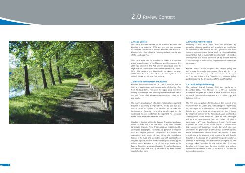
<strong>Kilcullen</strong> is located within the Eastern Transition Landscape<br />
Character <strong>Area</strong> and is on the River Liffey water corridor<br />
Landscape Character <strong>Area</strong>. These areas are characterised by<br />
undulating topography. The lands are generally of medium<br />
size and regular pattern. Hedgerows are usually well<br />
maintained with scattered trees along the boundar<strong>ie</strong>s.<br />
Pasture is the major land use in this area with patches of nonirrigated<br />
agricultural lands. Pasturelands generally occupy the<br />
Liffeys banks. <strong>Kilcullen</strong> is one of the larger towns in the<br />
Eastern Transition Landscape Character <strong>Area</strong> while there are a<br />
number of larger towns along the river Liffey water corridor<br />
mainly further north.<br />
2.3 <strong>Plan</strong>ning Policy Context<br />
<strong>Plan</strong>ning at this local level must be informed by<br />
prevailing planning polic<strong>ie</strong>s and standards as established<br />
in international and national reports, guidelines and other<br />
documents. A consistent theme in all planning and related<br />
documents is that of ‘sustainable development’ – defined as<br />
‘development that meets the needs of the present without<br />
compromising the ability of future generations to meet their<br />
own needs.’<br />
<strong>Kildare</strong> County Council supports this national policy and<br />
this concept is a major component of the <strong>Kilcullen</strong> <strong>Local</strong><br />
<strong>Area</strong> <strong>Plan</strong>. The <strong>Plan</strong>ning Authority has also had regard<br />
to European Union policy Directives and national policy<br />
guidelines during the preparation of this <strong>Local</strong> <strong>Area</strong> <strong>Plan</strong>.<br />
2.3.1 National Spatial Strategy<br />
The National Spatial Strategy (NSS) was published in<br />
December 2002. The Strategy is a 20-year planning<br />
framework designed to ach<strong>ie</strong>ve a better balance of social,<br />
economic, physical development and population growth<br />
between centres.<br />
The NSS sets out polic<strong>ie</strong>s for <strong>Kilcullen</strong> in the context of its<br />
location within the Dublin and Mid-East Region. The Strategy<br />
for this region is to consolidate the metropolitan area of<br />
Dublin and concentrate development into the ‘Primary<br />
Development Centres’ in the hinterland. <strong>Area</strong>s identif<strong>ie</strong>d as<br />
‘Strategic Rural Assets’ within the Dublin and Mid-East Region<br />
will separate these centres from each other. <strong>Kilcullen</strong> is<br />
designated as a ‘Primary Development Centre’. The Strategy<br />
stipulates that these centres need to aim at a population level<br />
that supports self-sustaining growth, but which does not<br />
undermine the promotion of critical mass in other regions.<br />
Primary Development Centres must take account of wider<br />
considerations for example their relationship with Dublin.<br />
<strong>Kilcullen</strong> is also located on a ‘National Transport Corridor’ as<br />
outlined in the strategy. This corridor runs along the M9. The<br />
strategy makes provision for the unique role of Primary<br />
Development Centres given the close proximity and scale of<br />
Dublin and the need for balance between the city and the<br />
surrounding count<strong>ie</strong>s.<br />
5


