Minutes of the 19th meeting - Archaeological Survey of India
Minutes of the 19th meeting - Archaeological Survey of India
Minutes of the 19th meeting - Archaeological Survey of India

You also want an ePaper? Increase the reach of your titles
YUMPU automatically turns print PDFs into web optimized ePapers that Google loves.
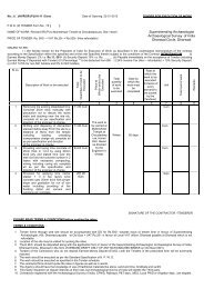
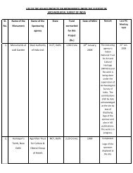
11. CS<br />
No.4596<br />
, Ward<br />
No.4,<br />
Bharuc<br />
h, Shri<br />
Amirbe<br />
g<br />
Nazirbe<br />
g Mirza,<br />
C/1709,<br />
Malbari<br />
Darwaj<br />
a O/o<br />
Jeliben’<br />
s House,<br />
Bharuc<br />
h.<br />
Jami<br />
Masjid,<br />
Bharuc<br />
h<br />
Prohibit<br />
ed area<br />
a)<br />
64.0<br />
0 m<br />
b)<br />
64.0<br />
0 m<br />
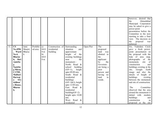
Construction <strong>of</strong><br />
residential<br />
building<br />
Surrounding<br />
situation and<br />
approximate<br />
height <strong>of</strong> <strong>the</strong><br />
existing buildings<br />
near <strong>the</strong><br />
monument -<br />
North: Road &<br />
school building<br />
(GF+1), height<br />
upto 09.00 mts.<br />
South: Road &<br />
residential<br />
buildings<br />
(GF+1&2), height<br />
upto 12.00 mts.<br />
East: Road &<br />
residential<br />
building(GF+2)<br />
height upto 10.00<br />
mts.<br />
West: Road &<br />
residential<br />
12<br />
Open Plot The<br />
proposed<br />
land was<br />
allotted to<br />
<strong>the</strong><br />
applicant<br />
by <strong>the</strong><br />
Government<br />
being a<br />
poor<br />
person and<br />
having no<br />
land to<br />
reside.<br />
however, desired that<br />
<strong>the</strong> Ahmedabad<br />
Municipal Corporation<br />
may be asked to give a<br />
power-point<br />
presentation before <strong>the</strong><br />
Committee in <strong>the</strong> next<br />
<strong>meeting</strong> to take a final<br />
view. The decision on<br />
<strong>the</strong> proposal was<br />
deferred.<br />
- SA, Vadodara Circle<br />
gave a fresh powerpoint<br />
presentation on<br />
<strong>the</strong> proposal with <strong>the</strong><br />
help <strong>of</strong> area map,<br />
photographs <strong>of</strong> <strong>the</strong><br />
monument, site <strong>of</strong><br />
construction and<br />
buildings existing at <strong>the</strong><br />
site, Google Earth<br />
image and also <strong>the</strong><br />
details <strong>of</strong> height <strong>of</strong><br />
buildings existing<br />
between <strong>the</strong> monument<br />
and site <strong>of</strong> construction.<br />
The Committee<br />
observed that <strong>the</strong> area<br />
around <strong>the</strong> monument is<br />
dotted with modern<br />
buildings and<br />
construction as<br />
proposed at <strong>the</strong> site