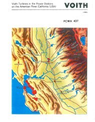
PCWA-L 467.pdf - PCWA Middle Fork American River Project ...
PCWA-L 467.pdf - PCWA Middle Fork American River Project ...
PCWA-L 467.pdf - PCWA Middle Fork American River Project ...

You also want an ePaper? Increase the reach of your titles
YUMPU automatically turns print PDFs into web optimized ePapers that Google loves.
2. SELECTION OF GAGING-sTATION SITES 9<br />
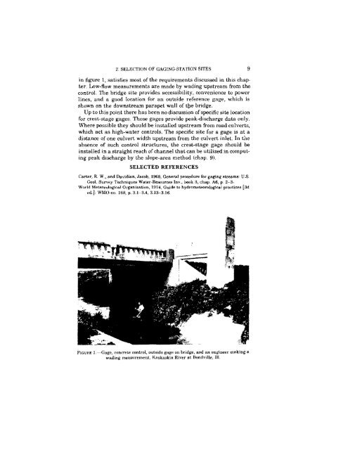
in figure 1, satisfies most of the requirements discussed in this chap·<br />
ter. Low-flow measurements are made by wading upstream from the<br />
control. The bridge site provides accessibility, convenience to power<br />
lines, and a good location for an outside reference gage, which is<br />
shown on the downstream parapet wall of tbe bridge.<br />
Up to this point there has been no discussion ofspecific site location<br />
for crest-stage gages. Those gages provide peak-discharge data only.<br />
Where possible they should be installed upstream from road culverts,<br />
which act as high-water controls. The specific site for a gage is at a<br />
distance of one culvert width upstream from the culvert inlet In the<br />
absence of such control structures, the crest-stage gage should be<br />
installed in a straight reach ofchannel that can be utilized in computing<br />
peak discharge by the slope-area method (chap. 9).<br />
SELECTED REFERENCES<br />
Carter, R. W" and Davidian.. Jacob, 1968, General procedure for gaging streams: U.s.<br />
Geoi. Survey Techniques Water-Resources lov., book 3, chap. A6, p. 2-3.<br />
World Meteorological Organization, 1974, Guide to hydrometeorological practices (3d<br />
cd.], WMO·no. 168, p. 3.I-3.4, 3.13--3.16.<br />
FIGURE I.-Gage, concrete control, outside gage on bridge, and an engineer making a<br />
wading measurement, Kaskaskia <strong>River</strong> at Bondville, Ill.