PCWA-L 467.pdf - PCWA Middle Fork American River Project ...
PCWA-L 467.pdf - PCWA Middle Fork American River Project ...
PCWA-L 467.pdf - PCWA Middle Fork American River Project ...

You also want an ePaper? Increase the reach of your titles
YUMPU automatically turns print PDFs into web optimized ePapers that Google loves.
4. STAGE MEASUREMENT<br />
RESISTANCE SYSTEM<br />
The resistance system, as used in the U.S.A., was developed by the<br />
UB. Weather Bureau. It provides remote indications of water level<br />
for distances up to about 40 mi (about 65 km). Two models are available,<br />
one for distances of about a mile (1.6 km) and the other for<br />
longer distances. The system consists of two potentiometers in a<br />
wheatstone-bridge circuit with a microammeter null indicator. One of<br />
the potentiometers is located in the gage house and is actuated by a<br />
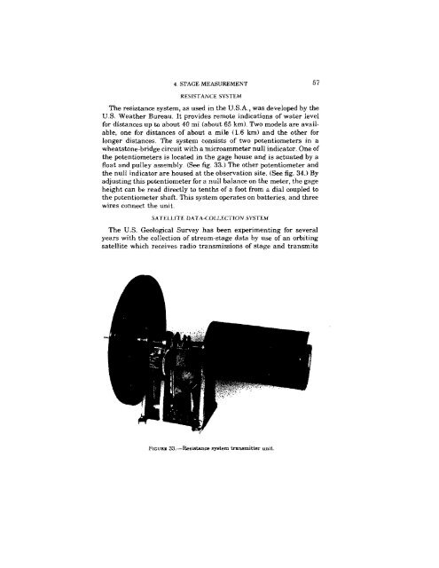
float and pulley assembly. (See fig. 33.) The other potentiometer and<br />
the null indicator are housed at the observation site. (See fig. 34.) By<br />
adjusting this potentiometer for a null balance on the meter, the gage<br />
height can be read directly to tenths of a foot from a dial coupled to<br />
the potentiometer shaft. This system operates on batteries, and three<br />
wires connect the unit.<br />
SATELLITE DATA-COLLECTION SYSTEM<br />
The U.S. Geological Survey has been experimenting for several<br />
years with the collection of stream-stage data by use of an orbiting<br />
satellite which receives radio transmissions of stage and transmits<br />
FIGtJRli: 33,-Resistance system transmitter unit.<br />
57