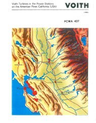
PCWA-L 467.pdf - PCWA Middle Fork American River Project ...
PCWA-L 467.pdf - PCWA Middle Fork American River Project ...
PCWA-L 467.pdf - PCWA Middle Fork American River Project ...

Create successful ePaper yourself
Turn your PDF publications into a flip-book with our unique Google optimized e-Paper software.
9. INDIRECT DETERMINAnON OF PEAK DlSCHAKGE 273<br />
CHAPTER 9.-INDIRECT DETERMINAnON OF<br />
PEAK DISCHARGE<br />
INTRODUCTION<br />
During floods, it is frequently impossible or impractical to measure<br />
the peak discharges when they occur because of conditions beyond<br />
controL Roads may he impassable; structures from which currentmeter<br />
measurements might have been made may be nonexistent, not<br />
suitably located, or destroyed; knowledge of the flood rise may not be<br />
available sufficiently in advance to permit reaching the site near the<br />
time of tbe peak; the peak may be so sharp that a satisfactory current-meter<br />
measurement could not be illade even with an engineer<br />
present at the time; the flow ofdebris or ice may be such as to prevent<br />
use of a current meter; or limitations of personnel might make it<br />
impossible to obtain direct measurements of high-stage discharge at<br />
numerous locations during a short flood period, Consequently, many<br />
peak discharges must be determined after the passage of the flood by<br />
indirect methods such as slope-area, contracted opening, fiow-overdam,<br />
or flow-through-culvert.<br />
Indirect determinations of discharge make use of the energy equation<br />
for computing streamflow. The specific equations differ for different<br />
types of flow, such as unobstructed open-channel flow, flow over<br />
dams, and flow through culverts. However, all the methods involve<br />
these general factors:<br />
1. Physical characteristics of the channel; that is dimensions and<br />
conformation of the channel within the reach used and boundary<br />
conditions.<br />
2. Water-surface elevations at time of peak stage to define the upper<br />
limit of the cross-sectional areas and the difference in elevation<br />
between two or more significant cross sections.<br />
3. Hydraulic factors based on physical characteristics, water-surface<br />
elevations, and discharge, such as roughness coefficients and discharge<br />
coefficients.<br />
This chapter provides only a brief general discussion of tbe procedures<br />
used in collecting field data and in computing discharge by the<br />
various indirect methods. That highly specialized subject is treated in<br />
detail in the several manuals of the series "Techniques of Water<br />
Resources Investigations of the United States Geological Survey"<br />
that are listed as references at the end of this chapter.