vynnunt ųiatfr - State Law Publisher
vynnunt ųiatfr - State Law Publisher
vynnunt ųiatfr - State Law Publisher
You also want an ePaper? Increase the reach of your titles
YUMPU automatically turns print PDFs into web optimized ePapers that Google loves.
918 GOVERNMENT GAZETTE, W.A. [29 March, 1956.<br />
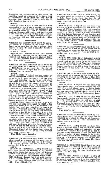
WHEREAS the GREENBUSHES Road Board, by<br />
resolution passed at a meeting of the Board held<br />
at Greenbushes on or about the 20th day of<br />
November, 1947, resolved to open the road hereinafter<br />
described, that is to say:-<br />
5456/08.<br />
Road No. 11157. A strip of land one chain wide<br />
commencing on the Western boundary of Nelson<br />
Location 1598 and extending (as delineated and<br />
coloured dark brown on L. and S. Diagram 63760)<br />
Southward through said location and Location 1599<br />
to the Western boundary of the latter location.<br />
Ia. ir. 15.lp. and 3r. 7p. being resumed from Nelson<br />
Locations 1598 and 1599 respectively. (Plan<br />
439B/40, Dl.)<br />
WHEREAS the HARVEY Road Board, by resolution<br />
passed at a meeting of the Board held at<br />
Harvey on or about the 18th day of October, 1955,<br />
resolved to open the road hereinafter described,<br />
that is to say:<br />
L. and S. 1384/98.<br />
Road No. 9768. (Widening of Part.) That portion<br />
of Wellington Location 698 as delineated and<br />
coloured dark brown on L and S. Diagram 63496.<br />
ir. 17.4p. being resumed from Wellington Location<br />
698. (Plan 383D/40, A4.)<br />
WhEREAS the KELLERBERRIN Road Board, by<br />
resolution passed at a meeting of the Board held<br />
at Kellerberrin on or about the 11th day of<br />
July, 1955, resolved to open the road hereinafter<br />
described, that is to say:-<br />
1003/55<br />
Road No. 11168. A strip of land one chain wide<br />
leaving Massinghazn Street at the North-East corner<br />
of lot 22 of Avon Location 3777 (L.T.O. Plan<br />
3199) and extending (as shown on said plan)<br />
Southward along the Eastern boundary of said<br />
lot and to and along the Eastern boundaries of<br />
lots 23 to 26 inclusive and 41 to 46 inclusive to<br />
the South-East corner of the lastmentloned lot.<br />
Road No. 11169 (Forrest Street). A strip of land<br />
one chain wide leaving Mitchell Street at the<br />
South-West corner of lot 54 of Avon Location 3777<br />
(L.T.O. Plan 3199) and extending (as shown on<br />
said plan) Eastward along the Southern boundary<br />
of said lot and to and along the Southern boundaries<br />
of lots 53 to 46 inclusive and onward to the<br />
Eastern alignment of road No. 11168.<br />
Road No. 11170 (Hammond Street). A strip of<br />
land one chain wide leaving road No. 11168 at the<br />
South-East corner of lot 26 of Avon Location 3777<br />
(L.T.O. Plan 3199) and extending (as shown on<br />
said plan) Westward along the Southern boundaries<br />
of said lot and to and along the Southern<br />
boundaries of lots 27 to 30 inclusive, 9 to 13 inclusive<br />
and Icellerberrin Lot 362 to Mitchell Street<br />
at the South-West corner of the lastmentioned lot.<br />
Road No. 11171 (Watt Street). A strip of land<br />
one chain wide leaving Massingham Street at the<br />
North-East corner of lot 5 of Avon Location 3777<br />
(L.T.O. Plan 3199) and extending (as shown on<br />
said plan) Southward along the Eastern boundary<br />
of said lot and to and along the Eastern boundaries<br />
of lots 6 to 9 inclusive to road No. 11170<br />
(Hammond Street) at the South-East corner of<br />
the lastmentioned lot, 5a Or 7p. being resumed<br />
from Avon Location 3777.<br />
(Plan Kellerberrin Townsite.)<br />
WHEREAS the KOJONUP Road Board, by resolution<br />
passed at a meeting of the Board held at<br />
Kojonup on or about the 24th day of November,<br />
1950, resolved to open the road hereinafter described,<br />
that is to say:-<br />
4476/50<br />
Road No. 9935 (Extension). A strip of land one<br />
chain wide leaving the terminus of the present<br />
road at the South-East corner of lot 1 of Kojonup<br />
Location 4430 (L.T.O. Diagram 6916) and extending<br />
(as delineated and coloured dark brown on OP.<br />
6328) Eastward through lot 3 of said location<br />
(L.T.O. Diagram 6918) to its Eastern boundary<br />
6a, lr. 26p. being resumed from Kojonup Location<br />
4430. (Plan 4150/40, F3.)<br />
WHEREAS the LAKE GRACE Road Board, by<br />
resolution passed at a meeting of the Board, held<br />
at Lake Grace on or about the 2nd day of<br />
September, 1947, resolved to open the road hereinafter<br />
described, that is to say:-<br />
4910/47.<br />
Road No. 11162. A strip of land one chain wide<br />
widening in parts, commencing at the North-East<br />
corner of Williams Location 9525 and extending<br />
(as surveyed and as delineated and coloured dark<br />
brown on L. and S. Diagram 63512) Southward<br />
along the Eastern boundary of said location and<br />
through and along part of the Western boundary<br />
of location 9526, Reserve 16893, to a surveyed road<br />
on the Southern boundary of location 9525. 3a.<br />
lr. 20p, being resumed from Williams Location<br />
9525. (Plan 387/80, D4.)<br />
WHEREAS the MANJIMUP Road Board, by resolution<br />
passed at a meeting of the Board held at<br />
Manjimup on or about the 8th day of December,<br />
1956, resolved to open the road hereinafter described,<br />
that is to say:-<br />
4082/15,<br />
Road No. 6781 (Giblet Street Extension). A strip<br />
of land one chain wide leaving the terminus of the<br />
present road at the South corner of Manjimup<br />
Lot I and extending South-Westward (widening<br />
as shown on OP. 6520) to and along the South-<br />
Eastern boundary of lot 276 to Rose Street at the<br />
West corner of the latter lot. (Plan Manjimup<br />
Townaite.)<br />
WHEREAS the MANJIMTJP Road Board, by resolution<br />
passed at a meeting of the Board held at<br />
Manjimup on or about the 17th day of May, 1955,<br />
resolved to open the road hereinafter described.<br />
that is to say:-<br />
1453/55<br />
Road No. 11176. A strip of lane one chain wide<br />
(unsurveyed) leaving the Western side of road No.<br />
10021 at a point situate about 12 chains South<br />
from the North-East corner of Nelson Location<br />
5492 and extending South-Westward through Saw<br />
Milling Area No. 120/33 to its Southernmost boundary.<br />
Road No. 11177. A strip of land 75 links wide<br />
(unsurveyed) leaving the North-Western side of<br />
road No. 11176 at a point on said side of road<br />
No. 11176 situate about 1 chain 50 links South-<br />
Westward from its junction with road No. 10021<br />
and extending North-Westward through Saw Milling<br />
Area No. 120/33 for a distance of about 5<br />
chains.<br />
(Plan 443A/40, Al.)<br />
WHEREAS the MANJIMTJP Road Board, by resolution<br />
passed at a meeting of the Board held at<br />
Manjimup on or about the 25th day of September,<br />
1946, resolved to open the road hereinafter described,<br />
that Is to say:-<br />
1178/18.<br />
Road No. 11183. A strip of land one chain wide,<br />
leaving a surveyed road at the South-West corner<br />
of Nelson Location 12070 and extending (as delineated<br />
and coloured dark brown on L and S.<br />
Diagram 63768) Northward outside and along the<br />
Western boundary of said location to its North-<br />
West corner; thence North-Westward outside and<br />
along part of the South-Western boundary of location<br />
9600 for a distance of 20 chains 35.4 links.<br />
(Plan 4390/40, E4.)<br />
WHEREAS the MANJIMTJP Road Board, by resolution<br />
passed at a meeting of the Board held at<br />
Manjimup on or about the 17th day of February,<br />
1955, resolved to open the road hereinafter described,<br />
that is to say:-<br />
2252/32.<br />
Road No. 4581 (Widening of Part). A strip of<br />
land one chain wide along the Southern side of<br />
the present road extending from the North-west<br />
to the North-East corner of Nelson Location 9482.<br />
(Plan 4390/40, D3.)


