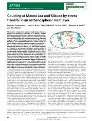
Topographic Maps and Digital Elevation Models
Topographic Maps and Digital Elevation Models
Topographic Maps and Digital Elevation Models
SHOW LESS

Create successful ePaper yourself
Turn your PDF publications into a flip-book with our unique Google optimized e-Paper software.
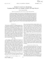
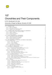
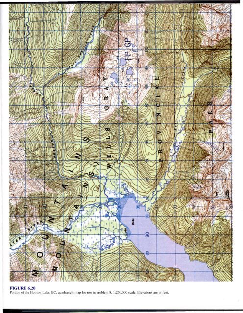
FIGURE 6.20<br />
Portion of the Hobson Lake, Be, quadrangle map for use in problem 8. I:250,000 scale. <strong>Elevation</strong>s are in feel.