QUESTAR III SUBJECT/TITLE INDEX P ART & MUSIC: BAROQUE ...
QUESTAR III SUBJECT/TITLE INDEX P ART & MUSIC: BAROQUE ...
QUESTAR III SUBJECT/TITLE INDEX P ART & MUSIC: BAROQUE ...
You also want an ePaper? Increase the reach of your titles
YUMPU automatically turns print PDFs into web optimized ePapers that Google loves.
Catalog<br />
GEORGIA<br />
place−<br />
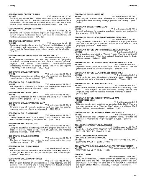
GEOGRAPHICAL ODYSSEYS: PERU<br />
GEOGRAPHY SKILLS: SAMPLING<br />
VH3908 VHS videocassette, JS, 30 VH928 VHS videocassette, IJ, 10, C<br />
Students will explore Peru, where two cultures -that of the great This program explains three fundamental concepts employed by<br />
Inca civilization and its Spanish conquerors -have combined in a geographers when sampling: average, percent, and density. (FFH,<br />
thriving land of contrasts, of imposing urban structures and ruined 1995)<br />
ancient cities, modern industry and traditional ways. (WA, 99)<br />
GEOGRAPHY SKILLS: THEME MAPS<br />
GEOGRAPHICAL ODYSSEYS: TURKEY VH927 VHS videocassette, IJ, 10, C<br />
VH3904 VHS videocassette, JS, 30 Several techniques for mapping population density are explored in<br />
Students will explore Turkey's region of Cappadocia, a site of this program. (FFH, 1995)<br />
surreal, magical landscapes dotted with citadels, monasteries, and<br />
hidden underground cities. (WA, 99) GEOGRAPHY SKILLS: SOLVING GEOGRAPHY PROBLEMS<br />
VH931<br />
VHS videocassette, IJ, 10, C<br />
GEOGRAPHICL ODYSSEYS: EGYPT<br />
Using the skill of classification and comparison, this program shows<br />
VH3906 VHS videocassette, JS, 30 how we can recognize patterns, which in turn help to solve<br />
Students will explore Egypt and the Valley of the Nile River, a world geography problems. (FFH, 1995)<br />
of mysteries and monuments. Here, temples, pyramids, golden<br />
tombs, and the Great Sphinx were built to the glory of the afterlife. GEOGRAPHY TUTOR: E<strong>ART</strong>H'S PHYSICAL FEATURES-VOL.IV<br />
(WA, 99) VH3262 VHS videocassette, I-J, C<br />
Some questions answered in Volume 4 are: What is a continent?<br />
GEOGRAPHY: FIVE THEMES FOR THE PLANET E<strong>ART</strong>H<br />
What is a peninsula? What is a plateau? Excellent tape for Earth<br />
VH3240 VHS videocassette, I-J, 17, C Science classes. (Wilson, 1991)<br />
This program introduces the five key themes in geography<br />
education: location−position on the Earth's surface;<br />
GEOGRAPHY TUTOR: GLOBAL PROBLEMS AND ISSUES-VOL.VI<br />
physical and human characteristics; human/environment<br />
VH3264<br />
VHS videocassette, I-J, C<br />
interactions; movement of people, goods, and ideas; and regions<br />
Important issues such as ozone layer, water pollution and the<br />
−how they form and change. (NG, 1992)<br />
greenhouse effect are discussed in depth. (Wilson, 1991)<br />
GEOGRAPHY SKILLS: CONTOURS<br />
VH926<br />
VHS videocassette, IJ, 10, C<br />
This program examines an oblique view of a mountain and describes<br />
how elevation levels are obtained. (FFH, 1995)<br />
GEOGRAPHY SKILLS: DIRECTIONS<br />
VH889<br />
VHS videocassette, IJ, 10, C<br />
The importance of orienting a map to the landscape is emphasized<br />
to help students visualize directions. (FFH, 1995)<br />
GEOGRAPHY SKILLS: DISTANCE<br />
VH888<br />
VHS videocassette, IJ, 10, C<br />
Calculating distances on the landscape and using map scales are<br />
explored in this program. (FFH, 1995)<br />
GEOGRAPHY SKILLS: GATHERING DATA<br />
VH929<br />
VHS videocassette, IJ, 10, C<br />
Different types of research; patterns; and the need for careful,<br />
organized gathering of data are discussed. (FFH, 1995)<br />
GEOGRAPHY SKILLS: GRAPHING<br />
VH930<br />
VHS videocassette, IJ, 10, C<br />
Cartography−the science of drawing charts, diagrams, and maps<br />
−and the skill of graphing are presented. (FFH, 1995)<br />
GEOGRAPHY SKILLS: LATITUDE<br />
VH847<br />
VHS videocassette, IJ, 10, C<br />
Using the equator as the starting point, this program shows how the<br />
Tropic of Cancer, Arctic Circle, Tropic of Capricorn, and Antarctic<br />
circle are measured. (FFH, 1995)<br />
GEOGRAPHY TUTOR: MAP AND GLOBE TERMS-VOL.I<br />
VH3259<br />
VHS videocassette, I-J, C<br />
Items such as map distortions, meridians, grids, latitude and<br />
longitude and parts of the map are discussed. (Wilson, 1991)<br />
GEOGRAPHY TUTOR: MAP SKILLS-VOL.<strong>III</strong><br />
VH3261<br />
VHS videocassette, I-J, C<br />
This volume answers questions that students ask concerning "map<br />
skills". Such subjects as map directions, plotting latitude and<br />
longitude, map symbols and road maps are examined in detail.<br />
(Wilson, 1991)<br />
GEOGRAPHY TUTOR: TYPES OF MAPS AND MAP<br />
PROJECTIONS-VOL.II<br />
VH3260<br />
VHS videocassette, I-J, C<br />
This volume asks such questions as: What is a Polar Map? What are<br />
the main purposes of a Weather Map? What is a Climate Map?<br />
Fifteen different items explained. (Wilson, 1991)<br />
GEOGRAPHY TUTOR: WEATHER AND CLIMATE-VOL.V<br />
VH3263<br />
VHS videocassette, I-J, C<br />
Topics discussed are: Meteorology, Weather Fronts, Tornados and<br />
Hurricanes. Outstanding live photography included. (Wilson,<br />
1991)<br />
GEOLOGIST/HORTICULTURE/GARDENING<br />
VH3479<br />
VHS videocassette, JH, 30, C<br />
(Vol.3:Prog.8) (CAREERS FOR THE 21ST CENTURY) (CAREERS FOR<br />
THE 21ST CENTURY) (TakeOff, 1993)<br />
GEOGRAPHY SKILLS: LONGITUDE<br />
VH887<br />
VHS videocassette, IJ, 10, C<br />
The lines of longitude are related to local times, using the prime<br />
meridian and the sun. (FFH, 1995)<br />
GEOMETRY/ESTIMATION/PROBLEM<br />
SOLVING/STATISTICS:SAMPLING<br />
VH1651<br />
VHS videocassette, INT., 60, C<br />
(SOLVE IT) (SOLVE IT) (St.Ed., 1987)<br />
GEOGRAPHY SKILLS: MAP GRIDS<br />
GEOMETRY/PROBLEM SOLVING/RATION-PROPORTION-PERCENT<br />
VH846<br />
VHS videocassette, IJ, 10, C VH1653<br />
VHS videocassette, INT., 45, C<br />
The simple scientific method of determining location−by means of (SOLVE IT) (SOLVE IT) (St.Ed., 1987)<br />
a map grid−is described, and its advantages and disadvantages<br />
outlined. (FFH, 1995)<br />
GEORGIA O'KEEFE<br />
VH1691<br />
VHS videocassette, I-J-H, 60, C<br />
GEOGRAPHY SKILLS: MAP SYMBOLS<br />
Here, for the first time, O'Keefe appears on camera to talk candidly<br />
VH836<br />
VHS videocassette, IJ, 10, C about her work and life. Her paintings figure prominently also,<br />
This program teaches an understanding of map legends, and the showing her wide range in style and how nature−the mountains<br />
techniques of identifying and locating information through different and desert of New Mexico, especially, continued to inspire her.<br />
sizes and shapes of symbols. (FFH, 1995) (MET,)<br />
141


