Ayr Central Conservation Area Character Appraisal - South Ayrshire ...
Ayr Central Conservation Area Character Appraisal - South Ayrshire ...
Ayr Central Conservation Area Character Appraisal - South Ayrshire ...

You also want an ePaper? Increase the reach of your titles
YUMPU automatically turns print PDFs into web optimized ePapers that Google loves.
<strong>South</strong> <strong>Ayr</strong>shire Council<br />
October 2008<br />
CONSERVATION AREA CHARACTER APPRAISAL<br />
AYR CENTRAL
AYR CENTRAL CONSERVATION AREA CHARACTER APPRAISAL<br />
OCTOBER 2008<br />
Prepared by Nick Haynes & Associates for <strong>South</strong> <strong>Ayr</strong>shire Council<br />
Department of Development, Safety & Regulation<br />
<strong>South</strong> <strong>Ayr</strong>shire Council<br />
Burns House<br />
Burns Statue Square<br />
AYR<br />
KA7 1UT<br />
www.south-ayrshire.gov.uk<br />
The production of this document is part-funded by the Heritage Lottery Fund under the<br />
Townscape Heritage Initiative Stage 2 Development Award for <strong>Ayr</strong>.<br />
Consultant Team<br />
Nick Haynes: buildings<br />
Fiona Jamieson: gardens & open spaces<br />
Euan Leitch: buildings<br />
Rob Robinson (Heritage Consulting): interpretation/awareness<br />
Vanessa Stephen: context and project co-ordination<br />
Simon Stronach (Headland Archaeology): archaeology<br />
© Text: <strong>South</strong> <strong>Ayr</strong>shire Council.<br />
© Mapping: Crown copyright. All mapping data is licensed to <strong>South</strong> <strong>Ayr</strong>shire Council from<br />
Ordnance Survey with the permission of the Controller of Her Majesty’s Stationery Office.<br />
All rights reserved. Licence number 100020765.<br />
© Images: copyright of Nick Haynes unless otherwise credited.<br />
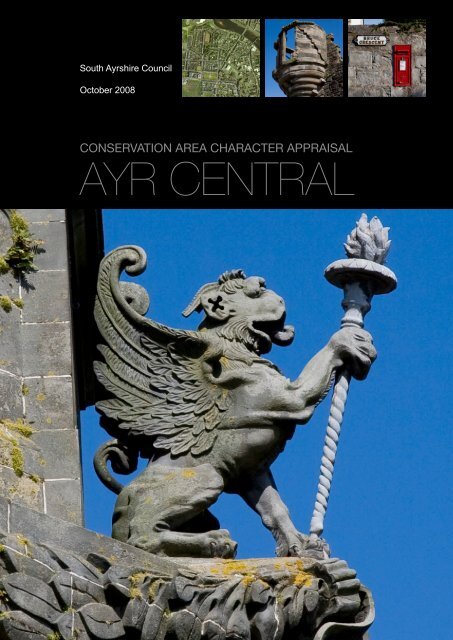
Cover images:<br />
1. Detail of griffin, Town Buildings, New Bridge Street<br />
2. Aerial photograph, © <strong>South</strong> <strong>Ayr</strong>shire Council<br />
3. Detail of Miller’s Folly, Citadel<br />
4. Detail of post box and street sign, Bruce Crescent<br />
Frontispiece opposite:<br />
Sandgate looking North to the Town Buildings and New Bridge Street.<br />
PDF EDITION<br />
Part, section and sub-section headings are tagged in the index for navigation. Clicking<br />
on the coloured side-bars on each page returns the reader to the index. Hyperlinks to<br />
websites outside the document can be activated by clicking.
CONTENTS<br />
SUMMARY............................................................................................................... 4<br />
PART ONE – HISTORY, CHARACTER & APPEARANCE<br />
INTRODUCTION...................................................................................................... 7<br />
<strong>Conservation</strong> <strong>Area</strong>s............................................................................................... 7<br />
What does <strong>Conservation</strong> <strong>Area</strong> Status Mean?...................................................... 7<br />
<strong>Character</strong> <strong>Appraisal</strong>s ............................................................................................ 7<br />
Designation............................................................................................................. 8<br />
Boundaries............................................................................................................. 8<br />
LOCATIONAL CONTEXT........................................................................................ 10<br />
Reasons for location............................................................................................. 11<br />
Regional context.................................................................................................... 11<br />
Geology................................................................................................................... 11<br />
Topography............................................................................................................. 11<br />
Important historic, social, economic and cultural associations....................... 12<br />
DEVELOPMENT HISTORY..................................................................................... 13<br />
Prehistoric.............................................................................................................. 13<br />
Mediaeval................................................................................................................ 13<br />
17th century............................................................................................................ 14<br />
18th Century........................................................................................................... 15<br />
19th Century (first half).......................................................................................... 16<br />
19th Century (second half).................................................................................... 18<br />
20th Century........................................................................................................... 19<br />
CHARACTER & APPEARANCE............................................................................. 20<br />
Setting..................................................................................................................... 20<br />
Street Pattern......................................................................................................... 22<br />
Buildings & Townscape: Archaeological Resources......................................... 25<br />
Buildings & Townscape: Principal Historic Buildings........................................ 28<br />
Buildings & Townscape: Other Buildings of Townscape Merit......................... 32<br />
Open Space............................................................................................................ 35<br />
Trees and Hedges.................................................................................................. 38<br />
<strong>Character</strong> <strong>Area</strong>s..................................................................................................... 39<br />
<strong>Character</strong> <strong>Area</strong>s: Sandgate................................................................................... 40<br />
<strong>Character</strong> <strong>Area</strong>s: High Street................................................................................ 46<br />
<strong>Character</strong> <strong>Area</strong>s: Wellington Square.................................................................... 51<br />
<strong>Character</strong> <strong>Area</strong>s: Citadel....................................................................................... 56<br />
<strong>Character</strong> <strong>Area</strong>s: Villa............................................................................................ 59<br />
2
PART TWO – MANAGEMENT CONTEXT<br />
MANAGEMENT BACKGROUND............................................................................ 62<br />
Assessment of Significance................................................................................. 62<br />
Planning Policies: General.................................................................................... 63<br />
Planning Policies: <strong>Conservation</strong> <strong>Area</strong>................................................................. 64<br />
Planning Policies: Supplementary Guidance...................................................... 65<br />
Planning Policies: Article 4 Directions and Advertisement Control ................ 66<br />
Planning Policies: Archaeology........................................................................... 66<br />
IDENTIFICATION OF MANAGEMENT ISSUES .................................................... 67<br />
Buildings At Risk................................................................................................... 67<br />
Sensitivity Analysis............................................................................................... 68<br />
Public Realm .......................................................................................................... 70<br />
MANAGEMENT OPPORTUNITIES......................................................................... 72<br />
Development Opportunity Sites........................................................................... 72<br />
Planning Action...................................................................................................... 73<br />
Enhancement ............................................................................................................. 74<br />
PUBLIC AWARENESS AND INTERPRETATION................................................... 76<br />
Existing Provision.................................................................................................. 76<br />
Summary Of Key Issues........................................................................................ 80<br />
Suggested Projects .............................................................................................. 81<br />
PRIORITISED ACTION SUMMARY ....................................................................... 83<br />
PART THREE - BIBLIOGRAPHY & APPENDICES<br />
BIBLIOGRAPHY...................................................................................................... 86<br />
APPENDIX A: Archaeological resources............................................................. 87<br />
APPENDIX B: Listed Buildings............................................................................. 89<br />
APPENDIX C: Key Historic Buildings................................................................... 101<br />
APPENDIX D: Open Spaces.................................................................................. 104<br />
APPENDIX E: Summary of Local Plan Policies................................................... 124<br />
APPENDIX F: Potential Interpretation & Awareness Projects........................... 126<br />
APPENDIX G: Proposed Townscape Heritage Initiative <strong>Area</strong> Map.................... 134<br />
APPENDIX H: Suggested Boundary Amendments............................................. 135<br />
3
SUMMARY<br />
This document is organised in three parts. Part One outlines the history and development<br />
of <strong>Ayr</strong>, and describes the surviving historical features of the town. Part Two examines the<br />
management context of the <strong>Conservation</strong> <strong>Area</strong> including applicable planning policies and<br />
guidance, and presents suggested actions for future protection and enhancement. Part<br />
Three contains a select bibliography and appendices setting out further details of sites,<br />
policies and suggested actions.<br />
Summary of Part One: History, <strong>Character</strong> & Appearance<br />
The introductory section sets out the general statutory and policy framework of conservation<br />
areas, the implications for owners and occupiers, the purpose of <strong>Character</strong> <strong>Appraisal</strong>s,<br />
and the specific background to the designation of the current boundaries of <strong>Ayr</strong> <strong>Central</strong><br />
<strong>Conservation</strong> <strong>Area</strong>.<br />
The broader context of <strong>Ayr</strong> Town Centre is described, including: the strategic reasons for<br />
the location of the settlement; how the town relates to the surrounding region with regard<br />
to transport, administration, economy and education; the solid and sedimentary geological<br />
formation of the area; the raised beach topography of <strong>Ayr</strong> Bay; and significant cultural<br />
associations with figures such as William the Lion, William Wallace, Robert Bruce, Robert<br />
Burns and John Loudon MacAdam.<br />
The development history of <strong>Ayr</strong> shows that its strategic location at a confluence of trading<br />
routes and its natural harbour helped the settlement to flourish around two principal streets<br />
following the grant of a Royal Charter in 1205. The streets were planned and laid out<br />
to maximise the natural land formation to provide shelter for trading activities: the initial<br />
development of the Sandgate was susceptible to blown sand, perhaps leading to the unusual<br />
alignment and duplicate trading facilities in the High Street. Newton-on-<strong>Ayr</strong> also began its<br />
independent existence in the mediaeval period.<br />
The town evolved through a process of gradual expansion in the mediaeval period, followed<br />
by rapid expansion in planned residential developments and renewal of the centre in<br />
the late 18th and 19th centuries. The renewal was generally sensitive to the earlier land<br />
ownership patterns of long narrow ‘rigs’ and vennels set at right angles to the streets. A<br />
number of exceptional public buildings were constructed. The new residential areas fitted<br />
into and around the remains of Cromwell’s fortified hexagonal Citadel of 1652. 20th century<br />
developments were by and large less sensitive to the historic layouts.<br />
Having outlined the development history of the town, the <strong>Character</strong> <strong>Appraisal</strong> examines<br />
what survives in terms of archaeology, historic buildings, open spaces, and natural features.<br />
In summary, the Town Centre is rich in archaeological resources and historic buildings of<br />
national, regional and local interest. There are several open spaces of regional or higher<br />
interest, including the Auld Kirk Kirkyard, but the seaside location and urban nature of<br />
development militate against significant areas of planting. Within the overall <strong>Ayr</strong> <strong>Central</strong><br />
<strong>Conservation</strong> <strong>Area</strong>, five smaller areas of distinctive character are identified: Sandgate; High<br />
Street, Wellington Square; Citadel; and the villa area. The characteristics of these areas,<br />
such as the spatial arrangement, principal buildings, building density and height, materials,<br />
and current usage, are described in detail.<br />
4
Summary of Part Two: Management Context<br />
The second part of the <strong>Character</strong> <strong>Appraisal</strong> sets out a brief assessment of the significance<br />
of <strong>Ayr</strong> <strong>Central</strong> <strong>Conservation</strong> <strong>Area</strong> in a national context, and outlines the current planning<br />
policies relevant to the preservation and enhancement of the area.<br />
The management of conservation areas involves a wide range of issues (planning,<br />
economic development, transport, street maintenance etc.) and people (local and national<br />
public authorities and agencies, voluntary and amenity bodies, businesses, and individuals<br />
etc.). The <strong>Appraisal</strong> attempts to identify particular issues that currently impact adversely<br />
on the condition or character of the <strong>Conservation</strong> <strong>Area</strong>, and to suggest possible means<br />
of improvement. 1–3 New Bridge Street is the only building included on the Scottish Civic<br />
Trust’s ‘Buildings at Risk Register’, but this is already recognised as a priority for repair in the<br />
recent bid to the Heritage Lottery Fund for a Townscape Heritage Initiative scheme. Other<br />
identified issues include the poor general level of basic building maintenance, weathering<br />
and erosion of stonework, and the loss of the mediaeval rig pattern in new developments.<br />
In managing the public realm it is desirable to retain any existing historic features, such as<br />
setted road surfaces and the distinctive cast-iron street signs. Future enhancement schemes<br />
could build on the success of recent high quality improvement schemes in Old Bridge Street<br />
and around Loudoun Hall. Several potential development sites including <strong>South</strong> Harbour Road,<br />
‘Affleck’s’ behind the Sandgate, and the corner site at the junction of the Sandgate and High<br />
Street, are highlighted as opportunities to enhance the <strong>Conservation</strong> <strong>Area</strong>. Other potential<br />
enhancements to the <strong>Conservation</strong> <strong>Area</strong> and its immediate surroundings are suggested:<br />
repair of the buildings at the south end of the New Bridge; appropriate redevelopment of the<br />
car parks on Boswell Park; replacement of the brick buildings fronting the river behind 12–16<br />
and 26–48 High Street; reinstatement of railings at Barns Terrace, Alloway Place and Miller<br />
Street; and environmental improvements to the riverside walk and <strong>South</strong> Harbour Street.<br />
Opportunities for the improvement of interpretation provision and awareness/educational<br />
activities to promote the understanding and enjoyment of the <strong>Conservation</strong> <strong>Area</strong> were<br />
considered. Whilst there are a number of tourist initiatives in place, a more co-ordinated<br />
and inclusive approach to the promotion of <strong>Ayr</strong> Town Centre’s cultural and built heritage<br />
is suggested through potential projects such as an official website and town trail, unified<br />
accessible signage, temporary movable exhibitions to maintain the appearance of vacant<br />
shopfronts, programmes of talks and community events, education packs, and new media<br />
information.<br />
As part of the <strong>Character</strong> <strong>Appraisal</strong> a review of the existing <strong>Ayr</strong> <strong>Central</strong> <strong>Conservation</strong> <strong>Area</strong><br />
boundaries was undertaken. It is recommended that consideration is given to amending the<br />
boundaries to include key aspects of the town’s history, setting and character: Low Green,<br />
the Pavilion, Place de St Germain-en-Laye, the Esplanade and putting greens; the Twa’<br />
Brigs and the approaches and viewpoints to the Town Centre from Newton/Wallacetown; a<br />
wider context for the Citadel walls to take in grassed amenity strips on the west and north<br />
and the former quays on <strong>South</strong> Harbour Street; the remaining historic parts of the Sandgate;<br />
later 19th century terraces in Dalblair Road; the Railway Station, Station Hotel and Burns<br />
Statue.<br />
5
© Washington Wilson Collection, University of Aberdeen. Licensor: www.scran.ac.uk.<br />
Sandgate looking north, circa 1880. Photograph by George Washington Wilson.<br />
© Carnegie Library, <strong>Ayr</strong>.<br />
View of the Auld Brig and Town Buildings, 1859.<br />
6
<strong>Ayr</strong> <strong>Central</strong> <strong>Conservation</strong> <strong>Area</strong> <strong>Character</strong> <strong>Appraisal</strong><br />
Part One<br />
PART ONE – HISTORY, CHARACTER & APPEARANCE<br />
INTRODUCTION<br />
<strong>Conservation</strong> <strong>Area</strong>s<br />
<strong>Conservation</strong> areas are ‘areas of special architectural or historic interest, the character of<br />
which it is desirable to preserve or enhance’, designated by planning authorities as required<br />
by Section 61 of the Planning (Listed Buildings & <strong>Conservation</strong> <strong>Area</strong>s)(Scotland) Act 1997.<br />
<strong>South</strong> <strong>Ayr</strong>shire Council currently has 21 designated conservation areas, varying in character<br />
from the urban centres and residential suburbs to rural villages<br />
What does <strong>Conservation</strong> <strong>Area</strong> Status Mean?<br />
The designation places a duty on planning authorities to draw up proposals from time to<br />
time for the preservation or enhancement of the area, to consider the effect of planning<br />
applications on the character or appearance of the area, and to apply special controls within<br />
the area. The conservation area controls relate to:<br />
• Demolition of buildings<br />
• Removal of, or work to, trees<br />
• Small house extensions, roof alterations, stone cleaning or painting of the exterior,<br />
provision of hard surfaces, and<br />
• Satellite dishes<br />
Further specific controls, known as ‘Article 4’ and ‘Control of Advertisements’ Directions,<br />
extend the requirement for planning permission for certain types of work in <strong>Ayr</strong> <strong>Central</strong><br />
<strong>Conservation</strong> <strong>Area</strong>. Details of the Article 4 and Control of Advertisements Directions are set<br />
out on page 66.<br />
<strong>Character</strong> <strong>Appraisal</strong>s<br />
Each conservation area has its own unique character and appearance. The purpose of a<br />
<strong>Character</strong> <strong>Appraisal</strong> is to identify the key elements that contribute to the special historic or<br />
architectural character of the area. Clear identification of these elements allows measures<br />
for their preservation or enhancement to be prioritised.<br />
It is intended that the history of development, townscape analysis and character assessment<br />
set out in the <strong>Character</strong> <strong>Appraisal</strong> will guide owners, occupiers, the planning authority,<br />
and other stakeholders in the ongoing management of the area. The <strong>Appraisal</strong> identifies<br />
opportunities and priorities for enhancement, and sets out the policy framework for the<br />
determination of development proposals.<br />
7
Part One<br />
<strong>Ayr</strong> <strong>Central</strong> <strong>Conservation</strong> <strong>Area</strong> <strong>Character</strong> <strong>Appraisal</strong><br />
This product includes mapping data licensed from Ordnance Survey with the permission of the Controller of Her Majesty’s<br />
Stationery Office. Crown copyright and/or database right 2008. All rights reserved. Licence number 100020765.<br />
<strong>Ayr</strong> <strong>Central</strong> <strong>Conservation</strong> <strong>Area</strong> Boundary, August 2008.<br />
Designation<br />
The <strong>Ayr</strong> <strong>Central</strong> <strong>Conservation</strong> <strong>Area</strong> was originally designated in 1969. The boundaries were<br />
revised in 1976 and 1980. Article 4 Directions were approved on 22 March 1977 and revisions<br />
approved on 11 February 1982. A Control of Advertisements Direction was approved on 27<br />
April 1983. The conservation area was classified as ‘outstanding’ for the purposes of grantaid<br />
by the Historic Buildings Council for Scotland (former advisory body to the Secretary of<br />
State for Scotland and subsequently the Scottish Ministers) in 1978.<br />
This <strong>Character</strong> <strong>Appraisal</strong> includes recommendations for further amendment of the<br />
conservation area boundaries to include Low Green, High Green, a broader area around the<br />
Citadel, the <strong>South</strong> Quay, the Twa Brigs, part of Newton-on-<strong>Ayr</strong>/Wallacetown between the<br />
bridges, further properties on the Sandgate, part of Dalblair Road, the railway station, and<br />
part of Burns Statue Square. Further details are set out in Appendix H. These suggested<br />
amendments have not been adopted at the time of writing (August 2008). Separate public<br />
consultation will be undertaken before any boundary amendments are adopted formally by<br />
<strong>South</strong> <strong>Ayr</strong>shire Council.<br />
Boundaries<br />
The current boundary of the conservation area contains the medieval core of the town, the<br />
Citadel, and the villa areas as far south as Miller Road; there is substantial ‘exclusion zone’<br />
within the area that takes account of the modern developments and gap sites at the back of<br />
the High Street around Carrick Street, Boswell Park and Dalblair Road.<br />
8
<strong>Ayr</strong> <strong>Central</strong> <strong>Conservation</strong> <strong>Area</strong> <strong>Character</strong> <strong>Appraisal</strong><br />
Part One<br />
Included: starting at the southern end of the New<br />
Bridge, and moving in a clockwise direction, the<br />
conservation area boundary runs as follows: along the<br />
south bank of the River <strong>Ayr</strong> to the south-east corner<br />
of the Parish Kirkyard; along the southern boundary<br />
of the Kirkyard, then south along the western side of<br />
Mill Wynd and behind the eastern side of Kyle Street;<br />
at Smith Street the boundary follows the building line<br />
along the northern side of the road and around the north<br />
side of Burns Statue Square; at the south-east end of<br />
Dablair Road the boundary runs behind the buildings<br />
fronting the west side of Burns Statute Square, then<br />
behind the south side of Miller Road (where it forms<br />
a mutual boundary with <strong>Ayr</strong> 2 <strong>Conservation</strong> <strong>Area</strong>); at<br />
Racecourse Road it runs north along the east side of the<br />
road, then along the northern boundary of the Fairfield<br />
Street properties to Low Green; the boundary follows<br />
the eastern edge of Low Green to Wellington Square,<br />
then westwards along the south side of Pavilion Road<br />
before heading north immediately behind the Council<br />
offices to Bath Place; from the south side of Bath Place<br />
the boundary runs along the rear of the properties on<br />
the west side of Queen’s Terrace to Cromwell Road<br />
and along the line of the Citadel Wall to Miller’s Folly;<br />
from Miller’s Folly the boundary runs along the south<br />
side of <strong>South</strong> Harbour Street back to the south end of<br />
the New Bridge.<br />
Excluded: starting at the north-east property boundary<br />
of 43 Sandgate, the boundary of the ‘excluded zone’<br />
runs as follows: along the rear of the Newmarket<br />
Street and High Street rigs then behind 85–49 Dalblair<br />
Road; from there the boundary crosses to the south<br />
side of Dalblair Road and behind the properties on the<br />
west side of Dalblair Road and Homebriar House, to<br />
Fullarton Street; the boundary passes along the north<br />
side of Fullarton Street behind Holy Trinity Church and<br />
continues past the Bus Station to the east side of Fort<br />
Street; from the south-west corner of 54 Fort Street<br />
the boundary runs behind the properties at 100–60<br />
Sandgate before crossing to the east side of Sandgate<br />
at the Post Office, and back to 43 Sandgate.<br />
<strong>South</strong>ern boundary at Smith Street.<br />
Northern boundary at the Citadel.<br />
Part of excluded zone at Fullarton Street.<br />
County Buildings, included in the<br />
<strong>Conservation</strong> <strong>Area</strong>; Place de St<br />
Germain-en-Laye Gardens and Steven<br />
Fountain currently excluded.<br />
9
Part One<br />
<strong>Ayr</strong> <strong>Central</strong> <strong>Conservation</strong> <strong>Area</strong> <strong>Character</strong> <strong>Appraisal</strong><br />
LOCATIONAL CONTEXT<br />
This product includes mapping data licensed from Ordnance Survey with the permission of the Controller of Her Majesty’s<br />
Stationery Office. Crown copyright and/or database right 2008. All rights reserved. Licence number 100020765.<br />
Regional context map.<br />
This product includes mapping data licensed from Ordnance Survey with the permission of the Controller of Her Majesty’s<br />
Stationery Office. Crown copyright and/or database right 2008. All rights reserved. Licence number 100020765.<br />
Local context map.<br />
10
<strong>Ayr</strong> <strong>Central</strong> <strong>Conservation</strong> <strong>Area</strong> <strong>Character</strong> <strong>Appraisal</strong><br />
Part One<br />
Reasons for location<br />
The natural harbour at the mouth of the River <strong>Ayr</strong> and the fordable nature of the river<br />
immediately upstream were probably the principal reasons for the location of a town at <strong>Ayr</strong>.<br />
The fords across the river enabled the convergence of several land routes at this point: north<br />
from Irvine and Glasgow, north-east from Kilmarnock, east from Cumnock, south-east from<br />
Castle Douglas, and south-west from Girvan and Stranraer.<br />
Regional context<br />
<strong>Ayr</strong> is situated on the south west coast of Scotland on the Firth of Clyde at the mouth of the<br />
River <strong>Ayr</strong> with a population of 46,431 (census 2001). It is the administrative, business and<br />
judicial centre of <strong>South</strong> <strong>Ayr</strong>shire Council and serves a mainly rural hinterland from Dundonald<br />
in the north to Ballantrae in the south. It is identified in the National Planning Framework as<br />
part of a Core Investment <strong>Area</strong> with the towns of Kilmarnock and Irvine in the neighbouring<br />
Local Authorities. It is 35 miles south-south west of Glasgow and has strong economic and<br />
cultural links with the Glasgow City Region. The town is connected by rail and road (the<br />
A77) to Stranraer and Kilmarnock, the M77 to Glasgow and is a hub for the local bus service.<br />
<strong>Ayr</strong>’s close proximity to Glasgow Prestwick International Airport makes it a key gateway to<br />
Scotland, strengthened by the harbour links with Ireland and the Continent. <strong>Ayr</strong> is home to<br />
three institutions of further education; <strong>Ayr</strong> College; University of the West of Scotland, <strong>Ayr</strong><br />
Campus; and the Scottish Agricultural College.<br />
Geology<br />
<strong>Ayr</strong> is situated within the relatively low-lying central part of Scotland between the Grampian<br />
Highlands and the <strong>South</strong>ern Uplands known as the Midland Valley.<br />
Defined in the north by the Highland Boundary Fault and in the south by the <strong>South</strong>ern Upland<br />
Fault the Midland Valley has the structure of an ancient rift valley. The floor of the Midland<br />
Valley comprises rocks of mainly Devonian and Carboniferous age of both sedimentary and<br />
igneous origin.<br />
Physiographically the Midland Valley is diverse and comprises areas of low-lying farmland<br />
and upland moor.<br />
<strong>Ayr</strong> is situated on the western edge of one of the largest lowland areas (below 180m) The<br />
solid geology is the sedimentary formation Westphalian (Coal Measures) that extends under<br />
the sea to the west. The drift geology is Pleistocene raised beach alluvium.<br />
Topography<br />
<strong>Ayr</strong> lies midpoint of a sweeping bay, characterised as a raised beach, which extends from<br />
Troon in the north to the Heads of <strong>Ayr</strong> in the south. The topography is typical of a raised<br />
beach being relatively level with a gentle fall from east to west. A distinctive aspect of the<br />
coastal scenery of <strong>South</strong> <strong>Ayr</strong>shire is the pronounced platform created by the raised beach<br />
and the dramatic cliff line of the Heads of <strong>Ayr</strong>.<br />
<strong>Ayr</strong> has grown up on the floodplain of the River <strong>Ayr</strong>, which flows across the raised beach<br />
from east to west dividing the town into northern and southern parts. To the east of the A79<br />
Bridge crossing the River <strong>Ayr</strong> flows within a natural valley that is in places deep where the<br />
erosive action of the river has worn down through the soft raised beach alluvium. East of<br />
the A79 Bridge crossing the river is channelled between walls that protect the town from<br />
flooding.<br />
The topography of the <strong>Conservation</strong> <strong>Area</strong> and the potential additions is typified as being<br />
relatively level with a gentle fall towards the coast.<br />
11
Part One<br />
<strong>Ayr</strong> <strong>Central</strong> <strong>Conservation</strong> <strong>Area</strong> <strong>Character</strong> <strong>Appraisal</strong><br />
Important historic, social, economic and cultural associations<br />
Established as a Royal Burgh in 1205 by William the Lion, <strong>Ayr</strong> is now best known for its<br />
connection with figures from history and as a county town that has provided leisure pursuits<br />
for the population of the <strong>Central</strong> Lowlands. Numerous stories link William Wallace and<br />
Robert Bruce to the town in the late 13th century. The 18th century poet Robert Burns (1759<br />
–1796) was born 2 miles to the south in the village of Alloway and received English and<br />
French lessons in a house on Sandgate. He immortalised the Auld Brig and the New Bridge<br />
in his poem The Briggs of <strong>Ayr</strong> (1786) and the town is now central to the annual ‘Burns an’<br />
a’ That’ festival. The road engineer John Loudon MacAdam (1756–1836) who was born in<br />
Lady Cathcart’s House invented a method of road building using graded aggregates with a<br />
camber. When combined with tar in the mid 19th century the road surface became known<br />
as tar-macadam.<br />
Although having some amount of industry in the early 19th century the arrival of the railway<br />
in 1840 saw the town become favoured by the Victorian middle class as a holiday resort<br />
because of its beautiful setting on the coast within easy reach of Glasgow. This aspect of<br />
the town continued through the 20th century as many of the Victorian villas became hotels<br />
and Butlins opened a holiday camp to the south. Improved road links have ensured that <strong>Ayr</strong><br />
remains a popular daytrip from Glasgow.<br />
There has been horse racing in <strong>Ayr</strong> since the 16th century, and a racecourse was laid out<br />
in 1770. <strong>Ayr</strong> Racecourse remains Scotland premier racecourse hosting the annual Scottish<br />
Grand National in April and the <strong>Ayr</strong> Gold Cup in September. The <strong>Ayr</strong> Flower show has been<br />
an annual summer event since 1960 and is the Scottish equivalent of the Chelsea Flower<br />
show. It is now held on the Rozelle Estate.<br />
<strong>Ayr</strong> is not a heavily industrialised town, but <strong>Ayr</strong> Harbour has been a busy port trading with<br />
Ireland and the Continent. It once had a significant fishing fleet and a busy shipbuilding yard.<br />
The harbour was a major exporter of coal when coalmining dominated the county, and some<br />
is still handled there today. In the early 21st century it remains a transport hub between road/<br />
rail and sea. The harbour is a regular berth for the pleasure paddle steamship The Waverley<br />
and is home to <strong>Ayr</strong> Yacht Club.<br />
The economy of <strong>Ayr</strong> was built on its role as an administrative, business and judicial centre<br />
for <strong>South</strong> <strong>Ayr</strong>shire. Once a market town, it is now a regional shopping destination.<br />
William Wallace statue,<br />
Wallace Tower,<br />
High Street.<br />
Robert Burns statue,<br />
Burns Statue Square.<br />
12
<strong>Ayr</strong> <strong>Central</strong> <strong>Conservation</strong> <strong>Area</strong> <strong>Character</strong> <strong>Appraisal</strong><br />
Part One<br />
DEVELOPMENT HISTORY<br />
Prehistoric<br />
It is likely that the area now covered by the town was<br />
occupied in the prehistoric period. No in situ prehistoric<br />
remains have been recovered during excavations but<br />
several stray finds, such as a stone axe from Alloway<br />
Street and a fragment of cannel coal bangle from King<br />
Street in Newton, provide general evidence for activity.<br />
The title ‘<strong>Ayr</strong>’ is usually taken to be derived from a very<br />
early Indo-European word for river.<br />
Mediaeval<br />
William the Lion built a new castle at <strong>Ayr</strong> in 1197 and a<br />
royal burgh was founded shortly after. Presumably this<br />
increased the king’s control over an area that was very<br />
much part of Scotland’s western frontier. The castle<br />
provided protection to the natural harbour at the <strong>Ayr</strong>’s<br />
mouth. The <strong>Ayr</strong> could be forded immediately upriver<br />
from the harbour and this meant that several land routes<br />
converged here. The town was to develop into the<br />
west coast’s pre-eminent port and it was foreign trade,<br />
primarily with Ireland, that stimulated early growth.<br />
There may have been an existing settlement prior to the<br />
founding of the burgh and some excavations on High<br />
Street have uncovered 12th century pottery. It has been<br />
suggested that the earliest part of the town was located<br />
around Sandgate, but excavations have yet to find any<br />
firm evidence. The site of the original parish church of St<br />
John’s has been excavated and architectural fragments<br />
recovered suggest it too was built around the time of<br />
the castle.<br />
The town seems to have developed fairly rapidly with<br />
High Street becoming its main axis. Development<br />
presumably spread down from the junction with<br />
Sandgate and at least by the 14th century there were<br />
properties to the south of Carrick Street. Even further<br />
south recent excavations at Kyle Street found remains<br />
of a 13th to 14th century tannery. During this period<br />
documents record that a large proportion of exports<br />
from the town were hides.<br />
Reproduced by permission of the<br />
Trustees of the National Library of<br />
Scotland<br />
First pictogram of <strong>Ayr</strong> from<br />
Joan Blaeu’s 1654 Atlas (Kyle), probably<br />
based on late 16th century maps by<br />
Timothy Pont. The kirk, gateways and<br />
bridge are evident.<br />
© National Library of Scotland. Licensor<br />
www.scran.ac.uk.<br />
‘Auld Brig from the Black Bull, Newton’<br />
by George Hutton, 1789, showing the old<br />
gatehouse.<br />
Reproduced by permission of the<br />
Trustees of the National Library of<br />
Scotland.<br />
St John’s Kirk, from John Slezer’s ‘The<br />
Prospect of the Town of Air from the<br />
East’ in ‘Theatrum Scotiae’, 1693.<br />
Reproduced by permission of the Trustees of the National Library of Scotland.<br />
‘The Town of Aire, from ye House of Newtowne’ in John Slezer’s ‘Theatrum Scotiae, 1693.<br />
13
Part One<br />
<strong>Ayr</strong> <strong>Central</strong> <strong>Conservation</strong> <strong>Area</strong> <strong>Character</strong> <strong>Appraisal</strong><br />
It is not known whether these remains reflect that the<br />
burgh stretched this far south or whether this rather<br />
noxious industry was located just outside the town’s<br />
limits. Certainly later maps from the 17th century show<br />
the edge of the town to be further north, closer to Carrick<br />
Street. It may be the case that <strong>Ayr</strong> was bigger in the<br />
early mediaeval period, and contracted later because<br />
of a downturn in her economic fortunes.<br />
The town was embroiled in national events during<br />
the Wars of Independence and has strong historical<br />
associations with this period. In 1297 William Wallace<br />
burned the Barns of <strong>Ayr</strong> and the castle; the latter feat<br />
was repeated a year later by Robert the Bruce. It has<br />
been said that Wallace was held in the Tolbooth of <strong>Ayr</strong><br />
prior to being taken to England. Following his coronation<br />
Robert I launched an invasion of Ireland from the town<br />
in 1315, after an assembly held in St John’s Church.<br />
Loudon Hall, Boat Vennel.<br />
Scotland’s oldest surviving merchant’s<br />
house, dating from circa 1513.<br />
17th century<br />
Several centuries later the town remained of sufficient<br />
strategic importance to be the location for a Cromwellian<br />
fort, along with Perth and Leith, one of three such in the<br />
south of Scotland. The construction of the fort involved<br />
the abandonment of the old parish church of St John,<br />
and the construction of a new parish church in 1654<br />
on the site of the Franciscan Friary between the High<br />
Street and the River <strong>Ayr</strong>.<br />
Auld Kirk, built in 1654 to replace St John’s<br />
Kirk, at that time occupied by Cromwell’s<br />
troops at the Citadel.<br />
Detail of datestone, Auld Kirk, 1654.<br />
© Krigsarkivet, Stockholm.<br />
‘Plan of the Town and Fort of <strong>Ayr</strong>’ by<br />
Hans Ewald Tessin, 1654.<br />
14
<strong>Ayr</strong> <strong>Central</strong> <strong>Conservation</strong> <strong>Area</strong> <strong>Character</strong> <strong>Appraisal</strong><br />
Part One<br />
18th Century<br />
Captain J Mackie, a traveller in 1723, described the<br />
‘town of Air which looks like a fine beauty in decay’.<br />
The collapse of trade with France during the wars,<br />
particularly the importation of wine, contributed to a<br />
decline in population to approximately two-thirds of its<br />
late 17th century level.<br />
The wine trade recovered from 1765, and other<br />
businesses, such as fishing, tobacco imports, coal<br />
exports, shoe-making, weaving and banking also<br />
helped to revive the town.<br />
The second half of the century was a time of relative<br />
prosperity, expansion and improvement for <strong>Ayr</strong>. Cross<br />
Street, now Newmarket Street, was formed within the<br />
boundaries of old rig plots to link the High Street and<br />
Sandgate in 1767. Fort Street was laid out in 1781.<br />
Robert Adam submitted proposals in 1785 for a grand<br />
scheme involving a remodelled Sandgate Tolbooth and<br />
the construction of a new bridge and streets lining both<br />
sides of the river. The New Bridge, based on Adam’s<br />
design, and the New Bridge Street link to Sandgate<br />
were built by Alexander Stevens in 1786.<br />
© The British Library. Licensor: www.<br />
scran.ac.uk.<br />
Plan of <strong>Ayr</strong> from William Roy’s Military<br />
Survey, 1747–55.<br />
© Carnegie Library, <strong>Ayr</strong><br />
Engraving after Robert Adam’s<br />
unrealised scheme for a bridge and river<br />
front, circa 1785.<br />
© Scottish National Portrait Gallery. Licensor www.scran.ac.uk.<br />
‘The New and Auld Brigs, <strong>Ayr</strong>’ by Henry Duguid, early 19th century.<br />
The watercolour shows: the first New Brig on an axis with the old High Tolbooth steeple in Sandgate;<br />
Alexander Stevens’ house to the left of the New Brig; the river before embankment; low gabled buildings<br />
fronting the river; the Laigh Tolbooth steeple in the High Street; and the Auld Brig.<br />
15
Part One<br />
<strong>Ayr</strong> <strong>Central</strong> <strong>Conservation</strong> <strong>Area</strong> <strong>Character</strong> <strong>Appraisal</strong><br />
Reproduced by permission of the<br />
Trustees of the National Library of<br />
Scotland.<br />
Andrew Armstrong’s Town Plan, 1775.<br />
19th Century (first half)<br />
The zeal for ‘improvement’ continued into the early 19th<br />
century with the demolition of the old tolbooths in the<br />
High Street and Sandgate, and the construction of new<br />
public buildings such as the <strong>Ayr</strong> Academy (1799), <strong>Ayr</strong><br />
Library Society (1804), the Methodist Church (1813),<br />
the Theatre Royal (1815), <strong>Ayr</strong> New Church (1818),<br />
County Buildings (1812–22), Town Buildings (1828–<br />
30), and Wallace Tower (1831).<br />
At the same time, large parts of the Sandgate and High<br />
Street were remodelled or redeveloped, and large areas<br />
in <strong>Ayr</strong> Burgh, Newton and Wallacetown laid out for the<br />
construction of terraces: Fullarton Street (c1800), Barns<br />
Street (c1800), Alloway Place (c1800), Wellington<br />
Square (1808), Charlotte Street (1813), and Queen’s<br />
Terrace (c1845).<br />
Development of the town in the second half of the<br />
19th century was profoundly influenced by the opening<br />
of the Glasgow-<strong>Ayr</strong> line by the Glasgow, Paisley,<br />
Kilmarnock & <strong>Ayr</strong> Railway Co. in 1840. Whilst <strong>Ayr</strong> never<br />
became a major manufacturing centre, the arrival of the<br />
railway had a significant effect, boosting the harbour<br />
trade, enabling a wider range of industrial businesses,<br />
and establishing the town as a holiday resort. The<br />
new station of 1856 at Townhead, replacing the first<br />
terminus at Bridge Street in Newton, attracted a number<br />
of industries to the southern end of the High Street at<br />
Kyle Street.<br />
© Carnegie Library, <strong>Ayr</strong>.<br />
Design by Thomas Hamilton for the Town<br />
Buildings, 1827.<br />
16
<strong>Ayr</strong> <strong>Central</strong> <strong>Conservation</strong> <strong>Area</strong> <strong>Character</strong> <strong>Appraisal</strong><br />
Part One<br />
Reproduced by permission of the Trustees of the National Library of Scotland.<br />
John Wood’s Town Plan, 1818.<br />
Reproduced by permission of the Trustees of the National Library of Scotland.<br />
Ordnance Survey Town Plan, 1856.<br />
17
Part One<br />
<strong>Ayr</strong> <strong>Central</strong> <strong>Conservation</strong> <strong>Area</strong> <strong>Character</strong> <strong>Appraisal</strong><br />
In the commercial heart of the town, trading increasingly<br />
moved from carts, stalls and markets to shops, and<br />
many buildings were redeveloped or replaced. The<br />
single storey meal market in the High Street was<br />
replaced in 1853 by the current structure known as<br />
Winton Buildings. Opulent commercial premises were<br />
built for the Union Bank at 128–130 High Street in 1856,<br />
for the Royal Bank of Scotland at 39 Sandgate in 1857,<br />
and for the Commercial Bank at 34 Sandgate in 1863.<br />
19th Century (second half)<br />
Whilst new public structures were fewer in the second<br />
half of the century, significant works were undertaken<br />
and numerous buildings were renewed and extended.<br />
Following its collapse in 1877, the New Bridge was<br />
rebuilt and widened. <strong>Ayr</strong> Academy was also rebuilt in<br />
1880 and extended in 1907. The seaside Esplanade<br />
was begun in 1880.<br />
Private collection. Wallace Tower and<br />
High Street from the south-east, circa<br />
1895. James Valentine, photographer.<br />
The <strong>Ayr</strong> Burgh Acts of 1873 and 1885 allowed the<br />
widening of the High Street on the east side between<br />
the Union Bank and Mill Street and also at Kyle Street.<br />
This work allowed improved access to and from the<br />
dramatic new French Renaissance-style hotel and<br />
station of 1886 at Townhead.<br />
Residential development continued apace, particularly<br />
in the areas south of Miller Road (1852) now included<br />
within <strong>Ayr</strong> 2 <strong>Conservation</strong> <strong>Area</strong>. The Citadel lands,<br />
previously in low-density industrial use as a brewery,<br />
were sold to eccentric gunsmith John Miller in 1853, and<br />
slowly developed with a terrace and villas throughout<br />
the second half of the 19th century.<br />
Private collection. Sandgate, circa 1895.<br />
James Valentine, photographer.<br />
The end of the 19th century and beginning of the 20th<br />
was a period of prosperity and confidence for much<br />
of <strong>Ayr</strong> Town Centre. The construction of the Carnegie<br />
Public Library in Newton in 1893 reflected the desire to<br />
spread the benefits of <strong>Ayr</strong> Burgh’s success to its less<br />
affluent suburbs. Although never completed externally,<br />
Holy Trinity Episcopal Church in Fullarton Street was<br />
a major addition to the ecclesiastical architecture of<br />
the town in 1898. The town was also well-served by<br />
<strong>Ayr</strong>-based architects such as James A Morris, James<br />
Kennedy Hunter, William Cowie, John & Henry Vincent<br />
Eaglesham, who expressed the civic confidence<br />
in bold red sandstone commercial and residential<br />
developments at the southern end of the core area. A<br />
tramway opened in 1901.<br />
© Dundee City Council, <strong>Central</strong> Library,<br />
Photographic Collection. Licensor www.<br />
scran.ac.uk. Photograph by Alexander<br />
Wilson of the High Street/Sandgate<br />
junction showing the tramway in 1903.<br />
18
<strong>Ayr</strong> <strong>Central</strong> <strong>Conservation</strong> <strong>Area</strong> <strong>Character</strong> <strong>Appraisal</strong><br />
Part One<br />
20th Century<br />
By the time of the First World War the urban form of<br />
<strong>Ayr</strong> Town Centre had reached the layout and density of<br />
development that is still recognisable today.<br />
The Inter-War years, the height of <strong>Ayr</strong>’s draw as a<br />
seaside resort, saw the replacement of some of the<br />
tenements at the northern end of the High Street with<br />
shops such as the former Woolworths (1933–35 and<br />
remodelled 1959), Burton’s (1936–37) and Marks &<br />
Spencer (1935) stores, and several developments<br />
including the former Glasgow Savings Bank at 67 High<br />
Street (1937), CKD Galbraith at Killoch Place (1936),<br />
the old fire station at 13 Sandgate (1929), the Odean<br />
Cinema (1937) at Burns Statue Square, the former<br />
Orient Cinema (1932) at Main Street, Newton, the<br />
extension of the County Buildings (1935), housing at<br />
Mill Street, and the seaside shelters.<br />
Private collection. Repairing the Auld<br />
Brig, 1910. A drypoint by Sir Muirhead<br />
Bone, who lived at Wellington Chambers,<br />
Alloway Place, in the late 19th century.<br />
Bone was the UK’s first official war artist<br />
in 1916.<br />
The architectural historian Colin McWilliam noted the<br />
town’s ‘strong urge to renewal and fragmentation’ in<br />
1975, a tendency that continued to the end of the 20th<br />
century, particularly in the area between the west side<br />
of the High Street and the east side of Fullarton Street/<br />
Dalblair Road (now largely excluded from the <strong>Central</strong><br />
<strong>Conservation</strong> <strong>Area</strong>).<br />
Other significant developments of the late 20th century<br />
within the Town Centre and Newton include: 105<br />
High Street (1964); demolition of the Tolbooth around<br />
Newton Steeple for a road scheme (1968); 147–149<br />
High Street (1968–69); redevelopment behind the<br />
façade of 168–170 High Street (1971–72); 145 High<br />
Street (1973); the Marks & Spencer store (1974, on<br />
the site of <strong>Ayr</strong>’s oldest townhouse); demolition of the<br />
quayside warehouses on <strong>South</strong> Harbour Street (1976);<br />
the Buttermarket development (BHS, 1984); Kyle<br />
Centre (1987); Clydesdale Bank, Alloway Street (1987).<br />
The most recent large-scale redevelopment is the <strong>Ayr</strong><br />
<strong>Central</strong> shopping centre (2005–2008) in Kyle Street.<br />
© Crown copyright: RCAHMS. Licensor:<br />
www.rcahms.gov.uk. Newton Tolbooth<br />
before demolition of the surrounding<br />
Town House in 1968.<br />
© RCAHMS. Reproduced courtesy of<br />
J R Hume. Licensor: www.rcahms.gov.uk.<br />
<strong>South</strong> Harbour Street warehouses<br />
photographed by John Hume in 1966.<br />
The warehouses were damaged by fire<br />
and demolished in 1976. The site remains<br />
vacant.<br />
19
Part One<br />
<strong>Ayr</strong> <strong>Central</strong> <strong>Conservation</strong> <strong>Area</strong> <strong>Character</strong> <strong>Appraisal</strong><br />
CHARACTER & APPEARANCE<br />
Setting<br />
Long views to <strong>Ayr</strong> Town Centre<br />
The low-lying situation of <strong>Ayr</strong> beside the coast makes the town visible from long distances<br />
in the surrounding countryside, which rises gently inland, and on approaches to the town.<br />
The Town Buildings steeple is the most conspicuous element in the profile of the town from<br />
distances at least as far away as Troon (9 miles).<br />
Long views from <strong>Ayr</strong> Town Centre<br />
The most spectacular views from <strong>Ayr</strong> are the open coastal views from the vicinity of the<br />
Esplanade, which stretch round from Greenan and the Heads of <strong>Ayr</strong> in the south, out<br />
westwards to the rugged profile of Arran, and north to Bute. There are fine views across Low<br />
Green to Newark, Brown Carrick and Blacktop Hills. Otherwise long-distance views from<br />
ground level are largely constrained by surrounding development in other parts of <strong>Ayr</strong>.<br />
Short views to <strong>Ayr</strong> Town Centre<br />
There are fine views to <strong>Ayr</strong> Town Centre from the north bank and bridges/viaduct over the<br />
River <strong>Ayr</strong>. Key historic features in the views include the Town Buildings steeple, the bridges,<br />
the Auld Kirk, 1–17 (odd nos.) and 2–10 (even nos.) New Bridge Street, 1–13 (odd nos.)<br />
<strong>South</strong> Harbour Street, and Miller’s Folly/citadel walls. Negative features in these views<br />
include the backland buildings of 12–24 (even nos.) and 42–48 (even nos.) High Street, which<br />
present long unrelieved 1930s brick elevations to the riverfront. Although the architectural<br />
articulation of 66–90 (even nos.) High Street is more varied, the monolithic nature of these<br />
1970s buildings is at odds with the medieval rig pattern and diversity of buildings in this core<br />
area.<br />
Similarly there are good views to the Town Centre from the Esplanade. The continuous open<br />
ground of the citadel car park, putting greens, Place de St Germain-en-Laye Gardens, and<br />
Low Green allow a variety of viewpoints back into the Town Centre. Key historic elements<br />
in these views are the steeple, citadel walls, St John’s Tower, County Buildings and the<br />
Pavilion.<br />
Short views from <strong>Ayr</strong> Town Centre <strong>Conservation</strong> <strong>Area</strong><br />
From <strong>South</strong> Harbour Road there are views along and across the River <strong>Ayr</strong> from the Port of<br />
<strong>Ayr</strong> to Newton and the New Brig. Whilst there are few historic features, apart from New Brig<br />
and the Borderline Theatre, the open aspect across the river is pleasant.<br />
From the south end of the Auld Brig there are good views of the other bridges and Newton/<br />
Wallacetown. From the riverside walkway behind Marks & Spencer and BHS there are views<br />
of the Auld Brig, Turner’s Bridge, and the architecturally varied 1960s and 1970s Wallacetown<br />
developments, including the three monumental towerblocks (1969–70).<br />
Views within <strong>Ayr</strong> Town Centre <strong>Conservation</strong> <strong>Area</strong><br />
Notable views within the Town Centre include:<br />
Up and down the Sandgate/New Bridge Street.<br />
Up and down the High Street.<br />
Along Kirkport to the Kirkyard Gateway.<br />
Along Boat Vennel to Loudoun Hall.<br />
To Miller’s Folly and the Citadel from the surrounding streets/paths.<br />
To St John’s Tower from surrounding streets.<br />
Across Wellington Square to the County Buildings.<br />
Views across the Auld and New brigs to Newton/Wallacetown.<br />
To Newton Tower from Main Street and King Street.<br />
To the back of the County Buildings across St Germain-en-Laye Gardens.<br />
Across Low Green to the Pavilion.<br />
20
<strong>Ayr</strong> <strong>Central</strong> <strong>Conservation</strong> <strong>Area</strong> <strong>Character</strong> <strong>Appraisal</strong><br />
Part One<br />
This product includes mapping data licensed from Ordnance Survey with the permission of the Controller of Her Majesty’s<br />
Stationery Office. Crown copyright and/or database right 2008. All rights reserved. Licence number 100020765.<br />
Long views to and from <strong>Ayr</strong> <strong>Central</strong> <strong>Conservation</strong> <strong>Area</strong>.<br />
This product includes mapping data licensed from Ordnance Survey with the permission of the Controller of Her Majesty’s<br />
Stationery Office. Crown copyright and/or database right 2008. All rights reserved. Licence number 100020765.<br />
Short views to/from and in/around <strong>Ayr</strong> <strong>Central</strong> <strong>Conservation</strong> <strong>Area</strong>.<br />
The noted views are indicative, not comprehensive; other viewpoints are possible.<br />
21
Part One<br />
<strong>Ayr</strong> <strong>Central</strong> <strong>Conservation</strong> <strong>Area</strong> <strong>Character</strong> <strong>Appraisal</strong><br />
Street Pattern<br />
KEY<br />
Earliest development<br />
This product includes mapping data licensed from Ordnance Survey with the permission of the Controller of Her Majesty’s<br />
Stationery Office. Crown copyright and/or database right 2008. All rights reserved. Licence number 100020765.<br />
Sketch plan showing the how the layout of the town might have appeared in the early 13th century at the time of<br />
the foundation of the Royal Burgh. Based on current Ordnance Survey mapping and plans drawn by Willam Dodd<br />
in his 1969 study of <strong>Ayr</strong>’s development. The Sandgate forms the main street with long narrow land holdings,<br />
or ‘rigs’, set out at right-angles. William the Lion built his castle in about 1197 and founded the burgh in 1205.<br />
KEY<br />
Earliest development<br />
2nd phase<br />
This product includes mapping data licensed from Ordnance Survey with the permission of the Controller of Her Majesty’s<br />
Stationery Office. Crown copyright and/or database right 2008. All rights reserved. Licence number 100020765.<br />
Sketch plan showing the how the layout of the town might have appeared in the mid 13th century. The burgh<br />
grew rapidly in the space between the Sandgate and the River <strong>Ayr</strong>, forming the distinctive shape of what is now<br />
the High Street. The ‘Seagate’, modernday Boat Vennel, led to the Common Quay. The Blackfriars established<br />
a church and community on the outskirts of the burgh in 1230. The River <strong>Ayr</strong> was forded in four places and a<br />
timber bridge stood in the location of the existing Auld Brig.<br />
22
<strong>Ayr</strong> <strong>Central</strong> <strong>Conservation</strong> <strong>Area</strong> <strong>Character</strong> <strong>Appraisal</strong><br />
Part One<br />
KEY<br />
Earliest development<br />
2nd phase<br />
Later mediaeval<br />
Citadel. 1652<br />
This product includes mapping data licensed from Ordnance Survey with the permission of the Controller of Her Majesty’s<br />
Stationery Office. Crown copyright and/or database right 2008. All rights reserved. Licence number 100020765.<br />
Sketch plan showing the approximate layout of the town in about 1660, based on current Ordnance Survey<br />
mapping, Tessin’s 1654 plan, and William Dodd’s 1969 plans. Apart from the Sandgate, High Street and Boat<br />
Vennel, today’s Academy Street, St John Street, Carrick Street, Mill Street, Kyle Street and Alloway Street were<br />
all developing.<br />
Reproduced by permission of the Trustees of the National Library of Scotland. Ordnance Survey Map of 1858<br />
overlaid with the coloured extent of <strong>Ayr</strong> in about 1660, showing the development of the town in the 18th and<br />
early 19th centuries (in black and white). The loose grid of streets to the south of the Citadel was laid out in the<br />
early 19th century. Newmarket Street linked the Sandgate and High Street in 1767. The first New Bridge was built<br />
in 1786. Development of the Citadel lands was to follow in the 1860s.<br />
23
Part One<br />
<strong>Ayr</strong> <strong>Central</strong> <strong>Conservation</strong> <strong>Area</strong> <strong>Character</strong> <strong>Appraisal</strong><br />
Street Pattern<br />
The earliest development of streets in <strong>Ayr</strong> is not known with any certainty. A plausible outline<br />
was proposed by William A Dodd in his 1972 essay ‘<strong>Ayr</strong>: a Study in Urban Development’.<br />
Dodd suggested that development of the pre-burghal settlement began with Sandgate,<br />
then the Doongate, as a broad and gated street axially aligned with the ford across the<br />
River <strong>Ayr</strong> (at the site of the current New Brig), and almost parallel to the sand dunes along<br />
the coast. The street sloped gently towards the river, but terminated a safe distance from<br />
the flood level. Buildings lined the street with vennels providing access to outbuildings and<br />
the long narrow rigs behind. Blown sand is known to have been a significant problem in<br />
the mediaeval period. The alignment parallel to the shore, with backlands in between, was<br />
presumably planned to provide a civic space protected from the wind and sand. In spite of<br />
this, the northern end of the street was eventually narrowed to prevent sand blown from this<br />
direction into the street.<br />
The early church, located adjacent to the surviving St John’s Tower, was some distance<br />
to the west, between the town and the dunes. The burgh was founded formally by William<br />
the Lion in 1205 in support of his new castle of 1197. Dodd speculated that the grant of a<br />
royal charter was the spur to creation of the upper end of the High Street where it joins the<br />
northern end of the Sandgate. The rig pattern suggests that it was planned to curve around<br />
the existing Sandgate rigs in the sheltered eastern area constrained by the river (possibly<br />
following an existing route to Galloway and Dumfries).<br />
The layout of Sandgate appears to have changed little in the following centuries, during which<br />
development activity was concentrated on the High Street. By 1230, when the Blackfriars<br />
acquired peripheral lands behind the east side of the High Street, development is thought to<br />
have reached the modern-day Carrick and Mill Streets. 250 years later, the High Street had<br />
extended southwards to the point where it now divides into Kyle and Alloway Streets. By the<br />
late 16th century development activity had returned to the Sandgate, which was extended<br />
southwards and a new tolbooth built. Following the Reformation in 1559 the Blackfriars’<br />
lands were developed on the east side of Mill Street. All this early development followed a<br />
similar pattern of buildings constructed hard against the sides of the street with long narrow<br />
rigs stretching behind at right angles to the street.<br />
The town is shown at a similar extent in 1654 when Hans Ewald Tessin marked the street<br />
plan on his plan of the new citadel fortifications. It was not until the second half of the 18th<br />
century that new streets were planned and constructed. Newmarket Street was built in 1767,<br />
linking the Sandgate with the High Street. Its distinctive bend in the middle is the result of<br />
following the pattern of the mediaeval rigs. Other ancient routes, such as Harbour Street and<br />
Fort Street along the back of the Sandgate rigs, were formalised into streets.<br />
A small part of Robert Adam’s grand town plan was realised by Alexander Stevens in the<br />
creation of New Bridge Street and the New Brig in 1786–87. However, the rational largescale<br />
planning and building of streets and squares came relatively late to <strong>Ayr</strong> in the early<br />
1800s on ‘greenfield’ sites beside the ancient routes to the south and west of the historic<br />
core. These streets were built over a number of years by different developers on variouslyowned<br />
land, leading to the creation of a loose grid-pattern, rather than the formal geometric<br />
arrangements of Glasgow and Edinburgh or even the small scheme at Wallacetown.<br />
A formal plan was prepared for the citadel in 1799, but by the time building began in the<br />
1860s the prevailing fashion was for a more informal mixture of terraces and crescents. The<br />
new streets remained within the old boundaries of the Citadel, and what remained of the<br />
walls was incorporated into property boundaries.<br />
The Esplanade and sea-wall were built from the 1880s. The last major street to be constructed<br />
in the historic core was Boswell Park in 1907–08, built on the lands of the old Sandgate<br />
House and the Carrick Oval cycle track.<br />
24
<strong>Ayr</strong> <strong>Central</strong> <strong>Conservation</strong> <strong>Area</strong> <strong>Character</strong> <strong>Appraisal</strong><br />
Part One<br />
Buildings & Townscape: Archaeological Resources<br />
This product includes mapping data licensed from Ordnance Survey with the permission of the Controller of Her Majesty’s<br />
Stationery Office. Crown copyright and/or database right 2008. All rights reserved. Licence number 100020765.<br />
KEY<br />
Noted sites<br />
1. Laigh Tolbooth (site)<br />
2. Over Tolbooth (site)<br />
3. Hospital (site)<br />
4. Newton Tolbooth Tower<br />
5. Wallace Tower<br />
6. Loudoun Hall<br />
7. Lady Cathcart’s House<br />
8. <strong>Ayr</strong> Castle (site)<br />
9. Newton Castle (site)<br />
10. St John’s Tower<br />
11. Blackfriars (site)<br />
12. Auld Kirk/Greyfriars<br />
13. Newton Parish Church<br />
Please see Appendix A for further<br />
details of these sites.<br />
Excavated archaeological sites<br />
•<br />
A. Garden Street Excavation<br />
B. Kyle Street Excavation<br />
C. 167–169 High Street Excavation<br />
Cromwellian Citadel<br />
Upstanding outer wall<br />
Scheduled sections<br />
Former extent of outer wall<br />
<strong>Conservation</strong> <strong>Area</strong><br />
Historic core (West of<br />
Scotland Archaeology<br />
Service action zone)<br />
25
Part One<br />
<strong>Ayr</strong> <strong>Central</strong> <strong>Conservation</strong> <strong>Area</strong> <strong>Character</strong> <strong>Appraisal</strong><br />
Compared to most Scottish towns a large amount of<br />
archaeological work has been undertaken within <strong>Ayr</strong> and<br />
Newton. Much of this was undertaken in the 1980s as<br />
part of the <strong>Ayr</strong> Rescue Archaeology Project, a publiclyfunded<br />
programme to excavate sites threatened by<br />
redevelopment.<br />
Since the introduction of planning policy guidance<br />
relating to archaeology in 1994 a variety of mostly smallscale<br />
work has been commissioned by developers in<br />
connection with planning applications. The locations<br />
of all excavations that have recorded archaeological<br />
remains are shown on the map on page 25. An<br />
assessment of the town’s archaeological resource was<br />
undertaken and reported in a Burgh Survey of 1977 and<br />
an update was produced in 1996.<br />
Loudoun Hall, Boat Vennel<br />
Above and below:<br />
Listed, but not scheduled, parts of<br />
the Citadel wall at Cromwell Road and<br />
Miller’s Folly respectively. The Citadel<br />
was designed in 1652 by Hans Ewald<br />
Tessin. Parts of the fortifications are<br />
no longer visible, but large sections of<br />
the walls survive on the western and<br />
northern sides.<br />
The results gathered from the <strong>Ayr</strong> Rescue Archaeology<br />
Project have been synthesised into a single, as yet<br />
unpublished, academic article (written by D Perry of<br />
SUAT Ltd). Summary results from more recent work are<br />
accessible digitally within local and national databases.<br />
Within <strong>Ayr</strong> mediaeval deposits have been shown to<br />
survive on <strong>South</strong> Harbour Street, Sandgate and along<br />
the length of High Street; even extending some way<br />
down Kyle Street. This information, as well as historic<br />
mapping and documentary evidence, can be used to<br />
define a historic core where archaeological deposits<br />
can be expected to survive if not previously removed<br />
by ground reduction for modern developments. The<br />
West of Scotland Archaeology Service (WoSAS) have<br />
defined this area for planning purposes and it is shown<br />
on the map on the previous page. The same is true of<br />
Newton, however far less archaeological work has been<br />
done here and our knowledge of how far the mediaeval<br />
town might have extended is less well developed.<br />
The potential for archaeological remains within any<br />
individual site will reflect the particular circumstances<br />
of that site, the most important factor being the scale<br />
of any modern development and associated clearance.<br />
The specific potential of individual sites can only be<br />
assessed on a case-by-case basis.<br />
26
<strong>Ayr</strong> <strong>Central</strong> <strong>Conservation</strong> <strong>Area</strong> <strong>Character</strong> <strong>Appraisal</strong><br />
Part One<br />
In terms of quality of remains the archaeological resource of <strong>Ayr</strong> should be defined as rich.<br />
In common with many coastal burghs the town was regularly inundated with windblown<br />
sand. Although a nuisance to the inhabitants this sand has buried and protected layers of<br />
archaeological remains. At 167–169 High Street, a depth of some 2.5 m of archaeological<br />
material was excavated. The types of remains recorded have been varied, for example<br />
burials from the former parish church, timber buildings near the harbour, and features<br />
relating to industrial processes.<br />
Further details of sites of particular archaeological interest and potential are set out in<br />
Appendix A.<br />
St John’s Tower, 15th century, the only above-ground remains of the Parish Kirk of St John the Baptist<br />
(founded circa 1200). Excavations in 1987 revealed foundations of parts of the older nave, south porch, and<br />
south transept.<br />
27
Part One<br />
<strong>Ayr</strong> <strong>Central</strong> <strong>Conservation</strong> <strong>Area</strong> <strong>Character</strong> <strong>Appraisal</strong><br />
Buildings & Townscape: Principal Historic Buildings<br />
This product includes mapping data licensed from Ordnance Survey with the permission of the Controller of Her Majesty’s<br />
Stationery Office. Crown copyright and/or database right 2008. All rights reserved. Licence number 100020765.<br />
KEY<br />
<strong>Conservation</strong> <strong>Area</strong><br />
•<br />
Principal historic building<br />
Upstanding Citadel walls and gate<br />
28
<strong>Ayr</strong> <strong>Central</strong> <strong>Conservation</strong> <strong>Area</strong> <strong>Character</strong> <strong>Appraisal</strong><br />
Part One<br />
All the principal historic buildings in and around the<br />
town centre are protected from damaging changes by<br />
statutory listing. The listed buildings of <strong>Ayr</strong> Burgh were<br />
resurveyed by Historic Scotland in 1999. Nos. 8–10<br />
(even nos.) High Street, the Bus Station frontage to<br />
the Sandgate and the Provost Kennedy monument in<br />
Wellington Square Gardens are not currently listed,<br />
but possibly merit further assessment. Listed building<br />
consent is needed for most works to listed buildings.<br />
A summary of all listed buildings in <strong>Ayr</strong> <strong>Central</strong><br />
<strong>Conservation</strong> <strong>Area</strong> is included at Appendix B.<br />
Note: an item can contain more than one<br />
building (e.g. a terrace of houses can be<br />
listed as one item).<br />
The principles of selection for statutory listing are<br />
primarily based on:<br />
• Age and rarity<br />
• Architectural interest<br />
• Close historical associations<br />
Listed buildings are categorised according to their<br />
national, regional, or local importance in the following<br />
categories:<br />
• Category A: buildings of national or international<br />
importance, either architectural of historic, or fine<br />
little-altered examples of some particular period<br />
style or building type;<br />
• Category B: buildings of regional or more than local<br />
importance, or major examples of some particular<br />
period, style or building type;<br />
• Category C(S): buildings of local importance, lesser<br />
examples of any period, style, or building type,<br />
as originally constructed or altered; and simple,<br />
traditional buildings which group well with others.<br />
Queen’s Court House,<br />
39 Sandgate (Category A).<br />
In addition, a system of group categories exists to<br />
highlight the contextual relationship that an individual<br />
listed building may possess in relation to others (e.g.<br />
a planned square). These are A and B Groups. They<br />
are in addition to the individual category. They serve to<br />
flag considerations of setting, function, design, planning<br />
and historic combinations where the individual value is<br />
enhanced by its association with others.<br />
<strong>Ayr</strong> Town Centre is particularly well endowed with a<br />
wide variety of historic buildings of all periods, including<br />
11 listed at Category A, denoting national significance.<br />
Parts of the Citadel walls are both scheduled (of national<br />
importance by definition) and listed.<br />
Holy Trinity Church,<br />
Fullarton Street (Category A).<br />
29
Part One<br />
<strong>Ayr</strong> <strong>Central</strong> <strong>Conservation</strong> <strong>Area</strong> <strong>Character</strong> <strong>Appraisal</strong><br />
It is not possible to describe the character and interest<br />
of all 268 listed items in the Town Centre <strong>Conservation</strong><br />
<strong>Area</strong> in detail in this <strong>Appraisal</strong>, but some indication of<br />
their special qualities can be found in a number of key<br />
buildings.<br />
For the purposes of this <strong>Appraisal</strong> twenty-one key<br />
historic buildings are identified, either listed at Category<br />
A or those in Category B that have a significant individual<br />
impact on the Town Centre <strong>Conservation</strong> <strong>Area</strong> or its<br />
immediate surroundings. With the exception of Barns<br />
House, which is set in its own grounds and in private<br />
ownership, the key buildings are widely visible from<br />
public spaces and form important structural elements of<br />
the town’s layout, character and history.<br />
Lady Carthcart’s House,<br />
22 Sandgate (Category A).<br />
Three buildings survive from the mediaeval period:<br />
St John’s Tower (14th century); Auld Brig (1470<br />
onwards); and Loudoun Hall (1513 with 1534 north<br />
wing). Whilst these structures and their surrounding<br />
sites offer archaeological potential (as noted above),<br />
the structures are protected by listing at Category A<br />
rather than as Scheduled Monuments. All three are<br />
landmark structures in various views of the town centre.<br />
Several large 17th–century structures can also be found<br />
in <strong>Ayr</strong>. Parts of Lady Cathcart’s House, 22 Sandgate,<br />
are thought to date from the early 17th century. The<br />
construction of Cromwell’s massive Citadel (1652)<br />
had a profound effect on the development of the town,<br />
superseding William the Lion’s castle, displacing the<br />
town kirk, and influencing the layout and development<br />
of the area into the 19th century. The Auld Kirk along<br />
Auld Kirk Gateway, Kirkport, 1654<br />
(Category A).<br />
New Bridge (Category B).<br />
30
<strong>Ayr</strong> <strong>Central</strong> <strong>Conservation</strong> <strong>Area</strong> <strong>Character</strong> <strong>Appraisal</strong><br />
Part One<br />
with its gateway and kirkyard were built from 1654 to<br />
replace the secularised St John’s Kirk in the Citadel.<br />
The site is a green oasis in the town centre because<br />
initially it stood outside the burgh boundaries in the<br />
ownership of the Blackfriars; the Greyfriars built a<br />
church in the northern part of the site from 1472, and<br />
the burgh expanded around it. Although Newton Cross<br />
has been moved several times, the shaft is thought to<br />
date from 1675.<br />
The great age of civic improvement in <strong>Ayr</strong> began in the<br />
late 18th century with the construction of the first New<br />
Bridge (replaced on the same site in a similar style by the<br />
second New Bridge in 1877). 1–3 New Bridge Street<br />
formed part of the impressive new approach to the town<br />
from Newton. Newton’s own civic pride was expressed<br />
in reconstruction of its Tolbooth in 1795, including the<br />
tower that now survives on the King Street traffic island.<br />
The County Buildings of 1818–22 brought new urban<br />
sophistication to the planned suburb of Wellington<br />
Square. The apogee of civic building was reached in<br />
Thomas Hamilton’s Town Buildings of 1827 with its<br />
spectacular 64m steeple. Hamilton also designed the<br />
Tudor-Gothic Wallace Tower (1831–34) in the High<br />
Street and the former <strong>Ayr</strong>shire Bank (1832) opposite<br />
the Town Buildings in the Sandgate.<br />
If the late 18th century and early 19th century was the<br />
great period of civic improvement in <strong>Ayr</strong>, the mid and<br />
late 19th century was a time of commercial confidence<br />
and renewal. A number of banks built new premises,<br />
including the palazzo-style 39 Sandgate (1857) of the<br />
Royal Bank of Scotland by Edinburgh architects, Peddie<br />
& Kinnear. Much of the wealth was fuelled by newfound<br />
mobility and trading opportunities brought by the<br />
railway. The importance of the railway to <strong>Ayr</strong>, both for<br />
its trading links and its growing popularity as a holiday<br />
resort, is reflected in the grand hotel and station built in<br />
1886 for the Glasgow & <strong>South</strong> Western Railway by their<br />
Chief Engineer, Andrew Galloway.<br />
The spiritual and social well-being of the town was<br />
enhanced by the construction of John L Pearson’s<br />
magnificent Holy Trinity Episcopal Church (1898) in<br />
Fullarton Street, and by the Carnegie Library (1893)<br />
in Main Street, a design from the Glasgow architects<br />
Campbell Douglas & Morrison. The light-hearted<br />
holiday atmosphere of the Esplanade is captured in<br />
the white-harled landmark of the Pavilion, 1911 by<br />
James K Hunter – prominent in views to the southwestern<br />
side of the town.<br />
Town Buildings Steeple, designed by the<br />
Edinburgh architect Thomas Hamilton<br />
in 1827. Set in a low-lying position, the<br />
steeple was designed to ensure that<br />
the bells could be heard throughout the<br />
town. (Category A).<br />
31
Part One<br />
<strong>Ayr</strong> <strong>Central</strong> <strong>Conservation</strong> <strong>Area</strong> <strong>Character</strong> <strong>Appraisal</strong><br />
Buildings & Townscape: Other Buildings of Townscape Merit<br />
This product includes mapping data licensed from Ordnance Survey with the permission of the Controller of Her Majesty’s<br />
Stationery Office. Crown copyright and/or database right 2008. All rights reserved. Licence number 100020765.<br />
Buildings of townscape merit.<br />
KEY<br />
Individual buildings<br />
18th/19th–Century Terraces<br />
•<br />
Wellington Chambers, Fort St/Fullarton St<br />
Academy Street<br />
<strong>Ayr</strong> Academy, Fort Street<br />
Alloway Place<br />
Dansarena, Fort Street<br />
Barns Street<br />
Winton Buildings, High Street<br />
Barns Terrace<br />
75 High Street/2 Newmarket Street<br />
Charlotte Street<br />
Tam O’Shanter Inn, 230 High Street<br />
Dalblair Road*<br />
1–3 Alloway Street/3 Kyle Street<br />
Eglinton Terrace<br />
Borderline Theatre, Main Street*<br />
Miller Road<br />
<strong>Ayr</strong> Martyrs’ Free Church, George St*<br />
Queen’s Terrace<br />
Wellington Square<br />
Late 19th/early 20th century corner blocks<br />
•<br />
77–85 Dalblair Rd/54–62 Alloway St<br />
18 Smith Street<br />
48–52 Smith Street<br />
67–71 Sandgate*<br />
1–23 Burns Statue Square<br />
26–30 Fort Street<br />
2–6 Main Street*<br />
34–36 Main Street*<br />
<strong>Ayr</strong> <strong>Central</strong> <strong>Conservation</strong> <strong>Area</strong><br />
* indicates outside current boundary of<br />
<strong>Ayr</strong> <strong>Central</strong> <strong>Conservation</strong> <strong>Area</strong><br />
32
<strong>Ayr</strong> <strong>Central</strong> <strong>Conservation</strong> <strong>Area</strong> <strong>Character</strong> <strong>Appraisal</strong><br />
Part One<br />
Apart from the main architectural set pieces and buildings of historical interest, a number of<br />
other buildings are considered to make a significant contribution to the townscape or setting<br />
of the <strong>Ayr</strong> <strong>Central</strong> <strong>Conservation</strong> <strong>Area</strong>. These are either individual buildings that provide<br />
variety or structure to the street scene, or groups of buildings that have a combined impact.<br />
Omission from the following selection does not imply a lack of merit, rather that there is not<br />
space to describe every building of interest, and that the selected buildings appear to have a<br />
particular presence. Buildings visible from, or on the approaches to, the <strong>Conservation</strong> <strong>Area</strong><br />
are also mentioned.<br />
Wellington Chambers, 62–74 (Even Nos) Fort St and 2–10 (Even Nos) Fullarton St<br />
Designed in 1895 by H V Eaglesham, this large red sandstone block of tenements is a<br />
significant presence opposite the southern end of the Sandgate.<br />
Early and mid 19th–century terraces<br />
A number of fine unified terraces of houses contribute to the character of the inner suburbs<br />
of <strong>Ayr</strong>. Notable examples include: Fullarton Street (c1800), Barns Street (c1800), Alloway<br />
Place (c 1800), Wellington Square (1808), Charlotte Street (1813), Queen’s Terrace (c1845),<br />
Barns Terrace (1845–60), Eglinton Terrace (1860s), Miller Road (1860s), Dalblair Road<br />
(1880).<br />
Late 19th/early 20th–century corner blocks<br />
<strong>Ayr</strong> possesses a number of high quality tenement and shop blocks that articulate the street<br />
junctions with a variety of gables, towers and domes, particularly at the south end of the town<br />
centre. Valuable examples include: 77–85 (Odd Nos) Dalblair Road and 54–62 (Even Nos)<br />
Alloway Street (1896, J K Hunter); 18 Smith Street (1897); 48–52 (even nos.) Smith Street<br />
(circa 1895); 67–71 (Odd Nos.) Sandgate (1911, J R Johnstone); and the curving group at<br />
1–23 (odd nos.) Burns Statue Square (Nos. 1–7, James A Morris, 1901; Nos. 9–15, William<br />
Cowie, 1900; Nos. 17–23, J & HV Eaglesham, 1894). Unlisted blocks of lesser impact are:<br />
2–6 (even nos.) Main Street; 34–36 (even nos.) Main Street; 26–30 (even nos.) Fort Street.<br />
<strong>Ayr</strong> Academy, Fort Street<br />
With its imposing classical frontage of 1880 by Clarke & Bell, <strong>Ayr</strong> Academy dominates the<br />
northern end of Fort Street. To the side is a large art school extension of 1907 by James A<br />
Morris, with expansive north-facing windows overlooking the River <strong>Ayr</strong>.<br />
48–52 Smith Street.<br />
33
Part One<br />
<strong>Ayr</strong> <strong>Central</strong> <strong>Conservation</strong> <strong>Area</strong> <strong>Character</strong> <strong>Appraisal</strong><br />
Dansarena, Fort Street<br />
Temple-fronted relief church for the Auld Parish Kirk,<br />
designed by David Hamilton in 1807–10.<br />
Tam O’Shanter Inn, 230 High Street<br />
The last of the thatched cottages to survive at the south<br />
end of the High Street. Photographs from the second<br />
half of the 19th century show that this section of the<br />
High Street was once principally composed of this type<br />
of vernacular dwelling. The name of the inn is thought<br />
to have been adopted by an enterprising publican, John<br />
Glass, in the 1840s, cashing in on the success of Burns’<br />
poem, rather being the genuine setting of the poem.<br />
Borderline Theatre, Main Street.<br />
Borderline Theatre, Main Street<br />
Built as the Darlington Place Church by Clarke & Bell<br />
in 1860. Converted to a theatre in 1986, the building<br />
stands on a prominent site at the east end of New Brig,<br />
and encloses the northern end of River Street where it<br />
meets Main Street.<br />
Winton Buildings, High Street<br />
1844 replacement for the old meal market. The site in<br />
the middle of the High Street was occupied at an early<br />
date by the Laigh Tolbooth. Originally part of the High<br />
Street, the area behind was named as Hope Street from<br />
about 1855. At that time it had a bad reputation as a<br />
thieves’ den. It is still commonly known as the ‘Back of<br />
the Isle’.<br />
75 High Street.<br />
75 High Street and 2 Newmarket Street<br />
A Baronial tenement and shops of 1886 by Allan<br />
Stevenson, notable for its lively profile and 1810 statue<br />
of William Wallace (who was reputed to have been<br />
imprisoned in the Laigh Tolbooth, which once stood<br />
nearby).<br />
The West Kirk Bar, Sandgate<br />
Although not of the highest level of architectural<br />
sophistication, the former Free Kirk of 1845 by William<br />
Gale makes a decent contribution to the variety of<br />
building styles and types in the Sandgate.<br />
<strong>Ayr</strong> Martyrs Free Church, George Street<br />
Constructed in 1832 as the first Reformed Presbyterian<br />
Church, or Covenanting Church, in <strong>Ayr</strong>. The restrained<br />
classical temple front groups well with the adjacent<br />
contemporary terrace.<br />
West Kirk Bar, Sandgate.<br />
34
<strong>Ayr</strong> <strong>Central</strong> <strong>Conservation</strong> <strong>Area</strong> <strong>Character</strong> <strong>Appraisal</strong><br />
Part One<br />
Open Space<br />
This product includes mapping data licensed from Ordnance Survey with the permission of the Controller of Her Majesty’s<br />
Stationery Office. Crown copyright and/or database right 2008. All rights reserved. Licence number 100020765.<br />
KEY<br />
Open Space<br />
1. New Bridge Street<br />
2. Fish Market<br />
3. High Street<br />
4. Loudoun Hall<br />
5. Miller’s Folly<br />
6. Ailsa Place<br />
7. Miller Road<br />
8. Barns Park<br />
9. St John’s Tower<br />
10. Wellington Square<br />
11. Fort Tennis Courts<br />
12. <strong>Ayr</strong> Bowling Green<br />
13. Auld Kirk<br />
14. Alloway Park Field*<br />
15. Barns Terrace<br />
16. <strong>South</strong> Harbour Street*<br />
17. Seabank Road*<br />
18. Citadel Wall North*<br />
19. Citadel Wall West*<br />
20. Newton Cross*<br />
21. King Street*<br />
22. Miniature Golf*<br />
23. Putting Green*<br />
24. Place de St Germain-en-Laye*<br />
25. Low Green*<br />
26. Burns Statue Square*<br />
27. Ramsay Garden*<br />
River <strong>Ayr</strong>/Firth of Clyde*<br />
<strong>Ayr</strong> <strong>Central</strong> <strong>Conservation</strong> <strong>Area</strong><br />
<strong>Ayr</strong> 2 <strong>Conservation</strong> <strong>Area</strong><br />
* indicates outside current <strong>Conservation</strong> <strong>Area</strong> boundary<br />
35
Part One<br />
<strong>Ayr</strong> <strong>Central</strong> <strong>Conservation</strong> <strong>Area</strong> <strong>Character</strong> <strong>Appraisal</strong><br />
The town is characterised by a largely commercial<br />
centre with little public or private amenity open<br />
space in and around Sandgate and High Street, from<br />
which former rigs and gardens to the rear have been<br />
progressively lost to development over the past 300<br />
years. On the once pastoral burgh fringes, the two<br />
mediaeval monastic foundations beside the River <strong>Ayr</strong><br />
were similarly displaced as the old town expanded<br />
under fluctuating political and economic conditions.<br />
© Fiona Jamieson. Public space beside<br />
Winton Buildings, Hope Street/High<br />
Street. ‘Poet & Scholar’ bronze sculpture<br />
by Douglas Cocker, 1995.<br />
The 20th century saw Carrick oval, a 19th–century<br />
cycling track formerly in the vicinity of Boswell Park,<br />
decay and disappear under a new street layout<br />
(Newspaper Cutting, 1907, Carnegie Library, <strong>Ayr</strong>), while<br />
the small John Welch garden, restored in the 1930s<br />
(<strong>Ayr</strong>shire Post, June 10, 1932), was later overwhelmed<br />
by Littlewoods in the High Street. Welch was one<br />
of <strong>Ayr</strong>’s first Protestant ministers and a son-in-law of<br />
John Knox. His garden was revered as ‘one of the<br />
most sacred and historic spaces in <strong>Ayr</strong>’ (Close, p.36,<br />
2005). This and the ample grounds of Dalblair House, a<br />
fine neo-classical mansion, later a hotel, on the corner<br />
of Alloway Street and Dalblair Road were lost to late<br />
1960s–80s commercial developments.<br />
As the conservation movement gathered strength,<br />
Loudoun Hall, on the north side of Sandgate, became a<br />
cause celèbre. Here, an open forecourt was reclaimed<br />
in the 1970s, otherwise few spaces now survive tucked<br />
in behind main-street frontages.<br />
Reproduced by permission of the<br />
Trustees of the National Library of<br />
Scotland. Dalblair House gardens,<br />
Ordnance Survey town Plan, 1856.<br />
From the crowded High Street/Sandgate, lesser streets<br />
and vennels feed west and south into the more open,<br />
tranquil domestic terraces and villa areas displaying<br />
small street-front plots and long gardens behind,<br />
© Fiona Jamieson. Wellington Square Gardens.<br />
36
<strong>Ayr</strong> <strong>Central</strong> <strong>Conservation</strong> <strong>Area</strong> <strong>Character</strong> <strong>Appraisal</strong><br />
Part One<br />
serviced from a rear lane or mews. Such streets or lanes find their way directly or indirectly<br />
into wide expansive public open spaces—Esplanade, Low Green and Wellington Square.<br />
Smaller green areas are interspersed, e.g., St John’s Tower grounds and the adjacent tennis<br />
courts, <strong>Ayr</strong> Bowling Club in Cassillis Street/Bath Place, supported by simple roadside strips<br />
of amenity grassland or planting too narrow to be developed.<br />
These residential 19th–century suburbs to <strong>Ayr</strong>’s old heartland have spread over former<br />
common ground or the private policies of a few large mansions, e.g. Barns House, a once<br />
considerable estate on the south side of the town (an earlier house of c.1690 is preserved<br />
in the low side wing), or lie within the abandoned defensive walls of the former 17th–century<br />
Citadel.<br />
East and north-east of the High Street, the town’s natural expansion was impeded by<br />
the river where the banks were formerly occupied by fishing or harbour-related activities,<br />
warehousing or noxious industries. These have been superseded by residential or shopping<br />
units.<br />
A few ancient lanes still lead to the riverside and to the four bridges. The fine structures<br />
allowed the town to escape its bounds northwards, connecting it with the former separate<br />
Barony burgh of Newtown, with Wallacetown and districts much further afield.<br />
A key, longstanding green space alongside the river today and integrated into a 20th–century<br />
riverside walk is the mid 17th–century Auld Kirk and graveyard. This overlays the site of the<br />
earlier, medieval Franciscan monastery. A tree-lined grassy bank and children’s playground<br />
to the south, between Turner’s bridge and the railway viaduct, is outwith the <strong>Conservation</strong><br />
<strong>Area</strong>, but also contributes to the amenity of this stretch of the river.<br />
The river, a prominent water feature, inadvertently functions as one of the town’s open<br />
spaces, providing fresh air and calm from the congestion and bustle of the busy centre. The<br />
riverside walk, an underused asset, interacts with its wider setting, now largely contained by<br />
modern housing developments on the north-east bank. A walk was formed on the south bank,<br />
just outwith the <strong>Conservation</strong> <strong>Area</strong>, in 1910 (Strawhorn, p.213, 1989), then later extended<br />
down to the Auld Brig. The seaside ‘partner’ to the west, the Esplanade promenade, has no<br />
confinement, It offers uninterrupted expansive views over the wide crescent-shaped bay<br />
with the sea stretching to the horizon. Both waterways are important wildlife corridors.<br />
© Fiona Jamieson. Auld Kirk Kirkyard.<br />
37
Part One<br />
<strong>Ayr</strong> <strong>Central</strong> <strong>Conservation</strong> <strong>Area</strong> <strong>Character</strong> <strong>Appraisal</strong><br />
© Fiona Jamieson.<br />
Trees at Barns House.<br />
© Fiona Jamieson. Barns Terrace.<br />
© Fiona Jamieson. Hedges at Park<br />
Terrace.<br />
Place de St Germain-en-Laye Gardens.<br />
Further details and analysis of individual sites are set<br />
out in Appendix D. The sites are considered under the<br />
following types: public real open space; public amenity<br />
verges or strips; public parks; recreational grounds (public<br />
and private); other public spaces; and private open space.<br />
Trees and Hedges<br />
The <strong>Conservation</strong> <strong>Area</strong> is not heavily planted with trees<br />
due to the proximity of public spaces to the sea front, the<br />
sandy soil conditions and the limited size of many private<br />
gardens. Most surviving tree planting was undertaken in<br />
the 19th or 20th century, in sheltered locations, and is<br />
to be found mainly in the more ample Victorian terraces<br />
or villa gardens. Barns House has a good collection of<br />
beech, lime, sycamore, ash, Portugal laurel, holly and<br />
other specimens. Planting around the Auld Kirk includes<br />
pine, horse chestnut sweet chestnut, variegated holly as<br />
well as the more common sycamore. Other notable tree<br />
groups are around Fort Tennis Courts, St John’s Tower<br />
and in front of Barns Terrace. Park Terrace, Miller Road,<br />
Barns Park and Crescent shelter various backland and<br />
roadside trees. Behind the Edwardian tenements and<br />
triangle of Alloway Place/Fullarton Street/Barns Street a<br />
few surprisingly mature trees can still be found. Likewise<br />
on the south side of the former Cathcart Church in Fort<br />
Street (now Dansarena) and on the corner of Bruce<br />
Crescent and Citadel Place. In more sterile locations,<br />
e.g. Dalblair Road or around the edge of municipal car<br />
parks trees have been planted by the Council. Sycamores<br />
thrive best in the <strong>Conservation</strong> <strong>Area</strong>, but lime appears to<br />
cope well in the High Street. Dutch elm disease has been<br />
problematic, with losses in Alloway Place and Miller Road<br />
(information courtesy of Fiona Ross). Trees in Burns<br />
Statue Square are now planted in a different location from<br />
their historic predecessors. A few fruit trees are tucked<br />
away in private gardens.<br />
Where railings were removed for the War effort these<br />
have sometimes been replaced by hedges behind the<br />
low walling. However, this is not a strong feature of<br />
the <strong>Conservation</strong> <strong>Area</strong>. Many copes were simply left<br />
unadorned and gardens ‘undefended’. Significant hedging<br />
is found is Park Terrace where a fine stretch of privet<br />
neatly supports the original surviving, decorative cast-iron<br />
gateways. A short section of thorn and privet flanks the<br />
tennis pavilion in Montgomery Terrace. Privet surrounds<br />
Wellington Square and the sunken Rose Garden in Place<br />
St Germain-en-Laye, much needed protection for these<br />
public parks following removal of the original railings<br />
during World War II. A long section of hedge defines the<br />
high part of Low Green alongside County Buildings and<br />
shelters a simple bedding scheme here.<br />
38
<strong>Ayr</strong> <strong>Central</strong> <strong>Conservation</strong> <strong>Area</strong> <strong>Character</strong> <strong>Appraisal</strong><br />
Part One<br />
<strong>Character</strong> <strong>Area</strong>s<br />
This product includes mapping data licensed from Ordnance Survey with the permission of the Controller of Her Majesty’s<br />
Stationery Office. Crown copyright and/or database right 2008. All rights reserved. Licence number 100020765.<br />
<strong>Character</strong> <strong>Area</strong>s.<br />
KEY<br />
<strong>Character</strong> <strong>Area</strong>s<br />
<strong>Ayr</strong> <strong>Central</strong> <strong>Conservation</strong> <strong>Area</strong><br />
Sandgate<br />
High Street<br />
Wellington Square<br />
Citadel<br />
Villa <strong>Area</strong><br />
Within the current conservation area boundary there are five zones that exhibit their own<br />
distinctive characteristics in terms of development history, layout, scale and density, and<br />
architectural style and detailing: Sandgate; High Street; Wellington Square; Citadel; and the<br />
southern villa area. These areas are shown on the map above, and described by area below.<br />
39
Part One<br />
<strong>Ayr</strong> <strong>Central</strong> <strong>Conservation</strong> <strong>Area</strong> <strong>Character</strong> <strong>Appraisal</strong><br />
<strong>Character</strong> <strong>Area</strong>s: Sandgate<br />
This product includes mapping data licensed from Ordnance Survey with the permission of the Controller of Her Majesty’s<br />
Stationery Office. Crown copyright and/or database right 2008. All rights reserved. Licence number 100020765.<br />
Sandgate <strong>Character</strong> <strong>Area</strong><br />
Sandgate <strong>Character</strong> <strong>Area</strong><br />
The identified ‘Sandgate’ area covers probably the earliest developed area of the town,<br />
including Sandgate itself, the old rig lands running off the street at right angles, Fort Street<br />
(the western boundary of the Sandgate rigs), and the lands between Fort Street and the line<br />
of the 17th century Citadel walls.<br />
William the Lion’s royal castle, to which the early town was closely linked, stood in the northeastern<br />
part of the ‘Citadel’ area immediately adjoining ‘Sandgate’.<br />
40
<strong>Ayr</strong> <strong>Central</strong> <strong>Conservation</strong> <strong>Area</strong> <strong>Character</strong> <strong>Appraisal</strong><br />
Part One<br />
East side of Sandgate, from the corner of Newmarket Street to New Bridge Street.<br />
Spatial Analysis<br />
Sandgate follows an axis east-northeast to south-southwest from the New Bridge crossing of<br />
the River <strong>Ayr</strong>, rising gently to a level at its broadest between 39 and 24 Sandgate. Both sides<br />
follow a continuous building line abutting the footway. Particularly on the western side of<br />
New Bridge Street and Sandgate, the buildings behind the main street are arranged in long<br />
narrow strips equating to the ancient pattern of rigs. Almost all the street frontages appear<br />
to relate to the rig widths, either as single or combined units. New Bridge Street is narrow,<br />
becoming broader where it joins Sandgate at the point where the Over Tolbooth once stood.<br />
Fort Street runs broadly parallel along the back of the old Sandgate rigs, running away from<br />
the river but curving to meet the south end of Sandgate. Many buildings abut the footway,<br />
apart from those at the north end, which are set back to varying distances. <strong>South</strong> Harbour<br />
Street runs parallel to the river with buildings primarily on the south side. With the exception<br />
of the old lifeboat station, it has an open north aspect to the River <strong>Ayr</strong>.<br />
The cross streets of Academy Street and Cathcart Street are narrow, with buildings abutting<br />
the footway. St John Street is narrow and enclosed by tall rubble walls. Street openings are<br />
narrow, apart from the opening to High Street, which is very broad with a landscaped area.<br />
Boat Vennel is narrow at its junction with New Bridge Street but opens into a landscaped<br />
enclosed courtyard. There are one or two very narrow vennels, one adjacent to the Town<br />
Buildings, one between 41 and 43 Sandgate, another between 6 and 8 Sandgate and one<br />
arched pend at 1–3 New Bridge Street.<br />
Architecture<br />
The architecture of Sandgate and its environs consists of predominantly 19th century 3–<br />
storey classical tenements and contains <strong>Ayr</strong>’s most spectacular and historic buildings on its<br />
mediaeval street pattern. Much of the 19th century redevelopment of Sandgate appears to<br />
have aimed to regularise the frontages in terms of height and the arrangement of window<br />
openings. It is very possible that much earlier fabric survives behind the 19th century<br />
frontages, as was discovered during the archaeological analysis of Lady Cathcart’s House<br />
41
Part One<br />
<strong>Ayr</strong> <strong>Central</strong> <strong>Conservation</strong> <strong>Area</strong> <strong>Character</strong> <strong>Appraisal</strong><br />
at 22 Sandgate in 1988. The pared classicism is interspersed with former banks and public<br />
buildings competing in Greek Revival, Italian Renaissance, Scottish Baronial and Edwardian<br />
Baroque. The buildings remain commercial premises on the ground floor with the upper<br />
storeys residential.<br />
The most significant building in <strong>Ayr</strong> is undoubtedly the category A–listed neoclassical Town<br />
Buildings (1827–32), 21–29 New Bridge Street, by Thomas Hamilton. The 225–foot obelisk<br />
steeple that rises from an octagonal belfry guarded by torch-bearing gryphons sitting on a<br />
swagged base provides a landmark par excellence.<br />
The earliest buildings that remain in the area are the 2–storey, L–plan Loudoun Hall (circa<br />
1513), Boat Vennel, and Lady Cathcart’s House (circa 1600), 22 Sandgate, a 3–storey<br />
townhouse, both of which have been much restored in the late 20th century and are category<br />
A–listed. Loudon Hall is a rare and outstanding example of a 16th century townhouse built<br />
for a wealthy burgess, and the quality of restoration in the 20th century by the Marquess of<br />
Bute and the architect Robert Hurd adds to its importance.<br />
The decorative double-bowed river facade of nos. 1–3 New Bridge Street (1787), with the<br />
pared classicism of no. 2 across the street, presents an elegant Georgian gateway to the<br />
town centre on the approach across the New Bridge from Newton. The category A–listed<br />
building was designed by the architect Alexander Stevens to compliment his design of the<br />
first New Bridge of 1786–8, and the fine detailing set the bar high for the later redevelopment<br />
on Sandgate. The fenestrated quadrant corners of 10 and 12 New Bridge Street frame<br />
Boat Vennel attractively.<br />
The Sandgate area contains four buildings constructed for banks in the 19th century, the<br />
most notable being the category A–listed 34 New Bridge Street (1832) for the <strong>Ayr</strong>shire Bank,<br />
by Thomas Hamilton, in bold Greek Revival featuring an Ionic colonnade over channelled<br />
ashlar on the ground floor. Two other former banks are excellent examples of commercial<br />
Italian Renaissance palazzos, at 39 Sandgate (1857) and 34 Sandgate (1863), category A–<br />
and B–listed respectively. Both have finely sculpted stonework. The baronial 24 Sandgate<br />
(1877) has crow-stepped gables and was built for the Bank of Scotland.<br />
34 New Bridge Street, built for the <strong>Ayr</strong>shire Bank by<br />
Thomas Hamilton in 1832.<br />
39 Sandgate, built for the Royal Bank of Scotland by<br />
Peddie & Kinnear in 1857.<br />
42
<strong>Ayr</strong> <strong>Central</strong> <strong>Conservation</strong> <strong>Area</strong> <strong>Character</strong> <strong>Appraisal</strong><br />
Part One<br />
<strong>Ayr</strong> Academy, Fort Street. Re-built on the site in 1880 by Clarke and Bell.<br />
Amidst the restrained classical tenements, the B–listed 33–35 & 37 Sandgate are notable<br />
for their greater use of classical reference. The sequence of 5 round-headed windows on<br />
nos. 33–35 and the Venetian windows on no. 37 offer pleasing variety to the street, the latter<br />
painted a deep red in contrast to the prevailing off-white. 27–29 Sandgate shares their<br />
greater decoration and is markedly taller.<br />
The terrace of 8–20 Sandgate follows irregular plot widths in a variety of 1–, 2– and 3–bay<br />
tenements. 14 Sandgate is notable, being a single bay and lower than its neighbours, with<br />
a tripartite, pedimented first floor window. Although all are 19th century buildings, the variety<br />
in feu widths suggests that they follow the pattern of the mediaeval burgage plots.<br />
The building line steps into the street significantly at the B–listed, crow-stepped 41 Sandgate<br />
former County Club (1873) and stables, no doubt maintaining the narrowing of the street<br />
to prevent the ingress of sand from the dunes as recorded in 1425. The stables form a<br />
pleasant sequence of courtyards that lead on to Newmarket Street. The B–listed former<br />
Post Office at 43 Sandgate (outside the current conservation area) stands out with its crowstepped<br />
gable, the conical tower in the re-entrant corner narrowing the street further.<br />
The southern part of Sandgate is more workaday with a much altered late 19th–century 2–<br />
storey dropping to 1–storey terrace forming the west side, broken by the pedimented church<br />
hall at 54 Sandgate and the striking former Sandgate Church (1845), an early exercise in<br />
Norman Gothic Revival (B–listed). The east side of lower Sandgate has seen the Georgian<br />
Sandgate House that stood on the corner of Boswell Park replaced with the unremarkable<br />
post-war General Post Office. The Edwardian Baroque of the former Liberal Club at 67–71<br />
Sandgate (1911) provides a robust anchor to the corner with Fullarton Street. The adjacent<br />
single storey Bus Station offers a sedate conclusion to Sandgate, with its regular 11–bay<br />
elevation of nine round-headed windows and entrances.<br />
The town has provided a school since 1233 and it has been on Fort Street since the late 18th<br />
century. <strong>Ayr</strong> Academy (1880) continues the tradition and this Grecian building represents<br />
the teaching of Art, Science & Literature with medallions of Sir David Wilkie, James Watt and<br />
Robert Burns above the entrance. The Mackintosh-inspired Art and Science Department<br />
43
Part One<br />
<strong>Ayr</strong> <strong>Central</strong> <strong>Conservation</strong> <strong>Area</strong> <strong>Character</strong> <strong>Appraisal</strong><br />
Dansarena, Fort Street, 1807–10.<br />
Cathcart Street Relief Church, 1816.<br />
Doorpiece, 20 Cathcart Street.<br />
(1907), by local architect James A Morris, is a prominent<br />
contribution to the skyline when viewed from Newtonon-<strong>Ayr</strong>.<br />
Neighbour to the school is Dansarena (1807–<br />
10), formerly the Cathcart Church and built when the<br />
congregation of <strong>Ayr</strong> Auld Kirk exceeded its capacity.<br />
The Art Nouveau arched gateway is an attractive<br />
addition to the street. The Victorian tenements are<br />
simply detailed and the domed corner of 26 Fort Street<br />
is a pleasing contribution to the streetscape. There<br />
are some B–listed examples of early 19th–century<br />
townhouses at 47–49 Fort Street (1824) and 52–54<br />
Fort Street and <strong>Ayr</strong> Baptist Church (1817), formerly<br />
the Theatre Royal, at 51 Fort Street is a local landmark<br />
on the square where Fort Street and Sandgate meet.<br />
10–22 Academy Street (1780) is a fine terrace of<br />
tenements with corniced doorpieces denoting it as<br />
a fashionable late 18th–century address. In a row of<br />
townhouses 5 Cathcart Street (early–19th century) is<br />
notable for a cavetto splayed doorpiece, a recurring<br />
and attractive motif of Georgian and early Victorian<br />
<strong>Ayr</strong>. Cathcart Street Relief Church (1816) has been<br />
converted into residential use and St Columba Church<br />
is of interest as a restrained piece of Art Deco with a<br />
geometric frieze over three long windows. The arched<br />
windows of the triple-bayed 6 Cathcart Street (1890)<br />
are unusual in the area, the building having been<br />
coachworks.<br />
<strong>South</strong> Harbour Street is predominantly composed of<br />
early 19th–century tenements facing the river with 1–5<br />
being B–listed and notable for its pedimented doorpiece<br />
and tripartite windows. 9–13 <strong>South</strong> Harbour Street has<br />
a distinctive 1–storey section with bows separated by<br />
pilasters and is also B–listed. The single storey building<br />
that sits on the quay (The Waterside Bar, formerly the<br />
lifeboat station) offers a positive contribution to the<br />
street and the gable-hooded pulleys of 37–49 <strong>South</strong><br />
Harbour Street are a good relic of warehousing from<br />
the street’s industrial past. The B–listed Miller’s Folly<br />
is a mid 19th–century bartizan added to the Citadel wall<br />
that terminates the street.<br />
Materials<br />
The Old Customs House, 2 Fort Street,<br />
c1810.<br />
Sandstone is the main material employed in the<br />
construction of the buildings on Sandgate, although<br />
much of it is ashlar hidden beneath a layer of off-white<br />
paint (e.g. 1–3 New Bridge Street). Window surrounds<br />
are commonly painted a darker colour. Those that<br />
remain unpainted are in pale sandstone, with the notable<br />
exceptions in red (27–29, 43 & 56–58 Sandgate; Bus<br />
Station; and 26–36 Fort Street). The surface treatments<br />
include rubble (41 Sandgate), coursed, squared (37<br />
Sandgate), stugged (23 Sandgate), snecked, bull-faced<br />
44
<strong>Ayr</strong> <strong>Central</strong> <strong>Conservation</strong> <strong>Area</strong> <strong>Character</strong> <strong>Appraisal</strong><br />
Part One<br />
(no. 43 Sandgate), ashlar (Town Buildings; 13, 24 & 56 Sandgate) and polished ashlar (34<br />
New Bridge Street; 27–29, 39, 67–71 & 58 Sandgate). A number are painted render or harl<br />
and only Lady Cathcart’s House is a lime wash render, the use of which possibly reflects a<br />
shift in conservation practice from that evidenced by the exposed rubble of Loudoun Hall.<br />
There is one building with brick upper storeys at 3 Academy Street and the sides and rear<br />
of most buildings are of rubble sandstone, occasionally harled apart from the red brick side<br />
elevation of 56–58 Sandgate.<br />
The majority of buildings have original timber sash and case windows in a variety of<br />
configurations crown, cylinder or plate glass. New Bridge Street retains a 6-over-6 pattern<br />
but Sandgate employs a greater variety with only the 20th century windows having horn<br />
details (e.g. 16–18 New Bridge Street; 13 and 54 Sandgate). Leaded and stained glass are<br />
to be found on the ecclesiastical buildings. The Bridges Bar retains patterned etched glass.<br />
The shopfronts predominantly have simple display windows with modern, plate glass in<br />
timber or aluminium frames. 33 Sandgate has particularly attractive traditional multi-paned<br />
upper sections. Most are beneath a continuous cornice and some New Bridge Street<br />
shopfronts are divided by fluted pilasters. 1–3 Sandgate has Ionic pilasters between the<br />
bays. Most finishes are ashlar, painted stone or timber. Traditional doors are 2–leaf to<br />
shops and panelled doors to tenement stair entrances with rectilinear fanlights over.<br />
The pitched roofs retain their grey Scottish slate with diminishing courses and lead ridge<br />
details; only no. 43 Sandgate has a terracotta ridge tile and Lady Cathcart’s House a stone<br />
ridge tile. 10–12 Sandgate is more unusual, being piended. The corner dome of 67–71<br />
Sandgate is tiled in red. Dormers are predominantly canted and piended but with segmentalheaded<br />
(8–10 New Bridge Street; 21–25 Sandgate) and gable-headed (41 Sandgate) also<br />
making an appearance. Most buildings retain their cast-iron rainwater goods fed from either<br />
lead parapet guttering or half-round gutters.<br />
The chimney wallheads are either corniced or coped stacks with circular cans, apart from<br />
7–9 Cathcart Street which has an attractive fluted can on the tympanum gable. The majority<br />
appear to be cement rendered, bar some that are brick rebuilds (e.g. 22 Academy Street) or<br />
that on 56–58 Sandgate.<br />
Few buildings have boundary walls or railings but Dansarena and <strong>Ayr</strong> Academy have square<br />
plan gatepiers, low coped stone walls with iron railings. 41 Sandgate has a low coped stone<br />
wall, with spearheaded iron railings and particularly notable lamp standards with barleysugar<br />
posts. 58 Sandgate has iron gate-piers and railings on a low coped stone wall. 20 Cathcart<br />
Street has low coped stone walls with spiked iron railings and 2 Fort Street has a low coped<br />
boundary wall. Walls to the rear of properties tend to be high with stone copes, as seen on<br />
St John Street.<br />
Fluted chimney cans, 7–9 Cathcart Street<br />
45
Part One<br />
<strong>Ayr</strong> <strong>Central</strong> <strong>Conservation</strong> <strong>Area</strong> <strong>Character</strong> <strong>Appraisal</strong><br />
<strong>Character</strong> <strong>Area</strong>s: High Street<br />
This product includes mapping data licensed from Ordnance Survey with the permission of the Controller of Her Majesty’s<br />
Stationery Office. Crown copyright and/or database right 2008. All rights reserved. Licence number 100020765.<br />
High Street <strong>Character</strong> <strong>Area</strong><br />
High Street <strong>Character</strong> <strong>Area</strong><br />
The ‘High Street’ <strong>Character</strong> <strong>Area</strong> comprises the full length of the High Street and its<br />
continuation in Kyle and Alloway Streets, along with the remaining historic backlands,<br />
including Newmarket Street. Parts of the north sides of Smith Street and Burns Statue<br />
Square and Dalblair Road form the southern boundary. Large parts of the western backlands<br />
of the High Street have been redeveloped, and are not included in the conservation area<br />
or the High Street character zone. For similar reasons Mill Street is also excluded from this<br />
character assessment, although historically it was closely associated with the development<br />
of the High Street. Today the area is predominantly a busy retail centre.<br />
46
<strong>Ayr</strong> <strong>Central</strong> <strong>Conservation</strong> <strong>Area</strong> <strong>Character</strong> <strong>Appraisal</strong><br />
Part One<br />
North end of the High Street from the site of the Malt Cross, Sandgate.<br />
Spatial Analysis<br />
The oldest part of the High Street is the northern end, where it meets Sandgate at the Town<br />
Buildings. The arrangement of the old rig pattern at this point suggests that the High Street<br />
was a later (planned) development than Sandgate, and needed to wrap around the existing<br />
Sandgate rigs in the space between Sandgate and the River <strong>Ayr</strong>. At the eastern edge of the<br />
Sandgate rigs there is a sharp bend where the alignment of the High Street changes from<br />
east-west to north-south. From an early date a market was held at the Malt Cross at the<br />
junction of Sandgate with the High Street, which probably explains the generous breadth<br />
of the street (about 20m) at this point. Narrow vennels, characteristic of planned mediaeval<br />
settlements, lead off at right angles to the street. The vennels are offset so that wind is not<br />
channelled directly across the main street.<br />
As the street turns southwards, the width pinches to about 12m before opening out again<br />
into a very broad (42m) area around the Fish Cross and Winton Buildings. The Hope Street<br />
area was originally part of the High Street. This was the principal market area and site of the<br />
Laigh Tolbooth. An ancient narrow lane forms the approach to the Auld Brig on the east side.<br />
Newmarket Street leads off to the west to form a link between the High Street and Sandgate.<br />
Created in 1767, the alignment and width of Newmarket Street also reflects the mediaeval rig<br />
pattern. The low scale of the buildings here provides an attractive pedestrian environment.<br />
On the east side Kirkport is a narrow route to Auld Kirk and the surrounding open area of<br />
the kirkyard. Travelling further south the main street narrows again to about 15m at No. 146,<br />
and continues until the Wallace Tower and Carrick Street – this width was achieved by street<br />
widening in the 1880s. The Kyle Port, one of the numerous mediaeval gateways, stood in<br />
this vicinity. Nile Court, a small enclave of red sandstone buildings leads off a pend on the<br />
east side. The street broadens again south of Wallace Tower to Kyle Street.<br />
High Street bifurcates towards Townhead at Kyle and Alloway Streets. Although Alloway<br />
Street is wider, the prime alignment is Kyle Street, parallel to the River <strong>Ayr</strong> – Alloway Street<br />
was a turning off the main route. The two streets are linked at the southern end by the<br />
broad curve of tenements on Smith Street and the north side of Burns Statue Square. The<br />
enclosure of the street space is lost at this point as the roads open out into the square and<br />
Station forecourt.<br />
47
Part One<br />
<strong>Ayr</strong> <strong>Central</strong> <strong>Conservation</strong> <strong>Area</strong> <strong>Character</strong> <strong>Appraisal</strong><br />
High Street from the south end<br />
Architecture<br />
The architecture of the High Street and its surrounds comprises a mixture of tenements<br />
and <strong>Ayr</strong>’s main retail buildings. Many of the High Street buildings were redeveloped in the<br />
19th century and 20th century. Less sympathetic late 20th century developments have<br />
concentrated in and around this commercial heart. Stylistically there is a huge range of<br />
buildings, from refined classical tenements of the early 1800s to the more florid historicist<br />
styles of the late 19th century and touches of Art Nouveau in the early 20th century. The<br />
scale is mainly 2– or 3–storey; taller in the northern part of the area, lower in Kyle and<br />
Alloway Streets.<br />
At the junction with Sandgate, the Town Buildings (described in the Sandgate <strong>Character</strong><br />
<strong>Area</strong>) dominate. The other principal public building on the High Street, Wallace Tower<br />
(1833), is also by the architect Thomas Hamilton, this time in the style of a Tudor-Gothic folly.<br />
Between the High Street and the River <strong>Ayr</strong>, on the lands of the Greyfriars, stands the Auld<br />
Kirk (1654–66) and its associated gateway and kirkyard. One of four churches of the<br />
Cromwellian occupation period in <strong>Ayr</strong>shire (<strong>Ayr</strong>, Fenwick, New Cumnock and Sorn), the size<br />
and design of the Auld Kirk expresses the wealth and urban confidence of the burgh at this<br />
period – it cost nearly ten times the grant given by Cromwell for the replacement of St John’s<br />
Kirk at the Citadel.<br />
For the most part Newmarket Street comprises simple 2–storey houses of about 1830,<br />
but Nos. 4–10 and 27–35 of circa 1780 show the earlier building typology of this street. On<br />
the corner with the High Street is a lively baronial tenement of 1886 by Allan Stevenson<br />
containing William Reid’s 1810 statue of William Wallace.<br />
Banks to rival those in the Sandgate were drawn to the High Street. Among the best remaining<br />
buildings are those at 128–130 High Street for the Union Bank (1856) in Grecian style by<br />
Robert Paton, 67 High Street for the Savings Bank of Glasgow (1937) in miniature Tuscan<br />
style by Eric A Sutherland, and 119–123 High Street for the Bank of Scotland (1902) in neo-<br />
Georgian style by Peddie & Washington Browne.<br />
48
<strong>Ayr</strong> <strong>Central</strong> <strong>Conservation</strong> <strong>Area</strong> <strong>Character</strong> <strong>Appraisal</strong><br />
Part One<br />
There are few remaining historic shopfronts in the High<br />
Street. Perhaps the finest can be found at the early 19th<br />
century bow-fronted shop at the division of Kyle and<br />
Alloway Streets: No. 2 Kyle Street and 1–3 Alloway<br />
Street. Hourstons department store at 22–30 Alloway<br />
Street has a good 1950s shopfront of grey marble<br />
effect.<br />
Several shops on the north side of the High Street near<br />
Sandgate were constructed in the 1930s: Nos. 12–24<br />
High Street (1933–35, built as Woolworths), Nos. 34–<br />
40 (1936–37, built as Burton’s) and Nos. 42–48 (1935,<br />
built as Marks & Spencer). The High Street frontages<br />
appear to be of low to moderate interest for their period,<br />
but substantial damage was caused to the historic rig<br />
pattern and the appearance of the waterfront by the<br />
construction of these stores.<br />
Last remaining thatched cottage on the<br />
High Street: Tam O’Shanter Inn, 230 High<br />
Street.<br />
None of the historic domestic buildings on the High<br />
Street remains as originally constructed. No. 45 High<br />
Street, at Fish Cross opposite the end of Old Bridge<br />
Street, was a typical mid 18th–century tenement with a<br />
‘nepus’ (wallhead) gable, but it was reconstructed to a<br />
similar design in the 1990s following a structural failure.<br />
8–10 High Street is a fine late 18th century tenement,<br />
altered at the ground floor for shops. Its pair on the<br />
corner with Sandgate (see bottom photo on page 18)<br />
is now demolished. Mid 19th century frontages to the<br />
buildings at 18–24 High Street might conceal earlier<br />
fabric.<br />
The town houses at 85–103 High Street have also<br />
been changed at the ground floor for retail purposes,<br />
but above the appearance is little-altered from its<br />
early 19th century form. Photographs from the 1880s<br />
show a number of 2–storey thatched cottages at the<br />
southern end of the High Street. Of these only the Tam<br />
O’Shanter Inn, 230 High Street, now remains. It is<br />
likely that this end of the High Street was always less<br />
intensely developed.<br />
Early shopfront, 2 Kyle Street/1–3<br />
Alloway Street.<br />
At Smith Street and Burns Statue Square the building<br />
heights increase from Kyle and Alloway Streets to finish<br />
the block with a confident sweep of red sandstone<br />
shops and tenements at 1–23 Burns Statue Square<br />
(1894–1901), 18 Smith Street (1897), and 48–52<br />
Smith Street (c 1895). 77–85 Dalblair Road continues<br />
this style of development.<br />
Late 20th century retail developments, such as Marks &<br />
Spencer (1974) and BHS (1984, Ian Burke & Partners)<br />
at 66–90 High Street and 147–149 High Street (1968–<br />
69), took a comprehensive approach to redevelopment<br />
in monolithic blocks. The Kyle Centre (1987, Shepherd<br />
Robson with Cowie & Partners) is largely screened from<br />
Former Union Bank, 128–130 High Street<br />
49
Part One<br />
<strong>Ayr</strong> <strong>Central</strong> <strong>Conservation</strong> <strong>Area</strong> <strong>Character</strong> <strong>Appraisal</strong><br />
Long narrow rigs and vennels at the back of the High Street/Hope Street.<br />
the High Street by the retention of façades at 209 and<br />
213. The lower scale, high quality facing materials, and<br />
street integration of the recent <strong>Ayr</strong> <strong>Central</strong> shopping<br />
centre in Kyle Street have proved successful.<br />
Red sandstone tenement with carved<br />
details, corner dome and small-pane<br />
upper sashes in the windows. 18 Smith<br />
Street.<br />
Materials<br />
As in the Sandgate, the predominant building material<br />
at the northern end of the High Street is reddish blonde<br />
sandstone, probably from local quarries. The New<br />
Statistical Account of 1837 describes the local freestone<br />
as difficult and expensive to quarry, so most building<br />
stone was brought from surrounding parishes. Many<br />
of these buildings are now painted. At the Townhead<br />
(southern) end of the High Street, near to the railway,<br />
red sandstone is the main building material.<br />
Although most shopfronts at ground floor level have<br />
been altered, timber sash and case windows survive<br />
in large numbers at the upper floors. Some 12–pane<br />
windows survive, but the majority are later 4– or 2–pane<br />
windows dating from the mid 19th century onwards.<br />
More unusual lying-pane windows can be found at<br />
47–49 High Street. Small-pane upper sashes over<br />
single pane lower sashes were popular in the late 19th<br />
century, and these types of window are common in the<br />
red sandstone tenements of that period at the southern<br />
end of the area.<br />
The main roofing material is grey Scottish slate, laid<br />
in diminishing courses on pitched roofs. Most of the<br />
cast-iron rainwater goods are utilitarian rather than<br />
decorative features.<br />
50
<strong>Ayr</strong> <strong>Central</strong> <strong>Conservation</strong> <strong>Area</strong> <strong>Character</strong> <strong>Appraisal</strong><br />
Part One<br />
<strong>Character</strong> <strong>Area</strong>s: Wellington Square<br />
This product includes mapping data licensed from Ordnance Survey with the permission of the Controller of Her Majesty’s<br />
Stationery Office. Crown copyright and/or database right 2008. All rights reserved. Licence number 100020765.<br />
Wellington Square <strong>Character</strong> <strong>Area</strong><br />
Wellington Square <strong>Character</strong> <strong>Area</strong><br />
The defined area includes the planned terraces south of the Citadel, the Sheriff Court/County<br />
Buildings, Wellington Chambers, and Holy Trinity Episcopal Church in Fullarton Street. The<br />
area is largely characterised by early 19th century terraces of classical houses laid out in<br />
broad streets on an informal grid-pattern.<br />
Spatial Analysis<br />
The grid of Wellington Square and the surrounding streets were laid out in the early 19th<br />
century on a broadly north-south axis to the south of the Citadel. Wellington Square is large<br />
with a park bound by the one-sided terraced roadway and the north and south terraces<br />
separated from the footway by a sunken basement. The adjacent streets are predominantly<br />
terraces abutting the footway although Alloway Terrace, Barns Terrace and Park Terrace are<br />
set back and the west side of Queen’s Terrace is set back with basements. Park Terrace<br />
is one-sided facing an open area of paddock. Alloway Park curves south off Alloway Place,<br />
open on one side.<br />
Architecture<br />
14 Wellington Square provides civic status with the Sheriff Court (1818–22) and its tetrastyle<br />
portico of Ionic columns beneath a modest dome. It is the A–listed lynchpin of a B–listed<br />
group formed by the north and south terraces of early 19th–century 2–storey classical<br />
51
Part One<br />
<strong>Ayr</strong> <strong>Central</strong> <strong>Conservation</strong> <strong>Area</strong> <strong>Character</strong> <strong>Appraisal</strong><br />
houses with basements and attics, all painted in pale colours. They are predominantly<br />
3–bays, with some mirrored 2–bay pairs, most with appropriate architraves, cornicing and<br />
block-pedimented doorpieces. 26 and 27 Wellington Square differ slightly by being 3–<br />
storey without basements and 26 has a double columnar doorpiece. To the rear of the<br />
Court are the County Buildings (1931) by Alexander Mair, an excellently executed B–listed<br />
example of inter-war classicism. Taking its cues from the Georgian courthouse, it subtly<br />
translates them into a confident classical yet modern statement of the British Empire in the<br />
20th century. Just outside the current conservation area boundary is <strong>Ayr</strong> Pavilion (1911) by<br />
James K Hunter, a B–listed Italianate confection with 4–corner campanile. Standing on the<br />
edge of the Low Green it is an <strong>Ayr</strong> landmark.<br />
Barns Street is the earliest completed terrace of Georgian <strong>Ayr</strong>. While both sides form a B–<br />
listed group, the north side is the earlier; it is a row of 3– and 4–bay 2–storey houses, with<br />
several cavetto-splayed doorpieces. The south side is a terrace of 2–storey mirrored pairs<br />
of houses with a number sharing 3–columned fluted doorpieces. 1 Barns Street (circa<br />
1803) is noteworthy as a classical, 3–bay detached residence with an advanced fluted Ionic<br />
porch.<br />
3–15 Charlotte Street is an early 19th–century terrace of 2–storey, 3–bay houses, some<br />
with cavetto-splayed doorpieces. Opposite is a later 19th–century terrace of 2–storey<br />
tenements on the site formerly occupied by Templeton’s carpet factory. 28 Charlotte Street<br />
has a notable angled entrance porch and 32C is the particularly attractive Old Headmaster’s<br />
House of the 19th century Infant School. 39 Charlotte Street is the sole mid 19th–century<br />
classical villa, now a hotel with an intriguing extension on Queen’s Terrace by James A Morris<br />
that has a large arched window at the ground floor.<br />
The west side of Queen’s Terrace consists of two B–listed terraces of single storey, 3–bay<br />
houses over a raised basement, 1–17 (1844–1851) being the template for 19–33 (1861),<br />
painted a variety of hues beneath a mutuled cornice. They face a late 19th–century 2–storey,<br />
11–bay terrace of 2–bay houses with canted bays apart from the flat-fronted no.12. While<br />
dominated by the County Buildings, 14 and 16 Bath Place (1846) should be noted for the<br />
Tudor-Gothic hood-moulds on a classical house, and 4 Bath Place is an attractive mid19th–<br />
North side of Wellington Square.<br />
52
<strong>Ayr</strong> <strong>Central</strong> <strong>Conservation</strong> <strong>Area</strong> <strong>Character</strong> <strong>Appraisal</strong><br />
Part One<br />
century, single storey grouping of gabled bays. Cassillis Street connects Wellington Square<br />
with the development within the Citadel and has a fine B–listed terrace at 6–14 (mid19th<br />
century) of 2–storey mirrored pairs of houses with basements. Cromwell Road is tucked<br />
beneath the southern Citadel wall with a row of single storey cottages and one 2–storey, 3–<br />
bay classical villa. Initially it led to <strong>Ayr</strong>’s first gas works, and was called ‘Gas Works Road’.<br />
1–14 Alloway Place (earlier 19th century) is a B–listed terrace of 2–storey, 3–bay houses<br />
with columned doorpieces and a pronounced vermiculated base course. It is the only<br />
completed portion of a square proposed by Lord Alloway. Opposite is a typically Victorian<br />
Italianate villa, Dereel (circa 1875) and the adjacent 1–14 Barns Terrace (1845–1860).<br />
Both are B–listed and Barns Terrace is a simple classical terrace of paired and mirrored<br />
houses sharing a 36–bay palace front. 1–4 Barns Park (later 19th–century) combines the<br />
simplicity of Barns Terrace with the addition of the Doric porticoes on Alloway Place and is<br />
B–listed. 1–8 Park Terrace (later 19th century) should have followed the pattern of Alloway<br />
Place but remains a solid example of a Victorian terrace of paired 2–storey, 3–bay houses<br />
with canted outer bays. Alloway Park has paired Victorian villas with rounded bays looking<br />
across the paddock to the detached villas of Park Terrace; Reigate is notable for its tower.<br />
The service lanes remain free from significant development with a notable 19th century<br />
outbuilding to the rear of 22 Wellington Square with an arched entrance and another to<br />
the rear of 13 Alloway Place. Other lane buildings are 1–storey or 1–storey and attic. The<br />
rhythmic rear elevation of diminishing storeys at 18–38 Queen’s Terrace provides an<br />
intriguing view from Charlotte Street.<br />
Standing at the end of Sandgate are HV Eaglesham’s Wellington Chambers (1895). Sited<br />
on the corner of Fort Street and Fullarton Street, it visually terminates Sandgate with its 5–<br />
storey corner tower. The polished red ashlar groups well with the Bus Station and former<br />
Liberal Club.<br />
Holy Trinity Church, Fullarton Street (1888), is an impressive example of JL Pearson’s<br />
Wellington Chambers, 62–74 Fort Street and 2–10 Fullarton Street. Designed in 1895 by H V Eaglesham. A<br />
red sandstone landmark at the end of the Sandgate and the east side of Wellington Square. Window-frames,<br />
balcony guards and doors are all painted in contrasting green.<br />
53
Part One<br />
<strong>Ayr</strong> <strong>Central</strong> <strong>Conservation</strong> <strong>Area</strong> <strong>Character</strong> <strong>Appraisal</strong><br />
Sheriff Court and County Buildings, Wellington Square. Designed by Robert Wallace,1818–1822.<br />
work in an Early English Gothic style, and his most<br />
complete work in Scotland. The intended tower and<br />
spire were never completed and the short tower was<br />
finished in precast concrete in 1964 by Roger Pinckney.<br />
The context of the church is very poor, surrounded by<br />
car parks. Fullarton Street also has a 2–storey early<br />
19th–century terrace. Outside the current conservation<br />
area boundary is the Boswell Park Bingo Hall (1930),<br />
formerly the <strong>Ayr</strong> Playhouse, a prominent local landmark<br />
with its large fanlight over the entrance. It is the earliest<br />
surviving of Fairweather’s ‘super-cinemas’ in Scotland.<br />
Previously on the site was the baroque-fronted roller<br />
skating rink.<br />
Paired doorways, Barns Street.<br />
Queen’s Terrace, 1844 onwards.<br />
Materials<br />
Sandstone is the main material employed in the<br />
construction of the buildings with the majority being<br />
painted. The surface treatments include rubble,<br />
coursed, squared (e.g. 22–24 Barns Place), snecked<br />
(4 Bath Place), tuck pointed (7 Charlotte Street), ashlar<br />
and polished ashlar (Sheriff Court). Painted render<br />
(e.g. 26, 27 Wellington Square; 1 Barns Street) and<br />
harl (e.g. 20–22 Wellington Square; <strong>Ayr</strong> Pavilion) are<br />
also used. Red sandstone is rarely used (10 Charlotte<br />
Street; Dereel, Alloway Place; the dressings of 19–37<br />
Charlotte Street). Rear and side elevations are primarily<br />
sandstone rubble or harl with noted brick exceptions<br />
(18–38 Queen’s Terrace; 6 and 8 Charlotte Street).<br />
The majority of buildings have original timber sash and<br />
case windows in a variety of configurations with float<br />
and plate glass. 12–pane predominate on Wellington<br />
Square and 4–pane on Barns Street with a mixture<br />
54
<strong>Ayr</strong> <strong>Central</strong> <strong>Conservation</strong> <strong>Area</strong> <strong>Character</strong> <strong>Appraisal</strong><br />
Part One<br />
on other streets. There is some distinctive lying-pane<br />
glazing (Bath Place; 6–14 Cassillis Street) and the<br />
County Buildings have well detailed metal- framed<br />
windows. Some stained glass can be found on Queen’s<br />
Terrace. Doors are timber panelled with letterbox<br />
fanlights in the main.<br />
The pitched roofs are of grey Scottish slate with<br />
diminishing courses and lead ridge details (only 26<br />
Wellington Square and ‘Reigate’ on Park Terrace have<br />
red ridge tiles). Dormers are in the main piended or<br />
piended-and-canted but there are leaded segmentalarched<br />
dormers at 27 Wellington Square. Some<br />
terraces still remain free from dormers (e.g. Alloway<br />
Place; Barns Terrace). Most buildings have cast-iron<br />
rainwater goods fed from either lead parapet guttering<br />
or half-round gutters. There is also a trumpet-flared<br />
ventilation pipe that appears across the area.<br />
The chimney stacks are primarily coped, occasionally<br />
corniced (e.g. 3–11 Charlotte Street), with circular,<br />
square (4 Wellington Square) and polygonal cans<br />
(with some remarkably tall cans at 2 Barns Street). 10<br />
Charlotte Street has a notable detailed chimney wallhead<br />
and corniced stack on its main elevation. The<br />
majority appear to be stone with some cement rendered<br />
and brick rebuilds.<br />
Boundaries on principal street fronts are low coped<br />
stone walls with some square plan stone gate-piers<br />
(e.g. Barns Terrace; Alloway Park). The balusters on<br />
the wall at the <strong>Ayr</strong> Pavilion are from the first New Bridge.<br />
Rear boundaries tend to be high coped rubble walls<br />
(terracotta copes remain on the garden walls to the rear<br />
of Wellington Square) with some rendered. Traditional<br />
spear-headed railings remain (e.g. Wellington Square;<br />
Barns Street; Barns Park), more decorative railings<br />
elsewhere (e.g. Queen’s Terrace). Park Terrace has<br />
some original cast-iron gate-piers and railings.<br />
Lying pane windows, Bath Place.<br />
10 Wellington Square.<br />
© <strong>South</strong> <strong>Ayr</strong>shire Council. Aerial view of Wellington Square.<br />
55
Part One<br />
<strong>Ayr</strong> <strong>Central</strong> <strong>Conservation</strong> <strong>Area</strong> <strong>Character</strong> <strong>Appraisal</strong><br />
<strong>Character</strong> <strong>Area</strong>s: Citadel<br />
This product includes mapping data licensed from Ordnance Survey with the permission of the Controller of Her Majesty’s<br />
Stationery Office. Crown copyright and/or database right 2008. All rights reserved. Licence number 100020765.<br />
Citadel <strong>Character</strong> <strong>Area</strong><br />
Citadel <strong>Character</strong> <strong>Area</strong><br />
The Citadel <strong>Character</strong> <strong>Area</strong> comprises the land formerly enclosed by the Cromwellian Citadel<br />
of 1652. At the centre of the area is St John’s Tower and gardens. The surrounding ground<br />
is developed with low density housing, either in terraces or as detached or semi-detached<br />
villas in their own plots. Whilst the southern wall of the Citadel is fragmentary and there is<br />
little above-ground evidence of the eastern wall, large sections of the northern and western<br />
walls survive as the defining feature of the area.<br />
56
<strong>Ayr</strong> <strong>Central</strong> <strong>Conservation</strong> <strong>Area</strong> <strong>Character</strong> <strong>Appraisal</strong><br />
Part One<br />
Part of the north-east bastion of Cromwell’s 1652 Citadel. Miller’s Folly was added in the 19th century.<br />
Spatial Analysis<br />
Set within the boundary walls of the hexagonal Cromwellian fort are a group of terraces,<br />
primarily built on one side. Bruce Crescent and Montgomerie Terrace are built facing<br />
Eglinton Terrace around the open park of St John’s Tower and the <strong>Ayr</strong> Tennis Club. Arran<br />
Terrace faces out over the fort with views to the sea. All buildings are set back from the<br />
public footpath in their own gardens. Citadel Place is a broad street that leads into the<br />
terraced group and has buildings that abut the footway on the south side. Where the wall<br />
has ceased to exist, buildings and building plots still reflect the outline of the Citadel.<br />
Architecture<br />
The Citadel area is dominated by St John’s Tower (14th century), all that remains of the<br />
earlier church. The corbelled parapet and cap house are a distinctive landmark. Historical<br />
associations with Robert the Bruce, John Knox, Mary Queen of Scots and Oliver Cromwell<br />
mark it of great cultural significance. Losing the church in the early 18th century and gaining<br />
romantic accretions by its 19th–century owner, John Miller, it was restored in the early 20th<br />
century by JK Hunter, under the ownership of the Marquess of Bute, to the 17th century<br />
appearance as recorded in John Slezer’s view of 1693.<br />
The grounds within the Citadel were feued by John Miller in the mid 19th century and the<br />
architecture reflects the period. Citadel Place has a fine row of 19th century dwellings,<br />
paired and detached houses. 5 and 7 Citadel Place (later 19th century) feature a variant<br />
of an <strong>Ayr</strong> motif with round-arched cavetto-splayed doorpieces. There remains a portion of<br />
moulded arch to what would have been the east entrance to the Citadel on Citadel Place<br />
Lane (1652). Bruce Crescent forms a row of single-storey and attic villas with a variety<br />
of particularly striking dormers. Montgomerie Terrace is primarily 2-storey paired villas<br />
but with 4–7 a group of single villas with angled entrance porches that may have taken<br />
inspiration from the earlier 28 Charlotte Street. 1–27 Eglinton Terrace (later 19th century) is<br />
an unbroken 2–storey terrace of mirrored pairs of 3–bay houses in restrained neoclassicism<br />
and the most imposing and elegant properties within the Citadel. The balustraded entrances<br />
with ball finials are a discretely decorative feature. Arran Terrace is a pretty street of single–<br />
storey and attic cottages with a modillion cornice that faces landscaped strip and the wall of<br />
the Citadel. Just outside the current conservation area boundary 2 and 3 Seabank Road<br />
(later 19th century) feature unusual bowed dormers with curved eaves.<br />
57
Part One<br />
<strong>Ayr</strong> <strong>Central</strong> <strong>Conservation</strong> <strong>Area</strong> <strong>Character</strong> <strong>Appraisal</strong><br />
Materials<br />
Sandstone is the main material employed in the<br />
construction of the buildings within the Citadel with some<br />
being painted (e.g. 15 and 17 Citadel Place). 3 Bruce<br />
Crescent has red ashlar dressing and red sandstone is<br />
used on some villas (e.g. 8 and 9 Montgomerie Street;<br />
6 Citadel Place; 13 and 14 Arran Terrace). The surface<br />
treatments include rubble, coursed, squared, ashlar and<br />
polished ashlar. Render and harl appear on occasional<br />
side elevations (e.g. 19–25 Citadel Place) the remainder<br />
being sandstone rubble. The rear elevations of Eglinton<br />
Terrace are distinctive in red sandstone rubble.<br />
Decorative bargeboards and diamond<br />
slates over the porch of a cottage ornée<br />
in Bruce Crescent.<br />
The majority of buildings have original timber sash and<br />
case windows in a 2-over-2 configuration with plate<br />
glass. There is some distinctive lying-pane glazing<br />
retained (e.g. 1 and 3 Citadel Place; 5 Bruce Crescent)<br />
and 3 Seabank Road has 12– and 18–paned windows.<br />
St John’s Tower has leaded glass windows. Timber<br />
panelled doors prevail with letter box fanlights.<br />
The pitched roofs are of grey Scottish slate with<br />
diminishing courses and lead ridge details; only 8 and<br />
9 Montgomerie Terrace and 6 Citadel Place have a<br />
terracotta ridge tile. Dormers are in the main gableheaded<br />
or canted and piended but there are leaded<br />
round-arched (24 and 25 Eglinton Terrace). Most<br />
buildings have cast iron rainwater goods fed from<br />
either lead parapet guttering or half-round gutters. The<br />
chimney stacks are either corniced or coped with circular<br />
or octagonal cans. The majority appear to be stone or<br />
cement rendered, bar some that are brick rebuilds. 1<br />
Arran Terrace has a notable modillion corniced stack<br />
and 3 Bruce Crescent has attractively detailed double<br />
height stacks in dressed red sandstone.<br />
St John’s Tower.<br />
Boundaries on principal street fronts are low coped<br />
stone walls with some square plan stone gate-piers on<br />
Bruce Street and Montgomerie Terrace. A coped rubble<br />
wall encloses St John’s Tower. Rear boundaries tend<br />
to be high coped rubble walls with some rendered (e.g.<br />
Eglinton Place). The original iron railings have been<br />
removed although many iron gate-piers remain and the<br />
railings to the platt on 1 Montgomerie Terrace remain.<br />
There are decorative iron gates to the park entrances<br />
of St John’s Tower.<br />
Eglinton Terrace.<br />
58
<strong>Ayr</strong> <strong>Central</strong> <strong>Conservation</strong> <strong>Area</strong> <strong>Character</strong> <strong>Appraisal</strong><br />
Part One<br />
<strong>Character</strong> <strong>Area</strong>s: Villa<br />
This product includes mapping data licensed from Ordnance Survey with the permission of the Controller of Her Majesty’s<br />
Stationery Office. Crown copyright and/or database right 2008. All rights reserved. Licence number 100020765.<br />
Villa <strong>Character</strong> <strong>Area</strong><br />
Villa <strong>Character</strong> <strong>Area</strong><br />
The Villa <strong>Character</strong> <strong>Area</strong> contains just two streets: Miller Road and Barns Crescent. There<br />
are two short runs of terraced houses, but otherwise the buildings are detached or semidetached<br />
villas in their own grounds. The area is similar in character to <strong>Ayr</strong> 2 <strong>Conservation</strong><br />
<strong>Area</strong> immediately to the south.<br />
Spatial Analysis<br />
The streets of Barns Crescent and Miller Road are characterised by their broad roadway and<br />
the buildings being set significantly back within their plots. Miller Road runs on an east-west<br />
axis; Barns Crescent runs north before curving to meet Alloway Place.<br />
Architecture<br />
Barns House (17th & 19th century) is a 2–storey A–listed 3–bay villa with a Doric detailed<br />
entrance porch, formerly the house of the Barns Estate. The neighbouring properties on<br />
Barns Crescent are mirrored, paired Victorian villas of 2–storey to the east side and single–<br />
storey and attic cottages to the west side. 6 and 8 Barns Crescent have particularly finely<br />
detailed stonework.<br />
Miller Road has a selection of mid-to-late 19th–century villas and terrace with 10–24 Miller<br />
Road a B–listed 16–bay terrace of 2–storey mirrored 2–bay houses, some with Doric<br />
columned porticoes. Other buildings are paired mirrored villas and 30 Miller Terrace is<br />
a fine B–listed detached villa with coupled Corinthian columns and barley sugar window<br />
mullions. 33–43 Miller Terrace is a simple 15–bay terrace of 2–storey tenements.<br />
59
Part One<br />
<strong>Ayr</strong> <strong>Central</strong> <strong>Conservation</strong> <strong>Area</strong> <strong>Character</strong> <strong>Appraisal</strong><br />
Materials<br />
Sandstone is the main material employed in the<br />
construction of the buildings with some being painted.<br />
The surface treatments include coursed, ashlar and<br />
polished ashlar. Rear and side elevations are primarily<br />
sandstone rubble or harl.<br />
The majority of buildings have original timber sash and<br />
case windows in 4– and 2–pane configurations with<br />
plate glass, a notable exception being 3– and 6–pane<br />
at 22–43 Miller Place. Doors are timber panelled with<br />
letterbox fanlights in the main.<br />
Barns House.<br />
The pitched roofs are of grey Scottish slate with<br />
diminishing courses and lead ridge details. Only Barns<br />
Crescent has decorative canted dormers with some<br />
small round-arched, leaded dormers. Most buildings<br />
have cast-iron rainwater goods fed from either lead<br />
parapet guttering or half-round gutters.<br />
The chimney stacks are primarily coped, occasionally<br />
corniced, with circular and polygonal cans. The majority<br />
appear to be stone with some cement rendered and<br />
brick rebuilds.<br />
Pair of villas, Miller Road. Fluted columns<br />
to the doorpieces and an unusual<br />
wallhead chimney.<br />
Boundaries on street fronts are low coped stone walls<br />
with some square and circular plan stone gate-piers.<br />
Barns House is enclosed by a high rubble wall as<br />
are some side boundary walls. Original iron railings<br />
remain at 6 Barns Crescent and iron gate-piers remain<br />
elsewhere.<br />
Terraced villas, Miller Road.<br />
60
<strong>Ayr</strong> <strong>Central</strong> <strong>Conservation</strong> <strong>Area</strong> <strong>Character</strong> <strong>Appraisal</strong><br />
Part Two<br />
PART TWO – MANAGEMENT CONTEXT<br />
MANAGEMENT BACKGROUND............................................................................ 62<br />
Assessment of Significance................................................................................. 62<br />
Planning Policies: General.................................................................................... 63<br />
Planning Policies: <strong>Conservation</strong> <strong>Area</strong>................................................................. 64<br />
Planning Policies: Supplementary Guidance...................................................... 65<br />
Planning Policies: Article 4 Directions and Advertisement Control ................ 66<br />
Planning Policies: Archaeology........................................................................... 66<br />
IDENTIFICATION OF MANAGEMENT ISSUES .................................................... 67<br />
Buildings At Risk................................................................................................... 67<br />
Sensitivity Analysis............................................................................................... 68<br />
Public Realm .......................................................................................................... 70<br />
MANAGEMENT OPPORTUNITIES......................................................................... 72<br />
Development Opportunity Sites........................................................................... 72<br />
Planning Action...................................................................................................... 73<br />
Enhancement ............................................................................................................. 74<br />
PUBLIC AWARENESS AND INTERPRETATION................................................... 76<br />
Existing Provision.................................................................................................. 76<br />
Summary Of Key Issues........................................................................................ 80<br />
Suggested Projects .............................................................................................. 81<br />
PRIORITISED ACTION SUMMARY ....................................................................... 83<br />
61
Part Two<br />
<strong>Ayr</strong> <strong>Central</strong> <strong>Conservation</strong> <strong>Area</strong> <strong>Character</strong> <strong>Appraisal</strong><br />
MANAGEMENT BACKGROUND<br />
Assessment of Significance<br />
In writing his classic account of Scottish towns in 1975, Scottish Townscape, the architectural<br />
historian Colin McWilliam selected <strong>Ayr</strong> as one of his ten townscapes for detailed study<br />
alongside Aberdeen, Banff, Cupar, Dumfries, Edinburgh, Glasgow, Haddington, Inverness<br />
and Montrose. Whilst not necessarily the ‘best’ example of any particular size or type of town,<br />
the towns (and cities) were chosen for their exemplary qualities in place-making: quietly,<br />
and always with good functional reason, exploiting their natural setting; adapting a modest<br />
range of building types to suit their circumstances; attention to rational planning rather than<br />
fancy building; both looking back to historical roots and reaching outwards for new ideas.<br />
McWilliam defined key components of his best townscapes as: their abstract sculptural<br />
qualities of space and enclosure; diversity and contrast in scale, hierarchy, architectural<br />
style; the ‘town-mark’, or signature with which the town announces itself from a distance;<br />
and the memorable entry.<br />
Three decades after McWilliam’s account, <strong>Ayr</strong> continues to hold its place as one of the finest<br />
Scottish townscapes: the mediaeval street and land ownership patterns, planned and formed<br />
in response to the natural location and functional requirements, are still discernable in the<br />
core area around Sandgate and the High Street; Scotland’s oldest merchant’s townhouse<br />
survives in Loudoun Hall; the dramatic approach to the town across the River <strong>Ayr</strong> remains<br />
intact; one of the most significant surviving Cromwellian fortifications continues to exert its<br />
influence on the plan of the town; the replacement 1654 church remains in active use; the<br />
most spectacular ‘town-mark’ of any Scottish burgh, Thomas Hamilton’s Town Buildings<br />
steeple, can still be seen for miles around; the early 19th century planned streets bring a calm<br />
and rational order to the southern outskirts of the busy centre; late 19th–early 20th–century<br />
confidence is expressed in the red sandstone tenements around Burns Statue Square; and<br />
the lively seaside activities can be found at the Pavilion and Esplanade.<br />
The late 20th century was not entirely kind to the historic fabric of the core, as the ‘hole’ in the<br />
Town Centre <strong>Conservation</strong> <strong>Area</strong> boundary and the lack of really high quality new buildings<br />
on the High Street testify, but neither was it completely destructive.<br />
In a national context <strong>Ayr</strong> should be considered of outstanding architectural and historic<br />
significance for its mediaeval survivals and archaeological potential, 17th century<br />
interventions, early 19th century public buildings, planned streets and open spaces, and<br />
historical associations.<br />
62
<strong>Ayr</strong> <strong>Central</strong> <strong>Conservation</strong> <strong>Area</strong> <strong>Character</strong> <strong>Appraisal</strong><br />
Part Two<br />
This product includes mapping data licensed from Ordnance Survey with the permission of the Controller of Her Majesty’s<br />
Stationery Office. Crown copyright and/or database right 2008. All rights reserved. Licence number 100020765.<br />
Aerial view of the current <strong>Ayr</strong> <strong>Central</strong> <strong>Conservation</strong> <strong>Area</strong>.<br />
Planning Policies: General<br />
Legislation and Statutory Instruments<br />
Planning (Listed Buildings & <strong>Conservation</strong> <strong>Area</strong>s)(Scotland) Act 1997.<br />
Town & Country Planning (Scotland) Act 1997.<br />
Town and Country Planning (General Permitted Development) (Scotland) Order 1992 (and<br />
subsequent amendments).<br />
Policy and guidance<br />
Approved <strong>Ayr</strong>shire Joint Structure Plan (2007).<br />
Adopted <strong>South</strong> <strong>Ayr</strong>shire Local Plan (2007)<br />
The Scottish Ministers, Memorandum of Guidance on Listed Buildings and <strong>Conservation</strong><br />
<strong>Area</strong>s (1998).<br />
Scottish Executive, National Planning Policy Guideline 5 (Archaeology and Planning) (1998).<br />
Scottish Executive, National Planning Policy Guideline 18 (Planning and the Historic<br />
Environment) (1999).<br />
Scottish Government, Consultative Draft Scottish Planning Policy 23 (Planning and the<br />
Historic Environment) (2008).<br />
Scottish Executive, A Policy on Architecture for Scotland (2001).<br />
Scottish Executive, Designing Places – A Policy Statement for Scotland (2001).<br />
63
Part Two<br />
<strong>Ayr</strong> <strong>Central</strong> <strong>Conservation</strong> <strong>Area</strong> <strong>Character</strong> <strong>Appraisal</strong><br />
Planning Policies: <strong>Conservation</strong> <strong>Area</strong><br />
A summary of all <strong>South</strong> <strong>Ayr</strong>shire Local Plan policies relevant to <strong>Ayr</strong> <strong>Central</strong> <strong>Conservation</strong><br />
<strong>Area</strong> is included in Appendix E. The Local Plan guidance on development in conservation<br />
areas is set out in full below.<br />
Criteria for Development in <strong>Conservation</strong> <strong>Area</strong>s<br />
General<br />
1. Applications for development within conservation areas will be expected to include<br />
detailed plans, sections and elevations of the existing building(s) and any proposed<br />
alterations. Details of materials proposed for use, external finishing materials,<br />
landscaping, (where appropriate) and the relationship of the proposed development<br />
within the overall townscape will also be expected.<br />
Redevelopment<br />
2. Where it has been demonstrated to the satisfaction of the Council that a listed building<br />
or building within a conservation area cannot be retained, preference will be given to<br />
proposals which retain building frontages which are important to the townscape over<br />
demolition and redevelopment proposals.<br />
3. The demolition of listed buildings, or buildings considered to be important within<br />
conservation areas will normally only be approved where acceptable re-development<br />
proposals are submitted and approved concurrently. Short term landscaping or<br />
appropriate screening of such sites may also be required.<br />
Townscape Features<br />
4. In addition to the general guidance of design for new development in Panel One,<br />
proposals for new development in conservation areas should also, where practical,<br />
incorporate local townscape characteristics, for example pedestrian or vehicle pends,<br />
surfaced by whin setts stone or blockwork.<br />
Building Materials<br />
5. Within conservation areas, building materials used will be expected to comprise<br />
natural stone, wet dash harling or lime washed smooth render. Windows and doors<br />
will be required to be proportioned sympathetically to adjacent properties, and roofs<br />
will be required to be finished in natural slate or acceptable slate substitute.<br />
Views and Vistas<br />
6. Development proposals should have due regard to their wider impact in terms of their<br />
visibility from distant points and the preservation of important landmarks, views and<br />
vistas from and through the development site.<br />
Alterations and Extensions<br />
7. Proposed alterations or extensions to buildings should utilise similar materials as used<br />
in the original structure, and be sympathetic to the design features, character and<br />
proportions of the original property. The original building will normally be expected<br />
to remain the dominant feature when viewed from its main frontage(s). Important<br />
features (e.g. string courses) should not be removed or obscured — especially<br />
where the property forms an element of a terrace or coherent group of buildings.<br />
Repairs<br />
8. Repairs to property within conservation areas should utilise the same materials as<br />
those which require repair wherever they remain available. Proposals to replace<br />
previous work which used non-traditional methods or materials, and restore original<br />
features will be favourably viewed.<br />
Dormer Windows<br />
9. The design of dormer extensions should complement the existing property and neither<br />
change its character nor alter the original profile. They should be kept as small as<br />
64
<strong>Ayr</strong> <strong>Central</strong> <strong>Conservation</strong> <strong>Area</strong> <strong>Character</strong> <strong>Appraisal</strong><br />
Part Two<br />
possible, set away from gables, hips, and below the roof ridge. They should have a<br />
traditional appearance, normally with hipped or gabled roof. Windows should reflect<br />
the style and proportion of existing windows and be positioned so as to form a definite<br />
relationship with the main facade of the building. It is the preference of the Council<br />
that dormers should generally be restricted to rear or secondary frontages. Additional<br />
detailed guidance is given in the Council’s Dormer Window Policy Guide.<br />
Stone Cleaning<br />
10. Stone cleaning of listed buildings and all buildings within conservation areas requires<br />
the approval of the Council. The stone cleaning of listed buildings will be encouraged<br />
only where the proposed method is proven not to be detrimental to stone finish or<br />
detailing. The stone cleaning of individual properties within a terrace or listed group of<br />
premises will only be encouraged where the group is to be cleaned in one phase, and<br />
by the same method (approved by the Council).<br />
Painting Buildings<br />
11. Generally, unpainted stone frontages should remain unpainted, unless it is proven<br />
that the property was painted originally and forms an element of a terrace or group of<br />
painted buildings.<br />
12. The repainting of frontages should utilise traditional, muted colour schemes with<br />
strong colours used sparingly. Window and door mouldings or other features may be<br />
emphasised with different colour tones where appropriate. Window and door frames,<br />
mullions and transoms should normally be painted white.<br />
Retail/Commercial Buildings<br />
13. Original retail and commercial frontages and features are now rare. Those remaining<br />
will be protected from insensitive alteration. Proposals which seek to restore or replicate<br />
such features will be supported.<br />
14. The design of the frontages of shops, offices, restaurants etc., should be based on<br />
a carefully considered composition of traditional elements at ground floor level, i.e.<br />
fascia, shop window, door stallrisers, pillasters and advertising signs. The proportions<br />
of any shopfront and fascia should complement the balance of the complete frontage<br />
and it is insufficient to consider the design of the individual shopfront in isolation from<br />
the frontage as a whole.<br />
Additional, detailed guidance is available in the Council’s guidelines for shopfronts, signage,<br />
sunshades and canopies in conservation areas.<br />
Planning Policies: Supplementary Guidance<br />
Supplementary planning guidance relevant to <strong>Ayr</strong> <strong>Central</strong> <strong>Conservation</strong> <strong>Area</strong> is available<br />
on the following topics:<br />
Window Alterations: Policy Guidelines for Listed Buildings and Buildings in <strong>Conservation</strong><br />
<strong>Area</strong>s (www.south-ayrshire.gov.uk)<br />
Planning Policy No.7 - Dormer Windows (1994)<br />
Planning Policy No.12 - Sunshades & Canopies on Commercial Frontages (1981)<br />
Planning Policy Report No.13 – Advertisement Signs General (1982)<br />
Planning Policy No.14 - Velux Rooflights (1982)<br />
Planning Policy No.17 - Advertisement Signs - Wellington Square, <strong>Ayr</strong> (1986)<br />
Planning Policy No.19 - Satellite Receiver Dishes (1987)<br />
Planning Policy No.20 - Design guidelines for Shopfronts and Signage in <strong>Ayr</strong> <strong>Central</strong> <strong>Conservation</strong><br />
<strong>Area</strong> (1992)<br />
Planning Policy No.24 - Shopfront Security (1994)<br />
Much of the guidance is from the 1980s and early ‘90s and could be usefully updated.<br />
65
Part Two<br />
<strong>Ayr</strong> <strong>Central</strong> <strong>Conservation</strong> <strong>Area</strong> <strong>Character</strong> <strong>Appraisal</strong><br />
Planning Policies: Article 4 Directions and Advertisement Control<br />
Permitted development rights within a conservation area are restricted under the Town and<br />
Country Planning (General Permitted Development) (Scotland) Order 1992. In summary,<br />
planning permission is required amongst other things for stonecleaning, cladding, external<br />
painting, roof alterations and the formation of hard surfaces within the conservation area.<br />
The area of extensions to dwelling houses which may be erected without permission is<br />
restricted to 16m² or 10% of the existing size, whichever is greater. There are additional<br />
controls over satellite dishes. For full details please see the 1992 Order and subsequent<br />
amendments.<br />
Under Article 4 of the Town and Country Planning (General Permitted Development)<br />
(Scotland) Order 1992, the planning authority can seek approval of the Scottish Ministers<br />
for additional Directions that restrict permitted development rights. The Directions effectively<br />
control the proliferation of relatively minor alterations to buildings in conservation areas<br />
that can cumulatively lead to erosion of character and appearance. Development is not<br />
precluded, but such alterations will require planning permission and special attention will be<br />
paid to the potential effect of proposals.<br />
In order to safeguard and enhance the qualities of the conservation area the following<br />
classes of restriction to permitted development rights in <strong>Ayr</strong> <strong>Central</strong> <strong>Conservation</strong> <strong>Area</strong> apply<br />
by means of Article 4 Directions:<br />
Class 1 Enlargement, improvement or other alteration to a dwelling house.<br />
Class 2 Any alteration to the roof of a dwellinghouse including the enlargement of a<br />
dwellinghouse by way of an addition or alteration to its roof.<br />
Class 3 Provision or alteration of buildings or enclosures within the curtilage of a dwelling<br />
house.<br />
Class 5 The erection or provision within the curtilage of a dwellinghouse of a container for<br />
the storage of oil.<br />
Class 7 Construction or alteration of gates, fences, walls or other means of enclosure.<br />
Class 15 The use of land (other than a building or land within the curtilage of a building) for<br />
any purpose, except as a caravan site or an open air market, on not more than 28 days in<br />
total in any calendar year, and the erection or placing of moveable structures on the land for<br />
the purposes of that use.<br />
Class 43 Development required for the purposes of the Post Office.<br />
A separate Direction under the 1984 Town and Country Planning (Control of Advertisements)<br />
(Scotland) Regulations removes permitted development rights for advertisements on<br />
business premises in <strong>Ayr</strong> <strong>Central</strong> <strong>Conservation</strong> <strong>Area</strong>.<br />
Planning Policies: Archaeology<br />
Three standing sections of the surviving Cromwellian Citadel are scheduled ancient<br />
monuments. These comprise two stretches of wall (SAM 6140 & 6141) and the only<br />
surviving gateway (SAM 6142). As stated in National Planning Policy Guideline 5 (NPPG5)<br />
’Scheduled ancient monuments are of national importance and it is particularly important<br />
that they are preserved in situ and within an appropriate setting. Development which would<br />
have an adverse effect on scheduled monuments or the integrity of their setting, should<br />
not be permitted unless there are exceptional circumstances.’ Historic Scotland should be<br />
consulted on all potential impacts on scheduled ancient monuments.<br />
Although this last paragraph deals with scheduled ancient monuments, it is also stated that<br />
many sites of national importance are not yet scheduled, and where these sites are known<br />
to the planning authority they should be treated as if they were scheduled. With regard to the<br />
Cromwellian Citadel those surviving sections that have not been scheduled would also be<br />
regarded as of national importance and afforded the same level of protection.<br />
The protection of the below ground archaeological resource is dealt with as part of the<br />
66
<strong>Ayr</strong> <strong>Central</strong> <strong>Conservation</strong> <strong>Area</strong> <strong>Character</strong> <strong>Appraisal</strong><br />
Part Two<br />
planning process on a case by case basis as advised by the Council’s archaeological advisors<br />
(WoSAS) and outlined in the <strong>South</strong> <strong>Ayr</strong>shire Local Plan. Advice will follow guidance provided<br />
in NPPG5 and NPPG18 (both likely to be replaced in the near future by Scottish Planning<br />
Policy 23); namely that the primary policy objective is that archaeological remains should be<br />
preserved wherever feasible and where this is not possible, an archaeological excavation<br />
incorporating the recording and analysis of remains and publication of the findings, together<br />
with the deposition of the artefacts in an appropriate museum and the records in the National<br />
Monuments Record of Scotland, can be an acceptable alternative.<br />
In the case of standing buildings guidance has been provided in National Planning Policy<br />
Guideline 18. NPPG18 introduces the concept of building recording as a potential condition<br />
on planning applications.<br />
Of particular note it states ‘In all cases of demolition or significant alteration of historic buildings,<br />
structures and streetscape, planning authorities are also encouraged to make it a condition<br />
of consent that applicants arrange suitable programmes of recording features that would be<br />
destroyed in the course of the proposed works.’ and ‘Where important hidden features or<br />
buried remains may be revealed during the course of the works, planning authorities should<br />
ensure that suitable arrangements can be made for their retention or recording.’<br />
The latter guidance should be followed when considering planning applications concerning<br />
historic buildings and such applications should routinely be passed for comment to WoSAS.<br />
The benefits of such recording programmes are well illustrated by the example of Lady<br />
Cathcart’s House, 22 Sandgate, where much earlier fabric was discovered during the survey<br />
of what appeared to be a 19th century building.<br />
IDENTIFICATION OF MANAGEMENT ISSUES<br />
Buildings At Risk<br />
1–3 New Bridge Street (category A) is included on the<br />
Buildings at Risk Register for Scotland as compiled by<br />
the Scottish Civic Trust. It is hoped that a successful<br />
Townscape Heritage Initiative (THI) bid to the Heritage<br />
Lottery Fund will act as a catalyst for repair of this<br />
building. Although not included on the Buildings at<br />
Risk Register, substantial structural repairs have been<br />
identified at 1–5 <strong>South</strong> Harbour Street (category B).<br />
Again it is hoped that the THI will stimulate action to<br />
address these repairs. 1–5 Fort Street, with a distinctive<br />
quadrant corner, also appears to be in poor condition.<br />
The former Drill Hall at 1–7 Burns Statue Square has<br />
suffered severe fire damage. Although not widely<br />
visible in the <strong>Conservation</strong> <strong>Area</strong>, it would be desirable<br />
to maintain as much of James A Morris’ 1901 buildings<br />
as is possible in any redevelopment scheme.<br />
Some former industrial buildings remain in the backlands<br />
of the main streets. Although not listed these<br />
contribute to the history of <strong>Ayr</strong>’s development. Derelict<br />
examples can be seen between the Town Buildings and<br />
Newmarket Street, in the linear buildings running the<br />
length of some feus on Sandgate, and in the service<br />
lanes to the rear of properties on Wellington Square and<br />
Alloway Place. It is recommended that further study of<br />
these structures is undertaken before any application<br />
for conservation area consent is considered.<br />
1–3 New Bridge Street.<br />
67
Part Two<br />
<strong>Ayr</strong> <strong>Central</strong> <strong>Conservation</strong> <strong>Area</strong> <strong>Character</strong> <strong>Appraisal</strong><br />
Sensitivity Analysis<br />
National guidance on conservation area appraisals, as<br />
set out in Planning Advice Note 71: <strong>Conservation</strong> <strong>Area</strong><br />
Management, calls for analysis of ‘sensitivity’ in the<br />
conservation area. For the purpose of this <strong>Appraisal</strong>,<br />
‘sensitivity’ is understood to include issues that impact<br />
negatively on the special qualities of the area, and<br />
which offer reasonable potential for improvement or for<br />
further study/guidance.<br />
Vegetation likely to cause damage to<br />
stonework over the long term through<br />
root penetration into joints and excessive<br />
absorption of water into the stone.<br />
Erosion has removed the carved fluting<br />
detail from the seaward (right) side of<br />
these doorpiece columns. Long-term<br />
leakage from the downpipe has stained<br />
the stone to the right of the doorpiece.<br />
Stone erosion. The erosion of stonework is a general<br />
problem throughout the conservation area, but<br />
particularly on the west side nearest the coast. Rain,<br />
wind, salt and sand are likely to be the main contributory<br />
factors. It is recommended that more detailed guidance<br />
on the problem, and how to respond to it, is drawn up<br />
for use by householders and businesses.<br />
Painting of stonework. Painting of stonework can<br />
exacerbate erosion problems by trapping moisture in<br />
stone. Further guidance for householders on this issue<br />
is also required. Where stonework remains unpainted,<br />
new painting should not be attempted. In some places,<br />
particularly planned terraces and the Sandgate buildings<br />
regularised in the 19th century, the wide variety of<br />
colours detracts from the overall harmony of the group.<br />
There may be a case for an agreed palette of colours to<br />
minimise strong contrasts in unified terraces.<br />
Poor maintenance. There is widespread evidence of<br />
the neglect of basic regular maintenance of buildings<br />
throughout the conservation area, in particular the<br />
clearance of rhones and downpipes and removal of<br />
vegetation at roof level. Apart from the visual impact<br />
of neglect, blocked rainwater goods and consequent<br />
vegetation can cause structural damage over the long<br />
term.<br />
Windows. Replacement windows in non-traditional<br />
materials, using different opening methods can cause<br />
a gradual diminution in the authenticity and quality<br />
of historic buildings and areas over a period of time.<br />
There appears to be scope for confusion in the current<br />
web-based windows guidance, which offers different<br />
advice for different categories of listing and for unlisted<br />
buildings in the conservation area.<br />
Satellite dishes. There are some areas where satellite<br />
dishes are evident in such numbers that they detract<br />
from the historic character of the area. It would be<br />
desirable to encourage multiple owners/occupiers to<br />
collaborate in using a single dish or cable system.<br />
© Fiona Jamieson<br />
Large breaches in boundary walls and<br />
loss of garden to car parking.<br />
68
<strong>Ayr</strong> <strong>Central</strong> <strong>Conservation</strong> <strong>Area</strong> <strong>Character</strong> <strong>Appraisal</strong><br />
Part Two<br />
Boundary walls. Some former mews lanes have<br />
large sections of garden walling missing exposing<br />
gardens with uninterrupted areas of tarmac, lacking<br />
greenery and revealing sterile backlands. A few<br />
gardens are overdeveloped, but loss to car parking<br />
is seen as the greatest problem. Much of this is now<br />
irreversible while properties remain in commercial use.<br />
Planning permissions or Article 4 Direction Orders<br />
under the Planning Acts were either too late or not<br />
applied vigorously enough in the past to protect the<br />
garden setting and amenity of many properties. More<br />
detailed guidance and incentives may be necessary to<br />
encourage retention or restitution of a portion of garden<br />
ground and to gradually restore the historic character<br />
of the <strong>Conservation</strong> <strong>Area</strong>, where this can be achieved.<br />
Tree Preservation Orders. There are no Tree<br />
Preservation Orders in the <strong>Conservation</strong> <strong>Area</strong>. Although<br />
it is an offence to fell, lop or wilfully destroy trees in<br />
the designated area and consent is required from the<br />
Local Authority for such action, this situation would be<br />
strengthened with Tree Preservation Orders. A number<br />
of prominent tree groups merit a TPO—namely, Barns<br />
Park, Barns House, Barns Terrace, The Auld Kirk,<br />
Dalblair Road, Fort Tennis Courts and St John’s Tower.<br />
Tree Preservation Orders exist for individual groups of<br />
trees ‘which are seen as giving amenity value to the<br />
community’. There may be other groups or individual<br />
trees that the local community cherish. A detailed tree<br />
survey is recommended.<br />
Poorly detailed uPVC replacement<br />
windows on the top floor do not reflect<br />
the qualities of the traditional materials,<br />
opening method, slender frames and<br />
mouldings of the original windows on the<br />
floors below.<br />
Mediaeval development pattern. The mediaeval<br />
development pattern of long rigs and vennels leading off<br />
the High Street and Sandgate survives in a surprisingly<br />
large number of locations. Whilst the fabric may not be<br />
medieval, the pattern of subsequent developments often<br />
follows the original arrangement and division of landownership.<br />
The survival of this degree of early medieval<br />
planning is unusual. Many 20th century developments<br />
have failed to recognise or take account of this<br />
distinctive pattern. It would be desirable to develop a<br />
specific policy and accompanying guidance to protect<br />
the surviving pattern – mainly in the area currently<br />
proposed for the Townscape Heritage Initiative.<br />
Traffic. Key locations where the volume and speed of<br />
traffic at certain times of day make pedestrian movement<br />
around the <strong>Conservation</strong> <strong>Area</strong> difficult include Sandgate<br />
and Burns Statue Square. In longer term strategies for<br />
traffic management it would be desirable to improve<br />
priority for pedestrians in these areas.<br />
Satellite dishes in historic Boat Vennel<br />
fronting the public space at Loudoun<br />
Hall.<br />
69
Part Two<br />
<strong>Ayr</strong> <strong>Central</strong> <strong>Conservation</strong> <strong>Area</strong> <strong>Character</strong> <strong>Appraisal</strong><br />
Public Realm<br />
Setted road surface at Cromwell Road.<br />
Street sign and post box at Bruce<br />
Crescent.<br />
© Euan Leitch<br />
Street lamp at Barns Crescent.<br />
Historic surfaces<br />
Kirkport, Academy Street and Cromwell Road remain<br />
setted. Some tarmac roads have setted gutters e.g.<br />
Kyle Street and the roads around the Citadel. It may<br />
be that some surfaces remain setted under a layer of<br />
tarmac leaving a strip of exposed setts as gutters, or<br />
that the centre of the road was originally ‘metalled’ and<br />
replaced in tarmac. The setts appear to be whinstone<br />
and probably date from the second half of the 19th<br />
century.<br />
A significant quantity of late 19th century granite and<br />
whinstone kerbing survives, particularly outside the<br />
pedestrianised historic core. Historic photographs (e.g.<br />
Sandgate, p6) suggest that the normal gutter treatment<br />
was setts. Some stone gutters also survive.<br />
No early public paving surfaces are apparent, although<br />
there are remnants of sandstone and setted paving in<br />
the pends to vennels off the Sandgate. Further research<br />
is required to establish the type and source of early<br />
paving in the town.<br />
Historic signage<br />
The earliest street signs were probably painted directly<br />
onto buildings or boundary walls. In the early 19th<br />
century some street names were cut into the stonework.<br />
Fine examples of this exist at 1 Wellington Square and<br />
10 Dalblair Road (just outside the current <strong>Conservation</strong><br />
<strong>Area</strong> boundary).<br />
<strong>Ayr</strong> has a very fine collection of historic cast-iron street<br />
name signs, the oldest probably dating from the 1870s.<br />
These signs are painted with a white background and<br />
black lettering and borders. A distinctive feature is the<br />
circular moulding around the fixture bolts at the outer<br />
edges. The originals were supplied over a number of<br />
years, so are not entirely consistent in appearance,<br />
and there are several modern replacements of varying<br />
quality.<br />
Historic lighting<br />
Very few lamp standards of any age survive in the<br />
<strong>Conservation</strong> <strong>Area</strong>. Six street lamps were first provided<br />
in 1747, but their appearance is not known. A gas works<br />
was established at the Citadel in 1824, and street<br />
lighting followed on the main streets in 1826.<br />
Barns Place and Barns Crescent retain a number of<br />
lamp standards with highly exaggerated swan necks –<br />
the date is uncertain, as swan necked designs became<br />
popular for both gas and electric fittings from the 1890s<br />
(to avoid the shadow cast by mounting the lamp fixing<br />
directly on the pole). There are also cast-iron lamp<br />
standards at 41 Sandgate and on the New Bridge and<br />
wrought-iron standards on the Auld Brig.<br />
70
<strong>Ayr</strong> <strong>Central</strong> <strong>Conservation</strong> <strong>Area</strong> <strong>Character</strong> <strong>Appraisal</strong><br />
Part Two<br />
Modern public realm<br />
There are good public realm schemes using high quality<br />
natural materials at Old Bridge Street, Loudoun Hall, the<br />
new <strong>Ayr</strong> <strong>Central</strong> Shopping Centre (including the paving<br />
of Kyle Street), Fish Cross, and around the south side<br />
of Winton Buildings on the High Street.<br />
The largest public realm scheme in the High Street uses<br />
pink concrete slab and block paving and ‘black-top’<br />
tarmac road surfacing. Similar concrete paving is also<br />
to be found in Sandgate and Newmarket Street. Whilst<br />
the schemes are relatively recent, the materials and<br />
design are not of a sufficiently high standard to match<br />
the quality of the spaces and surrounding buildings.<br />
In the longer term it would be desirable to replace the<br />
schemes with higher quality natural materials that last,<br />
weather and perform in harmony with the best of the<br />
surrounding buildings.<br />
Outside the pedestrianised centre the quality of public<br />
realm is generally not high – mainly black-top surfaces<br />
to both streets and pavements, but also some streets<br />
with poured concrete or precast concrete slab paving.<br />
Whilst resources for public realm work will always be<br />
limited, a co-ordinated approach in targeted locations<br />
might achieve gradual improvements. In view of the<br />
large numbers of departments, agencies and statutory<br />
undertakers involved in the creation and maintenance<br />
of the public realm, there may be a case for establishing<br />
a co-ordinating group and production of pubic realm<br />
guidance specific to the Town Centre <strong>Conservation</strong><br />
<strong>Area</strong>.<br />
Remains of a historic setted surface,<br />
partly covered in concrete, in a vennel off<br />
the Sandgate.<br />
Whinstone setts marking the entrance<br />
to Charlotte Street Mews, badly repaired<br />
with tarmac after road works.<br />
High quality traditional surfacing<br />
materials with contemporary detailing,<br />
above in Old Bridge Street, left at<br />
Loudoun Hall.<br />
71
Part Two<br />
<strong>Ayr</strong> <strong>Central</strong> <strong>Conservation</strong> <strong>Area</strong> <strong>Character</strong> <strong>Appraisal</strong><br />
MANAGEMENT OPPORTUNITIES<br />
Development site and poor quality public<br />
realm at <strong>South</strong> Harbour Street.<br />
Part of the ‘Affleck’s’ site behind<br />
Sandgate.<br />
Potential development site at the corner<br />
of the High Street and New Bridge Street.<br />
Development Opportunity Sites<br />
<strong>South</strong> Harbour Street. There is a long-term<br />
development site adjacent to Miller’s Folly on <strong>South</strong><br />
Harbour Street. It is strongly recommended that a<br />
specific design and development brief is prepared for<br />
this key site to ensure that any development is of the<br />
highest quality, taking into account the setting and<br />
archaeology of the Citadel and views to and from the<br />
conservation area behind.<br />
Affleck’s Site, behind Sandgate. This site is identified<br />
as a development opportunity site in the Local Plan.<br />
Two former industrial buildings and a low range of<br />
former stabling occupy part of the site. The original use<br />
of the buildings is not known, but the oldest is thought<br />
to predate 1818. The feasibility for incorporation of the<br />
buildings into new development should be considered.<br />
A development brief is recommended to ensure that<br />
any new development is of an appropriate scale and<br />
design for these ancient backlands (probably part of the<br />
earliest planned settlement in the 12th century).<br />
High Street/New Bridge Street. The demolition of 2–6<br />
High Street has left a small gap site on the prominent<br />
junction between the High Street and New Bridge<br />
Street, opposite the Town Buildings. Whilst the small<br />
garden ground has some amenity value, the two gables<br />
looming over the site make it appear unresolved. It would<br />
be appropriate to reinstate a building on this site, as<br />
proposed by the <strong>Ayr</strong> Renaissance initiative. A building of<br />
the highest quality is required for this important location.<br />
A development brief is recommended.<br />
72
<strong>Ayr</strong> <strong>Central</strong> <strong>Conservation</strong> <strong>Area</strong> <strong>Character</strong> <strong>Appraisal</strong><br />
Part Two<br />
Planning Action<br />
The principal planning action recommendation of this <strong>Appraisal</strong> is that consideration be<br />
given to amending the <strong>Conservation</strong> <strong>Area</strong> boundaries to include more of the approaches<br />
and context of the town centre. The proposed amendments are shown on the map below<br />
and set out in detail with reasoned justifications in Appendix H.<br />
This product includes mapping data licensed from Ordnance Survey with the permission of the Controller of Her Majesty’s<br />
Stationery Office. Crown copyright and/or database right 2008. All rights reserved. Licence number 100020765.<br />
KEY<br />
Existing <strong>Ayr</strong> <strong>Central</strong> <strong>Conservation</strong> <strong>Area</strong><br />
Proposed boundary amendments<br />
<strong>Ayr</strong> 2 <strong>Conservation</strong> <strong>Area</strong><br />
Proposed inclusion areas<br />
1. Bridges/Newton/Wallacetown<br />
2. Low Green/Esplanade<br />
3. Citadel<br />
4. Sandgate<br />
5. Station/Burns Statue Square<br />
73
Part Two<br />
<strong>Ayr</strong> <strong>Central</strong> <strong>Conservation</strong> <strong>Area</strong> <strong>Character</strong> <strong>Appraisal</strong><br />
Townscape Heritage Initiative <strong>Area</strong>: New<br />
Bridge Street/<strong>South</strong> Harbour Street.<br />
Large area of blank corrugated cladding<br />
at the 1st floor.<br />
View from the Auld Brig to the Town<br />
Buildings. The unattractive long brick<br />
frontages (behind 12–16 and 26–48<br />
High Street) are aligned contrary to the<br />
direction of the medieval development<br />
pattern and prevent access from the High<br />
Street to the riverside.<br />
Enhancement<br />
New Bridge Street, High Street, <strong>South</strong> Harbour<br />
Street, Newmarket Street. A Townscape Heritage<br />
Initiative (THI) area is proposed for the historic core of<br />
the town around the main approach from New Bridge. A<br />
map of the proposed THI area is included at Appendix<br />
G. A number of buildings are in need of repair, and the<br />
quality of the public realm throughout the area could be<br />
improved.<br />
Boswell Park and surrounding area. The current<br />
‘excluded zone’ within the overall Town Centre<br />
<strong>Conservation</strong> <strong>Area</strong> boundary has a significant negative<br />
effect on the appearance of the historic core. Whilst the<br />
area has always been a ‘backland’, it has the potential to<br />
augment the special qualities of the <strong>Conservation</strong> <strong>Area</strong><br />
with appropriately scaled contemporary development.<br />
The large open car parks and undefined street<br />
boundaries provide a very poor quality of urban space.<br />
The <strong>Ayr</strong> Renaissance initiative proposes substantial<br />
upgrading and repair of this area.<br />
Blind upper storeys. The characteristic pattern of<br />
windows to the upper storeys of retail units has been<br />
lost at two buildings in the conservation area: 48<br />
Sandgate and 26–30 High Street. In the long term it<br />
would be beneficial to articulate these frontages more<br />
sympathetically.<br />
Riverfront behind 12–16 and 26–48 High Street. This<br />
is another area recognised by the <strong>Ayr</strong> Renaissance<br />
initiative as having a poor impact on the Town Centre<br />
<strong>Conservation</strong> <strong>Area</strong>. Highly visible on the main approach<br />
to the town centre over the New and Auld Brigs, these<br />
brick-built structures present a physical and visual<br />
barrier between the River <strong>Ayr</strong> and the High Street. The<br />
proximity of the buildings to the water’s edge prevents<br />
the continuation of the riverside walkway.<br />
74
<strong>Ayr</strong> <strong>Central</strong> <strong>Conservation</strong> <strong>Area</strong> <strong>Character</strong> <strong>Appraisal</strong><br />
Part Two<br />
<strong>South</strong> Harbour Street. Whilst the street and waterfront<br />
are not currently included in the <strong>Conservation</strong> <strong>Area</strong>,<br />
they are potential assets to its setting and appearance<br />
in principal views. Both are badly served by the poor<br />
quality of the public realm. The area is identified as<br />
a priority for environmental improvement in the Local<br />
Plan Planning Policy Framework for <strong>Ayr</strong> Town Centre.<br />
Riverside Walk. The riverside walk from the Auld Brig<br />
now forms part of the extensive 66km River <strong>Ayr</strong> Way,<br />
Scotland’s first source to sea path network. It would<br />
be extremely desirable to enhance the amenity of this<br />
unsightly pedestrian route, improving existing building<br />
frontages alongside it, upgrading the walkway itself<br />
but retaining any relevant historic sections of riverside<br />
walling or railings, if appropriate. This linear space<br />
could be better linked into the town centre, and into<br />
other major public open spaces—Low Green and the<br />
Esplanade—possibly by creating a green corridor or<br />
pathway along Harbour Street. This would accord with<br />
<strong>Ayr</strong>shire’s Biodiversity Action Plan (2001). A detailed<br />
wildlife and habitat audit of the <strong>Conservation</strong> <strong>Area</strong><br />
would be beneficial.<br />
Railings. In common with many other towns, great<br />
quantities of 18th and 19th century iron railings were<br />
removed from <strong>Ayr</strong> in support of the war effort during the<br />
Second World War. The loss of these original architectural<br />
features is still noticeable today. Enhancement of the<br />
conservation area could be achieved by reinstatement<br />
of these missing elements, especially in unified terraces.<br />
Barns Street, Alloway Place, and Miller Road are main<br />
thoroughfares where reinstatement of railings would<br />
have a particularly beneficial impact.<br />
<strong>South</strong> Harbour Street.<br />
© Fiona Jamieson<br />
Alloway Place, where iron railings were<br />
removed during the Second World War.<br />
Only the dwarf supporting walls survive.<br />
75
Part Two<br />
<strong>Ayr</strong> <strong>Central</strong> <strong>Conservation</strong> <strong>Area</strong> <strong>Character</strong> <strong>Appraisal</strong><br />
PUBLIC AWARENESS AND INTERPRETATION<br />
This section of the report addresses public awareness, and specifically the public’s awareness<br />
of the value and importance of the historic environment.<br />
As with the rest of the <strong>Conservation</strong> <strong>Area</strong> <strong>Appraisal</strong> it relates to the geographical area as<br />
defined by the conservation area boundary, however, many of the projects listed in the<br />
opportunities section may be applied on much wider or much more concentrated areas as<br />
required.<br />
The core objective of this section is to:<br />
Identify a broad range of appropriate and necessary media and activities to raise the public’s<br />
awareness and understanding of <strong>Ayr</strong>’s history and heritage and contribute to a greater<br />
appreciation of <strong>Ayr</strong>’s historic environment<br />
The section begins with a brief summary of existing provision followed by key issues to be<br />
addressed and concludes with opportunities for raising awareness.<br />
Existing Provision<br />
The <strong>Conservation</strong> <strong>Area</strong> currently benefits from a variety of interpretive structures which do<br />
to some extent demonstrate the town’s importance and help raise awareness of the historic<br />
environment and <strong>Ayr</strong>’s rich heritage. Based upon site visits the current provision includes,<br />
but is not exclusively limited to:<br />
© Rob Robinson<br />
Cromwell Citadel information panel.<br />
• Site specific graphic panels<br />
• <strong>Ayr</strong>-Ways orientation panels<br />
• The Lang Scots Mile panels<br />
• Directional finger posts<br />
• Building plaques<br />
• Interpretive art installations<br />
• Monuments and statues<br />
• Indoor exhibitions<br />
• Self guided walks<br />
• Tour guides (bus and walking)<br />
• Websites<br />
• Events<br />
Each is taken in turn and elaborated upon below.<br />
© Rob Robinson<br />
Replica Saker and info board.<br />
Site specific graphic panels<br />
These are in a variety of styles and materials. Cast metal<br />
plaques can be found at Miller’s Folly, St John’s Tower<br />
and Wallace’s Tower while engraved metal plaques can<br />
be found at St John’s Tower and the replica Saker. In<br />
addition there is also a large printed laminated panel<br />
covering Cromwell’s citadel also at the replica Saker<br />
(indeed the replica Saker itself should be noted as an<br />
interpretive tool). Most of these panels are set into<br />
stone (existing walls or made structures). Although the<br />
panels are interesting, they have been installed some<br />
time ago and are ‘dry’ in presentational style and most<br />
are not Disability Discrimination Act (DDA) compliant,<br />
due to the use of capital letters, the lack of graphic<br />
material, colour contrasts and positioning, with the<br />
exception of Cromwell’s Citadel panel.<br />
76
<strong>Ayr</strong> <strong>Central</strong> <strong>Conservation</strong> <strong>Area</strong> <strong>Character</strong> <strong>Appraisal</strong><br />
Part Two<br />
<strong>Ayr</strong>-Ways orientation panels<br />
In total there are some seven free standing structures<br />
located throughout the town centre. Although primarily<br />
an orientation tool, with maps on the reverse side, they<br />
also serve important interpretive functions with each<br />
fore panel covering key topics and stories of relevance<br />
to the local area, although some topic related sites<br />
are more immediate than others. These have been<br />
installed recently and are of high quality, although<br />
several typos were noticed and they could, arguably,<br />
have been written in a more engaging style.<br />
The Lang Scots Mile panels<br />
These are a series of panels cover the one–mile long<br />
esplanade walk from the Citadel Leisure Centre to the<br />
southern end of the esplanade. The panels, which are<br />
directly repeated (with different ‘you are here’ signs)<br />
along the route highlight points of interest accompanied<br />
by a short piece of text, although it appears that not<br />
all highlights can be seen directly from the route. The<br />
interpretive or informative sign is accompanied by<br />
directional waymarker signs with footprint symbols at<br />
their top.<br />
© Rob Robinson. <strong>Ayr</strong>-Ways orientation<br />
panel<br />
Directional finger posts<br />
Finger posts to points of interest and facilities can be<br />
found throughout the town, these are generally found at<br />
key junctions or resting areas. They may be considered<br />
to indirectly raise awareness of key historic buildings.<br />
Building plaques<br />
A number of key historic buildings also have external<br />
wall mounted plaques, such as Lady Cathcart’s House,<br />
the Auld Kirk and residences associated with Robert<br />
Burns and other local historical figures of note.<br />
© Rob Robinson. Lang Scots Mile panel.<br />
Interpretive art installations<br />
There are a wide variety of art installations installed<br />
throughout the town centre, many of which can be<br />
regarded to be interpretive and more importantly<br />
many should be considered to be interpreting <strong>Ayr</strong>’s<br />
rich cultural heritage. Of particular note are the fish<br />
cross and some of the installations at Loudoun Hall,<br />
especially the hall model and engraving. It is worthy of<br />
note that the Loudoun Hall forecourt installations were<br />
accompanied by a small booklet explaining the history<br />
of the site, the project and information on the sculptures,<br />
although copies of this are now difficult to find.<br />
© Rob Robinson. Interpretive art at<br />
Loudoun Hall<br />
77
Part Two<br />
<strong>Ayr</strong> <strong>Central</strong> <strong>Conservation</strong> <strong>Area</strong> <strong>Character</strong> <strong>Appraisal</strong><br />
Monuments and memorials<br />
Numerous statues and monuments, located throughout<br />
the town centre, reference <strong>Ayr</strong>’s historical celebrities and<br />
celebrate <strong>Ayr</strong>’s cultural importance. These include the<br />
likes of Robert Burns, William Wallace and numerous<br />
memorials in the vicinity of Wellington Square.<br />
Indoor exhibitions<br />
© Rob Robinson. Fish Cross: art and<br />
commemoration.<br />
Although there are likely to be more, the only indoor<br />
exhibitions or panels seen were in the waiting area<br />
of the Council buildings (Burns House) and a small<br />
exhibition in the Carnegie Library, although the latter<br />
at the time of visit primarily related to <strong>Ayr</strong>shire Railway<br />
Preservation Group and the Dunaskin Heritage Centre<br />
and further exhibitions on Charles Rennie Mackintosh<br />
(and the <strong>Ayr</strong> connection) and Nelson Mandela.<br />
Self-guided walks<br />
There are at least three means of undertaking selfguided<br />
walks in <strong>Ayr</strong> and at least eight routes, not<br />
including the riverside walk or the Lang Scots Mile.<br />
These are:<br />
© Rob Robinson. Indoor exhibition,<br />
Carnegie Library.<br />
• Using the <strong>Ayr</strong>-Ways panels and accompanying<br />
leaflet to visit the key sites of note and the panels<br />
(the leaflets are an excellent orientation tool for<br />
visitors and are available in the Council buildings<br />
and library, but not in the TIC at the time of visit.<br />
• Using the TIC map and print out – the TIC, on<br />
request, will print a two page A4 trail comprising an<br />
overview of <strong>Ayr</strong>’s history and ten points of interest<br />
• Purchasing and using the Historic <strong>Ayr</strong> (a guide<br />
for visitors) publication – this includes six trails for<br />
<strong>Ayr</strong> and one for Newton-upon-<strong>Ayr</strong>. Each <strong>Ayr</strong> trail<br />
is around a mile long and focuses on a different<br />
aspect of <strong>Ayr</strong>’s history or geographical area – the<br />
two colour map within the publication makes it<br />
difficult to follow the routes as all seven routes are<br />
coloured red.<br />
Tour guides (bus and walking)<br />
There are also tour guides to help visitors, and locals,<br />
experience <strong>Ayr</strong>. This includes an open top bus, although<br />
this really coverers Burn’s and <strong>Ayr</strong>shire rather than<br />
<strong>Ayr</strong> town itself. The tour leaves <strong>Ayr</strong> bus station hourly<br />
during June, July and August.<br />
© Rob Robinson. Information board,<br />
Cromwell Road Car Park.<br />
Walking and private group tours of <strong>Ayr</strong> are, however,<br />
much more widely promoted and with the key tour<br />
operator appearing to be ‘Walk About <strong>Ayr</strong>’, http://www.<br />
walkaboutayr.com/. Donald offers first or third person<br />
tours of <strong>Ayr</strong> and <strong>Ayr</strong>shire, focusing on the area’s heritage<br />
and historical figures, most notably Robert Burns.<br />
78
<strong>Ayr</strong> <strong>Central</strong> <strong>Conservation</strong> <strong>Area</strong> <strong>Character</strong> <strong>Appraisal</strong><br />
Part Two<br />
Websites<br />
There are numerous websites covering <strong>Ayr</strong>’s history<br />
and heritage, some of which provide virtual tours of<br />
the town, highlighting the key buildings and points of<br />
interest. The most visible through ‘Google’ searches<br />
are:<br />
www.clydesite.co.uk/ayr/<br />
www.maybole.org/community/ayr/ayr.htm<br />
www.intayrnet.com/ayr/ayr_town.html<br />
www.ayrshirescotland.com/towns/ayr.html<br />
For most of these sites it is not clear who the site<br />
belongs to and there does not appear to be an official<br />
site for <strong>Ayr</strong> or its heritage.<br />
Events<br />
Although <strong>Ayr</strong> has an extensive events programme, few<br />
focus specifically on the town’s historic environment.<br />
The only directly related event appears to the Doors<br />
Open Day, this year to be held on Sunday 7th September,<br />
with participating buildings including Loudoun Hall, the<br />
Tower of St John’s and the Masonic Lodge amongst<br />
others.<br />
© Rob Robinson. Directional finger and<br />
‘What’s On’ board at the junction of New<br />
Bridge Street and the High Street.<br />
Lang Scots Mile information panel next to<br />
the Citadel Leisure Centre.<br />
79
Part Two<br />
<strong>Ayr</strong> <strong>Central</strong> <strong>Conservation</strong> <strong>Area</strong> <strong>Character</strong> <strong>Appraisal</strong><br />
Summary Of Key Issues<br />
Although there is currently a reasonably wide variety of interpretive media on offer that<br />
relates <strong>Ayr</strong>’s heritage to visitors and residents, there are numerous issues too. These may<br />
be summarised, in no particular order, as:<br />
• A focus on specifics – the majority of interpretation focuses on specific key buildings,<br />
features and past events or people. While this is appropriate and quite normal, it does<br />
mean that there is little in terms of interpretive provision that addresses the wider subject<br />
of <strong>Ayr</strong>’s historic environment in general or that helps pull it all together. The interpretation<br />
is made up of components that do not fit together to form a cohesive story as well as<br />
they might.<br />
• Understanding levels of awareness – to what extent is there an understanding of<br />
what local people know and think about their local historic environment. Do they care,<br />
understand, appreciate? They need to be asked!<br />
• Behaviour – some monuments and media, including the replica Saker have been the<br />
subject of vandalism.<br />
• Audiences – the majority of provision caters for either visitors to the town or those with<br />
a considerable predisposition to the historic environment.<br />
• Topics – although the <strong>Ayr</strong>-Ways systems is broad in terms of topics covered, the majority<br />
of interpretive provision focuses on Burns and Cromwell, to the detriment and omission<br />
of other topics, namely the river (and old bridge) and <strong>Ayr</strong>’s coastal connections.<br />
• Disability Discrimination Act – many of the older panels and plaques are not DDA<br />
compliant due to the use of capital letters, the lack of graphic material, colour contrasts<br />
and positioning.<br />
• Uncoordinated interpretation and tours – the existing interpretation has been installed<br />
in phases over several decades and this is clear in terms of the material covered with<br />
overlaps between different panels covering the same topics. The walking tours are of<br />
particular note in that there is no one single self guided highlights tour.<br />
• Some damaged or dirty panels – although not a major issue a number of panel frames<br />
are slightly damaged a several graphic panels are in need of a clean, particularly the<br />
Lang Scots Mile.<br />
• Lack of a focal point / town museum – it is surprising that an administrative centre of<br />
the standing of <strong>Ayr</strong> does not have a town museum or focal point for its artefact based<br />
heritage. At present Loudoun Hall may be that focal point but it is not regularly accessible<br />
to the public.<br />
• Style mix and clutter – the nature of installing different interpretive structures over<br />
time has led to media clutter in some areas (Miller’s Folly) and has in general led to a<br />
profusion of structure styles that detracts from the visitor experience (at least six different<br />
styles of interpretive panel are used at present).<br />
• Need to engage young people – there is arguably a need to engage more with younger<br />
people, including those of primary school age, teenagers and young adults.<br />
• Vacant shops and lack of appreciation – the vacant and poor condition of a number<br />
of shops and buildings in the upper High Street area is unsightly and their unkempt state<br />
of disrepair will breed a further lack of appreciation for local heritage.<br />
80
<strong>Ayr</strong> <strong>Central</strong> <strong>Conservation</strong> <strong>Area</strong> <strong>Character</strong> <strong>Appraisal</strong><br />
Part Two<br />
Suggested Projects<br />
The following opportunities have been identified as desirable projects which could contribute<br />
to a growing awareness of the importance and value of <strong>Ayr</strong>’s historic environment in both<br />
local people and visitors (further information on each suggested project is included at<br />
“APPENDIX F: Potential Interpretation & Awareness Projects” on page 126):<br />
Project 1<br />
Objective<br />
Project 2<br />
Objective<br />
Project 3<br />
Objective<br />
Project 4<br />
Objective<br />
Project 5<br />
Objective<br />
Project 6<br />
Objective<br />
Project 7<br />
Objective<br />
Project 8<br />
Objective<br />
Project 9<br />
Objective<br />
Project 10<br />
Objective<br />
Project 11<br />
Objective<br />
Project 12<br />
Objective<br />
Consultation and Involvement<br />
To find out exactly what a broad section of local residents think about<br />
their town centre and allow them the opportunity to contribute towards<br />
its enhancement and interpretation.<br />
Interpretive Audit, Plan and Style Guide<br />
To provide a fully coordinated and integrated approach to interpretation<br />
and visitor signage.<br />
Official Town Heritage Trail<br />
To develop and promote a single unified town trail with accompanying<br />
literature .<br />
<strong>Ayr</strong>-Waves<br />
To cater for younger audiences through the media led approach.<br />
Shop Front Exhibition<br />
To highlight the importance of <strong>Ayr</strong>’s historic buildings and improve the<br />
appearance of the upper High Street area.<br />
Mobile Exhibition<br />
To raise awareness amongst local audiences of the value of <strong>Ayr</strong>’s<br />
historic environment in general.<br />
Lectures For All Programme<br />
To develop and deliver a programme of lectures, talks and<br />
demonstrations to a diverse range of audiences on the importance of<br />
<strong>Ayr</strong>’s historic environment.<br />
Community Heritage Event – The <strong>Ayr</strong> Time Festival<br />
To celebrate <strong>Ayr</strong>’s unique and distinctive cultural heritage in order<br />
to generate tourism and day trip visits and develop a sense of pride<br />
and appreciation amongst local people. The Lanark Medieval History<br />
Festival is a good similar historical based festival to look at as a<br />
comparator.<br />
Education Pack and Local Schools Involvement<br />
To engage local school children with the historic environment.<br />
Official Historic <strong>Ayr</strong> Website<br />
To create an official website for the town of <strong>Ayr</strong>, its heritage and its<br />
historic buildings.<br />
<strong>Ayr</strong> in Pictures (Town Hall Public Screen)<br />
To utilise the currently redundant LCD / Plasma screen on the High<br />
Street window of the Town Hall to deliver key messages regarding the<br />
importance of the building in this part of the town.<br />
Town Museum Feasibility – Scoping Study<br />
To scope the feasibility of developing a town museum for <strong>Ayr</strong> – with<br />
the ultimate objective of providing a focal point for the heritage of <strong>Ayr</strong>.<br />
81
Part Two<br />
<strong>Ayr</strong> <strong>Central</strong> <strong>Conservation</strong> <strong>Area</strong> <strong>Character</strong> <strong>Appraisal</strong><br />
Although <strong>Ayr</strong> already has a variety of interpretive media covering a range of topics, there<br />
is definitely scope for improvement, particularly under the banner of improving awareness<br />
and appreciation of the historic environment. The majority of provision at present is geared<br />
towards either visitors to the town or those who have a keen interest in history and heritage,<br />
while a lack of integration or cohesion in terms of messages, audiences and media styles<br />
lessens their impact and success.<br />
There are considerable opportunities to further raise awareness and appreciation of <strong>Ayr</strong> as a<br />
historic town and the twelve projects listed above are only suggestions. It is likely that others<br />
may emerge as funding allows or as ideas are developed by local individuals. Nevertheless<br />
the projects listed above are intended to provide a fairly broad and comprehensive line of<br />
possibilities; aiming to reach as broad an audience profile as possible through a diverse<br />
range of media and activities.<br />
It is also envisaged that the opportunities or projects listed above may be selected as<br />
required to form a part of either the <strong>Ayr</strong> Townscape Heritage Initiative phases or the wider<br />
<strong>Ayr</strong> Renaissance project, and with this in mind the scale of the projects may vary accordingly.<br />
Taking the projects forward is always the most difficult, but usually the most rewarding<br />
part, and as stated above the scale of the projects may vary to suit specific objectives,<br />
budgets or personnel. The latter is crucial as all projects will require ‘people time’ in order<br />
to develop, plan, organise and deliver them, and the amount of time required should not be<br />
underestimated, especially for events. Identifying the project champion for each element will<br />
be vital to each project’s success.<br />
82
<strong>Ayr</strong> <strong>Central</strong> <strong>Conservation</strong> <strong>Area</strong> <strong>Character</strong> <strong>Appraisal</strong><br />
Part Two<br />
PRIORITISED ACTION SUMMARY<br />
The following summary tables draw together suggested actions identified in Part 2 of the<br />
<strong>Appraisal</strong> (and associated Open Space actions identified in on page 104). These actions are<br />
intended in addition to the day-to-day operation of planning controls to protect the essential<br />
character of the <strong>Conservation</strong> <strong>Area</strong>.<br />
Short Term (1–2 Years)<br />
• Establish Townscape Heritage Initiative (THI) <strong>Area</strong>.<br />
• Bring forward proposals for <strong>Conservation</strong> <strong>Area</strong> boundary amendments.<br />
• Commission householder guidance on stone repairs and painting.<br />
• Update Supplementary Planning Policy Guidance as necessary.<br />
• Bring forward proposals for tackling maintenance issues.<br />
• Bring forward proposals for raising awareness/interpretation/education.<br />
• Draw up development briefs for sensitive sites.<br />
• Reinstate missing parts of hedge at Wellington Square Gardens.<br />
• Establish a co-ordination group for works to the public realm.<br />
Medium Term (2–5 Years)<br />
• Operate Townscape Heritage Initiative <strong>Area</strong>.<br />
• Implement public realm improvements at <strong>South</strong> Harbour Street (Local Plan priority).<br />
• Implement public realm improvements to riverside walkway.<br />
• Bring forward a policy and guidance to protect the medieval rigs.<br />
Long Term (5 Years or more)<br />
• Replacement of the riverfront buildings behind 12–16 and 26–48 High Street (<strong>Ayr</strong><br />
Renaissance project).<br />
• Re-design of Burns Statue Square (<strong>Ayr</strong> Renaissance project)<br />
• Redevelopment of Boswell Park area (<strong>Ayr</strong> Renaissance project).<br />
• Replace the public realm surfaces in the Sandgate, High Street and Newmarket Street<br />
with appropriate high quality natural materials.<br />
• Improve pedestrian priority at Sandgate and Burns Statue Square.<br />
• Encourage reinstatement of railings in Alloway Place, Barns Street, and Miller Road.<br />
• Encourage reinstatement of garden ground and boundary walls to service lanes.<br />
• Encourage improvements to design of upper storeys at 48 Sandgate (and 26–30 High<br />
Street, if not already covered by the <strong>Ayr</strong> Renaissance project above).<br />
83
Part Two<br />
<strong>Ayr</strong> <strong>Central</strong> <strong>Conservation</strong> <strong>Area</strong> <strong>Character</strong> <strong>Appraisal</strong><br />
84
<strong>Ayr</strong> <strong>Central</strong> <strong>Conservation</strong> <strong>Area</strong> <strong>Character</strong> <strong>Appraisal</strong><br />
Bibliography<br />
& Appendices<br />
PART THREE - BIBLIOGRAPHY & APPENDICES<br />
BIBLIOGRAPHY...................................................................................................... 86<br />
APPENDIX A: Archaeological resources............................................................. 87<br />
APPENDIX B: Listed Buildings............................................................................. 89<br />
APPENDIX C: Key Historic Buildings................................................................... 101<br />
APPENDIX D: Open Spaces.................................................................................. 104<br />
APPENDIX E: Summary of Local Plan Policies................................................... 124<br />
APPENDIX F: Potential Interpretation & Awareness Projects........................... 126<br />
APPENDIX G: Proposed Townscape Heritage Initiative <strong>Area</strong> Map.................... 134<br />
APPENDIX H: Suggested Boundary Amendments............................................. 135<br />
85
Bibliography<br />
<strong>Ayr</strong> <strong>Central</strong> <strong>Conservation</strong> <strong>Area</strong> <strong>Character</strong> <strong>Appraisal</strong><br />
BIBLIOGRAPHY<br />
Books<br />
Author<br />
<strong>Ayr</strong>shire Archaeological & Natural<br />
History Society<br />
Title<br />
Historic <strong>Ayr</strong>: A Guide for Visitors (2001)<br />
Close, Rob<br />
<strong>Ayr</strong>shire & Arran RIAS Illustrated Architectural Guide<br />
(1992)<br />
Close, Rob The Street Names of <strong>Ayr</strong> (2001)<br />
Close, Rob <strong>Ayr</strong>: A History & Celebration (2005)<br />
Dodd, William A <strong>Ayr</strong>: A Study of Urban Growth (1972)<br />
Gourlay, Robert & Turner, Anne Burgh Survey of <strong>Ayr</strong> (1977; revised 1994)<br />
Howard, Deborah<br />
Scottish Architecture from the Reformation to the Restoration,<br />
1560–1660 (1995)<br />
Kennedy, R & J Old <strong>Ayr</strong> (1992)<br />
Love, Dane <strong>Ayr</strong> Past & Present (2003)<br />
Love, Dane <strong>Ayr</strong> Stories (2000)<br />
Love, Dane Pictorial History of <strong>Ayr</strong> (1995)<br />
Mays, Deborah (ed.) The Architecture of Scottish Cities (1997)<br />
McWilliam, Colin Scottish Townscape (1975)<br />
Reid, Denholm & Andrew, Ken <strong>Ayr</strong> Remembered (2001)<br />
Strawhorn, John The History of <strong>Ayr</strong> (1989)<br />
Websites<br />
Website Address<br />
www.britishmuseum.org<br />
www.edina.ac.uk/stat-acc-scot<br />
Details<br />
British Museum: online images of <strong>Ayr</strong>.<br />
Text of the Old and New Statistical Accounts of Scotland,<br />
1791–99 and 1837.<br />
www.gazetteerofscotland.org.uk Text of Francis Groome’s Gazetteer of Scotland, 1896<br />
(2nd edition).<br />
www.historic-scotland.gov.uk Historic Scotland: information on scheduled monuments<br />
and listed buildings.<br />
www.nas.gov.uk<br />
National Archives of Scotland: catalogue of holdings.<br />
www.nls.uk<br />
National Library of Scotland: catalogue of books; online<br />
historical maps.<br />
www.pastmap.org.uk<br />
Online mapping of scheduled monuments, listed<br />
buildings, designed landscapes, National Monuments<br />
Record of Scotland catalogue, local Sites & Monuments<br />
Record catalogues.<br />
www.rcahms.gov.uk<br />
Royal Commission on the Ancient & Historical Monuments<br />
of Scotland: catalogue of holdings.<br />
www.scottisharchitects.org.uk Online Dictionary of Scottish Architects.<br />
www.scran.ac.uk<br />
Scottish Cultural Resources Access Network: online<br />
images.<br />
www.south-ayrshire.gov.uk <strong>South</strong> <strong>Ayr</strong>shire Council: planning, library and archives<br />
information.<br />
86
<strong>Ayr</strong> <strong>Central</strong> <strong>Conservation</strong> <strong>Area</strong> <strong>Character</strong> <strong>Appraisal</strong><br />
APPENDIX A: Archaeological resources<br />
Appendix A<br />
This product includes mapping data licensed from Ordnance Survey with the permission of the Controller of Her Majesty’s<br />
Stationery Office. Crown copyright and/or database right 2008. All rights reserved. Licence number 100020765.<br />
Archaeological events and sites in <strong>Ayr</strong> and Newton.<br />
KEY<br />
Noted sites<br />
1. Laigh Tolbooth (site)<br />
2. Over Tolbooth (site)<br />
3. Hospital (site)<br />
4. Newton Tolbooth Tower<br />
5. Wallace Tower<br />
6. Loudoun Hall<br />
7. Lady Cathcart’s House<br />
8. <strong>Ayr</strong> Castle (site)<br />
9. Newton Castle (site)<br />
10. St John’s Tower<br />
11. Blackfriars (site)<br />
12. Auld Kirk/Greyfriars<br />
13. Newton Parish Church<br />
Excavated archaeological sites<br />
•<br />
A. Garden Street Excavation<br />
B. Kyle Street Excavation<br />
C. 167–169 High Street Excavation<br />
Cromwellian Citadel<br />
Upstanding outer wall<br />
Scheduled sections<br />
Former extent of outer wall<br />
<strong>Conservation</strong> <strong>Area</strong><br />
Historic core (West of<br />
Scotland Archaeology<br />
Service action zone)<br />
87
Appendix A<br />
<strong>Ayr</strong> <strong>Central</strong> <strong>Conservation</strong> <strong>Area</strong> <strong>Character</strong> <strong>Appraisal</strong><br />
Public buildings<br />
Unusually <strong>Ayr</strong> had two tollbooths: the Laigh Tolbooth (1) in the High Street, which was the<br />
older and apparently fell into disuse in the 16th century, and the Over Tolbooth in Sandgate<br />
(2). Both were demolished in the early 19th century. A hospital (3) was established by the<br />
burgh in the 17th century and was located to the southwest of the town. Newton had a<br />
tolbooth built in 1795 on Main Street; the tower remains standing (4).<br />
A bridge existed at <strong>Ayr</strong> in the 13th century, presumably made of wood. The standing stone<br />
‘Auld Brig’ is thought to date to the 15th century and is a rare example of a mediaeval<br />
bridge.<br />
Private Buildings<br />
The Auld Toor (5) may have started life as a private building in the 16th century. It was<br />
purchased by the town in the 17th century and the current building, named the Wallace<br />
Tower, is a re-building from 1832.<br />
Loudoun Hall (6) dates from at least the early 16th century and is a rare survival of a private<br />
town house from this date. Lady Cathcart’s House (7) is a good example of the discovery<br />
of earlier elements in an ostensibly later structure. The building was initially thought to be<br />
19th century in date but renovations revealed that later alterations hid a largely 17th century<br />
structure. Archaeological recording led to the further discovery of 16th century features,<br />
suggesting that an even earlier building had been absorbed.<br />
Fortifications<br />
The royal castle at <strong>Ayr</strong> (8) overlooked the harbour to the northwest of town. It seems to have<br />
stood until after 1542, as it was occupied by French troops at that time. No archaeological<br />
remains related to the castle have been recorded and nothing certain is known about its<br />
form.<br />
The castle was not standing when the Cromwellian Citadel was constructed between<br />
1652 and 1654. Some parts of the Citadel’s defences are now scheduled and it is the best<br />
preserved example of such a fort in Scotland. Several excavations have been undertaken<br />
in and around the Citadel. The earliest, in 1976 was carried out to the immediate rear of the<br />
north bastion that hosts Miller’s Folly. This recovered large amounts of medieval pottery,<br />
probably brought from elsewhere along with soil to form a rampart behind the outer wall.<br />
It also recorded another wall thought to be associated with the defences. More recently an<br />
evaluation undertaken in Citadel Place in 2007 found evidence for both the moat and wall of<br />
the citadel, although these had been very disturbed. These discoveries confirm that remains<br />
of the fort can survive below the surface where no visible remains are present and the line<br />
of the defences and interior should be viewed as archaeologically sensitive.<br />
A tower or manor existed in Newton (9) by 1540, and it was recorded as having been blown<br />
down in a storm during 1701. A ditch possibly related to the tower was recorded during an<br />
excavation near its supposed location.<br />
Ecclesiastical sites<br />
The parish church of St John’s was abandoned after construction of the citadel and has since<br />
been demolished, except for the standing tower (10). The tower is a 15th century addition,<br />
and the church itself has been dated to around the time of the founding of the burgh. Several<br />
excavations have been undertaken on the site, the most recent in 2001, and have confirmed<br />
that burials still survive in the vicinity.<br />
The Dominicans or Blackfriars had a monastery at <strong>Ayr</strong> by 1242. The buildings were<br />
demolished after the Reformation but documents indicate that they were located at the foot<br />
of Mill Street (11).<br />
Much later the Franciscans or Greyfriars had a friary in the town by 1498. The site was<br />
later used to build the Auld Kirk in 1654 (12). Excavations uncovered part of the friary<br />
graveyard in 1982 and the Auld Kirk still stands.<br />
A parish church was built relatively late, 1779, in Newton (13). It does not stand any longer<br />
but was formerly behind the tolbooth.<br />
88
<strong>Ayr</strong> <strong>Central</strong> <strong>Conservation</strong> <strong>Area</strong> <strong>Character</strong> <strong>Appraisal</strong><br />
APPENDIX B: Listed Buildings<br />
Appendix B<br />
This product includes mapping data licensed from Ordnance Survey with the permission of the Controller of Her Majesty’s<br />
Stationery Office. Crown copyright and/or database right 2008. All rights reserved. Licence number 100020765.<br />
Listed buildings in and around <strong>Ayr</strong> <strong>Central</strong> <strong>Conservation</strong> <strong>Area</strong>. Listed building points as at June 2008. Crown<br />
copyright, courtesy of Historic Scotland.<br />
KEY<br />
•<br />
•<br />
•<br />
Category A<br />
Category B<br />
Category C(S)<br />
<strong>Conservation</strong> <strong>Area</strong><br />
In the following summary list entries are ordered by street, then number, then name. The<br />
date of listing is expressed as yyyy/mm/dd.<br />
‘HS Ref’ is the listing reference number allocated by Historic Scotland. It is possible to access<br />
the full list description online by adding the reference number to the following web address:<br />
http://hsewsf.sedsh.gov.uk/hslive/hsstart?P_HBNUM=<br />
‘RCAHMS Ref’ is the reference number allocated by the Royal Commission on the Ancient<br />
& Historical Monuments of Scotland (RCAHMS) to records in their collections. It is possible<br />
to view the catalogue entries by adding the reference number to the following web address:<br />
http://www.rcahms.gov.uk/pls/portal/newcanmore.newcandig_details_gis?inumlink=<br />
89
Appendix B<br />
<strong>Ayr</strong> <strong>Central</strong> <strong>Conservation</strong> <strong>Area</strong> <strong>Character</strong> <strong>Appraisal</strong><br />
Street<br />
No. or Name<br />
Category<br />
Grp<br />
Cat<br />
List Date<br />
HS<br />
Ref<br />
RCAHMS<br />
Ref<br />
Academy Street 9 and 11 C(S) 1980/01/10 21466 201391<br />
Academy Street 10-14 (Even Nos) C(S) 1980/01/10 21467 201393<br />
Academy Street 16 and 18 C(S) 1980/01/10 21468 201793<br />
Academy Street 20 and 22 C(S) 1980/01/10 21469 121750<br />
Academy Street 2 C(S) 2000/03/29 47131 201794<br />
Lane<br />
Ailsa Place, Citadel Fortifications B 1971/02/05 21547 201795<br />
Arran Terrace,<br />
Bruce Crescent<br />
(Rear),<br />
Citadel Lane,<br />
Mountgomerie<br />
Terarace (Rear)<br />
and <strong>South</strong><br />
Harbour Street<br />
Including Miller’s Folly<br />
Alloway Place 1-5a (Inclusive Nos), B B 1971/02/05 21488 41832<br />
Including Boundary Walls<br />
Alloway Place 6-9 (Inclusive Nos), B B 1971/02/05 21489 41833<br />
Including Boundary Walls<br />
and Railings<br />
Alloway Place 10-14 (Inclusive Nos), B B 1971/02/05 21490 41834<br />
Including Boundary Walls<br />
Alloway Place Dereel, <strong>Ayr</strong> Ex-<br />
B 1980/01/10 21491 201395<br />
Servicemen’s Club<br />
Including Gatepier, Gates<br />
and Boundary Walls<br />
Alloway Street 22-28 (Even Nos) C(S) 1999/03/29 47136 201807<br />
Alloway Street 30 C(S) 1999/03/29 47137 265126<br />
Arran Terrace 1, (Clyde Cottage) and C(S) 1980/01/10 21492 244012<br />
1a, Including Boundary<br />
Wall, Gatepiers and<br />
Gates<br />
Barns Crescent 1, Barns House Including A 1971/02/05 21496 200949<br />
Ancillary Structures,<br />
Walled Garden,<br />
Gatepiers, Gates and<br />
Boundary Wall<br />
Barns Crescent 6, 6a and 8, Including C(S) 1980/01/10 21497 201513<br />
Boundary Wall<br />
Barns Park 1-4 (Inclusive Nos), B 1971/02/05 21498 201514<br />
Including Gatepiers,<br />
Railings and Boundary<br />
Wall<br />
Barns Street 1, Berkeley House, B B 1971/02/05 21499 41825<br />
Including Boundary Walls<br />
Barns Street 2 B B 1971/02/05 21502 41830<br />
90
<strong>Ayr</strong> <strong>Central</strong> <strong>Conservation</strong> <strong>Area</strong> <strong>Character</strong> <strong>Appraisal</strong><br />
Appendix B<br />
Street<br />
No. or Name<br />
Category<br />
Grp<br />
Cat<br />
List Date<br />
HS<br />
Ref<br />
RCAHMS<br />
Ref<br />
Barns Street 3, Including Railings B B 1971/02/05 21500 41828<br />
Barns Street 4 B B 1971/02/05 47144 201811<br />
Barns Street 5 and 5a, Including B B 1971/02/05 47138 240427<br />
Railings<br />
Barns Street 6 B B 1971/02/05 47145 239857<br />
Barns Street 7, Including Railings B B 1971/02/05 21501 41826<br />
Barns Street 8 B B 1971/02/05 47146 239858<br />
Barns Street 9 and 11, Town Hotel B B 1971/02/05 47139 240419<br />
Barns Street 10 B B 1971/02/05 47156 239859<br />
Barns Street 12 B B 1971/02/05 47157 239860<br />
Barns Street 14 Barns Street and 30 B B 1971/02/05 47158 239862<br />
and Fullarton<br />
Street<br />
Fullarton Street<br />
Barns Street 15 and 17, Including<br />
Railings<br />
B B 1971/02/05 47140 201809<br />
Barns Street<br />
and Fullarton<br />
Street<br />
16 Barns Street and 32<br />
Fullarton Street<br />
B B 1971/02/05 47159 239863<br />
Barns Street 18 C(S) B 1971/02/05 47160 239864<br />
Barns Street 19 and 21 B B 1971/02/05 47141 240421<br />
Barns Street 20 C(S) B 1971/02/05 47161 239865<br />
Barns Street 22 and 24 C(S) B 1971/02/05 47162 239866<br />
Barns Street 23 and 25, Including B B 1971/02/05 47142 240423<br />
Railings<br />
Barns Street 26 and 28, Including C(S) B 1971/02/05 47163 239869<br />
Railings<br />
Barns Street 27 and 29, Including B B 1971/02/05 47143 201810<br />
Railings<br />
Barns Terrace 1-14 (Inclusive Nos), B 1971/02/05 21503 41831<br />
Including Boundary Wall<br />
and Gatepiers<br />
Bath Place 4, Wellington Lodge, C(S) 1999/03/29 47164 201813<br />
Including Boundary Wall,<br />
Gatepiers and Railings<br />
Bath Place 14 and 16, Including B 1971/02/05 21504 201515<br />
Boundary Wall,<br />
Gatepiers, Gates and<br />
Railings<br />
Boat Vennal Loudoun Hall A 1980/01/10 21656 41819<br />
Boswell Park Bingo Hall (Former <strong>Ayr</strong> B 1999/03/29 47166 201814<br />
Playhouse)<br />
Bruce Crescent 1 and 2, inc Boundary C(S) 1980/01/10 21511 201523<br />
Wall and Gatepiers<br />
Bruce Crescent 3, Including Boundary<br />
Wall and Gatepiers<br />
C(S) 1980/01/10 21512 201524<br />
91
Appendix B<br />
<strong>Ayr</strong> <strong>Central</strong> <strong>Conservation</strong> <strong>Area</strong> <strong>Character</strong> <strong>Appraisal</strong><br />
Street<br />
No. or Name<br />
Category<br />
Grp<br />
Cat<br />
List Date<br />
HS<br />
Ref<br />
RCAHMS<br />
Ref<br />
Bruce Crescent<br />
Bruce Crescent<br />
Bruce Crescent<br />
Burns Statue<br />
Square<br />
Burns Statue<br />
Square<br />
Burns Statue<br />
Square<br />
Burns Statue<br />
Square<br />
4, Including Boundary<br />
Wall and Gatepiers<br />
C(S) 1980/01/10 21513 201526<br />
5, Including Boundary C(S) 1980/01/10 21514 201527<br />
Wall, Gatepiers and<br />
Postbox<br />
St John The Baptist’s B 1971/02/05 21766 41745<br />
Tower inc Gatepiers,<br />
Gates & Boundary Wall<br />
1-7 (Odd Nos) B 1980/01/10 21517 201822<br />
9-15 (Odd Nos) B 1980/01/10 21518 265131<br />
17-23 (Odd Nos) C(S) 1980/01/10 21519 265132<br />
Monument To Robert<br />
Burns Including Railings<br />
B 1971/02/05 21515 41744<br />
Carrick Street Gaiety Theatre B 1972/12/08 21522 201278<br />
Cassilis Street 5 Including Boundary B 1980/01/10 21526 201425<br />
Wall<br />
Cassilis Street 6 and 6a, Including B 1980/01/10 21525 201429<br />
Railings and Gate<br />
Cassilis Street 8 and 10, Including B 1980/01/10 47167 201823<br />
Railings and Gates<br />
Cassilis Street 12 and 14, Including B 1980/01/10 47168 244502<br />
Railings and Gate<br />
Cathcart Street 5 C(S) 1971/02/05 21527 41874<br />
Cathcart Street 6 C(S) 1980/01/10 21529 201827<br />
Cathcart Street 7 and 9 C(S) 1971/02/05 21528 41735<br />
Cathcart Street 8 C(S) 1980/01/10 21530 201432<br />
Cathcart Street 10, 12, 12a and 14 C(S) 1971/02/05 21531 201830<br />
Cathcart Street 16 and 18 C(S) 1971/02/05 21532 244507<br />
Cathcart Street 17, Flats A-N, (Former B 1980/01/10 21534 201431<br />
Relief Church) Including<br />
Boundary Wall and<br />
Gatepiers<br />
Cathcart Street 20, Cathcart House B 1971/02/05 21533 244508<br />
Including Boundary Wall<br />
and Railings<br />
Charlotte Street<br />
and Fort Street<br />
2, 4 Charlotte Street and<br />
43 Fort Street<br />
C(S) 1980/01/10 21545 244459<br />
Charlotte Street<br />
and Fort Street<br />
3 Charlotte Street and<br />
45b Fort Street<br />
C(S) 1980/01/10 21536 244461<br />
Charlotte Street 5 C(S) 1980/01/10 21537 244462<br />
Charlotte Street 6 and 8 C(S) 1980/01/10 21546 201421<br />
Charlotte Street 7, Grant House C(S) 1980/01/10 21538 244463<br />
92
<strong>Ayr</strong> <strong>Central</strong> <strong>Conservation</strong> <strong>Area</strong> <strong>Character</strong> <strong>Appraisal</strong><br />
Appendix B<br />
Street<br />
No. or Name<br />
Category<br />
Grp<br />
Cat<br />
List Date<br />
HS<br />
Ref<br />
RCAHMS<br />
Ref<br />
Charlotte Street 9, Shangri-La C(S) 1980/01/10 21539 244464<br />
Charlotte Street 11 B 1980/01/10 21540 201435<br />
Charlotte Street 13 C(S) 1980/01/10 21541 244467<br />
Charlotte Street 15 C(S) 1980/01/10 21542 201416<br />
Charlotte Street 17 B 1980/01/10 21543 201838<br />
Charlotte Street 39, Almont Hotel, C(S) 1980/01/10 21544 201417<br />
Including Boundary Wall<br />
and Postbox<br />
Citadel Lane (Rear Of 2 Montgomerie B 1971/02/05 21548 41779<br />
Terrace), Citadel Gate<br />
Citadel Place 1, 3 Citadel Pl & 19 Fort B 1971/02/05 21549 201449<br />
and Fort Street St<br />
Citadel Place 5 and 7, Including Gates B 1980/01/10 21550 244514<br />
Citadel<br />
Place and<br />
Montgomerie<br />
Terrace<br />
Citadel Place<br />
Citadel Place<br />
8-12 (Even Nos) Citadel<br />
Place and 1 Montgomerie<br />
Terrace Including<br />
Boundary Walls<br />
15 and 17, Including<br />
Gates and Railings<br />
19-25 (Odd Nos),<br />
Including Boundary Wall,<br />
Gatepiers and Railings<br />
C(S) 1971/02/05 21553 201452<br />
B 1971/02/05 21551 201450<br />
C(S) 1971/02/05 21552 201451<br />
Cromwell Road 6 and 8 C(S) 1999/03/29 47173 201857<br />
Dalblair Road 17-25 (Odd Nos), C(S) 1980/01/10 21560 201549<br />
Including Boundary Wall<br />
Dalblair Road 27-39 (Odd Nos) C(S) 1980/01/10 21561 201858<br />
Dalblair Road 36-40 (Even Nos), C(S) 1980/01/10 21564 201861<br />
Including Boundary Wall<br />
Dalblair Road 49-53 (Odd Nos) C(S) B 1999/03/29 47174 201859<br />
Dalblair Road 55-63 (Odd Nos) C(S) B 1999/03/29 47175 265140<br />
Dalblair Road 65-69 (Odd Nos) C(S) B 1999/03/29 47176 265141<br />
Dalblair Road 71-75 (Odd Nos) C(S) B 1980/01/10 21562 265142<br />
Dalblair Road 77-85 (Odd Nos) Dalblair B B 1980/01/10 21563 200937<br />
and Alloway<br />
Street<br />
Road and 54-62 (Even<br />
Nos) Alloway Street<br />
Eglinton Terrace 1-27 (Inclusive Nos), B 1971/02/05 21573 201585<br />
Including Boundary<br />
Walls, Gatepiers, Railings<br />
& Gates<br />
Fort Street 2, Old Custom House B 1977/02/15 21579 201223<br />
Including Boundary Wall<br />
Fort Street 47 and 49 B 1980/01/10 21578 201610<br />
Fort Street 52 and 54 B 1980/01/10 21581 201607<br />
93
Appendix B<br />
<strong>Ayr</strong> <strong>Central</strong> <strong>Conservation</strong> <strong>Area</strong> <strong>Character</strong> <strong>Appraisal</strong><br />
Street<br />
No. or Name<br />
Category<br />
Grp<br />
Cat<br />
List Date<br />
HS<br />
Ref<br />
RCAHMS<br />
Ref<br />
Fort Street and<br />
Fullarton Street<br />
62-74 (Even Nos) Fort<br />
Street and 2-10 (Even<br />
Nos) Fullarton Street,<br />
Wellington Chambers<br />
B 1980/01/10 21584 201608<br />
Fort Street <strong>Ayr</strong> Academy B 1971/02/05 21582 200777<br />
Fort Street Former Cathcart Church B 1971/02/05 21583 201247<br />
Including Archway,<br />
Gatepiers, Gates,<br />
Railings<br />
Fullarton Street 18 and 20 C(S) 1999/03/29 47186 201890<br />
Fullarton Street 22 and 24 C(S) 1999/03/29 47187 201892<br />
Fullarton Street 25 and 27, Including C(S) 1980/01/10 21585 201893<br />
Boundary Wall<br />
Fullarton Street Holy Trinity Church A 1971/02/05 21586 201273<br />
(Scottish Episcopal) Inc<br />
Church Hall<br />
High Street 11-15 (Odd Nos) B 1980/01/10 21593 201680<br />
High Street 17-21 (Odd Nos) B 1980/01/10 21594 245322<br />
High Street 23 and 25 B 1980/01/10 21595 245324<br />
High Street 35-39 (Odd Nos) C(S) 1980/01/10 21596 201668<br />
High Street 47 and 49 C(S) 1971/02/05 21597 245624<br />
High Street 50 B 1980/01/10 21620 265085<br />
High Street 51 C(S) 1971/02/05 21598 201706<br />
High Street 53 and 53a B 1980/01/10 21599 201682<br />
High Street 54 High Street and 1 Old B 1980/01/10 21621 201677<br />
and Old Bridge<br />
Street<br />
Bridge Street<br />
High Street 55-59 (Odd Nos) B 1980/01/10 21600 245337<br />
High Street 61 and 63 B 1980/01/10 21601 245338<br />
High Street 71 and 73 C(S) 1980/01/10 21602 201685<br />
High Street and<br />
Newmarket<br />
Street<br />
High Street and<br />
Newmarket<br />
Street<br />
75 High Street and 2<br />
Newmarket Street<br />
77-81 (Odd Nos) High<br />
Street and 1 Newmarket<br />
Street<br />
B 1980/01/10 21603 245349<br />
B 1980/01/10 21604 201742<br />
High Street 84 and 86 C(S) 1980/01/10 21622 201675<br />
High Street 85 and 87 C(S) 1980/01/10 21605 245294<br />
High Street 88-98 (Even Nos) B 1977/02/15 21623 265083<br />
High Street 89 and 91 C(S) 1980/01/10 21606 245296<br />
High Street 93 and 95 C(S) 1980/01/10 21607 245315<br />
High Street 97 and 99 C(S) 1980/01/10 21608 265086<br />
High Street 101 and 103 C(S) 1971/02/05 21609 201679<br />
High Street 106 and 110 C(S) 1980/01/10 21626 245149<br />
94
<strong>Ayr</strong> <strong>Central</strong> <strong>Conservation</strong> <strong>Area</strong> <strong>Character</strong> <strong>Appraisal</strong><br />
Appendix B<br />
Street<br />
No. or Name<br />
Category<br />
Grp<br />
Cat<br />
List Date<br />
HS<br />
Ref<br />
RCAHMS<br />
Ref<br />
High Street and<br />
Kirk Port<br />
112 and 114 High Street<br />
and 1 Kirk Port<br />
B 1980/01/10 21627 245147<br />
High Street 116 and 118 C(S) 1980/01/10 21628 201720<br />
High Street 120 and 122 C(S) 1980/01/10 21629 201722<br />
High Street 123 B 1971/02/05 21610 201703<br />
High Street 124 and 126 C(S) 1980/01/10 47201 239880<br />
High Street 128 and 130 B 1971/02/05 21630 239881<br />
High Street 134-142 (Even Nos) B 1980/01/10 21631 201723<br />
High Street 146 B 1980/01/10 21632 201725<br />
High Street 148-156 (Even Nos) B 1980/01/10 21633 201727<br />
High Street and 155, 157 High Street and B 1999/03/29 47200 201745<br />
Carrick Street 2, 4 Carrick Street<br />
High Street 158 and 160 C(S) 1980/01/10 21634 245155<br />
High Street 162-170 (Even Nos) C(S) 1980/01/10 21635 201715<br />
High Street and<br />
Mill Street<br />
172-176 (Even Nos) High<br />
Street and 1-7 (Odd Nos)<br />
Mill Street, Wallace Tower<br />
B 1971/02/05 21636 41775<br />
High Street 207 and 209 C(S) 1980/01/10 21612 201673<br />
High Street 211-217 (Odd Nos) C(S) 1980/01/10 21613 265079<br />
High Street 212-218 (Even Nos) C(S) 1999/03/29 47206 201752<br />
High Street 219-223 (Odd Nos) C(S) B 1980/01/10 21615 201711<br />
High Street 224 and 226 C(S) 1999/03/29 47207 201754<br />
High Street 225-231 (Odd Nos) C(S) B 1980/01/10 21616 245286<br />
High Street 228 C(S) 1980/01/10 21637 201754<br />
High Street 230 B 1971/02/05 21638 201664<br />
High Street 233 and 235 C(S) B 1980/01/10 21618 265118<br />
High Street 234 C(S) 1980/01/10 21639 201757<br />
High Street 237-241 (Odd Nos) C(S) B 1980/01/10 21619 201709<br />
Hope Street 18 and 20 C(S) 1980/01/10 21646 205774<br />
Kirk Port 9 C(S) B 1980/01/10 21650 202691<br />
Kirk Port 10 and 12 C(S) B 1980/01/10 21651 202690<br />
Kirk Port 14 C(S) B 1980/01/10 21652 205828<br />
Kirk Port Auld Kirk Of <strong>Ayr</strong>, Church A 1971/02/05 21653 41840<br />
Of Scotland<br />
Kirk Port Auld Kirk Of <strong>Ayr</strong> Gateway A 1971/02/05 21654 41842<br />
Kirk Port Auld Kirk Of <strong>Ayr</strong><br />
B 1971/02/05 21655 205801<br />
Graveyard Including<br />
Boundary Walls and<br />
Lamp Standard<br />
Kyle Street and<br />
Alloway Street<br />
2 Kyle Street and 1 and 3<br />
Alloway Street<br />
C(S) 1999/03/29 47208 205829<br />
95
Appendix B<br />
<strong>Ayr</strong> <strong>Central</strong> <strong>Conservation</strong> <strong>Area</strong> <strong>Character</strong> <strong>Appraisal</strong><br />
Street<br />
No. or Name<br />
Category<br />
Grp<br />
Cat<br />
List Date<br />
HS<br />
Ref<br />
RCAHMS<br />
Ref<br />
Miller Road 1-5 (Odd Nos), Including B 1980/01/10 21673 202749<br />
Gatepiers and Boundary<br />
Wall<br />
Miller Road 4 and 6, Including B 1971/02/05 21678 205952<br />
Railings and Boundary<br />
Wall<br />
Miller Road 7 and 9, Including C(S) 1980/01/10 21674 205946<br />
Boundary Wall<br />
Miller Road 8 C(S) 1971/02/05 21679 205953<br />
Miller Road 10-24 (Even Nos), B 1971/02/05 21680 202754<br />
Including Gatepiers,<br />
Gates, Railings and<br />
Boundary Walls<br />
Miller Road 25 and 27, Including C(S) 1980/01/10 21675 202750<br />
Boundary Wall<br />
Miller Road 26 and 28, Including B 1971/02/05 21681 202755<br />
Boundary Wall<br />
Miller Road 30, Including Gatepiers, B 1980/01/10 21682 202756<br />
Gates and Boundary Wall<br />
Miller Road 32, Including Gatepiers C(S) 1980/01/10 21683 202757<br />
and Boundary Wall<br />
Miller Road 33-43 (Odd Nos),<br />
Including Gatepiers,<br />
Railings and Boundary<br />
Wall<br />
C(S) 1980/01/10 21677 202758<br />
Montgomerie<br />
Terrace<br />
New Bridge<br />
Street<br />
New Bridge<br />
Street<br />
New Bridge<br />
Street<br />
New Bridge<br />
Street<br />
New Bridge<br />
Street<br />
New Bridge<br />
Street<br />
New Bridge<br />
Street and High<br />
Street<br />
New Bridge<br />
Street<br />
30 and 31, Including<br />
Boundary Walls and<br />
Gatepiers<br />
C(S) 1971/02/05 21684 202760<br />
1 and 3 A 1971/02/05 21689 41862<br />
2-6 (Even Nos) B 1971/02/05 21693 41865<br />
7-11 (Odd Nos) B 1980/01/10 21690 41863<br />
8 and 10 B 1971/02/05 21694 41866<br />
12 and 14 B 1980/01/10 21695 41867<br />
13-17 (Odd Nos) C(S) 1980/01/10 21691 205997<br />
21 and 29 New Bridge<br />
Street and 1-9 (Odd<br />
Nos) High Street, Town<br />
Buildings<br />
A 1980/01/10 21692 41822<br />
22 C(S) 1980/01/10 21696 41868<br />
96
<strong>Ayr</strong> <strong>Central</strong> <strong>Conservation</strong> <strong>Area</strong> <strong>Character</strong> <strong>Appraisal</strong><br />
Appendix B<br />
Street<br />
No. or Name<br />
Category<br />
Grp<br />
Cat<br />
List Date<br />
HS<br />
Ref<br />
RCAHMS<br />
Ref<br />
New Bridge<br />
Street<br />
New Bridge<br />
Street<br />
New Bridge<br />
Street<br />
New Bridge<br />
Street and<br />
Academy Street<br />
Newmarket<br />
Street<br />
Newmarket<br />
Street<br />
Newmarket<br />
Street<br />
Newmarket<br />
Street<br />
Newmarket<br />
Street<br />
Newmarket<br />
Street<br />
Newmarket<br />
Street<br />
Newmarket<br />
Street<br />
Newmarket<br />
Street<br />
Newmarket<br />
Street<br />
Newmarket<br />
Street<br />
Newmarket<br />
Street<br />
Newmarket<br />
Street<br />
Newmarket<br />
Street<br />
Newmarket<br />
Street<br />
Newmarket<br />
Street<br />
Newmarket<br />
Street<br />
Newmarket<br />
Street<br />
24 and 26 B 1980/01/10 21697 41869<br />
28 and 30 C(S) 1980/01/10 21698 41870<br />
32 C(S) 1980/01/10 21699 41871<br />
34 New Bridge Street and A 1980/01/10 21700 41872<br />
2, 2a Academy Street<br />
Including Boundary Wall<br />
3 C(S) B 1980/01/10 21703 206094<br />
4 C(S) B 1980/01/10 21711 202788<br />
5-9 (Odd Nos) C(S) B 1980/01/10 21704 202786<br />
6-10 (Even Nos) C(S) B 1980/01/10 21712 228627<br />
11 and 13 C(S) B 1980/01/10 21705 206095<br />
12 C(S) B 1980/01/10 21713 202448<br />
15-19 (Odd Nos) C(S) B 1980/01/10 47221 206096<br />
18-22 (Even Nos) C(S) B 1980/01/10 21714 246067<br />
21-25 (Odd Nos) C(S) B 1980/01/10 21706 206097<br />
27 and 29 C(S) B 1980/01/10 21707 206099<br />
30-38 (Even Nos) C(S) B 1980/01/10 21715 202789<br />
31-39 (Odd Nos) C(S) B 1980/01/10 47222 246079<br />
40 and 42 C(S) B 1980/01/10 21716 202836<br />
41 and 43 C(S) B 1980/01/01 21708 206100<br />
44 and 46 C(S) B 1980/01/10 47224 202776<br />
45-51 (Odd Nos) C(S) B 1980/01/10 47223 206101<br />
48 C(S) B 1980/01/10 47225 202790<br />
50-66 (Even Nos) C(S) B 1980/01/10 21717 202449<br />
97
Appendix B<br />
<strong>Ayr</strong> <strong>Central</strong> <strong>Conservation</strong> <strong>Area</strong> <strong>Character</strong> <strong>Appraisal</strong><br />
Street<br />
No. or Name<br />
Category<br />
Grp<br />
Cat<br />
List Date<br />
HS<br />
Ref<br />
RCAHMS<br />
Ref<br />
Newmarket 53-57 (Odd Nos) C(S) B 1980/01/10 21709 202450<br />
Street<br />
Newmarket 71 C(S) B 1982/01/19 21710 206103<br />
Street<br />
Nile Court Former Masonic Hall B 1999/03/29 47226 206226<br />
Park Terrace 1-8a (Inclusive Nos), C(S) 1980/01/10 21723 202546<br />
Including Boundary<br />
Walls, Gatepiers, Gates<br />
& Railings<br />
Queen’s Terrace 1-17 (Odd Nos), Including B 1971/02/05 21724 202594<br />
Boundary Walls and<br />
Railings<br />
Queen’s Terrace<br />
and Bath Place<br />
Queen’s Terrace<br />
2 Queen’s Terrace and<br />
18 Bath Place Including<br />
Boundary Wall<br />
4 and 6, Including<br />
Railings<br />
B 1971/02/05 21726 202835<br />
C(S) 1971/02/05 47229 206229<br />
Queen’s Terrace 8-16 (Even Nos) C(S) 1980/01/10 21727 202834<br />
Queen’s Terrace 19-33 (Odd Nos), B 1971/02/05 21725 202598<br />
Including Boundary Walls<br />
and Railings<br />
Racecourse<br />
Road<br />
1 and 3, Including<br />
Gatepiers and Boundary<br />
Wall<br />
B 1971/02/05 21728 41835<br />
Racecourse<br />
Road<br />
5, Meteor Hotel Including<br />
Railings and Boundary<br />
Wall<br />
C(S) 1980/01/10 21729 202610<br />
Sandgate 1 and 3 B 1971/02/05 21769 41836<br />
Sandgate and 2 and 4 Sandgate and 1 B 1980/01/10 21782 41861<br />
Academy Street Academy Street<br />
Sandgate 7-11 (Odd Nos) B 1971/02/05 21770 41837<br />
Sandgate 8 B 1980/01/10 21783 41847<br />
Sandgate 10 and 12 C(S) 1980/01/10 21784 41848<br />
Sandgate 13 C(S) 1980/01/10 21771 206116<br />
Sandgate 14 B 1980/01/10 21785 41849<br />
Sandgate 15 and 17 B 1980/01/10 21772 41839<br />
Sandgate 16 and 18 C(S) 1980/01/10 21786 41850<br />
Sandgate and<br />
Cathcart Street<br />
20 Sandgate and 1<br />
Cathcart Street<br />
B 1980/01/10 21787 41851<br />
Sandgate 21-25 (Odd Nos) B 1980/01/10 21773 41737<br />
Sandgate and 22 Sandgate and 2 and 4 A 1980/01/10 21788 41852<br />
Cathcart Street Cathcart Street<br />
Sandgate 24 C(S) 1980/01/10 21789 41854<br />
Sandgate 27 and 29 C(S) 1980/01/10 21774 41843<br />
98
<strong>Ayr</strong> <strong>Central</strong> <strong>Conservation</strong> <strong>Area</strong> <strong>Character</strong> <strong>Appraisal</strong><br />
Appendix B<br />
Street<br />
No. or Name<br />
Category<br />
Grp<br />
Cat<br />
List Date<br />
HS<br />
Ref<br />
RCAHMS<br />
Ref<br />
Sandgate 33 and 35 B 1980/01/10 21775 41844<br />
Sandgate 34 and 34a B 1977/02/15 21790 41855<br />
Sandgate 37 B 1971/02/05 21776 41736<br />
Sandgate 39, Queen’s Court House A 1971/02/05 21777 41845<br />
Sandgate 41, Queen’s Court B 1977/02/15 21778 41846<br />
Centre, Including Lamp<br />
Standards, Railings and<br />
Boundary Walls<br />
Sandgate 43 B 1980/01/10 21779 202866<br />
Sandgate 67-71 (Odd Nos) C(S) 1980/01/10 21781 203190<br />
Sandgate 58a, Former Sandgate B 1980/01/10 21794 41873<br />
Church and Church Hall,<br />
Including Gatepiers,<br />
Gates, Railings &<br />
Boundary Wall<br />
Sandgate 56 and 58 C(S) 1999/03/29 47236 203098<br />
Sandgate 54 and 54a C(S) 1980/01/10 47576 41858<br />
Smith Street 18 B 1980/01/10 21799 202897<br />
Smith Street 24-30 (Even Nos) C(S) B 1999/03/29 47237 202890<br />
Smith Street 32-38 (Even Nos) C(S) B 1999/03/29 47238 206205<br />
Smith Street 40-46 (Even Nos) C(S) B 1999/03/29 47239 202898<br />
Smith Street 48-56 (Even Nos) B B 1999/03/29 47240 206206<br />
<strong>South</strong> Harbour 1-5 (Odd Nos) B 1971/02/05 21800 41859<br />
Street<br />
<strong>South</strong> Harbour 7 C(S) 1971/02/05 21801 245009<br />
Street<br />
<strong>South</strong> Harbour 9-13 (Odd Nos) B 1971/02/05 21802 41860<br />
Street<br />
<strong>South</strong> Harbour 23 and 25 C(S) 1980/01/10 47577 206236<br />
Street<br />
Wellington<br />
Square<br />
1, Including Railings and<br />
Gate<br />
B B 1971/02/05 21815 41732<br />
Wellington<br />
Square<br />
Wellington<br />
Square<br />
Wellington<br />
Square<br />
Wellington<br />
Square<br />
Wellington<br />
Square<br />
Wellington<br />
Square<br />
2 and 3, Including<br />
Railings and Gates<br />
B B 1971/02/05 47242 206252<br />
4, Including Railings & B B 1971/02/05 47243 206266<br />
Gate<br />
5 and 6, Including B B 1971/02/05 47244 206268<br />
Railings and Gates<br />
7 and 8, Including B B 1971/02/05 47245 206269<br />
Railings and Gate<br />
9, Including Railings B B 1971/02/05 47246 206304<br />
10, Including Railings<br />
and Gate<br />
B B 1971/02/05 47247 206342<br />
99
Appendix B<br />
<strong>Ayr</strong> <strong>Central</strong> <strong>Conservation</strong> <strong>Area</strong> <strong>Character</strong> <strong>Appraisal</strong><br />
Street<br />
No. or Name<br />
Category<br />
Grp<br />
Cat<br />
List Date<br />
HS<br />
Ref<br />
RCAHMS<br />
Ref<br />
Wellington<br />
Square<br />
Wellington<br />
Square<br />
Wellington<br />
Square<br />
Wellington<br />
Square<br />
Wellington<br />
Square<br />
Wellington<br />
Square<br />
Wellington<br />
Square<br />
Wellington<br />
Square<br />
Wellington<br />
Square<br />
Wellington<br />
Square<br />
Wellington<br />
Square<br />
Wellington<br />
Square<br />
Wellington<br />
Square<br />
Wellington<br />
Square<br />
Wellington<br />
Square<br />
Wellington<br />
Square<br />
Wellington<br />
Square<br />
Wellington<br />
Square<br />
Wellington<br />
Square<br />
Wellington<br />
Square<br />
Wellington<br />
Square<br />
11, Including Railings and<br />
Gate<br />
B B 1971/02/05 47248 268301<br />
12, Including Railings B B 1971/02/05 47249 206311<br />
and Gates<br />
14, Sheriff Court A B 1971/02/05 21820 41823<br />
16 C(S) B 1971/02/05 21816 228349<br />
17 C(S) B 1971/02/05 47251 206314<br />
18 B B 1971/02/05 47252 41731<br />
19, Including Railings B B 1971/02/05 47253 228352<br />
20 B B 1971/02/05 47254 203318<br />
21, Including Railings B B 1971/02/05 47255 228645<br />
22, Including Carriage- B B 1971/02/05 47256 228653<br />
House<br />
23 B B 1971/02/05 47257 228662<br />
24 B B 1971/02/05 47258 228652<br />
25 B B 1971/02/05 21817 41827<br />
26 C(S) B 1980/01/10 21818 41824<br />
27 B B 1971/02/05 21819 203317<br />
Monument To James<br />
George Smith Neill, CB<br />
B B 1980/01/10 21821 206346<br />
Monument To Archibald B B 1980/01/10 21822 206350<br />
William, Earl of Eglinton<br />
and Wintoun<br />
Monument To Sir James B B 1980/01/10 21823 206358<br />
Fergusson of Kilkerran<br />
County Buildings B B 1971/02/05 47250 41823<br />
Including Gates<br />
War Memorial C(S) B 1999/03/29 47259 203225<br />
Garden Gatepiers, Gates<br />
and Boundary Walls<br />
C(S) B 1999/03/29 47260 206352<br />
100
<strong>Ayr</strong> <strong>Central</strong> <strong>Conservation</strong> <strong>Area</strong> <strong>Character</strong> <strong>Appraisal</strong><br />
APPENDIX C: Key Historic Buildings<br />
Appendix C<br />
This product includes mapping data licensed from Ordnance Survey with the permission of the Controller of Her Majesty’s<br />
Stationery Office. Crown copyright and/or database right 2008. All rights reserved. Licence number 100020765.<br />
Key historic buildings.<br />
Town Buildings, 21 and 29 New Bridge Street and 1-9 (Odd Nos) High Street<br />
Without doubt the most spectacular architectural feature of <strong>Ayr</strong> is the 64m steeple above<br />
the Town Buildings, designed by the Edinburgh architect Thomas Hamilton in 1827. Built<br />
on the site of the old assembly rooms and adjacent to the site of the old High Tolbooth, the<br />
new building combined the functions of these two predecessors. The stone was brought<br />
via the Forth & Clyde Canal from Cullaloe in Fife. The enormous height of the steeple was<br />
a response to local concerns that the bells would be inaudible from the low-lying site. The<br />
steeple dominates views to the town from all directions, and is a key element of the skyline.<br />
Sensitively extended into the High Street by James Sellars of Campbell Douglas & Sellars<br />
in 1878-81.<br />
Loudoun Hall, Boat Vennel<br />
Built for James Tait in about 1513, Loudon Hall is the earliest surviving merchant’s townhouse<br />
known to survive anywhere in Scotland. Last repaired by ARP Lorimer Architects in 1997-98.<br />
34 New Bridge Street and 2, 2a Academy Street<br />
Another commission for Thomas Hamilton, won on the back of his success in the 1818<br />
competition for the Burns Monument at Alloway, this time for the <strong>Ayr</strong>shire Bank in 1832. A<br />
chaste Grecian design, serving as a counterpoint to the almost baroque sculptural qualities<br />
of the Town Buildings opposite.<br />
101
Appendix C<br />
<strong>Ayr</strong> <strong>Central</strong> <strong>Conservation</strong> <strong>Area</strong> <strong>Character</strong> <strong>Appraisal</strong><br />
Lady Cathcart’s House, 22 Sandgate<br />
Dating from circa 1600, the relatively narrow frontage and long range of lower buildings<br />
along Cartcart Street probably reflect the medieval rigg pattern. John Loudon MacAdam<br />
(1756-1836), the pioneer road engineer, is reputed to have been born in the house. Cathcart<br />
Street was opened in about 1822, replacing an existing house and vennel off Sandgate.<br />
Repaired from 1991 by Simpson & Brown Architects, the building is coated in a striking<br />
creamy yellow lime-wash.<br />
Queen’s Court House, 39 Sandgate<br />
Designed for the Royal Bank of Scotland in the prevalent Italian palazzo style by Edinburgh<br />
architects, Peddie & Kinnear in 1857. The stone was brought from Dunaskin quarry near<br />
Dalmellington.<br />
Auld Kirk of <strong>Ayr</strong> and Kirkard Gateway, Kirk Port<br />
After the requisitioning of the old parish church by Oliver Cromwell’s troops in 1652, the<br />
Commonwealth Government subsidised the construction of a new kirk in the current site<br />
on the old Greyfirars’ lands. Theophilius Rankeine is credited with the design. A low T-plan<br />
building with gabled ‘dormer’ windows, the kirk retains three burgess lofts (merchants,<br />
tradesmen, and sailors) and its pulpit. The highly ornate 17th century monument to the<br />
long-serving minister (1639-82), William Adair, stands against the north wall. The kirkyard is<br />
entered from the narrow Kirk Port by a substantial gateway dated 1656.<br />
Auld Brig<br />
Preceded by a timber structure, the current stone bridge is thought to date from around<br />
1470. One of several medieval gateways to the town once stood at its northern (Newton/<br />
Wallacetown) end. Massive masonry piers and cutwaters support the four arches. Famously,<br />
and accurately, the Auld Brig predicts the collapse of the New Brig in Robert Burns’ humorous<br />
1786 poem The Briggs of <strong>Ayr</strong>. The Auld Brig was extensively repaired by James A Morris in<br />
1910.<br />
1-3 New Bridge Street<br />
The double-bowed river frontage of 1-3 New Bridge Street forms part of the elegant welcome<br />
on the road from Newton to the core of the town. Built by the designer of the first New Bridge,<br />
Alexander Stevens, as an ornament to the bridge and as a home for himself.<br />
New Bridge<br />
Probably based on earlier classical designs by Robert Adam, construction of Alexander<br />
Stevens’ first New Bridge began in 1786 on the site of an early ford. A new road linked the<br />
bridge axially with Sandgate and the tower of the old tollbooth that stood in the middle of<br />
the street. The floods of 1877 swept away the first New Brig. A second wider ‘New Brig’ was<br />
constructed in the following year by the engineers Blyth & Cunningham.<br />
Wallace Tower, 172-176 (Even Nos) High Street and 1-7 (Odd Nos) Mill Street<br />
In 1673 the Burgh Council bought an old tower in the High Street belonging to the former<br />
Provost Adam Ritchie as ‘ane correctione house’. Whilst the tower was repaired and re-used<br />
on several occasions, it had become unsafe by the early 19th century. Thomas Hamilton<br />
designed a new ‘gothick’ style tower in 1831, but this too became unstable and had to be<br />
rebuilt in 1834. Widening of the High Street in the 1880s by demolition of properties on<br />
the north side left the tower as the only building projecting into the street on the original<br />
alignment.<br />
Holy Trinity Episcopal Church, Fullarton Street<br />
Although Holy Trinity, 1898, is incomplete externally, lacking its projected 56m tower and<br />
spire, it remains a major example of the work of the scholarly English architect John L<br />
Pearson (designer of Truro Cathedral). The interior is of outstanding quality, with beautifully<br />
crafted timberwork, ironwork and stained glass.<br />
102
<strong>Ayr</strong> <strong>Central</strong> <strong>Conservation</strong> <strong>Area</strong> <strong>Character</strong> <strong>Appraisal</strong><br />
County Buildings, Wellington Square<br />
Robert Wallace’s set-piece court-house of 1818-22 brings classical order to the west side of<br />
Wellington Square. The 1931 extension behind by Alex Mair complements the original with<br />
its monumental form and Inter-War classical details.<br />
St John’s Tower, Bruce Crescent<br />
The construction of Cromwell’s citadel overlooking the harbour and mouth of the River<br />
<strong>Ayr</strong> required the abandonment of the old Parish Church of St John the Baptist. Although<br />
Cromwell’s troops used the old kirk for storage, it was not maintained, and all but the tower<br />
was demolished at the end of the 17th century. The tower, which is thought to date from circa<br />
1300, was adapted for use as part of a quirky house for the landowner John Miller in the<br />
mid 19th century. The 3rd Marquess of Bute commissioned the architect James K Hunter to<br />
restore the tower to its appearance in the late 17th century engraving by John Slezer.<br />
Citadel<br />
Cromwell’s citadel continues to exert an influence over the built form of the town, both in<br />
its surviving walls and also the alignment of subsequent streets and property boundaries.<br />
Construction of the 6-sided fortifications started in 1652 after the designs of the military<br />
engineer, Hans Ewald Tessin. The Citadel was part of a network of fortifications built to<br />
maintain Oliver Cromwell’s control in Scotland. Only the eastern gateway and the north and<br />
west walls survive with their corner bastions in a much repaired or reconstructed state. The<br />
19th century owner of the citadel, John Miller, constructed the unusual turret on the corner<br />
of <strong>South</strong> Harbour Street as a folly.<br />
<strong>Ayr</strong> Pavilion<br />
An exotic confection of white-harled towers with pantiled roofs, the Pavilion was designed by<br />
local architect James K Hunter in 1911 as a seaside entertainment venue. The white towers<br />
are a landmark on the south side of the town.<br />
Railway Station and Hotel<br />
Designed in 1886 by the Chief Engineer of the Glasgow & <strong>South</strong> Western Railway Co.,<br />
Andrew Galloway. Built in the form of a sprawling French château, with Mansard and pavilion<br />
roofs, the station and hotel form a suitably grand arrival point at Townhead.<br />
Newton Tower<br />
A relatively late remnant of Newton’s independent civic life, dating from the reconstruction<br />
of the tollbooth in 1795 by the Wallacetown mason, John Neil. Although a landmark on the<br />
approach to the New Bridge, the white-harled 5-stage Tower has been stranded on a traffic<br />
island since the demolition of the surrounding tollbooth for a road widening scheme in 1967.<br />
Newton Cross<br />
Another relic of Newton’s ancient status as a Burgh of Barony, the badly eroded inscription<br />
on the market cross reads: ‘Newtoun 1675 Rebuilt 1775’. The cross has been moved several<br />
times since its 1775 reconstruction.<br />
Carnegie Library<br />
The 1893 library in Renaissance style by the Glasgow architects, Campbell Douglas &<br />
Morrison, uses its oblique site cleverly by closing the view from the New Brig and deftly<br />
turning the corner on Main Street. Fine interior features include a tiled entrance hall and<br />
stained glass stair window by Stephen Adam & Co.<br />
Barns House, Barns Crescent<br />
This beautiful classical villa of circa 1800 once stood at the centre of its own small estate.<br />
Remains of an older house, circa 1690, survive in the lower side wing. The ancient southwestern<br />
route from Carrick Street to Racecourse Road ran immediately in front of the house:<br />
residual avenue trees from this route are shown on the 1st edition OS map. Parts of the<br />
estate were gradually sold for development from about 1800.<br />
Appendix C<br />
103
Appendix D<br />
<strong>Ayr</strong> <strong>Central</strong> <strong>Conservation</strong> <strong>Area</strong> <strong>Character</strong> <strong>Appraisal</strong><br />
APPENDIX D: Open Spaces<br />
This product includes mapping data licensed from Ordnance Survey with the permission of the<br />
Controller of Her Majesty’s Stationery Office. Crown copyright and/or database right 2008. All rights<br />
reserved. Licence number 100020765.<br />
Open spaces (excluding car parks) in and around <strong>Ayr</strong> Town Centre <strong>Conservation</strong> <strong>Area</strong>.<br />
KEY<br />
Open Space<br />
1. New Bridge Street<br />
2. Fish Market<br />
3. High Street<br />
4. Loudoun Hall<br />
5. Miller’s Folly<br />
6. Ailsa Place<br />
7. Miller Road<br />
8. Barns Park<br />
9. St John’s Tower<br />
10. Wellington Square<br />
11. Fort Tennis Courts<br />
12. <strong>Ayr</strong> Bowling Green<br />
13. Auld Kirk<br />
14. Alloway Park Field*<br />
15. Barns Terrace<br />
16. <strong>South</strong> Harbour Street*<br />
17. Seabank Road*<br />
18. Citadel Wall North*<br />
19. Citadel Wall West*<br />
20. Newton Cross*<br />
21. King Street*<br />
22. Miniature Golf*<br />
23. Putting Green*<br />
24. Place de St Germain-en-Laye*<br />
25. Low Green*<br />
26. Burns Statue Square*<br />
27. Ramsay Garden*<br />
River <strong>Ayr</strong>/Firth of Clyde*<br />
<strong>Ayr</strong> <strong>Central</strong> <strong>Conservation</strong> <strong>Area</strong><br />
<strong>Ayr</strong> 2 <strong>Conservation</strong> <strong>Area</strong><br />
* indicates outside current <strong>Conservation</strong> <strong>Area</strong> boundary<br />
104
<strong>Ayr</strong> <strong>Central</strong> <strong>Conservation</strong> <strong>Area</strong> <strong>Character</strong> <strong>Appraisal</strong><br />
Appendix D<br />
Summary<br />
The <strong>Conservation</strong> <strong>Area</strong> contains diverse open space types from public realm space, amenity<br />
verges and strips, public parks, recreation grounds and a single graveyard. All contribute<br />
to the character of the <strong>Conservation</strong> <strong>Area</strong>, the setting of listed buildings or monuments and<br />
have some nature conservation and amenity value. Most are generally in reasonable heart,<br />
though standards of maintenance and upkeep in some publicly-owned spaces could be<br />
improved. Miller’s Folly, Harbour Street, is the only significant wasteland and major eyesore.<br />
One space, the Auld Kirk Graveyard, is deemed to be of national significance in its own right.<br />
It contains a number of notable historic gravestones and mural monuments and provides the<br />
setting for the ‘A’ listed Kirk, a rare example of its period.<br />
A few other seemingly lesser open spaces are also nationally rated for reasons of setting.<br />
The cultural significance of the ground and forecourt to Loudoun Hall is enhanced by that<br />
building’s Category A listing. In the proposed extensions to the <strong>Conservation</strong> <strong>Area</strong>, the<br />
amenity strips adjoining the Cromwellian Citadel, while only of local intrinsic interest, have<br />
enhanced value in providing the setting for that outstanding scheduled monument. Similarly,<br />
Ramsay Garden, beside the Auld Brig O’<strong>Ayr</strong>.<br />
A number of public realm spaces and parks are of more than local interest due to the<br />
quality of monuments or sculpture they display and the public spaces’ inherent historical<br />
interest. The most notable collection of monuments is situated in Wellington Square. Of the<br />
remainder, the statue of Robert Burns is the finest, though its original landscape setting is<br />
now much degraded. Park St Germain-en-Laye Gardens contains the fine late-Victorian<br />
Steven Fountain, donated by a partner in a major iron founding company. These last two<br />
areas are worthy of inclusion in the proposed <strong>Conservation</strong> <strong>Area</strong> extension, along with<br />
Low Green, which has particular historical interest as the Town’s common ground and<br />
longstanding recreational area with a well-recorded history. The associated putting greens,<br />
Esplanade and public realm areas cannot but be included too.<br />
INDIVIDUAL SITE SURVEY PART ONE: SITES WITHIN THE EXISTING AYR CENTRAL<br />
CONSERVATION AREA<br />
Public Realm Open Space<br />
These are small modest areas of mostly hard landscaping which make a contribution to the<br />
general amenity of the <strong>Conservation</strong> area. Though the <strong>Conservation</strong> <strong>Area</strong> has few spaces<br />
of this type, some contain fine sculptural elements, e.g. beside Winton Buildings and Fish<br />
Cross, or provide a setting for key historic buildings, e.g. Loudoun Hall.<br />
1. Gap site on the corner of High Street and Sandgate<br />
History/Description:<br />
A longstanding, pocket seating area on a site awaiting redevelopment. It sits uncomfortably<br />
at the busy High Street/Sandgate junction, railed off from the pavement and traffic. Two<br />
large sign boards provide an advertising stance for local entertainments and offer a degree<br />
of screening from traffic amongst the surrounding clutter of assorted street furniture and<br />
materials. Exposed building gables are partially screened by several purple beech trees.<br />
Condition:<br />
Fair but design and amenity extremely poor.<br />
Assessment of significance:<br />
Of no real significance; the trees ‘soften’ an otherwise prominent and unsightly gap site.<br />
105
Appendix D<br />
<strong>Ayr</strong> <strong>Central</strong> <strong>Conservation</strong> <strong>Area</strong> <strong>Character</strong> <strong>Appraisal</strong><br />
Opportunities for Planning Action/Enhancement:<br />
Building redevelopment is strongly encouraged. If this is not imminent, the trees should be<br />
retained and the layout/design enhanced.<br />
Ownership: the space is privately owned.<br />
2. Fish Cross, Hope Street<br />
History/Description:<br />
The historic site of the town’s Fishmarket, established in 1539 (Love, p.28, 1995) and<br />
described in 1828 as “a dirty awkward and confined corner […] over two common sewers or<br />
principal gutters” (Strawhorn, 1989). The Fish Cross was a post or pillar holding a pivoted<br />
beam with two suspended weighing pans. The site is now marked by a focal sculptural figure<br />
’Reminiscence’ by Malcolm Robertson, commemorating the loss of the <strong>Ayr</strong> fishing fleet to<br />
Troon, in 1996 (Moore, 2005). The figure is surrounded by plant tubs from 1970-90s-era<br />
of High Street improvements and other adhoc street furniture including, at time of several<br />
visits, unsightly refuse bins. The floorscape is marked out in a pattern of pink and black<br />
granite setts with an inscribed paving stone in the nearby slabbed pavement.<br />
Condition:<br />
Fair. The bronze sculptural figure is of high quality design but the street furniture and<br />
surrounding amenity is poor.<br />
Assessment of significance:<br />
An excellent piece of public art marking the end of <strong>Ayr</strong>’s long fishing tradition and the site<br />
of an historic public space. The bronze figure and site is of regional significance. The<br />
layout is of more local significance.<br />
Opportunities for Planning Action/Enhancement:<br />
Enhancement of surrounding streetscape and street furniture would be beneficial. There<br />
is scope for raising the general quality of layout and design in conjunction with wider High<br />
Street enhancement. Examine the scope for storage of refuse bins elsewhere/collection<br />
outwith shopping hours and/or arrange for uplift to the rear of premises, if this is feasible.<br />
Ownership: the space is privately owned.<br />
3. Triangular Seating <strong>Area</strong> by Winton Buildings, Hope Street<br />
History/Description:<br />
Marks the general site of the medieval Meal Market, now a triangular pocket public amenity<br />
open space graced by a 1990s-period abstract modern sculpture—‘Poet and Scholar’ by<br />
Douglas Cocker. The granite sett paving, timber/metal seating and metal work railing provide<br />
a setting for the artwork. The sett pattern is similar to Fish Cross. Three semi-mature lime<br />
trees provide welcome greenery in the High Street. The area is split level, the High Street<br />
pavement being higher than the seating area and stone slab pavement leading to Hope<br />
Street.<br />
Condition:<br />
Good; seats now suffering a bit from wear and tear.<br />
Assessment of Significance:<br />
The statue, erected in 1996 on the bicentenary of the death of Robert Burns, is a competent<br />
piece of modern public art by a notable Scottish sculptor. As a space of some historical interest<br />
it has regional significance; the layout surrounding it is of more local significance.<br />
106
<strong>Ayr</strong> <strong>Central</strong> <strong>Conservation</strong> <strong>Area</strong> <strong>Character</strong> <strong>Appraisal</strong><br />
Opportunities for Planning Action/Enhancement:<br />
There is scope for improving the general quality of layout and design in conjunction with<br />
wider High Street enhancement and improvement of Fish Cross. Retention of the trees is to<br />
be encouraged.<br />
Ownership: the space is privately owned.<br />
4. Loudoun Hall Forecourt, Boat Vennel<br />
History/Description:<br />
Originally ground adjoining the 16th-century townhouse of the Campbells of Loudoun, for<br />
many years hereditary Sheriffs of <strong>Ayr</strong>shire. The house was saved from demolition by the<br />
Marquis of Bute and restored in 1946-48. The building provides a meeting place for local<br />
clubs and societies. The courtyard was laid out in the 1970s and remodelled in 1997 by<br />
architects Reiach & Hall in conjunction with artists Gordon Young and Louice Lusby Taylor.<br />
The space is approached via Boat Vennel off Sandgate, bypassing a bronze model of the<br />
building set on a plinth, then proceeding under a trabeated gateway. The paved courtyard<br />
is sculptural in form containing a mixture of stone paving and soft landscaping. Historical<br />
reminders of <strong>Ayr</strong> are present such as the ‘seat of justice’ and mock 15th and 16th-century<br />
arrow slits and gun loops in the high north stone wall, which hugs low wall-bench seating.<br />
Quirky bronze sculptural features are slipped into design—a bronze fish in the lane to the<br />
harbour and a scotch pie in Boat Vennel, both by pupils of <strong>Ayr</strong> Academy; a bronze fish and<br />
chip wrapper is tucked beside the seat of justice, known affectionately as ‘Sheena’s seat’<br />
after Sheena Andrews, a leading Trustee of Loudoun Hall (information courtesy of Michael<br />
Hitchon). The south courtyard wall by contrast comprises a simple, blue/green-opaque glass<br />
screen with two panels inscribed ‘watching the shadows move with the sun’ and ‘at the edge<br />
of the sea’ A line of rowan and whitebeam is set in large iron shipyard(?) plates in front. The<br />
courtyard is floodlit at night. A small grassy lawn adjoins the building on the Harbour Street<br />
side.<br />
Condition:<br />
Fair–good. General standard of maintenance is poor. The area is beginning to look down<br />
at heel and litter is a problem; there is no firm edge to the shrub bed against the north wall<br />
leaving areas of exposed earth and the potential for damage to adjacent paving. One tree is<br />
dead and requires to be replaced.<br />
Assessment of Significance:<br />
This is a recent twentieth-century open space and much used pedestrian through-route<br />
linking Sandgate and Harbour Street, providing peace and tranquillity from the adjacent<br />
busy thoroughfares. The design provides a sensitive setting for Loudoun Hall, a Category A<br />
listed building, and incorporates interesting local history elements. The space is of national<br />
significance in providing the setting for the A-listed Loudoun Hall, but the design<br />
itself is of regional significance.<br />
Opportunities for Planning Action/Enhancement:<br />
There is scope for environmental improvement, conserving and reinterpreting relevant<br />
sculptural elements relating to the old Town and the site history.<br />
Ownership: <strong>South</strong> <strong>Ayr</strong>shire Parks Department.<br />
Public Amenity Verges or Strips<br />
These are linear roadside strips of planting, distinctive lines of roadside trees, or pockets of<br />
grassland which contribute to the setting of listed buildings/scheduled monuments and the<br />
general amenity of the <strong>Conservation</strong> <strong>Area</strong>. Though only of local significance, their loss would<br />
diminish the environmental quality of the CA and the setting of key built features.<br />
Appendix D<br />
107
Appendix D<br />
5. Citadel North Bastion and Miller’s Folly<br />
<strong>Ayr</strong> <strong>Central</strong> <strong>Conservation</strong> <strong>Area</strong> <strong>Character</strong> <strong>Appraisal</strong><br />
History/Description:<br />
An unmaintained and neglected wasteland occupying the prominent northern bastion of the<br />
Cromwellian Citadel. The defining gazebo or Miller’s folly on the corner of the 17th-century<br />
walling is said to have been built with ‘Baron’ Miller’s own hands during the latter half of the<br />
19th century (Love, 2000, p.88). The site was occupied for a time by a Mill and yard and past<br />
archaeological investigation has revealed a coal pit. There is currently unimpeded access to<br />
the site, to the grassy slopes and top of the Citadel wall.<br />
Condition:<br />
Poor; seemingly abandoned wasteland<br />
Assessment of Significance:<br />
Of outstanding/national significance as part of the listed building/scheduled monument.<br />
Opportunities for Planning Action/Enhancement:<br />
A detailed specialist report is required to advise on how best to preserve, manage and<br />
enhance this prominent site/open space that forms part of the Citadel/scheduled area.<br />
Archaeological preservation, amenity enhancement, public safety and interpretation should<br />
interlink with the nearby environmental improvements already undertaken by the Council.<br />
Ownership: the space is partly in the ownership of <strong>Ayr</strong> Common Good Fund, but the Council<br />
does not own all the land.<br />
6. Ailsa Place and Arran Terrace Verge Strips<br />
History/Description:<br />
Amenity grass banking with several ad-hoc, wind-bent whitebeams set in the Arran Terrace<br />
section; the trees probably planted in the mid-20th century. The two strips form a bank<br />
behind the top of the 17th-century scheduled Citadel wall.<br />
Condition:<br />
Good.<br />
Significance:<br />
Of only local significance in relation to the contribution the strips make to the amenity of the<br />
adjacent housing, but of national significance in relation to the setting of the Citadel wall, a<br />
scheduled ancient monument.<br />
Opportunities for Planning Action/Enhancement:<br />
Maintain in good condition and replace trees as necessary (there may be archaeological<br />
considerations in relation to ground disturbance). No immediate action required.<br />
Ownership: <strong>Ayr</strong> Common Good Fund.<br />
7. Dalblair Way Strip<br />
History/Description:<br />
A simple line of six sycamore trees set into gravel on the east side of the pavement. All<br />
appear to be mid-later 20th century apart from one slightly older specimen, possibly part of<br />
the gift from a local Nurseryman, Mr Bryden, in the early 1920s (see item No 11, Fort Tennis<br />
Courts).<br />
Condition:<br />
Good.<br />
108
<strong>Ayr</strong> <strong>Central</strong> <strong>Conservation</strong> <strong>Area</strong> <strong>Character</strong> <strong>Appraisal</strong><br />
Significance:<br />
Only of local significance.<br />
Opportunities for Planning Action/Enhancement:<br />
Only ongoing management is required.<br />
Ownership: <strong>South</strong> <strong>Ayr</strong>shire Council Roads Department.<br />
8. Barns Park Roadside Planting<br />
History/Description:<br />
Avenue-type planting leading to Barns House and Barns Park. Trees on the north side are<br />
planted in the roadway, those on the south in the pavement. Planting is a mix of sycamore<br />
and elm. A gap lies on the north side where one tree has been lost. The original planting<br />
is probably contemporary with nearby residential development and the reforming of Barns<br />
House grounds in the mid-later 19th century.<br />
Condition:<br />
Good, but planting gaps require to be filled.<br />
Significance:<br />
Only of local significance in enhancing the local amenity.<br />
Opportunities for Planning Action/Enhancement:<br />
Replant with sycamore when trees die or have to be felled. There have been losses in the<br />
vicinity with Dutch elm disease.<br />
Ownership: either the adjacent proprietors or <strong>South</strong> <strong>Ayr</strong>shire Council. Ownership not<br />
established during the preparation of this <strong>Appraisal</strong>.<br />
Public Parks<br />
The seaward side of the High Street is blessed with several public parks. None merit<br />
inclusion in Historic Scotland’s Inventory of Gardens and Designed Landscapes, but they<br />
are nevertheless of regional cultural importance and make a significant contribution to the<br />
character of the Outstanding <strong>Conservation</strong> <strong>Area</strong>. The value of the grounds St John’s Tower<br />
may be enhanced by its surviving archaeology. All spaces have a longstanding association<br />
with the old Burgh of <strong>Ayr</strong> and have historical interest in their own right. They contribute to the<br />
setting of significant listed buildings or enhance key views. The Esplanade, Low Green and<br />
Park St. Germain-en-Laye Gardens on Bath Place/Pavilion Road, although not presently<br />
part of <strong>Ayr</strong> 1 <strong>Conservation</strong> <strong>Area</strong>, are discussed under PART 2, items 23 and 24. Given their<br />
well-charted history, they are worthy of inclusion in the <strong>Conservation</strong> <strong>Area</strong>. The last two<br />
provide the main horticultural display in the town centre, apart from minor roadside plots<br />
elsewhere. Similarly, Burns Statue Square though much degraded is a pilgrimage site for<br />
disciples of Scotland’s famous poet, song writer and collector; a number of lesser spaces/<br />
amenity strips are contained within the proposed more cohesive boundary and contribute to<br />
the local environment.<br />
9. St John’s Tower Grounds, Eglinton Terrace<br />
History/Description:<br />
A vestige of <strong>Ayr</strong>’s medieval parish church, the associated remains of which are buried within<br />
the surrounding grassy walled enclosure. The church was requisitioned by Cromwell in<br />
the 17th century and enclosed within his Citadel. The nave and transepts of the building<br />
were taken down some time after Slezer’s view of <strong>Ayr</strong> (1693). The tower and remnants<br />
Appendix D<br />
109
Appendix D<br />
<strong>Ayr</strong> <strong>Central</strong> <strong>Conservation</strong> <strong>Area</strong> <strong>Character</strong> <strong>Appraisal</strong><br />
with the Citadel passed through several hands (it gained the status of a Burgh of Barony<br />
when in the possession of the Montgomeries of Eglinton), before the land was acquired, in<br />
1854, by John ‘Baron’ Miller’ (Close, 1992). Miller was a returnee Indian Nabob, gunsmith<br />
and antiquarian (Moore, 2005). Forming new additions on the east side of the tower, Miller<br />
created a small mansionhouse for himself, known as ‘Fort Castle’. Around this he laid out<br />
a small walled parkland-style Victorian landscape, and proceeded to develop the adjacent<br />
Citadel bounds for housing. In 1913/14, the Tower and grounds were acquired from Miller’s<br />
Trustees by the Marquis of Bute. A noted antiquarian and lover of ancient buildings, Bute<br />
restored the tower to its authentic detail, removing Miller’s accretions. In 1949, the building<br />
and grounds were taken over by the Town Council in whose ownership they remain today<br />
(Strawhorn, p.247, 1994).<br />
Elements of mature surviving ‘avenue’ planting and boundary planting, mainly sycamore,<br />
the odd elm and lime, relate largely to Miller’s 19th-century approach to his tower house and<br />
boundary screen planting. One pear tree of uncertain date by the east gate suggests some<br />
fruit trees at one time. Older trees have been augmented recently with younger specimens<br />
planted by <strong>South</strong> <strong>Ayr</strong>shire Council and others donated by local people (information Michael<br />
Hitchon). The area is locked to the public, but accessible on request and the tower is open<br />
on the annual ‘Doors Open Day’. A notice on the grass indicates ‘No Ball Games’. There<br />
were complaints about children playing football and episodes of vandalism in the past when<br />
the space was open in the 1980s.<br />
Condition:<br />
Fair. The grass is kept neatly mown with a few areas left wild for nature conservation.<br />
The19th-century gateways are badly in need of repair; notices are down at heel and<br />
padlocked gates give a dispiriting air for visitors. The young trees, particularly the oaks are<br />
not doing well. More care needs to be given to the choice of tree species and soil conditions.<br />
Vandalism is a problem—there were formerly seats around part of the area but these were<br />
assembled together and set on fire.<br />
Significance:<br />
The parkland layout and older tree planting on this site largely date from the mid 19thcentury,<br />
possibly with a few replacements in the Bute-ownership period and some recent<br />
new young planting. The original layout though simple has high significance in relation to the<br />
setting of the Category B listed tower and the amenity of the <strong>Conservation</strong> <strong>Area</strong>. The trees<br />
are visible from a number of viewpoints and may be worthy of a Tree Preservation Order.<br />
The value of the space is enhanced by the surviving archaeology, the distinguished history<br />
of the site, the different conservation/restoration principles of Baron Miller and the Marquis<br />
of Bute, thus giving the site at least regional, if not higher, significance depending upon<br />
the archaeology.<br />
Opportunities for Planning Action/Enhancement:<br />
Continuity of tree planting is important but greater consideration needs to be given to species<br />
proven to survive; keep trees along the former Miller east approach, and otherwise to the<br />
perimeter and away from built remains. Allow appreciation of the Tower, particularly on the<br />
south side; undertake required repairs to gateways, enhance signage and interpretation.<br />
Provide some seating and permit more open access to allow greater enjoyment by the<br />
general public and visitors. Keep the generally mown Victorian parkland character, with only<br />
a few areas allowed to run wild.<br />
Ownership: <strong>South</strong> <strong>Ayr</strong>shire Council’s Common Good Fund.<br />
110
<strong>Ayr</strong> <strong>Central</strong> <strong>Conservation</strong> <strong>Area</strong> <strong>Character</strong> <strong>Appraisal</strong><br />
10. Wellington Square Green<br />
History/Description:<br />
Wellington Square was laid out on the former common ‘High Green’ (information courtesy of<br />
Kenneth Wilson) as a level, communal private green for the surrounding residential terraces,<br />
in the first decade of the 19th century. It was so named after the 1st Duke of Wellington’s<br />
victory at Waterloo, in 1815. Early plans (OS 1855) show a simple, railed lawn with four<br />
entrance gateways as today, but having only a narrow, linear perimeter path. The space<br />
remained thus until the second half of the 19th century when the statue of Brigadier General<br />
George Smith Neill was erected (1859) beside the east gate, followed by that of the 13th Earl<br />
of Eglinton and Winton (1865), by the west gate. Both monuments, by Mathew Noble, SCT,<br />
were then linked by a new broad cross walk with central circular flower bed.<br />
Sir James Fergusson of Kilkerran’s statue, by W. Gascombe John R.A., was added in 1910,<br />
commanding the view down Sandgate at the north-east corner. Two years later, with the<br />
agreement of the surrounding proprietors, the Town Council ‘resumed control’ of the green<br />
with the intention of keeping it as a public park, maintaining it, and making it more ornamental<br />
(Council Minutes, pp.83, 405, 1912). A hedge inside the railings, proposed in 1915, may not<br />
have been planted until slightly later (further research required). Trees and privet hedge are<br />
mentioned in 1916, when a considerable crowd attended two evening performances of the<br />
Newfoundland Band (Minutes. p.250, 1916).<br />
Following the First World War, the central grey granite cenotaph by J. K. Hunter was raised<br />
(1924) to commemorate those who had lost their lives, replacing the former circular flower<br />
bed. The war memorial provided a more commanding central focus to the park. The small<br />
granite monolith to John Loudon Macadam, the road maker, was added in 1935, in the southwest<br />
corner, cleverly leaving the fine outlook south-west over Low Green unobstructed. The<br />
adjacent rockwork dates from this time (Council Minutes),<br />
About this period, the park was generally overhauled by the Town Council. The old perimeter<br />
walk was made serpentine and the newly-created curvaceous border between the path and<br />
the railings became a flower bed. New, formal, geometrical, flower beds were laid out on the<br />
grass, complementing a line of trees (whitebeam) along the northern and eastern sides of<br />
the park, and the hedge. The Alloway Place pavement was narrowed at this time to provide<br />
a new outer hedge and border to the street. These improvements mark the high point in the<br />
park’s development.<br />
World War II sadly saw the removal of the railings, but retention of the gates (Minutes,<br />
p.218, 1940); the trees with one exception did not withstand the soil or exposure and in<br />
more recent times the standard of park maintenance has declined. The pink granite obelisk<br />
and fountain to the <strong>Ayr</strong> banker and Provost, William Kennedy (1868), originally stood at the<br />
junction of Sandgate and Fort Street. It was relocated to the north-west corner of the park in<br />
1993 (Love, p.60, 1995). In one small space, Wellington Square Green now contains a fine<br />
collection of 19th and early 20th-century figurative monuments and sculptural work. More<br />
recently, the green is occasionally used for large public events—‘Burns and a’ that’ Festival<br />
and ‘September Fest’—when boards are laid own on the grass (information courtesy of<br />
Fiona Ross).<br />
Condition:<br />
Fair. There are gaps in the hedging and damaged supporting fencing; perimeter flowers<br />
borders are scraggy and the planted rockwork area behind the Macadam memorial almost<br />
bare soil. A clutter of different park furniture does not aid the Park’s amenity or attractiveness;<br />
the setting of the Macadam monument is particularly compromised. Paths require more<br />
regular raking. The clutter of surrounding street signs detracts from the park’s quality.<br />
Intensity of public events in the Park may lead to more wear and tear and loss of amenity.<br />
Appendix D<br />
111
Appendix D<br />
<strong>Ayr</strong> <strong>Central</strong> <strong>Conservation</strong> <strong>Area</strong> <strong>Character</strong> <strong>Appraisal</strong><br />
Significance:<br />
Wellington Square does not have some of the quality monuments found in larger public<br />
parks, e.g. Kelvingrove Park, Glasgow, but for a pocket park it contains a remarkably good<br />
and precious collection of regional interest, commemorating personalities of local and<br />
national fame. The Eglinton, Neill and Fergusson monuments are category ‘B’ listed. The<br />
Cenotaph and the Provost Kennedy monument may also merit listing. Unusually, the Square<br />
did not follow the traditional planting principles of many late Georgian Edinburgh New Town<br />
Gardens or Glasgow Squares, lacking a perimeter tree and shrub belt due to the seaside<br />
exposure and sandy soil conditions. It seems to have been planned as a private green rather<br />
than a more ornamental square, perhaps harking back to its earlier High Green days and<br />
the Town Council’s feuing conditions (further research required). It is understood to have<br />
been used in 1870 as a ladies’ croquet lawn (Strawhorn, p.20, 1989). Its present layout and<br />
planting character is a pleasing fusion of late Georgian, Victorian and 1930s. The early 19thcentury<br />
architectural setting remains largely intact. The Square has cultural significance<br />
as a small, well-preserved late-Georgian square-cum-green now public park of undoubted<br />
regional significance. In association with the surrounding buildings and monuments, this<br />
value may be slightly higher.<br />
Opportunities for Planning Action/Enhancement:<br />
Retain as public open space. Continue to use in its present form for primarily passive<br />
recreation. Improve the general standard of maintenance and park furniture; simplify clutter<br />
of street and park furniture and advertising sign boards; enhance the Macadam rockwork<br />
area with new planting; renew perimeter bedding and hedging; restore the original railings.<br />
Complaints of vandalism are nothing new—the conduct of boys and girls climbing on the<br />
statues, overturning seats, and making noises in the Green on Sundays are cited in 1916,<br />
resulting in the appointment of a Sunday watchman (Minutes, 1916). There is scope for<br />
improving interpretation of the park’s monuments and its history.<br />
The symmetrical hedge and grass strips with flower beds flanking the park’s east entrance in<br />
Alloway Place are now an integral part of the design and should be maintained to the same<br />
high standards.<br />
Ownership: privately owned.<br />
Recreational Grounds (Public and Private)<br />
These were initially small and few in number and established primarily for the local population.<br />
As <strong>Ayr</strong> became one of the most popular tourist resorts of south-west Scotland, new facilities<br />
were added to attract families on a day trip to the sea side—the Low Green and Esplanade<br />
(discussed under Part 2, item 24) provided both passive and active recreation with the<br />
benefit of an adjacent fine sandy beach and safe bathing waters. Further family/child-friendly<br />
recreational facilities were added in the 1920s—putting greens, with children’s playground<br />
(the latter relocated from Low Green and now back there again) and boating pond added<br />
in the 1930s (Minutes, p.8, 61 and 86, 1937). The site of the pond and playground awaits<br />
building redevelopment and is not assessed. The two-mile long Esplanade still provides<br />
excellent fresh air and exercise and is also now part of a main <strong>Ayr</strong>shire cycling route and<br />
core path network. As the car dominates, more space has been afforded to car parking.<br />
Aspects of traffic management are not discussed here.<br />
11. Fort Tennis Courts, Eglinton Terrace<br />
History/Description:<br />
The early site history is assumed top be linked with the development of the medieval Burgh<br />
and St John the Baptist Church. Its ownership thereafter marries with that of St John’s<br />
Tower (see item 9). At the end of the19th century/early 20th-century it appears to have been<br />
112
<strong>Ayr</strong> <strong>Central</strong> <strong>Conservation</strong> <strong>Area</strong> <strong>Character</strong> <strong>Appraisal</strong><br />
grazing land in the hands of ‘Baron’ Miller. A late Victorian/Edwardian photograph shows a<br />
simple field sloping up to the higher ground of Seabank Road/Montgomery Terrace (Reid &<br />
Andrew, p.25, 2001). It was still let for grass and grazing in 1917 and known as ‘Fort Green’.<br />
(Council Minutes, p.208).<br />
The land was purchased by the Town Council from Miller’s Trustees in 1914 (Minutes, p.258,<br />
1914). The surrounding proprietors contributed to the purchase price following the Council’s<br />
stated intention to create a public park. A line of trees was planted around the perimeter two<br />
years later, but after discussions regarding different sporting uses, tennis was settled upon.<br />
Progress was delayed until 1921, due to Council financial difficulties. The pavilion was up<br />
and the courts were operational by 1922; gates and railings followed a year later (Minutes,<br />
p.304, 1915; p.64, 1916; p.35, 1922; p.170, 1923). The grass and flower-beds flanking the<br />
pavilion appear contemporary with these operations. The site has change little over the<br />
years, apart from recent upgrading of the courts, minor modifications to the pavilion, changes<br />
in shrub planting content and more recently a general decline in standards of maintenance.<br />
Condition:<br />
The tennis courts are in fair–good condition, the surrounding court fencing, landscaping,<br />
paths and steps less so, with a few elements of distinctive 1920s rockwork edging to the<br />
pavement alongside Montgomery Terrace laid flat. The original sycamore and whitebeam<br />
trees appear generally sound and have survived surprisingly well, being more sheltered and<br />
less exposed than Wellington Square.<br />
Significance:<br />
Fort Tennis Courts appear to be the earliest purpose-designed public tennis courts in the old<br />
Burgh and are, therefore, of some historical interest (public courts at Newton Public Park<br />
were planned at the same date). There were earlier lawn tennis clubs in <strong>Ayr</strong> with courts<br />
at <strong>South</strong> Park Road and Ballantine Drive (Strawhorn, p.20, 1989), but these appear to<br />
have been private clubs. The Fort courts are contemporary with other public courts, e.g.<br />
Kelvingrove Park, Glasgow, and Duthie Park, Aberdeen, also 1922. Though not the earliest<br />
of the public courts they are nevertheless of some local historical interest in the joint nature<br />
of the purchase by the Local Authority and the surrounding proprietors. The boundary trees<br />
are also worthy of attention seemingly donated by a local Nurseryman, Mr Bryden, whose<br />
generosity benefited a number of streets and spaces in the town (Minutes, p.64, 1916). The<br />
courts are considered to be of local significance. The earlier/archaeological association of<br />
the land with the Citadel may enhance that value.<br />
Opportunities for Planning Action/Enhancement:<br />
All that is required is enhanced standards of grounds maintenance. The sycamore and<br />
whitebeams around the site periphery are worthy of a Tree Preservation Order.<br />
Ownership: <strong>Ayr</strong> Common Good Fund.<br />
12. <strong>Ayr</strong> Bowling Green, Cassilis Street<br />
History/Description:<br />
The Club’s detailed history has not been examined but the secluded green largely hidden<br />
behind high stone walls was formed in 1834. Its layout is recorded on the 1855 Ordnance<br />
Survey. A bowling pavilion was added in the early 20th century and the original tree-lined<br />
border subsequently superseded by ornamental flower plots, probably about this time.<br />
Each plot is now maintained in a competitive style by individual club members. Intervening<br />
shelters were added between the borders in the later 20th century. The club is of the late<br />
Regency/early Victorian period and is thus of some historical interest in its own right, albeit<br />
with a later pavilion. It is well-preserved example of its type, forming part of a reasonably<br />
intact contemporary late Georgian/early Victorian layout.<br />
Appendix D<br />
113
Appendix D<br />
<strong>Ayr</strong> <strong>Central</strong> <strong>Conservation</strong> <strong>Area</strong> <strong>Character</strong> <strong>Appraisal</strong><br />
Condition:<br />
Good/Excellent. The space is kept in first class condition. There are some later additions<br />
to the pavilion.<br />
Significance:<br />
The earliest recorded subscription green in Scotland is said to be at Haddington, 1709<br />
(Scottish Bowling Association records), while the bowling green laid out by the Earl of<br />
Mar’s gardener at Cowan’s Hospital, Stirling, dates from 1712–13 (Garden History Society<br />
newsletter, 57, 1999). <strong>Ayr</strong> Bowling Green is thus not the earliest but is nevertheless an<br />
historic club of more than local interest. It is considered to be of regional significance due<br />
to its well-preserved setting and period of development. It is a good example of its type and<br />
well worthy of preservation.<br />
Opportunities for Planning/Enhancement:<br />
It is a well-kept space and needs no improvement meantime.<br />
Ownership: privately owned.<br />
Other Public Spaces<br />
The only other distinct public space is the graveyard of the Auld Kirk. Its management, like<br />
many cemeteries and graveyards in Scotland, was vested in the Local Authority, in 1922. It<br />
remains a treasured and venerated public space, of considerable historical interest to locals<br />
and visitors alike.<br />
13. Auld Kirk Graveyard, Kirk Port<br />
History/Description:<br />
The mid-, 17th-century Auld Kirk graveyard overlays the much earlier, medieval Franciscan<br />
foundation which occupied the site from about 1474 until the Reformation. The church,<br />
erected in 1652–55 in compensation for the loss of St John’s Church in the Cromwellian<br />
Citadel, retains its historic graveyard which is still well preserved today. Enhanced by its<br />
river-side setting and by later amenity tree planting dating mostly mid-later 19th-century/<br />
early 20th century, apart from one older-looking sweet chestnut. This is a significant historic<br />
space, containing the graves of many contemporaries of Robert Burns, a monument to the<br />
seven Covenanters, hanged in 1666 for their part in the Pentland Rising, as well as other<br />
noteworthy gravestones and mural monuments. The building itself is one of very few erected<br />
during the Cromwellian era. The historic approach from the High Street is largely intact.<br />
Existing stone-edged gravel paths (some stone edging removed in the past?) around the<br />
Church and from the High Street are probably original with the later insertion of a curving<br />
granolithic path linking with the riverside walk. A small area of seating and concrete paving<br />
overlooks the river. The river boundary wall is a disconcerting mix of railings and walling,<br />
changing to tubular railing alongside the graveyard.<br />
Condition:<br />
Good. Only a few broken bottles and a little litter mar the space. A couple of trees show<br />
modest signs of decay and simply require skilled pruning. The paved seating area is uneven,<br />
looks a little tired and dated, as do the riverside railings.<br />
Significance:<br />
This is one of the most visited historic open spaces in <strong>Ayr</strong> and is of national significance in<br />
association with the Auld Kirk. It links the High Street with the riverside walk and provides a<br />
welcome retreat from the bustle of the town centre.<br />
114
<strong>Ayr</strong> <strong>Central</strong> <strong>Conservation</strong> <strong>Area</strong> <strong>Character</strong> <strong>Appraisal</strong><br />
Opportunities for Planning Action/Enhancement:<br />
This should remain a contemplative space providing peace and tranquillity, but it could be<br />
better linked into other riverside and town-centre attractions. There is scope for improving<br />
the quality of paving, amenity of the seating area and riverside walk. Continue to maintain<br />
tree planting with any replacements kept along path edges to avoid damage to gravestones.<br />
Enhance interpretation of the space. The adjacent sections of the riverside walk are dispiriting<br />
and extremely low grade to say the least, and urgently require upgrading. The Auld Kirk<br />
should not be viewed in isolation but as an interlinked space connecting the town with the<br />
riverside and the wider area.<br />
Ownership: <strong>South</strong> <strong>Ayr</strong>shire Council’s Cemeteries Department.<br />
Private Open Space<br />
Private open space is of mixed character and quality. Regency and Victorian planned streets<br />
generally hold small garden plots of which the largest and most prominent is the much older<br />
Barns House on the corner of Barns Park and Barns Crescent. Though much of that estate<br />
was disposed of for development in the 19th century, it still provides a prominent tree canopy<br />
to the street frontage and welcome greenery to the surrounding area. Berkley House/Hotel<br />
on the corner of Barns Street and Alloway Place presents its sizeable and now to be much<br />
cherished historic walled garden to Alloway Place and Wellington Lane—one of the few<br />
surviving highly-visible large Georgian gardens not to be subsumed under tarmac or building<br />
and well worthy of conservation.<br />
The field between Alloway Park and Park Terrace is a private horse park surprisingly still<br />
enduring today in the middle of a bustling town, while the secluded <strong>Ayr</strong> Bowling Club on the<br />
north side of Bath Place hides away behind its high stone. Barns Terrace with its ‘dressed<br />
ground’ provides a welcome mini-private parkland landscape in Alloway Place, similar to<br />
Glasgow-style communal private gardens, but the low walling is missing its railings.<br />
Regrettably many smaller private gardens have been lost to parking—Wellington Square,<br />
Miller Road, Barns Street and Alloway Place are the worst examples where the change<br />
from residential to business premises has impacted adversely on front and backland areas,<br />
resulting in the loss of garden ground, aggravated by loss of historic railings during World<br />
War II, the paving over or tarmacing of spaces, leaving little or no garden and a legacy of<br />
large breaches in rear mews walling. The extent of loss becomes more apparent when<br />
comparison is made with the highly detailed historic garden layouts recorded on the 1855<br />
Ordnance Survey of <strong>Ayr</strong> Burgh. Domestic private gardens cannot be covered individually<br />
and only significant private spaces are dealt with below.<br />
14. Field between Alloway Park and Park Terrace<br />
History/Description:<br />
The detailed history has not been researched. It is presumed to have originally been part of<br />
the Burgh’s common land (see item 24) but by the time of the 1st edition Ordnance Survey,<br />
1855, was already hived off for intended residential development in the manner of Wellington<br />
Square. This was eventually realised but in a more adhoc manner with the building of Park<br />
Terrace and Alloway Park. The small field or grass park with its original simple cast-iron<br />
railings is an unusual survival, overlooked today by a smart Victorian terrace and detached,<br />
later 19th-century villas, contributing greatly to their amenity.<br />
Condition:<br />
Good.<br />
Appendix D<br />
115
Appendix D<br />
Significance:<br />
Of local historical interest and significance only.<br />
<strong>Ayr</strong> <strong>Central</strong> <strong>Conservation</strong> <strong>Area</strong> <strong>Character</strong> <strong>Appraisal</strong><br />
Opportunities for Planning Action/Enhancement:<br />
None required other than continued good maintenance of railings and grassland.<br />
Ownership: privately owned.<br />
15. Barns Terrace<br />
History/Description:<br />
A fine, private ‘dressed ground’ fronting the stylish 1–14 Barns Terrace. Building commenced<br />
c.1845 but was not completed until c.1860. The 1st edition Ordnance Survey, 1855, shows<br />
the private grounds laid out and complete much as today. The original design indicates a<br />
simple semi-formal double line of offset trees (not quite quincunx pattern) which appear<br />
to have been replaced in the grassy lawn in a slightly more random fashion as trees have<br />
matured, succumbed to disease, weather or age. The broad grassy strip between the drive<br />
and trees gives the sense of a more ample depth to the amenity belt.<br />
Condition:<br />
Good. There are some traffic management problems with cars straying onto the lawn when<br />
parking capacity is full.<br />
Significance:<br />
Highly significant to the setting of this ‘handsome B’ listed, mid-later Victorian terrace and<br />
of regional significance. The only communal historic private garden of its type in <strong>Ayr</strong> 1<br />
<strong>Conservation</strong> <strong>Area</strong>, echoing some Glasgow and Edinburgh New Town private gardens of the<br />
period or earlier. Further research may be beneficial.<br />
Opportunities for Planning Action/Enhancement:<br />
Continuity of planting closely reflecting the original design is essential and maintenance of<br />
the forest-scale rather than substituting smaller ornamental trees. There is a need to ensure<br />
parking does not become such an issue that the area of grass is reduced or damaged.<br />
Restoration of the boundary wall railings should be encouraged.<br />
Ownership: the garden is in the ownership of the adjacent proprietors.<br />
INDIVIDUAL SITE SURVEY, PART 2: ASSESSMENT OF GREEN SPACES WITHIN<br />
SUGGESTED CONSERVATION AREA BOUNDARY EXTENSIONS<br />
Public Realm Spaces, Amenity Verges or Strips<br />
16. <strong>South</strong> Harbour Street Strip<br />
History/Description<br />
A small, recently-formed, wire-fenced planted strip acting as buffer to the river.<br />
Condition:<br />
Fair.<br />
Assessment of Significance:<br />
No real significance other than providing safety barrier to riverfront and a small degree of<br />
amenity to the street and new housing.<br />
116
<strong>Ayr</strong> <strong>Central</strong> <strong>Conservation</strong> <strong>Area</strong> <strong>Character</strong> <strong>Appraisal</strong><br />
Opportunities for Planning Action/Enhancement:<br />
This aspect should be considered in relation to strategic overall improvements to Harbour<br />
Street and the river frontage.<br />
Ownership: <strong>Ayr</strong> Common Good Fund.<br />
17. The amphitheatre and semi-circular seating area beside the NW Bastion (Lang<br />
Scots Mile Walkway)<br />
History/Description:<br />
A 1990s public realm improvement comprising a paved and circular seating area providing<br />
expansive views across the Esplanade and to the Citadel. A separate pre-cast concrete<br />
amphitheatre-type seating area with level grassy arena lies nearer the Citadel walling. The<br />
standard of design is simple and the paving and seating materials used throughout are of<br />
standard quality.<br />
Condition:<br />
Good.<br />
Significance:<br />
Only of local significance.<br />
Opportunities for Planning Action/Enhancement:<br />
The space will be enhanced on completion of nearby building developments, providing these<br />
are of high quality design and there is integration of floorscape and landscaping.<br />
Ownership: <strong>Ayr</strong> Common Good Fund.<br />
18. Cromwell Fort strip (Lang Scots Mile Walkway)<br />
History/Description:<br />
A recent amenity grass bank below the north-west Citadel walling, displaying showpiece<br />
canon and plaque detailing the Cromwellian Fort’s history. It is an important adjunct to the<br />
recently formed pedestrian route or <strong>Ayr</strong> Mile. It is used for sun bathing/passive recreation in<br />
good weather and contributes to the setting of the historic walling.<br />
Condition:<br />
Good.<br />
Assessment of Significance:<br />
Although recent and only of local interest, it is of national significance in relation to the<br />
setting of the Citadel wall, a scheduled ancient monument.<br />
Opportunities for Planning Action/Enhancement:<br />
Pleasing in its present form. No action required.<br />
Ownership: <strong>Ayr</strong> Common Good Fund.<br />
19. Cromwell Fort strip by Esplanade Car Park<br />
History/Description:<br />
A recent amenity grass bank below the west Citadel walling, It is an important adjunct to<br />
the recently-formed pedestrian route or <strong>Ayr</strong> Mile and contributes to the setting of the historic<br />
walling. It is used for sun bathing/passive recreation in good weather.<br />
Appendix D<br />
117
Appendix D<br />
<strong>Ayr</strong> <strong>Central</strong> <strong>Conservation</strong> <strong>Area</strong> <strong>Character</strong> <strong>Appraisal</strong><br />
Condition:<br />
Good.<br />
Assessment of Significance:<br />
Although recent and only of local interest, it is of national significance in relation to the<br />
setting of the Citadel wall, a scheduled ancient monument.<br />
Opportunities for Planning Action/Enhancement:<br />
Retain in its present form. No action required.<br />
Ownership: <strong>Ayr</strong> Common Good Fund.<br />
20. Newton Cross Strip, New Bridge Street<br />
History/Description:<br />
A small, landscaped triangle formed in the late 1960s/early 1970s when the River Street<br />
access to New Bridge Street was closed off. Its main interest lies in the B-listed, historic<br />
Newton Mercat Cross. The cross originally stood in the main street in front of Newton<br />
Tolbooth or Steeple. It was rescued from Newton Churchyard and repositioned between the<br />
old and new bridge, on a new pedestal surrounded by a railing in 1905 (<strong>Ayr</strong>shire Advertiser,<br />
p.5, 1905). The present landscaping came later. The sculptural cycle route waymarker is a<br />
more recent addition. The modest shrub and tree planting is enhanced by formal summer<br />
bedding in the holiday season.<br />
Condition:<br />
Fair. The planting and layout is worn-looking and outdated.<br />
Significance:<br />
The cross, inscribed ‘Neuton 1675; rebuilt 1775’ is of regional significance but the landscape<br />
layout has little merit and is of no real significance other than enhancing the approach to<br />
the New Bridge and Sandgate.<br />
Opportunities for Planning Action/Enhancement:<br />
This should be considered in relation to any proposals for upgrading the amenity and quality<br />
of River Street to take advantage of the fine river frontage, the setting of the nearby bridges<br />
and the approach to the old town.<br />
Ownership: in private ownership.<br />
21. Newton Steeple Strip, King Street<br />
History/Description:<br />
A planted central reservation on the dual carriageway which softens the shock of the<br />
amputated Newton Steeple now separated from its demolished Tolbooth body (built 1795).<br />
This act of ‘traffic management’ was undertaken when the ring road was completed in the<br />
late 1960s/early 1970s. Some considered thought was given to making the best use of the<br />
limited space employing ornamental rockwork and carefully grading the mostly evergreen<br />
planting to meet the Steeple.<br />
Condition:<br />
Fair. It looks careworn and a bit threadbare.<br />
Significance:<br />
Of no cultural significance other than local amenity value, While only of local significance<br />
it contributes to the setting of the unfortunate Steeple and enhances the amenity of a major<br />
118
<strong>Ayr</strong> <strong>Central</strong> <strong>Conservation</strong> <strong>Area</strong> <strong>Character</strong> <strong>Appraisal</strong><br />
road leading into the heart of the <strong>Conservation</strong> <strong>Area</strong>.<br />
Opportunities for Planning Action/Enhancement:<br />
Improve upkeep and maintain in a healthy condition despite traffic fumes and other<br />
challenges.<br />
Ownership: <strong>Ayr</strong> Common Good Fund.<br />
Recreational Grounds (Public and Private)<br />
22. Esplanade Putting Green and Crazy Golf Course<br />
Includes Queens Terrace Lane strips (adjoining east side)<br />
History/Description:<br />
Formerly part of Low Green and presumably grazing ground subsequently adapted for<br />
recreational use, Council Minutes record the formation of an 18-hole putting green on the<br />
two plots of ground between Cromwell Road and Bath Place, in 1921 (Minutes pp.127,<br />
228, 1921). Alongside Queens Terrace Lane, two grassy strips with seating were later hived<br />
off, and the fringes of the greens enclosed by a privet hedge and shrubs as part of later<br />
improvements to the sea front, probably in the1950s/60s. The sea view from the seats is<br />
now obscured by the hedging. Putting continues in the southern space while a crazy golf<br />
course supplanted the north green. Evergreen shrubs and dog rose bushes are interwoven<br />
around the crazy golf course playing areas.<br />
Condition:<br />
Fair-Good.<br />
Significance:<br />
The putting green is in the early phase of public park putting green provision in Scotland,<br />
however, no detailed survey has been carried out of this sport; a putting green was proposed<br />
for Baxter Park, Dundee, in 1912, but did not proceed. Thomas Mawson included a putting<br />
green in his new plan for Stanley Park, Liverpool, (1922). The game is allied to golf which<br />
was played at an earlier period in Scottish public parks (e.g. Glasgow Green and Alexandra<br />
Park, Glasgow) and on sea-side links. Crazy golf is a much later innovation. In the absence<br />
of more detailed research both spaces are presently deemed to be of local significance.<br />
Opportunities for Planning/Enhancement:<br />
Would benefit from enhanced upkeep.<br />
Ownership: <strong>Ayr</strong> Common Good Fund.<br />
Public Parks<br />
23. Place de St Germain-en-Laye Gardens (formerly the ‘Rock Gardens and Rose<br />
Garden’ and prior to that known as ‘Jail Green’)<br />
History/Description:<br />
Originally part of the Town’s common green whose early evolution is described under Low<br />
Green (item 24). By 1775, Armstrong’s map shows it as forming part of the washing green<br />
on the south side of the Citadel. The nomenclature ‘Jail Green’ came later from the adjacent<br />
County Gaol, opened in 1822 and demolished in 1931 (Love, p.48, 1995). Both properties<br />
were separate entities and one assumes the Gaol, lying behind its high stone wall, had no<br />
rights over the public Green other than visual. Situated between Pavilion Road and Bath<br />
Place, Jail Green was still a simple, rough grassy space when the splendid cast-iron Steven<br />
fountain was donated to the town, and located here in 1892. The fountain was a gift from the<br />
Appendix D<br />
119
Appendix D<br />
<strong>Ayr</strong> <strong>Central</strong> <strong>Conservation</strong> <strong>Area</strong> <strong>Character</strong> <strong>Appraisal</strong><br />
iron founder and partner in the firm of McDowall, Steven & Co. Ltd., Hugh Steven of Skeldon<br />
House, near Dalrymple (Strawhorn, p. 207, 1989), It stands in its original position at the<br />
Green’s seaward end. The fountain is category B-listed. An early 19th-century photograph<br />
confirms the space’s use occasionally for open-air performances/entertainment (R. & J.<br />
Kennedy, p.12, 2005).<br />
Following demolition of the Gaol and its replacement by the new extension to the County<br />
Buildings, completed 1935, the Green was redesigned, made more ornamental and divided<br />
into two distinct spaces—a ‘rock garden’ retaining the Steven fountain as its focus, and<br />
a smaller interlinked sunken ‘rose garden’ the latter initially surrounded by railings to the<br />
east, in front of the new County Building (Council Minutes, p.113, 1937–38; p.227, 1941–42;<br />
Love, p.91,1995). Former rough grass was replaced by fine lawns with linear and axial cross<br />
paths. A sinuous path was laid alongside the long borders of the rock garden, echoing similar<br />
work in Wellington Square Green (Reid and Andrew, p. 40, 2001). The layout suggests the<br />
hand of a single designer and was part of a comprehensive package of improvements to the<br />
setting of the County Buildings and sea front in the period just prior to World War II.<br />
The present two-stage or stepped, red sandstone walling with seat recesses on the north and<br />
southern boundaries of the ‘rock garden’, however, appear to be a slightly later 20th-century<br />
modification replacing the 1930s rock-work (c/f today’s photo with c. 1935 photograph, p.233<br />
in Strawhorn). Council Minutes refer to ‘rock mounds facing the sea’ which were swept away<br />
in the early 1940s, when a new amphitheatre-type bandstand replaced the old Victorian<br />
one on Low Green (Love, p.12, 2000; Minutes, p.319, 1940–41; p.309 1941–42). The new<br />
walling may have been erected at this time (further research required). The paving to the<br />
seating areas, sett edging and the seat designs appear contemporary with this work. The<br />
new bandstand stood between the fountain and the Esplanade with its rear to the sea.<br />
By 1955, the bandstand appears to have been removed and only curved flanking shelters<br />
remained which have since been scaled down. The ground and bank was altered to meet<br />
the Esplanade.<br />
In the sunken garden, low sandstone walling, hedging and densely planted borders with<br />
salt and wind tolerant shrubs and trees helped to shelter the roses and other plants from<br />
the elements. The character of this space remains largely unchanged and was enhanced in<br />
1960 with the addition of Pilkington Jackson’s Royal Scottish Fusiliers Memorial, on an axis<br />
with the Steven fountain. Stylistically, the monument follows similar earlier 19th-century War<br />
Memorials and is perfectly in keeping with its environment.<br />
In 1987, to commemorate the twinning of <strong>Ayr</strong> with its new French ‘cousin’, the Steven<br />
Fountain was refurbished and both gardens were re-named Place St Germain-en-Laye<br />
Gardens (information courtesy of Fiona Ross).<br />
Condition:<br />
Fair. These early 1930s/40s formal gardens remain relatively intact though standards of<br />
planting in the surrounding wall borders and general maintenance have markedly declined.<br />
The wavy paths around the edge of the former rock garden were probably straightened when<br />
the present two-stage sandstone walling and recessed seating areas replaced the earlier<br />
1930s rockwork (further research). Some red gravel paths in the sunken rose garden have<br />
been macadamised which detracts from the quality of that space. Much of the surrounding<br />
shrub planting in this garden is looking rather ragged. Flower bedding is kept up here during<br />
the summer. A detailed record of surviving 1930s–40s structural planting, namely, hedging,<br />
shrub and tree planting should be undertaken so that continuity of long-established and<br />
successful sea-side tolerant species can be maintained.<br />
Significance:<br />
The 1930s/40s garden design and layout is of more than local interest and should be viewed<br />
with Wellington Square Green as part of an integrated 1940s Park layout around the County<br />
120
<strong>Ayr</strong> <strong>Central</strong> <strong>Conservation</strong> <strong>Area</strong> <strong>Character</strong> <strong>Appraisal</strong><br />
Buildings. When taken In association with the Steven fountain and Royal Scottish Fusilier’s<br />
Memorial, the Place St Germain-en-Laye Gardens have regional significance. The loss of<br />
the 1940s bandstand (few pre-War 20th-century examples now survive) does not diminish<br />
that value.<br />
Opportunities for Planning Action/Enhancement:<br />
Enhanced standards of planting and maintenance are required, and ongoing preservation<br />
of the historic character.<br />
Ownership: <strong>South</strong> <strong>Ayr</strong>shire Council’s Common Good Fund.<br />
24. Low Green and Esplanade<br />
History/Description:<br />
Low Green is defined today as the grassy area south of Pavilion Road. It once encompassed<br />
a much wider coastal strip from the Rivers <strong>Ayr</strong> to Doon, forming part of the land granted by<br />
King William the Lion to his new Royal Burgh of <strong>Ayr</strong>, c. 1205.<br />
In the 16th century, the Town Council established regulations concerning the grazing of the<br />
coastal sand hills, reserving the right of the Townspeople to hold games here according to<br />
custom, a privilege which may well date back to the earliest days of the Burgh (plaque on<br />
Pavilion Road). The drifting sands were long a problem for the town and various appeals<br />
were made to stabilise the dunes from early times. In the 1720s, Colonel Cathcart, later Lord<br />
Cathcart of Sundrum, in partnership with Colonel Nugent, the officer commanding customs<br />
in <strong>Ayr</strong>, created pasture where Low Green now lies. This was achieved by mixing the sand<br />
with the town’s ‘muck’ in return for 57 years’ grazing rights (information courtesy of Kenneth<br />
Wilson). By the late 18th century, the Green was described as ‘a common of between 80<br />
and 90 acres, for feeding milk cows, and free to every burgess (Statistical Account, 1799).’ A<br />
section to the south was lost to the (old) racecourse in 1770, thus reducing its extent to that<br />
more or less remaining today (Love, pp.123,124). Delineated on Wood’s Plan, 1818, Low<br />
Green may have been trimmed a little further by the late Victorian villa gardens in Fairfield,<br />
Road, Savoy Park and Wheatfield Roads, which lie within <strong>Ayr</strong> <strong>Conservation</strong> <strong>Area</strong> 2, on the<br />
former Barns Estate.<br />
Low Green’s history shows that it was used for many different purposes over the centuries,<br />
progressively feued to different townsfolk until the precious surviving space along the seafront<br />
finally passed into the management and care of the Town Council some time between 1897<br />
and 1937. In the 1870s, part was reserved for women to play croquet and it was home to<br />
different football clubs including <strong>Ayr</strong> Thistle (Love, p.9, 2000).<br />
In the later 19th century, the Green became the town’s public park supplied with fashionable<br />
Victorian amenities and with the bonus of a stretch of fine sand. The advancement of the<br />
railway reinforced its attraction and improvements were undertaken in the 1880s. Humps<br />
and bumps were levelled during a period of local unemployment in the weaving and carpet<br />
trade. In 1881, the first stretch of the Esplanade (using dockyard spoil) was completed, a<br />
sea wall was built and work continued until the wall reached the mouth of the River Doon, in<br />
1893. The grass was adorned with park bench seats. An octagonal cast-iron bandstand was<br />
added soon after, funded by public subscription (this structure survived into the 1930s). A<br />
children’s playground was introduced in the early 20th century and further ‘add on’ facilities<br />
were developed north of Bath Place (discussed elsewhere).<br />
The most significant development on Low Green was the building of the Pavilion Theatre<br />
beside the County Buildings, in 1911. This entertainment palace contained 1500 seats and<br />
room for 1000 standing. Leased to the Popplewell family, it provided summer variety shows,<br />
ballroom dancing and other amusements until the family gave up tenure in 1967 (Love, pp.<br />
9,145, 2000). It continues as a children’s sea-side attraction today and is privately owned.<br />
The immediate pre/post-war period saw the reformation of the children’s playground on the<br />
Appendix D<br />
121
Appendix D<br />
<strong>Ayr</strong> <strong>Central</strong> <strong>Conservation</strong> <strong>Area</strong> <strong>Character</strong> <strong>Appraisal</strong><br />
west side of the Pavilion, the introduction of shelters and kiosks along the Esplanade and<br />
the creation of the hedged seating area east of the Pavilion. With European funding, the<br />
playground was upgraded to the present adventure playground, in 1995.<br />
Low Green’s history is charted fully in Council Minutes and deserves much deeper research.<br />
Its longstanding recreational use is closely allied to the economic and social history of <strong>Ayr</strong>.<br />
Open-air amenities have changed according to the requirements of each generation, and<br />
pressures for development have long been resisted. It is much cherished by townsfolk and<br />
visitors alike as a public open space beside the beach and fully deserves to be part of the<br />
<strong>Ayr</strong> Town Centre <strong>Conservation</strong> <strong>Area</strong>.<br />
Condition:<br />
Fair.<br />
Cultural Significance<br />
High—of regional significance as a longstanding recreational area and surviving<br />
undeveloped common ground. It has a well-recorded history and long association with <strong>Ayr</strong><br />
old town.<br />
<strong>Conservation</strong>/Enhancement Recommendations:<br />
Retain as an historic grassy open space/common. Continue to use in its present form for public<br />
events and for passive and active recreation. Improve the general standard of maintenance;<br />
replace vandalised seats; enhance general quality of Esplanade and associated street<br />
furniture; enhance street entrances onto Low Green, retaining historic ironwork (Victorian<br />
cycle barriers?) and horonising (flint-like slips of stone paving); retain historic walling on east<br />
side. Further building development or laying down of hard surfaces on the Green should<br />
be resisted. Protect the historical character of the Pavilion, although it is now in separate<br />
ownership.<br />
Ownership: <strong>Ayr</strong> Common Good Fund with the exception of the Pavilion, which is now in<br />
private hands.<br />
25. Burns Statue Square<br />
History/Description:<br />
In earlier times, this was the site of the cattle market and before that farming land of the<br />
Burgesses of <strong>Ayr</strong> (Castle, p.3, 1994). Burns Statue Square was described by Robert Close,<br />
in 1992, as ‘a tawdry ill-assorted space, in no sense a square, containing George Lawson’s<br />
exceptionally well-executed statue of Burns (1892) and Thomas Brock’s moving, if rather<br />
neglected <strong>South</strong> African War Memorial (1902).’ Similar comments apply to this small public<br />
space and ‘pilgrimage’ site today.<br />
Burns statue looks south towards the poet’s birth-place in Alloway, and was presented to the<br />
Town by <strong>Ayr</strong> Burns Club in 1891. Its fine pedestal displays scenes from Burns life and poems.<br />
The detailed history of the surrounding layout and changes to it have not been researched<br />
in depth, but early 20th-century photographs show that the statue was approached from<br />
the south with no through passage as today. The inner circular viewing area was then<br />
surrounded by a low railing and set in a much larger triangular-shaped ornamental lawn<br />
enclosed by robust as well as decorative iron work, apparently gifted by Sir William Arrol<br />
(Reid & Andrew, p.6, 7, 2001 and Love p.50, 2000). Low, cast- or wrought-iron seats set<br />
at intervals on the cope were incorporated into the design. Sadly, the original railings and<br />
elaborate lamp standards, on the still extant red sandstone copes, were removed c.1940 to<br />
help the War effort (R & J Kennedy, p.48, 2005). The present low bench-type seats on the<br />
south side may be survivors of the original seating.<br />
The area was conjoined with the <strong>South</strong> African War Memorial to the east by the 1950s<br />
(Reid and Andrew, p.6, and 7, 2001). In the 1970s, it was then partly truncated on the<br />
north, isolating the William McKerrel fountain to accommodate a new one-way traffic system<br />
(Strawhorn, p.255, 1989). The cul-de-sac parking area to the south almost seems to have<br />
122
<strong>Ayr</strong> <strong>Central</strong> <strong>Conservation</strong> <strong>Area</strong> <strong>Character</strong> <strong>Appraisal</strong><br />
been added in half-hearted ‘compensation’.<br />
Existing hedges and spear-headed railings are post-war, as are the grass, trees, assorted<br />
seats and street furniture and general mish-mash of paving. A plethora of sign boards does<br />
not help. Noise and fumes from incessant traffic detract further from the amenity of the<br />
space and the appreciation of the fine monument.<br />
The nearby triangular island of red paviors holds a decent late 19th/early twentieth-century<br />
town clock possibly relocated(?) to the ‘Square’. The adjacent pink granite fountain presented<br />
to the inhabitants of <strong>Ayr</strong> by William McKerrel Esquire of Hillhouse (1868) is now swamped by<br />
five large plant containers. As noted above, the fountain once adjoined the pavement tip of<br />
the original Burns Statue enclosure.<br />
Burns Statue is listed at category B, as is the <strong>South</strong> African War Memorial. The listing<br />
will apply to the coping and seating around the monument. The nearby clock and William<br />
McKerrel fountain are good streetscape items.<br />
Condition:<br />
Poor. The layout and amenity of the area is extremely poor.<br />
Significance:<br />
This is not the leading or earliest monument to Burns, as that honour can be claimed by<br />
Alloway, but the statue is of high cultural significance. Its setting is much degraded by the<br />
loss of the railings and the tawdriness of its general surroundings. However, in association<br />
with the <strong>South</strong> African Memorial and the other surviving 19th/early 20th-century elements the<br />
open space still has regional significance. Council Minutes suggest that the Burns statue<br />
moulds were used to provide an exact replica for one commissioned by the Scottish Society<br />
of Halifax, Nova Scotia (Minutes, p.346, 1915). This, along with potential for restoration of<br />
the original railings and layout reinforces the value of the Square further.<br />
Opportunities for Planning Action/Enhancement:<br />
The need to improve this depressing public space commemorating Scotland’s leading poet<br />
is pressing. There is sufficient photographic and other evidence to restore the monument’s<br />
original iron-work setting and layout as part of a wider scheme of environmental improvement<br />
to the Square. Further historical research would be beneficial. The <strong>Ayr</strong> Renaissance initiative<br />
recognises the need for significant upgrading of this area.<br />
Ownership: privately owned.<br />
26. Ramsay Garden by Old Brig, River Terrace<br />
History/Description:<br />
A small triangular municipal pocket park at the north-east end of the Auld Brig. It appears to<br />
supersede an older former commercial yard and was formed in 1955 in honour of Johnny<br />
Ramsay, a local grocer who was also well known for being a magician and conjurer. It may<br />
have been modified when the award-winning 1970s housing and adjacent walkway were<br />
developed on the north side of the river. It provides a sheltered seating area and quiet retreat<br />
and with its trees adds amenity to the setting of the ‘A’ listed Auld Brig and the north side of<br />
the river.<br />
Condition:<br />
Good.<br />
Significance:<br />
Although only of local significance, it greatly enhances the setting and amenity of the Auld<br />
Brig o’ <strong>Ayr</strong>, a scheduled monument, thus elevating its seemingly low cultural significance.<br />
Wild orchids are a hidden treasure to be found growing in a recess by the bridge (Fiona<br />
Ross).<br />
Opportunities for Planning Action/Enhancement:<br />
Continue present good stewardship.<br />
Ownership: <strong>Ayr</strong> Common Good Fund.<br />
Appendix D<br />
123
Appendix E<br />
<strong>Ayr</strong> <strong>Central</strong> <strong>Conservation</strong> <strong>Area</strong> <strong>Character</strong> <strong>Appraisal</strong><br />
APPENDIX E: Summary of Local Plan Policies<br />
<strong>South</strong> <strong>Ayr</strong>shire Local Plan Policies of particular relevance to <strong>Ayr</strong> <strong>Central</strong> <strong>Conservation</strong><br />
<strong>Area</strong>.<br />
Policy<br />
Ref.<br />
OFF1<br />
OFF2<br />
RET2<br />
RET4<br />
RET5<br />
RET7<br />
TOUR1<br />
TOUR3<br />
TOUR5<br />
ENV5<br />
ENV7<br />
ENV9<br />
ENV10<br />
ENV12<br />
Summary of Purpose<br />
Class 2 office development will be directed to the peripheral retail area of town<br />
centres, and neighbourhood centres as identified on the Proposals Map<br />
Changes of use from dwellinghouse to class 2 office, or office to dwellinghouse<br />
will normally be permitted.<br />
There shall be a presumption in favour of large scale retail developments (over<br />
1,000sqm gross floorspace) being directed to the defined town centres of <strong>Ayr</strong>,<br />
Prestwick, Troon, Girvan and Maybole.<br />
Within the core shopping areas of town centres, as identified on the Proposals<br />
Map, shops should be the predominant ground floor use.<br />
Within the peripheral areas of town centres, as defined in the Proposals Map,<br />
proposals for town centre uses and other complementary uses (as defined in<br />
note 1 below) will be favourably viewed.<br />
Proposals in <strong>Ayr</strong> town centre will be assessed against the Planning Strategy for<br />
<strong>Ayr</strong> Town Centre<br />
The Council will favourably view proposals which will provide or improve tourist<br />
and leisure facilities.<br />
There shall be a presumption in favour of the retention and improvement of<br />
existing significant leisure, recreation and tourist facilities.<br />
There shall be a presumption in favour of large scale commercial leisure developments<br />
being located in the existing town centres of <strong>Ayr</strong>, Prestwick, Troon,<br />
Girvan and Maybole.<br />
The Council will presume in favour of safeguarding from development all green<br />
spaces which are important to local amenity or recreational use. Recreational<br />
spaces includes sports fields, pitches, greens and other similar open air facilities.<br />
Those green spaces which are identified on the Proposals Map make,<br />
in addition to their local importance, a valued and valuable contribution to the<br />
wider environment.<br />
The Council will presume in favour of the protection of the banks of the River<br />
<strong>Ayr</strong> and River Doon, for their nature conservation interests, landscape importance<br />
and informal recreational purposes.<br />
The Council will presume in favour of protecting the foreshore from development.<br />
The Council will seek to safeguard historic gardens and designed landscapes.<br />
Proposals affecting these areas will be considered in terms of landscape impact<br />
and in relation to their history, architecture, horticulture and nature conservation<br />
qualities.<br />
In assessing development proposals involving loss of, or works to, trees the<br />
Council will consider the extent of any adverse impact on the locality and will<br />
include as part of its assessment of such development proposals measures to<br />
safeguard trees, especially those covered by a provisional or confirmed tree<br />
preservation order.<br />
124
<strong>Ayr</strong> <strong>Central</strong> <strong>Conservation</strong> <strong>Area</strong> <strong>Character</strong> <strong>Appraisal</strong><br />
Appendix E<br />
BE1<br />
BE2<br />
BE3<br />
BE4<br />
BE5<br />
BE6<br />
BE7<br />
H6<br />
H7<br />
H17<br />
IMP 2<br />
To ensure a consistent high standard of development within the plan area,<br />
proposals will be considered in terms of compliance with the design criteria<br />
detailed in panel 1.<br />
The Council will presume in favour of protecting listed buildings and their settings,<br />
especially from inappropriate development and will actively encourage the<br />
sensitive maintenance, restoration and re-use of all such properties.<br />
All new development within, or affecting the setting of a conservation area shall<br />
be required to preserve or enhance its character or appearance.<br />
The Council will actively encourage and, where resources permit, implement<br />
upgrading and enhancement programmes for conservation areas.<br />
To ensure a consistent high standard of development within conservation areas,<br />
proposals will be considered in terms of compliance with the design criteria of<br />
panel 1 of policy BE1 and the following design panel 2.<br />
The Council will seek to protect scheduled ancient monuments, (including their<br />
setting) and archaeological sites and encourage sympathetic proposals for their<br />
promotion for educational or recreational purposes.<br />
Where the Council is convinced that the benefits of proposed development outweigh<br />
the benefits of preserving archaeology resources where known or considered<br />
likely to be present, the Council will ensure that provision is made by the<br />
developer for the proper excavation and recording of possible remains.<br />
Within settlements, residential development and the conversion of properties<br />
considered by the Council to be suitable for residential use will normally be<br />
permitted (subject to conditions)<br />
Within areas predominantly in residential use as identified on the Proposals<br />
Map, the Council will seek to protect the character and amenity of the area concerned,<br />
especially from non-residential development with potentially adverse<br />
effects on local amenity.<br />
Within Town centres, the Council will presume in favour of retaining dwellings,<br />
especially where such dwellings are located above ground floor and will normally<br />
permit the conversion/development of properties to provide dwellings<br />
subject to compliance with policy RET4 and RET5, townscape considerations,<br />
the provision of an acceptable residential amenity, and the proposed dwelling(s)<br />
having access gained not solely through business or retail premises.<br />
Enforcement action with regard to breaches in planning control will be initiated<br />
in cases where:<br />
a) unauthorised and unsatisfactory development has taken place; or<br />
b) b) the term of planning conditions imposed on a development have not<br />
been substantially complied with.<br />
Planning Policy Framework for <strong>Ayr</strong> Town Centre<br />
<strong>Ayr</strong> Town Centre Strategy<br />
125
Appendix F<br />
<strong>Ayr</strong> <strong>Central</strong> <strong>Conservation</strong> <strong>Area</strong> <strong>Character</strong> <strong>Appraisal</strong><br />
APPENDIX F: Potential Interpretation & Awareness Projects<br />
Project AR1 Consultation and Involvement<br />
Objective<br />
Description<br />
To find out exactly what a broad section of local residents think about<br />
their town centre and allow them the opportunity to contribute towards its<br />
enhancement and interpretation<br />
To commission a programme of consultation and involvement comprising<br />
on-street face to face questionnaires and focus groups. It will be crucial<br />
that the programme includes a full cross section of <strong>Ayr</strong>’s resident and<br />
visiting populations in terms of socio-economic groups, age profiles<br />
and life stages. A key outcome will be to involve and ultimately cater<br />
for those who do not normally associate themselves with the historic<br />
environment.<br />
Project AR2<br />
Objective<br />
Description<br />
Interpretive Audit, Plan and Style Guide<br />
To provide a fully coordinated and integrated approach to interpretation and<br />
visitor signage<br />
To commission an interpretation professional to undertake the following:<br />
• Audit all existing interpretation in terms of content and condition to<br />
determine ‘is it any good?’<br />
• Provide an over-arching interpretation strategy for <strong>Ayr</strong>’s town centre<br />
with key interpretive objectives and key themes and messages (it will<br />
be crucial that it becomes clear that <strong>Ayr</strong> is important for much more than<br />
Robert Burns)<br />
• Develop the strategy into an interpretive plan with outline content for<br />
identified media and costs. It is envisaged that this will include currently<br />
omitted areas such as the Auld Kirk, the old bridge and the riverside<br />
walk area and a revision of currently installed interpretation (excluding<br />
the <strong>Ayr</strong> Ways structures which it should leave and aim to complement)<br />
– the plan may also include additional projects mentioned below (town<br />
trail and <strong>Ayr</strong>-Waves)<br />
• Produce a style guide for all new and replacement interpretive structures<br />
and any associated visitor infrastructure as required (the latter may<br />
include pedestrian finger post signage, litter bins, benches and What’s<br />
On notice boards).<br />
126
<strong>Ayr</strong> <strong>Central</strong> <strong>Conservation</strong> <strong>Area</strong> <strong>Character</strong> <strong>Appraisal</strong><br />
Appendix F<br />
Project AR3 Official Town Heritage Trail<br />
Objective<br />
Description<br />
To develop and promote a single unified town trail with accompanying<br />
literature<br />
To create a single must do circular walk that takes in the highlights of <strong>Ayr</strong>. It<br />
is likely that this will in practice comprise a shorter and longer walk to cater<br />
for different abilities. The important considerations are that:<br />
• The trail is presented in one place (leaflet and website) and is well<br />
publicised<br />
• The trail is well denoted on the ground<br />
It is likely that the trail will use as much existing on the ground interpretation<br />
as possible and require limited new panels. Instead it will be a paper based<br />
trail using a fully accessible interpretive leaflet, which will be downloadable<br />
from related websites.<br />
Regarding the trail’s demarcation on the ground this may be by inset metal<br />
or stone tiles linking to a particular aspect of <strong>Ayr</strong>’s past, such as its maritime<br />
history or picking up on particular building types (similar to the Seven Seas<br />
Fish Trail in Hull), in order to limit intrusive waymarking and provide additional<br />
interpretive opportunities.<br />
Project AR4 <strong>Ayr</strong>-Waves<br />
Objective<br />
Description<br />
To cater for younger audiences through the media-led approach.<br />
To add an element of the town heritage trail that is technology based using<br />
either standard mobile phone, Bluetooth or UpCode technology to deliver<br />
interpretation to user’s mobile phones.<br />
It will be vital that young people (primary school and teenagers) are involved<br />
in the development of the project and in the production of the interpretation.<br />
It will be necessary to produce three different technology based tour options;<br />
one for general visitors, one for teenagers and one for primary school<br />
children.<br />
Each tour will deliver audience specific interpretation in an audio (and<br />
potentially audio-visual) format that brings the historic environment to life in<br />
a meaningful way for that particular audience age group.<br />
127
Appendix F<br />
<strong>Ayr</strong> <strong>Central</strong> <strong>Conservation</strong> <strong>Area</strong> <strong>Character</strong> <strong>Appraisal</strong><br />
Project AR5<br />
Objective<br />
Description<br />
Shop Front Exhibition<br />
To highlight the importance of <strong>Ayr</strong>’s historic buildings and improve the<br />
appearance of the upper High Street area<br />
To commission the design of a shop window exhibition display that could be<br />
moved from shop to shop as required. It would focus on the historical and<br />
architectural importance of the buildings in the upper High Street area in<br />
a manner and language that connects with local people, particularly those<br />
without a previous interest in local heritage. This exhibition may also be<br />
linked to the future proposed THI scheme and be updateable expressing<br />
why the area is so important and what is being planned for the surrounding<br />
buildings.<br />
An alternative form for this project may be the full window display of an<br />
historic image of that particular building with a few choice words covering<br />
when it was built, its past uses and residents, what stood there before and<br />
why it is important. This would be applied to all vacant shops in the area<br />
and be window or shop.<br />
Project AR6<br />
Objective<br />
Description<br />
Mobile Exhibition<br />
To raise awareness amongst local audiences of the value of <strong>Ayr</strong>’s historic<br />
environment in general<br />
To commission the production of a small portable exhibition (most likely<br />
using some form of robust network roller display system) that could and<br />
would be located for a month at a time different locations. Some may be<br />
areas where people with an interest are likely to be present, such as the<br />
Carnegie Library and the Town Hall but the majority of venues are envisaged<br />
as those to catch local residents who are not naturally interested in the<br />
historic environment, such as doctor’s surgery waiting rooms, supermarket<br />
café areas, <strong>Ayr</strong> racecourse foyer, the Gaiety Theatre, <strong>Ayr</strong> <strong>Central</strong> shopping<br />
area, the bus station, the railway station etc.<br />
The exhibition must be aimed at non-specialists, be graphic based and<br />
with simple key messages that demonstrate the importance of buildings<br />
that the viewer will have often seen but never really considered before.<br />
Although it should reference the town’s key highlight buildings as hooks<br />
the focus should be on the lesser-known buildings under threat.<br />
128
<strong>Ayr</strong> <strong>Central</strong> <strong>Conservation</strong> <strong>Area</strong> <strong>Character</strong> <strong>Appraisal</strong><br />
Appendix F<br />
Project AR7<br />
Objective<br />
Lectures For All Programme<br />
To develop and deliver a programme of lectures, talks and demonstrations to<br />
a diverse range of audiences on the importance of <strong>Ayr</strong>’s historic environment<br />
Description<br />
It is likely that in practice these may be organised or delivered through<br />
another agency or local amenity body, such as the Kyle and Carrick Civic<br />
Society (while some, particularly those relating to ancestry or literature, may<br />
be organised and delivered through the <strong>Ayr</strong>shire Chamber Tourism Forum<br />
Culture and Heritage Sub-group), albeit with specialists coming in from<br />
elsewhere to deliver many of the talks. Ideally these should run monthly for<br />
a three year period and include:<br />
• Talks based upon buildings of note (and lesser note)<br />
• Talks based upon local historical figures and legends<br />
• Talks based upon vernacular building restoration<br />
• Demonstrations of relevant techniques or practices (past industries,<br />
crafts and skills)<br />
• Reconstructions or re-enactments of historical events or eras<br />
The important consideration is that sufficient focus is given towards<br />
audiences with limited or no previous understanding of the subject and that<br />
talks are geared to a wide variety of audiences of different ages, abilities<br />
and levels of understanding - the programme must be inclusive in approach.<br />
A further consideration would be to ensure that at least some of the talks<br />
and demonstrations are actually taken out to audiences while others may<br />
use historic buildings, particularly making more public use of Loudoun Hall<br />
if possible (and its forecourt).<br />
129
Appendix F<br />
<strong>Ayr</strong> <strong>Central</strong> <strong>Conservation</strong> <strong>Area</strong> <strong>Character</strong> <strong>Appraisal</strong><br />
Project AR8<br />
Objective<br />
Description<br />
Community Heritage Event – The <strong>Ayr</strong> Time Festival<br />
To celebrate <strong>Ayr</strong>’s unique and distinctive cultural heritage in order to generate<br />
tourism and day trip visits and develop a sense of pride and appreciation<br />
amongst local people<br />
The idea is to create a large-scale annual event (in one or more location)<br />
that celebrates <strong>Ayr</strong>, its history and its historic environment. In order to have<br />
mass appeal it is likely that the event will need to be lively, engaging, fun<br />
and primarily delivered for and by local people. It will be hoped or envisaged<br />
that the event will grow in size, popularity and scope each year.<br />
It will be important that the event is timed so as not to conflict with other<br />
existing events and festivals and may be timed to deliver maximum<br />
economic benefits for the town.<br />
In summary, concepts for the ‘<strong>Ayr</strong> Time Festival’ include:<br />
• Carnival type procession with era or period based themes, with<br />
participation by community based groups<br />
• Major re-enactments related to key episodes in <strong>Ayr</strong>’s past such as<br />
Cromwell or its maritime history using the bridges and the river<br />
• Smaller scale demonstrations and living history displays<br />
• Stalls with historic based crafts, foods and representation by all heritage<br />
related societies and clubs<br />
• Specific children’s events and stalls<br />
• Musicians, acrobats, storytellers, jesters and entertainers<br />
• Associated dinners, dances and talks in the evening<br />
• A major ‘wow’ type focus to the event to be determined through<br />
community involvement<br />
In order to be successful this event must be very carefully planned, well<br />
funded and fully supported by a broad cross section of the local population.<br />
It will also require considerable time devoted by the key organiser or<br />
organising committee, time which is not catered for in the indicative budget.<br />
As a point of note, existing festivals or large scale events relate to horse<br />
racing, Burns, Jazz and the <strong>Ayr</strong> mixed arts festival held in September, while<br />
much smaller but relevant events include the Doors Open Day and the<br />
<strong>South</strong> <strong>Ayr</strong>shire History Fair.<br />
The Lanark Medieval History Festival is a good similar historical based<br />
festival to look at as a comparator.<br />
130
<strong>Ayr</strong> <strong>Central</strong> <strong>Conservation</strong> <strong>Area</strong> <strong>Character</strong> <strong>Appraisal</strong><br />
Appendix F<br />
Project AR9<br />
Education Pack and Local Schools Involvement<br />
Objective<br />
Description<br />
To engage local school children with the historic environment<br />
To commission the design and production of a high quality education pack, of<br />
similar standard to the SNH Tentsmuir Pack: www.snh.org.uk/nnr-scotland/<br />
publications_detail.asp?pubID=92.<br />
The pack should provide a wide range of ideas and activities to encourage<br />
and help teachers (of primary and secondary school children) to visit <strong>Ayr</strong>’s<br />
historic buildings and use them for education – they key is to ensure that a<br />
wide variety of topics or subjects are covered that directly relate to the new<br />
Curriculum for Excellence.<br />
The pack should be produced by an educational professional, most likely<br />
with input from local schools to ensure buy in. The pack should be available<br />
as a PDF download and on disc but should also be produced as a high<br />
quality hard copy printed version and sent to all schools in <strong>Ayr</strong> and potentially<br />
all in <strong>South</strong> <strong>Ayr</strong>shire.<br />
This project may at some point in the future be complemented by some form<br />
of outdoor classroom – this may be in Loudoun Hall forecourt if actually<br />
outdoors or could be ‘out of school’ and be located in an appropriate building.<br />
131
Appendix F<br />
<strong>Ayr</strong> <strong>Central</strong> <strong>Conservation</strong> <strong>Area</strong> <strong>Character</strong> <strong>Appraisal</strong><br />
Project AR10 Official Historic <strong>Ayr</strong> Website<br />
Objective<br />
Description<br />
To create an official website for the town of <strong>Ayr</strong>, its heritage and its historic<br />
buildings<br />
To commission web designers (or an interpretive design agency with<br />
experience in website production) to produce a new website.<br />
The exact nature of the website requires further consideration and<br />
consultation as the site may be:<br />
• Focused on the <strong>Ayr</strong> Renaissance project<br />
• Focused on the THI project<br />
• Focused on <strong>Ayr</strong> as a visitor destination<br />
• Focused on <strong>Ayr</strong>’s town trail and its historic buildings<br />
• Focused more towards the community as a resource for local residents<br />
• Geared towards highlighting forthcoming heritage based events<br />
• Any combination of the above with appropriate web-links to other sites<br />
and organisations including the Family History website being developed<br />
by the <strong>Ayr</strong>shire Chamber Tourism Forum Culture and Heritage Subgroup<br />
Obviously the exact nature of the website and its objectives will determine<br />
who is to be involved in its development. However, a key objective in<br />
whatever form the website takes should be to share the value and importance<br />
of <strong>Ayr</strong>’s historic environment with its visiting and resident communities.<br />
Project AR11 <strong>Ayr</strong> in Pictures (Town Hall Public Screen)<br />
Objective<br />
Description<br />
To utilise the currently redundant LCD / Plasma screen on the High Street<br />
window of the Town Hall to deliver key messages regarding the importance<br />
of the building in this part of the town<br />
To commission an AV company to produce a four-minute loop DVD to be<br />
played on the screen. It is likely that there will be no sound available on the<br />
street so the production will be visual only – comprising images (potentially<br />
moving and stills) and subtitle type text.<br />
Ideally the short film will use archive footage (moving and stills) to show the<br />
area in its prime and demonstrate the importance of the area to the town’s<br />
heritage, focusing on key buildings to be enhanced as part of the THI and<br />
the upper High Street area.<br />
132
<strong>Ayr</strong> <strong>Central</strong> <strong>Conservation</strong> <strong>Area</strong> <strong>Character</strong> <strong>Appraisal</strong><br />
Appendix F<br />
Project AR12<br />
Objective<br />
Description<br />
Town Museum Feasibility – Scoping Study<br />
To scope the feasibility of developing a town museum for <strong>Ayr</strong> – with the<br />
ultimate objective of providing a focal point for the heritage of <strong>Ayr</strong><br />
To commission a scoping study to test the waters regarding developing a<br />
new museum for the county town of <strong>Ayr</strong>.<br />
The scoping study should:<br />
• Investigate market demand (actual based elsewhere and potential<br />
based in <strong>Ayr</strong>)<br />
• Investigate local support from key stakeholders<br />
• Investigate national support from relevant agencies<br />
• Investigate suitable venues / buildings<br />
• Identify suitable associated uses or partners<br />
• Investigate potential running costs<br />
• Demonstrate social, political, economic and community benefits<br />
• Identify constraints and risks<br />
• Identify potential sources of funding<br />
• Provide an action plan on the way forward<br />
A more detailed full feasibility study would then be required to determine<br />
actually feasibility should the initial scoping study demonstrate demand<br />
and a desire to continue by relevant parties.<br />
133
Appendix G<br />
<strong>Ayr</strong> <strong>Central</strong> <strong>Conservation</strong> <strong>Area</strong> <strong>Character</strong> <strong>Appraisal</strong><br />
APPENDIX G: Proposed Townscape Heritage Initiative <strong>Area</strong> Map<br />
This product includes mapping data licensed from Ordnance Survey with the permission of the Controller of Her Majesty’s<br />
Stationery Office. Crown copyright and/or database right 2008. All rights reserved. Licence number 100020765.<br />
Proposed Townscape Heritage Initiative <strong>Area</strong>.<br />
134
<strong>Ayr</strong> <strong>Central</strong> <strong>Conservation</strong> <strong>Area</strong> <strong>Character</strong> <strong>Appraisal</strong><br />
APPENDIX H: Suggested Boundary Amendments<br />
Appendix H<br />
This product includes mapping data licensed from Ordnance Survey with the permission of the Controller of Her Majesty’s<br />
Stationery Office. Crown copyright and/or database right 2008. All rights reserved. Licence number 100020765.<br />
Suggested boundary amendments to <strong>Ayr</strong> <strong>Central</strong> <strong>Conservation</strong> <strong>Area</strong>.<br />
KEY<br />
Existing <strong>Ayr</strong> <strong>Central</strong> <strong>Conservation</strong> <strong>Area</strong><br />
Proposed boundary amendments<br />
<strong>Ayr</strong> 2 <strong>Conservation</strong> <strong>Area</strong><br />
Proposed inclusion areas<br />
1. Bridges/Newton/Wallacetown<br />
2. Low Green/Esplanade<br />
3. Citadel<br />
4. Sandgate<br />
5. Station/Burns Statue Square<br />
135
Appendix H<br />
<strong>Ayr</strong> <strong>Central</strong> <strong>Conservation</strong> <strong>Area</strong> <strong>Character</strong> <strong>Appraisal</strong><br />
Potential Boundary Amendment No.1: Twa Brigs and Newton-on-<strong>Ayr</strong>/Wallacetown<br />
Category A<br />
Category B<br />
•<br />
Category C(S)<br />
Existing CA<br />
Amendment<br />
This product includes mapping data licensed from Ordnance Survey with the permission of the Controller of Her Majesty’s<br />
Stationery Office. Crown copyright and/or database right 2008. All rights reserved. Licence number 100020765.<br />
Potential boundary amendment No.1 to include the Twa Brigs and their approaches from Newton-on-<strong>Ayr</strong> and<br />
Wallacetown.<br />
Reasoned justification<br />
The purpose of this proposed amendment is to include <strong>Ayr</strong>’s famous bridges within the<br />
<strong>Ayr</strong> <strong>Central</strong> <strong>Conservation</strong> <strong>Area</strong>. The approaches to the bridges through Newton-on-<strong>Ayr</strong> and<br />
Wallacetown, the riverbanks, and the River <strong>Ayr</strong> itself also make an important contribution to<br />
the historical development and character of the town centre.<br />
Description of proposed boundary<br />
The following description starts at a point 5m to the west of 25 <strong>South</strong> Harbour Street (on<br />
the north-eastern boundary of the existing conservation are) and continues in a clockwise<br />
direction around the suggested extension.<br />
From the starting point the boundary crosses <strong>South</strong> Harbour Street to the riverbank, and<br />
continues across the River <strong>Ayr</strong> just to the west of the line of the former railway bridge. On the<br />
north bank the boundary runs eastwards along the centre line of North Harbour Street, then<br />
northwards along the property boundary of the Borderline Theatre and eastwards behind<br />
Nos 1-5 (odds) Main Street. The boundary then follows the centre line of Main Street to the<br />
traffic island just north of Newton Tower. Following the centre line of the north carriageway<br />
of King Street, the boundary then turns southwards along the centre of Garden Street. At<br />
the southern end of Garden Street the boundary passes behind Nos 2-8 (evens) Garden<br />
Street and Nos 11-24 (inclusive) River Street, and then along the centre of George Street<br />
to the embankment of King Street. The boundary continues behind the Free Church and<br />
adjacent green space before following the rear property boundaries of George Street and<br />
eastern side of 3 River Terrace. From here it passes southwards along the centre of River<br />
Terrace and then straight across the River <strong>Ayr</strong> to the south bank. The proposed boundary of<br />
the extension meets the existing conservation area boundary at the junction between Marks<br />
& Spencer and BHS.<br />
136
<strong>Ayr</strong> <strong>Central</strong> <strong>Conservation</strong> <strong>Area</strong> <strong>Character</strong> <strong>Appraisal</strong><br />
Exclusions<br />
The proposed amendments to the conservation area<br />
boundary have been drawn to include significant groups<br />
of buildings of historic character and interest. Relatively<br />
recent 20th century developments at North Harbour<br />
Street, the west side of Main Street, the TKMaxx (former<br />
Asda) site on George Street and Garden Street, and<br />
Riverside House are not included within the extended<br />
area. Consideration was given to extending the area<br />
further along the west and east sides of Main Street,<br />
but many of the older buildings here have been altered<br />
significantly.<br />
Appendix H<br />
Principal features<br />
The proposed extension of the <strong>Ayr</strong> <strong>Central</strong> <strong>Conservation</strong><br />
<strong>Area</strong> includes: the Twa Brigs; a stretch of the River <strong>Ayr</strong><br />
extending either side of the bridges; the north bank<br />
of the river, taking in the Borderline Theatre, Newton<br />
Cross, River Street and River Terrace; the approach<br />
to the New Bridge, comprising Newton Tower, the east<br />
side of Main Street and the Carnegie Library; and the<br />
approach to the Auld Brig from George Street.<br />
Newton Tolbooth Tower, 1795.<br />
History<br />
Newton-on-<strong>Ayr</strong> became a Burgh of Barony by 1446. A<br />
substantial tower house existed, probably to the east<br />
of Garden Street, until 1701. There is some dispute<br />
over whether the Main Street area or the area around<br />
the Auld Brig was the initial settlement. Archaeological<br />
evidence points to the latter. Newton grew substantially<br />
during the late 18th and 19th centuries on the back of<br />
the Royal Burgh of <strong>Ayr</strong>’s successful trading status. The<br />
Auld Brig linked the two burghs in about 1470. From the<br />
18th century Main Street became the core, incorporating<br />
the traditional burgh institutions such as the Tolbooth<br />
(1795 tower) and Market Cross (dated 1675). A ‘New<br />
Bridge’, designed by Alexander Stevens, linked Newton<br />
to the Sandgate in the 1780s. By the early years of<br />
the 19th century River Terrace had been developed,<br />
leaving a broad open area along the north bank of the<br />
River <strong>Ayr</strong>. Wallacetown too developed around the end<br />
of the Auld Brig in the 1830s. The Darlington Place<br />
Church (now Borderline Theatre) was constructed in<br />
1860 and the New Bridge was replaced in turn by the<br />
current ‘New Bridge’ by engineers Blyth & Cunningham<br />
in 1877. The embankment of this area appears to date<br />
from a similar period. Subsequent major developments<br />
include demolition of the old kirk and Tolbooth buildings<br />
surrounding the tower, and the construction of the<br />
TKMaxx store in George Street.<br />
<strong>Ayr</strong> Martyrs Free Church, George Street,<br />
1832.<br />
137
Appendix H<br />
<strong>Ayr</strong> <strong>Central</strong> <strong>Conservation</strong> <strong>Area</strong> <strong>Character</strong> <strong>Appraisal</strong><br />
Auld Brig, circa 1470<br />
Building<br />
Category<br />
Auld Brig<br />
A<br />
New Bridge<br />
B<br />
Borderline Theatre, North Harbour Street<br />
B<br />
Newton Cross, Main Street<br />
B<br />
Carnegie Library, 12-14 Main Street<br />
B<br />
Newton Tower, Main Street<br />
B<br />
2-4 River Terrace B<br />
Former Mission Hall, 17 River Street<br />
C(S)<br />
2 George Street C(S)<br />
4-10 George Street C(S)<br />
12-16 George Street C(S)<br />
<strong>Ayr</strong> (Martyrs) Free Church of Scotland and Church Hall, George Street C(S)<br />
Listed buildings within the potential boundary amendment area at Bridges/Newton/Wallacetown.<br />
138
<strong>Ayr</strong> <strong>Central</strong> <strong>Conservation</strong> <strong>Area</strong> <strong>Character</strong> <strong>Appraisal</strong><br />
Potential Boundary Amendment No. 2: Low Green, High Green and Esplanade<br />
Appendix H<br />
Royal Scots Fusiliers Memorial, Place de<br />
St Germain-en-Laye.<br />
•<br />
Category A<br />
Category B<br />
Category C(S)<br />
Existing CA<br />
Amendment<br />
Potential boundary amendment No. 2 to include<br />
Low Green, Esplanade, Place de St Germain-en-<br />
Laye, Putting Green, and Miniature Golf.<br />
Esplanade wall.<br />
Reasoned justification<br />
The purpose of this amendment is to include the large area of open space at Low Green<br />
and the High Green public gardens to the north within the <strong>Ayr</strong> <strong>Central</strong> <strong>Conservation</strong> <strong>Area</strong>.<br />
Historically the area formed part of the land granted to the Royal Burgh of <strong>Ayr</strong> by William the<br />
Lion circa 1205, and it has a long history of communal use by the townspeople. Visually it<br />
forms an attractive green setting for the town centre, and is part of a long continuous green<br />
strip between the coast and the edge of the town. The Esplanade was created from 1881<br />
to 1893, and the Pavilion was constructed in 1911. These features also make an important<br />
contribution to the seaside character of the town.<br />
Description of proposed boundary<br />
The description starts at the SW corner of the property boundary of 5 Savoy Park in the<br />
existing conservation area, and continues in a clockwise direction.<br />
From the SW corner of 5 Savoy Park the proposed boundary runs southwards, incorporating<br />
139
Appendix H<br />
<strong>Ayr</strong> <strong>Central</strong> <strong>Conservation</strong> <strong>Area</strong> <strong>Character</strong> <strong>Appraisal</strong><br />
the path across the end of Wheatfield Road, to the point where it meets the boundary of the<br />
existing <strong>Ayr</strong> 2 <strong>Conservation</strong> <strong>Area</strong> at the northern property boundary of 3 Craigweil Road.<br />
From here the proposed boundary continues westwards in a straight line along the mutual<br />
boundary of <strong>Ayr</strong> 2 <strong>Conservation</strong> <strong>Area</strong> and then along the kerb of the footpath on the north<br />
side of Blackburn Drive to the beach side of the Esplanade sea wall. The boundary includes<br />
the sea wall from this point northwards to steps opposite and just beyond the west end<br />
of Cromwell Road. Continuing eastwards across the Esplanade at the north side of the<br />
pedestrian crossing, the boundary then follows the north side of Cromwell Road where it<br />
meets the boundary of the existing conservation area on the east side of Queen’s Terrace<br />
Lane.<br />
Principal features<br />
The proposed extension to the <strong>Ayr</strong> <strong>Central</strong> <strong>Conservation</strong> <strong>Area</strong> includes: the large open area<br />
of Low Green; the Pavilion; the Esplanade and sea wall; the fountain and memorial gardens<br />
at the back of the County Buildings; the putting green, crazy golf course and car park at the<br />
Horizon Hotel.<br />
History<br />
Further details can be found in Appendix D. Low Green is defined today as the grassy area<br />
south of Pavilion Road. It once encompassed a much wider coastal strip from the Rivers <strong>Ayr</strong><br />
to Doon, forming part of the land granted by King William the Lion to his new Royal Burgh<br />
of <strong>Ayr</strong>, c. 1205.<br />
In the 16th century, the Town Council established regulations concerning the grazing of the<br />
coastal sand hills, reserving the right of the Towns people to hold games here according to<br />
custom, a privilege which may well date back to the earliest days of the Burgh (plaque on<br />
Pavilion Road). The drifting sands were long a problem for the town and various appeals<br />
were made to stabilise the dunes from early times. In the 1720s, Colonel Cathcart, later<br />
Lord Cathcart of Sundrum, in partnership with Colonel Nugent, officer commanding customs<br />
in <strong>Ayr</strong>, created pasture where Low Green now lies. This was achieved by mixing the sand<br />
<strong>Ayr</strong> Pavilion, 1911.<br />
140
<strong>Ayr</strong> <strong>Central</strong> <strong>Conservation</strong> <strong>Area</strong> <strong>Character</strong> <strong>Appraisal</strong><br />
with the town’s ‘muck’ in return for 57 years’ grazing rights (information courtesy of Kenneth<br />
Wilson). By the late 18th century, the Green was described as ‘a common of between 80<br />
and 90 acres, for feeding milk cows, and free to every burgess (Statistical Account, 1799).’ A<br />
section to the south was lost to the (old) racecourse in 1770, thus reducing its extent to that<br />
more or less remaining today (Love, pp.123,124). Delineated on Wood’s Plan, 1818, Low<br />
Green may have been trimmed a little further by the late Victorian villa gardens in Fairfield,<br />
Road, Savoy Park and Wheatfield Roads, which lie within <strong>Ayr</strong> <strong>Conservation</strong> <strong>Area</strong> 2, on the<br />
former Barns Estate.<br />
Low Green’s history shows that it was used for many different purposes over the centuries,<br />
progressively feued to different townsfolk until the precious surviving space along the seafront<br />
finally passed into the management and care of the Town Council some time between 1897<br />
and 1937. In the 1870s, part was reserved for women to play croquet and it was home to<br />
different football clubs including <strong>Ayr</strong> Thistle (Love, p.9, 2000).<br />
In the later 19th century, the Green became the town’s public park supplied with fashionable<br />
Victorian amenities and with the bonus of a stretch of fine sand. The advancement of the<br />
railway reinforced its attraction and improvements were undertaken in the 1880s. Humps<br />
and bumps were levelled during a period of local unemployment in the weaving and carpet<br />
trade. In 1881, the first stretch of the Esplanade (using dockyard spoil) was completed, a<br />
sea wall was built and work continued until the wall reached the mouth of the River Doon, in<br />
1893. The grass was adorned with park bench seats. An octagonal cast-iron bandstand was<br />
added soon after, funded by public subscription (this structure survived into the 1930s). A<br />
children’s playground was introduced in the early 20th century and further ‘add on’ facilities<br />
were developed north of Bath Place (discussed elsewhere).<br />
Situated between Pavilion Road and Bath Place, Jail Green was still a simple, rough grassy<br />
space when the splendid cast-iron Steven Fountain was donated to the town, and located<br />
here in 1892. Following demolition of the Gaol and its replacement by the new extension to<br />
the County Buildings, completed 1935, the Green was redesigned, made more ornamental<br />
Appendix H<br />
View across Low Green to the Pavilion and town centre.<br />
141
Appendix H<br />
<strong>Ayr</strong> <strong>Central</strong> <strong>Conservation</strong> <strong>Area</strong> <strong>Character</strong> <strong>Appraisal</strong><br />
and divided into two distinct spaces—a ‘rock garden’ retaining the Steven Fountain as its<br />
focus, and a smaller interlinked sunken ‘rose garden’.<br />
The most significant 20th century development on Low Green itself was the building of the<br />
Pavilion Theatre beside the County Buildings in 1911. This entertainment palace contained<br />
1500 seats and room for 1000 standing. Leased to the Popplewell family, it provided summer<br />
variety shows, ballroom dancing and other amusements until the family gave up tenure in<br />
1967 (Love, pp. 9,145, 2000). It continues as a children’s sea-side attraction today and is<br />
privately owned.<br />
The immediate pre/post-war period saw the reformation of the children’s playground on the<br />
west side of the Pavilion, the introduction of shelters and kiosks along the Esplanade and<br />
the creation of the hedged seating area east of the Pavilion. With European funding, the<br />
playground was upgraded to the present adventure playground, in 1995.<br />
Building<br />
<strong>Ayr</strong> Pavilion<br />
Steven Memorial Fountain<br />
Category<br />
B<br />
B<br />
Listed buildings within the potential boundary amendment area No. 2 at Low Green/Esplanade.<br />
Steven Fountain, Place de St Germain-en-Laye, 1892.<br />
142
<strong>Ayr</strong> <strong>Central</strong> <strong>Conservation</strong> <strong>Area</strong> <strong>Character</strong> <strong>Appraisal</strong><br />
Potential Boundary Amendment No. 3: Citadel<br />
Appendix H<br />
Potential Boundary Amendment No. 3: Citadel.<br />
•<br />
Category A<br />
Category B<br />
Category C(S)<br />
Existing CA<br />
Amendment<br />
This product includes mapping data licensed from Ordnance Survey with the permission of the<br />
Controller of Her Majesty’s Stationery Office. Crown copyright and/or database right 2008. All rights<br />
reserved. Licence number 100020765.<br />
Reasoned Justification<br />
The purpose of this proposed amendment is to include a more expansive setting for<br />
Cromwell’s Citadel within the <strong>Ayr</strong> <strong>Central</strong> <strong>Conservation</strong> <strong>Area</strong> and to maintain the character<br />
of the south riverbank. The historical layers of development at the south quayside, the<br />
Citadel, and Miller’s Folly are important to an understanding of the town’s progress, and<br />
are prominent in key views. On the west side of the Citadel, the boundary is amended<br />
to include the two listed buildings on Seabank Road, which form part of the 19th century<br />
villa development otherwise included within the existing boundary. Amendment of the north<br />
boundary is proposed to include the strip of green space adjoining the Citadel walls.<br />
Description of proposed boundary<br />
The following description starts in the south-east corner of the Cromwell Road car park<br />
adjacent to 13 Ailsa Place (on the north-western boundary of the existing conservation area)<br />
and continues in a clockwise direction around the suggested extension.<br />
From the starting point the boundary runs north, parallel to the Citadel along the line of the<br />
kerbed grass verge, following the kerb where it turns to the west along the rear of 1-3 Seabank<br />
Road. It returns north on the right hand verge of the footpath until it meets the centreline of<br />
the footpath (part of the Lang Scots Mile Walkway) that leads to <strong>South</strong> Harbourside Road.<br />
The boundary continues east along the centre of the footpath until it meets the carriageway<br />
of <strong>South</strong> Harbour Street where it follows the kerb south-east for 38m, then crosses the road<br />
to the riverbank. It follows the riverbank east to a position north of a point 5m to the west of<br />
25 <strong>South</strong> Harbour Street where it meets the existing boundary.<br />
Exclusions<br />
The harbour area to the north and west of the proposed extension forms part of the existing<br />
Citadel Masterplan area, for which plans have been implemented, or are in the course of<br />
development.<br />
Principal features<br />
The proposed extension of the <strong>Ayr</strong> <strong>Central</strong> <strong>Conservation</strong> <strong>Area</strong> includes: Seabank Road;<br />
areas of landscaping verging on the Citadel; <strong>South</strong> Harbour Road and the south bank of the<br />
river.<br />
143
Appendix H<br />
<strong>Ayr</strong> <strong>Central</strong> <strong>Conservation</strong> <strong>Area</strong> <strong>Character</strong> <strong>Appraisal</strong><br />
Franklin Villa, Seabank Road.<br />
Undulating grass strip adjacent to the<br />
west wall of the Citadel.<br />
History<br />
The Churchill Infantry Barracks were sited in the area<br />
immediately to the north of the Citadel with a Powder<br />
Magazine, Hospital, Dead House, Lavatory and Officers<br />
Stables existing between the north fortified corners of<br />
the Citadel. These buildings have been lost and the<br />
area lightly landscaped in recent years. Seabank Road<br />
was formed in the late nineteenth century breaching the<br />
east wall of the fortification. 19th Century warehouses<br />
(Paton’s Grain & Seed Store) on <strong>South</strong> Harbour Street<br />
were demolished in 1976 and the land now lies vacant.<br />
The quay on the south bank of the river dates from<br />
the early 18th century and has had repeated rebuilds,<br />
the last being with the construction of the Harbour<br />
Branch Viaduct in 1899 and appears never to have had<br />
buildings on it.<br />
The properties on Seabank Road are fine late nineteenth<br />
century villas with the bowed dormers of Franklin Villa<br />
being of particular architectural interest. The south side<br />
of the river bank is a stone built quay with no building<br />
extant and currently given over to parking. The absence<br />
of development results in an unobstructed view of the<br />
Citadel and Miller’s Folly from the north river bank and<br />
New Bridge. The buildings of 23-41 <strong>South</strong> Harbour<br />
Street within the existing conservation area are 2 storeys<br />
with slated roofs built parallel to the riverbank and the<br />
building height increases to the south within the raised<br />
ground level of the Citadel. The proposed conservation<br />
area extension would include the area formerly occupied<br />
by the warehouses that had the same orientation and<br />
followed a similar gradual increase in height, low at the<br />
quay to higher inland. The remainder of the proposed<br />
extension forms landscaped areas of grass that provide<br />
an appropriate setting for the Scheduled Monument of<br />
Cromwell’s Citadel.<br />
Building<br />
Category<br />
1 Seabank Road C(S)<br />
2-3 Seabank Road C(S)<br />
Listed buildings within the potential boundary amendment area No. 3 at the Citadel.<br />
Riverfront at <strong>South</strong> Harbour Road.<br />
144
<strong>Ayr</strong> <strong>Central</strong> <strong>Conservation</strong> <strong>Area</strong> <strong>Character</strong> <strong>Appraisal</strong><br />
Potential Boundary Amendment No. 4: Sandgate, Bus Station and Bingo Hall<br />
Appendix H<br />
•<br />
Category A<br />
Category B<br />
Category C(S)<br />
Existing CA<br />
Amendment<br />
This product includes mapping data licensed from Ordnance Survey with the permission of the Controller of Her Majesty’s<br />
Stationery Office. Crown copyright and/or database right 2008. All rights reserved. Licence number 100020765.<br />
Potential Boundary Amendment No. 4: Sandgate, Bus Station and Bingo Hall.<br />
Reasoned Justification<br />
The purpose of these proposed amendments is to include the early-mid nineteenth century<br />
houses/shops, the 1893 former post office, and early 20th century developments at the<br />
south end of the Sandgate within the <strong>Ayr</strong> <strong>Central</strong> <strong>Conservation</strong> <strong>Area</strong>. The 19th century<br />
buildings on the west side of the Sandgate are similar in character to their neighbours,<br />
which are already included within the conservation area. The B-listed former post office<br />
at 43 Sandgate, with its conical roof and crowstepped gable, is of significant townscape<br />
quality and interest. Similarly the Edwardian Baroque 67-71 Sandgate and the more modest<br />
arcaded red sandstone bus station next door provide a good level of architectural interest<br />
at the end of the street. Behind, the former <strong>Ayr</strong> Playhouse (now bingo hall), although of<br />
individual character, groups better with the buildings within the conservation area than those<br />
outside.<br />
Description of proposed boundary<br />
The following description starts at the corner of the Head Post Office on the junction of<br />
Sandgate and Boswell Park (on the internal north-western boundary of the existing<br />
conservation area) and continues in a clockwise direction around the suggested extension.<br />
From the starting point the boundary proceeds to the centre line of Boswell Park which it<br />
then follows south-east to the centre line of Douglas Street. It continues on the centre line<br />
of the Douglas Street carriage way until it reaches a point parallel to the south east corner<br />
of the 4 Boswell Park. The boundary continues along to the south west corner of the 4<br />
Boswell Park where it turns south-west to meet the boundary of the existing <strong>Ayr</strong> <strong>Central</strong><br />
<strong>Conservation</strong> <strong>Area</strong> on Fullarton Street.<br />
It is also proposed to extend the conservation area around the property boundary of 43<br />
Sandgate recognizing its notable townscape value.<br />
Principal features<br />
The proposed extension of the <strong>Ayr</strong> <strong>Central</strong> <strong>Conservation</strong> <strong>Area</strong> includes: the south end of<br />
Sandgate; the Bus Station; the south side of a section of Boswell Park including the Bingo<br />
Hall; and 43 Sandgate.<br />
145
Appendix H<br />
<strong>Ayr</strong> <strong>Central</strong> <strong>Conservation</strong> <strong>Area</strong> <strong>Character</strong> <strong>Appraisal</strong><br />
43 Sandgate, former post office, 1893.<br />
Bus Station, Sandgate frontage, 1924.<br />
History<br />
The OS Town Plan of 1855 shows the buildings of 60-<br />
100 Sandgate complete with the area now occupied by<br />
the Bus Station and the former <strong>Ayr</strong> Playhouse being<br />
open park land. 67-71 Sandgate was built in 1911, the<br />
<strong>Ayr</strong> Playhouse in 1930 (replacing a previous building<br />
that was burnt down) and the Bus Station was purposebuilt<br />
as an omnibus station by Hay & Steel in 1924.<br />
Adjacent buildings within the existing conservation<br />
area; Holy Trinity Church (1888); Wellington Chambers<br />
(1895).<br />
<strong>Character</strong> and appearance<br />
The west side of Sandgate is characterised by modest<br />
terrace of 1-2 storey properties with grey slate roofs that<br />
although altered retain their nineteenth century massing<br />
and materials. The east side of Sandgate has the<br />
striking 3 storey former Liberal Club a landmark building<br />
in the area, the circular domed bay and pedimented<br />
door particularly attractive features. The neighbouring<br />
Bus Station, although more restrained in detail, forms a<br />
balanced 2-storey counterpart to the terrace opposite.<br />
There is a continuity of materials in the use of red<br />
sandstone ashlar, as found at Wellington Chambers<br />
within the existing conservation area. The former <strong>Ayr</strong><br />
Playhouse offers a bold art deco façade to Boswell<br />
Park, recently upgraded from listing category C(S) to<br />
B in recognition of its intact qualities and significant<br />
contribution to streetscape.<br />
Building<br />
Category<br />
67-71 Sandgate(former Liberal Club) C(S)<br />
Registrar’s Office (former Post Office) 43 Sandgate<br />
Bingo Hall (former <strong>Ayr</strong> Playhouse), 4 Boswell Park<br />
B<br />
B<br />
Listed buildings within the potential boundary amendment area No. 4 at Sandgate.<br />
Detail of doorway at 67-71 Sandgate, 1911<br />
146
<strong>Ayr</strong> <strong>Central</strong> <strong>Conservation</strong> <strong>Area</strong> <strong>Character</strong> <strong>Appraisal</strong><br />
Potential Boundary Amendment No. 5: <strong>Ayr</strong> Railway Station/Burns Square<br />
Appendix H<br />
•<br />
Category A<br />
Category B<br />
Category C(S)<br />
Existing CA<br />
Amendment<br />
This product includes mapping data licensed from Ordnance Survey with the permission of the Controller of Her Majesty’s<br />
Stationery Office. Crown copyright and/or database right 2008. All rights reserved. Licence number 100020765.<br />
Potential Boundary Amendment No. 5: <strong>Ayr</strong> Railway Station/Burns Square.<br />
Reasoned Justification<br />
The purpose of this proposed amendment is to include the civic centre within the <strong>Ayr</strong> <strong>Central</strong><br />
<strong>Conservation</strong> <strong>Area</strong>. A key point of arrival from <strong>Ayr</strong> Railway Station, Burns Square is an<br />
important gateway to the town centre and the link between the Station, Hotel, War Memorial<br />
and the Burns Statue should be contained within the <strong>Conservation</strong> <strong>Area</strong>.<br />
Description of proposed boundary<br />
The following description starts at the south-east corner of 48 Smith Street (on the west<br />
boundary of the existing conservation area) and continues in a clockwise direction around<br />
the suggested extension.<br />
From the starting point the boundary crosses Smith Street to meet the south-west corner<br />
of the boundary of Kyle Court and follows this property boundary to its north-east corner.<br />
The boundary then crosses the railway lines and platforms meeting the north-east corner of<br />
the property on the east side of the tracks (Craigs, Station Road). The boundary continues<br />
along the east side of the platform going around the east side of the station building to<br />
Station Bridge. It follows the parapet on the north side of the bridge crossing the junction<br />
and following the centre line of Burns Square car park to the centre of the traffic island at the<br />
junction between Killoch Place and Miller Street. The proposed boundary continues along<br />
the centre line of Miller Street and terminates where it meets the boundary of the existing<br />
<strong>Ayr</strong> <strong>Central</strong> <strong>Conservation</strong> <strong>Area</strong>.<br />
Exclusions<br />
The south side of Burns Statue Square, despite the presence of Andrew Mather’s Odeon, is<br />
much compromised by later 20th century development.<br />
Principal features<br />
The proposed extension of the <strong>Ayr</strong> <strong>Central</strong> <strong>Conservation</strong> <strong>Area</strong> includes: Burns Statue<br />
Square; Killoch Place, Smith Street and <strong>Ayr</strong> Railway Station & Hotel.<br />
147
Appendix H<br />
<strong>Ayr</strong> <strong>Central</strong> <strong>Conservation</strong> <strong>Area</strong> <strong>Character</strong> <strong>Appraisal</strong><br />
History<br />
Burns Stature Square is located in the south east corner<br />
of the town centre formed in the late 19th century as<br />
the town extended with the arrival of the rail line. The<br />
memorial to Robert Burns was in place by 1882 with the<br />
Station and Hotel opening in 1885. The Burns Memorial<br />
lost its original decorative iron railings and lamp<br />
standards in a contribution to the WWII effort. These<br />
have been replaced by more modest circular railings.<br />
Killoch Place was laid out in the mid 19th century.<br />
Statue of Robert Burns, 1882.<br />
Burns Statue Square clock.<br />
Killoch Place.<br />
Building<br />
<strong>Ayr</strong> Station and Station Hotel<br />
Monument to Robert Burns<br />
<strong>South</strong> African War Memorial<br />
<strong>Character</strong> and appearance<br />
The 3-storey and attic red sandstone Station Hotel of<br />
1886 is a fine example of the Scottish railway hotel and<br />
with its stone gate piers, iron railings and landscaping<br />
has distinct civic presence. It set the precedent in<br />
material and massing for the later group of red ashlar<br />
buildings with slate roofs on Burns Statue Square within<br />
the existing <strong>Conservation</strong> <strong>Area</strong>. The buildings on the<br />
west side of Killoch Place are a 2- and 3-storey mixture<br />
of ashlar and painted ashlar and render as the square<br />
makes the transition from civic to residential. The<br />
<strong>Ayr</strong>shire & Galloway Hotel is marked on the OS Town<br />
Plan of 1855 and has later additions. Nos. 3 and 6 may<br />
have some original nineteenth century fabric and no. 7 is<br />
noteworthy as an altered piece of art deco that attempts<br />
to match the public nature of the square. The clock,<br />
granite fountain, Memorial to Robert Burns (1892) and<br />
the <strong>South</strong> African War Memorial (1902) mark the civic<br />
importance of the square and are of historic importance<br />
to the development of the Town Centre. The existing<br />
road layout prevents the square from performing well as<br />
a public space, despite having the appropriate historic<br />
and civic components.<br />
Category<br />
B<br />
B<br />
B<br />
Listed buildings in potential boundary amendment area No. 5 at Burns Statue Square.<br />
Railway Station & Hotel, 1886.<br />
148
<strong>Ayr</strong> <strong>Central</strong> <strong>Conservation</strong> <strong>Area</strong> <strong>Character</strong> <strong>Appraisal</strong><br />
Potential Boundary Amendment No. 6: Dalblair Road<br />
Appendix H<br />
•<br />
Category A<br />
Category B<br />
Category C(S)<br />
Existing CA<br />
Amendment<br />
This product includes mapping data licensed from Ordnance Survey with the permission of the Controller of Her Majesty’s<br />
Stationery Office. Crown copyright and/or database right 2008. All rights reserved. Licence number 100020765.<br />
Potential Boundary Amendment No. 6: Dalblair Road.<br />
Reasoned justification<br />
The amended boundary is intended to include a small number of stone-built late 19th and<br />
early 20th century residential properties of traditional character.<br />
Description of boundary<br />
The following description starts at a point adjoining the current <strong>Conservation</strong> <strong>Area</strong> boundary<br />
in the centre of the frontage of 30 Barns Street and continues in a clockwise direction.<br />
The proposed boundary runs south from 30 Barns Street along the centre of Dalblair Road<br />
and turns eastwards along the centre of the access road to the Kyle Centre multi-storey car<br />
park. The boundary then follows the rear property boundaries of 13-39 (odd nos.) Dalblair<br />
Road before running along the side of No.39 and crossing the road to rejoin the existing<br />
<strong>Conservation</strong> <strong>Area</strong>.<br />
Principal features<br />
The proposed extension to the <strong>Ayr</strong> <strong>Central</strong> <strong>Conservation</strong> <strong>Area</strong> contains: 2-10 (even nos.)<br />
Dalblair Road;13 Dalblair Road; 17-25 (odd nos.) Dalblair Road; 27-39 (odd nos.) Dalblair<br />
Road; and 32 & 34 Dalblair Road.<br />
History<br />
The proposed extension is situated just to the east of the former Barns Estate, on the edge<br />
of the area currently omitted from the middle of <strong>Ayr</strong> <strong>Central</strong> <strong>Conservation</strong> <strong>Area</strong>. Dalblair<br />
House of circa 1790 once stood on the site now occupied by Dalblair Arcade (1966). Feuing<br />
of the grounds began in the 1830s. The terrace at 17-25 Dalblair Road was constructed in<br />
about 1880. 2-10 Dalblair Road, originally Dalblair Quadrant, was built circa 1906.<br />
149
Appendix H<br />
<strong>Ayr</strong> <strong>Central</strong> <strong>Conservation</strong> <strong>Area</strong> <strong>Character</strong> <strong>Appraisal</strong><br />
<strong>Character</strong> and appearance<br />
Whilst there are gaps in the appearance of Dalblair Road, the proposed <strong>Conservation</strong> <strong>Area</strong><br />
extension comprises small groups of buildings that retain the original scale and density of<br />
this residential suburb. The properties are all stone-built with slate roofs, of two storeys, and<br />
retain a number of traditional features including timber sash and case windows, panelled<br />
doors, stone chimneys, and decorative chimney pots. The buildings are later, but similar in<br />
size and type to the neighbouring houses in Barns Street and Barns Park.<br />
Building<br />
Category<br />
17-25 (odd nos.) Dalblair Road C(S)<br />
27-39 (odd nos.) Dalblair Road C(S)<br />
Listed buildings within potential boundary amendment area No. 6 at Dalblair Road.<br />
13 Dalblair Road, built in cottage ornée style with decorative bargeboards and polygonal chimney stacks; now<br />
extended and in use as pub.<br />
17-39 (odd nos.) Dalblair Road.<br />
150
<strong>Ayr</strong> <strong>Central</strong> <strong>Conservation</strong> <strong>Area</strong> <strong>Character</strong> <strong>Appraisal</strong><br />
Appendix H<br />
Chimneypot details at 17-25 Dalblair Road.<br />
151
Department of Development, Safety & Regulation<br />
<strong>South</strong> <strong>Ayr</strong>shire Council<br />
Burns House<br />
Burns Statue Square<br />
AYR<br />
KA7 1UT<br />
www.south-ayrshire.gov.uk