

Sacramento Surveyors Visit the NGS Airborne Gravimeter - CLSA
Sacramento Surveyors Visit the NGS Airborne Gravimeter - CLSA
Sacramento Surveyors Visit the NGS Airborne Gravimeter - CLSA

Create successful ePaper yourself
Turn your PDF publications into a flip-book with our unique Google optimized e-Paper software.
By: Marti Ikehara<br />
Marti is <strong>the</strong> State Geodetic Advisor with National Geodetic Survey, an agency within NOAA. She has<br />
been in this position in California for 11+ years. Prior to that, she was a ground-water hydrologist<br />
with <strong>the</strong> U.S. Geological Survey for nearly 20 years, first in Honolulu (5 years) and <strong>the</strong>n in<br />
<strong>Sacramento</strong>, investigating land subsidence while in California. One of her main duties is to help <strong>the</strong><br />
public locate and utilize accurate horizontal and vertical control in <strong>the</strong>ir surveying, engineering, and<br />
mapping projects. Of increasing interest is determining and understanding <strong>the</strong> relationship between<br />
geodetic vertical and tidal datums along <strong>the</strong> coast and tidally-influenced waters. As we shift to a spatial<br />
reference system that is defined by permanent continuous GPS reference stations (ra<strong>the</strong>r than passive<br />
monuments in <strong>the</strong> ground) and real-time surveying ra<strong>the</strong>r than static, a key role for <strong>the</strong> Advisor is<br />
to provide assistance in expanding, accessing, and utilizing <strong>the</strong> National Spatial Reference System.<br />
<strong>Sacramento</strong> <strong>Surveyors</strong> <strong>Visit</strong><br />
<strong>the</strong> <strong>NGS</strong> <strong>Airborne</strong> <strong>Gravimeter</strong><br />
On <strong>the</strong> sunny, clear, crisp, calm morning of February<br />
5, 2011, about two dozen people got a close-up<br />
look at <strong>the</strong> National Geodetic Survey’s (<strong>NGS</strong>) airborne<br />
gravimeter installed in an airplane stationed at McClellan<br />
Field, <strong>Sacramento</strong>. <strong>NGS</strong> California Geodetic Advisor<br />
(GA), Marti Ikehara, and members of <strong>the</strong> <strong>NGS</strong> GRAV-D<br />
(Gravity for <strong>the</strong> Redefinition of <strong>the</strong> American Vertical<br />
Datum) team, Justin Dahlberg and Carly Weil, hosted a<br />
‘Show-n-Tell’ for Land <strong>Surveyors</strong> from <strong>the</strong> <strong>Sacramento</strong><br />
Chapter of <strong>CLSA</strong>, <strong>the</strong> Caltrans Office of Land Surveys, as<br />
well as for <strong>the</strong> GA emeritus (retired!), Don D’Onofrio.<br />
Because a production flight was scheduled for that day<br />
at 8:30 a.m., <strong>the</strong> ‘show’ was set for 7:00 a.m. promptly.<br />
Early birds got to munch on donuts, apples and bananas<br />
provided by <strong>the</strong> Chapter in <strong>the</strong> passenger lounge at <strong>the</strong><br />
McClellan Jet Service FBO (Fixed Base Operator).<br />
Justin provided information about <strong>the</strong>ir operations,<br />
which commenced in <strong>Sacramento</strong> on January 3, 2011<br />
and concluded on February 24, 2011. During this period,<br />
<strong>NGS</strong> utilized a Pilatus PC-12 aircraft owned by Bureau of<br />
Land Management (BLM), which is primarily used for<br />
<strong>the</strong>ir firefighting operations in Fairbanks, Alaska. The aircraft<br />
had not been reserved for o<strong>the</strong>r activities for <strong>the</strong> fall<br />
and winter, so <strong>NGS</strong> has been operating on this aircraft<br />
since mid-September, 2010 through a cooperative<br />
agreement with BLM. Operations continued in Fairbanks<br />
and Anchorage through mid-November when it became<br />
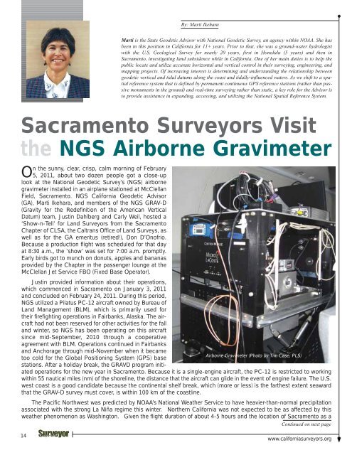
<strong>Airborne</strong> <strong>Gravimeter</strong> (Photo by Tim Case, PLS)<br />
too cold for <strong>the</strong> Global Positioning System (GPS) base<br />
stations. After a holiday break, <strong>the</strong> GRAVD program initiated<br />
operations for <strong>the</strong> new year in <strong>Sacramento</strong>. Because it is a single-engine aircraft, <strong>the</strong> PC-12 is restricted to working<br />
within 55 nautical miles (nm) of <strong>the</strong> shoreline, <strong>the</strong> distance that <strong>the</strong> aircraft can glide in <strong>the</strong> event of engine failure. The U.S.<br />
west coast is a good candidate because <strong>the</strong> continental shelf break, which (more or less) is <strong>the</strong> far<strong>the</strong>st extent seaward<br />
that <strong>the</strong> GRAV-D survey must cover, is within 100 km of <strong>the</strong> coastline.<br />
The Pacific Northwest was predicted by NOAA’s National Wea<strong>the</strong>r Service to have heavier-than-normal precipitation<br />
associated with <strong>the</strong> strong La Niña regime this winter. Nor<strong>the</strong>rn California was not expected to be as affected by this<br />
wea<strong>the</strong>r phenomenon as Washington. Given <strong>the</strong> flight duration of about 4-5 hours and <strong>the</strong> location of <strong>Sacramento</strong> as a<br />
Continued on next page<br />
14<br />
www.californiasurveyors.org


