

Brookvale West - Basingstoke and Deane Borough Council
Brookvale West - Basingstoke and Deane Borough Council
Brookvale West - Basingstoke and Deane Borough Council

You also want an ePaper? Increase the reach of your titles
YUMPU automatically turns print PDFs into web optimized ePapers that Google loves.
Conservation Area Appraisal<br />
Conservation Area Appraisal<br />
<strong>Brookvale</strong> <strong>West</strong><br />
…making <strong>Brookvale</strong> a difference <strong>West</strong>
Conservation Area Appraisal<br />
Introduction<br />
The <strong>Brookvale</strong> <strong>West</strong> Conservation Area was first designated in 1999 by<br />
<strong>Basingstoke</strong> <strong>and</strong> <strong>Deane</strong> <strong>Borough</strong> <strong>Council</strong> in recognition of the special<br />
architectural <strong>and</strong> historic interest of the area.<br />
Having designated the Conservation Area, the Local Authority has a<br />
statutory duty to ensure that those elements that form its particular<br />
character or appearance should be preserved or enhanced, especially<br />
when considering planning applications.<br />
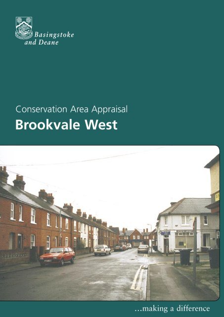
Worting Road with Downsl<strong>and</strong> Parade<br />
<strong>and</strong> Stowell’s funeral parlour<br />
It is therefore necessary to define <strong>and</strong> analyse those qualities or elements<br />
that contribute to, or detract from, the special interest of the area <strong>and</strong><br />
to assess how they combine to justify its designation as a Conservation<br />
Area. Such factors can include:<br />
• its historic development;<br />
• the contribution of buildings <strong>and</strong> structures <strong>and</strong> the spaces that<br />
surround them; <strong>and</strong><br />
• the relationship of the built environment with the l<strong>and</strong>scape.<br />
Worting Road<br />
They can also include the less tangible senses <strong>and</strong> experiences such<br />
as noise or smells, which can play a key part in forming the distinctive<br />
character of an area.<br />
The Appraisal takes the form of written text <strong>and</strong> an Appraisal plan. In<br />
both respects every effort has been made to include or analyse those<br />
elements that are key to the special character of the area. Where<br />
buildings, structures or features have not been specifically highlighted<br />
it does not necessarily follow that they are of no visual or historic value<br />
to the Conservation Area. The document is intended to be an overall<br />
framework <strong>and</strong> guide within which decisions can be made on a sitespecific<br />
basis.<br />
This Appraisal of the <strong>Brookvale</strong> <strong>West</strong> Conservation Area follows its review<br />
in 2003 by <strong>Basingstoke</strong> <strong>and</strong> <strong>Deane</strong> <strong>Borough</strong> <strong>Council</strong> <strong>and</strong> explains what<br />
its designation means for those who live <strong>and</strong> work in the area.<br />
This document was adopted as Supplementary Planning Guidance by the<br />
<strong>Borough</strong> of <strong>Basingstoke</strong> <strong>and</strong> <strong>Deane</strong> on 17 July 2003 <strong>and</strong> complements<br />
the policies of the <strong>Borough</strong> Local Plan (review).<br />
It has been subject to consultation with <strong>Council</strong>lors <strong>and</strong> local amenity<br />
groups. A full list of consultees, copies of their responses, <strong>and</strong> details of<br />
the <strong>Council</strong>’s consideration of the issues raised during the consultation<br />
period are available for inspection, by appointment, at the Civic Offices,<br />
during normal office hours.<br />
2<br />
<strong>Brookvale</strong> <strong>West</strong>
Conservation Area Appraisal<br />
Location <strong>and</strong> Population<br />
The <strong>Brookvale</strong> <strong>West</strong> Conservation Area comprises a number of primarily<br />
residential streets, located to the west of <strong>Basingstoke</strong> town centre.<br />
The Conservation Area is bordered to the north by Churchill Way <strong>West</strong><br />
<strong>and</strong> to the south by Worting Road. The rear gardens of properties on the<br />
east side of Queen’s Road from the eastern border, <strong>and</strong> the boundary of<br />
the King George V playing fields makes up the western border<br />
Historic Development<br />
Settlement Origins<br />
The Conservation Area was formerly meadow l<strong>and</strong>. It was developed for<br />
housing at the end of the 19th <strong>and</strong> beginning of the 20th centuries.<br />
Prior to this development the upper reaches of the River Loddon flowed<br />
from <strong>West</strong> Ham Farm, through the surrounding fields towards the historic<br />
<strong>Basingstoke</strong> town centre. The area between the present Worting Road<br />
<strong>and</strong> the railway was known as Salisbury Field in the medieval period. In<br />
the early 19th century, the northern section became known as Longcroft,<br />
<strong>and</strong> then Newtown in the 1880s.<br />
By 1900, the streets in the eastern part of <strong>Brookvale</strong> (Essex, Rayleigh, <strong>and</strong><br />
Southend Roads) had already been built. At this time the plots of l<strong>and</strong><br />
that were to form the <strong>Brookvale</strong> <strong>West</strong> Conservation Area (George Street,<br />
Alex<strong>and</strong>ra Road <strong>and</strong> Queen’s Road) were sold for development.<br />
112 Worting Road<br />
Alex<strong>and</strong>ra Road<br />
Settlement Development<br />
The <strong>Brookvale</strong> <strong>West</strong> Conservation Area developed as a rectilinear grid of<br />
streets between the earlier <strong>Brookvale</strong> East development <strong>and</strong> Thornycroft’s<br />
factory to the west. Constructed between 1897 <strong>and</strong> 1912, Queen’s Road,<br />
Alex<strong>and</strong>ra Road, George Street, Deep Lane, Lower Brook Street, College<br />
Road <strong>and</strong> May Street formed the residential area. The southern edge of<br />
the area is formed by Worting Road. This is likely to have been an historic<br />
route into <strong>Basingstoke</strong> <strong>and</strong> is represented on a 1762 map. Thornycroft’s<br />
factory, constructed in 1898, provided vehicles for military purposes in<br />
the First <strong>and</strong> Second World Wars. As a major employer, its relationship<br />
with the development of the area would have been significant. The<br />
buildings were demolished in 1991, <strong>and</strong> a superstore now st<strong>and</strong>s on the<br />
site.<br />
Original door <strong>and</strong> quarry tiles in Alex<strong>and</strong>ra<br />
Road<br />
<strong>Brookvale</strong> <strong>West</strong> 3
Conservation Area Appraisal<br />
The type of housing in the <strong>Brookvale</strong> <strong>West</strong> Conservation Area is similar to<br />
that of many towns <strong>and</strong> cities of their period. This was a reaction against<br />
the slum housing constructed in the factory towns earlier in the 19th<br />
century. The 1875 Public Health Act, <strong>and</strong> the Model by-laws that derived<br />
from the Act, set amenity <strong>and</strong> layout st<strong>and</strong>ards, which resulted in minimum<br />
street widths <strong>and</strong> open areas to the rear of dwellings.<br />
Within the established street pattern speculative building companies<br />
developed small numbers of plots on an ‘ad hoc’ basis. The result is a subtle<br />
variation in house design <strong>and</strong> detail.<br />
Combined porch <strong>and</strong> bay roofs, Alex<strong>and</strong>ra Road<br />
Original quarry tiles, Alex<strong>and</strong>ra Road<br />
Ground floor bays at Alex<strong>and</strong>ra Road<br />
Characteristic of the period, the social hierarchy of status <strong>and</strong> wealth is<br />
reflected in the scale <strong>and</strong> design of the properties. In <strong>Brookvale</strong> these<br />
include terraces of small two-up two-down properties (such as those in<br />
George Street <strong>and</strong> Deep Lane). At the other end of the scale are shorter<br />
rows of paired houses, often with more intricate detailing <strong>and</strong> bay windows<br />
(such as those in Lower Brook Street, Queen’s Road, Alex<strong>and</strong>ra Road <strong>and</strong><br />
Worting Road). The detached <strong>and</strong> semi-detached, villa-style houses in<br />
Worting Road are distinctive in their greater mass, form <strong>and</strong> plot size. The<br />
architectural quality of these buildings, <strong>and</strong> their position on the periphery<br />
of the larger mass of housing, is indicative of their intended higher status.<br />
Deep Lane was constructed in 1903, <strong>and</strong> originally led to the farm owned<br />
by the May family who established a Brewery in Brook Street in 1755. On<br />
the 1897 Ordnance Survey map, Deep Lane is shown to extend along the<br />
course of the present Lower Brook Street as far as Queen’s Road. Apart<br />
from a few changes to May Street <strong>and</strong> George Street, the layout of the<br />
road pattern <strong>and</strong> arrangement of properties is essentially the same as on<br />
the 1912 Ordnance Survey map.<br />
Although principally residential in character, the Conservation Area has<br />
always included a small mix of shops <strong>and</strong> other commercial uses. Some<br />
buildings that were constructed for a specific commercial or social purpose<br />
have survived. This has ensured that the historic character <strong>and</strong> social<br />
structure of the period can still be appreciated - even if the original function<br />
has long ceased. Queen’s Road, for example, used to have six shops, only<br />
one of which remains in commercial use <strong>and</strong>, the Dairy, which closed in<br />
1995. The distinctive form <strong>and</strong> arrangement of these buildings is still<br />
evident.<br />
The King George V Playing Field was acquired in 1910, <strong>and</strong> laid out in<br />
1922. The surrounding local community used it for sporting events <strong>and</strong><br />
recreation. Between the field <strong>and</strong> the Waterworks (built in 1906 with a<br />
nearby public swimming pool) was a Shellmex <strong>and</strong> BP Depot dating from<br />
the 1950s.<br />
In addition to housing <strong>and</strong> commercial uses, <strong>Brookvale</strong> School, formerly<br />
known as Brook Street Elementary School, formed a key element in the<br />
historic <strong>and</strong> social development of the area. Opened in 1909 to serve a<br />
4<br />
<strong>Brookvale</strong> <strong>West</strong>
Conservation Area Appraisal<br />
growing population, it could originally accommodate around 200 children.<br />
In the 1960s, Churchill Way <strong>West</strong> was constructed through the playground<br />
on the north side of the school. The school closed in 1985 <strong>and</strong> was taken<br />
over <strong>and</strong> used by the Technical College until the end of 1998. The school<br />
was converted to residential use in 2001.<br />
The 1912 Ordnance Survey map shows a working men’s mission hall,<br />
situated at the corner of Deep Lane <strong>and</strong> George Street. This eventually<br />
became the Methodist Hall, which was demolished in 1997, when flats<br />
were built on the site. A Railway Mission Hall <strong>and</strong> St Michael’s Hall were<br />
situated on May Street, which was constructed in the 1880s.<br />
The Alton Light Railway, now the site of the Ringway <strong>West</strong> on the northern<br />
border of the Conservation Area, was built in 1901. It closed in 1917<br />
when the tracks were taken up <strong>and</strong> used in France during the Great War.<br />
Although re-opened in 1924, the railway finally closed for passengers in<br />
1932 <strong>and</strong> for goods in 1936.<br />
Two-storey bays at Alex<strong>and</strong>ra Road<br />
An Appraisal of the Conservation Area<br />
An Overview<br />
The Appraisal plan identifies those buildings, views, <strong>and</strong> key features<br />
considered essential to the special character or appearance of the<br />
Conservation Area. In addition to the listed buildings, it also includes<br />
unlisted buildings of particular individual or group value, which are indicated<br />
on the Appraisal plan as notable. This is not to undermine the value of<br />
other unmarked buildings or structures that reflect the historic development<br />
of the village without detracting from its special qualities.<br />
Chimney detail, Alex<strong>and</strong>ra Road<br />
Individual hedgerows have not been included on the Appraisal plan.<br />
However, their contribution to the character of the Conservation Area<br />
should not be underestimated <strong>and</strong> their significance is implicit in the<br />
Appraisal.<br />
The essential appearance of the Conservation Area is of two-storey brick<br />
buildings, arranged in a cohesive <strong>and</strong> ordered layout of rectilinear streets.<br />
Within this framework the form <strong>and</strong> design of buildings can be divided<br />
into three groups by street. These are made up of rows of terraces, semi<br />
detached pairs <strong>and</strong> three-storey villas. The use of detailing <strong>and</strong> decorative<br />
features in each of these types establishes the special appearance of<br />
<strong>Brookvale</strong> <strong>West</strong>.<br />
Passageway at Alex<strong>and</strong>ra Road<br />
Much of the original street pattern, its houses <strong>and</strong> their features, <strong>and</strong> the<br />
integrated mix of commercial <strong>and</strong> community uses still survives. These<br />
provide an appreciable underst<strong>and</strong>ing of the cultural <strong>and</strong> social history of<br />
<strong>Basingstoke</strong> at the beginning of this century. The contribution of these<br />
elements as a whole is essential to the special character <strong>and</strong> historic interest<br />
of the area.<br />
<strong>Brookvale</strong> <strong>West</strong> 5
Conservation Area Appraisal<br />
Built Form<br />
There are no buildings in the Conservation Area included on the Statutory<br />
List of Buildings of Special Architectural or Historic Interest. The streetscape<br />
does, however, comprise a number of notable unlisted buildings.<br />
In general, <strong>Brookvale</strong> <strong>West</strong> is typical of many growing towns of the late<br />
19th <strong>and</strong> early 20th centuries. Its built form is characteristic in style <strong>and</strong><br />
appearance of the majority of mass built residential properties in Engl<strong>and</strong> at<br />
this time.<br />
George Street looking east to Queen’s Road<br />
George Street<br />
George Street looking west to the<br />
King George V playing field<br />
The majority of buildings are constructed of an orange/red brick, with grey<br />
slate roofs. The area was developed in a relatively short period around a<br />
planned street layout <strong>and</strong> common building line. This creates the overall<br />
visual cohesion that characterises the area. The rhythmic punctuation<br />
of roofs by lines of chimney stacks, the articulation of otherwise plain<br />
elevations by projecting bay windows, <strong>and</strong> the delineation of house plots<br />
<strong>and</strong> their frontages by front garden walls, are examples which collectively<br />
create a strong <strong>and</strong> distinctive identity.<br />
However, within this overall framework, the architectural quality of<br />
<strong>Brookvale</strong> has distinctive qualities on a smaller, more individual scale.<br />
Principal architectural features, such as windows <strong>and</strong> doorways, are often<br />
emphasised by the use of rendered or plain brick pillars, lintels <strong>and</strong> arches.<br />
Bay windows of various sizes are also prominent in the area, as is the<br />
use of decorative joinery features. Turned wood porches, eaves details,<br />
bargeboards <strong>and</strong> arrangements of glazing bars on sash casement windows<br />
are all evident in many different forms.<br />
General architectural trends of the period are also reflected in a stylised<br />
manner. The Gothic revival towards the end of the 19th century is reflected<br />
by the popularity of polychromattic brickwork, or different coloured bricks<br />
in stripes or patterns. This is well illustrated by buildings in Lower Brook<br />
Street <strong>and</strong> Alex<strong>and</strong>ra Road. In the late 19th <strong>and</strong> the early 20th centuries,<br />
the style <strong>and</strong> details of buildings were also influenced by a move towards<br />
‘rustic’ <strong>and</strong> ‘country’ architecture. Features such as half-timbering, tilehanging,<br />
<strong>and</strong> the use of tiles decoratively within the main brickwork to<br />
form small patterned details, were included in the design of a building. The<br />
terraced houses on Worting Road <strong>and</strong> the long terrace on the south side of<br />
George Street are examples of this derivation of the architectural style.<br />
There are other features that reinforce the essential historic character of the<br />
Conservation Area. These include red <strong>and</strong> black quarry tile front paths, with<br />
clay edging pavers of rope-work design, <strong>and</strong> small garden walls with canted<br />
or half round moulded coping bricks.<br />
6<br />
<strong>Brookvale</strong> <strong>West</strong>
Conservation Area Appraisal<br />
The wide range of these features, <strong>and</strong> more especially the significant degree<br />
to which most buildings have retained the essential components of their<br />
original form, are essential in creating the special historic <strong>and</strong> architectural<br />
interest of the area.<br />
Key Individual Buildings<br />
There are four buildings that make a significant individual contribution to<br />
<strong>Brookvale</strong> in terms of their appearance, historic value or their position in the<br />
streetscape.<br />
<strong>Brookvale</strong> School, constructed in 1909, is one of the earliest buildings in the<br />
area. Its gabled red brick elevations <strong>and</strong> varied arrangement of slate roof<br />
slopes serve to reduce the mass of the sizable building. This sits comfortably<br />
with the domestic scale <strong>and</strong> character of the surrounding residential streets.<br />
The small area of open frontage, created by the school being set back<br />
slightly from the pavement, also ensures that the building does not overdominate<br />
the residential street. It provides an important setting by which to<br />
appreciate the front elevation.<br />
The classical style circular cupola with its lead-covered roof is a distinctive<br />
feature, both in the immediate streetscape <strong>and</strong> from some distance away.<br />
This, together with the rear elevation, forms a prominent l<strong>and</strong>mark on the<br />
ring road, distinguishing the Conservation Area from the other surrounding<br />
terraced streets.<br />
Tile hanging in George Street<br />
Bay windows in George Street<br />
The Downsl<strong>and</strong> Parade shops on the south side of Worting Road were<br />
constructed in the early 1930s. The metal bay windows, with curved glass<br />
used to form the corner sections, are distinctive features of the Art Deco<br />
building. Although the ground floor shop fronts have been replaced, the<br />
overall architectural integrity of the building is retained. It forms a dominant<br />
stop to the view south up Alex<strong>and</strong>ra Road.<br />
Stowell’s funeral business is next to the shops. The Victorian lodge has<br />
been much extended to the rear <strong>and</strong> west. The gabled front façade, with<br />
its decorative timber bargeboard, provides a picturesque feature <strong>and</strong> visual<br />
stop to the view up Queen’s Road, particularly when set against the mature<br />
trees to the east.<br />
Lower Brook Street<br />
112 Worting Road, is an attractive painted brick <strong>and</strong> slate, classically<br />
styled, house in a mature l<strong>and</strong>scape setting. Its rusticated quoins <strong>and</strong> three<br />
pedimented first floor windows give it a distinctive <strong>and</strong> individual character.<br />
The property was restored in 2002, with the addition of a small singlestorey<br />
side extension <strong>and</strong> the erection of a new garage on the west side of<br />
the house.<br />
<strong>Brookvale</strong> <strong>West</strong> 7
Conservation Area Appraisal<br />
Significant Groups of Buildings<br />
There are certain groups of buildings in the Conservation Area of particular<br />
significance, by way of either their completeness of original design <strong>and</strong><br />
features, or as a result of their position in the streetscene. These are<br />
identified on the Appraisal plan.<br />
The Character <strong>and</strong> Importance of Public<br />
<strong>and</strong> Private Spaces<br />
Lower Brook Street<br />
New housing in Lower Brook Street<br />
Despite the compact nature of the housing, the overall character is not<br />
one of over-development <strong>and</strong> lack of space, but of relative spaciousness<br />
<strong>and</strong> environmental quality. This character is principally derived from the<br />
contribution of the private spaces, which are as much a component of the<br />
streetscape as the built form.<br />
In addition to the small front gardens, each building has a regular allocation<br />
of rear garden. Views of these gardens are key to the character of the area,<br />
notably from along the back alley access ways between Queen’s Road/<br />
Alex<strong>and</strong>er Road, <strong>and</strong> George Street/Lower Brook Street. The views across<br />
the rear gardens of the south side of Lower Brook Street from College<br />
Road, <strong>and</strong> of the gardens in Worting Road from the bisecting north/south<br />
streets, are also of interest. These views are reinforced by glimpses of<br />
rear gardens, afforded by the occasional mid-terrace passageways or side<br />
accessways between the shorter rows of houses.<br />
Views west along the two east/west streets focus on the open character<br />
<strong>and</strong> mature planting of the King George V playing fields. The terraces along<br />
Lower Brook Street are also punctuated by a l<strong>and</strong>scaped space, formerly<br />
allotments, <strong>and</strong> by the mature planting around the former school.<br />
Other Features of Architectural or<br />
Historic Interest<br />
The survival of original stone kerb <strong>and</strong> gutter linings is of integral value to<br />
the character of the Conservation Area. Together with the larger flat stone<br />
slabs <strong>and</strong> areas of former access to rear yards, they add a subtle patina to<br />
the appearance of the streets. Some of the original high level street name<br />
plates also survive, again adding to the overall historic ambience of the area.<br />
8<br />
<strong>Brookvale</strong> <strong>West</strong>
Conservation Area Appraisal<br />
Building Materials<br />
The traditional building materials of the Conservation Area reflect the<br />
increasing variety that could be sourced via the modern railway <strong>and</strong> road<br />
networks, <strong>and</strong> the techniques of mass production. Brick of various colours,<br />
including pre-formed decorative specials are the predominant building<br />
material. It is occasionally used in association with tile hanging on building<br />
elevations. Clay roofing tiles are also used particularly on buildings aspiring<br />
to higher social status. This is in contrast to the use of slate as the main<br />
roof covering elsewhere in the area.<br />
Joinery is of particular importance in the Conservation Area. It was used in<br />
various forms to distinguish houses of otherwise similar design. Although<br />
there has been some replacement of these features, enough remain to<br />
make the area special. The following are examples.<br />
Tiled path in Lower Brook Street<br />
• Sash Windows - timber with between 8 <strong>and</strong> 16 square panes. Some<br />
illustrate the style at the time of building, with Art Nouveau details<br />
using narrow panes to each side of the window <strong>and</strong> a large pane to<br />
the centre - found on the north side of Lower Brook Street.<br />
• Bay windows - all originally with sash windows, <strong>and</strong> slate roofs with<br />
associated leadwork detailing.<br />
• Original style front doors - four panelled, often with a pane of glass at<br />
the top or two vertical panes.<br />
Passageway in Lower Brook Street<br />
• Porches - often with intricate timber detailing, for example Alex<strong>and</strong>ra<br />
<strong>and</strong> Queen’s Roads.<br />
The extensive survival of red <strong>and</strong> black quarry tile pathways with rope<br />
edging is important in adding to the richness of the appearance of the<br />
area.<br />
Given the domestic scale <strong>and</strong> simple provincial architecture of the buildings<br />
in the Conservation Area, historic joinery (such as sash windows, doors<br />
<strong>and</strong> door hoods) are often the features that define the appearance of<br />
properties. Although some groups of buildings have been modernised, the<br />
use <strong>and</strong> overall effect of inappropriate replacement windows <strong>and</strong> doors is<br />
limited.<br />
Open space on the south<br />
side of Lower Brook Street<br />
<strong>Brookvale</strong> <strong>West</strong> 9
Conservation Area Appraisal<br />
Green Spaces, Trees, Hedges <strong>and</strong> other<br />
Natural or Cultivated Features<br />
Shop <strong>and</strong> Post Office, Queen’s Road<br />
The King George V playing field is the only large open space in the<br />
Conservation Area. It provides short vistas throughout the west of the<br />
area, <strong>and</strong> along George Street <strong>and</strong> Lower Brook Street. To the south<br />
of Lower Brook Street, part of the original allotment area is now used<br />
as a car-parking/communal area. This provides views of the rear of the<br />
terraced houses in George Street. Smaller cultivated areas, such as the<br />
small front gardens, are just as important. Many of the houses retain the<br />
original garden walls <strong>and</strong> quarry tile pathways, with rope edging.<br />
Although there are only a few individual trees of streetscape importance,<br />
there are a few groups of smaller trees in rear gardens. Together, these<br />
add variety to the area. Examples include the group between Alex<strong>and</strong>ra<br />
Road <strong>and</strong> Queen’s Road, <strong>and</strong> along the River Loddon at the western end<br />
of Lower Brook Street.<br />
The Setting of the Conservation Area<br />
Lower Brook Street<br />
Although Lower Brook Street is located close to the centre of <strong>Basingstoke</strong><br />
town, the Conservation Area is bounded to the south, west <strong>and</strong> north<br />
by areas of completely different character <strong>and</strong> grain. This serves to<br />
differentiate the area from the surrounding development.<br />
In particular, vegetation frames views to the east <strong>and</strong> north of Lower<br />
Brook Street, outside the Conservation Area boundary. It is particularly<br />
important in long range views from Worting Road down Queen’s Road,<br />
<strong>and</strong> provides a lush background to the houses.<br />
Punctuating the far horizon of views east <strong>and</strong> north are the distinctive<br />
high rise buildings of the modern town.<br />
King George V playing field with<br />
Deep Lane in the background<br />
Areas of Archaeological Significance<br />
There are no areas of designated archaeological potential in the<br />
Conservation Area. However, there are several recorded archaeological<br />
finds in the immediate vicinity of the <strong>Brookvale</strong> <strong>West</strong> Conservation<br />
Area. Roman finds were discovered to the north east in 1839 <strong>and</strong> 1879,<br />
indicating the possible site of a Roman building. Further to the east <strong>and</strong><br />
south, archaeological finds include flint tools, dated to the paeleolithic<br />
<strong>and</strong> neolithic periods.<br />
10<br />
<strong>Brookvale</strong> <strong>West</strong>
Conservation Area Appraisal<br />
Conservation Area Planning Controls<br />
The following controls apply within the Conservation Area in addition to<br />
normal planning controls:<br />
• Conservation Area Consent is normally required for the demolition of<br />
buildings or structures over a certain size within a Conservation Area.<br />
• The <strong>Council</strong> must be given six weeks notice of any intention to<br />
undertake works to, cut down or uproot any trees over a certain size<br />
in the Conservation Area.<br />
• Planning applications which, in the opinion of the <strong>Borough</strong> <strong>Council</strong>,<br />
would affect the special character of the Conservation Area must be<br />
advertised <strong>and</strong> the opportunity given for public comment. This may<br />
include proposals outside the Conservation Area which nevertheless<br />
affect its setting.<br />
Statutory policies relating to Conservation Areas <strong>and</strong> listed buildings are<br />
set out in the adopted <strong>Basingstoke</strong> <strong>and</strong> <strong>Deane</strong> <strong>Borough</strong> Local Plan. These<br />
policies reflect the statutory duty on the Local Planning Authority to have<br />
regard to the preservation of historic buildings or their setting, <strong>and</strong> for<br />
the enhancement of areas designated as of being of special interest.<br />
These policies seek to ensure that particular attention will be paid to<br />
the scale, height, form, materials <strong>and</strong> detailing of proposals including<br />
boundary treatments <strong>and</strong> other features of note. In order to consider the<br />
implications of development <strong>and</strong> given the detail required, the <strong>Borough</strong><br />
<strong>Council</strong> will normally require proposals within the Conservation Area<br />
to be submitted in the form of a full, <strong>and</strong> not outline, application. The<br />
<strong>Borough</strong> <strong>Council</strong>’s conservation officers are available for advice <strong>and</strong><br />
information on all matters relating to development proposals in the<br />
Conservation Area.<br />
Grants<br />
The <strong>Borough</strong> <strong>Council</strong> provides grants for various types of work. These<br />
include Historic Buildings Grants, Environment <strong>and</strong> Regeneration Grants,<br />
<strong>and</strong> Village <strong>and</strong> Community Hall Grants. Leaflets are available explaining<br />
the purpose <strong>and</strong> criteria for each grant <strong>and</strong> an approach to the <strong>Council</strong> is<br />
recommended for further information on any grant.<br />
<strong>Brookvale</strong> <strong>West</strong> 11
Conservation Area Appraisal - <strong>Brookvale</strong> <strong>West</strong> late 19th Century OS Map<br />
Courtesy of Hampshire County <strong>Council</strong><br />
12<br />
<strong>Brookvale</strong> <strong>West</strong>
Conservation Area Appraisal<br />
<strong>Brookvale</strong> <strong>West</strong><br />
…making a difference<br />
<strong>Basingstoke</strong> <strong>and</strong> <strong>Deane</strong> <strong>Borough</strong> <strong>Council</strong><br />
Civic Offices London Road <strong>Basingstoke</strong> Hants RG21 4AH<br />
Telephone 01256 844844 Fax 01256 845200<br />
www.basingstoke.gov.uk<br />
Produced by Graphics/Corporate Information Division April 2004<br />
4767


