teaching - Earth Science Teachers' Association
teaching - Earth Science Teachers' Association
teaching - Earth Science Teachers' Association

You also want an ePaper? Increase the reach of your titles
YUMPU automatically turns print PDFs into web optimized ePapers that Google loves.
<strong>teaching</strong><br />
EARTH<br />
SCIENCES<br />
<strong>Earth</strong> System<br />
<strong>Science</strong>: A Better<br />
Way to Teach<br />
<strong>Science</strong> Enquiry<br />
Geology and the<br />
Human Environment<br />
– The Nuclear<br />
Waste Problem<br />
Iron Ore Formation:<br />
A Laboratory Model<br />
Developing<br />
Observational Skills<br />
for Geoscience<br />
Fieldwork:<br />
a Web-based<br />
Teaching Exercise<br />
<strong>Earth</strong> <strong>Science</strong><br />
Activities and<br />
Demonstrations:<br />
Sedimentary Rocks<br />
An <strong>Earth</strong> <strong>Science</strong><br />
Fieldtrip for Key<br />
Stage 3 Pupils<br />
Further Thoughts –<br />
Where Next for ESTA?<br />
New ESTA Members<br />
Websearch<br />
Book Reviews<br />
ESTA Diary<br />
Cash for Research<br />
News and Resources<br />
Journal of EARTH SCIENCE TEACHERS ASSOCIATION<br />
Volume 26 ● Number 3, 2001 ● ISSN 0957-8005<br />
www.esta-uk.org
Teaching <strong>Earth</strong> <strong>Science</strong>s: Guide for Authors<br />
The Editor welcomes articles of any length and nature and on any topic related to<br />
<strong>Earth</strong> science education from cradle to grave. Please inspect back copies of TES,<br />
from Issue 26(3) onwards, to become familiar with the journal house-style.<br />
Three paper copies of major articles are requested. Please use double line spacing<br />
and A4 paper and please use SI units throughout, except where this is inappropriate<br />
(in which case please include a conversion table). The first paragraph of each<br />
major article should not have a subheading but should either introduce the reader<br />
to the context of the article or should provide an overview to stimulate interest. This<br />
is not an abstract in the formal sense. Subsequent paragraphs should be grouped<br />
under sub-headings.<br />
Text<br />
Please also supply the full text on disk or as an email attachment: Microsoft Word<br />
is the most convenient, but any widely-used wordprocessor is acceptable.<br />
References<br />
Please us the following examples as models<br />
(1) Articles<br />
Mayer, V. (1995) Using the <strong>Earth</strong> system for integrating the science curriculum.<br />
<strong>Science</strong> Education, 79(4), pp. 375-391.<br />
(2) Books<br />
McPhee, J. (1986 ) Rising from the Plains. New York: Fraux, Giroux & Strauss.<br />
(3) Chapters in books<br />
Duschl, R.A. & Smith, M.J. (2001) <strong>Earth</strong> <strong>Science</strong>. In Jere Brophy (ed), Subject-<br />
Specific Instructional Methods and Activities, Advances in Research on Teaching.<br />
Volume 8, pp. 269-290. Amsterdam: Elsevier <strong>Science</strong>.<br />
Figures<br />
Prepared artwork must be of high quality and submitted on paper and disk. Handdrawn<br />
and hand-labelled diagrams are not normally acceptable, although in some<br />
circumstances this is appropriate. Each figure must be submitted as a separate file.<br />
Photographs<br />
Please submit colour or black-and-white photographs as originals. They are also<br />
welcomed in digital form on disk or as email attachments: .jpeg format is to be preferred.<br />
Please use one file for each photograph.<br />
Copyright<br />
There are no copyright restrictions on original material published in Teaching <strong>Earth</strong><br />
<strong>Science</strong>s if it is required for use in the classroom or lecture room. Copyright material<br />
reproduced in TES by permission of other publications rests with the original publisher.<br />
Permission must be sought from the Editor to reproduce original material<br />
from Teaching <strong>Earth</strong> <strong>Science</strong>s in other publications and appropriate acknowledgement<br />
must be given.<br />
All articles submitted should be original unless indicted otherwise and should<br />
contain the author’s full name, title and address (and email address where relevant).<br />
They should be sent to the Editor,<br />
Dr Roger Trend,<br />
School of education,<br />
University of Exeter,<br />
Exeter,<br />
EX1 2LU, UK;<br />
Tel 01392 264768;<br />
Email R.D.Trend@exeter.ac.uk<br />
Editor<br />
WHERE IS PEST?<br />
Published by the <strong>Earth</strong> <strong>Science</strong> Teachers<br />
From this issue onwards PEST<br />
will not be printed on yellow,<br />
although it will continue to be<br />
printed as the centre 4 pages in<br />
Teaching <strong>Earth</strong> <strong>Science</strong>s. This<br />
change is to reduce ESTA‚s costs.
Journal of EARTH SCIENCE TEACHERS ASSOCIATION<br />
Volume 26 ● Number 3, 2001 ● ISSN 0957-8005<br />
<strong>Earth</strong> System<br />
<strong>Science</strong>: A Better<br />
Way to Teach<br />
<strong>Science</strong> Enquiry<br />
Geology and the<br />
Human Environment<br />
– The Nuclear<br />
Waste Problem<br />
Iron Ore Formation:<br />
A Laboratory Model<br />
Developing<br />
Observational Skills<br />
for Geoscience<br />
Fieldwork:<br />
a Web-based<br />
Teaching Exercise<br />
<strong>Earth</strong> <strong>Science</strong><br />
Activities and<br />
Demonstrations:<br />
Sedimentary Rocks<br />
An <strong>Earth</strong> <strong>Science</strong><br />
Fieldtrip for Key<br />
Stage 3 Pupils<br />
Further Thoughts –<br />
Where Next for<br />
ESTA?<br />
New ESTA Members<br />
Websearch<br />
Book Reviews<br />
Diary<br />
Cash for Research<br />
hS i<br />
www.esta-uk.org<br />
TEACHING EARTH SCIENCES ● Volume 26 ● Number 3, 2001<br />
<strong>teaching</strong><br />
EARTH<br />
SCIENCES<br />
Teaching <strong>Earth</strong> <strong>Science</strong>s is published quarterly by<br />
the <strong>Earth</strong> <strong>Science</strong> Teachers’ <strong>Association</strong>. ESTA<br />
aims to encourage and support the <strong>teaching</strong> of<br />
<strong>Earth</strong> <strong>Science</strong>s, whether as a single subject or as<br />
part of science or geography courses.<br />
Full membership is £25.00; student and retired<br />
membership £12.50.<br />
Registered Charity No. 1005331<br />
Editor:<br />
Dr. Roger Trend<br />
School of Education<br />
University of Exeter<br />
Exeter EX1 2LU<br />
Tel: 01392 264768<br />
Email: R.D.Trend@exeter.ac.uk<br />
Advertising:<br />
Andy Dickinson<br />
6 Rushton Close, Widnes<br />
Cheshire WA8 9ZF<br />
Tel: 0151 424 9358<br />
Reviews Editor:<br />
Dr. Denis Bates<br />
Institute of Geography and <strong>Earth</strong> <strong>Science</strong>s<br />
University of Wales<br />
Aberystwyth<br />
Dyfed SY23 3DB<br />
Tel: 01970 622639<br />
Email: deb@aber.ac.uk<br />
Council Officers:<br />
President:<br />
Alan McKirdy<br />
Scottish Natural Heritage<br />
2 Anderson Place<br />
Edinburgh EH6 5NP<br />
Chairman:<br />
Ian Thomas<br />
National Stone Centre<br />
Porter Road, Wirksworth<br />
Derbyshire DE4 4LS<br />
Secretary:<br />
Dr. Dawn Windley<br />
Thomas Rotherham College<br />
Moorgate, Rotherham<br />
South Yorkshire<br />
Membership Secretary:<br />
Owain Thomas<br />
PO Box 10, Narberth<br />
Pembrokeshire SA67 7YE<br />
Treasurer:<br />
Geoff Hunter<br />
6 Harborne Road<br />
Tackley, Kidlington<br />
Oxon OX5 3BL<br />
Contributions to future issues of Teaching <strong>Earth</strong><br />
<strong>Science</strong>s will be welcomed and should be<br />
addressed to the Editor.<br />
Opinions and comments in this issue are the<br />
personal views of the authors and do not<br />
necessarily represent the views of the <strong>Association</strong>.<br />
Designed by Character Design<br />
Highridge, Wrigglebrook Lane, Kingsthorne<br />
Hereford HR2 8AW<br />
Printed by Gemini Press<br />
Unit A1, Dolphin Way, Shoreham by Sea,<br />
West Sussex BN43 6NZ<br />
CONTENTS<br />
86 Editorial<br />
87 From the ESTA Chair<br />
Ian Thomas<br />
89 <strong>Earth</strong> System <strong>Science</strong>:<br />
A Better Way to Teach <strong>Science</strong> Enquiry<br />
Richard A. Duschl<br />
94 Geology and the Human Environment –<br />
The Nuclear Waste Problem<br />
Owain Thomas<br />
98 Iron Ore Formation: A Laboratory Model<br />
John Moseley<br />
102 Developing Observational Skills for Geoscience<br />
Fieldwork: a Web-based Teaching Exercise<br />
Pamela Murphy<br />
106 <strong>Earth</strong> <strong>Science</strong> Activities and Demonstrations:<br />
Sedimentary Rocks<br />
Mike Tuke<br />
110 An <strong>Earth</strong> <strong>Science</strong> Fieldtrip for Key Stage 3 Pupils<br />
Owain Thomas<br />
112 Further Thoughts – Where Next for ESTA?<br />
Ian Thomas<br />
113 New ESTA Members<br />
114 Websearch<br />
116 Reviews<br />
118 ESTA Diary<br />
119 Cash for Research<br />
120 News and Resources<br />
<strong>teaching</strong><br />
EARTH<br />
SCIENCES<br />
Visit our website at www.esta-uk.org<br />
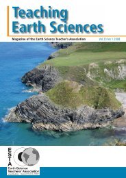
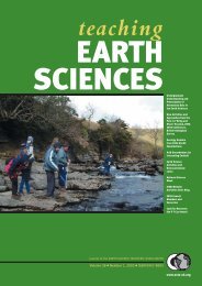
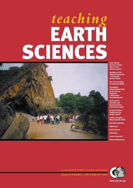
Cover picture<br />
The beach south of the harbour at<br />
Saundersfoot has a spectacular<br />
anticline – see page 110<br />
85 www.esta-uk.org
TEACHING EARTH SCIENCES ● Volume 26 ● Number 3, 2001<br />
Editorial<br />
The Key Stage 3 National Strategy has now hit UK<br />
secondary schools, with new and highly-structured<br />
approaches to <strong>teaching</strong> and learning advocated<br />
(and required?) for all schools. First to be<br />
implemented are literacy and numeracy, not only within<br />
English/maths lessons but also across the whole<br />
school curriculum. Literacy is the most advanced in its<br />
introduction in schools, apparently because its documentation<br />
has been produced slightly earlier than the<br />
maths materials! For Key Stage 3 teachers, other than<br />
English specialists, the key document is a large leverarch<br />
file called Literacy Across the Curriculum (DFEE<br />
2001) which was published in April 2001 for implementation<br />
during the current academic year. This<br />
INSET file is full of suggestions for enhancing children’s<br />
literacy across the KS3 curriculum. There is<br />
much that is not new but nevertheless the document<br />
provides a comprehensive source of material.<br />
Although the KS3 Literacy Strategy is obviously<br />
intended for children in Years 7, 8 and 9 (aged 11-14<br />
years), there is much that can be adapted for use in Key<br />
Stage 4 and post-16. For example the section on<br />
“Spelling and Vocabulary” includes, among other<br />
things, a checklist of 25 different strategies for improving<br />
students’ grasp of specialist words. Most of these are<br />
appropriate for post-16 <strong>teaching</strong>: hands up all post-16<br />
teachers whose students always spell “environment”<br />
correctly, with the middle “n” intact!<br />
The section called “Writing Non-fiction” is likely to<br />
be one of the most relevant sections for TES readers.<br />
Many of the issues addressed in this section relate not<br />
only to writing but also to reading, although later sections<br />
in the file deal with reading more explicitly.<br />
Analysing texts is one of these issues. Students are<br />
encouraged to examine texts (either written or read by<br />
them) at three levels: text; sentence; and word. Different<br />
questions need to be asked at each level and,<br />
through evaluation and re-drafting, written texts can be<br />
improved. By employing the same analyses students<br />
can enhance their understanding of their reading texts.<br />
This leads me conveniently to the use of narrative in<br />
<strong>teaching</strong> geoscience: an issue which is, unsurprisingly,<br />
not thoroughly covered in the KS3 strategy.<br />
Many readers will know of the so-called Deprat<br />
Affair. Roger Osborne (1999) provides a crisp account.<br />
The book is written rather as a thriller, with deliberate<br />
withholding of the final outcome till late in the book. It<br />
is a good read and not a lengthy book. I won’t spoil it for<br />
you now: well, not much anyway.<br />
Briefly, and for the uninitiated, during the first<br />
decade of the Twentieth Century Jaques Deprat (born<br />
1880) rose to become one of the most highly-regarded<br />
young geologists in France, with an international<br />
reputation. In fact his rise within the profession was<br />
meteoric. After obtaining a doctorate at the Sorbonne,<br />
he set off with his wife and two children in 1909 to<br />
French Indo-China as Head of the Geological Service<br />
of Indo-China. French Indo-China comprised present-day<br />
Vietnam, Cambodia and Laos. Deprat was<br />
based in Hanoi.<br />
Deprat was an active climber and explorer and much<br />
of his work in Indo-China involved fieldwork in<br />
remote and inhospitable localities. The narrator paints<br />
a vivid picture of a glamorous life . Deprat published his<br />
work regularly, although this was often a long-drawnout<br />
process because of the ship travel time to France.<br />
Specimens and documents were constantly and routinely<br />
moving between colony and mother country.<br />
Deprat’s international standing continued to strengthen,<br />
largely as a result of his pioneer work in structural<br />
geology: the reputation of the French Indo-China Geological<br />
Service rose accordingly. Then in 1917 the first<br />
bombshell struck: he was accused of fraud. To be precise,<br />
he was accused of placing some European trilobite<br />
specimens alongside some obtained in Indo-China.<br />
Trinucleus and Dalmanites spp. were involved. Clearly<br />
this was a most serious accusation and the story really<br />
starts here: I won’t go on.<br />
The Deprat story has all the key ingredients of a<br />
successful whodunnit: several suspects, strong personalities,<br />
envy, conspiracy, ambition, nepotism and so<br />
forth. For TES readers it has the extra ingredient of<br />
geology. Added to these are the twists in the tale itself:<br />
it is definitely not a straightforward story and the<br />
extent to which we have achieved “closure” remains<br />
highly debatable.<br />
How can we use rich narrative material such as this<br />
(Osborne 1999) in our geoscience <strong>teaching</strong>? First, we<br />
should recognise that many students, post-16 or otherwise,<br />
take well to such stories so we might ensure they<br />
engage with them. The reading simply enriches the<br />
experiences of some, but obviously not of all.<br />
Second, and more systematically, we might be able to<br />
use the narrative as stimulus material: a “way in” to the<br />
study of trilobites, investigations, structural geology,<br />
plate movements or whatever. This is particularly<br />
important for those learners who relate more readily to<br />
tales of human interaction than they do to scientific<br />
accounts (which they often perceive as cold)<br />
Third, as all teachers are teachers of literacy, we<br />
might be able to use sections of the text, or material<br />
written by ourselves covering the same ground, as the<br />
basis for analysis at text, sentence or word levels. At the<br />
word level, for example, the Deprat story involves not<br />
only the two trilobite genera named above but also several<br />
other fossil species, nappes, Tethys, various lithologies,<br />
Palaeozoic geographies, fieldwork procedures and<br />
conventions and so forth. At the sentence level the fol-<br />
www.esta-uk.org<br />
86
ESTA?<br />
Websearch<br />
Book Reviews<br />
Diary<br />
TEACHING EARTH SCIENCES ● Volume 26 ● Number 3, 2001<br />
lowing sample from Osborne (1999) is offered as a<br />
potentially fruitful case for analysis in terms of language<br />
and geology: “There are numerous specimens of Ptychaspis<br />
walcotti, a fossil trilobite from the Cambrian, and<br />
Deprat had found an example of Trinucleus ornatus<br />
known from Ordovician strata in Europe – one of the<br />
suspect trilobites” (p. 197). At the text level the entire<br />
book provides a tightly-structured narrative, with some<br />
key facts withheld till the closing chapters .....but tantalisingly<br />
suggested in the earlier chapters.<br />
Lastly, I am wondering if there is scope to work up a<br />
learning activity based on the Deprat material which<br />
develops children’s literacy and geoscience skills? It<br />
could require students to analyse the geological evidence<br />
and propose solutions: any offers?<br />
Roger Trend<br />
References<br />
Osborne, Roger (1999). The Deprat Affair: Ambition,<br />
Revenge and Deceit in French Indo-China. London:<br />
Jonathan Cape<br />
DFEE (2001). Literacy Across the Curriculum. London:<br />
DFEE (Document Code 0235/2001)<br />
To Advertise in<br />
<strong>teaching</strong><br />
EARTH<br />
SCIENCES<br />
Telephone<br />
???<br />
on ??<br />
<strong>teaching</strong><br />
EARTH<br />
SCIENCES<br />
Journal of EARTH SCIENCE TEACHERS ASSOCIATION<br />
Volume 26 ● Number 3, 2001 ● ISSN 0957-8005<br />
rth <strong>Science</strong><br />
ach<br />
<strong>Earth</strong> System<br />
<strong>Science</strong>: A Be ter<br />
Way to Teach<br />
<strong>Science</strong> Enquiry<br />
Geology and the<br />
Human Environment<br />
– The Nuclear<br />
Waste Problem<br />
Iron Ore Formation:<br />
A Laboratory Model<br />
Developing<br />
Observational Skills<br />
for Geoscience<br />
Fieldwork:<br />
a Web-based<br />
Teaching Exercise<br />
<strong>Earth</strong> <strong>Science</strong><br />
Activities and<br />
Demonstrations:<br />
Sedimentary Rocks<br />
An <strong>Earth</strong> <strong>Science</strong><br />
Fieldtrip for Key<br />
Stage 3 Pupils<br />
Further Thoughts –<br />
Where Next for<br />
New ESTA Members<br />
Cash for Research<br />
www.esta-uk.org<br />
From the ESTA Chair:<br />
What a Year! 2000-2001<br />
How many times have we heard that phrase over the last twelve months – and<br />
with justification? Taking the period between the two AGMs – the froth of<br />
the Millennium celebrations was beginning to blow away – the Dome was<br />
deflated – getting anywhere by road, then rail (and now air) was a nightmare – an<br />
ever-warming or at least more variable climate, and that was before the ESTA conference<br />
at Kingston. Within 48 hours, the whole World was plunged into turmoil.<br />
By contrast, a review of developments across <strong>Earth</strong> science as a whole, let<br />
alone the UK or <strong>Earth</strong> science <strong>teaching</strong> and ESTA in particular, appears so<br />
infinitesimal as to be unworthy of consideration. But there are many positives<br />
to report here in the face of such wide-ranging despondency.<br />
At the beginning of our year, the first tentative moves had been made to<br />
engage the co-operation of the Royal Society of Chemistry (RSC) and these<br />
had received an enthusiastic response. The aim was to seek the involvement<br />
of those <strong>teaching</strong> ‘mainstream’ sciences to improve the quality of delivery<br />
of <strong>Earth</strong> science in all schools – starting with the secondary sector. Hosted<br />
by the Royal Society, the first full meeting went exceptionally well, and<br />
engaged the RSC, the Institute of Physics and the Institute of Biology,<br />
together with representatives of the geological community. A surprise<br />
bonus was the announcement by Annette Thomas that UK Offshore<br />
Operators <strong>Association</strong> (UKOOA) was prepared to underwrite the running<br />
costs of the Joint <strong>Earth</strong> <strong>Science</strong> Education Initiative (JESEI) and this no<br />
doubt stimulated the three scientific Institutions to add their support in<br />
their respective fields. Our sincere thanks go to all concerned.<br />
So the mythology of all-pervasive antagonism to the <strong>Earth</strong> sciences by<br />
non-<strong>Earth</strong> scientist teachers was not only debunked: there was a real spirit<br />
of engagement by people prepared to back words with action and finance.<br />
This is of course the ‘official view from the top’. The position at the chalk-<br />
(or should we say calcined gypsum) face may not yet be so enlightened, but<br />
the mechanism of cascading authoritative and proven quality <strong>Earth</strong> science<br />
<strong>teaching</strong> materials with the endorsement of their own institutions is<br />
designed to address this situation precisely. That was the essential groundwork.<br />
By the end of the summer, the hard grind of producing that quality<br />
material, the decisions on the most appropriate vehicle for dissemination,<br />
style of presentation etc were only just beginning.<br />
If you feel that you could help this initiative in any way, or have useful<br />
ideas, please contact me (especially if you are at heart a converted chemist,<br />
physicist or biologist!). Later stages will need to address primary level and<br />
links with geography – and, perhaps in the far distance, informing the wider<br />
public of good <strong>Earth</strong> science.<br />
Another ‘reason to be cheerful’, over the year has been the marked success<br />
of the <strong>Earth</strong> <strong>Science</strong> Education Unit at the University of Keele. Whereas this<br />
is not strictly an ESTA activity, access to the Keele infrastructure has enabled<br />
ESTA members to pilot an invaluable INSET service (which logistically<br />
ESTA itself would have been unable to deliver at this scale). Moreover it has<br />
now achieved a standard sufficiently high in terms of quality and results to<br />
attract further substantial funding from UKOOA to cover the costs of a<br />
national ‘roll out’. Long may this partnership continue.<br />
Having served on the Primary Group for eleven years (and providing<br />
INSET as far back as the Liverpool conference in 1991) I know that the consistent<br />
hard work of members has been very largely unsung. They are now<br />
building on the excellent pack on Rocks, by drawing up <strong>teaching</strong> material on<br />
soils. Within their relatively slender budget, their output is very good value for<br />
money indeed. Neither of these would have been possible without the generous<br />
support of the Curry Fund – we are most grateful. Cont. on page 88<br />
87 www.esta-uk.org
TEACHING EARTH SCIENCES ● Volume 26 ● Number 3, 2001<br />
Cont. from page 87<br />
We should take this opportunity to thank Geo Supplies<br />
for all their efforts on our behalf over the last 15<br />
years. The new look journal also represents a great deal<br />
of hard work, particularly on the part of Roger Trend.<br />
This should mark the first step in improving ESTA’s<br />
presentation. The academic content of ESTA’s output<br />
has always been good; the ideas have been first rate (see<br />
above!) – this is endorsed by the extent to which they<br />
are copied by others! We now need to extend this standard<br />
to all our work – we live in a highly competitive,<br />
design-conscious world. Having worked in the print<br />
industry, I am only too aware that poor design can be<br />
the downfall of so many otherwise first class initiatives.<br />
The relaunch of the ESTA web site marks another<br />
advance in the same direction – thanks to Helen King<br />
for all her early work and to Carol Levitt in setting up<br />
the new site.<br />
Tribute also goes to Geraint Owen and Duncan<br />
Hawley for rescuing the Swansea Conference last year<br />
and to Neil Thomas’ valiant effort in turning around<br />
the Kingston Conference. Peter Kennett has been heavily<br />
involved in planning the 2002 conference at the<br />
British Geological Survey near Nottingham – this<br />
already promises to be a conference with a difference<br />
and one not to be missed.<br />
The year also saw a number of Council changes with<br />
Alastair Fleming, Andy Britnell, Polly Rhodes and Jane<br />
Butterfield moving on and Owain Thomas (my father’s<br />
namesake, but I assure you, no relation – nor are any of the<br />
other Thomas’s featuring here!) will be joining Council.<br />
We hope to announce other appointments shortly. In particular<br />
the work of Alastair Fleming over many, many<br />
years for ESTA deserves special mention. Although he is<br />
stepping down from Council for a well deserved retirement,<br />
he continues to play an active part in JESEI.<br />
No list can be comprehensive in recording adequately<br />
all the work of those in ESTA over the year and<br />
particularly that of my fellow Council members –<br />
thanks to you all.<br />
Where next? We need to continue developing and<br />
extending partnerships as exemplified by JESEI and<br />
ESEU; we need to extend and cascade some of these<br />
activities into the geography and primary fields; to continue<br />
upgrading our presentational standards; and in<br />
the longer term to consider other initiatives such as<br />
informal public education. We need to do this in the<br />
context of a well thought out (say 5 year) plan. (see page<br />
116 for Further Thoughts).<br />
Ian Thomas<br />
Chair, ESTA<br />
Character Design and the<br />
New Teaching <strong>Earth</strong> <strong>Science</strong>s<br />
Editor’s Note. Readers will have noticed the new-look TES. ESTA Council hopes that it meets with members’<br />
approval: please let me have your response. ESTA has also changed its design and production<br />
company. Character Design, based in rural Herefordshire, comprises Richard and Kerry Low: I have<br />
invited them to tell us about themselves.......<br />
We met working for a small graphic design company in Sussex at the foot of the South Downs and probably<br />
spent too many lunch hours walking up on the Downs and imagining living in the countryside.<br />
In the summer of 1997 we moved to Haywards Heath, to set up “Character Design”. We decided to work<br />
from home to keep costs down and avoid commuting: this then developed into a whole new way of working.<br />
Most of our work is now carried out using email, sending proofs digitally to the printers. Although this cuts<br />
down on meetings with our clients, our top priority at all times is to give a full personal service.<br />
We work with a number of associations, companies and individual business owners based in Brighton, London,<br />
Cambridge, Macclesfield and now Exeter (TES Editor). Our work varies: the majority is regular publications,<br />
newsletters and magazines which often means working into the night to achieve deadlines. We are also<br />
involved in the production and maintenance of websites.<br />
In November 1999 we moved into ‘Highridge’ in Herefordshire, with all our clients staying in tow. We now<br />
have a wonderful scenic view from our office and are able to walk straight out of our house into the fields or<br />
get lost in our garden - well worth the hard work!<br />
Working long hours during the week we spend every possible minute of the weekend outside, walking and<br />
cycling with our two children Sean and Emily.<br />
Kerry & Richard Low, Character Design<br />
www.esta-uk.org<br />
88
TEACHING EARTH SCIENCES ● Volume 26 ● Number 3, 2001<br />
<strong>Earth</strong> System <strong>Science</strong>:<br />
A Better Way to Teach <strong>Science</strong> Enquiry<br />
RICHARD A. DUSCHL<br />
This paper was delivered as the Keynote Lecture at the Annual Conference of the <strong>Earth</strong> <strong>Science</strong><br />
Teachers <strong>Association</strong> at Kingston University in September 2001. It provides an overview of the<br />
context in which <strong>Earth</strong> System <strong>Science</strong> has emerged as the dominant perspective on global<br />
issues. This then provides the platform for the consideration of the <strong>Earth</strong> System curriculum<br />
frameworks which have been developed over the last decade. The lecture and this article are<br />
based on the chapter by Duschl and Smith in “Subject-Specific Instructional Methods and<br />
Activities”, Advances in Research on Teaching, Volume 8 (Duschl & Smith 2001).<br />
Introduction<br />
The second half of the 20th Century has been a time of<br />
rapid change in the character of the <strong>Earth</strong> sciences. The<br />
transition is one moving away from a focus on the surface<br />
geology of mapping and mining and toward a focus<br />
on global change and <strong>Earth</strong> systems (Mayer & Armstrong,<br />
1990). A science once dominated by historical<br />
types of explanations revealing the ‘story in the rocks’ is<br />
slowly evolving into a causal modelling science for<br />
making predictions (e.g., climate changes, <strong>Earth</strong>quakes,<br />
volcanic eruptions, flooding, hurricanes) and understanding<br />
how human activity effects global change.<br />
Thus, not surprisingly, the information or subject matter<br />
and the cognitive and the material tools needed to<br />
engage in <strong>Earth</strong> science inquiry have shifted as well.<br />
John McPhee elegantly captures the character of this<br />
change in his book Rising From the Plain. The story is<br />
about the geology of Wyoming told through the experiences<br />
of a high country, Rocky Mountain regional field<br />
geologist – Dave Love. For Love, geology was a kind of<br />
story telling. Through experiences of touching different<br />
geologic structures, you piece together the implied tectonics;<br />
i.e., the story in the rocks. He, like many other<br />
geologists, relate to the Hindu fable of blind men and<br />
the elephant (each individual feeling a different part of<br />
the elephant comes to different opinions of what it is).<br />
But field geologists like Dave Love are a dieing breed.<br />
In recent years, the number of ways to feel the elephant<br />
has importantly increased. While science has<br />
assimilated such instruments as the scanning transmission<br />
electron microscope, the inductively coupled plasma<br />
spectrophotometer, and the 39 Ar/ 40 Ar laser microbe<br />
. . . .the percentage of geologists has steadily diminished<br />
who go out in the summer and deal with rock, and the<br />
number of people has commensurately risen who work<br />
the year around in fluorescent light with their noses on<br />
printouts. (McPhee 1986, p 146).<br />
Feeding facts and fragments of the <strong>Earth</strong> into laboratory<br />
machines is referred to as “black-box geology” carried<br />
out by “analog geologists” (McPhee 1986, p 146).<br />
At the beginning of the 1900s and well into the 20th<br />
Century geology and the other <strong>Earth</strong> sciences were<br />
essentially atheoretical disciplines. The theories and<br />
paradigms that influenced geological inquiry came<br />
from the physical sciences – i.e., physics and chemistry.<br />
In the words of Thomas Kuhn (1970), geology and the<br />
other <strong>Earth</strong> sciences (e.g., oceanography, climatology,<br />
planetary geology, meteorology) were immature sciences<br />
since they lacked an organizing paradigm.<br />
The rapid changes in technology during the 20th<br />
Century have significantly impacted all the sciences.<br />
But the impacts on the <strong>Earth</strong> and geological sciences<br />
were nothing short of revolutionary. For during this<br />
past century the geological sciences made the transition<br />
from an immature science to a mature paradigm-driven<br />
science. Furthermore, observational techniques, tools<br />
and guiding conceptions (e.g., theoretical frameworks)<br />
have evolved and along the way shifted what comes to<br />
count as doing <strong>Earth</strong> science research and inquiry. In<br />
brief, descriptive inquiry approaches to the <strong>Earth</strong> sciences<br />
have given way to model-based inquiry<br />
approaches. The focus on local mapping and mining,<br />
and human-observational techniques have yielded to<br />
global mapping and modelling, and instrument-observational<br />
techniques. New tools like websites and CD-<br />
Roms have literally made it possible for students of the<br />
<strong>Earth</strong> sciences to have direct access to the raw data and<br />
models being used to study planet <strong>Earth</strong>.<br />
Consider the release of classified satellite imagery<br />
data. For approximately 30 years, Landsat satellites<br />
snapped pictures of the surface of the <strong>Earth</strong>. Employing<br />
5 bands of electromagnetic radiation (3 visible light<br />
bands and 2 infrared light bands), details about the surface<br />
of the <strong>Earth</strong> are revealed. The amount of information<br />
is enormous and computer technologies have now<br />
made this data available for public use. Schools with<br />
online capabilities can access the data. Such databases<br />
allow local, regional, and global groups to conduct<br />
inquiries about environmental and climatic changes.<br />
Consider the Terra mission that monitors the vital<br />
signs of the planet (King & Herring, 2000). Terra is a<br />
89 www.esta-uk.org
TEACHING EARTH SCIENCES ● Volume 26 ● Number 3, 2001<br />
Table 1:<br />
Terra instruments<br />
and the vital signs<br />
monitored by each<br />
instrument<br />
Terra Instrument<br />
ASTER<br />
Advanced Spaceborne Thermal Emisssion and reflection<br />
Radiometer<br />
CERES<br />
Clouds and the <strong>Earth</strong>’s Radiant Energy System<br />
MOPITT<br />
Measurements Of Pollution In The Troposphere<br />
MISR<br />
Multi-angle Imaging SpectroRadiometer<br />
MODIS<br />
MODerate-resolution Imaging Spectroradiometer<br />
Vital Signs being Monitored<br />
clouds, glaciers, land temp. land use, natural disasters,<br />
sea ice, snow cover, vegetation<br />
radiation, clouds<br />
pollution<br />
aerosols, clouds, land use, natural disasters, vegetation<br />
aerosols, air temp., clouds, fires, land temp., land use,<br />
natural disasters, ocean productivity, ocean temperature,<br />
radiation, sea ice, snow cover, vegetation, water vapor<br />
complex, $1.3 billion <strong>Earth</strong> satellite launched in<br />
December 1999 that is designed to measure 16 of the 24<br />
characteristics scientists have identified as factors that<br />
play a role in determining climate. Terra is part of the<br />
<strong>Earth</strong> Observing System (EOS), a National Aeronautic<br />
and Space Administration (NASA) program designed<br />
to gather data for developing models of climate and climate<br />
changes.<br />
The 16 vital signs being monitored by Terra are:<br />
aerosols; air temperature; clouds; fires; glaciers; land<br />
temperature; land use; natural disasters; ocean productivity;<br />
ocean temperature; pollution; radiation; sea ice;<br />
snow cover; vegetation; and water vapour. Table 1 gives<br />
a listing of the specific Terra instruments and the vital<br />
signs each monitors (King & Herring, 2000).<br />
<strong>Earth</strong> System <strong>Science</strong><br />
Examining the list of vital signs being monitored by the<br />
5 Terra instruments (Table 1), one gains an appreciation<br />
of the <strong>Earth</strong> systems students should be learning about<br />
in schools. Scientists do not yet understand the causeand-effect<br />
relationships among <strong>Earth</strong>’s lands, oceans,<br />
and atmosphere well enough to predict what, if any,<br />
impacts these rapid changes will have on future climate<br />
conditions. Scientists need to make many measurements<br />
all over the world, over a long period of time, in<br />
order to assemble the information needed to construct<br />
accurate computer models that will enable them to<br />
forecast the causes and effects of climate change. These<br />
new activities have focused our attention on ‘<strong>Earth</strong> System<br />
<strong>Science</strong>’.<br />
In <strong>Earth</strong> system science, the planet <strong>Earth</strong> is viewed as<br />
evolving as a synergistic physical system of interrelated<br />
phenomenon, processes and cycles. Given the concerns<br />
that humankind is impacting <strong>Earth</strong>’s physical climate system,<br />
a broader concept of <strong>Earth</strong> as a system is emerging.<br />
Within this concept, knowledge from the traditional <strong>Earth</strong><br />
science disciplines of geology, meteorology and oceanography<br />
along with biology is being gleaned and integrated to<br />
form a physical basis for <strong>Earth</strong> system science.<br />
This concept of the <strong>Earth</strong> as a complex and dynamic<br />
entity of interrelated subsystems implies that there<br />
is no process or phenomenon within the <strong>Earth</strong> system<br />
that occurs in complete isolation from other elements<br />
of the system.<br />
The initial views of the <strong>Earth</strong> Systems (ES) approach<br />
to <strong>Earth</strong> science education emerged from a conference<br />
that brought science educators and Bretherton Report<br />
geoscientists together in Washington DC in April 1988.<br />
The core issue was to abandon “the reductionist<br />
approach of focusing on the specific contributions of<br />
certain scientific disciplines in understanding concepts<br />
and process with their defined domain and replace it<br />
with a curriculum framework that relates the concepts<br />
and processes “to the <strong>Earth</strong> system in which they operate<br />
and interact with other processes and concepts”<br />
(Mayer & Armstrong, 1990; p 155).<br />
The problem is that whereas scientists function in<br />
interdisciplinary teams to pursue scientific inquiries<br />
(for example, more than 800 scientists from many disciplines<br />
are working on the numerous datasets collected<br />
by the Terra mission), our science education<br />
curriculum frameworks still honor the separate discipline<br />
model of <strong>teaching</strong> science. The move to <strong>Earth</strong><br />
systems, and thus to an integrated science approach,<br />
according to Mayer and Armstrong (1990) recognizes;<br />
(1) the need for curriculum to reflect our social and<br />
economic systems and the basic understanding of the<br />
nature of scientific investigation; (2) how science disciplines<br />
are now intimately intertwined; (3) mathematics<br />
as an essential tool of modern science; (4)<br />
application of science in industry and global developments;<br />
and (5) the need for citizens to understand how<br />
technology is used in our society, to see the role evidence<br />
has as the real authority in science, and to see the<br />
power of theories in the investigation of nature.<br />
<strong>Earth</strong> System Curriculum Frameworks<br />
In the decade following the 1988 conferences, there<br />
have been several significant developments in the<br />
www.esta-uk.org<br />
90
TEACHING EARTH SCIENCES ● Volume 26 ● Number 3, 2001<br />
design of <strong>Earth</strong> system science curriculum. A nontechnological<br />
focused approach is found in Mayer’s<br />
“<strong>Earth</strong> Systems Education” (Mayer 1991; Fortner,<br />
1991), which became manifest as PLESE (Program for<br />
Leadership in <strong>Earth</strong> Systems Education) (Mayer et. Al.,<br />
1992). Technological approaches to <strong>Earth</strong> systems science<br />
can be found in the K-12 GLOBE Program (Global<br />
Learning and Observation to Benefit the<br />
Environment) (Rock et al, 1997); and the Learning<br />
through Collaborative Visualization (CoVis) Project<br />
(Edelson, Gordin & Pea, 1999).<br />
PLESE emerged from a teacher enhancement initiative<br />
at Ohio State University funded by the National<br />
<strong>Science</strong> Foundation in 1990. Initial efforts within<br />
PLESE led to the formation of a set of core concepts<br />
considered prerequisite for a 21st-century view of planet<br />
<strong>Earth</strong>, and the set of seven understandings that constitute<br />
a framework for <strong>Earth</strong> systems education:<br />
Understanding 1. <strong>Earth</strong> is unique, a planet of rare beauty<br />
and great value.<br />
Understanding 2. Human activities, collective and individual,<br />
conscious and inadvertent, are seriously impacting<br />
planet <strong>Earth</strong>.<br />
Understanding 3. The development of scientific thinking<br />
and technology increases our ability to utilize <strong>Earth</strong><br />
and space.<br />
Understanding 4. The <strong>Earth</strong> system is composed of the<br />
interacting subsystems of water, land, ice, air, and life.<br />
Understanding 5. Planet <strong>Earth</strong> is more than 4 billion<br />
years old and its subsystems are continually evolving.<br />
Understanding 6. <strong>Earth</strong> is a small subsystem of a solar<br />
system within the vast and ancient universe.<br />
Understanding 7. There are many people with careers that<br />
involved study of <strong>Earth</strong>’s origin, processes, and evolution.<br />
The PLESE Project yielded <strong>Science</strong> as a Study of <strong>Earth</strong>: A<br />
Resource Guide for <strong>Science</strong> Curriculum Restructure (Mayer and<br />
Fortner, 1995) that educators could use to restructure<br />
their curriculum toward an <strong>Earth</strong> systems approach.<br />
GLOBE is a worldwide initiative to recruit schoolaged<br />
children in the gathering of data to help scientists<br />
develop models that will test the information contained<br />
in satellite images. UK teachers can learn more about<br />
GLOBE by visiting their website www.globe.org.uk<br />
Students in 9500 schools in 90 countries are currently<br />
part of the GLOBE effort. Students data-gathering and<br />
reporting protocols have been established for the areas<br />
of study outlined in Table 2. Participating schools collect<br />
environmental observations at or near their schools<br />
and report their data through the Internet. These data<br />
are added to NASA and NOAA global databases. Scientists<br />
use GLOBE data in their research and provide<br />
feedback to the students to enrich their science education.<br />
Global images based on GLOBE student data are<br />
displayed on the World Wide Web, enabling students<br />
and other visitors to visualize the student environmental<br />
observations.<br />
The CoVis project also focuses on the support of student<br />
inquiries. Employing powerful visualization tools<br />
similar to those used by scientists, students develop and<br />
test <strong>Earth</strong> system models. The CoVis researchers have<br />
so far developed the Climate Visualizer, the Radiation-<br />
Budget Visualizer, and the Greenhouse Effect Visualizer<br />
and the Worldwatcher which combines all the<br />
Visualizers (Edelson, Gordin & Pea, 1999).<br />
At the KS3 level, Worldwatcher Project www.worldwatcher.northwestern.edu<br />
students learn about the<br />
scientific factors that contribute to the controversial<br />
global warming debate. The project places students as<br />
advisors to the heads of state of several different<br />
nations, prompting students to learn about the issue as<br />
they respond to the various questions and concerns of<br />
these leaders. As expert scientists on the issue, the class<br />
is challenged to understand and explain to the heads of<br />
state what forces affect climate and what global warming<br />
actually means. Once they do this, they are asked to<br />
help the different nations of the world understand how<br />
global warming will affect them and what they can do<br />
about it. Each student team advises one country and<br />
presents a proposal that offers a set of solutions which<br />
address the concerns of their country. Stages of the project<br />
include an introduction to the basic issues of global<br />
warming, understanding the factors that contribute<br />
to temperature change, investigating the factors that<br />
determine global temperature and energy use, understanding<br />
potential consequences of atmospheric pollution<br />
on global climate, and finding solutions to these<br />
types of problems.<br />
Area<br />
Atmosphere<br />
Hydrology<br />
Soil<br />
Landcover/Biology<br />
Phenology<br />
Measurements<br />
Precipitation pH, cloud type, cloud cover, rainfall,<br />
snowfall, and min. max, and current temperature<br />
Transparency, water temperature, dissolved oxygen,<br />
pH, electrical conductivity, salinity, alkalinity, nitrate<br />
Structure, color, consistence, texture, bulk density,<br />
particle size distribution, pH, and fertility (N, P, K) of<br />
samples taken from each horizon, soil infiltration,<br />
surface slope (in degrees), soil moisture, soil<br />
temperature, diurnal variation of soil temperature<br />
Qualitative land cover, quantitative land cover,<br />
dominant and co-dominant vegetation species, tree<br />
height and circumference, biomass of the herbaceous<br />
ground cover.<br />
Lilac phenology, budburst phenology<br />
The WorldWatcher KS4 Curriculum Project is<br />
building a year-long, inquiry-based, visually intensive<br />
environmental science curriculum centered on three<br />
key issues: Populations, Resources, and Sustainability;<br />
Meeting the Demand for Energy in Southern Wisconsin;<br />
Managing Water Resources in California and Local<br />
Environmental Issues. In the first unit, students are<br />
introduced to the investigation techniques that they<br />
Table 2:<br />
GLOBE areas of<br />
study and<br />
measurements<br />
91 www.esta-uk.org
TEACHING EARTH SCIENCES ● Volume 26 ● Number 3, 2001<br />
will use throughout the curriculum. They begin to<br />
wrestle with the problems of sustainability as they<br />
investigate the growth in human population and<br />
resource usage.<br />
The second component of the curriculum centers<br />
on the issue of how a community will meet the increasing<br />
demand for electricity. The third portion of the curriculum<br />
focuses on organism interaction, plant<br />
adoption strategies, and impacts on the ecosystem due<br />
to resource allocation in the Mojave Desert and Great<br />
Central Valley in California. A fourth component of the<br />
curriculum allows students to apply what they have<br />
learned to their own local area. The activities that make<br />
up this unit are interwoven with the other three units<br />
over the entire year.<br />
<strong>Earth</strong> science Pedagogical Practices<br />
The structure of knowledge, the epistemic goals and<br />
data-gathering processes within the <strong>Earth</strong> sciences<br />
afford certain opportunities for learning science, learning<br />
about science, and learning to do science. The challenge<br />
is one that resides in the dual agenda of science<br />
education – learning what we know vs learning how we<br />
come to know and why we believe it. The challenge<br />
represents the balance that is sought in the curriculum<br />
between learning, on the one hand, the canonical<br />
knowledge of scientific disciplines (what we know)<br />
and, on the other hand, the epistemic structures and<br />
social and economic application issues that arise during<br />
engagement in science-in-the-making activities and<br />
inquiries. The new <strong>Earth</strong> system database and technological<br />
resources coupled with the new <strong>Earth</strong> science<br />
systems framework, make possible project-based science<br />
and extend inquiry-based opportunities not otherwise<br />
as easily attainable in other disciplines.<br />
Furthermore, the global, national, regional and local<br />
environmental perspectives associated with <strong>Earth</strong> system<br />
science have the potential to situate the subject<br />
matter in meaningful and relevant contexts of study.<br />
The implication is that inquiry instructional methods<br />
employing model-based learning and reasoning activities<br />
establish the grounds for best practices in the<br />
<strong>teaching</strong> and learning of the <strong>Earth</strong> sciences.<br />
The recent focus on science enquiry in the National<br />
Curriculum (Scheme 1) suggests previous efforts to<br />
infuse inquiry <strong>teaching</strong> approaches into science programs<br />
have not made inroads on science education<br />
practices. New research results have begun to shift the<br />
perspective away from final form science to a perspective<br />
of ‘science-in-the-making’. Driven by a consideration<br />
of the revisionary nature of the growth of scientific<br />
knowledge and coupled with analyses of the cognitive<br />
and social practices of scientists, it is not surprising that<br />
the focus has been on engaging learners in the conversations<br />
and languages of science. During science-inthe-making<br />
episodes, debates and arguments about<br />
representations, models, evidence, theories, methods,<br />
aims, are played out.<br />
The <strong>Earth</strong> system science frameworks outlined<br />
above can provide rich contexts for inquiry learning.<br />
<strong>Earth</strong> system science is well suited to promote inquiry<br />
conversations.<br />
Working with <strong>Earth</strong> system science frameworks<br />
Edelson et al (1999), have developed a set of curriculum<br />
design strategies for planning and delivering inquirybased<br />
instruction and learning. The strategies include<br />
(1) using meaningful problems to establish motivating<br />
contexts for inquiry, (2) using staging activities to introduce<br />
learners to background knowledge and investigative<br />
techniques, (3) using bridging activities to bridge the<br />
gap between the practices of students and scientists, (4)<br />
using scaffolds that embed tacit knowledge of experts in<br />
supportive user-interfaces; (5) providing a library of<br />
resources as an embedded information source; and (6) providing<br />
record-keeping tools which allow students to record<br />
procedures and store products generated.<br />
In my own work, (Duschl and Gitomer, 1997) on<br />
formative assessment learning environments we have<br />
developed a whole class instructional strategy called<br />
‘assessment conversations’. Here teachers select<br />
examples of student work that reflect the diversity of<br />
thinking or diversity of strategies. Then, the work is<br />
shared and discussed to expose what the students were<br />
thinking and what strategies were used to complete<br />
the task. In this process of formative assessment, students<br />
learn from seeing others’ ideas. The role of the<br />
teacher is to choose the work that leads to attaining the<br />
goals of the lessons. The five key features of our<br />
approach to inquiry are (1) situating the curriculum<br />
unit in a meaningful problem solving context, (2)<br />
encouraging students to use multiple ways of showing<br />
understanding (e.g., drawings, labeled diagrams, writing,<br />
etc.), (3) engaging learners in the public consideration<br />
of ideas (e.g., assessment conversations), (4)<br />
employing formative assessment practices in three<br />
domains – conceptual learning, representational<br />
learning, and epistemic learning; (5) using scientific criteria<br />
and curriculum goals as organizing principles to<br />
evaluate knowledge claims.<br />
Implications for Instruction<br />
The <strong>Earth</strong> system science framework and the inquiry<br />
models proposed by Mayer, Edelson, and myself challenge<br />
ideas about the content of <strong>Earth</strong> science courses.<br />
One shift is moving from the construction of scientific<br />
knowledge claims to the construction and evaluation of<br />
scientific knowledge claims. Another shift is from independent<br />
activities that verify conceptual relationships to<br />
sequences of activities/lessons that build and test conceptual<br />
models and inform decisions about subsequent<br />
inquiries and designs of investigations.<br />
The availability of global databases and investigative<br />
and communication tools coupled with the relevance of<br />
environmental issues and the problems of sustainable<br />
development enable the K-12 <strong>Earth</strong> science curriculum<br />
to occupy a privileged position in science education.<br />
www.esta-uk.org<br />
92
Journal of EARTH SCIENCE TEACHERS ASSOCIATION<br />
Volume 26 ● Number 3, 2001 ● ISSN 0957-8005<br />
rth <strong>Science</strong><br />
ach<br />
Iron Ore Formation:<br />
A Laboratory Model<br />
Developing<br />
Observational Ski ls<br />
for Geoscience<br />
Fieldwork:<br />
Stage 3 Pupils<br />
Further Thoughts –<br />
Where Next for<br />
ESTA?<br />
New ESTA Members<br />
Websearch<br />
Book Reviews<br />
Diary<br />
Cash for Research<br />
TEACHING EARTH SCIENCES ● Volume 26 ● Number 3, 2001<br />
The <strong>Earth</strong> system science approach is well suited to<br />
support the kind of inquiry-based, model-based and<br />
metacognitive-based approaches that underpin knowing<br />
science, knowing about science, and knowing how<br />
to do science.<br />
Richard Duschl is Professor of <strong>Science</strong> Education at<br />
King’s College London. His first degree, and teacher<br />
certification, is in <strong>Earth</strong> <strong>Science</strong> Education followed<br />
by a Masters degree in geology and a PhD. in science<br />
education. Richard taught secondary school <strong>Earth</strong> science<br />
and college level introductory geology courses.<br />
Richard A. Duschl<br />
Franklin-Wilkins Bldg<br />
Waterloo Bridge Wing<br />
King’s College London<br />
Waterloo Rd. London SE1 9NN<br />
References<br />
Duschl, R. and Gitomer, D. (1997) Strategies and<br />
challenes to changing the focus of assessment and<br />
instruction in science classrooms. Educational<br />
Assessment, 4(1): 337-73.<br />
Duschl, R.A. & Smith, M.J. (2001) <strong>Earth</strong> <strong>Science</strong>. In<br />
Jere Brophy (ed), Subject-Specific Instructional Methods<br />
and Activities, Advances in Research on Teaching. Volume 8<br />
pages 269-290. Amsterdam: Elsevier <strong>Science</strong>.<br />
Edelson, D., Gordin, D. & Pea, R. (1999) Addressing the challenges of<br />
inquiry-based learning through technology and curriculum design. The<br />
Journal of the Learning <strong>Science</strong>s, 8(3&4), 391-450.<br />
Fortner, R. (ed.) (1991) <strong>Earth</strong> systems education (Special Issue) <strong>Science</strong><br />
Activities, 28, 1.<br />
King, M.D. & Herring, D.D. (2000) Monitoring <strong>Earth</strong>’s Vital Signs.<br />
Scientific American, 282(4), 92-97.<br />
Kuhn, T. (1962/1970) The structure of scientific revolutions, 2nd Ed. Chicago:<br />
University of Chicago Press.<br />
Mayer, V., and Fortner, R.W. (Eds.). (1995) <strong>Science</strong> as a study of <strong>Earth</strong>: A<br />
resource guide for science curriculum restructure. The Ohio State University. 246 p.<br />
Mayer, V. (1995) Using the <strong>Earth</strong> system for integrating the science<br />
curriculum. <strong>Science</strong> Education, 79(4), 375-391.<br />
Mayer, V. (1991) <strong>Earth</strong>-system science - a planetary prespective. The<br />
<strong>Science</strong> Teacher, 58, 31-36.<br />
Mayer, V. & Armstrong, R. (1990) What every 17-year old should know<br />
about planet <strong>Earth</strong>: The report of a conference of educators and<br />
geoscientists. <strong>Science</strong> Education, 74(2), 155-165.<br />
McPhee, J. (1986 ) Rising from the plains. New York: Fraux, Giroux &<br />
Strauss<br />
Rock, B., Blackwell, T., Miller, D. & Hardison, A. (1997) The GLOBE<br />
program: A model for international environmental education. In K.C.<br />
Cohen (Ed.), Internet links for science education: Students-scientist partnerships.<br />
New York: Plenum.<br />
New Posting? Retiring? Stay in touch with<br />
Teaching <strong>Earth</strong> <strong>Science</strong>s News and Activities<br />
Subscribe to<br />
Teaching <strong>Earth</strong> <strong>Science</strong>s<br />
Subscription rates<br />
Full membership<br />
Student and retired membership<br />
£25.00 to UK addresses £12.50 to UK addresses<br />
Subscriber Details<br />
<strong>teaching</strong><br />
EARTH<br />
SCIENCES<br />
TITLE<br />
NAME<br />
<strong>Earth</strong> System<br />
<strong>Science</strong>: A Be ter<br />
Way to Teach<br />
<strong>Science</strong> Enquiry<br />
Geology and the<br />
Human Environment<br />
– The Nuclear<br />
Waste Problem<br />
ADDRESS<br />
a Web-based<br />
Teaching Exercise<br />
<strong>Earth</strong> <strong>Science</strong><br />
Activities and<br />
Demonstrations:<br />
Sedimentary Rocks<br />
An <strong>Earth</strong> <strong>Science</strong><br />
Fieldtrip for Key<br />
www.esta-uk.org<br />
TOWN/CITY<br />
COUNTRY<br />
E-MAIL ADDRESS<br />
POST CODE/ZIP<br />
Membership Secretary:<br />
Owain Thomas<br />
PO Box 10, Narberth<br />
Pembrokeshire SA67 7YE<br />
Teaching <strong>Earth</strong> <strong>Science</strong>s - serving the <strong>Earth</strong> <strong>Science</strong> Education Community<br />
93 www.esta-uk.org
TEACHING EARTH SCIENCES ● Volume 26 ● Number 3, 2001<br />
Geology and the Human Environment:<br />
The Nuclear Waste Problem<br />
OWAIN THOMAS<br />
This paper was delivered as a workshop at the Annual Conference of the <strong>Earth</strong> <strong>Science</strong> Teachers<br />
<strong>Association</strong> at Kingston University in September 2001. It describes a Study Day set up at the<br />
National Museum and Gallery of Wales for AS Geology students. The core exercise requires<br />
students to engage with the basic spatial, geological and environmental issues which lie behind<br />
the decision to locate a nuclear power station.<br />
Introduction<br />
The National Museum and Gallery of Wales has an<br />
excellent record of supporting education throughout<br />
Wales. The Education Department is responsible for<br />
developing resources to complement the displays,<br />
including the superb “Evolution of Wales” exhibition.<br />
About eighteen months ago I suggested developing<br />
some educational resources to support the new AS/A2<br />
level specifications. Geraint Price, the Senior Education<br />
Officer was very keen to support the initiative and he<br />
worked with both Museum and Cardiff University<br />
staff to put together a study day for AS Geology students.<br />
I contributed a set of worksheets to complement<br />
the presentation made by the experts.<br />
We aimed to bring together as many aspects of the AS<br />
course as possible in an integrated problem-solving<br />
exercise and to meet this aim we developed the idea of<br />
choosing a suitable site for a nuclear waste facility on<br />
the imaginary South Pacific island of Nova Cambria.<br />
The study day<br />
Two groups of students attended the Museum for the<br />
study day in November 2000, one group from<br />
Amman Valley School, the other from Coleg Sir Gar<br />
(Carmarthenshire College) accompanied by their<br />
teacher, Dr. Liz Richards. Geraint Price arranged for a<br />
number of experts to give short presentations to the<br />
students, with each presentation being followed by a<br />
practical exercise. Dr Bob Owens and Sarah Chambers<br />
led respectively sessions on rock specimen identification<br />
and the use of fossils for relative dating.<br />
These were followed by Prof. Mike Bassett discussing<br />
fossil evidence for plate tectonics. Geraint contributed<br />
two sessions, one on volcanic hazards the other on<br />
groundwater processes. Dr Carolyn Heeps from the<br />
Education Department analysed the erosion and<br />
depositional processes affecting coasts. <strong>Earth</strong>quake<br />
hazards and monitoring was covered by Dr Pete Brabham<br />
from the University and his colleague, Dr<br />
Charles Harris, finished the day with a session on site<br />
investigation techniques.<br />
I think that the day was very successful. The students<br />
felt that the sessions were very interesting and provided<br />
a lot of interesting background information, despite the<br />
fact that we had tried to cover a great deal of material in<br />
the single day. The practical aspects were particularly<br />
popular with the students.<br />
Geraint Price and I decided that we would try to<br />
develop the materials so that they could be used in a<br />
number of different ways. The pack can be used in<br />
schools using specimens readily available in a standard<br />
departmental collection. Alternatively, materials can be<br />
borrowed from the Museum’s outreach collection and<br />
it is anticipated that the study day will be repeated at<br />
some point in the future.<br />
The activity pack<br />
The intention is that the pupils will practise a number<br />
of skills as they work their way through this pack,<br />
including:<br />
● rock specimen description and identification;<br />
● fossil identification;<br />
● cross-section drawing;<br />
● locating earthquake epicentres;<br />
● interpreting volcanic monitoring data;<br />
● calculating rates of coastal erosion;<br />
● determining permeability;<br />
● interpreting geophysical survey data.<br />
Each of the above activities is introduced to the students<br />
assuming relatively little prior knowledge.<br />
www.esta-uk.org<br />
94
TEACHING EARTH SCIENCES ● Volume 26 ● Number 3, 2001<br />
It is suggested that teachers begin by giving the students a scenario:<br />
The island of Nova Cambria is in the southern Pacific Ocean, approximately 1000 km east of<br />
New Zealand. Generating electricity is a major problem on the island because, at present, it<br />
has no accessible fossil fuel reserves. Mining was carried out in the past but the mines were<br />
abandoned long ago and mining records have since been lost. For many years the islanders<br />
have relied on imported fossil fuels, but this is now very expensive. Recently a deposit of<br />
uranium ore has been discovered and the island Government has decided to use it to generate<br />
electricity in a nuclear power station. The power station has been constructed but the problem<br />
is to find a suitable site for the storage of radioactive waste.<br />
The islanders have selected five possible sites. Your job is to use the geological data on the<br />
island to evaluate these sites and to choose the most appropriate location for the waste<br />
facility. Alternatively you can choose to abandon the project altogether.<br />
NORTH PACIFIC OCEAN<br />
N<br />
JAPAN<br />
HAWAIIAN ISLANDS<br />
PACIFIC OCEAN<br />
KILOMETRES<br />
0 450 900 1200<br />
PAPUA NEW GUINEA<br />
Tuvalu<br />
Solomon Islands<br />
Fiji<br />
Western Samoa<br />
AUSTRALIA<br />
Coral Sea<br />
Vauatu<br />
Tonga<br />
NEW<br />
ZEALAND<br />
SOUTH PACIFIC OCEAN<br />
Tasman Sea<br />
NOVA CAMBRIA<br />
Fig 1:<br />
Nova Cambria<br />
Location Map<br />
95 www.esta-uk.org
TEACHING EARTH SCIENCES ● Volume 26 ● Number 3, 2001<br />
Fig 2:<br />
Outline Geological<br />
Map of Nova Cambria<br />
X<br />
45<br />
marble<br />
North Town<br />
E<br />
NORTH<br />
KEY<br />
spotted<br />
Possible waste site<br />
siltstone<br />
slate<br />
Town<br />
marble<br />
Spring<br />
A<br />
30<br />
Port Michael<br />
River<br />
Nuclear<br />
Power<br />
Plant<br />
30<br />
30<br />
Dip and direction<br />
of dip<br />
Geological<br />
boundary<br />
Prysville (Island capital)<br />
West Village<br />
D<br />
30<br />
SCALE<br />
1km<br />
B<br />
Rock Units<br />
30<br />
Youngest<br />
Sedimentary<br />
C<br />
siltstone<br />
South Town<br />
Mount St. Thomas<br />
(extinct volcano)<br />
30<br />
Oldest<br />
Igneous<br />
Y<br />
www.esta-uk.org<br />
96
TEACHING EARTH SCIENCES ● Volume 26 ● Number 3, 2001<br />
See Figures 1 and 2 which provide the spatial context<br />
for the decision-making exercise.<br />
The following Activities 1 - 6 are intended to show the<br />
students that some of these sites are unsuitable for<br />
locating a nuclear waste facility. As they proceed<br />
through the pack, it is envisaged that they will progressively<br />
eliminate some of the sites. Eventually they will<br />
be left with a few possibilities from which they must<br />
choose, justifying their proposals.<br />
Activity 1 - Background<br />
The first activity asks students to think about the social,<br />
economic and geological factors associated with siting<br />
the facility - this is merely “setting the scene”. Hopefully<br />
the students will be able to assess the impact of the<br />
waste facility on island life.<br />
Activity 2 - The geology of the island<br />
In this exercise, the students are provided with a set of<br />
five specimens to describe and identify. These specimens<br />
correspond to the five potential sites. Fossils are<br />
included among the specimens and the pupils should<br />
compare them with the stratigraphic column in the<br />
pack. The fossils can be used to determine the relative<br />
ages of the sedimentary rocks. Dip arrows shown on the<br />
outline map can be used by the pupils to draw a simple<br />
cross-section (see Fig 2).<br />
Activity 3 - Plate tectonic setting<br />
This section covers the hazards associated with living in<br />
a tectonically active region. <strong>Earth</strong>quakes generated in<br />
the nearby collision zone may affect the island and the<br />
students are asked to plot the epicentre of earthquakes<br />
using seismograms. Volcanic monitoring data from the<br />
island is given and the students should try to interpret<br />
the significance of the measurements.<br />
Activity 4<br />
One of the proposed sites is located near the coast (see<br />
Fig 2). This activity examines the hazards posed by<br />
coastal processes; using historical coastline positions<br />
students can calculate the mean rate of erosion. If a<br />
sample of volcanic sand is available, the process of longshore<br />
drift can also be discussed.<br />
Activity 5<br />
Students can use the specimens to investigate permeability.<br />
This is an important factor in the choice of location<br />
since it is important to eliminate the chance<br />
radioactive material being transported by percolating<br />
groundwater. There are also several surface watercourses<br />
on the island, many near population centres.<br />
Activity 6<br />
Site investigation techniques are used prior to any<br />
major civil engineering project. Two examples of site<br />
investigation data are given and the students use these<br />
to locate subsurface problems in the region of one proposed<br />
site.<br />
Finally, the students are expected to fill in a short<br />
report, identifying the most appropriate choice and justifying<br />
their selection.<br />
Using the pack<br />
Geraint Price and his colleagues at the Museum have<br />
worked towards publishing this resource pack on the<br />
Internet, financially supported by the Curry Fund. It is<br />
intended that readers will be able to download the pack,<br />
(including a teachers’ guide with suggested answers)<br />
directly from the Museum’s website.<br />
Feedback<br />
The pack was presented to delegates at the ESTA 2001<br />
Annual Conference at Kingston University and we<br />
were delighted with the positive feedback on the activities.<br />
In addition, some suggestions were made for<br />
improving and developing the pack further and I am<br />
very grateful to everyone who contributed. If any readers<br />
use the pack in their <strong>teaching</strong>, feedback would be<br />
greatly appreciated.<br />
Acknowledgements<br />
I would like to thank everyone who contributed to the<br />
development of the pack, in particular Geraint Price<br />
and his colleagues, the participants on the study day<br />
Dr Carolyn Heeps, Prof. Mike Bassett, Dr Charles<br />
Harris, Dr Pete Brabham, Dr Bob Owens and Sarah<br />
Chambers. A number of other people also contributed<br />
ideas and suggestions Dr Barbara Knowles (NERC),<br />
Dr Andrew Butcher, Dr David Bailey, Dr Glen Ford,<br />
Dr Jill Norton (all from the BGS), Dr Lesley Cherns,<br />
Dr Rod Gayer, Mr Pete Loader, Ms Jo Conway and Dr<br />
Liz Richards. I would also like to express my gratitude<br />
to the students from the two schools and to the Geologists’<br />
<strong>Association</strong> for support from the Curry Fund.<br />
Owain Thomas<br />
Teacher i/c Geology<br />
Amman Valley School,<br />
Margaret Street,<br />
Ammanford,<br />
Carmarthenshire.<br />
SA18 2NW<br />
Tel. (01269) 592441<br />
97 www.esta-uk.org
TEACHING EARTH SCIENCES ● Volume 26 ● Number 3, 2001<br />
Iron Ore Formation:<br />
A Laboratory Model<br />
JOHN MOSELEY<br />
Geochemical processes are not easy to replicate. Actual time, temperature, pressure and pH-Eh<br />
levels can be difficult to reproduce accurately in a school laboratory. However, an interest in<br />
small-scale hematite deposits in Charnwood Forest (Leicestershire), South Shropshire, and the<br />
well-known iron ore deposits of the Forest of Dean, Gloucestershire has stimulated the<br />
development of some simple laboratory models. This investigation can be used to develop<br />
interesting and perhaps contentious discussion on geochemical processes as well as providing<br />
material for ‘A’ level geology course work.<br />
Figure 1<br />
The Precambrian<br />
geology of<br />
Charnwood Forest<br />
Geological Background<br />
The very late Precambrian to early Cambrian Charnian<br />
Supergroup of Charnwood Forest is overlain unconformably<br />
by red Triassic breccias, sandstones and mudstones.<br />
Field evidence and geochemical analyses show<br />
that more silicic rocks, silicified rhyolitic volcanics and<br />
quartz arenite sandstones are all preferentially hematised<br />
(Moseley 1994). The strong, slaty cleavage that<br />
penetrates all Charnian rocks provides structural planes<br />
that are stained, or carry thin deposits of hematite. Pale<br />
grey rhyolitic dust tuffs low in the succession carry a<br />
reddish hematite signature while quartz-rich sandstones<br />
from the Brand display thin hematite deposits<br />
along joint and cleavage planes. Cracked quartz phenocrysts<br />
in some of the porphyries (Whitwick) Complex<br />
of northwest Charnwood are an attractive red<br />
colour where hematite fills fractures (see Figure 1).<br />
Figure 2: Geology of South Shropshire<br />
Localities where rocks have been hematized<br />
1. Manstone Rock; 2. The Knolls; 3. Myndtown; 4. Wart hill<br />
In South Shropshire the Stiperstones Quartzite of<br />
the Ordovician Shelve inlier and Precambrian Uriconian<br />
Volcanic Group of The Knolls and Wart Hill<br />
inliers display some small scale hematisation, as do<br />
Longmyndian sandstones near Myndtown and<br />
Caradocian sandstones near Wart Hill (Moseley<br />
1994). There is no red bed cover here, but red Triassic<br />
strata crops out 20 km to the north. These strata might<br />
once have extended further south but have since been<br />
removed by erosion (see Figure 2). Sparse hematite<br />
deposits near Manstone Rock on the Stiperstones have<br />
some malachite and azurite associated with them and<br />
the possibility of derivation from weathering of traces<br />
of chalcopyrite associated with the sulphide-barite<br />
deposits of the overlying Mytton Flags Formation<br />
should not be overlooked.<br />
www.esta-uk.org<br />
98
TEACHING EARTH SCIENCES ● Volume 26 ● Number 3, 2001<br />
Figure 3:<br />
The Geology of the<br />
Forest of Dean<br />
The Carboniferous Crease Limestone and Coal<br />
Measure sandstones of the Forest of Dean (see Figure<br />
3) display some intense hematisation (Lowe 1993, King<br />
1998, Moseley 2000). These deposits were once extensively<br />
worked, and views differ on their origin. Weathering<br />
of either red Triassic strata or pyritous Coal<br />
Measure shales and coal probably sourced the iron.<br />
Speliogenesis might have accompanied hematisation as<br />
acidic, iron-bearing solutions descended and circulated.<br />
A pleasant walk of 500 metres westwards from the<br />
south end of Cannop Ponds along a forest track brings<br />
one to the memorial for miners lost in the Union Colliery<br />
disaster of 1904 (see Figure 4). Close by is a small<br />
privately owned drift mine. Pyritous shale waste can be<br />
seen here, already limonite stained due to pyrite<br />
decomposition. At the entrance to the nearby Slade Hill<br />
quarry, large joint-bounded sandstone blocks carry<br />
hematite deposits up to 2 cm thick.<br />
N<br />
O m 200<br />
Drift Mine<br />
Memorial<br />
Quarry<br />
Slade Hill<br />
To Lydney<br />
Forestry Track<br />
B4234<br />
Cannop Ponds<br />
Works<br />
Figure 4:<br />
Slade Hill Area,<br />
Forest of Dean<br />
Below:<br />
Titration<br />
A Laboratory Model<br />
The interpretation of British hematite deposits is that<br />
iron-bearing solutions derived from weathering of a red<br />
bed cover, or pyrite rich rocks (King 1998, Lowe 1993),<br />
or as in the Furness deposits (Rose and Dunham 1977),<br />
from a volcanic source, have circulated laterally and/or<br />
downwards, and deposited iron oxides in silicic or carbonate<br />
rocks. Unweathered source rock material is<br />
unproductive for generating solutions for laboratory<br />
99 www.esta-uk.org
TEACHING EARTH SCIENCES ● Volume 26 ● Number 3, 2001<br />
Table 1:<br />
Names and<br />
Formulae of<br />
Chemical Species<br />
Formula<br />
Fe 3+ (aq)<br />
Fe 3+ (aq)<br />
Fe203 (s)<br />
FeS2 (s)<br />
[Fe 111 (H20)6] 3+ (aq)<br />
[Fe 111 (OH) (H20)5] 2+ (aq)<br />
[Fe 111 (OH)3 (H20)3] 0 (s)<br />
FeCl3<br />
H2CO3 (aq)<br />
HCO3 (aq)<br />
CaCO3 (S)<br />
H2O (1)<br />
Iron (Ill) ion<br />
Iron (Ill) ion<br />
Iron (Ill) oxide (hematite)<br />
Iron sulphide (pyrite)<br />
Hexaaqua iron III.complex<br />
Hydroxopentaaqua iron Ill complex<br />
Trihydroxotriaqua iron III complex<br />
Iron chloride<br />
Carbonic acid<br />
Hydrogen carbonate ion<br />
Calcium carbonate<br />
water<br />
02 (g) oxygen<br />
C02 (g)<br />
2<br />
S04 (aq)<br />
Name<br />
carbon dioxide<br />
sulphate ion<br />
Species states<br />
Abbreviation<br />
aq<br />
g<br />
l<br />
s<br />
State<br />
aqueous solution<br />
gas<br />
liquid<br />
solid<br />
models. Crushed weathered pyritous Coal Measure<br />
shale and red Triassic sandstones stirred thoroughly<br />
with water can provide iron containing solutions.<br />
Aqua-ion chemistry (see Table 1) shows that iron<br />
in solution generates and maintains acid conditions.<br />
The pH and iron (III) concentration of the solutions<br />
described above can be determined by titration (see<br />
Photograph). As iron (III) concentration controls<br />
acidity (pH) rather than anion concentration (e.g.<br />
sulphate ion from oxidation and weathering of pyrite)<br />
iron (III) chloride can be employed at appropriate<br />
concentrations to replicate natural solutions. Samples<br />
of crushed pyritous shales produced solutions where<br />
hydroxonium ion concentration is 10 -4 M to 10 -5 M, or<br />
pH of 4-5, so 0.027g to 0.0027g of hydrated iron chloride<br />
dissolved in 1000 cm 3 H 2 O provides an appropriate<br />
concentration range for iron (III) and<br />
hydroxonium iron concentration.<br />
Different rock types and minerals can then be<br />
immersed in various iron-containing solutions. Even<br />
very dilute solutions (e.g. 10 -5 M iron (III) ions) over a<br />
few days react with carbonate rocks which develop a<br />
hydrated iron oxide coating. Unexpectedly (but much<br />
more slowly) sandstones can also develop iron oxide<br />
coatings (see discussion). Non-pyritous shales and<br />
mudstones show no reaction.<br />
This investigation is appropriate for laboratory based<br />
‘A’ level geology coursework. Depending on the range<br />
of concentrations for iron-bearing solutions, one to two<br />
hours should be allowed for initial setting up. Small<br />
hand specimens can be allowed to stand in solutions in<br />
250 ml. beakers. Reactions should be observed regularly<br />
over a one to two week period.<br />
Safety: Protective goggles should be worn at all<br />
times, due to acidic solutions used.<br />
Discussion<br />
Various discussion topics can be developed from the<br />
model described above. For example: Does the model<br />
replicate natural processes? If so, what are the geochemical<br />
reactions? This question may also appeal to ‘A’<br />
level chemistry students who have some appreciation of<br />
aqua-ion activity.<br />
The role of weak acids in speliogenesis is well<br />
known (Lowe 1993). Strong acids are those almost<br />
completely dissociated to give a high hydroxonium<br />
ion concentration. Weak acids undergo a small degree<br />
of dissociation to give low hydroxonium concentration.<br />
The aqua-ion model implies the development of<br />
strong acid conditions (Lowe and Gunn 1995) as<br />
limestone was rapidly attacked with the subsequent<br />
deposition of iron oxides. This can promote discussion<br />
on the possibility of speliogenesis not always<br />
being a slow process where limestones are overlain by<br />
pyritous sediments.<br />
Preferential mineralization is well documented if<br />
www.esta-uk.org<br />
100
TEACHING EARTH SCIENCES ● Volume 26 ● Number 3, 2001<br />
Some equations that may be applied now follow...<br />
1. Weathering and oxidation of pyrite<br />
Pyrite + oxygen + water = iron III ions + sulphate ions + hydrogen ions<br />
FeS2 (s) + 3 1 /2 02 (g) + H20(l) = Fe 2+ 2-<br />
(aq) + 2S04 (aq) + 2H + (aq)<br />
Iron II ions + hydrogen carbonate ions + oxygen + water = iron oxide + carbonic acid<br />
2Fe 2+ -<br />
(aq) + 4HCO3 (aq) +<br />
1<br />
/2O2 (g) + 2H20(l) = Fe203 (s) + 4H2C03 (aq)<br />
2. Formation of hydrated complex ions generating acidic conditions<br />
Iron III + water = hexaaqua iron III ions<br />
Fe 3+ (aq) + 6H20(l) = [Fe 111 (H20)6 ] 3+ (aq)<br />
Hexaaqua iron 111 + water = hydroxopentaaqua iron 111 + hydroxonium ion<br />
[Fe 111 (H20) 6] 3+ (aq) + H20(l) = [Fe 111 (0H)(H20)5] 2+ (aq) + H30 + (aq)<br />
3. Acidic solutions attacking limestones<br />
Hydroxonium ions + calcium carbonate ion = calcium ions + hydrogen carbonate + water<br />
H30 + (aq) + CaCO 3 (s) = Ca 2+ -<br />
(aq) + HCO3 (aq) + H20(l)<br />
4. Desiccation of hydroxoaquairon complexes to precipitateiron oxide<br />
Trihydroxotriaqua iron III = iron oxide + water<br />
2[Fe 111 (H2O)3(OH)3] 0 (s) = Fe203 + 9H20(l)<br />
not always fully understood. Mineralogically more simple<br />
rocks often seem more susceptible to mineralization<br />
processes.<br />
The susceptibility of carbonate rocks to acid attack<br />
means that, not surprisingly, iron ore deposition has<br />
occurred in these rocks (Moseley 2000). Hematisation<br />
of silicic rocks is less easily explained. There is the possibility<br />
of attraction between positive dipoles on<br />
aqua~ions and negatively charged SiO4 4- units (Moseley<br />
1994), an association hinted at in the variety of<br />
quartz called citrine. Much research remains to be done<br />
in this field.<br />
John Moseley<br />
Hutton Grammar School<br />
Liverpool Road<br />
Hutton<br />
Preston<br />
PR4 5SN<br />
Bibliography<br />
King, R.J. (1998) The History of Iron Mining in the Forest of’ Dean and<br />
Origin of the Ores. Bedrock Newsletter. 4:1-2.<br />
Krauskopf, K.B. (1989) Introduction to Geochemistry. Second Ed. McGraw-<br />
Hill.<br />
Lowe, DJ. (1993) The Forest of Dean Caves and Karst: Inception<br />
Horizons and Iron-Ore Deposits. Cave <strong>Science</strong>, 20(2):31-43.<br />
Lowe, D.J. and Gunn, J. (1995) The role of strong acid in<br />
speleoinception and subsequent cavern details<br />
Moseley, J.B. (1994) The Origin and Significance of the Hematisation of<br />
Silicie Rocks of Precambrian and Ordovician age in South Shropshire.<br />
Mercian Geologist, 13(3):111-115.<br />
Moseley, J.B. (2000) The Application of Geochemical Models to the<br />
Interpretation of the Forest of Dean Iron Ore Deposits. Proceedings of the<br />
Cotteswold Naturalists’ Field Club, Vol. Xli ((III) Forest of Dean Iron Ore<br />
Deposits. Proceedings of the Cotteswold Naturalists’ Field Club. Vol.XLI (III).<br />
Rose, W.C.C., and Dunham, K.C. (1977) Geology and Hematite Deposits of<br />
South Cumbria. Geol.Surv. of G.B. H.M.S.O.<br />
101 www.esta-uk.org
TEACHING EARTH SCIENCES ● Volume 26 ● Number 3, 2001<br />
Developing Observational Skills for Geoscience Fieldwork:<br />
A Web-based Teaching Exercise<br />
PAMELA MURPHY<br />
Introduction<br />
The use of field notebooks is a mainstay of geoscience<br />
<strong>teaching</strong>: most geologists would consider keeping an<br />
accurate field notebook, with data and observations in<br />
the form of both notes and field sketches, to be an<br />
essential skill. Assessment of fieldwork frequently takes<br />
two forms: the field notebook is used to develop and<br />
assess the observational skills of the student, through<br />
note taking and sketches; while field reports or assignments<br />
prepared after the fieldtrip are used to assess students’<br />
abilities to develop their ideas, apply their<br />
observations or put them into geological context.<br />
However, many students do not understand this<br />
emphasis on the notebook. Why do we assess their field<br />
notes when we don’t assess their lecture notes? Why do<br />
they need to make a sketch, when they have taken a<br />
photograph? Why should they make a sketch, when<br />
they can’t draw? Unless students understand the reason<br />
for the field notebook, and for field sketches, they are<br />
unlikely to make a good job of them. Although students<br />
can be shown examples of “good” field notebooks, they<br />
are more likely to learn what is required by undertaking<br />
exercises which ask them to decide for themselves what<br />
is good and bad practice, and to develop and use the<br />
necessary skills.<br />
Even if geoscience students understand the purposes<br />
of the field notebook and the importance of observational<br />
skills, many are still nervous about making<br />
observations in the field. Too often the notebook is<br />
treated as lecture notes rather than field observations.<br />
Field sketches should play a significant role in field<br />
notes but frequently student field sketches bear little<br />
relation to the actual outcrop. This is not through lack<br />
of artistic talent (which the students assume is the problem)<br />
but rather through lack of observation. The students<br />
need to develop their confidence in making field<br />
sketches, and to understand that it is in fact a skill that<br />
can be learnt.<br />
Work in the field is limited by constraints of time and<br />
expense. Developing in the classroom before a trip<br />
begins the skills and confidence necessary for fieldwork<br />
ensures that the students will gain as much as possible<br />
from their time in the field. To address these problems,<br />
an online <strong>teaching</strong> exercise has been developed. This<br />
can be accessed at www.kingston.ac.uk/esg/fieldwork<br />
The exercise is designed to teach students the reasons<br />
which underpin the tasks they are being asked to<br />
do, as well as to teach them the skills they need to produce<br />
a good field notebook. It therefore seeks to explain<br />
the reasons for field notes being recorded in certain<br />
ways: for example, the reason why an orientation and a<br />
scale are important on a field sketch, or indeed why a<br />
field sketch is required at all. The aim is to promote<br />
deeper understanding through practice and evaluation.<br />
Development<br />
Why on the web?<br />
A web-based exercise seemed ideal for this project<br />
because it is flexible, allows the use of photographs, and<br />
text and graphic explanations can be added where necessary.<br />
Websites comprise an attractive format for students,<br />
making it more interesting than a normal,<br />
paper-based exercise. The students can spend as long as<br />
necessary on each part of the assignment and can access<br />
it from university or school computers or from home.<br />
Little or no introduction or contact <strong>teaching</strong> time is<br />
needed. The web-based format also allows the resource<br />
to be shared between institutions.<br />
Who is it aimed at?<br />
The site was designed for Level One degree students,<br />
but it can also be used for A or AS Level students. Very<br />
little specific prior knowledge is assumed, and text and<br />
graphic explanations are included to cover, for example,<br />
normal versus reverse faulting, sedimentary way-up<br />
structures, or en echelon vein sets.<br />
How does it work?<br />
The exercise has been created as a fairly simple website,<br />
using HTML and javascript, and can be accessed using<br />
any appropriate web browser (e.g., Netscape or Internet<br />
Explorer). The site can also be copied to CD and then<br />
accessed in the same way. The website uses a framesbased<br />
layout. Although frames are often discouraged<br />
for web sites, because they can confuse navigation and<br />
search engines, in this case there should be no need to<br />
“search” the pages. When a link is followed, the lefthand<br />
frame loads the text or explanation page, while the<br />
right hand frame loads a graphic example (see Figure1).<br />
It was decided that use of online assessment would<br />
limit the exercises to multiple choice, short answer or<br />
drag-and-drop labelling exercises, preventing practice<br />
in drawing. Instead, a worksheet (in the form of a Word<br />
document) can be downloaded, printed out and completed.<br />
The worksheet has space for individual answers<br />
and diagrams, and a marking scheme.<br />
Features<br />
Photos<br />
The website is illustrated with numerous photographs of<br />
outcrops and geological features. These were mainly taken<br />
www.esta-uk.org<br />
102
TEACHING EARTH SCIENCES ● Volume 26 ● Number 3, 2001<br />
a) b)<br />
Original Rocks<br />
Figure 1<br />
Example from the<br />
webpage:<br />
Fault Plane<br />
● Work out what the direction of movement is on this fault.<br />
Produce a labelled diagram of the fault, showing the direction of<br />
movement, and the evidence you used to work it out.<br />
If you are unsure about how to work out and mark the fault<br />
movement, click below for an explanation.<br />
EXPLANATION<br />
Normal Fault<br />
Extensional: rocks are<br />
pulled apart and upper<br />
block slides downwards<br />
Reverse Fault<br />
Compressional: rocks are<br />
squeezed together and upper<br />
block moves upwards. (Also<br />
called a thrust fault)<br />
Strike-slip Fault<br />
Rocks move horizontally. There<br />
may be a component of normal<br />
or-reverse movement:<br />
(oblique-slip) (Also called a<br />
wrench or tear fault)<br />
© Pamela Murphy 2001<br />
a) Left-hand frame:<br />
a photo-based<br />
exercise. If<br />
students need<br />
more information,<br />
they can click on<br />
the “explanation”<br />
button, which will<br />
bring up the<br />
information shown<br />
in (b).<br />
b) Right hand<br />
frame: a simple<br />
explanation of<br />
fault movement to<br />
help with the<br />
exercise.<br />
from South-West England, in order to link with a<br />
Kingston University first-year residential fieldtrip. However,<br />
knowledge of the regional geology is not necessary.<br />
Many of the photographs are active, and clicking on them<br />
allows users to zoom in for more detail of particular sections.<br />
In some examples, moving the mouse over a photo<br />
or graphic will bring up explanations of certain areas.<br />
Frequently Asked Questions<br />
The website is set out in fairly informal language, and<br />
uses the common web format of a FAQ (or Frequently<br />
Asked Questions) page to explain the background and to<br />
answer students’ common questions about notebooks.<br />
Examples include why they are being asked to draw<br />
things, or why some teachers or lecturers insist that they<br />
“ink in” their field notebook, while others insist they do<br />
nothing to it at all once they leave the field.<br />
Explanations<br />
Very little prior knowledge is assumed, and explanations<br />
are given of the geological features in the examples. For<br />
example, alongside an exercise requiring students to<br />
draw a diagram from a photograph of a fault, and to<br />
work out and mark the direction of movement, there is<br />
a link to a page explaining fault movement, and reverse<br />
versus normal faulting (see Figure 1). In another example,<br />
a labelled diagram of a fold shows features such as<br />
axial planar cleavage: students are asked to produce a<br />
similarly labelled diagram from a photo of another fold,<br />
identifying similar key features (see Figure 2).<br />
Simple animated graphics have been created to<br />
demonstrate dynamic processes, such as refolding of<br />
folds or the production of curved mineral fibres in<br />
veins through shearing.<br />
a) b)<br />
Fold Hinge<br />
Axial Plane<br />
Figure 2<br />
Example exercise<br />
from the website.<br />
Intersection<br />
of Cleavage<br />
on bedding<br />
Axial Planar<br />
Cleavage<br />
a) Explanation of<br />
the features within<br />
a fold.<br />
b) Exercise<br />
requiring students<br />
to produce a<br />
labelled diagram<br />
of a fold.<br />
Fold Axis<br />
Fold Limb<br />
© Pamela Murphy 2001<br />
● Using the diagram above, work out which features can be seen<br />
on the photo. Then make a labelled diagram of this fold.<br />
(Click on the photo to zoom in)<br />
103 www.esta-uk.org
TEACHING EARTH SCIENCES ● Volume 26 ● Number 3, 2001<br />
Exercises<br />
The students are asked to download and complete the<br />
workbook. Some of the exercises require short textual<br />
answers, such as:<br />
● Explaining which of several methods of data recording<br />
is the best<br />
● Assessing the quality of examples of work from field<br />
notebooks by listing good and bad points<br />
● Listing the important features of an outcrop from a<br />
photograph.<br />
However, most of the exercises require students to produce<br />
a labelled diagram from a photograph. The aim of<br />
the task is not simply to copy the photograph: the diagram<br />
must be labelled, and it must contain information<br />
such as the direction of movement on a fault or the<br />
way-up of sedimentary structures. The students are<br />
therefore being asked not only to make observations<br />
but also to interpret them.<br />
A common problem when students are asked to produce<br />
field sketches is that they have no confidence in<br />
their drawing ability: they believe that they cannot draw.<br />
While there is no doubt that some people have a talent for<br />
drawing and others do not, many of the problems with<br />
student field sketches are the result of a lack of observation<br />
and care, rather than a lack of drawing ability. To<br />
overcome these problems, the students are taken<br />
through a sequence of steps, beginning with the decision<br />
whether or not a field sketch is necessary. It they decide<br />
to proceed with a field sketch, they have to identify its<br />
purposes (what the sketch is meant to show) before they<br />
begin to draw. They are then taken through the steps of<br />
adding labels, details, orientation and scale. In all cases,<br />
examples are given to illustrate the points being made.<br />
There are also tips such as how to record angles or proportions<br />
by first imagining a grid over the outcrop.<br />
In one exercise, the students are asked to draw a<br />
number of folds, using the minimum number of lines<br />
(see Figure 3). The point of this task is to develop students’<br />
skills of concentration on accurate observation of<br />
Figure 3<br />
Example exercise:<br />
students are<br />
asked to draw the<br />
shapes of these<br />
folds, using a<br />
limited number of<br />
lines. This forces<br />
them to<br />
concentrate on the<br />
shapes of the<br />
folds, rather than<br />
shadows, fractures<br />
or colours.<br />
A<br />
C<br />
2 lines should be<br />
enough to show<br />
this fold.<br />
In this case, one<br />
of the beds has<br />
been weathered<br />
out, leaving a<br />
hole, but this<br />
does not affect<br />
the shape of the<br />
fold. Two or three<br />
lines should be<br />
enough to show it.<br />
B<br />
D<br />
Again, one or two<br />
lines should be<br />
enough. There is<br />
some minor<br />
faulting present,<br />
but for this<br />
exercise it is not<br />
important: it is the<br />
shape of the fold<br />
you are looking at.<br />
Take extra care<br />
with this example,<br />
as the shapes are<br />
complicated.<br />
2. Using as few lines as possible, draw the shapes of these folds (only use lines, not labels):<br />
A<br />
B<br />
C<br />
D<br />
www.esta-uk.org<br />
104
WINTER 2001 ● Issue 35<br />
VOLCANOES<br />
BAD AND GOOD?<br />
Published by the <strong>Earth</strong> <strong>Science</strong> Teachers<br />
Published by the <strong>Earth</strong> <strong>Science</strong> Teachers’ <strong>Association</strong> Registered Charity No. 1005331<br />
This issue of Teaching Primary <strong>Earth</strong> <strong>Science</strong> addresses aspects of the National Curriculum areas of<br />
Geography and <strong>Science</strong>. Activities involving ICT and Literacy skills are suggested. There is opportunity<br />
to include Atlas skills, Research skills, imaginative writing and discussion.<br />
Introduction- Some Background Information<br />
In this issue we intend to consider Volcanoes, not only as a hazard but also to draw attention to how<br />
they can benefit people as well.<br />
Most volcanoes, on land or at sea, are located at or near plate boundaries. (See Teaching Primary<br />
<strong>Earth</strong> <strong>Science</strong>, number 4 - winter 1993- Mountain Building).<br />
Some of the disadvantages<br />
Volcanic eruptions are usually very spectacular. The really explosive and dangerous eruptions make<br />
the headlines in the news. Many of the less spectacular ones do not. The character of volcanic<br />
eruptions are very varied. The variations are related to the chemistry and temperature of the molten<br />
rock (lava).<br />
Runny lavas flow easily away from the crater of the volcano rather than solidifying in or close to it.<br />
Dissolved gases within the lava escape easily and so pressure rarely builds up. As a result the<br />
volcanoes associated with this type of lava erupt with less violence, but usually more frequently. Even<br />
fast flowing lava rarely kills anyone, though it can cause serious damage to property. Volcanoes in<br />
Iceland, for example, are of this type.<br />
Sticky lavas trap gas more easily. They don’t flow as far before they cool and solidify. Sticky lavas<br />
often ‘plug’ the volcano which causes pressure to build up below the earth’s surface. Eruptions are<br />
usually more violent. They consist not only of lava but also lava droplets and solid bits of rock<br />
blasted into the air. These bits are varied in size from small ash fragments to big ‘bombs’ and<br />
‘blocks’. Ash fall out is not particularly deadly but it may cause damage to buildings as a result of<br />
ash overloading roofs and causing them to collapse. The eruption in 1991 of Mount Pinatubo in the<br />
Philippines was of this type.<br />
Sometimes dissolved gas from the erupting lava mixes with the ash to produce a dangerous red-hot<br />
cloud that travels rapidly down the side of a volcano usually causing death and damage. Poisonous<br />
gases associated with volcanic eruptions kill people. Generally the air is unpleasant with sulphurous<br />
gases smelling like bad eggs. The ash that settles on the side of a volcano may at a later occasion get<br />
swept down in a huge mudslide.<br />
A good detailed account of Volcanic Hazards can be found on the Internet:<br />
www.cotf.edu/ete/modules/volcanoes/vclimate.html
WINTER 2001 ● Issue 35 ● VOLCANOES – BAD AND GOOD?<br />
Published by the <strong>Earth</strong> <strong>Science</strong> Teachers<br />
Some of the advantages<br />
● Soils that form from weathered basalt lava and ash fragments are normally very fertile. Crops grow<br />
very well. Many people choose to live on the flanks of the volcano to take advantage of such soils.<br />
● Lava flows that enter the sea build new land. This has happened in Hawaii, for example.<br />
● Fragments often make good building materials<br />
● Useful mineral deposits such as diamonds and opal are associated with volcanoes.<br />
● In Iceland, water heated by molten rock is used for heating homes or for making electricity.<br />
● Volcanoes such as Mount Vesuvius in Italy are important tourist attractions.<br />
● The earth’s atmosphere and the water on it evolved from gases produced by volcanic eruptions.<br />
● Volcanic eruptions that happened over millions of years created the earth’s atmosphere that<br />
enabled life to evolve on <strong>Earth</strong>.<br />
Suggested Activities<br />
Raising awareness of Hazards Associated with Volcanoes<br />
It would be topical to look at volcano hazards at the time of a volcanic eruption that was being<br />
regularly reported in the news. Many less spectacular volcanoes don’t make the news. However you<br />
can obtain relevant information on current eruptions from the Internet. Look at information on Current<br />
Eruptions on the following sites<br />
http://volcano.und.nodak.edu/<br />
http://volcanoes.usgs.gov/<br />
Class exercise:<br />
Use a World Map poster to locate and mark the volcanoes that are currently erupting. This might be an<br />
ongoing exercise that can be updated throughout the school year. Also mark onto the World Map any<br />
volcanoes that the children actually know about or have visited.<br />
Class exercise:<br />
Encourage the children to bring in any mementoes from their holidays- photos or rock specimens<br />
relating to volcanoes. Make a class display.<br />
Class exercise:<br />
Start a class scrapbook of articles from newspapers and magazines about volcanoes.<br />
Use video clips to illustrate how volcanoes can be dangerous.<br />
Source of good video footage and commentary may come from News reports from the Main News or<br />
from BBC Children’s Newsround. Alternatively record programmes and documentaries relating to<br />
volcanoes.<br />
Obtain information from the Internet describing the hazards of an eruption.<br />
The following site has a very detailed account of the 1991 eruption of Mount Pinatubo:<br />
http://wrgis.wr.usgs.gov/fact-sheet/fs113-97/<br />
A class exercise using ICT Skills for older children:<br />
Using resources from the Internet, newspaper articles and video information word process a<br />
newspaper report about a volcanic eruption with attention to the dangers volcanoes present to people.<br />
For younger children:<br />
Read the following (above right) extract to the class to emphasis the dangers of volcanic eruptions.
WINTER 2001 ● Issue 35 ● VOLCANOES – BAD AND GOOD?<br />
Published by the <strong>Earth</strong> <strong>Science</strong> Teachers<br />
Mount Pinatubo in the Philippines, a volcano dormant for 600 years, erupted on June 12th 1991. Thunderous<br />
explosions, shot out a mushroom of ash estimated by some to be 24km high was heard 80km away. There was<br />
so much ash that it blotted out the sun and made it cold. The volcano made the ground shake (earthquakes)<br />
which also caused damage to buildings. The eruption caused panic among the residents of nearby towns and<br />
cities. Many people left their homes and tried to get away from the eruption. Rocks the size of tennis balls were<br />
thrown up to 50km from the volcano. The ash gradually fell out of the sky. A reporter flying over the area wrote<br />
that the surrounding mountains looked as if snow had fallen on them. The ash fell everywhere- on towns, roads,<br />
cars, fields, and people. In some places it was 35cm deep. The weight of the ash caused many buildings to<br />
collapse, killing more people than the eruption itself. Electricity, water and telephones all failed. People found<br />
it difficult to breathe with all the ash in the air. The air also stank from the sulphur rich gases that had been<br />
thrown out in the eruption. It was like a massive stink bomb had been let off. The ash that fell on them<br />
destroyed many crops growing in the fields. Heavy rain washed much of the ash away and turned it into huge<br />
mudflows. These travelled very quickly down the hillsides and destroyed many bridges , roads and buildings.<br />
Unfortunately many people were swept away and lost their lives.<br />
Discuss with the class the meaning of the words in bold lettering. List the variety of hazards described<br />
in the article.<br />
A class exercise:<br />
Imaginative writing: To write a diary of a person who lives near Mount Pinatubo during the time of its<br />
eruption in 1991.<br />
Encourage the class to write about what it was like during the eruption. They could write about what<br />
they could see, hear, smell and feel.<br />
How did they feel during the eruption?<br />
They could also write about the ways in which the eruption made everyday life difficult and dangerous<br />
for people.<br />
Raising awareness of some of the benefits Associated with Volcanoes<br />
Overleaf is a list of statements that highlight some of the advantages and disadvantages (good and<br />
bad features) of volcanic eruptions. The list includes many features that are not used in any of the<br />
previous suggested resources and activities<br />
Duplicate and enlarge the list, laminate and cut into individual statements. Have spare blank cards<br />
prepared.<br />
Group Exercise: Each group separates the statements into ‘ good’ and ‘bad’.<br />
Alternatively lead a class activity and place ‘good’ and ‘bad’ onto prepared posters of two volcanoes.<br />
As visual aids use a bottled water such as Volvic that comes from a volcanic region. Obtain some<br />
pumice from Boots. In both cases students should be able to suggest additional comments- good and<br />
bad that they have witnessed in the previous activities. They could be written onto blank cards and<br />
also added to the work.<br />
Book references:<br />
Investigating Volcanoes and <strong>Earth</strong>quakes by Robin Kerrod. Published by Hermes House.<br />
Pocket Book of Planet <strong>Earth</strong> by Martyn Bramwell Published by Kingfisher Books.<br />
Usborne Nature Trail Book of Rocks by Martyn Bramwell<br />
Usborne Sience and Experiments Planet <strong>Earth</strong> by Fiona Watts
WINTER 2001 ● Issue 35 ● VOLCANOES – BAD AND GOOD?<br />
Published by the <strong>Earth</strong> <strong>Science</strong> Teachers<br />
The Laki eruption in Iceland in 1783<br />
killed no people. People living nearby<br />
were able to get safely away.<br />
The Laki eruption of 1783 covered and<br />
destroyed two churches and 14 farms.<br />
Ash and the gas from the Laki eruption of<br />
1783 killed grass and crops.<br />
The ash from the Laki eruption thrown<br />
into the air blotted out the sun. It made it<br />
cooler. Crops could not grow very well.<br />
The gases from ancient volcanic<br />
eruptions helped to create the<br />
atmosphere on <strong>Earth</strong>.<br />
A volcanic eruption on the island of<br />
Heimaey, Iceland in 1973 added a lot of<br />
extra land to the island. It provided better<br />
protection to the harbour.<br />
Mount Pinatubo threw much sulphur<br />
dioxide gas into the air. Scientists believe<br />
this caused a 1o C fall in world<br />
temperatures for over 5 years.<br />
Some people think that bottled drinking<br />
water from volcanic areas contains<br />
minerals that are good for their health.<br />
In Iceland as a result of the Laki eruption<br />
of 1783, nearly all of the cows, sheep<br />
and horses died. Many people died of<br />
famine.<br />
Icelandic people quarry a volcanic rock<br />
called pumice. Pumice is sold to Boots<br />
the Chemists in England who sell it to<br />
people so that they can scrub themselves<br />
in the bath!!<br />
In Iceland they use hot rock moving under<br />
the ground to heat water. This is used to<br />
heat people’s homes, outdoor swimming<br />
pools and even to help make electricity.<br />
In many parts of the World, ash from<br />
volcanoes makes very rich, fertile soil.<br />
Crops grow very well in those soils. Today<br />
people are once more farming the sides<br />
of Pinatubo.<br />
Many people go on holiday to Iceland to<br />
look at the volcanoes. Especially those<br />
that are not erupting!<br />
The ash from volcanic eruptions can get<br />
into the engines of aeroplanes flying<br />
through it. This is very dangerous!!<br />
In 2001 a group of tourists visiting Mount<br />
Pinatubo were surprised to find that<br />
many animals such as deer and monkeys<br />
are now once again living in the area.<br />
Gold and silver may be formed in<br />
volcanic material.<br />
COPYRIGHT<br />
There is no copyright on original material published in<br />
Teaching Primary <strong>Earth</strong> <strong>Science</strong> if it is required for <strong>teaching</strong> in<br />
the classroom. Copyright material reproduced by permission<br />
of other publications rest with the original publishers.<br />
To reproduce original material from P.E.S.T. in other<br />
publications, permission must be sought from the ESTA<br />
committee via: Peter York, at the address below.<br />
This issue was written by Peter York. Additional comments<br />
by John Reynolds, Nikki Whitburn and Stewart Taylor.<br />
Edited by Graham Kitts<br />
To subscribe to Teaching Primary <strong>Earth</strong> <strong>Science</strong> send<br />
£5.00 made payable to ESTA.<br />
c/o Mr P York,<br />
346 Middlewood Road North,<br />
Oughtibridge,<br />
Sheffield S35 0HF
TEACHING EARTH SCIENCES ● Volume 26 ● Number 3, 2001<br />
the geological elements rather than any “noise”. They<br />
have to draw the shape of the fold, and not get distracted<br />
by shadows, unimportant fractures or vegetation.<br />
Using the website<br />
The project was developed at Kingston University for<br />
first year students on a range of degree courses including<br />
Geology, Applied or Environmental Geology, Joint Honours<br />
Geology/Geography, <strong>Earth</strong> <strong>Science</strong>s and <strong>Earth</strong> and<br />
Planetary <strong>Science</strong>s. The original plan was for the students<br />
to complete the web-based exercise just before<br />
attending a week-long field course to South West England.<br />
However, the outbreak of Foot and Mouth in<br />
Spring 2001 meant that the field trip had to be delayed<br />
for several months. As a result, the exercise was not fresh<br />
in the students’ minds by the time they reached the field.<br />
However, references to the exercise were made during<br />
the fieldwork to remind them (and they often recognised<br />
sites of photographs, such as the refolded fold at Penally<br />
Point). The quality of field sketches did appear to have<br />
improved relative to previous years.<br />
Plagiarism<br />
A few students chose to copy off each other, rather than<br />
making drawings from the website photographs. This<br />
was fairly easy for the tutor to spot because the suspect<br />
pairs of drawings often looked almost identical but very<br />
different from the photographs! If the website was to be<br />
used purely within Kingston University, this problem<br />
could be avoided by using a learning management system<br />
(such as Blackboard (tm)) which can keep track of<br />
access by individual students. However, in this case the<br />
intention was to make the resource available to external<br />
users, so such a solution was not practical.<br />
Evaluation<br />
Students were asked to provide feedback via an anonymous<br />
questionnaire. Most completed the yes/no questions<br />
but many students did not select any of the<br />
optional comment boxes. The questions were:<br />
● How long did you spend on the assignment?<br />
40% 1-2 hours,<br />
50% 2-3 hours,<br />
10% >3 hours (usually 3 1/2 hours)<br />
● Do you think it will improve your field notebook<br />
skills?<br />
(100% Yes)<br />
● Did it help you to see the point of the field<br />
notebook?<br />
(95% Yes)<br />
● Other comments<br />
(tick-boxes, in order of positive responses)<br />
The explanations were useful (77%)<br />
It made me think about what I was doing (68%)<br />
It was easy to follow (50%)<br />
It was interesting (45%)<br />
I liked the fact that it was on the web (45%)<br />
I enjoyed it (32%)<br />
It took too long (27%)<br />
I had difficulty getting access<br />
to a computer to log on (18%)<br />
It was too difficult (9%)<br />
The website didn’t work properly (9%)<br />
I couldn’t download the workbook properly (9%)<br />
It was a waste of time (0%)<br />
It was too basic (0%)<br />
In the “open comments” section, several students commented<br />
on the flexibility provided by being able to<br />
complete the exercise in their own time. Interestingly,<br />
those who commented that the exercise had taken too<br />
much time said it took 2-3 hours, which is the normal<br />
length of time for a practical assignment. Their definition<br />
of “too long” is clearly different to the author’s!<br />
However, some commented that spending several<br />
hours logged in from home was expensive. In future, a<br />
few copies will be made available on CD to people who<br />
want to work from home.<br />
Conclusions<br />
The website format is ideal for <strong>teaching</strong> material such<br />
as this, when students can work at their own pace, and<br />
additional information can be provided. The indications<br />
are that such an approach is interesting to students<br />
and improves their performance in the field. The development<br />
time for such a project is large, however, and<br />
can only really be considered to be cost-effective where<br />
institutions can share software or where student numbers<br />
are large. It is for this reason that the website is<br />
being made freely available. Feedback from teachers or<br />
lecturers who use the website will be welcomed.<br />
The website is available at www.kingston.ac.uk<br />
/esg/fieldwork. Copies can also be made available on<br />
CD for a nominal charge. Enquiries or feedback should<br />
be addressed to Pamela Murphy (details below).<br />
Acknowledgements<br />
The development of this website was funded by a small<br />
grant from the Learning and Teaching Support Network<br />
subject centre for Geography, <strong>Earth</strong> and Environmental<br />
<strong>Science</strong>s.<br />
Pamela Murphy<br />
School of <strong>Earth</strong> <strong>Science</strong>s and Geography<br />
Kingston University<br />
Penrhyn Road<br />
Kingston Upon Thames<br />
Surrey KT1 2EE<br />
p.murphy@kingston.ac.uk<br />
105 www.esta-uk.org
TEACHING EARTH SCIENCES ● Volume 26 ● Number 3, 2001<br />
<strong>Earth</strong> <strong>Science</strong> Activities and Demonstrations:<br />
Sedimentary Rocks<br />
MIKE TUKE<br />
Editor’s Note: The following extracts are reproduced, with minor editing, from “<strong>Earth</strong> <strong>Science</strong><br />
Activities and Demonstrations” by Mike Tuke, published by John Murray, with the kind permission<br />
of author and publisher. Three items are given here: Frost Shattering; Making Rock; and Making<br />
Layers. All worksheets may be reproduced for non-commercial class use provided due<br />
acknowledgement is made.<br />
Frost Shattering<br />
Purpose<br />
To show how the expansion of water when<br />
it freezes may break up rocks.<br />
Requirements<br />
Per group:<br />
● Small glass jar with screw-on lid (plastic<br />
containers often stretch rather than break)<br />
● Clear polythene bag<br />
● Access to a freezer<br />
Notes (refer to worksheet)<br />
This activity is a useful one for pupils to do<br />
at home, although some parents may object.<br />
Several methods for finding the amount<br />
of expansion of ice are given below. The<br />
change in volume is about 9%.<br />
1. Seal off the needle end of a syringe with<br />
quick-glue or sealant such as Araldite.<br />
Half fill the syringe with water and note<br />
the position of the plunger. To get the<br />
air out of the syringe insert a wire down<br />
the side of the plunger before pushing it<br />
in. Then place the syringe in the freezer,<br />
and when the water has frozen note<br />
how far the plunger has moved out.<br />
2. Fill a balloon with water, tie its top and<br />
measure its circumference. Freeze it,<br />
and when it is solid measure its circumference<br />
again.<br />
3. Place a plastic measuring cylinder threequarters<br />
full of water in the freezer.<br />
When frozen the top of the ice will be<br />
uneven but an average level can be<br />
found.<br />
Q2 Water gets into the cracks in rocks,<br />
freezes and expands. This widens the crack<br />
and eventually breaks the rock apart.<br />
Q5 The scree (or talus deposits) which<br />
covers many the hillsides in the Lake District<br />
is formed in this way.<br />
Q6 Rocks shattered by frost will be found<br />
at the top of mountains, where lowest temperatures<br />
occur<br />
Making Rock<br />
Purpose<br />
To show how sediments are turned into rock.<br />
Requirements<br />
Per pupil:<br />
● Bunsen burner<br />
● Old dessert spoon<br />
● Concentrated sugar solution<br />
● Level dessert spoon of sand<br />
● Teat pipette<br />
Notes (refer to worksheet)<br />
There are three methods for making rock.<br />
Only this one can be completed in a lesson<br />
but the following are in some ways better.<br />
Method 1. Take a bucket and nearly fill it<br />
up with builders’ sand. Saturate the sand<br />
with water and leave for several days. This<br />
works well in hard water areas such as southeast<br />
England. You can part-bury a penny in<br />
the sand to show that the rock is artificial.<br />
This is the most effective method because it<br />
uses normal water and produces large lumps<br />
of rock, but it is the least reliable.<br />
Method 2. Fill a margarine container<br />
with sand and a concentrated solution of<br />
common salt. Leave it to evaporate. The<br />
top surface will become quite hard.<br />
Q1 Common salt is soluble, so would be<br />
dissolved away by rainwater.<br />
Q2 Precipitation differs from evaporation<br />
in that the water is not driven off; the<br />
chemical compound ceases to be in solution<br />
but the water is still present.<br />
Q3 No-one has yet observed sugar solutions<br />
in the <strong>Earth</strong>, but solutions containing<br />
calcium carbonate and iron compounds<br />
are common. The compounds may be precipitated<br />
between the sand grains to<br />
cement’ the grains together to form rock.<br />
Making Layers<br />
Purpose<br />
To show why sedimentary rocks are layered.<br />
Requirements<br />
Per group often pupils:<br />
● Several types of sand and pebbles, some<br />
rounded and some angular, of various<br />
sizes and colours, in separate containers<br />
(see Notes)<br />
● Coffee jar one third full of water and<br />
with a layer of sand in it (see Notes)<br />
● Cups or bottle tops with a capacity of<br />
about 30 ml<br />
Notes (refer to worksheet)<br />
This is a very important concept to get<br />
over to pupils, but it is also fairly easy to<br />
understand. This activity is often best done<br />
as a demonstration but is also useful as an<br />
activity for low ability children. It is best to<br />
choose pebbles that can easily be separated<br />
again, unless you have sieves.<br />
About ten cupfuls of sediment are sufficient<br />
in one coffee jar. Take care that the<br />
water in the jar does not overflow and that<br />
pupils do not all choose the same sediment.<br />
Both of these problems can be<br />
avoided by having cups already filled with<br />
sediment which pupils can just tip in. In<br />
this case the amount in each cup can be<br />
varied to give different thicknesses of sediment.<br />
Sand should be the first layer and if<br />
it is used to make another layer it should be<br />
put onto pebbles about 2 mm across, to<br />
stop it sinking down and obliterating the<br />
lower layers.<br />
Q1 (a) and (b) would have taken many<br />
years, (c), (d) and (e) days. (f) months.<br />
Q2 Sediments found: peat (top and latest<br />
layer), shells, volcanic ash, pebbles, mud,<br />
sand, mud, sand, mud, sand (lowest and<br />
oldest layer).<br />
www.esta-uk.org<br />
106
TEACHING EARTH SCIENCES ● Volume 26 ● Number 3, 2001<br />
Frost Shattering<br />
This worksheet is taken with permission, from <strong>Earth</strong> <strong>Science</strong>: Activities and Demonstrations, by Mike Tuke.<br />
Published by John Murray, 50 Albemarle St. London W1X 4BD. Tel 020 74934361<br />
107 www.esta-uk.org
TEACHING EARTH SCIENCES ● Volume 26 ● Number 3, 2001<br />
Making Rock<br />
This worksheet is taken with permission, from <strong>Earth</strong> <strong>Science</strong>: Activities and Demonstrations, by Mike Tuke.<br />
Published by John Murray, 50 Albemarle St. London W1X 4BD. Tel 020 74934361<br />
www.esta-uk.org<br />
108
TEACHING EARTH SCIENCES ● Volume 26 ● Number 3, 2001<br />
Making Layers<br />
This worksheet is taken with permission, from <strong>Earth</strong> <strong>Science</strong>: Activities and Demonstrations, by Mike Tuke.<br />
Published by John Murray, 50 Albemarle St. London W1X 4BD. Tel 020 74934361<br />
109 www.esta-uk.org
TEACHING EARTH SCIENCES ● Volume 26 ● Number 3, 2001<br />
An <strong>Earth</strong> <strong>Science</strong> Fieldtrip<br />
for Key Stage 3 Pupils<br />
OWAIN THOMAS<br />
In a recent article in Teaching <strong>Earth</strong> <strong>Science</strong>s I described some activities that could be used in<br />
science courses in Key Stage 4 (<strong>Earth</strong> <strong>Science</strong> in Double Award <strong>Science</strong>, TES 26(1), 2001: 13-14).<br />
Of course, pupils’ learning at Key Stage 4 must build on their prior learning in Key Stage 3, so this<br />
article describes a simple field trip for Key Stage 3 pupils. The area is south west Wales in the<br />
vicinity of Saundersfoot on the Pembrokeshire coast.<br />
Figure 1<br />
Why bother?<br />
Many teachers of GCSE and A level geology are concerned<br />
with the numbers of pupils who choose the subject.<br />
For several years in Amman Valley School, the<br />
number of students taking A level geology has declined<br />
alarmingly and we felt that one way of improving the<br />
uptake of the subject was to provide younger pupils<br />
with a positive experience of <strong>Earth</strong> science. An obvious<br />
way of doing this was to provide a field trip, on the basis<br />
that in pupils’ minds any time out of school is a positive<br />
experience, by definition!<br />
Another reason for organising a field trip was to<br />
provide help for my colleagues in <strong>teaching</strong> some of the<br />
Key Stage 3 <strong>Earth</strong> science. This is taught as a module<br />
in Year 9 in the chemistry lessons. I teach with three<br />
colleagues in the chemistry department, all of whom<br />
have little or no background in <strong>Earth</strong> science. As a<br />
geology specialist working within the science faculty,<br />
it is clearly my responsibility to provide curriculum<br />
leadership in this field and thereby help to make the<br />
<strong>Earth</strong> science component as interesting as possible for<br />
pupils and teachers alike.<br />
Organisation<br />
Time for field trips is becoming more difficult to find in<br />
school because of timetable and exam constraints.<br />
However, we normally schedule the trip as close to the<br />
end of the Summer Term as possible (tides permitting).<br />
Pupils are accepted on a first come first served basis (we<br />
usually take only one bus load) and they only pay a contribution<br />
towards the cost of hiring the bus. <strong>Science</strong><br />
staff accompany the pupils in the ratio 1:15.<br />
www.esta-uk.org<br />
110
TEACHING EARTH SCIENCES ● Volume 26 ● Number 3, 2001<br />
The activities<br />
The aim of this field trip is to stimulate interest in <strong>Earth</strong><br />
science rather than try to get them to learn lots of new<br />
ideas. The beach south of the harbour at Saundersfoot<br />
has a spectacular anticline (see front cover photograph)<br />
that clearly illustrates the ideas that sedimentary rocks<br />
form in layers and that these layers can be bent under<br />
pressure. The first activity (see Figure 1 Task 1) asks the<br />
pupils to draw the shape of the anticline and to decide<br />
on the type of rock it is made of (sedimentary, igneous<br />
or metamorphic). The quality of the field sketches is<br />
usually quite poor at first but at least it makes the pupils<br />
look at the rocks with a “scientific eye”. They examine<br />
the rocks (avoiding all possible hazards such as overhanging<br />
rocks) and estimate the dip of each limb.<br />
Approximately 50 metres back towards the harbour<br />
there is a small syncline in the cliff. This is much more<br />
difficult to spot, but once the layers have been pointed<br />
out the pupils can usually distinguish the structure. The<br />
pupils can appreciate from this that you can have “up”<br />
and “down” folds (see Figure 1 Task 2).<br />
In the same region there are some faults. This time a<br />
sketch is provided (see Figure 2 Task 3) and the pupils are<br />
expected to estimate the distance that the rocks have<br />
moved and to interpret this movement in terms of compression<br />
or extension. Initially they find this quite difficult<br />
but once the teacher has pointed out the sandstone marker<br />
bed they can easily identify the sense of movement.<br />
The final two activities involve simple observations on<br />
the sand and the pebbles found on the beach (see Figure<br />
2 Tasks 4 & 5). These exercises simply show the range of<br />
different materials that can be found in a small area and<br />
are designed to get pupils to think about their origins.<br />
I am planning to introduce a new activity for next<br />
year’s trip in which the pupils will measure and describe<br />
the ripples found in the sand. This will lead towards some<br />
new statements in the AQA double award syllabus.<br />
Conclusion<br />
Fieldwork is one of the great strengths of <strong>Earth</strong> science.<br />
Pupils can learn that science is all around us and we can<br />
“do science” in all of these environments - not just the<br />
laboratory. The pupils get a lot out of the experience<br />
and I feel that it is very worthwhile.<br />
If you are involved in <strong>teaching</strong> the <strong>Earth</strong> science component<br />
of the Key Stage 3 course, can you find a suitable<br />
site for a field trip like this? If, on the other hand, you are<br />
an <strong>Earth</strong> science specialist not involved in Key Stage 3<br />
science, why not offer your services to your colleagues?<br />
Owain Thomas<br />
Teacher i/c Geology<br />
Amman Valley School<br />
Margaret Street,<br />
Ammanford,<br />
Carmarthenshire. SA18 2NW<br />
Tel. (01269) 592441<br />
Figure 2<br />
111 www.esta-uk.org
TEACHING EARTH SCIENCES ● Volume 26 ● Number 3, 2001<br />
Further Thoughts – Where Next for ESTA?<br />
IAN THOMAS<br />
This brief article continues with the theme I started<br />
in my item “From the ESTA Chair” (page 87).<br />
Can we learn lessons from others? What potential<br />
partnerships might be developed? As I write the<br />
anticyclonic gloom is all pervasive. However, if we are<br />
to address one of the issues in Roger Trend’s last Editorial<br />
(TES 26/2) regretting the lack of interest (indeed<br />
outright avoidance) of meteorology in schools, few of<br />
those now leaving school will have the slightest idea<br />
what the label “meteorology” means, let alone its scientific<br />
basis. This is quite astounding when we live on a<br />
series of islands where changing weather is a national<br />
obsession. This is even more staggering when we are<br />
bombarded hourly by programmes, acres of newsprint<br />
and newsflashes on meteorological disasters, global<br />
warming, el Nino, the warmest October on record and<br />
so forth. Yet again, conditioned by the constraints of<br />
Exam Board specifications and the National Curriculum,<br />
many schools appear to be lagging behind developments<br />
(some of them longstanding) in the ‘real’<br />
World. This is perhaps even more remarkable still when<br />
one considers the emphasis for at least a decade on the<br />
environment – the main gap appears to be the unwillingness,<br />
inability or possibly fear of many involved to<br />
make the fundamental links between events and scientific<br />
explanations.<br />
Clearly ESTA cannot bite off more than it can chew<br />
– members are already stretched as they continue to<br />
make good progress in a wide range of fields. Just are we<br />
are improving <strong>Earth</strong> science <strong>teaching</strong> through an evergrowing<br />
network of partnerships, there may even be<br />
members willing to take this aspect further, for example<br />
by linking up with the Met. Office as it moves into its<br />
new home in Exeter.<br />
Broadening the theme a little further still, we might<br />
consider media coverage of the most popular, current,<br />
non-news issues of the day. In no particular order, these<br />
are likely to include: environmental matters; food and<br />
drink; art and design; and history/archaeology. ‘The<br />
environment’ can in turn embrace wildlife, major <strong>Earth</strong><br />
events, astronomy and at a stretch – dinosaurs. ESTA<br />
can rightly claim an interest in most of these. However,<br />
when set against the memberships of, for example, the<br />
National Trust, RSPB or county Wildlife Trusts, the<br />
number signing up for <strong>Earth</strong> science pales into insignificance.<br />
I may have missed a critical slot but David<br />
Attenborough’s recent highly-acclaimed Blue Planet<br />
series appeared to have little, if any, coverage of the<br />
most fundamental question of why the oceans are located<br />
where they are! Apart from the odd five minutes on<br />
black smokers, there was more on polar bears alone,<br />
although the piece on corals was instructive.<br />
Turning to another field, and bearing in mind that<br />
Sc4 ‘<strong>Earth</strong> and Beyond’ is virtually 100% ‘beyond’, it<br />
might be instructive to consider astronomy in a little<br />
more depth, or, as we should now term it, cosmology.<br />
On a recent cold Saturday night I joined about 200 others<br />
(some of whom had made an 80-mile round trip<br />
and including at least two school groups) outside, staring<br />
at a large video screen. For an hour nothing<br />
appeared to happen, but very few people left. It was too<br />
cloudy. Apparently it was equally cloudy at the two linkup<br />
stations in Portugal and Poland. Then, minutes<br />
before 9 pm, the clouds here began to break up as if to<br />
order, and we began to see on screen an eight-foot<br />
image of part of the Moon with a small but growing<br />
detached blob to the left – this was Saturn emerging<br />
from behind the Moon. With time, the image became a<br />
little clearer so that you just about pick out the planet’s<br />
rings. We were watching the ‘Occultation of Saturn by<br />
the Moon’. I would guess that 99.9% of the population<br />
have never heard of the term ‘occultation’ – yet this was<br />
how it was advertised and the press release (with the<br />
same title!) generated numerous calls for interviews<br />
with my colleague Rod Tippett (he has just been<br />
appointed honorary education officer for the Federation<br />
of Astronomical Societies).<br />
I want to mention two more examples. First, think of<br />
the room set in almost any American movie – a telescope<br />
is a prerequisite prop. Even more remarkable was<br />
news we received recently of people signing up for a<br />
luxury flight across southern Africa next year to watch<br />
the next major eclipse – at £10,000 each! There is not<br />
the slightest doubt that in the media, ‘astronomy’ is a<br />
magic world, yet you cannot even touch it.<br />
So what is it about <strong>Earth</strong> science in Britain which<br />
induces a Cinderella syndrome? Perhaps if we had<br />
more effective ways of predicting earthquakes or volcanic<br />
eruptions it might gain a little more popular<br />
appeal – not that we would witness too many of these<br />
events here. The British Geological Survey has made a<br />
step in the right direction in respect of the recent<br />
Melton Mowbray earthquake, by using a questionnaire<br />
in the press to solicit accounts of experiences of local<br />
people. Perhaps a selection of the results could be used<br />
in some new <strong>teaching</strong> materials?<br />
But this is hardly the real answer. I am sure that<br />
skilled and up-to-date presentation are critical factors –<br />
possibly one or two embryo Patrick Moores, David<br />
Attenboroughs and Tony Robinsons are now beginning<br />
to emerge but it is a very slow process – there is no<br />
magic bullet.<br />
However, considering its size, for many years ESTA<br />
has achieved much and continues to do so. With so<br />
much ground still to cover we can only do this, as I have<br />
always emphasised, through partnerships - with other<br />
institutions in the scientific community including universities,<br />
the other scientific institutions, the BGS, both<br />
www.esta-uk.org<br />
112
TEACHING EARTH SCIENCES ● Volume 26 ● Number 3, 2001<br />
New ESTA Members<br />
GAs, UKRIGS and, at some stage, those engaged in<br />
meteorology and cosmology. Should we extend our<br />
brief to cover what is conventionally called the public<br />
understanding of (<strong>Earth</strong>) science - which should perhaps<br />
more correctly begin with scientists better understanding<br />
the public. To do this effectively we do need a<br />
co-ordinated prioritised rolling plan covering, say, the<br />
next five years.<br />
POSTSCRIPT 1<br />
As I drew to a close, after days, the gloom outside has<br />
broken up to reveal an <strong>Earth</strong> scientist’s ‘to die for’<br />
panorama of sunset over the Matlock gorge – complete<br />
with dramatic folding, fault controlled features, a variety<br />
of rock types, classic mineralisation and, glacial geomorphology,<br />
but which most people see in perfectly<br />
valid terms effectively in one dimension as, ‘a nice view’<br />
(and I write as someone who has painted the scene a<br />
dozen times).<br />
POSTCRIPT 2<br />
Incidentally, has anyone tried recording the shipping<br />
forecasts – reports from coastal stations – over a number<br />
of days, then asking students to plot the returns to<br />
establish moving weather systems from real data – here<br />
is plenty of good science, mapwork, ICT and the added<br />
possibility of numeracy.<br />
Ian Thomas<br />
Chair, ESTA<br />
Mr Steven Apsey<br />
West Sussex<br />
Ms Sarah Archibald<br />
Staffordshire<br />
Mrs S Buckland<br />
Buckinghamshire<br />
Mrs C Carruthers<br />
Skelmersdale<br />
Dr Brian Chaffrey<br />
Somerset<br />
Miss Hannah Chalk<br />
Preston<br />
Mrs J Charlton<br />
Co Durham<br />
Mr Ben Church<br />
Monmouth<br />
Dr Peter Copley<br />
Staffordshire<br />
Miss Deborah Gatehouse<br />
West Midlands<br />
Mr Darren George<br />
Sandow<br />
Miss Madeline Glasby<br />
St. Neots<br />
Mr John Ibbotson<br />
Sheffield<br />
Mrs Jane Ladson<br />
Sheffield<br />
Miss Rachel Lindskell<br />
North Devon<br />
Mr Glyn Mark<br />
Cleobury Mortimer<br />
Mr Michael McCausland<br />
Whitchurch<br />
Mr Daniel J.Newton<br />
Pontypool<br />
Mr Rick Ramsdale<br />
Silstone<br />
Dr Julia Ranger<br />
Wiltshire<br />
Mrs C Roach<br />
Brighton, Hove & Sussex 6th<br />
Form College<br />
Mrs Christine Wilde<br />
Rawtenstall<br />
Top Ten Signs that you might be a Geologist<br />
10 You have responded “yes” to the question “What have you got in their – rocks ?”<br />
9 You have taken a 22 passenger van over “roads” that were really only intended for cattle.<br />
8 You have found yourself trying to explain to airport security that a geological hammer isn’t really a weapon.<br />
7 Your rock garden is located inside your house.<br />
6 You have hung a picture using a Silva compass clino as a level.<br />
5 Your collection of beer cans and/or bottles rivals the size of your rock collection.<br />
4 You consider a “recent event” to be anything that has happened within the last 100,000 years.<br />
3 Your photos include people only for scale and you have more pictures of your rock hammer than you have<br />
of your family.<br />
2 You have been on a fieldtrip that included scheduled stops at a gravel pit and/or a public house.<br />
And the number one sign you might be a geologist :<br />
1 You have uttered the phrase “Have you tried licking it ?”<br />
Dawn Windley<br />
113 www.esta-uk.org
TEACHING EARTH SCIENCES ● Volume 26 ● Number 3, 2001<br />
Websearch<br />
www.aloha.net/~smgon/ordersoftrilobites.htm<br />
“A Guide to the Orders of Trilobite: A site devoted to<br />
understanding trilobites”. This is a comprehensive site<br />
dealing with all aspects of trilobites. Well illustrated and<br />
written, it can be downloaded as hard copy to form a<br />
complete textbook.<br />
www.dinosaurmag.com/<br />
This is the web-site for a new magazine: Dinosaur, published<br />
in the USA. The “Premier” issue is available by<br />
online ordering on the web-site. Price: United States $5.95,<br />
plus $1.50 for S/H; Foreign $5.95, plus $3.50 for S/H.<br />
www-geology.ucdavis.edu/~GEL1/geologynews.html<br />
Geology in the News. This site provides coverage of<br />
geology news stories, mainly from American publications<br />
and organisations but, nonetheless, covers global<br />
issues. There are also links to Oceanography in the News<br />
and Palaeontology in the News (see below). Stories from<br />
the last three months are featured and an archive of older<br />
stories is also maintained.<br />
www-geology.ucdavis.edu/~GEL3/paleonews.html<br />
Palaeontology in the News<br />
www-geology.ucdavis.edu/~GEL116/oceannews.html<br />
Oceanography in the News<br />
communities.msn.co.uk/AmateurGeologists<br />
This is a web-site where individual geologists or groups can<br />
announce new finds or exposures, ask for help, list events<br />
or post pictures of their favourite specimens. Membership<br />
is open to any UK amateur, who may add their email<br />
address and a link to their own website if they like.<br />
nav.webring.yahoo.com/hub?ring=amateurgeologist<br />
This is a listing of web pages created by and for amateur<br />
geologists. Membership is open to individuals or<br />
groups who have web-sites which aim to pass on information<br />
to others. The sites can be owned by amateur<br />
geologists or professionals and academics - but the<br />
main purpose of the site must be to inform and share<br />
information rather than sell specimens or services.<br />
This and the above sites have been created by Mike<br />
Horne, Secretary of the Hull Geological Society.<br />
www.earthwaves.org/<br />
<strong>Earth</strong>Waves: Our Changing Planet. “<strong>Earth</strong>Waves is a<br />
web site dedicated to the subject of our planet, and the<br />
many changes encompassing it. You’ll find topics here<br />
ranging from earthquakes to the ozone layer.”<br />
www.solarviews.com/<br />
“Views of the Solar System presents a vivid multimedia<br />
adventure unfolding the splendor of the Sun, planets,<br />
moons, comets, asteroids, and more. Discover the latest<br />
scientific information, or study the history of space<br />
exploration, rocketry, early astronauts, space missions,<br />
spacecraft through a vast archive of photographs, scientific<br />
facts, text, graphics and videos. Views of the Solar<br />
System offers enhanced exploration and educational<br />
enjoyment of the solar system and beyond.”<br />
LANDSCAPE EVOLUTION<br />
leme.anu.edu.au/<br />
CRC LEME: Cooperative Research Center for Landscape<br />
Evolution and Mineral Exploration. “Aiding the<br />
discovery of concealed world-class ore deposits<br />
through knowledge of Australian landscape evolution.”<br />
erode.evsc.virginia.edu/<br />
Geomorphology. This is a series of lectures from the<br />
University of Virginia available on the www, including<br />
text slides, photos, diagrams, and speaker’s notes. It<br />
may be updated and expanded from time to time. The<br />
speaker’s notes included with the web-based version of<br />
these lectures include a selective bibliography of relevant<br />
literature and sources for illustrations.<br />
OCEANS<br />
www.fema.gov/fema/hurricaf.html<br />
Federal Emergency Management Agency (FEMA) Fact<br />
Sheet: Hurricanes<br />
seawifs.gsfc.nasa.gov/ocean-planet.html<br />
Ocean planet: A Smithsonian Institution Traveling<br />
Exhibition. “This electronic online companion exhibition<br />
contains all of the text and most of the panel<br />
designs and images found in the traveling exhibition.<br />
Includes information about the variety of educational<br />
materials associated with Ocean Planet, including a set<br />
of lessons and marine science activities which adapt<br />
several themes of the exhibition for use in the middle<br />
and high school classroom.”<br />
coastal.er.usgs.gov/<br />
The US Geological Survey (USGS) Center for Coastal<br />
Geology (includes educational resources).<br />
marine.usgs.gov/<br />
USGS Marine and Coastal Geology Program<br />
woodshole.er.usgs.gov/<br />
USGS Woods Hole Field Center: Geology of Coasts<br />
and Oceans<br />
www.esta-uk.org<br />
114
TEACHING EARTH SCIENCES ● Volume 26 ● Number 3, 2001<br />
www.pmel.noaa.gov/vents/home.html<br />
NOAA Vents programme: Researching the effects of<br />
underwater hydrothermal venting systems: covers all<br />
aspects of deep sea vents, including live camera coverage.<br />
EARTH’S INTERIOR<br />
www.seismo.unr.edu/ftp/pub/louie/class/100/interio<br />
r.html<br />
The <strong>Earth</strong>’s Interior: lecture notes and graphics from<br />
Prof John Louie at the University of Nevada.<br />
PLATE TECTONICS<br />
www.ngdc.noaa.gov/mgg/mggd.html<br />
National Geophysical Data Center: Marine Geology<br />
and Geophysics Division<br />
www-odp.tamu.edu/<br />
Ocean Drilling Program<br />
volcano.und.nodak.edu/<br />
Volcano World: “The world’s premier source of volcano<br />
info”. Excellent site for all ages, includes ‘<strong>teaching</strong> and<br />
learning’, ‘today in volcano history’, virtual field trips and<br />
loads more.<br />
craton.geol.brocku.ca/guest/jurgen/SITES.HTM<br />
Structure and Tectonics Groups on the WWW: an<br />
alphabetical Listing of University Research Groups in<br />
Structural Geology by country.<br />
www.fiu.edu/orgs/caribgeol/<br />
Caribbean Geology & Tectonics Website: “The<br />
Caribbean Geology website is designed to help the<br />
spread of information about the geosciences in the<br />
Caribbean and adjacent areas, and to encourage cooperation<br />
between the widely spread members of the<br />
Caribbean Geological community.”<br />
www-wsm.physik.uni-karlsruhe.de<br />
World Stress Map (WSM) project. “The WSM is a fundamental<br />
database for <strong>Earth</strong> System Management. It is a<br />
standard global stress compilation of recent tectonic<br />
stress data of more than 10, 000 quality ranked data sets.”<br />
It is a non-profit project. The database is freely available<br />
from the web-site.<br />
www.ucmp.berkeley.edu/geology/techist.html<br />
Plate Tectonics: History of an Idea. From the University<br />
of California, Berkeley Museum of Palaeontology.<br />
pubs.usgs.gov/publications/text/dynamic.html<br />
This Dynamic <strong>Earth</strong>: The Story of Plate Tectonics. Webbased<br />
version of the book by W. Jacquelyne Kious &<br />
Robert I. Tilling.<br />
www.platetectonics.com/<br />
Plate Tectonics: A whole new way of looking at your<br />
planet. Includes an article archive, ocean floor map with<br />
close ups and commentaries, and an online account of<br />
plate tectonics.<br />
www.ig.utexas.edu/research/projects/plates/plates.htm<br />
“PLATES is a program of research into plate tectonic and<br />
geologic reconstructions. It is supported by a consortium<br />
of oil companies. PLATES maintains an up-to-date<br />
oceanic magnetic and tectonic database, continuously<br />
adding new paleomagnetic, hot spot, geological and geophysical<br />
data to extend the span and accuracy of global<br />
plate reconstructions.”<br />
www.muohio.edu/tectonics/ActiveTectonics.html<br />
The Active Tectonics Web Server. This was established<br />
in order to effectively disseminate ideas resulting from<br />
the Active Tectonics initiative. The initiative intended<br />
to enhance multidisciplinary research on active tectonic<br />
environments. Contains some interesting earthquake<br />
images.<br />
EARTHQUAKES<br />
wwwneic.cr.usgs.gov/<br />
The US National <strong>Earth</strong>quake Information Center:<br />
World Data Center for Seismology, Denver.<br />
www.gps.caltech.edu/seismo/seismo.page.html<br />
California Institute of Technology Seismological Laboratory<br />
www.geophys.washington.edu/tsunami/<br />
Tsunami. “Tsunami! is a World-Wide Web site that has<br />
been developed to provide general information about<br />
tsunamis. Tsunamis are large water waves, typically<br />
generated by seismic activity, that have historically<br />
caused significant damage to coastal communities<br />
throughout the world. This site has been developed<br />
with a broad audience in mind; consequently, it contains<br />
extensive background information that is intended<br />
primarily for the general public, including<br />
information about the mechanisms of tsunami generation<br />
and propagation, the impact of tsunamis on<br />
humankind, and the Tsunami Warning System.”<br />
www.geophys.washington.edu/SEIS/<br />
Seismology and <strong>Earth</strong>quake Information from the<br />
University of Washington<br />
http://quake.usgs.gov/<br />
USGS: Latest <strong>Earth</strong>quake Information including<br />
real-time earthquake maps, shaking maps and seismogram<br />
displays.<br />
115 www.esta-uk.org
TEACHING EARTH SCIENCES ● Volume 26 ● Number 3, 2001<br />
Reviews<br />
An introduction to Atmospheric Physics by David G. Andrews<br />
Cambridge University Press, 2000, £17.95 (paperback), £50 (hardback).<br />
ISBN 0-521-62051-1.<br />
This book, as stated in the preface, is<br />
intended as an introductory text for<br />
third or fourth year undergraduates<br />
studying atmospheric physics, for<br />
graduate students studying atmospheric<br />
physics for the first time and for<br />
students of applied mathematics,<br />
physical chemistry and engineering who<br />
have an interest in the atmosphere. As<br />
such it assumes a basic knowledge of<br />
thermodynamics, electromagnetic<br />
radiation and quantum physics, together<br />
with some vector calculus. Its emphasis<br />
throughout is on the basic physical<br />
principles and their expression in an<br />
atmospheric context, rather than on a<br />
range of applications. Thus, it covers the<br />
three fundamental pillars of atmospheric<br />
physics – thermodynamics, radiation and<br />
fluid mechanics – with additional<br />
chapters on stratospheric chemistry,<br />
remote sensing and atmospheric<br />
modelling.<br />
The style of the book follows that of<br />
an earlier successful atmospheric physics<br />
text from an Oxford University author –<br />
Physics of Atmospheres by J. T.<br />
Houghton – in that an extensive list of<br />
problems follows each chapter which<br />
both illustrate the fundamental<br />
principles and introduce important<br />
applications. The problems will be<br />
indispensable to a serious student<br />
seeking to learn from this book and<br />
represent a valuable resource for<br />
<strong>teaching</strong> atmospheric science within<br />
physics courses. Solutions to each<br />
problem (and hints on how to obtain<br />
some of them) are provided at the end of<br />
the book.<br />
As expected from the target<br />
readership, the text concentrates on<br />
developing the basic equations of<br />
atmospheric physics from the first<br />
principles, explaining the many<br />
approximations and shortcuts that can<br />
make this branch of classical physics so<br />
confusing for undergraduates. Its remit<br />
is the <strong>Earth</strong>’s neutral atmosphere, from<br />
the ground to around 100 km altitude,<br />
which contains the weather and climate<br />
and the ozone layer as well as less<br />
familiar phenomena such as noctilucent<br />
clouds; it does not cover the ionosphere<br />
and magnetosphere.<br />
A short initial chapter introduces<br />
some essential terminology, presents the<br />
mean temperature and wind fields of the<br />
atmosphere and introduces some of the<br />
key phenomena (such as Rossby waves<br />
and the greenhouse effect) treated in<br />
detail in later chapters. This leads on to<br />
the second chapter, on atmospheric<br />
thermodynamics. The treatment here<br />
follows Houghton in introducing the<br />
tephigram – an invaluable graphical tool<br />
for representing the thermodynamic<br />
state of the troposphere, much used by<br />
meteorologists but often omitted from<br />
the basic text books. The introduction to<br />
cloud physics at the end of this chapter<br />
is rather short, and a reader interested in<br />
this subject will need to consult more<br />
specialised texts (one of which is given<br />
here as a reference).<br />
The strength of this book is<br />
the way it develops the<br />
fundamental ideas of<br />
atmospheric physics without<br />
introducing too much<br />
extraneous detail.<br />
The third chapter, on radiation, first<br />
derives basic equations of radiative<br />
transfer and spectroscopy before going<br />
on to describe the interaction of<br />
ultraviolet, visible and infrared radiation<br />
with the atmosphere. This leads on to a<br />
more detailed discussion of the<br />
greenhouse effect and atmospheric<br />
scattering. The mathematical<br />
development in this chapter is measured<br />
and carefully builds on basic principles; a<br />
careful balance must be struck between<br />
detail and clarity in this subject and<br />
Andrews is more successful than most<br />
authors in presenting this material in<br />
introductory texts.<br />
The two chapters on fluid mechanics<br />
are the best of the eight chapters in the<br />
book. They begin by deriving from first<br />
principles the basic equations of fluid<br />
dynamics, since this topic is often<br />
omitted from undergraduate physics<br />
courses. By building up carefully to<br />
quasi-geostrophic theory, gravity waves<br />
and Rossby waves the text emphasises<br />
the common principles underlying these<br />
concepts as well as opening up a broad<br />
field of atmospheric flows to quantitative<br />
study. This allows baroclimic and<br />
barotropic instability – topics often<br />
guarded by a palisade of differential<br />
equations in other texts – to be explained<br />
in a straightforward and logical way at<br />
the end of the chapter. An introduction<br />
to Ekman flow in the boundary layer is<br />
also included.<br />
The book concludes with three<br />
shorter chapters, on stratospheric<br />
chemistry, remote sounding and<br />
modelling. That on chemistry covers the<br />
basic concepts of atmospheric chemistry<br />
and provides an introduction to the<br />
Antarctic ozone hole. The remote<br />
sounding chapter has an impressive<br />
breadth for a book of this type, covering<br />
both passive and active (radar, lidar)<br />
ground-based methods as well as the<br />
more conventional space observations.<br />
The short final chapter gives a brief<br />
introduction to atmospheric modelling.<br />
The strength of this book is the way it<br />
develops the fundamental ideas of<br />
atmospheric physics without introducing<br />
too much extraneous detail. Its level is<br />
very well suited to its target readership<br />
and it is considerably more affordable<br />
than some of its competitors. Thus, I<br />
expect this book to become a standard<br />
text for many atmospheric physics<br />
courses in future years.<br />
Geraint Vaughan<br />
Department of Physics<br />
University of Wales Aberystwyth<br />
www.esta-uk.org<br />
116
TEACHING EARTH SCIENCES ● Volume 26 ● Number 3, 2001<br />
Reviews<br />
<strong>Science</strong> for GCSE: Double Award, 2nd edition by Graham Hill<br />
Hodder and Stoughton. August 2001, £15.99, 328pp.<br />
ISBN 0-340-80044-5.<br />
Ifirst encountered this title, in the<br />
Spring, in its first edition, when asked<br />
to review it for the current ESTA exercise<br />
of evaluating the <strong>Earth</strong> science content in<br />
all the available school <strong>Science</strong> textbooks.<br />
This review relates to the <strong>Earth</strong> science<br />
content, with only passing reference to<br />
the other aspects of science.<br />
My first reaction, on hearing of the<br />
appearance of a second edition, was one<br />
of annoyance – in order to be fair to the<br />
publisher, I would have to look at it all<br />
over again! On second thoughts, perhaps<br />
the many errors in the first edition<br />
would have been corrected, so I turned<br />
to the task with expectancy. I soon<br />
realised that the wording and diagrams<br />
had been “tweaked” in many places, but<br />
that very few misunderstandings had<br />
been altered; new errors had been<br />
introduced, and various topics, such as<br />
transport and erosion had been deleted<br />
altogether. So, what is it like now?<br />
At first sight, the book is beautifully<br />
produced, and well laid out. It allows more<br />
space than the dreaded double page spread<br />
approach, and is full of good photographs,<br />
which must surely attract the average Y10<br />
and 11 student: indeed, it is aimed at those<br />
who are likely to be in the A* to C grade<br />
category at GCSE. It is divided into the<br />
traditional categories of Life processes and<br />
living things; Materials and their<br />
properties and Physical processes. The<br />
<strong>Earth</strong> <strong>Science</strong> content is distributed<br />
throughout the three sections, with most<br />
of it, of course, being in the Materials bit.<br />
Of the book’s 322 pages (excluding<br />
index), <strong>Earth</strong> <strong>Science</strong> in the widest sense<br />
occupies about 10%, which is par for the<br />
course, in comparison with other books<br />
surveyed. However, it also ranks too<br />
highly in the list for the number of errors<br />
per page, which is around 2, depending<br />
on how many times you count things like<br />
“liquid mantle” on the same page!<br />
So, why am I so disappointed with<br />
this book? I have to say that it gives the<br />
appearance that the <strong>Earth</strong> science has<br />
been grudgingly squeezed in, to satisfy<br />
the National Curriculum, and not<br />
because the author derives any pleasure<br />
from the subject. I assume that he is<br />
thoroughly familiar with his own<br />
specialism, but it is very obvious that he<br />
has not studied <strong>Earth</strong> science. To their<br />
shame, the publishers do not seem to<br />
have supported their author by asking a<br />
competent <strong>Earth</strong> scientist to check the<br />
manuscript before publication. In<br />
general, the approach does not fulfil the<br />
spirit of the National Curriculum,<br />
which is to get students to evaluate the<br />
evidence – as found in the rocks; for or<br />
against evolution; plate tectonics etc.<br />
Instead, there are brief statements of<br />
facts (or near-facts!) which students are<br />
expected to digest, with minimal effort<br />
at working things out for themselves. A<br />
classic example of the author’s own lack<br />
of application of the evidence is found in<br />
the perennial problem of the nature of<br />
the mantle. Throughout most of the<br />
book (e.g. pp 199 and 200), the mantle is<br />
stated as being liquid, yet on page 301 it<br />
is implied, in the briefest treatment of<br />
seismic waves that I have seen, that S<br />
waves do not penetrate the core, because<br />
it is liquid, yet they are able to pass<br />
through the mantle.<br />
It is all too easy to pick out the errors<br />
in any book and to share a giggle over<br />
coffee, but there are so many serious<br />
ones here, that I think another approach<br />
is needed. Examples include the<br />
statement that limestone is a good<br />
example of a mineral (p192); there is<br />
confusion between weathering and<br />
erosion (p 194), and no coverage of<br />
transport and erosion, per se at all;<br />
reference to plates as being “crustal”, and<br />
no mention of the lithosphere (although<br />
this is named in the National<br />
Curriculum). An appropriate<br />
photograph of a beautiful fossil fern<br />
(albeit referred to as being preserved in<br />
slate) appeared in the first edition. In the<br />
second edition however, it has been<br />
replaced with a superb fossil fish, with<br />
the caption, “This fossil of a prehistoric<br />
fish was left when the rest of it became<br />
crude oil”. The most inaccurate item in<br />
the whole book is the diagram on page<br />
196, purporting to show “the formation<br />
of igneous, sedimentary and<br />
metamorphic rocks”. Among several<br />
interesting phenomena, it depicts<br />
“igneous rock next to mantle, e.g.<br />
quartz, granite”, and it really must be<br />
redrawn before too many students see it.<br />
Overall, it is not even the gross errors,<br />
such as those identified above, so much<br />
as an almost indefinable air about the<br />
book, that one cannot always put a finger<br />
on, yet which confirms the impression<br />
that the author is uncomfortable when<br />
writing outside his own field.<br />
So what can ESTA members and other<br />
readers do to be helpful? I suggest that<br />
readers might like to consult whichever<br />
colleague is responsible for buying books<br />
for the school, and offer to look at any<br />
inspection copy which might be ordered,<br />
to see if you could help correct the main<br />
problems before any purchase is<br />
confirmed. Alternatively, if the school is<br />
already equipped with the first edition, at<br />
least students will hear of erosion and<br />
transportation! Perhaps you could then<br />
prepare an erratum page, to be inserted<br />
into each copy. With a group which has<br />
already learned its stuff, the book could be<br />
issued for the students to spot the errors<br />
themselves – an instructive exercise, when<br />
used with the right group!<br />
In common with other firms, the<br />
publishers have expressed their<br />
willingness to take part in the overall<br />
ESTA review exercise, and we believe<br />
that they have done so, partly so that they<br />
can attend to any errors and omissions<br />
before further editions appear. This<br />
independently solicited review will appear<br />
before the major project is completed,<br />
and may appear more embarrassing to the<br />
publisher, but I do hope that it will<br />
prompt them into taking the appropriate<br />
action in time for the next edition.<br />
Peter Kennett<br />
Sheffield<br />
117 www.esta-uk.org
TEACHING EARTH SCIENCES ● Volume 26 ● Number 3, 2001<br />
Reviews<br />
This Dynamic <strong>Earth</strong>: the story of plate tectonics, by W J Kious and R I Tilling,<br />
USGS, Landscape format 27 x 21.5cm, 80pp, Obtainable from ESTA<br />
Promotions, price £7, post free. ISBN 0 16 048220 8.<br />
and<br />
This Dynamic Planet - world map of volcanoes, earthquakes, impact craters<br />
and plate tectonics, USGS. Landscape format wall map, 140 x 104cm, also<br />
from ESTA price £6 post free.<br />
This is an unsolicited review,<br />
written because I think the<br />
materials are so good that<br />
everyone ought to have them!<br />
ESTA also needs to declare an<br />
interest in that the items are<br />
stocked by ESTA Promotions.<br />
The map has been available<br />
through ESTA for several years,<br />
and a much-used one still features<br />
on a display board in my old lab (I<br />
pop in now and then, just to<br />
check!). It shows all that the title<br />
says, and is excellent for patternseeking<br />
exercises, as well as for<br />
stimulating students’ interests in<br />
general. The topography of the<br />
ocean floors is shown faintly, but<br />
used in conjunction with the<br />
colourful map of the oceans floors<br />
by Marie Tharp (which also<br />
happens to be available from<br />
ESTA), one has all one needs for<br />
doing justice to plate tectonics and<br />
a lot more besides.<br />
I first became aware of the<br />
booklet, This Dynamic <strong>Earth</strong>,<br />
whilst enduring the heat of<br />
Australia at the International<br />
Geo<strong>Science</strong> Education Conference<br />
last year, it having been brought as a<br />
free gift by the US delegation. It is<br />
quite excellent, giving the story of<br />
plate tectonics in clear English, with<br />
well chosen photographs, and with<br />
simple, bold diagrams. It also<br />
includes some of the human stories,<br />
such as how Wegener died in<br />
Greenland in 1930 and how Harry<br />
Hess managed to combine hunting<br />
enemy submarines during the War,<br />
with thinking about the geology of<br />
the ocean floors. It is not over<br />
(overly?!) American, and Vine and<br />
Matthews’ work is explained very<br />
clearly, among others.<br />
So far, I have only been made<br />
aware of one error, and that is a<br />
simple transposition of a caption<br />
on page 18, spotted by a historian!<br />
Since my discovery of the<br />
booklet, ESTA has ordered copies<br />
from the USGS and the <strong>Earth</strong><br />
<strong>Science</strong> Education team has<br />
added the items to the kit of<br />
“samples” taken round to INSET<br />
courses. Both the booklet and the<br />
map have proved extremely<br />
popular among <strong>Science</strong> teachers,<br />
who see them as a way of<br />
enlivening their own knowledge<br />
of the subject and of capturing<br />
their students’ interest. I find that<br />
I am selling either one or the<br />
other, and quite often both, at<br />
most of the meetings in recent<br />
months, and we have had to<br />
reorder twice already.<br />
If I made any personal money<br />
out of promoting something like<br />
this, I could rightly be castigated<br />
(I did look it up!). However, the<br />
only people to benefit will be<br />
YOU; your students and<br />
colleagues; ESTA (not by much!);<br />
and, of course the USGS and their<br />
carriers! Excellent value for money<br />
- buy one of each for Christmas!<br />
Peter Kennett<br />
Sheffield<br />
ESTA Diary<br />
JANUARY 2002<br />
Thurs 3 - Sat 5 January<br />
Liverpool University.<br />
<strong>Association</strong> for <strong>Science</strong><br />
Education Annual Meeting.<br />
Thurs 3rd Jan. is <strong>Earth</strong> <strong>Science</strong>s<br />
Day: Public lectures and INSET<br />
courses/workshops for Primary<br />
and Secondary teachers.<br />
UKOOA & ESTA.<br />
ESTA will have a staffed<br />
display/sales stand throughout<br />
the Meeting.<br />
MARCH 2002<br />
March 1 - 3<br />
Scotland Annual ASE<br />
Conference,<br />
Jordanhill School, Glasgow<br />
March 8 - 17<br />
National <strong>Science</strong> Week<br />
APRIL 2002<br />
Wed 3 - Fri 5 April<br />
UMIST (Manchester).<br />
Geographical <strong>Association</strong><br />
Conference.<br />
ESTA will have a staffed<br />
display/sales stand throughout<br />
the Conference.<br />
SEPTEMBER 2002<br />
Fri 13 - Sun 15 September<br />
British Geological Survey,<br />
Keyworth, Notts<br />
ESTA Annual Course and<br />
Conference.<br />
Friday 13th INSET courses<br />
Primary, KS3, KS4, A/AS level<br />
Geology, Higher Ed.<br />
www.esta-uk.org<br />
118
TEACHING EARTH SCIENCES ● Volume 26 ● Number 3, 2001<br />
Cash for Research: The P. T. Carr Award<br />
In 1996 the late Peter Towsley Carr left a bequest of £3,000 to create an award to be<br />
administered by the <strong>Earth</strong> <strong>Science</strong> Teachers <strong>Association</strong> (ESTA). The purpose was to fund<br />
geological research by practising schoolteachers.<br />
Peter Carr was born in 1925, and<br />
began his working career at High<br />
Duty Alloys in Slough. While<br />
working he studied part-time at Chelsea<br />
Polytechnic for a geology degree (with<br />
subsidiary maths) which he obtained<br />
around 1950.<br />
He joined the staff of what eventually<br />
became Herschel School, Slough, a technical<br />
high school, and remained there for<br />
the rest of his career. Initially he taught<br />
both subjects to A-level, but with only a<br />
small number of A-level geology students<br />
and an increasing shortage of qualified<br />
maths teachers, the school<br />
eventually decided that he was better (?)<br />
employed as a full-time mathematician.<br />
His brother Alan thinks he understood<br />
their logic in this, even if he was reluctant<br />
to agree with it.<br />
Peter himself struggled to do a research<br />
project on the Lizard in Cornwall, and was<br />
anxious that others might be funded in<br />
such a project to enable a successful outcome<br />
without undue financial difficulties.<br />
He died in February 1996.<br />
Aim of the award<br />
The aim of the award is to help to fund a<br />
practising schoolteacher wishing to undertake<br />
geological research, or to enable such a<br />
person to complete research already begun.<br />
‘Geological research’ is here interpreted<br />
in a wide sense, to include<br />
research into:<br />
● an aspect of the geology of an area,<br />
particularly one local to the teacher’s<br />
school<br />
● geological and <strong>Earth</strong> science education<br />
at all levels<br />
● the role of conservation in geology and<br />
<strong>Earth</strong> science<br />
● improving the use of geological collections<br />
in education<br />
● improving the public understanding of<br />
geology and <strong>Earth</strong> science<br />
● the use of Information Technology in<br />
any of the above<br />
Finance<br />
The legacy of £3000 has been invested to<br />
produce an income. This income will be<br />
used to fund an award every THREE<br />
years. It is anticipated that the award will<br />
usually be of the order of £500, but this<br />
cannot be guaranteed.<br />
Procedure for making the award<br />
ESTA Council will delegate responsibility<br />
for administering the award to a sub-committee<br />
which must include at least one<br />
from the Chairman, Secretary or Treasurer<br />
of the <strong>Association</strong>.<br />
Notice of the award will be publicised<br />
by the sub-committee in Teaching <strong>Earth</strong><br />
<strong>Science</strong>s (or its successor journals) and<br />
by other appropriate methods as decided<br />
by the sub-committee to try to maximise<br />
the number of potential applicants. A<br />
deadline for the receipt of applications<br />
will be set.<br />
The sub-committee, with the approval<br />
of ESTA Council, may suggest a specific<br />
area of geological research for which the<br />
award might be made on a particular occasion.<br />
This discretion is intended to allow<br />
the sub-committee to encourage research<br />
that may be of particular value to geological<br />
education at a given time.<br />
Applicants will be required to supply<br />
sufficient personal details of their qualifications<br />
and experience, including previous<br />
research if any, at least two referees who<br />
can attest to their suitability to undertake<br />
research and receive the award, and an<br />
outline of the research proposal in such<br />
format as the sub-committee may from<br />
time to time determine. Applicants will<br />
also be required to outline how the award<br />
will be used to enable the research to proceed.<br />
The sub-committee will scrutinise<br />
and evaluate the applications, and may ask<br />
to interview applicants if it is felt to be necessary.<br />
The sub-committee’s decision will<br />
be ratified by Council, and that decision<br />
will then be final.<br />
Wherever possible, the selection procedure<br />
will be timed to enable an announcement<br />
and presentation of the award at the<br />
Annual Conference of the <strong>Association</strong>,<br />
usually held in September.<br />
No serving member of ESTA Council<br />
will be eligible for the award, although<br />
an award-holder may later be elected or<br />
co-opted to Council without prejudice.<br />
Expectations of the award-holder<br />
The award-holder will be expected to<br />
1. undertake and complete the planned<br />
research project within an agreed<br />
timescale, in general before the next<br />
award is due to be made (normally<br />
three years).<br />
2. keep the sub-committee informed of<br />
the progress of the research by means<br />
of a brief annual report in a form specified<br />
by the sub-committee.<br />
3. inform the sub-committee without delay<br />
if a change in circumstances may lead to<br />
a delay in completing the research project<br />
within the agreed timescale, or to<br />
abandonment of the project.<br />
4. return such part of the monies awarded<br />
as the sub-committee may determine to<br />
be reasonable should he or she fail to<br />
complete the research project within the<br />
agreed timescale, or within such extended<br />
timescale as the sub-committee may<br />
grant at their complete discretion.<br />
5. publish his or her work as a paper in<br />
Teaching <strong>Earth</strong> <strong>Science</strong>s, and present his<br />
or her work to members as a talk at an<br />
Annual Conference of the <strong>Association</strong>.<br />
The closing date for the 2002 Award is July 31st 2002.<br />
Further details and application forms can be obtained from<br />
Dawn Windley, ESTA Secretary,<br />
Thomas Rotherham College,<br />
Moorgate, Rotherham, South Yorkshire<br />
119 www.esta-uk.org
TEACHING EARTH SCIENCES ● Volume 26 ● Number 3, 2001<br />
News and Resources<br />
Glaciers<br />
Colin Baxter Photography Ltd.<br />
have recently published a new<br />
book in their World Life Library<br />
series called Glaciers. This 72-page<br />
book comprises over 40 highquality<br />
colour photographs, most<br />
full-page, with accompanying text.<br />
The earlier 39 books in this series<br />
focus on the living world (Whales,<br />
Porpoises, Eagles, etc) but three of<br />
the more recent ones deal with<br />
“The Physical World”: Volcanoes,<br />
Tornadoes and, the very latest,<br />
Glaciers (ISBN 1-84107-074-2<br />
price £9.00). Full details can be<br />
obtained from Colin Baxter<br />
Photography Ltd, Grantown-on-<br />
Spey, Moray, PH26 3NA.<br />
Website: www.colinbaxter.co.uk.<br />
RDT<br />
Best Practice Research<br />
Scholarships<br />
Nearly two years ago the UK<br />
government announced a budget<br />
of £6 million over 2 years for<br />
serving teachers to carry out smallscale<br />
classroom-focused research<br />
which would be immediately<br />
relevant to their own situations.<br />
Bids in certain fields were invited,<br />
although these are sufficiently<br />
wide to encompass almost any<br />
school-based research. Teachers<br />
were invited to link up with<br />
Higher Education Mentors and<br />
submit bids for sums of about<br />
£2,500. Teachers across the<br />
country are now carrying out their<br />
research, some working alone<br />
(well, you know what I mean!) but<br />
most are in small teams or larger<br />
Press Release:<br />
“Material World” –<br />
Hanson’s education project for schools is launched on 1 October 2001<br />
“Material World is designed to introduce Key Stage 2 children (primary school children)<br />
to the processes of quarrying and brickmaking. The Material World project is made up<br />
of two essential resources for schools. Firstly, a visit to a Hanson quarry or brickworks,<br />
and secondly, the accompanying teachers’ resource pack. The site visit and the teachers’<br />
pack are designed to provide an enjoyable educational experience that relates closely to<br />
the National Curriculum.<br />
During a school visit to a Hanson site, teachers and pupils will learn about the history<br />
of quarrying and brickmaking in their area. They will see how stone or clay is collected<br />
and then processed. The site visits and resource pack show how these processes relate to<br />
the National Curriculum, with particular emphasis on materials and their properties,<br />
environmental issues and environmental change.<br />
Over 130 Hanson quarries and brickworks all over the UK are taking part in the<br />
project from September 2001, with school visits planned throughout the autumn<br />
months.<br />
The teachers’ resource pack has been written by Mike Hirst PGCE, an experienced<br />
teacher, author and editor. It has been checked by Hanson’s educational advisors. The<br />
Material World project took two years to develop, and - as well as a range of pupil<br />
activity sheets - includes 4 posters, a rock and a brick box, and fun elements including<br />
stickers, tree tags and quiz cards.<br />
Hanson are making no charge for site visits or the accompanying Material World<br />
resources. Hanson takes issues of safety at its sites extremely seriously. All site tours are<br />
thoroughly assessed for potential risks in accordance with company and Government<br />
regulations.<br />
Teachers can find out more information about Material World and how to contact<br />
their nearest Hanson brickworks or quarry by visiting:<br />
www.hansonplc.com/education<br />
consortia. The scheme is managed<br />
by Nord Anglia on behalf of<br />
DFES. It is anticipated that<br />
teachers will be invited to make<br />
bids for the next round of<br />
allocations (ie starting in<br />
September 2002) in January and<br />
February 2002. If any TES reader<br />
has an interest in drawing up a<br />
bid, or in being part of a larger<br />
research group, they should get<br />
further details from the Best<br />
Practice website at<br />
www.dfee.gov.uk/bprs. They could<br />
also contact an <strong>Earth</strong> science<br />
educationalist in the education<br />
department of a higher education<br />
institution. The TES Editor<br />
(Roger Trend) coordinates all Best<br />
Practice scholarships at the<br />
University of Exeter (ie not just<br />
the <strong>Earth</strong> science ones) and he<br />
would welcome enquiries.<br />
(R.D.Trend@exeter.ac.uk)<br />
RDT<br />
Review of Hanson’s<br />
“Material World”<br />
On October 1st Hanson launched<br />
a new pack on quarrying and<br />
brick-making, intended mainly for<br />
use at Key Stage 2 but with some<br />
potential for use at Key Stage 3. At<br />
the core of the project is a large<br />
ring-bound Teacher Resource Pack<br />
which is to be used in conjunction<br />
with a site visit (quarry or<br />
brickworks). This file contains<br />
detailed teacher notes, pupil<br />
resource sheets and pupil task<br />
sheets. Four folded A2 coloured<br />
posters are also included and at<br />
each of Hanson’s UK sites there is<br />
a Rock Box or a Brick Box which<br />
can be loaned to schools who are<br />
arranging a site visit. The materials<br />
are very attractive, very<br />
comprehensive and well-presented<br />
as robust sheets. All photocopiable<br />
sheets are laminated.<br />
The teacher file is divided into<br />
8 sections, each with teacher<br />
information and pupil learning<br />
activities. The Introduction sets<br />
www.esta-uk.org<br />
120
TEACHING EARTH SCIENCES ● Volume 26 ● Number 3, 2001<br />
RAISING STANDARDS IN EARTH SCIENCE TEACHING (The Joint <strong>Earth</strong> <strong>Science</strong> Education Initiative)<br />
In the run up to taking the ESTA chair in 2000, perhaps somewhat naively,<br />
I suggested that ESTA’s vision and priorities should be re-orientated,<br />
to address more fully the needs of the c10 million children in UK schools<br />
being taught science. The enormity of the task was awe-inspiring. The<br />
odds were clearly against success: not only were the resources meagre<br />
in the extreme, by all accounts there was an ‘entrenched folklore’ of<br />
antagonism towards <strong>Earth</strong> sciences on the part of ‘mainstream’ science<br />
teachers, having to shoe horn this alien science into an overcrowded<br />
science curriculum.<br />
At the same time, the initial findings of research (ongoing) by Chris<br />
King and Alastair Fleming of the <strong>Earth</strong> <strong>Science</strong> Education Unit (ESEU)<br />
at Keele University were disturbing. They pointed not only to<br />
widespread poor standards in <strong>Earth</strong> science <strong>teaching</strong> in schools by<br />
non-specialists, but also to howlers in textbooks and, even more<br />
worrying, in examination board questions, which would not be out of<br />
place in the pages of Just William (King 2001).<br />
To our pleasant surprise and great relief, preliminary soundings of<br />
the other science subject <strong>teaching</strong> associations were encouraging. Far<br />
from objections and turf wars, talks began in earnest in late 2000,<br />
embracing the Royal Society of Chemistry, the Institute of Physics, the<br />
Institute of Biology and ESTA under the good offices of the Royal<br />
Society. The Geological Society is also represented on the steering<br />
group. The parties involved were not merely amicable but enthusiastic<br />
in their willingness to confront the issues. Working together, the Joint<br />
<strong>Earth</strong> <strong>Science</strong> Education Initiative (JESEI) was established. With<br />
generous core funding (and most welcome direct involvement) from the<br />
United Kingdom Offshore Operators <strong>Association</strong> (UKOOA) and<br />
contributions of finance or expertise, from the subject <strong>teaching</strong><br />
organisations concerned, material is now being prepared to support and<br />
improve standards of <strong>Earth</strong> science delivery by chemistry, physics and<br />
biology teachers respectively. The aim is not necessarily to reinvent<br />
wheels, but to point practitioners to existing high quality material.<br />
Initial topics under way or being considered include: volcanoes<br />
(origins and impacts); copper mineralisation; limestone (the World’s<br />
most useful rock); characteristics of sandstones; seismic waves/ <strong>Earth</strong><br />
structure; and fossils. Again, thanks to UKOOA sponsorship, some of<br />
these will receive a first airing at the <strong>Association</strong> for <strong>Science</strong> Education<br />
annual conference in January 2002 in Liverpool. These and other<br />
dedicated <strong>Earth</strong> science workshops are being widely promoted at this<br />
annual event which usually attracts 4-5,000 participants.<br />
The current JESEI programme focuses upon secondary (Key Stages<br />
3 and 4) science; the ultimate intention is to extend the work to<br />
primary (Key Stages 1 and 2) and to geography.<br />
King, C. 2001. <strong>Earth</strong> <strong>Science</strong> <strong>teaching</strong> in England and Wales today:<br />
progress and challenges. Teaching <strong>Earth</strong> <strong>Science</strong> 26 pt2. Pp59-67<br />
Ian Thomas<br />
the scene, not only by giving<br />
mildly promotional information<br />
about Hanson’s global operations<br />
in quarrying and brickmaking but<br />
also by pointing teachers to the<br />
relevant National Curriculum<br />
statements in science, geography,<br />
maths and English.<br />
Section 1 of the teachers file<br />
(“Magnificent Materials”) focuses<br />
on rocks and minerals, especially<br />
in relation to a site visit. It is<br />
significant that “minerals” in the<br />
teachers’ notes are described as<br />
“ingredients from which rocks are<br />
made”, with no reference to the<br />
concept of bulk construction<br />
minerals. Surely this is an<br />
opportunity to clarify the<br />
difference in the two uses of the<br />
“mineral” label, at least for the<br />
teachers. Section 2 (“Researching<br />
Rocks”) contains a good selection<br />
of <strong>teaching</strong> ideas, although I<br />
always get suspicious when I read<br />
something like “geologists also<br />
group rocks according to their<br />
hardness” (page 2:2) because I<br />
know what often follows! I am<br />
afraid it is true this time as well.<br />
Later in Section 2 we find a pupil<br />
resource sheet (“Rock Fact Chart”)<br />
which comprises 15 rock types<br />
(basalt and granite, through shelly<br />
limestone and coal to slate and<br />
schist) which are summarised<br />
under 5 variables: Is it found in<br />
the UK? (all are ticked, of course);<br />
type of rock (igneous, sedimentary,<br />
metamorphic); can you scratch it<br />
with your fingernail? (the concept<br />
of hardenss applied to a rock: no<br />
comment!); can you scratch it<br />
with a steel nail? (ditto: no<br />
comment again, although<br />
conglomerate is ticked and granite<br />
is not ticked.... interesting); what<br />
colour is it? It is a pity that such<br />
woolly material is allowed to find<br />
its way into such a good resource.<br />
I wonder how it happened?<br />
Section 3 (“Bricks for Building”)<br />
offers some excellent <strong>teaching</strong> ideas<br />
about brick-making, heating<br />
materials and developing numeracy<br />
skills (although goggles are not<br />
mentioned where they should be).<br />
Sections 4 and 5 look at “Quarries<br />
in Action” and “Quarry Control”<br />
respectively and are strongly<br />
orientated towards a site visit.<br />
Section 6 continues with the strong<br />
environmental emphasis started in<br />
Section 5 and deals with the issues<br />
associated with quarry extension. A<br />
lively and imaginative role play is<br />
given: Miss Busy, Mr Strong, Mr<br />
Green etc, each with a brief role<br />
and each putting their views on the<br />
proposal to extend Rocky Quarry.<br />
Unlike other similar role-play<br />
situations, however, the “correct”<br />
answer is provided with the<br />
resources: “The local council<br />
decide to allow the extension to<br />
Rocky Quarry”! This predetermined<br />
outcome is given on<br />
the pupil resource sheet (p. 6:8), so<br />
perhaps the bright spark in Year 6<br />
who spots it right at the start of the<br />
debate might suggest that they call<br />
the whole thing off and either go<br />
home to watch tele or organise a<br />
militant demonstration! Clearly<br />
rational debate is merely a charade!<br />
The final two sections in the<br />
Teacher Resource Pack deal at<br />
greater length with environmental<br />
management.<br />
This is a good resource which,<br />
in the hands of a teacher who can<br />
not only exploit its strengths but<br />
also avoid its potential weaknesses,<br />
will enhance children’s<br />
understanding of the science and<br />
geography of quarrying and brickmaking<br />
in the UK.<br />
RDT<br />
121 www.esta-uk.org
TEACHING EARTH SCIENCES ● Volume 26 ● Number 3, 2001<br />
Jurassic Coast Makes a Splash on the World Wide Web<br />
A new and exciting website about<br />
the internationally important<br />
geology and fossils of the Dorset<br />
and East Devon coast is now<br />
accessible on the World Wide Web.<br />
The web site aims to promote<br />
new forms of special interest and<br />
out of season tourism through<br />
sections exploring interests such as<br />
fossil collecting, Portland Stone,<br />
dinosaur footprints, geology in the<br />
landscape and how the use of local<br />
stone has created the different<br />
character of the coastal towns and<br />
villages. Much of the content is<br />
based on the current nomination<br />
of this coastline for World<br />
Heritage Site status centred on the<br />
case that has been made to<br />
UNESCO. A further section<br />
provides educational resources for<br />
schools and colleges, based on the<br />
difficult issues of coast protection.<br />
‘We hope that the site will help<br />
people who already come to the coast to<br />
enjoy it further. However, many of these<br />
interests, by their very nature, are best<br />
explored outside of the main season and<br />
therefore we hope to promote visits in<br />
the spring, autumn and even winter.’<br />
Dorset and Devon County<br />
Councils and the Dorset Coast<br />
Forum have developed the web<br />
site. The funding partners reflect<br />
the multiple aims of the site: the<br />
Countryside Agency wish to<br />
promote awareness of the coast,<br />
the South West Grid for Learning<br />
are developing local educational<br />
resources and SCOPAC, (the<br />
Standing Conference On<br />
Problems Associated with the<br />
Coast) wish to explain the difficult<br />
issues that coastal engineers face<br />
when seeking to manage the coast.<br />
The Okehampton based company<br />
‘Image Makers’ has provided the<br />
technical expertise.<br />
Richard Edmonds said:<br />
‘In order to appreciate the problems facing<br />
the coastal engineers it is important to<br />
understand the geology and coastal<br />
processes acting along this coast. That is<br />
why we are developing a series of animations<br />
to illustrate the last 125 thousand<br />
years of history along this coast, including<br />
the latest theories on the formation of<br />
Chesil Beach.’<br />
‘And this is just the start as the site<br />
offers the potential to link with other<br />
internationally important fossil and<br />
geology sites around the world in order<br />
to promote a network of the top<br />
geological sites, again promoting special<br />
interest tourism.’<br />
The web site can be accessed at:<br />
www.jurassiccoast.com<br />
The World Heritage Site<br />
nomination has been put<br />
together by Dorset and Devon<br />
County Councils and the Dorset<br />
Coast Forum.<br />
For further information,<br />
contact:<br />
Richard Edmonds,<br />
Geological Co-Ordinator,<br />
Environmental Services Directorate,<br />
Dorset County Council,<br />
County Hall,<br />
Dorchester DT1 1XJ<br />
Tel 01305 224477<br />
or<br />
Sally King,<br />
Visitor Management Officer<br />
at the same address,<br />
Tel 01305 225091<br />
Editor’s Note:<br />
As we go to press we have the<br />
wonderful news that the<br />
“Jurassic Coast” has been<br />
granted World Heritage Site<br />
Status. More Later.<br />
An Important New British Geological Survey<br />
Project to boost school <strong>Earth</strong> science education<br />
Are you frustrated by a lack of good, imaginative<br />
<strong>teaching</strong> resources? Then you might like what the<br />
British Geological Survey is planning!<br />
We have just launched a new project - a<br />
programme of market research aimed at UK<br />
teachers of <strong>Earth</strong> <strong>Science</strong>, Geography and<br />
Geology to find out what they require in the way<br />
of <strong>teaching</strong> resources and materials; to identify<br />
any gaps in the spectrum of available <strong>teaching</strong><br />
resources for those subjects, and to attempt to<br />
discover what those teachers would ideally like in<br />
terms of <strong>teaching</strong> resources.<br />
The purpose of this market research will be<br />
to determine if the BGS can produce <strong>teaching</strong><br />
materials and resources to meet teachers’<br />
requirements. We are not only considering<br />
books as <strong>teaching</strong> resources - we shall be<br />
looking at resources across all media; printed<br />
text, web pages and downloadable information,<br />
CD-ROMs, slide sets and other photographic<br />
resources, sets of rock and mineral samples...let<br />
us know your needs! If new BGS products and<br />
publications prove to be feasible, they will be<br />
developed in tandem with those teachers<br />
willing to help the BGS with this aspect of the<br />
market research.<br />
The market research programme will initially<br />
take the form of a questionnaire, and will be<br />
backed up by face-to-face meetings with teachers,<br />
to discuss specific resource needs in detail. We are<br />
keen to get in touch with as many teachers as<br />
possible, and we would like as wide a range of<br />
input as we can gather.<br />
The questionnaire may be found on the BGS<br />
website: www.bgs.ac.uk/education/home.html<br />
This will take you to the BGS Education<br />
home page; there is a link on that page called<br />
‘Teachers’ Questionnaire’, where the<br />
questionnaire can either be downloaded or<br />
completed online. If you do download the<br />
questionnaire, please return it to:<br />
Elaine Johnston<br />
British Geological Survey<br />
Keyworth<br />
Nottingham NG12 5GG<br />
Tel 0115 936 3325 (direct)<br />
Fax 0115 936 3488<br />
email elj@bgs.ac.uk<br />
Your response is vital - we need your feedback!<br />
EJ<br />
www.esta-uk.org<br />
122
TEACHING EARTH SCIENCES ● Volume 26 ● Number 3, 2001<br />
UKRIGS has moved<br />
to:<br />
The National Stone Centre<br />
As the Royal Society for Nature<br />
Conservation (RSNC) has pulled<br />
out of geoconservation work<br />
they no longer pay the bills for<br />
UKRIGS, including the office<br />
support costs. This came from<br />
Landfill Tax through the Hanson<br />
Environmental Fund. They have<br />
also pulled out of Rockwatch,<br />
leaving The Geologists’<br />
<strong>Association</strong> with a similar<br />
funding problem. With John<br />
Reynolds declaring an interest,<br />
and Ian Thomas happy to oblige,<br />
UKRIGS has moved office to:<br />
UKRIGS<br />
The National Stone Centre<br />
Porter Lane<br />
Wirksworth<br />
Derbyshire,<br />
DE4 4LS.<br />
Tel 01629-824833<br />
E-mail:<br />
ukrigs@nationalstonecentre.org.uk<br />
Website:<br />
www.ukrigs.org.uk<br />
ASE Conference, Liverpool, 2002<br />
<strong>Earth</strong> <strong>Science</strong> Day, Thursday, 3rd January<br />
Give the <strong>Earth</strong> science you teach a boost<br />
Find out how <strong>Earth</strong> science can enhance your curriculum<br />
Take away materials and ideas that could revolutionise your <strong>teaching</strong> of <strong>Earth</strong> science<br />
Experience ‘cutting edge’ science and its media impact<br />
Time<br />
Item<br />
9.30 - 10.30 ESTA/UKOOA Distinguished Speaker - Dr. Peter Kokelaar,<br />
Liverpool University, ‘Pure science - sheer hype?: journalistic<br />
sensationalism of natural catastrophes and its dangers<br />
11.00 - 12.30<br />
2.00 - 3.30<br />
4.00 - 5.00<br />
Booked INSET Course - ESTA<br />
Primary. Sorting minerals:<br />
identifying rocks (KS2) - John<br />
Reynolds and Rod Tippett (National<br />
Stone Centre)<br />
ESTA Primary Workshop<br />
Investigating soils and eroding<br />
rivers (KS2) - John Reynolds and<br />
Niki Whitburn<br />
Booked INSET Course - ESTA<br />
Secondary. Investigating the<br />
changing <strong>Earth</strong> and atmosphere<br />
(KS4) - Peter Kennett (<strong>Earth</strong> <strong>Science</strong><br />
Education Unit)<br />
ESTA Secondary Workshop<br />
The dynamic rock cycle (KS3) -<br />
Chris King (<strong>Earth</strong> <strong>Science</strong><br />
Education Unit)<br />
ESTA/UKOOA Distinguished Speaker - Professor Nick Kusznir, Liverpool<br />
University, ‘Liverpool “Frontier <strong>Science</strong>” ● the sequel to plate tectonics’<br />
● Try out the hands-on activities of the workshops<br />
● Boost your <strong>Earth</strong> science background<br />
● Sample the workshops that you could book for your secondary school<br />
Joint <strong>Earth</strong> <strong>Science</strong> Education Initiative Morning, Friday 4th January<br />
Chemists helping chemists to teach <strong>Earth</strong> science<br />
Physicists helping physicists to teach <strong>Earth</strong> science<br />
Biologists helping biologists to teach <strong>Earth</strong> science<br />
- with advice from <strong>Earth</strong> scientists<br />
Time<br />
Item<br />
ESTA members are urged to<br />
make contact with their local<br />
RIGS Group. The Data<br />
Protection Act prevents ESTA<br />
from giving out Members’<br />
details for RIGS Groups to<br />
contact YOU. Details of your<br />
local RIGS Group can be<br />
obtained from the office.<br />
9.30 - 10.30<br />
10.40 - 11.40<br />
12.00 - 1.00<br />
Joint <strong>Earth</strong> <strong>Science</strong> Education Initiative (Royal Society of Chemistry)<br />
Chemistry resources for <strong>teaching</strong> <strong>Earth</strong> <strong>Science</strong> - presented by members of<br />
the RSC JESEI working group<br />
IoB <strong>Earth</strong> <strong>Science</strong> Initiative (Institute of Biology)<br />
Workshop for teachers - presented by members of the IoB JESEI<br />
working group<br />
<strong>Earth</strong> science enhancing physics <strong>teaching</strong> 11 - 16 (and visa versa)<br />
(Institute of Physics)<br />
- presented by members of the Institute of Physics JESEI working group<br />
We all have an interest in<br />
conserving and using our local<br />
geological/geomorphological<br />
sites. ESTA members have the<br />
educational expertise which is<br />
needed by RIGS Groups to help<br />
to select sites of educational<br />
value for conservation and use<br />
by anybody and everybody.<br />
JR<br />
● Come and try out the ideas and activities<br />
● Tell us what you think and what you would find helpful<br />
● Take away some of the ‘blueprints’ to use in your school<br />
ESTA Annual Conference 2002 at BGS Keyworth<br />
The next ESTA Annual Conference will be held on Sept 13-15 at the Headquarters of the British<br />
Geological Survey at Keyworth, near Nottingham. Full details will be sent to ESTA members as they<br />
become available. We anticipate a stimulating conference for teachers of <strong>Earth</strong> sciences across the<br />
age ranges, from cradle to grave. For those who do not know Keyworth, this is an opportunity not<br />
to be missed! Watch this space .... and be prepared to book early. RDT<br />
123 www.esta-uk.org
<strong>Earth</strong> <strong>Science</strong><br />
Teachers’ <strong>Association</strong><br />
www.esta-uk.org Registered Charity No. 1005331<br />
THEMATIC TRAILS<br />
GEOLOGY AND THE BUILDINGS OF OXFORD Paul Jenkins<br />
A walk through the city of Oxford is likened to visiting an<br />
open-air museum. Attention is drawn to the variety of<br />
building materials both ancient and modern, used in the<br />
fabric of the city. Discussion of their suitability,<br />
durability, susceptibility to pollution and weathering,<br />
maintenance and periodic replacement is raised.<br />
44 pages, 22 illustrations, ISBN 0 948444 09 6 Thematic<br />
Trails (1988) £2.40<br />
GEOLOGY AT HARTLAND QUAY Chris Cornford & Alan Childs<br />
In a short cliff-foot walk along the beach at Hartland<br />
Quay, visitors are provided with a straightforward<br />
explanation of the local rocks and their history.<br />
Alternative pages provide a deeper commentary on<br />
aspects of the geology and in particular provides<br />
reference notes for examining the variety of structures<br />
exhibited in this dramatic location.<br />
40 pages, 47 illustrations, ISBN 0 948444 12 6 Thematic<br />
Trails (1989) £2.40<br />
THE CLIFFS OF HARTLAND QUAY Peter Keene<br />
Interpreting the shapes of coastal landforms is introduced<br />
as a method of understanding something of the<br />
environmental history of this dramatic coastal landscape.<br />
A short walk following the coastal path to the south of<br />
Hartland Quay puts this strategy into practice.<br />
40 pages, 24 illustrations, ISBN 0 948444 05 3<br />
Thematic Trails (1990) £2.40<br />
STRAWBERRY WATER TO MARSLAND MOUTH Peter Keene<br />
A short cliff-top walk between the small but spectacular<br />
coastal coombes of Welcome Mouth and Marsland<br />
explains what beaches, streams and valley sides can<br />
tell us of the history of this coastal landscape. 40<br />
pages, 24 illustrations, ISBN 0 948444 06 1<br />
Thematic Trails (1990) £2.40<br />
VALLEY OF ROCKS; LYNTON Peter Keene & Brian Pearce<br />
The drama of the valley is explored both by offering<br />
explanation for the spectacular scenery and by recalling<br />
its theatrical setting as seen through the eyes of those<br />
who have visited the valley in the past.<br />
44 pages, 35 illustrations, ISBN 0 948444 25 8<br />
Thematic Trails (1990) £2.40<br />
THE CLIFFS OF SAUNTON Peter Keene & Chris Cornford<br />
I n a short cliff-foot walk along the beach at Saunton,<br />
visitors are provided with an explanation for the local rocks<br />
that make up the cliff and the shore. Alternative pages<br />
provide a deeper commentary on aspects of the geology<br />
and a chance on the return walk to reconstruct the more<br />
recent history of this coast by a practical examination of the<br />
cliff face. 44 pages, 30 illustrations, ISBN 0 948444 24 X<br />
Thematic Trails (May 1993) £2.40<br />
INTERPRETING PLEISTOCENE DEPOSITS Peter Keene<br />
A field interpretation guide for beginners. A simple<br />
<strong>teaching</strong> model using an adapted graphic log sheet. Of<br />
wide general educational application, but designed for<br />
use with the following trails: ‘Westward Ho! Coastal<br />
Landscape Trail’, ‘Valley of Rocks, Lynton’, ‘The Cliffs of<br />
Saunton’, ‘Strawberry Water to Marsland Mouth’, ‘Prawle<br />
Peninsula Landscape Trail’ and ‘Burrator Dartmoor<br />
Landform Trail’ 10 pages, 10 illustrations<br />
Thematic Trails (1993 edition) £2.40<br />
MENDIPS New Sites for Old;<br />
a student’s guide to the geology of the east Mendips.<br />
This guide gives a detailed description of 39 safe,<br />
accessible sites chosen for their educational potential.<br />
192 pages, 46 illustrations,<br />
ISBN 086139 319 8 (NCC 1985) £2.50<br />
MALVERN HILLS; a student’s guide to the geology of the<br />
Malverns. D. W. Bullard (1989)<br />
The booklet includes detailed description of 21 geological<br />
sites of interest in the area.<br />
73 pages, 31 illustrations,<br />
ISBN 086139 548 4 (NCC) £2.25<br />
WENLOCK EDGE; geology <strong>teaching</strong> trail M. J. Harley (1988)<br />
Six sites suitable for educational fieldwork are described<br />
and suitable exercises outlined.<br />
22 pages, 15 illustrations,<br />
ISBN 086139 403 8 (NCC) £1.50<br />
BURRATOR, DARTMOOR LANDFORM TRAIL Peter Keene & Mike<br />
Harley (1987)<br />
An interactive circular 6 mile walk exploring the evolution<br />
of tor and valley scenery on Dartmoor.<br />
21 pages, 12 illustrations,<br />
ISBN 086139 385 6 (NCC) £1.50<br />
THE ICE AGE IN CWM IDWAL<br />
The Ice Age invested Cwm Idwal with a landscape whose<br />
combination of glaciological, geological and floristic<br />
elements is unsurpassed in mountain Britain. Cwm Idwal<br />
is readily accessible on good paths within a few minutes<br />
walk of the modern A5 route through Snowdonia.<br />
22 pages, 16 illustrations,<br />
ISBN 0 9511175 4 8<br />
Addison Landscape Publications (1988) £3.00<br />
THE ICE AGE IN Y GLYDERAU AND NANT FFRANCON<br />
Ice in the last main glaciation in Wales carved the glacial<br />
highway of Nant Ffrancon through the heart of Snowdonia<br />
so boldly as to ensure its place amongst the best known<br />
natural landmarks in Britain. The phenomena is explained<br />
in a way that is attractive to both specialist and visitor<br />
alike. 30 pages, 20 illustrations,<br />
ISBN 0 9511175 3 X<br />
Addison Landscape Publications (1988) £3.00<br />
LONDON. ILLUSTRATED GEOLOGICAL WALKS.<br />
BOOK 1 (The City)<br />
Adds to the well-known Pevsner accounts of the buildings<br />
of the City of London by offering comment upon the rock<br />
types used in familiar City streets. Maps set out the route<br />
clearly. No previous knowledge of geology is assumed.<br />
98 pages, 98 photographs, 14 maps,<br />
ISBN 0 7073 0350 8<br />
Geologists’ <strong>Association</strong> (1984) £4.95<br />
LONDON. ILLUSTRATED GEOLOGICAL WALKS.<br />
BOOK 2 (The West End)<br />
A wide range of exotic rock types are found in the shop<br />
fronts of Piccadilly, Tottenham Court Road and the office<br />
blocks of Central London. Again no previous knowledge of<br />
geology is assumed.<br />
142 pages, 128 photos, 16 maps,<br />
ISBN 0 7073 0416 4<br />
Geologists’ <strong>Association</strong> (1985) £4.95<br />
ORDERS TO: Geoff Nicholson, 28 Harthill Ave., Leconfield, Beverley, East Yorkshire HU17 7LN<br />
Official orders will be invoiced. Cheques and postal orders should be made payable to ESTA<br />
www.esta-uk.org<br />
124
Key Stage 3<br />
<strong>Science</strong> of the <strong>Earth</strong> 11-14 Units have been devised to introduce <strong>Earth</strong> <strong>Science</strong> to pupils at Key<br />
Stage 3 level as part of their National Curriculum studies in <strong>Science</strong> and Geography.<br />
Each Unit occupies about one double period of <strong>teaching</strong> time and the Units are sold as 3-Unit<br />
packs. Units that are available now are:-<br />
GW: Groundwork - Introducing <strong>Earth</strong> <strong>Science</strong><br />
GW1 - Found in the Ground<br />
GW2 - Be a Mineral Expert<br />
GW3 - Be a Rock Detective<br />
LP: Life from the Past - Introducing Fossils<br />
LP1 - Remains to be seen<br />
LP2 - A well-preserved specimen<br />
LP3 - A fate worse than death - fossilization!<br />
ME: Moulding <strong>Earth</strong>’s Surface - Weathering, Erosion<br />
and Transportation<br />
ME1 - Breaking up rocks<br />
ME2 - Rain, rain and rain again<br />
ME3 - Landshaping<br />
PP: Power from the past: coal (a full colour poster is<br />
available with this Unit for a p & p charge of<br />
£1.15 (inc. VAT) please indicate if you do not<br />
require this.<br />
PP1 - Coal swamp<br />
PP2 - Layers and seams<br />
PP3 - ‘Unspoiling’ the countryside<br />
HC: Hidden changes in the <strong>Earth</strong>: introduction to<br />
metamorphism<br />
HC1 - Overheated<br />
HC2 - Under Pressure<br />
HC3 - Under Heat and Pressure<br />
M: Magma - introducing igneous processes<br />
M1 - Lava in the lab.<br />
M2 - Lava landscapes<br />
M3 - Crystallising magma<br />
SR: Secondhand rocks: Introducing sedimentary<br />
processes<br />
SR1 - In the stream<br />
SR2 - Blowing hot and cold<br />
SR3 - Sediment to rock, rock to sediment<br />
Key Stage 4<br />
BM: Bulk constructional minerals<br />
BM1 - What is our town made of?<br />
BM2 - From source to site<br />
BM3 - Dig it - or not?<br />
FW: Steps towards the rock face - introducing<br />
fieldwork<br />
FW1 - Thinking it through<br />
FW2 - Rocks from the big screen<br />
FW3 - Rock trail<br />
ES: <strong>Earth</strong>’s surface features<br />
ES1 - Patterns on the <strong>Earth</strong><br />
ES2 - Is the <strong>Earth</strong> cracking up?<br />
ES3 - <strong>Earth</strong>’s moving surface<br />
E: Power source: oil and energy<br />
E1 - Crisis in Kiama - which energy source now?<br />
E2 - Black gold - oil from the depths<br />
E3 - Trap - oil and gas caught underground<br />
WG: Water overground and underground<br />
WG1 - Oasis on a desert island-the permeability<br />
problem<br />
WG2 - Out of sight, out of mind? - waste disposal<br />
and ground water pollution<br />
WG3 - The dam that failed<br />
SPECIAL REDUCED PRICE<br />
£2.00 each (post free)<br />
for Key Stage 3<br />
A Teachers’ Guide to the<br />
‘<strong>Science</strong> of the <strong>Earth</strong>’ Approach - £1.00<br />
SoE1: Changes to the atmosphere<br />
SoE2: Geological Changes - <strong>Earth</strong>’s Structure and Plate Tectonics<br />
SoE3: Geological Changes - Rock Formation and Deformation<br />
Investigating the <strong>Science</strong> of the <strong>Earth</strong>. Practical and investigative activities for Key Stage 4 and beyond.<br />
Price £2.95(Per Unit)<br />
ROUTEWAY – solving planning and technical problems of building a major road. A three-unit pack dealing with<br />
aspects of planning and engineering geology and associated environmental problems. <strong>Science</strong> and<br />
Geography courses at Key Stage 4. Also applicable to problem-solving modules in ‘A’ level or Vocational <strong>Science</strong> or<br />
Geology courses.<br />
Price: £4.95<br />
Please note - to claim ESTA member prices on the above items, you must enclose a copy of this<br />
advertisement or an ESTA order form, or simply mention your ESTA membership.<br />
ORDERS TO: Geo Supplies Ltd., 49 Station Road, Chapeltown, Sheffield S35 2XE. Tel: (0114) 245 5746<br />
Official orders will be invoiced. Cheques and postal orders should be made payable to Geo Supplies Ltd.
<strong>Earth</strong> <strong>Science</strong><br />
Teachers’ <strong>Association</strong><br />
www.esta-uk.org Registered Charity No. 1005331<br />
GRAIN SIZE SCALE<br />
Laminated cards specially printed for ESTA<br />
(6 x 9 cm credit card size). They show<br />
grains from coarse sand down to silt.<br />
30p each<br />
20p each for 20 to 99 copies<br />
100 copies or more £15<br />
1000 copies £100<br />
WORKING WITH ROCKS PACK:<br />
Folder of Teacher notes and worksheets; Christina’s Story<br />
- tale of a marble headstone; 16 postcards of building<br />
stones - for town and graveyard trails.<br />
KS1/2/3. £7.00<br />
ROCK, MINERAL & FOSSIL KITS<br />
1. ESTA MINERAL SAMPLES<br />
Boxed set of ten minerals (haematite, magnetite,<br />
galena, pyrite, mica, gypsum, calcite, halite, quartz &<br />
feldspar), plus steel nail, copper coin, streak plate,<br />
dropper botter & magnifier. Essential for use with<br />
activities in PEST 9 - MINERALS (copy included).<br />
Suitable for KS2/KS3. £15.00<br />
2. DIVERSITY OF LIFE - FOSSIL REPLICAS SET<br />
Boxed fossil replicas, selected to illustrate the<br />
diversity of life over geological time (dinosaur tooth,<br />
trilobite, ammonite, shark tooth, icthyosaur tooth,<br />
fish, sea urchin, coral, reptile footprint, seed fern, sea<br />
lily & shrimp).<br />
Produced by GEOU (Open University Dept of <strong>Earth</strong><br />
<strong>Science</strong>s) & includes detailed notes and a copy of<br />
PEST 1 - FOSSILS.<br />
Suitable for KS2/KS3/KS4. £16.00<br />
3. ESTA ROCK KITS - ask for details<br />
POSTCARDS<br />
1. THE FLOOR OF THE OCEANS<br />
(14 x 9cm) miniature version of wall map.<br />
25p each, 10 or more 20p each.<br />
2. BUILDING STONES<br />
A set of 16 postcards depicting building or<br />
ornamental stones to be found in towns and cities<br />
throughout the country.<br />
All at natural size. £3.50.<br />
MAPS AND WALLCHARTS<br />
1. GEOTHERMAL MAP OF THE UNITED KINGDOM<br />
Published by BGS<br />
This coloured chart consists of a map (scale<br />
1:1,500,000) showing the geothermal potential of the<br />
UK along with annotations describing the major sites<br />
and projects. Size approx. 80 x 80 cm.<br />
£4.00 per folded map<br />
2. THE FLOOR OF THE OCEAN<br />
published by Marie Tharp<br />
Useful for 11-14 Unit - <strong>Earth</strong>’s surface features.<br />
Specially imported by ESTA from the USA. Printed on<br />
laminated paper, a superb map showing the relief<br />
featues of the ocean floor in graphic detail.<br />
£14.00 per rolled map<br />
3. LE PUYS VOLCANOES (AUVERGNE)<br />
Published by the French Bureau of Geology and Mines<br />
and the Auvergne Volcanoes Regional Park. Useful for<br />
11- 14 unit - Magma.<br />
A folded geological map of the region at 1: 25,000<br />
scale colourfully illustrates the volcanic sites - £9.00<br />
An accompanying sheet of 16 postcards has been cut<br />
into 4-A4 sized sheets for easier mailing - £5.00<br />
Set of maps and photos - £13.00<br />
4. GELOGICAL MAP OF THE WORLD<br />
Published by OU/ESSO with help from ESTA.<br />
Including oceanic crust colour coded by age,<br />
beautiful! 100cm x 150 cm. Price £8.00.<br />
5. TARR’S WORLD SEISMICITY MAP<br />
(return of an old favourite). This large map (120cm x<br />
90cm) shows a distribution of the world’s major<br />
earthquakes - shallow, medium and deep focus.<br />
Magnitudes and dates are given for many. £5.00<br />
6. U.K. GEOLOGY WALL MAP<br />
One of Ordnance Survey series for KS2/3, published<br />
with help from ESTA.<br />
£4.00 paper, £12.00 laminated.<br />
Some earlier items are still available - please enquire<br />
ORDERS TO: Geoff Nicholson, 28 Harthill Ave., Leconfield, Beverley, East Yorkshire HU17 7LN<br />
Official orders will be invoiced. Cheques and postal orders should be made payable to ESTA<br />
N.B. All items are posted free of charge.