teaching - Earth Science Teachers' Association
teaching - Earth Science Teachers' Association
teaching - Earth Science Teachers' Association

You also want an ePaper? Increase the reach of your titles
YUMPU automatically turns print PDFs into web optimized ePapers that Google loves.
TEACHING EARTH SCIENCES ● Volume 26 ● Number 3, 2001<br />
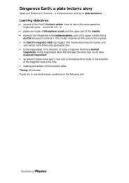
Geology and the Human Environment:<br />
The Nuclear Waste Problem<br />
OWAIN THOMAS<br />
This paper was delivered as a workshop at the Annual Conference of the <strong>Earth</strong> <strong>Science</strong> Teachers<br />
<strong>Association</strong> at Kingston University in September 2001. It describes a Study Day set up at the<br />
National Museum and Gallery of Wales for AS Geology students. The core exercise requires<br />
students to engage with the basic spatial, geological and environmental issues which lie behind<br />
the decision to locate a nuclear power station.<br />
Introduction<br />
The National Museum and Gallery of Wales has an<br />
excellent record of supporting education throughout<br />
Wales. The Education Department is responsible for<br />
developing resources to complement the displays,<br />
including the superb “Evolution of Wales” exhibition.<br />
About eighteen months ago I suggested developing<br />
some educational resources to support the new AS/A2<br />
level specifications. Geraint Price, the Senior Education<br />
Officer was very keen to support the initiative and he<br />
worked with both Museum and Cardiff University<br />
staff to put together a study day for AS Geology students.<br />
I contributed a set of worksheets to complement<br />
the presentation made by the experts.<br />
We aimed to bring together as many aspects of the AS<br />
course as possible in an integrated problem-solving<br />
exercise and to meet this aim we developed the idea of<br />
choosing a suitable site for a nuclear waste facility on<br />
the imaginary South Pacific island of Nova Cambria.<br />
The study day<br />
Two groups of students attended the Museum for the<br />
study day in November 2000, one group from<br />
Amman Valley School, the other from Coleg Sir Gar<br />
(Carmarthenshire College) accompanied by their<br />
teacher, Dr. Liz Richards. Geraint Price arranged for a<br />
number of experts to give short presentations to the<br />
students, with each presentation being followed by a<br />
practical exercise. Dr Bob Owens and Sarah Chambers<br />
led respectively sessions on rock specimen identification<br />
and the use of fossils for relative dating.<br />
These were followed by Prof. Mike Bassett discussing<br />
fossil evidence for plate tectonics. Geraint contributed<br />
two sessions, one on volcanic hazards the other on<br />
groundwater processes. Dr Carolyn Heeps from the<br />
Education Department analysed the erosion and<br />
depositional processes affecting coasts. <strong>Earth</strong>quake<br />
hazards and monitoring was covered by Dr Pete Brabham<br />
from the University and his colleague, Dr<br />
Charles Harris, finished the day with a session on site<br />
investigation techniques.<br />
I think that the day was very successful. The students<br />
felt that the sessions were very interesting and provided<br />
a lot of interesting background information, despite the<br />
fact that we had tried to cover a great deal of material in<br />
the single day. The practical aspects were particularly<br />
popular with the students.<br />
Geraint Price and I decided that we would try to<br />
develop the materials so that they could be used in a<br />
number of different ways. The pack can be used in<br />
schools using specimens readily available in a standard<br />
departmental collection. Alternatively, materials can be<br />
borrowed from the Museum’s outreach collection and<br />
it is anticipated that the study day will be repeated at<br />
some point in the future.<br />
The activity pack<br />
The intention is that the pupils will practise a number<br />
of skills as they work their way through this pack,<br />
including:<br />
● rock specimen description and identification;<br />
● fossil identification;<br />
● cross-section drawing;<br />
● locating earthquake epicentres;<br />
● interpreting volcanic monitoring data;<br />
● calculating rates of coastal erosion;<br />
● determining permeability;<br />
● interpreting geophysical survey data.<br />
Each of the above activities is introduced to the students<br />
assuming relatively little prior knowledge.<br />
www.esta-uk.org<br />
94