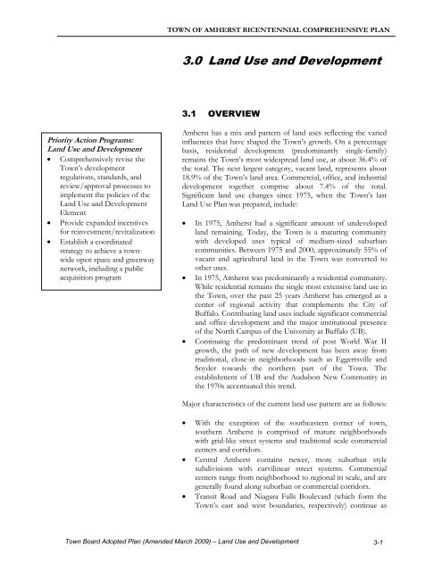
3.0 Land Use and Development - Town of Amherst
3.0 Land Use and Development - Town of Amherst
3.0 Land Use and Development - Town of Amherst

Create successful ePaper yourself
Turn your PDF publications into a flip-book with our unique Google optimized e-Paper software.
TOWN OF AMHERST BICENTENNIAL COMPREHENSIVE PLAN<br />
<strong>3.0</strong> <strong>L<strong>and</strong></strong> <strong>Use</strong> <strong>and</strong> <strong>Development</strong><br />
3.1 OVERVIEW<br />
Priority Action Programs:<br />
<strong>L<strong>and</strong></strong> <strong>Use</strong> <strong>and</strong> <strong>Development</strong><br />
• Comprehensively revise the<br />
<strong>Town</strong>’s development<br />
regulations, st<strong>and</strong>ards, <strong>and</strong><br />
review/approval processes to<br />
implement the policies <strong>of</strong> the<br />
<strong>L<strong>and</strong></strong> <strong>Use</strong> <strong>and</strong> <strong>Development</strong><br />
Element<br />
• Provide exp<strong>and</strong>ed incentives<br />
for reinvestment/revitalization<br />
• Establish a coordinated<br />
strategy to achieve a townwide<br />
open space <strong>and</strong> greenway<br />
network, including a public<br />
acquisition program<br />
<strong>Amherst</strong> has a mix <strong>and</strong> pattern <strong>of</strong> l<strong>and</strong> uses reflecting the varied<br />
influences that have shaped the <strong>Town</strong>’s growth. On a percentage<br />
basis, residential development (predominantly single-family)<br />
remains the <strong>Town</strong>’s most widespread l<strong>and</strong> use, at about 36.4% <strong>of</strong><br />
the total. The next largest category, vacant l<strong>and</strong>, represents about<br />
18.9% <strong>of</strong> the <strong>Town</strong>’s l<strong>and</strong> area. Commercial, <strong>of</strong>fice, <strong>and</strong> industrial<br />
development together comprise about 7.4% <strong>of</strong> the total.<br />
Significant l<strong>and</strong> use changes since 1975, when the <strong>Town</strong>’s last<br />
<strong>L<strong>and</strong></strong> <strong>Use</strong> Plan was prepared, include:<br />
• In 1975, <strong>Amherst</strong> had a significant amount <strong>of</strong> undeveloped<br />
l<strong>and</strong> remaining. Today, the <strong>Town</strong> is a maturing community<br />
with developed uses typical <strong>of</strong> medium-sized suburban<br />
communities. Between 1975 <strong>and</strong> 2000, approximately 55% <strong>of</strong><br />
vacant <strong>and</strong> agricultural l<strong>and</strong> in the <strong>Town</strong> was converted to<br />
other uses.<br />
• In 1975, <strong>Amherst</strong> was predominantly a residential community.<br />
While residential remains the single most extensive l<strong>and</strong> use in<br />
the <strong>Town</strong>, over the past 25 years <strong>Amherst</strong> has emerged as a<br />
center <strong>of</strong> regional activity that complements the City <strong>of</strong><br />
Buffalo. Contributing l<strong>and</strong> uses include significant commercial<br />
<strong>and</strong> <strong>of</strong>fice development <strong>and</strong> the major institutional presence<br />
<strong>of</strong> the North Campus <strong>of</strong> the University at Buffalo (UB).<br />
• Continuing the predominant trend <strong>of</strong> post World War II<br />
growth, the path <strong>of</strong> new development has been away from<br />
traditional, close-in neighborhoods such as Eggertsville <strong>and</strong><br />
Snyder towards the northern part <strong>of</strong> the <strong>Town</strong>. The<br />
establishment <strong>of</strong> UB <strong>and</strong> the Audubon New Community in<br />
the 1970s accentuated this trend.<br />
Major characteristics <strong>of</strong> the current l<strong>and</strong> use pattern are as follows:<br />
• With the exception <strong>of</strong> the southeastern corner <strong>of</strong> town,<br />
southern <strong>Amherst</strong> is comprised <strong>of</strong> mature neighborhoods<br />
with grid-like street systems <strong>and</strong> traditional scale commercial<br />
centers <strong>and</strong> corridors.<br />
• Central <strong>Amherst</strong> contains newer, more suburban style<br />
subdivisions with curvilinear street systems. Commercial<br />
centers range from neighborhood to regional in scale, <strong>and</strong> are<br />
generally found along suburban or commercial corridors.<br />
• Transit Road <strong>and</strong> Niagara Falls Boulevard (which form the<br />
<strong>Town</strong>’s east <strong>and</strong> west boundaries, respectively) continue as<br />
<strong>Town</strong> Board Adopted Plan (Amended March 2009) – <strong>L<strong>and</strong></strong> <strong>Use</strong> <strong>and</strong> <strong>Development</strong> 3-1
TOWN OF AMHERST BICENTENNIAL COMPREHENSIVE PLAN<br />
regional shopping destinations, as do nearby sections <strong>of</strong> eastwest<br />
corridors such as Sheridan Drive <strong>and</strong> Maple Road.<br />
• The northwestern <strong>and</strong> particularly the southeastern corners <strong>of</strong><br />
<strong>Amherst</strong> have fragmented l<strong>and</strong> use patterns featuring<br />
dissimilar uses (e.g., residential, <strong>of</strong>fice, <strong>and</strong> industrial) located<br />
next to each other.<br />
• Northern <strong>Amherst</strong> remains largely rural in character, with<br />
large areas <strong>of</strong> restricted agricultural l<strong>and</strong>, public open space,<br />
sensitive environmental resources, rural highways, <strong>and</strong> (mostly<br />
in the northeast) a large proportion <strong>of</strong> the vacant l<strong>and</strong><br />
remaining in the <strong>Town</strong>.<br />
• Public <strong>and</strong> semi-public uses (parks, schools, educational<br />
institutions, etc.) are located throughout the <strong>Town</strong>, generally<br />
as isolated rather than as connected properties.<br />
The generalized existing l<strong>and</strong> use pattern is shown in Figure 2.<br />
Figure 3 shows generalized existing zoning, which has contributed<br />
to the development <strong>of</strong> the <strong>Town</strong>’s current l<strong>and</strong> use pattern.<br />
According to the 2000 Census, the <strong>Town</strong>’s population was<br />
116,510. Population projections prepared for the Comprehensive<br />
Plan indicate that this figure may grow by a moderate range <strong>of</strong><br />
between 9 <strong>and</strong> 19% by 2020, to a total <strong>of</strong> 127,264 to 138,839. In<br />
addition, an additional 6.9 million square feet or 496 acres <strong>of</strong><br />
nonresidential (commercial retail, <strong>of</strong>fice, <strong>and</strong> industrial)<br />
development could be expected, based upon projected<br />
employment growth to 103,844 (a 37% increase). 1 This trend will<br />
reinforce <strong>Amherst</strong>’s development trend from a post World War II<br />
bedroom community to a more diverse regional activity center.<br />
According to the Comprehensive Plan Vision Statement,<br />
distinguishing l<strong>and</strong> use <strong>and</strong> development characteristics <strong>of</strong><br />
<strong>Amherst</strong> in the year 2018 will include:<br />
• Diverse neighborhoods, ranging in character from<br />
traditional to suburban to rural<br />
• Pedestrian-friendly, interconnected, mixed-use development<br />
patterns<br />
• Revitalized older neighborhoods <strong>and</strong> commercial<br />
corridors<br />
• Open space integrated into the overall pattern <strong>of</strong><br />
development<br />
• <strong>Development</strong> st<strong>and</strong>ards that promote objectives such as<br />
improved visual character, revitalization <strong>of</strong> older<br />
neighborhoods, <strong>and</strong> mixed-use development<br />
Context-sensitive design is an<br />
emerging approach to<br />
transportation planning that<br />
emphasizes collaborative planning<br />
with stakeholders to develop<br />
transportation improvements that<br />
preserve local values <strong>and</strong><br />
resources, while maintaining safety<br />
<strong>and</strong> mobility. Four types <strong>of</strong><br />
character corridors appropriate to<br />
different l<strong>and</strong> use contexts have<br />
been identified (See 6-1 for a<br />
complete discussion):<br />
• Traditional character:<br />
corridors located within<br />
higher intensity centers <strong>and</strong><br />
older neighborhoods.<br />
• Suburban character:<br />
corridors serving newer<br />
residential subdivisions, nonlocal<br />
traffic <strong>and</strong> automobileoriented<br />
development.<br />
• Commercial character:<br />
corridors with an established<br />
linear commercial<br />
development pattern.<br />
• Rural character: corridors<br />
possessing unique visual<br />
character due to their rural<br />
<strong>and</strong>/or scenic qualities.<br />
Vision Statement Directions:<br />
<strong>L<strong>and</strong></strong> <strong>Use</strong><br />
• Diverse neighborhoods<br />
• Mixed-use development<br />
patterns<br />
• Revitalized neighborhoods <strong>and</strong><br />
commercial areas<br />
• Improved development<br />
st<strong>and</strong>ards<br />
1 See the Inventory <strong>and</strong> Analysis Report for a complete documentation <strong>of</strong><br />
population <strong>and</strong> development projections (Available at:<br />
www.amherst.ny.us).<br />
3-2<br />
<strong>Town</strong> Board Adopted Plan (Amended March 2009) – <strong>L<strong>and</strong></strong> <strong>Use</strong> <strong>and</strong> <strong>Development</strong>
CREEK<br />
TONAWANDA<br />
RANSOM<br />
BLACK CREEK<br />
CREEK<br />
ELLICOTT<br />
.-, 990 .-, 90<br />
CREEK<br />
.-, 290<br />
VILLAGE OF<br />
WILLIAMSVILLE<br />
Generalized Existing <strong>L<strong>and</strong></strong> <strong>Use</strong><br />
LEGEND<br />
Agricultural <strong>L<strong>and</strong></strong><br />
Single Family Residential<br />
Office<br />
Vacant <strong>L<strong>and</strong></strong><br />
Industrial<br />
Low Density Residential Recreation <strong>and</strong> Open<br />
Space<br />
Medium Density Residential Public/Semi-Public<br />
Commercial<br />
Utilities<br />
BUFFALO-NIAGARA<br />
INTERNATIONAL AIRPORT<br />
Æ`<br />
Municipal Boundary<br />
Parcel Boundary<br />
Village <strong>of</strong> Williamsville<br />
Boundary<br />
Surface Water Body<br />
SOURCE NOTES :<br />
Original Source Data Provided by the<br />
<strong>Town</strong> <strong>of</strong> <strong>Amherst</strong><br />
<strong>L<strong>and</strong></strong> use data as <strong>of</strong> September 2000<br />
Map Compiled by URS Corporation<br />
Date: February, 2004<br />
FIGURE 2<br />
N<br />
0 0.25 0.5 0.75 1 1.25<br />
Miles
CREEK<br />
TONAWANDA<br />
RANSOM<br />
BLACK CREEK<br />
CREEK<br />
ELLICOTT<br />
.-, 990 .-, 290 BUFFALO-NIAGARA<br />
CREEK<br />
VILLAGE OF<br />
WILLAMSVILLE<br />
Generalized Existing Zoning<br />
LEGEND<br />
Suburban Agricultural<br />
Residential<br />
Single Family Residential<br />
Low Density Residential<br />
Medium Density Residential<br />
New Community District<br />
Planned Residential District<br />
Commercial - Non-Office<br />
Commercial - Office<br />
Community Facilities<br />
Industrial<br />
Municipal Boundary<br />
Parcel Boundary<br />
INTERNATIONAL AIRPORT<br />
Village <strong>of</strong> Williamsville<br />
Boundary<br />
New Community District<br />
Boundary<br />
Æ`<br />
Surface Water<br />
Body<br />
.-, 90<br />
SOURCE NOTES :<br />
FIGURE 3<br />
Original Source Data Provided by the <strong>Town</strong><br />
<strong>of</strong> <strong>Amherst</strong><br />
Zoning Data, September 2000<br />
This Zoning Map not <strong>of</strong>ficially adopted by the<br />
<strong>Amherst</strong> <strong>Town</strong> Board, Deed <strong>and</strong> other restrictions<br />
may apply to some parcels.<br />
For <strong>of</strong>ficial zoning information contact the<br />
<strong>Town</strong> <strong>of</strong> <strong>Amherst</strong> Building Department<br />
Map Compiled by URS Corporation 0<br />
Date: February, 2004<br />
N<br />
0.25 0.5 0.75<br />
Miles<br />
1 1.25
TOWN OF AMHERST BICENTENNIAL COMPREHENSIVE PLAN<br />
Together with the Conceptual <strong>L<strong>and</strong></strong> <strong>Use</strong> Plan, the goals,<br />
objectives, <strong>and</strong> policies set forth in this element are designed to<br />
guide future l<strong>and</strong> use <strong>and</strong> development/redevelopment within the<br />
<strong>Town</strong>. They include changes to development regulations <strong>and</strong><br />
processes, public investment <strong>and</strong> incentive strategies, <strong>and</strong> other<br />
actions to achieve the intent <strong>of</strong> the Vision Statement.<br />
3.2 GOALS, OBJECTIVES, AND POLICIES<br />
GOAL<br />
An interconnected mix <strong>of</strong> l<strong>and</strong> uses that includes revitalized<br />
older neighborhoods <strong>and</strong> commercial corridors, quality new<br />
development, vibrant activity centers, agriculture, <strong>and</strong> green<br />
spaces throughout the community<br />
Mixed-use <strong>and</strong> pedestrian-friendly development<br />
in the Village <strong>of</strong> Williamsville.<br />
OBJECTIVES<br />
• Promote the development/redevelopment <strong>of</strong> walkable higher<br />
density, mixed-use centers surrounded by lower density<br />
development<br />
• Implement context-sensitive st<strong>and</strong>ards <strong>and</strong> incentives to<br />
improve the quality <strong>and</strong> appearance <strong>of</strong> development<br />
• Encourage reinvestment in older neighborhoods <strong>and</strong><br />
commercial corridors in <strong>Amherst</strong><br />
• Target capital improvements to leverage private investment<br />
<strong>and</strong> enhance community appearance<br />
• Establish a town-wide network <strong>of</strong> parks, open spaces, <strong>and</strong><br />
greenway corridors<br />
• Improve the predictability <strong>and</strong> consistency <strong>of</strong> the<br />
development review <strong>and</strong> decision-making process<br />
POLICIES<br />
Vertical mixing <strong>of</strong> uses at Snyder Square.<br />
A. <strong>Development</strong> Patterns<br />
The Comprehensive Plan l<strong>and</strong> use policies are not intended to<br />
alter the amount <strong>of</strong> development in <strong>Amherst</strong>, but rather to<br />
redistribute densities to appropriate locations while maintaining<br />
lower density development in the surrounding areas. This will<br />
result in more sustainable l<strong>and</strong> use patterns that help to implement<br />
objectives such as promoting pedestrian-friendly development;<br />
preserving open space; <strong>and</strong> establishing centers <strong>of</strong> community<br />
activity.<br />
3-1 Exp<strong>and</strong> provisions <strong>and</strong> incentives for mixed-use<br />
development in designated activity centers.<br />
A mixed-use development consists <strong>of</strong> several types <strong>of</strong> activity,<br />
each <strong>of</strong> which could function independently, but which would<br />
benefit from proximity to each other. For example, residential<br />
units could be located on upper stories above ground level<br />
stores or in a residential development within easy walking<br />
distance <strong>of</strong> a neighborhood commercial center, thus providing<br />
<strong>Town</strong> Board Adopted Plan (Amended March 2009) – <strong>L<strong>and</strong></strong> <strong>Use</strong> <strong>and</strong> <strong>Development</strong> 3-3
TOWN OF AMHERST BICENTENNIAL COMPREHENSIVE PLAN<br />
ready access to shopping <strong>and</strong> other services. Adding <strong>of</strong>fice<br />
space would create the opportunity to live, work, <strong>and</strong> shop in<br />
the same vicinity, while a public facility or facilities (e.g., a<br />
park or school) would increase the range <strong>of</strong> activities. The<br />
result is an activity center that provides a focus for<br />
surrounding neighborhoods while promoting l<strong>and</strong> use<br />
objectives such as compact, pedestrian-friendly development.<br />
By definition, such activity centers are higher in density <strong>and</strong><br />
incorporate a wider range <strong>of</strong> uses than the lower density,<br />
predominantly residential areas surrounding them.<br />
Some established commercial centers in older parts <strong>of</strong><br />
<strong>Amherst</strong>, for example the Main Street/Eggert Road area in<br />
Eggertsville, possess some <strong>of</strong> the attributes <strong>of</strong> a village or<br />
traditional scale mixed-use activity center. However, as is<br />
typical <strong>of</strong> most suburban communities, post-war growth in<br />
<strong>Amherst</strong> has been principally automobile-oriented, single-use<br />
developments. To promote a more integrated development<br />
pattern, the Conceptual <strong>L<strong>and</strong></strong> <strong>Use</strong> Plan designates mixed-use<br />
activity centers in two contexts:<br />
• Established centers <strong>of</strong> community activity, such as<br />
clustered commercial uses, institutions, or community<br />
facilities that serve surrounding neighborhoods. In<br />
general, these locations could be enhanced to become<br />
activity centers.<br />
• In appropriate locations where centers <strong>of</strong> community<br />
activity currently do not exist. Certain locations in the<br />
central <strong>and</strong> northern parts <strong>of</strong> town suggest themselves for<br />
development as new neighborhood-serving, mixed-use<br />
centers based upon criteria such as road access, existing<br />
zoning, <strong>and</strong> relationship to developed or developing<br />
residential areas.<br />
The mixed-use concept is explained more fully in the<br />
discussion <strong>of</strong> mixed-use l<strong>and</strong> use patterns in Section 3.3.<br />
Strategies to achieve complementary mixes <strong>of</strong> uses in the<br />
designated locations include:<br />
• Improve regulations to encourage mixed-use. The<br />
following approach should be taken to improve the<br />
<strong>Town</strong>’s zoning districts to encourage more mixed-use<br />
development:<br />
− Evaluate existing commercial zoning districts for<br />
opportunities to focus on scale, add complementary<br />
uses, <strong>of</strong>fer incentives, <strong>and</strong> add performance st<strong>and</strong>ards<br />
− Evaluate the current mixed-use districts, which <strong>of</strong>fer<br />
variations on conventional “planned-unit<br />
development,” for opportunities to facilitate the types<br />
<strong>of</strong> development identified by the Conceptual <strong>L<strong>and</strong></strong><br />
Strategies to Achieve Mixed-<br />
<strong>Use</strong> <strong>Development</strong> Patterns<br />
• Improve zoning districts to<br />
encourage mixed uses<br />
• Target public improvements to<br />
promote private investment in<br />
mixed-use centers<br />
• Coordinate with other plan<br />
strategies, such as<br />
transportation <strong>and</strong> location <strong>of</strong><br />
community facilities<br />
3-4<br />
<strong>Town</strong> Board Adopted Plan (Amended March 2009) – <strong>L<strong>and</strong></strong> <strong>Use</strong> <strong>and</strong> <strong>Development</strong>
TOWN OF AMHERST BICENTENNIAL COMPREHENSIVE PLAN<br />
−<br />
<strong>Use</strong> Plan text for undeveloped areas designated as<br />
future mixed-use centers, including Evergreen Golf<br />
Course <strong>and</strong> Millersport Highway/New Road (see<br />
Policy 3-2 for further detail)<br />
Establish new village <strong>and</strong> traditional-oriented mixeduse<br />
districts to facilitate the types <strong>of</strong> development<br />
identified by the Conceptual <strong>L<strong>and</strong></strong> <strong>Use</strong> Plan text for<br />
older commercial areas such as the Village <strong>of</strong><br />
Williamsville, Main Street/Eggert Road, <strong>and</strong> Harlem<br />
Road/Kensington Avenue<br />
Clear st<strong>and</strong>ards should be established for each mixed-use<br />
district to address issues such as intensity/density, the<br />
types <strong>and</strong> mixes <strong>of</strong> uses, the relationship <strong>of</strong> these uses to<br />
surrounding l<strong>and</strong> uses (e.g., less intense uses at the edge<br />
<strong>of</strong> the center next to an adjacent residential area), <strong>and</strong><br />
other center design elements.<br />
• Targeted public investments, including infrastructure<br />
<strong>and</strong> urban design improvements to leverage desired<br />
private investment in mixed-use centers.<br />
• Coordination with other Comprehensive Plan<br />
policies, for example: transportation strategies to support<br />
transit service <strong>and</strong> sidewalk/bikepath connections to<br />
mixed-use centers; locating community facilities to<br />
increase center activity, etc.<br />
3-2 Encourage compact, pedestrian-friendly development<br />
through Planned Residential options, including but not<br />
limited to neo-traditional design.<br />
In contrast to older neighborhoods such as Eggertsville <strong>and</strong><br />
Snyder, which are characterized by grid street systems<br />
connected to traditional scale commercial centers, the<br />
predominant pattern <strong>of</strong> new residential development in<br />
<strong>Amherst</strong> is one <strong>of</strong> automobile-oriented subdivisions that are<br />
typically isolated from each other <strong>and</strong> from other uses.<br />
<strong>Amherst</strong>’s Zoning Code provides a Planned Residential<br />
District (PRD) option intended to promote more creative,<br />
flexible design, including variety in housing types, mixed uses,<br />
<strong>and</strong> open space preservation. However, this option has not<br />
been utilized.<br />
The PRD regulations should be updated <strong>and</strong> exp<strong>and</strong>ed to<br />
meet Comprehensive Plan objectives <strong>of</strong> achieving compact,<br />
interconnected, pedestrian-friendly development patterns.<br />
Issues that should be addressed in this update include:<br />
• Making this option a more viable alternative to<br />
conventional subdivision development. Techniques to<br />
achieve this objective include incentives (e.g., density<br />
<strong>Town</strong> Board Adopted Plan (Amended March 2009) – <strong>L<strong>and</strong></strong> <strong>Use</strong> <strong>and</strong> <strong>Development</strong> 3-5
TOWN OF AMHERST BICENTENNIAL COMPREHENSIVE PLAN<br />
bonuses, smaller lot sizes, narrow street widths to<br />
promote pedestrian scale) <strong>and</strong> clearer, more “userfriendly”<br />
regulations <strong>and</strong> approval processes.<br />
• Establishing clear development st<strong>and</strong>ards tied to<br />
Comprehensive Plan objectives. These st<strong>and</strong>ards can<br />
draw upon principles <strong>of</strong> compact, efficient development<br />
such as neo-traditional design. Also referred to as<br />
traditional neighborhood development (TND), neotraditional<br />
design is emerging nationally as an alternative<br />
to single-use, automobile-oriented subdivisions. Based<br />
upon characteristics predominant in pre-World War II<br />
communities, typical features <strong>of</strong> TND design include:<br />
− Interconnected, pedestrian-oriented street systems<br />
− Places to shop <strong>and</strong> work <strong>and</strong> public/institutional uses<br />
such as a school, park, or church within walking<br />
distance <strong>of</strong> residences, typically in neighborhood<br />
centers<br />
− Coordination with transit service<br />
This concept is not a new one to <strong>Amherst</strong>. Older<br />
neighborhoods such as Eggertsville <strong>and</strong> Snyder<br />
demonstrate many characteristics <strong>of</strong> TND design <strong>and</strong> can<br />
be drawn upon as models in developing the st<strong>and</strong>ards.<br />
Traditional residential<br />
neighborhood development.<br />
Source: www.pedbikeimages.org<br />
• Better defining locations appropriate for application<br />
<strong>of</strong> Planned Residential options. With a minimum size<br />
limit <strong>of</strong> 50 acres, the current PRD option is oriented<br />
towards “greenfield” development on larger sites <strong>and</strong><br />
thus is primarily applicable to northern <strong>Amherst</strong>. This<br />
size limit must be reevaluated <strong>and</strong> st<strong>and</strong>ards defined for<br />
application to infill <strong>and</strong> redevelopment sites in developed<br />
contexts. In addition, application <strong>of</strong> mixed-use options<br />
should be coordinated with mixed-use activity centers<br />
defined per Policy 3-1.<br />
3-3 Modify provisions <strong>of</strong> the Suburban Agricultural District<br />
to reduce conversions <strong>of</strong> rural to suburban development<br />
patterns.<br />
The <strong>Town</strong>’s lowest density residential zoning district at one<br />
unit per acre, the Suburban Agricultural (S-A) District has<br />
traditionally functioned as a “holding zone” for rezoning to<br />
more intense residential <strong>and</strong> other uses. This trend has created<br />
uncertainty <strong>and</strong> contributed to the gradual erosion <strong>of</strong> the<br />
<strong>Town</strong>’s rural character. The Conceptual <strong>L<strong>and</strong></strong> <strong>Use</strong> Plan shows<br />
certain areas in northern <strong>Amherst</strong> to remain in agricultural<br />
<strong>and</strong> rural uses. An agricultural zoning district should be<br />
created <strong>and</strong> applied to areas that are farmed or are designated<br />
as part <strong>of</strong> the <strong>Town</strong>’s Farml<strong>and</strong> Protection Program. To<br />
regulate residential development outside <strong>of</strong> these areas, a new<br />
zoning district (possibly renamed Rural Residential to more<br />
clearly identify the intent <strong>of</strong> the district) should be created<br />
with provisions added to promote rural development patterns.<br />
3-6<br />
<strong>Town</strong> Board Adopted Plan (Amended March 2009) – <strong>L<strong>and</strong></strong> <strong>Use</strong> <strong>and</strong> <strong>Development</strong>
TOWN OF AMHERST BICENTENNIAL COMPREHENSIVE PLAN<br />
For example, the base density could be reduced to one unit<br />
per three to five acres except for conservation developments<br />
that preserve at least 50% <strong>of</strong> the property as open space,<br />
which would be allowed to develop at a higher density. For<br />
other S-A properties, rezonings must be consistent with the<br />
policies recommended in the Comprehensive Plan <strong>and</strong> the<br />
criteria stated in Policy 3-16. In locations designated as<br />
activity centers on the Conceptual <strong>L<strong>and</strong></strong> <strong>Use</strong> Plan, higher<br />
density, mixed uses are appropriate. In other current S-A<br />
areas, the criteria should promote use <strong>of</strong> conservation<br />
development <strong>and</strong> other options to maintain rural character<br />
(see Policy 3-14).<br />
3-4 Reduce future new commercial development in North<br />
<strong>Amherst</strong> <strong>and</strong> along highway strips.<br />
In the 1975 Plan, the portion <strong>of</strong> <strong>Amherst</strong> generally located<br />
north <strong>of</strong> North French Road had been considered an area<br />
that would experience significant new population growth<br />
accompanying the expected conversion <strong>of</strong> this largely rural<br />
area to suburban uses. Consistent with policies in the 1993<br />
Northeast <strong>Amherst</strong> Plan <strong>and</strong> this Comprehensive Plan to limit<br />
utility extensions <strong>and</strong> retain rural densities <strong>and</strong> agricultural<br />
uses, North <strong>Amherst</strong> now has reduced potential for<br />
development. Likewise, the regulatory restrictions imposed by<br />
the Ransom Creek floodway <strong>and</strong> NYSDEC regulated<br />
wetl<strong>and</strong>s further reduce development potential below that<br />
depicted by present zoning designations. Policies to protect<br />
the scenic, largely agricultural <strong>and</strong> residential character <strong>of</strong> rural<br />
roads <strong>and</strong> to reduce the traffic impacts resulting from highway<br />
"strip" development suggest that commercial development in<br />
this area should occur in more compact, mixed-use centers or<br />
existing or newly designated commercial nodes. As illustrated<br />
on the Conceptual <strong>L<strong>and</strong></strong> <strong>Use</strong> Plan, these centers should be in<br />
key, high accessibility locations, such as the intersection <strong>of</strong><br />
Millersport Highway <strong>and</strong> New Road.<br />
Clear development st<strong>and</strong>ards<br />
are critical to the Aesthetic/<br />
Community Character Key<br />
Initiative <strong>and</strong> will improve the<br />
predictability <strong>of</strong> the review <strong>and</strong><br />
approval process for both citizens<br />
<strong>and</strong> developers.<br />
As a general rule, future new commercial development (as<br />
opposed to redevelopment in existing commercial areas)<br />
should be appropriately scaled <strong>and</strong> limited to mixed-use<br />
centers <strong>and</strong> retail nodes designated at key locations such as<br />
major intersections rather than being allowed to proliferate<br />
along arterial roadways.<br />
B. <strong>Development</strong> Character<br />
The Vision Statement emphasizes “high st<strong>and</strong>ards for the quality<br />
<strong>of</strong> development <strong>and</strong> redevelopment” <strong>and</strong> enhanced “visual<br />
character” through design as key to community character.<br />
Aesthetic/Community Character is one <strong>of</strong> the four major<br />
Comprehensive Plan Initiatives, one that will contribute to<br />
maintaining <strong>and</strong> enhancing <strong>Amherst</strong>’s status as a premier<br />
community in Western New York. Establishing st<strong>and</strong>ards <strong>and</strong><br />
guidance for design to achieve high quality development is critical<br />
<strong>Town</strong> Board Adopted Plan (Amended March 2009) – <strong>L<strong>and</strong></strong> <strong>Use</strong> <strong>and</strong> <strong>Development</strong> 3-7
TOWN OF AMHERST BICENTENNIAL COMPREHENSIVE PLAN<br />
to achieving the goals <strong>of</strong> the Vision Statement <strong>and</strong> implementing<br />
the Aesthetic/ Community Character initiative. Clear st<strong>and</strong>ards<br />
will also help to improve the predictability <strong>of</strong> the development<br />
review <strong>and</strong> approval process, thus eliminating a source <strong>of</strong><br />
frustration for citizens <strong>and</strong> developers alike (Amended 2-28-11;<br />
BCPA-10-1).<br />
3-5 Employ design st<strong>and</strong>ards to enhance community<br />
appearance <strong>and</strong> sense <strong>of</strong> place.<br />
Design st<strong>and</strong>ards are effective tools to guide <strong>and</strong> shape new<br />
development <strong>and</strong> revitalization initiatives <strong>and</strong> are important in<br />
addressing such issues as impacts on the visual character <strong>of</strong><br />
public roadways <strong>and</strong> on adjacent residential areas. Design<br />
st<strong>and</strong>ards should address the following considerations,<br />
especially for revitalization projects where complementing the<br />
surrounding context is important:<br />
• <strong>L<strong>and</strong></strong>scaping <strong>and</strong> lighting: The <strong>Town</strong>’s current<br />
regulations provide specific guidance to petitioners <strong>and</strong><br />
approval authorities regarding the <strong>Town</strong>’s expectations<br />
for l<strong>and</strong>scaping <strong>of</strong> new developments, including the<br />
percentage <strong>of</strong> the site that is l<strong>and</strong>scaped, screening <strong>and</strong><br />
interior l<strong>and</strong>scaping <strong>of</strong> parking areas, rear <strong>and</strong> side yard<br />
buffers <strong>and</strong> screening, <strong>and</strong> preservation <strong>of</strong> existing trees<br />
(coordinated with the <strong>Amherst</strong> Comprehensive Tree<br />
Law). However, revitalization projects may require<br />
flexible l<strong>and</strong>scaping st<strong>and</strong>ards to account for site<br />
constraints <strong>and</strong> provide for a more urban form <strong>of</strong><br />
l<strong>and</strong>scaping. Project lighting should be in accordance<br />
with an overall lighting plan <strong>and</strong> should avoid excessive<br />
illumination <strong>and</strong> light spread beyond the project limits.<br />
<strong>Development</strong> Considerations:<br />
• <strong>L<strong>and</strong></strong>scaping <strong>and</strong> lighting<br />
• Screening <strong>of</strong> visually obtrusive<br />
elements<br />
• Placement <strong>of</strong> building <strong>and</strong><br />
parking areas<br />
• General building design<br />
• Scale<br />
• Access <strong>and</strong> connectivity<br />
• Public safety<br />
• Signage<br />
• Screening <strong>of</strong> visually obtrusive elements: Elements<br />
such as outside mechanical equipment, dumpsters,<br />
ro<strong>of</strong>top HVAC equipment, <strong>and</strong> loading <strong>and</strong> service areas<br />
should continue to be screened from view from adjacent<br />
streets <strong>and</strong> properties.<br />
• Placement <strong>of</strong> building <strong>and</strong> parking areas in relation<br />
to each other <strong>and</strong> public roads: Depending upon the<br />
surrounding context, the location <strong>of</strong> buildings <strong>and</strong><br />
parking lots can have a significant impact on visual<br />
character. The pedestrian-friendly character <strong>of</strong> traditional<br />
commercial centers is directly related to buildings that are<br />
pulled up to the sidewalk/street with parking located<br />
behind or beside the buildings. In general, locating<br />
buildings closer to the street <strong>and</strong> parking to the sides <strong>and</strong><br />
rear <strong>of</strong> buildings will decrease the visual impact <strong>of</strong><br />
automobiles <strong>and</strong> create more <strong>of</strong> a pedestrian-friendly<br />
environment. This principle particularly applies to<br />
traditional commercial areas in Williamsville, Eggertsville,<br />
3-8<br />
<strong>Town</strong> Board Adopted Plan (Amended March 2009) – <strong>L<strong>and</strong></strong> <strong>Use</strong> <strong>and</strong> <strong>Development</strong>
TOWN OF AMHERST BICENTENNIAL COMPREHENSIVE PLAN<br />
<strong>and</strong> Snyder. However, the visual character <strong>of</strong> automobileoriented<br />
commercial corridors such as Niagara Falls<br />
Boulevard <strong>and</strong> Transit Road would be improved by<br />
policies that encourage a portion <strong>of</strong> required parking to<br />
be located to the side <strong>and</strong> rear <strong>of</strong> buildings in order to<br />
reduce the scale <strong>of</strong> front yard parking areas. Also<br />
important in reducing the scale <strong>of</strong> parking lots is<br />
decreasing the amount <strong>of</strong> parking required. The <strong>Town</strong>’s<br />
Zoning Code provision for an alternative parking plan<br />
allows for flexibility in the quantity <strong>of</strong> parking required.<br />
• Building design: While it is not appropriate to impose<br />
detailed architectural design requirements, guidelines<br />
should be established for certain issues to ensure<br />
complementary relationships to adjoining streets <strong>and</strong><br />
properties. These issues include building orientation,<br />
façade articulation, <strong>and</strong> building mass/height in<br />
relationship to the surrounding context.<br />
• Scale: The concept <strong>of</strong> scale can be incorporated into<br />
guidelines so that new development <strong>and</strong> revitalization is<br />
in harmony with an existing area. Appropriately scaled<br />
development is consistent or complementary in terms <strong>of</strong><br />
size <strong>and</strong> mass with the existing surroundings <strong>and</strong><br />
highways. St<strong>and</strong>ards should provide measures <strong>of</strong> scale to<br />
help achieve such consistency.<br />
Commercial development compatible with<br />
adjacent single-family housing.<br />
• Streetscape, access <strong>and</strong> connectivity: The <strong>Town</strong>’s<br />
Context-Sensitive Highway Design Report provides<br />
guidance on issues such as street geometry, sidewalks <strong>and</strong><br />
bicycle use, <strong>and</strong> streetscape elements such as trees,<br />
lighting, <strong>and</strong> other aesthetic elements. Access <strong>and</strong><br />
connectivity considerations include limiting the number<br />
<strong>of</strong> curb cuts, providing vehicular/pedestrian connections<br />
between adjacent developments, <strong>and</strong> providing<br />
pedestrian/sidewalk connections between adjacent<br />
neighborhoods <strong>and</strong> retail centers. The <strong>Town</strong>’s report,<br />
Access Management Strategies for Major Corridors,<br />
provides guidance on these issues.<br />
• Public safety: Crime Prevention Through<br />
Environmental Design (CPTED) is an approach to<br />
planning <strong>and</strong> design based upon the premise that design<br />
<strong>of</strong> the physical environment can positively influence<br />
human behavior to create a climate <strong>of</strong> safety <strong>and</strong> reduce<br />
crime. From a site design st<strong>and</strong>point, three key strategies<br />
<strong>of</strong> CPTED include 2 :<br />
2 National Crime Prevention Council website<br />
<strong>Town</strong> Board Adopted Plan (Amended March 2009) – <strong>L<strong>and</strong></strong> <strong>Use</strong> <strong>and</strong> <strong>Development</strong> 3-9
TOWN OF AMHERST BICENTENNIAL COMPREHENSIVE PLAN<br />
−<br />
−<br />
−<br />
Territoriality: Design to express ownership <strong>of</strong> a place,<br />
using elements such as fences, pavement treatment,<br />
signs, <strong>and</strong> l<strong>and</strong>scaping.<br />
Natural surveillance: Planning <strong>of</strong> l<strong>and</strong>scaping, lighting,<br />
<strong>and</strong> other elements to facilitate the ability to observe<br />
activities in the space<br />
Access control: Properly locating access points,<br />
combined with elements such as fencing, l<strong>and</strong>scaping,<br />
<strong>and</strong> lighting, to direct traffic in ways that discourage<br />
crime.<br />
• Signage: Signs can play an important role in defining the<br />
character <strong>and</strong> context <strong>of</strong> an area. Sign regulations <strong>and</strong><br />
st<strong>and</strong>ards need to be more sensitive to the local context,<br />
improve aesthetic character, <strong>and</strong> reduce “visual clutter”<br />
along commercial corridors. In general, signage should<br />
be consistent with the architectural style <strong>and</strong> scale <strong>of</strong><br />
buildings <strong>and</strong> be an integral component <strong>of</strong> the building<br />
<strong>and</strong> site.<br />
While design st<strong>and</strong>ards are intended to address nonresidential<br />
<strong>and</strong> multi-family development throughout<br />
<strong>Amherst</strong>, it is important that they not be applied through a<br />
“one-size-fits-all” approach, but rather be tailored as<br />
appropriate to address the unique characteristics <strong>of</strong> particular<br />
parts <strong>of</strong> town. For example, extensive interior l<strong>and</strong>scape<br />
area/l<strong>and</strong>scape buffer requirements may be appropriate for<br />
commercial development in a less dense (suburban) context in<br />
Central <strong>Amherst</strong>, but may be more difficult to apply to a<br />
smaller commercial lot in a more compactly developed area<br />
such as Eggertsville. In the latter context, reduced parking<br />
requirements <strong>and</strong> a narrower buffer with more concentrated<br />
screening (denser vegetation <strong>and</strong>/or a fence or wall) may be<br />
appropriate. Policies 3-6 to 3-8 further explore ways in which<br />
design st<strong>and</strong>ards should be adapted to local contexts.<br />
(Amended 2-28-11; BCPA-10-1).<br />
3-6 Apply context-sensitive design st<strong>and</strong>ards to designated<br />
character roads.<br />
Varying from traditional streets in older neighborhoods to<br />
major commercial thoroughfares to rural roads, the diverse<br />
roadway corridors within <strong>Amherst</strong> are key to the <strong>Town</strong>’s<br />
character. Design guidance has been established to maintain<br />
<strong>and</strong> enhance the character <strong>of</strong> different types <strong>of</strong> roadway<br />
corridors in the <strong>Town</strong> through coordinated treatment <strong>of</strong> the<br />
street/public right-<strong>of</strong>-way <strong>and</strong> adjacent l<strong>and</strong> uses. (See<br />
Transportation Policy 6-1 for a full discussion <strong>of</strong> this concept,<br />
including roads designated for application <strong>of</strong> context-sensitive<br />
design st<strong>and</strong>ards.) (Amended 2-28-11; BCPA-10-1).<br />
3-10<br />
<strong>Town</strong> Board Adopted Plan (Amended March 2009) – <strong>L<strong>and</strong></strong> <strong>Use</strong> <strong>and</strong> <strong>Development</strong>
TOWN OF AMHERST BICENTENNIAL COMPREHENSIVE PLAN<br />
3-7 Protect <strong>and</strong> retain the identity <strong>of</strong> special places through<br />
design guidelines.<br />
Certain places within the <strong>Town</strong> <strong>of</strong> <strong>Amherst</strong> have a special<br />
identity defined by factors such as historic character (e.g.,<br />
former “hamlets” such as Getzville <strong>and</strong> Swormville),<br />
geographic location (e.g., at a highway interchange or gateway<br />
entrance to the <strong>Town</strong>), or presence <strong>of</strong> an important<br />
community resource (e.g., a major park, public or private<br />
buildings or open space, or an educational campus). These<br />
places are <strong>of</strong>ten well known, however, others may need to be<br />
identified through collaborative planning with local residents<br />
(i.e., through the Neighborhood Improvement Plans<br />
recommended by Housing <strong>and</strong> Neighborhoods Policy 8-9).<br />
Master site planning <strong>and</strong> context-sensitive design guidelines<br />
should be employed for both public improvements (e.g., road<br />
improvement projects) <strong>and</strong> private development or<br />
revitalization to complement <strong>and</strong> reinforce the established<br />
character <strong>of</strong> the identified areas. Design guidelines that<br />
address the considerations in Policy 3-5 should be developed<br />
for these special places to conserve existing character <strong>and</strong><br />
scale (e.g., through treatment <strong>of</strong> building mass, orientation,<br />
<strong>and</strong> placement on the lot). Guidelines for key geographic<br />
locations should focus on context <strong>and</strong> reinforcing visual<br />
image <strong>and</strong> identity, for example through gateway <strong>and</strong><br />
l<strong>and</strong>mark treatments in accordance with Policy 3-11.<br />
Guidelines for community resources should be designed to<br />
complement <strong>and</strong> relate to the resource <strong>and</strong> surrounding<br />
context. Examples include preservation <strong>of</strong> key natural<br />
resources, the provision <strong>of</strong> pedestrian or visual access <strong>and</strong><br />
buffers between dissimilar uses (Amended 2-28-11; BCPA-10-<br />
1).<br />
Reinvestment in <strong>Amherst</strong>’s older<br />
neighborhoods <strong>and</strong> commercial<br />
areas is a Comprehensive Plan Key<br />
Initiative, both to ensure the health<br />
<strong>and</strong> vitality <strong>of</strong> these areas <strong>and</strong> to<br />
reduce pressures for development<br />
at the fringe.<br />
C. Reinvestment<br />
Spurring revitalization <strong>of</strong> <strong>and</strong> reinvestment in <strong>Amherst</strong>’s older<br />
neighborhoods <strong>and</strong> commercial areas is one <strong>of</strong> four key<br />
Comprehensive Plan Initiatives, both to reinforce the health <strong>and</strong><br />
vitality <strong>of</strong> these areas <strong>and</strong> to reduce pressures for “greenfield”<br />
development in fringe areas.<br />
3-8 Consider tax incentives for reinvestment, revitalization,<br />
<strong>and</strong> redevelopment <strong>of</strong> commercial properties <strong>and</strong><br />
housing in older areas with less emphasis on new<br />
"greenfield" development.<br />
The <strong>Amherst</strong> Industrial <strong>Development</strong> Agency (IDA) has<br />
historically <strong>of</strong>fered three different types <strong>of</strong> tax abatements for<br />
commercial developments in the <strong>Town</strong> <strong>of</strong> <strong>Amherst</strong>: real<br />
property tax abatements (10 years for commercial, 15 years<br />
for industrial), an exemption on sales taxes for the purchase<br />
<strong>of</strong> materials for construction <strong>and</strong> business startup, <strong>and</strong> an<br />
exemption from the mortgage recording tax.<br />
<strong>Town</strong> Board Adopted Plan (Amended March 2009) – <strong>L<strong>and</strong></strong> <strong>Use</strong> <strong>and</strong> <strong>Development</strong> 3-11
TOWN OF AMHERST BICENTENNIAL COMPREHENSIVE PLAN<br />
The <strong>Town</strong> <strong>of</strong> <strong>Amherst</strong> also has been able to <strong>of</strong>fer exemptions<br />
that are limited both by their scope <strong>and</strong> their geography under<br />
Section 485-b <strong>of</strong> the New York State Code. Section 485-b<br />
exemptions only apply to the <strong>Town</strong>’s share <strong>of</strong> property taxes,<br />
which is a small percentage <strong>of</strong> what property owners pay.<br />
These benefits are only available in certain redevelopment<br />
areas within the <strong>Town</strong>, including older commercial districts<br />
like Eggertsville <strong>and</strong> Snyder, as well as highway-oriented strips<br />
like older sections <strong>of</strong> Sheridan Drive <strong>and</strong> Transit Road.<br />
Recent policy changes by the <strong>Amherst</strong> <strong>Town</strong> Board (see<br />
below) may help, as they authorize the IDA to assist by<br />
<strong>of</strong>fering abatements for sales taxes on construction materials<br />
<strong>and</strong> mortgage recording taxes to properties located in 485-b<br />
zones.<br />
In the past, the bulk <strong>of</strong> these abatements have only been<br />
available for new construction; abatements for rehabilitation<br />
only applied to the value added by renovation, excluding the<br />
existing property assessment amount. However, recent<br />
changes in policy have broadened the scope <strong>of</strong> IDA<br />
abatements. The <strong>Amherst</strong> IDA has recently joined with the<br />
Erie County IDA <strong>and</strong> the other four local IDA’s in the<br />
county to develop a st<strong>and</strong>ard, county-wide eligibility policy for<br />
tax abatements.<br />
In addition to the “greenfield” industrial <strong>and</strong> commercial<br />
development, the new eligibility policy has broadened the<br />
horizons <strong>of</strong> the tax abatements to include:<br />
• Multi-tenant commercial buildings: Multi-tenant<br />
<strong>of</strong>fice or industrial buildings are now included in the<br />
abatement program, provided that at least two-thirds <strong>of</strong> a<br />
given building’s tenants are in one <strong>of</strong> the IDA’s priority<br />
industry designations (manufacturing, distribution,<br />
business services, <strong>and</strong> arts/entertainment/recreation).<br />
This policy may allow for more multi-tenant, urbanoriented<br />
<strong>of</strong>fice developments, as such locations are likely<br />
to be more desirable for multi-user rather than single-user<br />
buildings.<br />
• Long-term care/assisted living: Residential projects<br />
<strong>of</strong>fering continuing medical care to senior citizens in need<br />
<strong>of</strong> such living arrangements are now eligible for<br />
abatements. Since it was determined for the Inventory <strong>and</strong><br />
Analysis Report that the economics <strong>of</strong> assisted living<br />
facilities in <strong>Amherst</strong> are difficult, sales tax <strong>and</strong> property<br />
tax abatement (10-year) for such projects can help make<br />
them viable for private operators.<br />
• Civic facilities: Three categories <strong>of</strong> civic facilities in<br />
particular are specified in the IDA eligibility criteria –<br />
3-12<br />
<strong>Town</strong> Board Adopted Plan (Amended March 2009) – <strong>L<strong>and</strong></strong> <strong>Use</strong> <strong>and</strong> <strong>Development</strong>
TOWN OF AMHERST BICENTENNIAL COMPREHENSIVE PLAN<br />
dormitories, hospital facilities needed to uphold public<br />
health st<strong>and</strong>ards, <strong>and</strong> housing for adults over the age <strong>of</strong><br />
60. The third category is significant, as it applies to any<br />
housing aimed at senior citizens, <strong>and</strong> not just to assisted<br />
living or continuing care developments.<br />
• Hotels/motels: This abatement applies to the capital<br />
costs <strong>of</strong> construction or rehabilitation <strong>of</strong> lodging facilities<br />
<strong>and</strong> may provide some help for older properties.<br />
Beyond these particular uses, the new policy also states that<br />
any retail or health care businesses located in <strong>of</strong>ficially<br />
designated Neighborhood Redevelopment Areas will also be<br />
eligible for tax abatements. The policy clearly expresses that<br />
such areas may only be designated within the context <strong>of</strong><br />
comprehensive neighborhood redevelopment strategies.<br />
According to these st<strong>and</strong>ards, neighborhoods with existing or<br />
in-progress redevelopment strategies, such as Eggertsville <strong>and</strong><br />
Harlem-Kensington-Clevel<strong>and</strong>, should qualify.<br />
The <strong>Town</strong> should work with the <strong>Amherst</strong> IDA to identify<br />
<strong>and</strong> pursue opportunities to apply the new tax abatement<br />
eligibility policy to projects that will spur reinvestment <strong>and</strong><br />
revitalization <strong>of</strong> older parts <strong>of</strong> <strong>Amherst</strong>. Such projects should<br />
be considered a higher priority for tax abatements than<br />
“greenfield” development on vacant l<strong>and</strong>.<br />
It is important to note that, with the exception <strong>of</strong> the<br />
provisions for senior <strong>and</strong> assisted housing, the IDA<br />
abatements do not address housing construction or<br />
redevelopment. However, there are a number <strong>of</strong> federal<br />
programs aimed at making homeownership more attainable<br />
for first-time <strong>and</strong>/or low-income purchasers, as well as for<br />
rehabilitation <strong>of</strong> older housing units. Since some older areas<br />
<strong>of</strong> the <strong>Town</strong> <strong>of</strong> <strong>Amherst</strong> are in need <strong>of</strong> housing reinvestment,<br />
the <strong>Town</strong> should make sure that property owners, realtors,<br />
<strong>and</strong> homebuyers alike are aware <strong>of</strong> such opportunities. In<br />
addition, the <strong>Town</strong> could provide incentives such as deferrals<br />
in property tax increases on home improvements to<br />
encourage investment in existing housing for low <strong>and</strong><br />
moderate income families (see Housing <strong>and</strong> Neighborhoods<br />
Policy 8-6).<br />
3-9 Advance the redevelopment <strong>and</strong> revitalization <strong>of</strong><br />
underutilized, obsolete, <strong>and</strong> vacant properties for<br />
economically viable uses.<br />
As <strong>Amherst</strong> matures <strong>and</strong> market conditions evolve, some<br />
developed properties may no longer be economically viable as<br />
a result <strong>of</strong> changing economic conditions, obsolete buildings,<br />
or other market characteristics. Sustaining the economic<br />
viability <strong>and</strong> value <strong>of</strong> the <strong>Town</strong>’s neighborhoods <strong>and</strong><br />
commercial areas is critical to maintaining the <strong>Town</strong>’s high<br />
<strong>Town</strong> Board Adopted Plan (Amended March 2009) – <strong>L<strong>and</strong></strong> <strong>Use</strong> <strong>and</strong> <strong>Development</strong> 3-13
TOWN OF AMHERST BICENTENNIAL COMPREHENSIVE PLAN<br />
quality <strong>of</strong> life <strong>and</strong> reducing pressure for “greenfield”<br />
development.<br />
Depending on market conditions <strong>and</strong> other site <strong>and</strong> location<br />
factors, revitalization may feature one or more <strong>of</strong> the following<br />
approaches:<br />
• Reinvestment: Existing buildings are updated or<br />
improved <strong>and</strong> continue to accommodate existing or similar<br />
l<strong>and</strong> uses.<br />
• Adaptive reuse: Existing buildings are retained but are<br />
converted or adapted for new uses. This approach has the<br />
potential benefit <strong>of</strong> retaining buildings with an established<br />
neighborhood presence or that are historic <strong>and</strong> valued<br />
assets within the neighborhood.<br />
• Partial to full redevelopment: Existing buildings <strong>and</strong><br />
l<strong>and</strong> uses are either partially or fully replaced; this may also<br />
involve changes to the layout <strong>of</strong> the site. New uses may<br />
also be accommodated on the redeveloped site.<br />
Following is a description <strong>of</strong> several l<strong>and</strong> use scenarios in which<br />
revitalization may occur or be desired.<br />
• Residential: As housing ages, property maintenance <strong>and</strong><br />
reinvestment become critical. This is <strong>of</strong> particular concern<br />
when single-family housing is occupied by an aging<br />
population for whom resources may be limited. The<br />
strategy for single-family residential areas is to encourage<br />
reinvestment <strong>and</strong> strategic replacement as necessary per<br />
Policies 8-6 <strong>and</strong> 8-7. As market conditions change,<br />
existing multi-family housing may also undergo adaptive<br />
reuse or redevelopment, such as to provide new forms <strong>of</strong><br />
housing.<br />
• Neighborhood Commercial: Older neighborhood<br />
commercial areas are <strong>of</strong>ten characterized by small, shallow<br />
lots with limited amounts <strong>of</strong> parking <strong>and</strong> possibly outdated<br />
buildings <strong>and</strong> non-conforming structures. These<br />
commercial areas also tend to be in close proximity to<br />
residential areas. Revitalization may occur through<br />
reinvestment, adaptive reuse, or through redevelopment<br />
that may be induced when separate parcels are assembled<br />
to accommodate larger uses. These areas may also present<br />
opportunities for smaller, start-up, or specialty businesses<br />
which may incorporate live-work arrangements.<br />
• Community <strong>and</strong> Regional Commercial: Larger than<br />
neighborhood commercial areas, community <strong>and</strong> regional<br />
plazas <strong>and</strong> centers may not be able to accommodate<br />
contemporary forms <strong>of</strong> retail <strong>and</strong> other commercial uses<br />
<strong>and</strong> may require revitalization through reinvestment,<br />
adaptive reuse, or redevelopment to remain competitive.<br />
Adaptive reuse is the process <strong>of</strong><br />
converting or adapting older<br />
structures for purposes other than<br />
those initially intended.<br />
When the original use <strong>of</strong> a<br />
structure changes or is no longer<br />
required, as with older buildings<br />
from the industrial revolution,<br />
architects have the opportunity to<br />
change the primary function <strong>of</strong><br />
the structure, while retaining<br />
some <strong>of</strong> the existing architectural<br />
details that make the building<br />
unique. In local communities,<br />
unused schools or post <strong>of</strong>fice<br />
buildings have been adapted for<br />
reuse as retail stores or <strong>of</strong>fices.<br />
Encyclopedia <strong>of</strong> Community <strong>and</strong><br />
Environmental Management.<br />
3-14<br />
<strong>Town</strong> Board Adopted Plan (Amended March 2009) – <strong>L<strong>and</strong></strong> <strong>Use</strong> <strong>and</strong> <strong>Development</strong>
TOWN OF AMHERST BICENTENNIAL COMPREHENSIVE PLAN<br />
• Light Industrial / Research <strong>and</strong> <strong>Development</strong>: The<br />
first light industrial <strong>and</strong> research <strong>and</strong> development parks in<br />
the <strong>Town</strong> were developed in the early 1980’s <strong>and</strong> some <strong>of</strong><br />
their oldest buildings are nearing functional obsolescence.<br />
Reinvestment is necessary for many parcels. In addition,<br />
the parks are <strong>of</strong>ten bordered by residential <strong>and</strong> commercial<br />
development, presenting an opportunity to redevelop<br />
single-use buildings to include residential <strong>and</strong> retail uses<br />
<strong>and</strong> create a mixed-used environment.<br />
In addition to commercial <strong>and</strong> residential l<strong>and</strong> uses, public <strong>and</strong><br />
semi-public l<strong>and</strong> uses, such as schools, churches, golf courses<br />
<strong>and</strong> other recreational facilities, may require revitalization in<br />
the event that their continued operation becomes difficult due<br />
to changing demographic, economic, or social trends.<br />
• Community facilities: Community facilities, such as<br />
churches <strong>and</strong> schools, are typically integrated into<br />
neighborhoods, but may have building or site<br />
characteristics that pose challenges for their reuse, such as<br />
large existing buildings <strong>and</strong> parking areas. These facilities<br />
may be particularly well-suited for adaptive reuse.<br />
• Recreation <strong>and</strong> other large-scale community facilities:<br />
Typically comprised <strong>of</strong> several acres, these facilities, such<br />
as private golf courses with club houses <strong>and</strong> public / semipublic<br />
recreation fields, may provide important open space<br />
or recreation assets to surrounding neighborhoods.<br />
Redevelopment <strong>of</strong> large tracts <strong>of</strong> former recreational l<strong>and</strong><br />
such as golf courses or playing fields requires careful<br />
master planning that maintains the essential character <strong>of</strong><br />
the site while accommodating significant changes in use<br />
<strong>and</strong> density.<br />
Whether involving reinvestment, reuse, or complete<br />
redevelopment, all revitalization projects should consider how the<br />
development contributes to <strong>and</strong> fits within the surrounding context<br />
<strong>of</strong> its block, street, neighborhood, <strong>and</strong> the community as a whole.<br />
Such considerations include: l<strong>and</strong> use compatibility, building<br />
orientation <strong>and</strong> scale, vehicular access <strong>and</strong> pedestrian connectivity,<br />
<strong>and</strong> relationship to open space.<br />
When existing l<strong>and</strong> uses are continued on a site, greater design<br />
flexibility may be appropriate. For example, if existing commercial<br />
areas redevelop, flexibility in st<strong>and</strong>ards for density, building<br />
coverage, the mix <strong>of</strong> uses, <strong>and</strong> the amount <strong>of</strong> l<strong>and</strong>scaping should<br />
be considered.<br />
When redevelopment is proposed for a site, the following<br />
principles should be applied:<br />
<strong>Town</strong> Board Adopted Plan (Amended March 2009) – <strong>L<strong>and</strong></strong> <strong>Use</strong> <strong>and</strong> <strong>Development</strong> 3-15
TOWN OF AMHERST BICENTENNIAL COMPREHENSIVE PLAN<br />
• New development should complement the surrounding<br />
neighborhood <strong>and</strong> existing l<strong>and</strong> uses in terms <strong>of</strong> scale,<br />
form, <strong>and</strong> character.<br />
• New development should positively address design issues<br />
identified in Policy 3-5, as well as take into account the<br />
criteria recommended in Section 3.3 <strong>of</strong> the Plan.<br />
• New development should support adopted redevelopment<br />
<strong>and</strong> reinvestment policies <strong>and</strong> be consistent with relevant<br />
area plans or adopted regional plans.<br />
• New l<strong>and</strong> uses should not result in service requirements<br />
exceeding available infrastructure capacities unless<br />
mitigation measures are provided with the project or<br />
programmed through public sources.<br />
• Site design should adequately address any issues that may<br />
arise with a change in the use <strong>of</strong> the property, such as<br />
changes to circulation or parking.<br />
When redevelopment is proposed on l<strong>and</strong> parcels exceeding five<br />
acres, the following principles, in addition to those previously<br />
described, should also be applied:<br />
• In order to avoid a piecemeal approach <strong>and</strong> fragmented<br />
development pattern, a site redevelopment plan should be<br />
formulated that includes the entire parcel <strong>and</strong> considers<br />
the surrounding context. The site master plan should<br />
demonstrate that adjacent uses complement proposed uses<br />
<strong>and</strong> the cohesiveness among individual project<br />
components. In addition, the use <strong>of</strong> a planned unit<br />
development or unified approach, such as the Planned<br />
<strong>Development</strong> District (PDD) or Master Planned<br />
<strong>Development</strong> (MPD) approach, which permits flexibility<br />
<strong>and</strong> strives for cohesive design, should guide the<br />
redevelopment <strong>of</strong> larger parcels.<br />
• Design st<strong>and</strong>ards should be established to ensure<br />
compatibility with adjacent l<strong>and</strong> uses <strong>and</strong> to minimize<br />
impacts on residential areas. For example, st<strong>and</strong>ards<br />
should address, but not be limited to: buffer/edge<br />
treatment <strong>and</strong> transitional elements, l<strong>and</strong>scaping, signage,<br />
<strong>and</strong> building design elements (scale, height/mass,<br />
orientation, façade treatment) per considerations discussed<br />
per Policy 3-5.<br />
• Identified elements <strong>of</strong> the Open Space network, per Policy<br />
3-13, should be continued along identified physical<br />
features, be integrated into the development design, <strong>and</strong><br />
include connections between recreation <strong>and</strong> open space<br />
areas.<br />
• Consistent with the goals <strong>and</strong> objectives <strong>of</strong> Chapter 6<br />
(Transportation), connections should be provided within<br />
<strong>and</strong> between developments to enhance vehicular <strong>and</strong><br />
pedestrian circulation <strong>and</strong> reduce traffic congestion.<br />
Roadway design should be consistent with context-<br />
3-16<br />
<strong>Town</strong> Board Adopted Plan (Amended March 2009) – <strong>L<strong>and</strong></strong> <strong>Use</strong> <strong>and</strong> <strong>Development</strong>
TOWN OF AMHERST BICENTENNIAL COMPREHENSIVE PLAN<br />
sensitive principles, as expressed in the <strong>Town</strong> <strong>of</strong> <strong>Amherst</strong><br />
Context-Sensitive Highway Design Report <strong>and</strong> Policy 6-1,<br />
<strong>and</strong> should also employ access management strategies in<br />
accordance with Policy 6-4.<br />
A number <strong>of</strong> strategies are available to the <strong>Town</strong> to encourage the<br />
revitalization <strong>of</strong> underutilized, obsolescent, <strong>and</strong> vacant properties.<br />
Because <strong>of</strong> the importance <strong>of</strong> addressing revitalization for a<br />
number <strong>of</strong> different l<strong>and</strong> uses in multiple contexts as described<br />
above, <strong>and</strong> because <strong>of</strong> the complexity <strong>of</strong> issues involved in<br />
revitalization, the <strong>Town</strong> should pursue a coordinated approach that<br />
entails a variety <strong>of</strong> strategies. These strategies should be undertaken<br />
as part <strong>of</strong> a programmatic approach that includes the following<br />
elements:<br />
• Coordination <strong>and</strong> negotiation with other agencies,<br />
including public participation facilitation, <strong>and</strong> monitoring<br />
the effectiveness <strong>of</strong> revitalization activities;<br />
• Establishing business retention <strong>and</strong> technical assistance<br />
programs, providing public financing tools such as tax<br />
abatements (per Policy 3-8); preparing grants <strong>and</strong>/or<br />
providing management/ marketing programs.<br />
• Formulation <strong>of</strong> neighborhood <strong>and</strong> small area<br />
redevelopment plans including market analyses to guide<br />
revitalization activities.<br />
• <strong>L<strong>and</strong></strong> development regulation revision (per Policy 3-10);<br />
enforcement <strong>of</strong> property maintenance codes; development<br />
<strong>of</strong> design guidelines <strong>and</strong> innovative regulatory<br />
mechanisms, such as incentive zoning.<br />
• Building relationships through collaborative efforts that<br />
leverage public <strong>and</strong> private resources to encourage <strong>and</strong><br />
sustain revitalization. Such initiatives could include:<br />
development <strong>of</strong> municipal parking; assisting with site<br />
acquisition or assembly; improved public services <strong>and</strong><br />
infrastructure investments in targeted redevelopment areas<br />
<strong>and</strong> joint planning <strong>and</strong> redevelopment efforts.<br />
(Amended 2-28-11; BCPA-10-1)<br />
An important recommendation to<br />
promote revitalization <strong>of</strong><br />
<strong>Amherst</strong>’s older commercial areas<br />
is to replace the “one-size-fits-all”<br />
General Business Zoning District<br />
with a new neighborhood<br />
business zoning classification in<br />
these areas.<br />
3-10 Tailor commercial zoning districts to the unique<br />
physical characteristics <strong>of</strong> older commercial areas in<br />
need <strong>of</strong> revitalization.<br />
General Business (GB), the predominant zoning category<br />
that has been applied to older commercial areas in<br />
Eggertsville <strong>and</strong> elsewhere, is a “one-size-fits-all” district that<br />
treats these areas the same as larger scale, automobileoriented<br />
development along roadways such as Transit Road<br />
<strong>and</strong> Niagara Falls Boulevard. As recommended in the<br />
Eggertsville Action Plan, new business zoning provisions such<br />
as overlays should be developed for application in older,<br />
traditional business districts. These new provisions would<br />
<strong>Town</strong> Board Adopted Plan (Amended March 2009) – <strong>L<strong>and</strong></strong> <strong>Use</strong> <strong>and</strong> <strong>Development</strong> 3-17
TOWN OF AMHERST BICENTENNIAL COMPREHENSIVE PLAN<br />
update the General Business District <strong>and</strong> could replace the<br />
existing Neighborhood Business District, which has seen<br />
little use <strong>and</strong> is limited by the one-acre maximum lot<br />
st<strong>and</strong>ard. The new zoning provisions should address the<br />
following:<br />
• Mixed uses, such as residential units over ground floor<br />
retail or <strong>of</strong>fice <strong>and</strong> live-work structures.<br />
• Design st<strong>and</strong>ards to promote development that is<br />
pedestrian-friendly, oriented to the street, <strong>and</strong> in scale<br />
with the surrounding business district <strong>and</strong><br />
neighborhood. These st<strong>and</strong>ards should be derived from<br />
the established character <strong>of</strong> traditional business districts<br />
in Eggertsville <strong>and</strong> elsewhere. For example, front yard<br />
setback requirements should be reduced or eliminated to<br />
allow buildings to be pulled up to the sidewalk/street<br />
right-<strong>of</strong>-way line <strong>and</strong> parking generally located to the<br />
side <strong>and</strong> rear <strong>of</strong> buildings.<br />
• Parking requirements that reduce the need for<br />
extensive on-site parking lots, including credit for onstreet,<br />
shared, <strong>and</strong> public parking.<br />
A zoning overlay or district<br />
places additional requirements or<br />
provisions that are superimposed<br />
upon an existing zoning district<br />
within specified areas. Existing or<br />
new development within the<br />
overlay must comply with the<br />
requirements <strong>of</strong> both the base <strong>and</strong><br />
overlay districts. Overlay districts<br />
are most commonly used in areas<br />
requiring special protection or<br />
<strong>of</strong>fering unique opportunities.<br />
(Amended 2-28-11; BCPA-10-1)<br />
D. Public Investment<br />
The <strong>L<strong>and</strong></strong> <strong>Use</strong> <strong>and</strong> <strong>Development</strong> policies describe a range <strong>of</strong><br />
regulatory <strong>and</strong> incentive-based approaches to achieve<br />
Comprehensive Plan objectives such as mixed-use, aesthetic<br />
quality, <strong>and</strong> revitalization. Strategic investment in physical<br />
improvements to public l<strong>and</strong>scapes can also contribute to<br />
achieving these objectives, <strong>and</strong> is particularly relevant to the<br />
“Aesthetic/Community Character” <strong>and</strong> “Revitalization” key<br />
initiatives.<br />
3-11 Target capital investments to improve the aesthetic<br />
character <strong>of</strong> key locations within the <strong>Town</strong>.<br />
Targeted investment in visual improvements to public places<br />
(e.g., l<strong>and</strong>scaping, streetscape improvements, public art, <strong>and</strong><br />
signage) will help establish <strong>Amherst</strong> as a community with<br />
exceptional aesthetic character. In addition, it will help<br />
implement the “Greening <strong>Amherst</strong>” planting initiative<br />
proposed by Natural <strong>and</strong> Cultural Resources Policy 4-11.<br />
Towards this end, the <strong>Town</strong> should initiate a phased<br />
program <strong>of</strong> visual improvements in highly visible locations,<br />
including:<br />
• Gateway entrances to the <strong>Town</strong> on major roadways.<br />
These gateways provide the initial visual impression <strong>of</strong><br />
<strong>Amherst</strong> <strong>and</strong> should be developed with l<strong>and</strong>scaping,<br />
Well designed l<strong>and</strong>scaping, signage, <strong>and</strong><br />
pedestrian elements enhance visual character.<br />
Source: www.pedbikeimages.org<br />
3-18<br />
<strong>Town</strong> Board Adopted Plan (Amended March 2009) – <strong>L<strong>and</strong></strong> <strong>Use</strong> <strong>and</strong> <strong>Development</strong>
TOWN OF AMHERST BICENTENNIAL COMPREHENSIVE PLAN<br />
distinctive signage, <strong>and</strong> other improvements to set a<br />
positive image signaling entry into a special community.<br />
• Major corridors that define the visual experience <strong>of</strong><br />
traveling through <strong>Amherst</strong>. While these corridors are<br />
generally state or county roads, the <strong>Town</strong> should work<br />
with these jurisdictions to establish <strong>and</strong> implement<br />
enhanced context sensitive design st<strong>and</strong>ards that address<br />
elements such as street tree planting <strong>and</strong> other<br />
l<strong>and</strong>scaping, lighting, <strong>and</strong> pedestrian amenities.<br />
• <strong>L<strong>and</strong></strong>marks such as public art installations or creative<br />
designs <strong>of</strong> l<strong>and</strong>scapes or buildings can serve as visual<br />
focal points <strong>and</strong> sources <strong>of</strong> community identity.<br />
Opportunities should be sought to locate l<strong>and</strong>marks in<br />
visually prominent locations (e.g., gateway entrances to<br />
<strong>Amherst</strong>) as part <strong>of</strong> the phased program <strong>of</strong> visual<br />
improvements.<br />
• Public facilities <strong>and</strong> spaces are important to civic life<br />
<strong>and</strong> to the visual identity <strong>of</strong> the community. Highly<br />
visible facilities such as town buildings <strong>and</strong> parks should<br />
incorporate a high level <strong>of</strong> design with regard to<br />
elements such as architectural design, l<strong>and</strong>scaping, <strong>and</strong><br />
pedestrian amenities.<br />
Funds should be dedicated for continuing maintenance as<br />
well as installation <strong>of</strong> improvements. Both public <strong>and</strong> private<br />
sources <strong>of</strong> funding should be sought for these purposes.<br />
3-12 Initiate public capital investment projects to<br />
encourage/ support private investment.<br />
Capital investment is a tool that can be used by the <strong>Town</strong> to<br />
support desired types <strong>and</strong> locations <strong>of</strong> private development,<br />
particularly in older, developed parts <strong>of</strong> <strong>Amherst</strong> that are<br />
targets for reinvestment. Examples include streetscape<br />
improvements to improve visual character <strong>and</strong> encourage<br />
business investment in older commercial areas; road <strong>and</strong>/or<br />
utility improvements to support particularly desirable<br />
developments; <strong>and</strong> parks <strong>and</strong> recreational facilities or other<br />
amenities to enhance property values <strong>and</strong> encourage<br />
investment in selected residential neighborhoods. <strong>Town</strong><br />
investment could be leveraged by pursuing grants available<br />
from the state or other sources <strong>and</strong> by cost-sharing programs<br />
in which town funds are matched by private dollars (e.g., for<br />
façade improvements).<br />
E. Open Space System<br />
Open space preservation was one <strong>of</strong> the primary issues identified<br />
by citizens throughout the process <strong>of</strong> preparing the<br />
Comprehensive Plan. The Vision Statement emphasizes the<br />
<strong>Town</strong> Board Adopted Plan (Amended March 2009) – <strong>L<strong>and</strong></strong> <strong>Use</strong> <strong>and</strong> <strong>Development</strong> 3-19
TOWN OF AMHERST BICENTENNIAL COMPREHENSIVE PLAN<br />
importance <strong>of</strong> open space preservation to <strong>Amherst</strong>’s community<br />
character. Thus an open space system is conceived as an integral<br />
part <strong>of</strong> future l<strong>and</strong> use in <strong>Amherst</strong>, providing “connective tissue”<br />
that helps define the <strong>Town</strong>’s development patterns.<br />
3-13 Designate a town-wide open space <strong>and</strong> greenway<br />
network to be achieved through a variety <strong>of</strong><br />
mechanisms.<br />
The <strong>Town</strong> should work towards establishing an<br />
interconnected open space network within <strong>Amherst</strong> that<br />
integrates public parks <strong>and</strong> open spaces, private open spaces<br />
(e.g., country clubs <strong>and</strong> protected farml<strong>and</strong>s), <strong>and</strong><br />
environmentally sensitive resources. Existing public <strong>and</strong><br />
private open spaces can serve as the foundation <strong>of</strong> this<br />
network (see Figure 4). The network may include l<strong>and</strong>s<br />
under private ownership that do not include public access,<br />
but provide desirable open space. Already protected open<br />
spaces should be augmented by additional properties<br />
protected through a variety <strong>of</strong> mechanisms. The Conceptual<br />
<strong>L<strong>and</strong></strong> <strong>Use</strong> Plan (Figure 6) shows how these l<strong>and</strong>s are added<br />
to the pattern <strong>of</strong> existing open spaces to create a more<br />
interconnected network. Techniques to protect privately<br />
owned l<strong>and</strong> that should be included in the open space system<br />
include:<br />
Open space preservation is one<br />
<strong>of</strong> the priority issues identified by<br />
citizens, as reflected in the Vision<br />
Statement <strong>and</strong> Aesthetic/<br />
Community Character Key<br />
Initiative.<br />
• Regulatory approaches: Conservation development is<br />
one regulatory technique proposed to help preserve<br />
open space (see Policy 3-14). Other ways to integrate<br />
open space into new development should be explored<br />
(e.g., by establishing requirements for easements when<br />
new developments abut greenway corridors identified on<br />
the Open Space <strong>and</strong> Greenways Plan).<br />
• Public acquisition: See Policy 3-15.<br />
• Private l<strong>and</strong>owner conservation: Working with<br />
private, non-pr<strong>of</strong>it l<strong>and</strong> organizations such as the<br />
<strong>Amherst</strong> Conservation, Parks, <strong>and</strong> Recreation<br />
Foundation, private l<strong>and</strong>owners can preserve significant<br />
open space areas through voluntary actions, such as<br />
conservation easements that restrict future development,<br />
outright donations or bargain sale <strong>of</strong> properties, or<br />
limited (below market value or the intensity allowed by<br />
zoning) development. A variety <strong>of</strong> tax benefits are<br />
available to l<strong>and</strong>owners pursuing these options.<br />
In addition, the <strong>Town</strong> should identify <strong>and</strong> pursue<br />
properties for acquisition in residential areas that are<br />
under served by existing parks <strong>and</strong> recreational facilities.<br />
Residential areas located more than ½ mile from a local<br />
or community park are shown on Figure 4.<br />
3-20<br />
<strong>Town</strong> Board Adopted Plan (Amended March 2009) – <strong>L<strong>and</strong></strong> <strong>Use</strong> <strong>and</strong> <strong>Development</strong>
<strong>Amherst</strong><br />
Vetrans<br />
Canal Park<br />
Tonaw<strong>and</strong>a<br />
Nature View Park<br />
North<br />
<strong>Amherst</strong><br />
Fisherman's<br />
Wharf<br />
Ransom<br />
Creek<br />
Oakwood<br />
Golf<br />
Course<br />
&<br />
<strong>Amherst</strong><br />
Museum<br />
Colony<br />
Park<br />
RD<br />
MILLERSPORT HWY<br />
North <strong>Amherst</strong><br />
Recreation Area<br />
Dann<br />
Lake<br />
Park<br />
Creek<br />
CAMPBELL BLVD<br />
Evergreen<br />
Golf<br />
Course<br />
Creekwoods<br />
Park<br />
Nature View Park<br />
Penny<br />
Lane<br />
Park<br />
NEW<br />
Creek<br />
Lou Gehrig<br />
Park<br />
Black<br />
Ransom Oaks<br />
Golf Course<br />
SWEET HOME RD<br />
Smith<br />
Road<br />
Ellicott<br />
Creek<br />
Park<br />
NIAGARA FALLS BLVD<br />
Ellicott<br />
#* S<br />
BAILEY AVE<br />
Willow<br />
Ridge<br />
Park<br />
#* S<br />
N FRENCH RD<br />
DODGE RD<br />
#* #* S S<br />
#* S<br />
§¨¦ 990 Great<br />
Baehre<br />
#* S<br />
#*#* S S<br />
Conservation<br />
Area<br />
Clearfield<br />
Recreation Bassett<br />
Center<br />
Park<br />
Audubon Golf Course<br />
#* S<br />
MAPLE RD<br />
#* S<br />
Audubon<br />
#* S<br />
St. Leo's<br />
Cindy Drive Par 3<br />
Church<br />
Play Area Golf Course<br />
#* S<br />
§¨¦ 290 Highway Briarhurst<br />
Westwood Department Park<br />
Country<br />
#* S<br />
Park Forest Club<br />
Park<br />
Garnet<br />
Park<br />
Dellwood<br />
Park #* S<br />
Contry Club<br />
Campus Drive<br />
Park<br />
Country<br />
<strong>of</strong> Buffalo<br />
Recreation Area<br />
Club <strong>Amherst</strong><br />
#* S<br />
#* S<br />
State<br />
Park<br />
#* S<br />
Glen<br />
LaClair-<br />
North<br />
Park<br />
Kindel<br />
Forest<br />
Garrison<br />
#* S<br />
Wildlife<br />
Park<br />
South Long Isl<strong>and</strong> Park<br />
College<br />
Sanctuary Ball Diamond Park<br />
Park<br />
Harlem Road<br />
Lehigh<br />
Community<br />
Memory VILLAGE OF<br />
West Royal<br />
#* S<br />
Center<br />
Recreation<br />
Trail WILLIAMSVILLE<br />
Area<br />
Central<br />
§¨¦ 90<br />
Meyer Road<br />
Fields<br />
Eggertsville<br />
Park<br />
Cantalician<br />
Center<br />
EGGERT RD<br />
MAIN ST<br />
Saratoga<br />
Park<br />
HARLEM RD<br />
Walton<br />
Woods<br />
Park<br />
North<br />
French<br />
Recreation<br />
Area<br />
Getzville<br />
Park<br />
Creek<br />
SHERIDAN DR<br />
Kingsgate<br />
Park<br />
<strong>Amherst</strong><br />
Fields<br />
HEIM RD<br />
Alran<br />
Conservation<br />
Area<br />
Margaret<br />
Louise Park<br />
HOPKINS RD<br />
BUFFALO-NIAGARA<br />
INTERNATIONAL AIRPORT<br />
®q<br />
#* S<br />
YOUNGS RD<br />
T.O.A.<br />
Conservation<br />
Area<br />
Marinaccio<br />
Donation<br />
CASEY RD<br />
Paradise<br />
Park<br />
#* S #* S<br />
KLEIN RD<br />
MAIN ST<br />
Transit Valley<br />
Country Club<br />
Windsor<br />
Woods Park<br />
Dana Heights<br />
Recreation Area<br />
Wehrle FAA<br />
Recreation<br />
Area<br />
WEHRLE DR<br />
TRANSIT RD<br />
Parks, Open Space <strong>and</strong> Trail Map<br />
LEGEND<br />
Park <strong>and</strong> Recreation Area<br />
Private Recreation Area<br />
Agricultural Areas<br />
Areas Lacking Local Parks/Open Space<br />
#*S<br />
FEMA Floodway<br />
Multi - <strong>Use</strong> Trail (Existing)<br />
NYSDEC Regulated Wetl<strong>and</strong><br />
Multi - <strong>Use</strong> Trail (Proposed)<br />
Surface Water Body<br />
Natural Trail (Existing)<br />
Public School<br />
Natural Trail (Proposed)<br />
SOURCE NOTES:<br />
Original Source Data Provided by the <strong>Town</strong> <strong>of</strong><br />
<strong>Amherst</strong> Information Technology Department, URS<br />
Corporation <strong>and</strong> Wallace Roberts & Todd, LLC<br />
Map Compiled by the <strong>Town</strong> <strong>of</strong> <strong>Amherst</strong><br />
Planning Department<br />
Date: March, 2009<br />
FIGURE 4<br />
´<br />
0 0.25 0.5 0.75 1 1.25<br />
Miles
CREEK<br />
RD<br />
TONAWANDA<br />
RANSOM<br />
MILLERSPORT HWY<br />
CREEK<br />
BLACK CREEK<br />
CAMPBELL BLVD<br />
SWEET HOME RD<br />
NEW<br />
N. FRENCH RD<br />
NIAGARA FALLS BLVD<br />
ELLICOTT<br />
HEIM RD<br />
CASEY RD<br />
TRANSIT RD<br />
.-, 290<br />
CREEK<br />
MAPLE RD<br />
HOPKINS RD<br />
YOUNGS RD<br />
SHERIDAN DR<br />
BAILEY AVE<br />
EGGERT RD<br />
.-, 990 .-, 90<br />
MAIN ST<br />
HARLEM RD<br />
MAIN ST<br />
WEHRLE DR<br />
On-Street Bicycle/Pedestrian<br />
Network (Designated)<br />
On-Street Bicycle/Pedestrian<br />
Network (Proposed)<br />
BUFFALO-NIAGARA<br />
INTERNATIONAL AIRPORT<br />
On - Street Bicycle/Pedestrian Network<br />
LEGEND<br />
Roads<br />
Local Road<br />
County Road<br />
New York State Route<br />
Interstate Route<br />
Æ`<br />
SOURCE NOTES :<br />
Original Source Data Provided by the <strong>Town</strong> <strong>of</strong> <strong>Amherst</strong>.<br />
Map Compiled by Wallace Roberts & Todd, LLC.<br />
Date: February, 2004<br />
Figure 5<br />
N<br />
0 0.25 0.5 0.75 1 1.25<br />
Miles
TOWN OF AMHERST BICENTENNIAL COMPREHENSIVE PLAN<br />
To enhance connectivity, two types <strong>of</strong> linkages between<br />
individual tracts <strong>of</strong> l<strong>and</strong> comprising the open space<br />
network should be established:<br />
• Off-street greenways or recreational trail<br />
connections can be located along stream corridors,<br />
public rights-<strong>of</strong>-way, <strong>and</strong> other available routes where<br />
they do not negatively impact existing residential<br />
subdivisions. They can be established through<br />
acquisition, easements, or maintained under private<br />
ownership. Examples <strong>of</strong> such connections are illustrated<br />
on Figure 4. An overall greenway network is illustrated<br />
in Figure 6.<br />
• On-street sidewalk/bike lane connections along<br />
public roadways, as shown on Figure 5.<br />
Safe, clearly demarcated pedestrian crossings should be<br />
added where components <strong>of</strong> this network <strong>of</strong> pedestrian <strong>and</strong><br />
bicycle facilities cross major roadways.<br />
It should be noted that while public access is a primary<br />
objective <strong>of</strong> the open space system, it is not intended that it<br />
be provided to all properties within the system. Privately<br />
owned <strong>and</strong> preserved properties may provide significant<br />
open space <strong>and</strong> environmental benefits without being open<br />
to the public.<br />
Conventional subdivision development.<br />
Conservation development.<br />
Source: R<strong>and</strong>all Arendt, Rural by Design<br />
3-14 Encourage conservation development with incentives<br />
for the dedication <strong>of</strong> open space in private<br />
developments.<br />
Endorsed both by environmental interests <strong>and</strong> development<br />
organizations such as the National Homebuilders<br />
Association, conservation development is a “win-win”<br />
alternative to conventional subdivisions that both<br />
accommodates development <strong>and</strong> preserves valuable open<br />
space. Under this technique, houses <strong>and</strong> roadways are<br />
grouped closer together in compact development patterns to<br />
preserve valuable open space. Specific benefits <strong>of</strong> this<br />
approach include:<br />
• Conservation development provides open space <strong>and</strong><br />
recreational amenities for residents, increasing the value<br />
<strong>of</strong> the development. Studies have demonstrated that<br />
homes in conservation subdivisions typically have higher<br />
resale value than those in conventional subdivisions.<br />
• Conservation development provides environmental<br />
benefits such as maintenance <strong>of</strong> habitat areas <strong>and</strong> natural<br />
drainage patterns. In doing so, it can save money by<br />
necessitating considerably less extensive site grading <strong>and</strong><br />
<strong>Town</strong> Board Adopted Plan (Amended March 2009) – <strong>L<strong>and</strong></strong> <strong>Use</strong> <strong>and</strong> <strong>Development</strong> 3-21
TOWN OF AMHERST BICENTENNIAL COMPREHENSIVE PLAN<br />
less costly infrastructure improvements that do not<br />
compromise public safety or welfare.<br />
• The more compact development patterns allowed by<br />
conservation development lessen the amount <strong>of</strong> streets<br />
<strong>and</strong> utilities required, reducing initial site improvement<br />
(developer) costs <strong>and</strong> long-term (taxpayer) costs for<br />
maintenance <strong>and</strong> services.<br />
• Conservation development improves the visual quality<br />
<strong>of</strong> new development as seen from public roads by<br />
facilitating the maintenance <strong>of</strong> “green” buffers.<br />
• Conservation development preserves open space for the<br />
community at little expense to the taxpayer while<br />
creating enhanced value for developers. With proper<br />
planning <strong>and</strong> design, the open space can form part <strong>of</strong> an<br />
interconnected, community-wide system <strong>of</strong> parks,<br />
greenways, <strong>and</strong> trails.<br />
Conservation development differs from the cluster residential<br />
option provided by Section 203-3-7 <strong>of</strong> the <strong>Town</strong>’s Zoning<br />
Ordinance in its emphasis on design st<strong>and</strong>ards, flexibility, <strong>and</strong><br />
incentives to accommodate development while achieving<br />
meaningful open space preservation in a variety <strong>of</strong> contexts.<br />
Current cluster residential provisions should be modified to<br />
provide the <strong>Town</strong> with the option to m<strong>and</strong>ate the<br />
conservation development approach. The revised regulations<br />
should address the following:<br />
• Density: The starting point for determining allowable<br />
density should be the maximum number <strong>of</strong> lots that<br />
could realistically be developed on the l<strong>and</strong> per the<br />
requirements <strong>of</strong> the underlying zoning district, taking into<br />
consideration environmental limitations as demonstrated<br />
through a “yield plan.” The minimum lot size <strong>and</strong><br />
dimensional requirements specified by conventional<br />
zoning would be reduced to allow appropriate areas to be<br />
dedicated as permanent open space.<br />
• Incentives: Incentives in the form <strong>of</strong> density bonuses<br />
should be established to encourage use <strong>of</strong> this<br />
development option. The bonuses should be established<br />
on a sliding scale, increasing as the percentage <strong>of</strong><br />
dedicated open space increases.<br />
• St<strong>and</strong>ards: St<strong>and</strong>ards should be established for the design,<br />
use, ownership, <strong>and</strong> maintenance <strong>of</strong> dedicated open space<br />
areas. Most commonly, a private homeowner’s<br />
association assumes ownership <strong>and</strong> maintenance<br />
responsibilities. Other options include a private l<strong>and</strong><br />
conservation trust or, in cases where the open space<br />
would provide a key linkage in the town-wide open space<br />
system, it could be dedicated to the <strong>Town</strong> <strong>of</strong> <strong>Amherst</strong>.<br />
3-22<br />
<strong>Town</strong> Board Adopted Plan (Amended March 2009) – <strong>L<strong>and</strong></strong> <strong>Use</strong> <strong>and</strong> <strong>Development</strong>
TOWN OF AMHERST BICENTENNIAL COMPREHENSIVE PLAN<br />
The majority <strong>of</strong> vacant l<strong>and</strong> available for conservation<br />
development is located in the northern part <strong>of</strong> <strong>Amherst</strong>. In areas<br />
not served by public sewer, use <strong>of</strong> this option may be constrained<br />
by poor soil suitability for on-site sewage disposal. (Erie County<br />
Department <strong>of</strong> Health guidelines call for three-acre minimum lot<br />
sizes on the soil types typically found in North <strong>Amherst</strong>.)<br />
Nevertheless, the <strong>Town</strong> should work with the County to identify<br />
creative ways to accommodate conservation development while<br />
meeting on-site sewage disposal requirements (e.g., through use <strong>of</strong><br />
common systems or disposal fields located in easements within<br />
dedicated open space areas). In addition, opportunities should be<br />
sought to apply conservation development principles to infill<br />
development <strong>of</strong> smaller properties throughout the <strong>Town</strong> (e.g.,<br />
through relaxation <strong>of</strong> minimum lot st<strong>and</strong>ards to allow for<br />
establishment <strong>of</strong> common open space areas).<br />
3-15 Initiate a public open space acquisition program<br />
consistent with the open space, recreation, <strong>and</strong><br />
greenway network.<br />
In addition to other protection mechanisms, commitment <strong>of</strong><br />
funding for additional acquisition <strong>of</strong> open space by the<br />
<strong>Town</strong> <strong>of</strong> <strong>Amherst</strong> is key to successfully achieving a townwide<br />
open space <strong>and</strong> greenway network. These efforts will<br />
build upon the <strong>Town</strong>’s on-going open space acquisition<br />
program, which is derived from the 1988 Open Space<br />
Acquisition Plan <strong>and</strong> the 2002 Recreation <strong>and</strong> Parks Master Plan.<br />
The intent is to target town fiscal resources towards<br />
acquiring key parcels that can contribute to building the open<br />
space network based upon clear criteria. Proposed criteria<br />
include:<br />
• Connectivity: Certain properties may fill critical “gaps”<br />
in the system (e.g., along a stream corridor), thus helping<br />
to create a continuous network.<br />
• Distribution within the <strong>Town</strong>: As shown in Figure 4,<br />
the majority <strong>of</strong> protected open space is located in the<br />
central <strong>and</strong> northern parts <strong>of</strong> <strong>Amherst</strong>, with relatively<br />
little located in older areas in the southern part <strong>of</strong> town.<br />
While the relative absence <strong>of</strong> vacant l<strong>and</strong> makes it<br />
difficult to provide additional open space in these areas,<br />
efforts should be made to provide smaller scale open<br />
space (e.g., neighborhood parks <strong>and</strong> commons) in<br />
under-served locations (see Community Facilities Policy<br />
9-1 regarding parks <strong>and</strong> recreational facilities).<br />
• Protection <strong>of</strong> valuable natural <strong>and</strong> cultural resources:<br />
Open space values are enhanced by the presence <strong>of</strong><br />
significant natural (e.g., water resources <strong>and</strong> habitat<br />
areas) or cultural (e.g., recognized historic sites)<br />
resources.<br />
<strong>Town</strong> Board Adopted Plan (Amended March 2009) – <strong>L<strong>and</strong></strong> <strong>Use</strong> <strong>and</strong> <strong>Development</strong> 3-23
TOWN OF AMHERST BICENTENNIAL COMPREHENSIVE PLAN<br />
• Protection <strong>of</strong> visual resources: Areas that reflect<br />
community or rural character are important resources to<br />
be preserved <strong>and</strong> enhanced where possible, including<br />
l<strong>and</strong> along “special character” roads or around scenic<br />
natural <strong>and</strong> man-made features.<br />
The <strong>Town</strong> currently has a Recreation <strong>and</strong> Open Space Fund<br />
derived from fees charged for residential <strong>and</strong> commercial l<strong>and</strong><br />
development. The proposed acquisition program will require<br />
funding well beyond the levels generated by this fund.<br />
Nevertheless, in evaluating options for funding l<strong>and</strong><br />
acquisition, the <strong>Town</strong> should consider adjusting the fee<br />
schedule to more accurately reflect the value <strong>of</strong> the l<strong>and</strong> being<br />
developed.<br />
Another option to consider is providing the <strong>Town</strong> with the<br />
first option to purchase privately owned l<strong>and</strong> shown on the<br />
Parks, Open Space <strong>and</strong> Trails Plan or as open space on the<br />
Conceptual <strong>L<strong>and</strong></strong> <strong>Use</strong> Plan before it is <strong>of</strong>fered for sale on the<br />
open market. This approach would not obligate the <strong>Town</strong> to<br />
purchase such properties but would allow it to act if<br />
preservation <strong>of</strong> a property as open space is deemed to be in<br />
the best interest <strong>of</strong> the <strong>Town</strong> <strong>and</strong> funding is available.<br />
F. <strong>Development</strong> Review <strong>and</strong> Approval Process<br />
Along with the revised regulations <strong>and</strong> st<strong>and</strong>ards enacted as part<br />
<strong>of</strong> Comprehensive Plan implementation, the <strong>Town</strong>’s policies <strong>and</strong><br />
procedures for reviewing <strong>and</strong> approving proposed developments<br />
are a tool that can be used to promote the goals <strong>and</strong> objectives <strong>of</strong><br />
the <strong>L<strong>and</strong></strong> <strong>Use</strong> <strong>and</strong> <strong>Development</strong> Element. Several points are <strong>of</strong><br />
particular importance. First, the application <strong>of</strong> clearly defined<br />
principles <strong>and</strong> st<strong>and</strong>ards based upon the goals <strong>and</strong> policies <strong>of</strong> the<br />
Comprehensive Plan will improve the predictability <strong>of</strong> the review<br />
<strong>and</strong> approval process <strong>and</strong> increase certainty regarding project<br />
outcomes for both developers <strong>and</strong> residents. Second, review <strong>and</strong><br />
approval policies <strong>and</strong> procedures can be used to facilitate desired<br />
types <strong>of</strong> development (e.g., reinvestment in older areas or<br />
conservation development can be encouraged through the<br />
application <strong>of</strong> incentives coupled with simplified <strong>and</strong> expedited<br />
reviews). Conversely, review st<strong>and</strong>ards <strong>and</strong> procedures could be<br />
more stringent where protecting the integrity <strong>of</strong> established<br />
residential areas is <strong>of</strong> paramount importance. As a general rule,<br />
development review <strong>and</strong> approvals would be enhanced by an<br />
open process, including:<br />
Improving the predictability <strong>of</strong><br />
the development review <strong>and</strong><br />
approval process is an important<br />
part <strong>of</strong> the Governance Key<br />
Initiative.<br />
• <strong>Use</strong>r-friendly regulations that are readily underst<strong>and</strong>able<br />
<strong>and</strong> clearly convey the <strong>Town</strong>’s objectives to both developers<br />
<strong>and</strong> residents<br />
• Opportunities for informal interaction (developers/town<br />
staff, developers/neighbors) in the conceptual planning stages<br />
3-24<br />
<strong>Town</strong> Board Adopted Plan (Amended March 2009) – <strong>L<strong>and</strong></strong> <strong>Use</strong> <strong>and</strong> <strong>Development</strong>
TOWN OF AMHERST BICENTENNIAL COMPREHENSIVE PLAN<br />
before development plans are finalized <strong>and</strong> applications are<br />
filed<br />
• <strong>Use</strong> <strong>of</strong> digital technologies to allow for electronic<br />
submissions <strong>of</strong> applications <strong>and</strong> dissemination <strong>of</strong> information<br />
on the applications after they are submitted.<br />
Clear criteria tied to<br />
Comprehensive Plan policies <strong>and</strong><br />
the Conceptual <strong>L<strong>and</strong></strong> <strong>Use</strong> Plan<br />
should be established <strong>and</strong> used in<br />
reviewing requests for rezoning.<br />
3-16 Improve the predictability <strong>and</strong> consistency <strong>of</strong> the<br />
rezoning <strong>and</strong> other development approval processes<br />
through the application <strong>of</strong> clear town-wide l<strong>and</strong> use<br />
policies.<br />
Requests for changes in use or rezoning creates a climate <strong>of</strong><br />
uncertainty regarding future l<strong>and</strong> uses. A large proportion <strong>of</strong><br />
the requests involve conversion <strong>of</strong> property from zoning<br />
allowing lower intensity to more intensive uses. These<br />
rezonings generally involve conversions to higher density<br />
residential or retail commercial <strong>of</strong> l<strong>and</strong> zoned S-A <strong>and</strong> to<br />
retail commercial, <strong>of</strong>fice, or multi-family residential <strong>of</strong> l<strong>and</strong><br />
zoned single-family residential. The predictability <strong>and</strong><br />
consistency <strong>of</strong> development review <strong>and</strong> approval processes<br />
would be improved by the establishment <strong>of</strong> clear criteria for<br />
rezonings that are tied to the policies contained in this<br />
Comprehensive Plan. These criteria should include the<br />
following:<br />
• Rezonings from single-family to higher intensity uses<br />
(commercial retail, <strong>of</strong>fice, <strong>and</strong> multi-family residential)<br />
should support the establishment <strong>of</strong> mixed-use centers as<br />
described in Policy 3-1 <strong>and</strong> shown on the Conceptual<br />
<strong>L<strong>and</strong></strong> <strong>Use</strong> Plan.<br />
• <strong>L<strong>and</strong></strong> to remain in rural uses as described in Policy 3-3<br />
<strong>and</strong> designated on the Conceptual <strong>L<strong>and</strong></strong> <strong>Use</strong> Plan should<br />
not be rezoned to higher intensity uses.<br />
• Rezonings should help implement other comprehensive<br />
plan policies, for example:<br />
− Providing alternatives to automobile use (transit,<br />
bicycle/pedestrian connections, etc.)<br />
− Advancing the revitalization <strong>of</strong> underutilized or<br />
obsolescent properties (see Policy 3-9)<br />
− Providing open space as part <strong>of</strong> the development<br />
− Consistency with the established character <strong>of</strong> the<br />
highway corridor<br />
• The applicant should be required to address significant<br />
impacts on roads or other significant infrastructure<br />
systems. A traffic impact analysis should be required for<br />
projects above a certain size threshold.<br />
• The applicant should demonstrate that the proposed<br />
rezoning would not cause adverse impacts on adjacent<br />
l<strong>and</strong> uses with respect to scale, visual intrusion, light,<br />
noise, etc.<br />
<strong>Town</strong> Board Adopted Plan (Amended March 2009) – <strong>L<strong>and</strong></strong> <strong>Use</strong> <strong>and</strong> <strong>Development</strong> 3-25
TOWN OF AMHERST BICENTENNIAL COMPREHENSIVE PLAN<br />
Other development review <strong>and</strong> approval policies <strong>and</strong><br />
procedures should be evaluated for opportunities to improve<br />
predictability <strong>and</strong> consistency. One possible change is to<br />
move towards administrative (staff) review <strong>of</strong> minor<br />
projects, which would expedite processing <strong>of</strong> routine<br />
applications <strong>and</strong> allow the Planning Board to focus on more<br />
significant matters. Having clear st<strong>and</strong>ards in place (Policy 3-<br />
17) will support this change.<br />
3-17 Set clear st<strong>and</strong>ards for development quality to increase<br />
the level <strong>of</strong> certainty in the development review <strong>and</strong><br />
approval process.<br />
The absence <strong>of</strong> st<strong>and</strong>ards that clearly define the <strong>Town</strong>’s<br />
expectations regarding development character <strong>and</strong> quality is<br />
an important contributing factor to the uncertainty <strong>of</strong> the<br />
development review <strong>and</strong> approval process. Policies 3-5 to 3-<br />
7 propose enactment <strong>of</strong> more explicit st<strong>and</strong>ards to address<br />
community appearance/sense <strong>of</strong> place town-wide <strong>and</strong> at the<br />
scale <strong>of</strong> individual corridors <strong>and</strong> districts with special<br />
characteristics. Establishing these st<strong>and</strong>ards will help to<br />
increase predictability for developers by clearly stating the<br />
development guidelines they need to follow, reducing the<br />
potential for protracted review processes with costly plan<br />
revisions. The level <strong>of</strong> certainty will also be increased for<br />
neighbors <strong>of</strong> proposed development projects.<br />
3-18 Provide for periodic review <strong>and</strong> revision <strong>of</strong> the<br />
Comprehensive Plan <strong>and</strong> development regulations.<br />
The Comprehensive Plan should be viewed not as a static<br />
document, but as a living plan that will evolve over time as<br />
the <strong>Town</strong> works to achieve the vision <strong>of</strong> <strong>Amherst</strong>’s future<br />
through implementation <strong>of</strong> plan goals, objectives, <strong>and</strong><br />
policies. Of particular concern for the <strong>L<strong>and</strong></strong> <strong>Use</strong> <strong>and</strong><br />
<strong>Development</strong> Element is the application <strong>of</strong> plan policies to<br />
the development review <strong>and</strong> approval process, including<br />
revisions to the <strong>Town</strong>’s development regulations. To<br />
maximize the effectiveness <strong>of</strong> the Comprehensive Plan as a<br />
guide for town decision-makers, both the l<strong>and</strong> use policies<br />
<strong>and</strong> the development regulations that implement the policies<br />
should be periodically reviewed <strong>and</strong> revised as deemed<br />
necessary to more effectively achieve Comprehensive Plan<br />
objectives. Such reviews should be conducted on an annual<br />
basis, with a major review <strong>of</strong> the Comprehensive Plan<br />
scheduled every five years.<br />
3-26<br />
<strong>Town</strong> Board Adopted Plan (Amended March 2009) – <strong>L<strong>and</strong></strong> <strong>Use</strong> <strong>and</strong> <strong>Development</strong>
TOWN OF AMHERST BICENTENNIAL COMPREHENSIVE PLAN<br />
3.3 CONCEPTUAL LAND USE PLAN<br />
The Conceptual <strong>L<strong>and</strong></strong> <strong>Use</strong> Plan depicts a generalized future<br />
pattern <strong>of</strong> l<strong>and</strong> use in the <strong>Town</strong> <strong>of</strong> <strong>Amherst</strong>. This pattern reflects<br />
a number <strong>of</strong> influences, including:<br />
• The existing pattern <strong>of</strong> l<strong>and</strong> use (Figure 2), which for much <strong>of</strong><br />
the <strong>Town</strong> will change only slightly over the 20-year plan<br />
horizon<br />
• The pattern <strong>of</strong> existing zoning (Figure 3), which is largely<br />
responsible for the present use patterns<br />
• The policies set forth in Section 3.2 to encourage new l<strong>and</strong><br />
use patterns <strong>and</strong> characteristics<br />
Tables 1 <strong>and</strong> 2 show the distribution <strong>of</strong> l<strong>and</strong> within the various<br />
use categories shown on the Generalized Existing <strong>L<strong>and</strong></strong> <strong>Use</strong> map<br />
<strong>and</strong> the Conceptual <strong>L<strong>and</strong></strong> <strong>Use</strong> Plan (Figure 6). An exact<br />
comparison <strong>of</strong> existing <strong>and</strong> proposed l<strong>and</strong> uses cannot be made<br />
because the use categories are defined differently on the two<br />
maps. However, the tables provide a general characterization <strong>of</strong><br />
the proportional distribution <strong>of</strong> uses in 2000 <strong>and</strong> in the future as<br />
this plan is implemented. Since 2000, 53.9 acres <strong>of</strong> vacant l<strong>and</strong><br />
have been donated as Recreation <strong>and</strong> Open Space.<br />
Table 1. Existing <strong>L<strong>and</strong></strong> <strong>Use</strong> - 2000<br />
Category Acreage Percentage<br />
Agriculture 1,226 3.6%<br />
Commercial 1,367 4.0%<br />
Industrial 335 1.0%<br />
Office 818 2.4%<br />
Single Family Residential 10,685 31.1%<br />
Low Density Residential 753 2.2%<br />
Medium Density Residential 1,054 3.1%<br />
Recreation <strong>and</strong> Open Space 3,678 10.7%<br />
Public/Semi Public 2,578 7.5%<br />
Utilities 515 1.5%<br />
Vacant <strong>L<strong>and</strong></strong> 6,484 18.9%<br />
Roads, Utilities & Water 4,843 14.1%<br />
Source: Figure 2, Generalized Existing <strong>L<strong>and</strong></strong> <strong>Use</strong><br />
<strong>Town</strong> Board Adopted Plan (Amended March 2009) – <strong>L<strong>and</strong></strong> <strong>Use</strong> <strong>and</strong> <strong>Development</strong> 3-27
TOWN OF AMHERST BICENTENNIAL COMPREHENSIVE PLAN<br />
Table 2.<br />
Proposed <strong>L<strong>and</strong></strong> <strong>Use</strong><br />
Category Acreage Percentage<br />
Agriculture 1,786 5.2%<br />
Commercial – Retail 1,432 4.2%<br />
Commercial – Office 922 2.7%<br />
Industrial – Office 1,166 3.4%<br />
Rural Residential 1,717 5.0%<br />
Single Family Residential 13,807 40.4%<br />
Mixed Residential 1,298 3.7%<br />
Medium Residential 786 2.3%<br />
Mixed-<strong>Use</strong> 1,260 3.7%<br />
Recreation & Open Space 7,462 21.8%<br />
Community Facilities 471 1.4%<br />
Educational Campus 1,334 3.9%<br />
Transportation 790 2.3%<br />
Source: Figure 6, Conceptual <strong>L<strong>and</strong></strong> <strong>Use</strong> Plan<br />
In a maturing community such as <strong>Amherst</strong>, changes in the pattern<br />
<strong>of</strong> l<strong>and</strong> use will occur in several ways: through new development<br />
at the rural fringe, infill development within largely developed<br />
areas, <strong>and</strong> as redevelopment <strong>and</strong> revitalization occurs in older<br />
parts <strong>of</strong> town. The Conceptual <strong>L<strong>and</strong></strong> <strong>Use</strong> Plan map illustrates the<br />
desired pattern <strong>of</strong> l<strong>and</strong> uses to attain the community’s vision for<br />
the future. The future l<strong>and</strong> use pattern is influenced by existing<br />
l<strong>and</strong> use <strong>and</strong> zoning <strong>and</strong> the existing <strong>and</strong> planned network <strong>of</strong><br />
roads, utilities, parks, greenways <strong>and</strong> other factors that shape<br />
development <strong>and</strong> act as form-givers within the overall fabric <strong>of</strong><br />
the community.<br />
The Conceptual <strong>L<strong>and</strong></strong> Plan is neither a zoning map nor is it meant<br />
to show the existing or proposed use <strong>of</strong> individual parcels <strong>of</strong> l<strong>and</strong>.<br />
It is not meant to dictate l<strong>and</strong> use, nor is it meant to show any<br />
phasing or timing <strong>of</strong> development. The Plan is intended to<br />
communicate the overall direction <strong>and</strong> concept <strong>of</strong> future<br />
development. While it is intended to present a composite picture<br />
<strong>of</strong> the <strong>Town</strong> at full development, the Plan is designed to be<br />
flexible, to show relationships, to provide a generalized guide for<br />
future development, <strong>and</strong> establish a context for detailed area<br />
planning <strong>and</strong> design. Over time the Plan may be amended by the<br />
<strong>Town</strong> Board to reflect changes in social, economic, <strong>and</strong> cultural<br />
trends, so that it remains a relevant guide to community<br />
development.<br />
The following text describes the various use categories shown in<br />
Figure 6, the Conceptual <strong>L<strong>and</strong></strong> <strong>Use</strong> Plan.<br />
3-28<br />
<strong>Town</strong> Board Adopted Plan (Amended March 2009) – <strong>L<strong>and</strong></strong> <strong>Use</strong> <strong>and</strong> <strong>Development</strong>
Creek<br />
RD<br />
Tonaw<strong>and</strong>a<br />
Ransom<br />
k<br />
MILLERSPORT HWY<br />
Creek<br />
CAMPBELL BLVD<br />
k<br />
Creek<br />
Black<br />
SWEET HOME RD<br />
NIAGARA FALLS BLVD<br />
Ellicott<br />
N FRENCH RD<br />
k<br />
k<br />
k<br />
Creek<br />
k<br />
MAPLE RD<br />
HEIM RD<br />
k<br />
k<br />
DODGE RD<br />
k<br />
HOPKINS RD<br />
k<br />
NEW<br />
YOUNGS RD<br />
k<br />
CASEY RD<br />
KLEIN RD<br />
k<br />
TRANSIT RD<br />
SHERIDAN DR<br />
k<br />
BAILEY AVE<br />
k<br />
EGGERT RD<br />
k<br />
MAIN ST<br />
k<br />
HARLEM RD<br />
k<br />
§¨¦ 990 §¨¦ 290 §¨¦ 90<br />
VILLAGE OF<br />
WILLIAMSVILLE<br />
k<br />
MAIN ST<br />
WEHRLE DR<br />
BUFFALO-NIAGARA<br />
INTERNATIONAL AIRPORT<br />
Conceptual <strong>L<strong>and</strong></strong> <strong>Use</strong> Plan<br />
Rural Residential<br />
Single Family Residential<br />
Mixed Residential<br />
Medium Residential<br />
Commercial - Retail<br />
Commercial - Office<br />
Industrial - Office<br />
Mixed <strong>Use</strong><br />
Community Facilities<br />
Educational Campus<br />
Recreation, Open Space<br />
& Greenways<br />
Agriculture<br />
Transportation<br />
Surface Water<br />
k<br />
Mixed <strong>Use</strong> /<br />
Activity Centers<br />
Municipal Boundary<br />
Village <strong>of</strong> Williamsville<br />
Boundary<br />
SOURCE NOTES:<br />
Original Source Data Provided by the <strong>Town</strong> <strong>of</strong><br />
<strong>Amherst</strong> Information Technology Department, URS<br />
Corporation <strong>and</strong> Wallace Roberts & Todd, LLC<br />
Map Compiled by the <strong>Town</strong> <strong>of</strong> <strong>Amherst</strong><br />
Planning Department<br />
Date: March, 2009<br />
FIGURE 6<br />
´<br />
0 0.25 0.5 0.75 1 1.25<br />
Miles
TOWN OF AMHERST BICENTENNIAL COMPREHENSIVE PLAN<br />
3.3.1 Residential <strong>Use</strong>s<br />
Residential <strong>Use</strong> Categories<br />
• Rural Residential (1 unit/3 to<br />
5 acres)<br />
• Single-Family Residential (2 to<br />
4 units/acre)<br />
• Mixed Residential (4 to 12<br />
units/acre)<br />
• Medium Residential (12 to 60<br />
units/acre)<br />
Residential l<strong>and</strong> uses will continue to dominate the <strong>Town</strong>’s<br />
l<strong>and</strong>scape, accounting for nearly 50% <strong>of</strong> the total developed area.<br />
Acknowledging agriculture as an important component <strong>of</strong> the<br />
community, the Plan establishes a form <strong>of</strong> residential<br />
development that is consistent with <strong>and</strong> complementary to<br />
farming. Another important Comprehensive Plan policy is to<br />
maintain the economic viability <strong>and</strong> physical condition <strong>of</strong> existing<br />
residential uses along arterial <strong>and</strong> collector roadways, thus<br />
focusing commercial activity at key intersections <strong>and</strong> preventing<br />
strip development along highway corridors. New residential uses<br />
can be located along these corridors, however their design <strong>and</strong><br />
development should incorporate principles <strong>of</strong> access management<br />
<strong>and</strong> reverse frontage to preserve highway capacity.<br />
Rural Residential (1 unit/3 to 5 acres)<br />
As described in Policies 3.3 <strong>and</strong> 3.15, the Comprehensive Plan<br />
reinforces <strong>and</strong> exp<strong>and</strong>s upon policies established in the 1993<br />
Northeast Plan regarding the northern portion <strong>of</strong> the <strong>Town</strong>,<br />
which remains largely undeveloped <strong>and</strong> rural/agricultural in<br />
character. This area is predominately zoned “Suburban<br />
Agriculture” <strong>and</strong> has a permitted density <strong>of</strong> one dwelling per acre,<br />
which is not conducive to preservation <strong>of</strong> its rural character.<br />
Instead, the low-density pattern promoted by one-acre zoning<br />
could be described as sprawl, one in which the value <strong>of</strong> the scenic<br />
rural area will be lost <strong>and</strong> the efficiency <strong>and</strong> fiscal balance <strong>of</strong> a<br />
compact suburban pattern will not be achieved.<br />
Consistent with limiting further extensions <strong>of</strong> public facilities such<br />
as highways <strong>and</strong> sewers (Infrastructure Policy 7-3), much <strong>of</strong> this<br />
area will remain rural in character. Contributing factors include the<br />
area’s extensive open space resources, environmental constraints<br />
such as wetl<strong>and</strong>s <strong>and</strong> floodways, <strong>and</strong> low-density designation,<br />
coupled with the encouragement <strong>of</strong> conservation development<br />
(Policy 3-14) <strong>and</strong> the <strong>Town</strong>’s program to purchase development<br />
rights on agricultural l<strong>and</strong>s. The Conceptual <strong>L<strong>and</strong></strong> <strong>Use</strong> Plan<br />
identifies those areas that should no longer be considered in a<br />
“holding zone” for rezoning to suburban character residential or<br />
commercial use. They should be reserved for larger lot rural uses<br />
with an emphasis on preservation <strong>of</strong> open l<strong>and</strong> where homes abut<br />
agricultural l<strong>and</strong>s, maintaining rural character visible from the<br />
adjacent highways, <strong>and</strong> avoiding strip residential development.<br />
Recognition <strong>and</strong> adherence to right–to-farm practices that protect<br />
the long term viability <strong>of</strong> farming operations on l<strong>and</strong>s surrounding<br />
rural residential uses should be emphasized in development<br />
design.<br />
The density range <strong>of</strong> 1 unit/3 to 5 acres set for this category is<br />
based upon Erie County Department <strong>of</strong> Health guidelines that call<br />
for three-acre minimum lot sizes on the soil types typically found<br />
<strong>Town</strong> Board Adopted Plan (Amended March 2009) – <strong>L<strong>and</strong></strong> <strong>Use</strong> <strong>and</strong> <strong>Development</strong> 3-29
TOWN OF AMHERST BICENTENNIAL COMPREHENSIVE PLAN<br />
in the area. Consideration should be given to increasing the<br />
permitted net density as an incentive for conservation<br />
developments that preserve a substantial amount <strong>of</strong> open space if<br />
not precluded by soil suitability for on-site sewage disposal or<br />
other environmental constraints.<br />
Single-Family Residential (2 to 4 units/acre)<br />
Consistent with <strong>Amherst</strong>’s history as a suburban bedroom<br />
community, nearly one-half <strong>of</strong> the <strong>Town</strong>'s l<strong>and</strong> area will remain in<br />
relatively low-density, primarily single-family detached residential<br />
use. Policies for <strong>Amherst</strong>'s single-family neighborhoods are to<br />
preserve the neighborhood fabric <strong>and</strong> quality <strong>of</strong> life by limiting<br />
undesired influences such as commercial intrusions.<br />
Existing single-family residential l<strong>and</strong>s located along traditional<br />
<strong>and</strong> suburban highways, such as Main Street, Sheridan Drive,<br />
Maple Road, Hopkins Road <strong>and</strong> other collectors <strong>and</strong> arterials help<br />
to preserve the residential character <strong>and</strong> appearance <strong>of</strong><br />
neighborhoods in <strong>Amherst</strong>. These areas should be reinforced as<br />
residential through the use <strong>of</strong> design st<strong>and</strong>ards <strong>and</strong> contextsensitive<br />
highway design solutions that will help protect them<br />
from commercial incursion.<br />
Suburban scale single-family homes.<br />
While the bulk <strong>of</strong> the area depicted as Single-Family Residential<br />
on Figure 6 is fully developed, opportunities exist for new <strong>and</strong><br />
infill development. Such development should be consistent with<br />
the scale <strong>and</strong> character <strong>of</strong> the existing surrounding residential<br />
areas. The design <strong>of</strong> new subdivisions should include housing <strong>and</strong><br />
street patterns that complement the character <strong>of</strong> connecting<br />
streets <strong>and</strong> neighborhoods. New infill development should also<br />
be designed to be consistent with the established character <strong>of</strong><br />
surrounding/connected neighborhoods. Single-family residential<br />
development should not be encouraged where its location or<br />
access is inconsistent with existing or planned non-residential<br />
areas proposed in the Conceptual <strong>L<strong>and</strong></strong> <strong>Use</strong> Plan.<br />
Where single-family residential l<strong>and</strong> abuts agriculture or rural<br />
residential uses, development design connections should reflect a<br />
mutually beneficial transition from suburban to rural character.<br />
As an example, to the north <strong>of</strong> North French Road there exists a<br />
large area <strong>of</strong> large, deep frontage lots that reflects a rural<br />
development pattern. While this area is zoned for single-family<br />
development at higher densities, the pattern <strong>of</strong> parcelization does<br />
not lend itself to l<strong>and</strong> assembly <strong>and</strong> efficient subdivision<br />
development. Therefore, in spite <strong>of</strong> the suburban zoning <strong>and</strong> the<br />
availability <strong>of</strong> utilities <strong>and</strong> public facilities, the area designated for<br />
single-family use north <strong>of</strong> North French Road should strive to<br />
retain much <strong>of</strong> its low-density rural pattern <strong>and</strong> character,<br />
avoiding long uninterrupted strips <strong>of</strong> housing.<br />
3-30<br />
<strong>Town</strong> Board Adopted Plan (Amended March 2009) – <strong>L<strong>and</strong></strong> <strong>Use</strong> <strong>and</strong> <strong>Development</strong>
TOWN OF AMHERST BICENTENNIAL COMPREHENSIVE PLAN<br />
Mixed Residential (4 to 12 units/acre)<br />
Within the older sections <strong>of</strong> the <strong>Town</strong> (generally south <strong>of</strong> Maple<br />
Road), Mixed Residential designations comprised <strong>of</strong> small lot<br />
single-family, duplex, <strong>and</strong> other attached dwelling types, represent<br />
much <strong>of</strong> the <strong>Town</strong>'s stock <strong>of</strong> affordable housing. This type <strong>of</strong><br />
housing is also attractive for infill development along high access<br />
suburban <strong>and</strong> commercial corridors served by public<br />
transportation. Typical locations for this residential category<br />
include areas <strong>of</strong> transition between commercial uses <strong>and</strong> lower<br />
density single-family neighborhoods, as well as along collector or<br />
arterial highways or other areas that are generally unattractive for<br />
large lot, single-family development.<br />
Other areas <strong>of</strong> the <strong>Town</strong> designated for concentrations <strong>of</strong> Mixed<br />
Residential use include underutilized areas near designated activity<br />
centers <strong>and</strong> commercial areas. Examples include areas adjacent to<br />
mixed-use centers at UB, near the I-290/I-990 interchange,<br />
Millard Fillmore Hospital, <strong>and</strong> in the vicinity <strong>of</strong> New Road <strong>and</strong><br />
Millersport Highway.<br />
Medium Residential (12 to 60 units/acre)<br />
Medium Residential comprises the relatively small proportion <strong>of</strong><br />
the <strong>Town</strong>'s housing stock devoted to multi-family, largely rental<br />
apartment housing. Although longst<strong>and</strong>ing policy has tended to<br />
favor low-density, single-family residential use, the recent<br />
development trend has been a substantial increase in the amount<br />
<strong>of</strong> new multi-family housing. The need for higher density housing<br />
will grow along with the component <strong>of</strong> the population that will<br />
increasingly choose smaller housing types, including retirees,<br />
empty nesters, singles, <strong>and</strong> other smaller household types.<br />
As with the Mixed Residential category, location criteria for higher<br />
density housing include high access corridors served by public<br />
transportation, areas near commercial centers <strong>and</strong> employment<br />
concentrations, areas next to educational campuses, <strong>and</strong> areas near<br />
community facilities. New medium residential development<br />
should also be focused in designated mixed-use centers. Properly<br />
designed, medium density housing can provide a useful buffer<br />
between single family <strong>and</strong> non-residential uses.<br />
A growing form <strong>of</strong> residence in <strong>Amherst</strong> is housing for the<br />
elderly. Although the density for the Medium Residential category<br />
is 12 to 60 units per acre, the more typical range is 12 to 20 units.<br />
The higher densities apply to senior housing <strong>and</strong> assisted living<br />
facilities. Many <strong>of</strong> the location criteria above also apply to this<br />
form <strong>of</strong> housing. Proximity to proposed mixed-use centers,<br />
shopping, libraries <strong>and</strong> other community facilities help to sustain<br />
the resident’s active involvement in community life.<br />
Housing for students attending <strong>Amherst</strong>’s colleges <strong>and</strong> UB may<br />
also be developed at medium density. Student housing is best<br />
<strong>Town</strong> Board Adopted Plan (Amended March 2009) – <strong>L<strong>and</strong></strong> <strong>Use</strong> <strong>and</strong> <strong>Development</strong> 3-31
TOWN OF AMHERST BICENTENNIAL COMPREHENSIVE PLAN<br />
located within walking distance <strong>of</strong> these educational campuses or<br />
within designated mixed-use areas serving these schools.<br />
3.3.2 Commercial <strong>and</strong> Industrial <strong>Use</strong>s<br />
A strong commercial base is necessary to support <strong>Amherst</strong>’s<br />
quality <strong>of</strong> life <strong>and</strong> community amenities. The Conceptual <strong>L<strong>and</strong></strong><br />
<strong>Use</strong> Plan seeks to strengthen commercial opportunities at desired<br />
locations. Approximately 11% <strong>of</strong> the <strong>Town</strong>’s l<strong>and</strong> area is<br />
designated for commercial-retail, commercial-<strong>of</strong>fice, or industrial<strong>of</strong>fice<br />
use on the Conceptual <strong>L<strong>and</strong></strong> <strong>Use</strong> Plan.<br />
Commercial - Retail<br />
Owing to the <strong>Town</strong>'s origins as a post-war bedroom community<br />
with a strong suburban orientation, the predominant pattern <strong>of</strong><br />
commercial retail development is one <strong>of</strong> continuous “strips” <strong>of</strong><br />
commercial centers located along major highways. <strong>Amherst</strong>’s<br />
retail commercial centers generally fall within one <strong>of</strong> four types.<br />
These centers vary by the area <strong>and</strong> market they serve, the scale<br />
<strong>and</strong> placement <strong>of</strong> buildings, <strong>and</strong> the size <strong>of</strong> the businesses. The<br />
nature <strong>of</strong> each type <strong>of</strong> these centers is described below.<br />
• Traditional Centers: Traditional commercial centers are<br />
established commercial nodes that are pedestrian-oriented<br />
<strong>and</strong> defined by their close proximity to surrounding<br />
highways <strong>and</strong> residences. Generally found in older areas<br />
such as Eggertsville, Snyder <strong>and</strong> Williamsville, these centers<br />
are located along traditional highway corridors. Traditional<br />
centers have evolved within a given context, <strong>and</strong> their<br />
redevelopment requires careful consideration <strong>of</strong> l<strong>and</strong> uses<br />
<strong>and</strong> design to ensure compatibility with the surrounding<br />
community. Typical uses in these centers include single <strong>and</strong><br />
multi-family residential, small-scale convenience <strong>and</strong><br />
specialty retail, restaurants, <strong>of</strong>fices, <strong>and</strong> institutional uses.<br />
• Neighborhood Centers: Neighborhood commercial<br />
centers should be directed toward existing <strong>and</strong> proposed<br />
commercial nodes <strong>and</strong> located at intersections <strong>of</strong><br />
neighborhood collectors with arterials <strong>and</strong>/or other<br />
collector streets. Location <strong>of</strong> such centers should promote<br />
good pedestrian <strong>and</strong> bicycle access to the neighborhood that<br />
it serves <strong>and</strong> minimize traffic impacts on local streets.<br />
Where possible, these centers should be located in<br />
conjunction with neighborhood-scale civic uses, parks, <strong>and</strong><br />
public spaces. Special care <strong>and</strong> attention must be given to<br />
the scale, design, <strong>and</strong> form <strong>of</strong> such development so that they<br />
are consistent with the context <strong>of</strong> the surrounding<br />
neighborhood. Such centers should be located<br />
approximately one mile apart. Consideration should be<br />
given to amending the “Neighborhood Business” zoning<br />
Types <strong>of</strong> commercial centers<br />
• A traditional center can vary in<br />
size <strong>and</strong> is defined more by its<br />
context than its composition.<br />
These centers are pedestrian<br />
oriented <strong>and</strong> feature a mix <strong>of</strong> single<br />
<strong>and</strong> multi-storey residential <strong>and</strong><br />
small-scale non-residential uses.<br />
The size <strong>and</strong> density <strong>of</strong> these<br />
centers varies, however single<br />
buildings can be multi-story, multi<br />
use <strong>and</strong> are generally less than<br />
10,000 square feet.<br />
• A neighborhood center is the<br />
smallest scale center, providing<br />
convenience shopping for the dayto-day<br />
needs <strong>of</strong> residents in the<br />
immediate neighborhood. A<br />
neighborhood center typically<br />
contains less than 100,000 square<br />
feet <strong>of</strong> retail space <strong>and</strong> occupies a<br />
site less than ten acres in size.<br />
Single buildings can be multi-storey<br />
<strong>and</strong> multi-use <strong>and</strong> are generally less<br />
than 25,000 square feet.<br />
• A community center <strong>of</strong>fers a<br />
wider range <strong>of</strong> retail <strong>and</strong> service<br />
opportunities <strong>and</strong> serves a larger<br />
market area than a neighborhood<br />
center. A typical size for this type <strong>of</strong><br />
center is 150,000 square feet on 10<br />
to 25 acres. Single buildings can be<br />
single or multi-tenant, multi storey<br />
<strong>and</strong> are generally less than 75,000<br />
square feet.<br />
• A regional center provides retail<br />
goods <strong>and</strong> services in full range <strong>and</strong><br />
variety, drawing from a large<br />
population base. A regional center<br />
typically contains more than<br />
400,000 square feet on 50 to 100<br />
acres <strong>of</strong> l<strong>and</strong>. Single buildings can<br />
be single or multi-tenant, multistorey<br />
<strong>and</strong> range in size to greater<br />
than 75,000 square feet.<br />
3-32<br />
<strong>Town</strong> Board Adopted Plan (Amended March 2009) – <strong>L<strong>and</strong></strong> <strong>Use</strong> <strong>and</strong> <strong>Development</strong>
TOWN OF AMHERST BICENTENNIAL COMPREHENSIVE PLAN<br />
district to make it a form-based district that is more<br />
consistent with the size <strong>and</strong> scale criteria as stated in this<br />
section.<br />
• Community Centers: Community commercial centers<br />
should be located within existing <strong>and</strong> proposed commercial<br />
nodes <strong>and</strong> activity centers located at major intersections<br />
along arterial highways. These centers are more automobileoriented,<br />
serving several neighborhoods <strong>and</strong> usually<br />
providing goods <strong>and</strong> services that supplement those found<br />
in neighborhood centers. These centers are the preferred<br />
locations for moderately sized businesses that provide<br />
shoppers goods in addition to convenience goods <strong>and</strong><br />
services, pr<strong>of</strong>essional <strong>of</strong>fices, <strong>and</strong> specialty items. Care must<br />
be taken that community centers do not exp<strong>and</strong> in size to<br />
the point where they exhibit traffic, noise <strong>and</strong> activity typical<br />
<strong>of</strong> a regional center.<br />
The Walker Center,<br />
a community retail center.<br />
• Regional Centers: The four major commercial corridors<br />
identified below will continue to be the preferred locations<br />
for regional commercial centers. <strong>L<strong>and</strong></strong> uses in these centers<br />
are generally automobile-oriented <strong>and</strong> can <strong>of</strong>fer complete<br />
comparison shopping including full-line department stores,<br />
grocery stores, auto-oriented businesses, automobile sales<br />
<strong>and</strong> service, <strong>and</strong> other larger-scale single building businesses,<br />
<strong>and</strong> <strong>of</strong>fices.<br />
The success <strong>of</strong> a commercial center is strongly related to the<br />
function <strong>and</strong> character <strong>of</strong> adjacent highways. Transportation<br />
Policy 6-1 discusses the use <strong>of</strong> context-sensitive highway design to<br />
establish <strong>and</strong> maintain a beneficial relationship between l<strong>and</strong> use<br />
<strong>and</strong> the supporting transportation system. The Conceptual <strong>L<strong>and</strong></strong><br />
<strong>Use</strong> Plan acknowledges the established pattern <strong>of</strong> commercial use<br />
while directing redevelopment <strong>and</strong> new development to occur in<br />
designated centers. The largest concentration <strong>of</strong> retail use is<br />
located at the <strong>Town</strong>'s center <strong>of</strong> greatest vehicular accessibility:<br />
where I-290 crosses Sheridan Drive, Maple Road, <strong>and</strong> Niagara<br />
Falls Boulevard; <strong>and</strong> along Transit Road north <strong>of</strong> the New York<br />
State Thruway. These corridors include:<br />
• Niagara Falls Boulevard along the town line from Sheridan<br />
Drive to Tonaw<strong>and</strong>a Creek Road<br />
• Transit Road along the town line generally south <strong>of</strong> Klein<br />
Road<br />
• Maple Road from Niagara Falls Boulevard to Millersport<br />
Highway<br />
• Sheridan Drive from Niagara Falls Boulevard to I-290<br />
These concentrations <strong>of</strong> commercial development serve the entire<br />
region, as well as the residents <strong>of</strong> <strong>Amherst</strong> <strong>and</strong> immediately<br />
adjacent communities.<br />
<strong>Town</strong> Board Adopted Plan (Amended March 2009) – <strong>L<strong>and</strong></strong> <strong>Use</strong> <strong>and</strong> <strong>Development</strong> 3-33
TOWN OF AMHERST BICENTENNIAL COMPREHENSIVE PLAN<br />
Elsewhere within the <strong>Town</strong>, smaller centers or nodes <strong>of</strong><br />
commercial retail use are located at the intersections <strong>of</strong> arterial<br />
<strong>and</strong> collector highways. While commercial uses are located at<br />
these nodes, predominantly residential portions also exist between<br />
them, especially along Main Street, Sheridan Drive, Maple Road,<br />
North French Road, Sweet Home Road, North Forest Road,<br />
Hopkins Road, Youngs Road <strong>and</strong> Millersport Highway. These<br />
residential areas are to be protected from further encroachments<br />
by new commercial development or redevelopment. As<br />
redevelopment occurs within existing commercial areas, the<br />
application <strong>of</strong> design guidelines will improve their aesthetics,<br />
function, <strong>and</strong> access management, as described in Policy 3-5. <strong>Use</strong><br />
<strong>of</strong> traditional neighborhood design (TND) principles <strong>and</strong><br />
strategies for new or redeveloping centers should be encouraged,<br />
with the highest level <strong>of</strong> TND treatment applied to traditional <strong>and</strong><br />
neighborhood centers.<br />
There are businesses that have large market areas, have similar<br />
characteristics in terms <strong>of</strong> size, traffic <strong>and</strong> noise, but are not<br />
appropriately located within a conventional retail shopping center.<br />
These uses are primarily l<strong>and</strong> intensive commercial uses that<br />
include automobile-oriented uses, motels <strong>and</strong> hotels, <strong>and</strong><br />
commercial recreation facilities. These uses should be located<br />
within existing or proposed community <strong>and</strong> regional centers<br />
located along arterial <strong>and</strong> collector highways designated as<br />
suburban <strong>and</strong> commercial corridors.<br />
Also <strong>of</strong> note are those areas not designated for future commercial<br />
- retail use on the Conceptual <strong>L<strong>and</strong></strong> <strong>Use</strong> Plan, in spite <strong>of</strong> present<br />
commercial zoning designations. As noted in Policy 3-4, areas<br />
along Transit Road <strong>and</strong> Millersport Highway north <strong>of</strong> North<br />
French Road are designated for residential or mixed-use. This<br />
change in l<strong>and</strong> use classification stems from the likely reduction in<br />
population-driven dem<strong>and</strong> for commercial development, the<br />
presence <strong>of</strong> community/regional scale commercial establishments<br />
in surrounding communities (i.e., Lockport <strong>and</strong> Clarence), <strong>and</strong><br />
Comprehensive Plan policies to protect rural road corridors <strong>and</strong><br />
reduce the traffic <strong>and</strong> other impacts <strong>of</strong> commercial strip<br />
development.<br />
Commercial - Office<br />
While <strong>Amherst</strong> contains a growing proportion <strong>of</strong> <strong>of</strong>fice<br />
development, it is unlike many older communities that have a<br />
central business district anchored by high-density <strong>of</strong>fice use. As<br />
shown on the Conceptual <strong>L<strong>and</strong></strong> <strong>Use</strong> Plan, there are two primary<br />
concentrations <strong>of</strong> existing/planned commercial <strong>of</strong>fice<br />
development in <strong>Amherst</strong>:<br />
• The large modern suburban “corporate” <strong>of</strong>fice development<br />
along Audubon Parkway, planned as a key element <strong>of</strong> the<br />
Audubon New Community.<br />
3-34<br />
<strong>Town</strong> Board Adopted Plan (Amended March 2009) – <strong>L<strong>and</strong></strong> <strong>Use</strong> <strong>and</strong> <strong>Development</strong>
TOWN OF AMHERST BICENTENNIAL COMPREHENSIVE PLAN<br />
• Office infill development between Wehrle Drive <strong>and</strong> Sheridan<br />
Drive in southeast <strong>Amherst</strong>. Because <strong>of</strong>fice development in<br />
this area is occurring in close proximity to residential uses,<br />
close attention must be paid to site/design criteria pertaining<br />
to buffering <strong>and</strong> access management to avoid conflicts with<br />
established neighborhoods <strong>and</strong> commercial corridors.<br />
Appropriately scaled business <strong>and</strong> pr<strong>of</strong>essional <strong>of</strong>fices can be<br />
complementary components <strong>of</strong> designated commercial <strong>and</strong><br />
mixed-use centers. These <strong>of</strong>fices can be pedestrian- or<br />
automobile-oriented <strong>and</strong> serve local residents, businesses, <strong>and</strong><br />
institutions, as well as provide the employment component <strong>of</strong><br />
live-work establishments in mixed-use centers.<br />
The Conceptual <strong>L<strong>and</strong></strong> <strong>Use</strong> Plan recognizes the location <strong>of</strong><br />
commercial <strong>of</strong>fices outside <strong>of</strong> designated <strong>of</strong>fice or business parks.<br />
These individual <strong>of</strong>fice developments may not require large parcels<br />
<strong>and</strong> can therefore be accommodated on sites at locations within<br />
Plan-designated Commercial, Office, Industrial <strong>and</strong> Mixed-<strong>Use</strong><br />
areas. As existing <strong>of</strong>fice parks become filled <strong>and</strong> fewer large sites<br />
are available for new <strong>of</strong>fice parks, there is expected to be increased<br />
pressure to locate individual <strong>of</strong>fices on smaller sites in developed<br />
areas. In addition, the following principles should be used to assist<br />
in reviewing such <strong>of</strong>fice proposals:<br />
• Located along arterial roads as identified on Figure 9<br />
(Future Thoroughfare System).<br />
• Mid-block locations should be avoided.<br />
• Sited within close proximity to existing <strong>of</strong>fice or<br />
commercial sites.<br />
• Sites should provide an opportunity for access<br />
management with adjacent properties.<br />
• The site should produce minimal impact on residential<br />
neighborhoods or uses.<br />
• The site should provide sufficient space for l<strong>and</strong>scape<br />
buffers, especially to adjacent residential uses.<br />
Industrial <strong>Use</strong>s<br />
Due in part to the industrial legacy <strong>of</strong> the Buffalo region, early<br />
planning for the <strong>Town</strong> designated significant areas for industrial<br />
use. With the contraction <strong>of</strong> primary industrial activity in the<br />
region, the nature <strong>of</strong> these uses changed to smaller-scale<br />
manufacturing, distribution, <strong>and</strong> warehousing activities. The<br />
primary existing industrial l<strong>and</strong> concentrations are located in the<br />
southeastern corner <strong>of</strong> the <strong>Town</strong> near the Buffalo-Niagara<br />
International Airport (Wehrle Industrial Park) <strong>and</strong> in the<br />
northwestern corner <strong>of</strong> the <strong>Town</strong> north <strong>of</strong> the I-290/Sweet<br />
Home Road interchange (Audubon Industrial Park). Additional<br />
locations designated for industrial/<strong>of</strong>fice use include:<br />
<strong>Town</strong> Board Adopted Plan (Amended March 2009) – <strong>L<strong>and</strong></strong> <strong>Use</strong> <strong>and</strong> <strong>Development</strong> 3-35
TOWN OF AMHERST BICENTENNIAL COMPREHENSIVE PLAN<br />
• The area north <strong>of</strong> North French Road next to the I-<br />
990/North French Road interchange (Crosspoint<br />
Business Park).<br />
• North Audubon Parkway: the area generally located at the<br />
northern terminus <strong>of</strong> Audubon Parkway between Dodge<br />
Road, Sweet Home Road, Campbell Boulevard, <strong>and</strong> south<br />
<strong>of</strong> North French Road. This area is envisioned as a<br />
location for University-related <strong>and</strong> research business (see<br />
Economic <strong>Development</strong> Policy 5-7).<br />
These locations exhibit desirable site characteristics necessary for<br />
location <strong>of</strong> industrial uses. These characteristics include: direct<br />
access to major transportation routes, location away from<br />
residential neighborhoods, <strong>and</strong> large tracts <strong>of</strong> l<strong>and</strong> that allow for<br />
coordinated development <strong>of</strong> a park with ancillary uses that can be<br />
buffered from surrounding areas. These characteristics should also<br />
be used for the location <strong>of</strong> any new industrial areas.<br />
While excellent truck access will continue to make these areas<br />
attractive for industrial, distribution <strong>and</strong> warehousing uses, <strong>of</strong>fice<br />
<strong>and</strong> "flex" uses will likely consume an increasing proportion <strong>of</strong><br />
this industrially designated l<strong>and</strong>. Design guidelines should be put<br />
in place to reduce conflicts in function <strong>and</strong> aesthetics between<br />
industrial/warehousing <strong>and</strong> <strong>of</strong>fice uses, including the screening <strong>of</strong><br />
storage areas, truck parking, <strong>and</strong> buffer requirements.<br />
3.3.3 Mixed-<strong>Use</strong> Patterns<br />
Policy 3-1 proposes exp<strong>and</strong>ed provisions <strong>and</strong> incentives for<br />
mixed-use development. This policy shift has several motivations:<br />
• To provide added economic incentive <strong>and</strong> flexibility for reuse<br />
<strong>and</strong> reinvestment in aging <strong>and</strong> obsolescent commercial<br />
areas<br />
• To preserve <strong>and</strong> enhance traditional commercial centers<br />
• To provide additional housing opportunities <strong>and</strong> choices,<br />
including higher density, affordable housing in appropriate<br />
areas<br />
• To provide a more compact livable <strong>and</strong> walkable alternative<br />
to the prevalent pattern <strong>of</strong> commercial strip development <strong>and</strong><br />
separated uses<br />
• To provide a focus for new development, infill, <strong>and</strong><br />
redevelopment <strong>of</strong> commercial uses, as opposed to further<br />
strip commercial development along corridors such as Main<br />
Street, Sheridan Drive, Maple Road, North French Road, <strong>and</strong><br />
Millersport Highway<br />
• To promote development that supports pedestrian <strong>and</strong><br />
bicycle travel as well as transit use, thereby reducing auto<br />
usage <strong>and</strong> resulting roadway congestion <strong>and</strong> air pollution<br />
3-36<br />
<strong>Town</strong> Board Adopted Plan (Amended March 2009) – <strong>L<strong>and</strong></strong> <strong>Use</strong> <strong>and</strong> <strong>Development</strong>
TOWN OF AMHERST BICENTENNIAL COMPREHENSIVE PLAN<br />
• To encourage higher density centers <strong>of</strong> activity that exhibit<br />
high-quality design <strong>and</strong> a sense <strong>of</strong> place<br />
By definition, a mixed-use development consists <strong>of</strong> a deliberate,<br />
mutually-supporting mix <strong>of</strong> housing, civic uses, <strong>and</strong> commercial<br />
uses, including retail, restaurants, <strong>and</strong> <strong>of</strong>fices. There is significant<br />
physical <strong>and</strong> functional integration <strong>of</strong> project components, <strong>and</strong><br />
thus a relatively close-knit <strong>and</strong> intensive use <strong>of</strong> l<strong>and</strong>, including<br />
uninterrupted pedestrian connections. A mixed use development<br />
is usually the result <strong>of</strong> a coherent planning process that<br />
emphasizes the connectivity <strong>and</strong> links among uses.<br />
Seventeen activity centers are depicted on the Conceptual <strong>L<strong>and</strong></strong><br />
<strong>Use</strong> Plan as the primary locations for mixed uses in the <strong>Town</strong>. In<br />
addition, several other areas are designated for mixed uses as<br />
components <strong>of</strong> commercial centers.<br />
Mixed-use centers should be designed to achieve two primary<br />
objectives:<br />
• Provide a focus for new development <strong>and</strong> redevelopment in<br />
the <strong>Town</strong>, consistent with protecting the character <strong>of</strong><br />
adjacent residential areas<br />
• Enhance the viability <strong>of</strong> surrounding neighborhoods by<br />
providing identifiable centers <strong>of</strong> community activities such as<br />
shopping, work, recreation, <strong>and</strong> meetings<br />
Depending upon their type <strong>and</strong> scale, mixed-use centers typically<br />
exhibit the following characteristics <strong>and</strong> design features:<br />
• Mix <strong>of</strong> uses: A mixed use development should include a<br />
balanced mix <strong>of</strong> compatible, appropriately scaled uses,<br />
including traditional/neighborhood/community retail, <strong>of</strong>fice,<br />
<strong>and</strong> higher density residential. This mix <strong>of</strong> uses may be<br />
achieved in one or more <strong>of</strong> the following ways:<br />
1. Vertical Mixed <strong>Use</strong>. A single structure with the above<br />
floors used for residential or <strong>of</strong>fice use <strong>and</strong> a portion <strong>of</strong><br />
the ground floor for retail/commercial or service uses.<br />
2. Horizontal Mixed <strong>Use</strong> – Attached. A single structure<br />
which provides retail/commercial or service use in the<br />
portion fronting the public or private street with attached<br />
residential or <strong>of</strong>fice uses behind.<br />
3. Horizontal Mixed <strong>Use</strong> – Detached. Two or more<br />
structures on one site which provide retail/commercial or<br />
service uses in the structure(s) fronting the public or<br />
private street, <strong>and</strong> residential or <strong>of</strong>fice uses in separate<br />
structure(s) behind or to the side.<br />
It should be noted that certain types <strong>of</strong> use mixes <strong>of</strong>fer little<br />
or no benefit <strong>and</strong> may exacerbate l<strong>and</strong> use conflicts <strong>and</strong> traffic<br />
congestion. These may include, for example, disconnected<br />
“out parcels” for gas stations, fast food, or other forms <strong>of</strong><br />
<strong>Town</strong> Board Adopted Plan (Amended March 2009) – <strong>L<strong>and</strong></strong> <strong>Use</strong> <strong>and</strong> <strong>Development</strong> 3-37
TOWN OF AMHERST BICENTENNIAL COMPREHENSIVE PLAN<br />
strip commercial development. Because such uses emphasize<br />
vehicular access, their use in a mixed use development should<br />
be discouraged.<br />
• Connectivity <strong>and</strong> integration <strong>of</strong> uses: Traditional zoning<br />
codes tend to emphasize buffering between uses. Successful<br />
mixed use, by contrast, encourages linkages. This may be<br />
achieved through careful positioning <strong>of</strong> key project<br />
components around public spaces (for example, a street, park,<br />
plaza, or square), the interconnection <strong>of</strong> project components<br />
through pedestrian-friendly sidewalks <strong>and</strong> pathways, <strong>and</strong><br />
through consideration <strong>of</strong> the layout/orientation <strong>of</strong> buildings<br />
<strong>and</strong> the location <strong>of</strong> parking relative to structures <strong>and</strong><br />
walkways. Connection should also be provided to the<br />
surrounding area.<br />
• Urban design amenities: A variety <strong>of</strong> urban design<br />
amenities, such as sidewalks, l<strong>and</strong>scaping, <strong>and</strong> public spaces<br />
are used to create recognizable, pedestrian-friendly activity<br />
centers with a sense <strong>of</strong> place.<br />
• Active street frontage: First-floor street-frontage is generally<br />
reserved for more public uses, such as retail <strong>and</strong> restaurants.<br />
In addition, a maximum front yard depth is typically<br />
established <strong>and</strong> front yard parking is prohibited.<br />
• Compactness: Mixed use developments are typically denser<br />
than suburban-style <strong>and</strong> strip commercial development. Such<br />
compactness contributes to the walkbility <strong>of</strong> the development.<br />
• Community-serving facilities: A variety <strong>of</strong> civic <strong>and</strong> public<br />
uses, such as schools, libraries, day-care centers, <strong>and</strong><br />
government buildings, may be provided as part <strong>of</strong> the mix <strong>of</strong><br />
uses.<br />
• Convenient vehicular <strong>and</strong> pedestrian/bicycle access from<br />
surrounding neighborhoods.<br />
• Transit service: Because mixed-use developments are<br />
typically dense <strong>and</strong> <strong>of</strong>fer a variety <strong>of</strong> uses, they are desirable<br />
destinations for transit service. If provided, transit service<br />
may decrease the amount <strong>of</strong> vehicular traffic to the<br />
development <strong>and</strong> the amount <strong>of</strong> parking needed on-site.<br />
• Modified parking layout: In order to achieve a walkable,<br />
integrated development with an active street frontage, parking<br />
must be carefully designed. Parking is typically ancillary to the<br />
development, located behind or to the sides <strong>of</strong> buildings, with<br />
clearly defined pedestrian walkways that link parking to<br />
nearby buildings.<br />
The mixed-use activity centers proposed in the Conceptual <strong>L<strong>and</strong></strong><br />
<strong>Use</strong> Plan are <strong>of</strong> several types:<br />
• University-Related Center is designated on one large,<br />
undeveloped property located in close proximity to the UB<br />
North Campus. Larger in scale than the other mixed-use<br />
center types, this center is intended to provide for<br />
employment, housing, <strong>and</strong> other uses in support <strong>of</strong> the<br />
3-38<br />
<strong>Town</strong> Board Adopted Plan (Amended March 2009) – <strong>L<strong>and</strong></strong> <strong>Use</strong> <strong>and</strong> <strong>Development</strong>
TOWN OF AMHERST BICENTENNIAL COMPREHENSIVE PLAN<br />
Types <strong>of</strong> Mixed-<strong>Use</strong> Centers<br />
• University-Related Center<br />
• Special <strong>Use</strong> Centers<br />
• Highway/Intersection Centers<br />
• Urban/Village Centers<br />
University, while helping to achieve Comprehensive Plan<br />
objectives <strong>and</strong> policies for l<strong>and</strong> use <strong>and</strong> related elements.<br />
• Special <strong>Use</strong> Centers contain a mix <strong>of</strong> ancillary uses related<br />
to a major civic or institutional presence. The scale <strong>and</strong> types<br />
<strong>of</strong> l<strong>and</strong> uses in these centers should complement their<br />
purpose <strong>and</strong> function while complimenting <strong>and</strong> reinforcing<br />
the character <strong>of</strong> the surrounding neighborhood.<br />
• Largely suburban, automobile-oriented in nature,<br />
Highway/Intersection Centers typically occur at major<br />
roadway intersections. At these locations a mixture <strong>of</strong> <strong>of</strong>fice,<br />
retail <strong>and</strong> higher density housing is appropriate, but requires<br />
greater attention to design, relationships between uses,<br />
pedestrian linkages, <strong>and</strong> access management.<br />
• Urban/Village Centers are intended to promote a compact,<br />
pedestrian-friendly development pattern that reflects the<br />
character <strong>of</strong> <strong>Amherst</strong>’s traditional commercial centers.<br />
Included are established centers serving neighborhoods in the<br />
Williamsville, Eggertsville, <strong>and</strong> Snyder areas; two <strong>of</strong> <strong>Amherst</strong>’s<br />
original hamlets (Swormville <strong>and</strong> Getzville); <strong>and</strong> a proposed<br />
new “Urban/Village center” in Northeast <strong>Amherst</strong>.<br />
University-Related Center: This area is located on the east<br />
side <strong>of</strong> Millersport Highway across from the UB campus in the<br />
University Focal Planning Area (see Section 10.3). It is envisioned<br />
as accommodating a mix <strong>of</strong> residential <strong>and</strong> non-residential<br />
development with a variety <strong>of</strong> activities serving both the<br />
University community <strong>and</strong> private businesses <strong>and</strong> residents. Open<br />
space <strong>and</strong> recreational trails should be an integral part <strong>of</strong> the<br />
development. Examples <strong>of</strong> other potential uses include:<br />
• Off-campus student /faculty housing<br />
• Other housing facilities catering to groups interested in living<br />
in a University environment<br />
• Technology, research, <strong>and</strong> development functions<br />
• Business development incubators<br />
• Life-long <strong>and</strong> community outreach education programs<br />
• Conference facilities<br />
• Arts <strong>and</strong> athletic venues<br />
• Hotels <strong>and</strong> other commercial uses typically found in a<br />
community center serving both the University <strong>and</strong> the <strong>Town</strong><br />
As proposed by Economic <strong>Development</strong> Policy 5-7, the <strong>Town</strong><br />
should actively engage the University in planning for the<br />
appropriate development <strong>of</strong> this property. This should include<br />
shifting some present <strong>and</strong> planned activities from the campus<br />
academic core to <strong>of</strong>f-campus, mixed-use edges where businesses<br />
<strong>and</strong> the community can benefit from the presence <strong>of</strong> the<br />
University.<br />
<strong>Town</strong> Board Adopted Plan (Amended March 2009) – <strong>L<strong>and</strong></strong> <strong>Use</strong> <strong>and</strong> <strong>Development</strong> 3-39
TOWN OF AMHERST BICENTENNIAL COMPREHENSIVE PLAN<br />
Special <strong>Use</strong> Centers<br />
Special use centers shown on the Conceptual <strong>L<strong>and</strong></strong> <strong>Use</strong> Plan<br />
include:<br />
• Millard Fillmore Suburban Hospital<br />
• John James Audubon Parkway Municipal Complex<br />
• Hopkins Road/Dodge Road<br />
• Hopkins Road/Klein Road (Clearfield)<br />
• Evergreen <strong>L<strong>and</strong></strong>ing<br />
Millard Fillmore Suburban Hospital: Located at the<br />
intersection <strong>of</strong> Maple Road <strong>and</strong> Youngs Road, the Hospital,<br />
assisted living facilities, <strong>and</strong> adjacent <strong>of</strong>fice <strong>and</strong> higher density<br />
residential uses constitute an established activity center.<br />
Designation <strong>of</strong> this area as a special use center is intended to<br />
recognize, reinforce, <strong>and</strong> integrate its medical functions, providing<br />
a focus for future medically-related development, <strong>and</strong> limit<br />
incursions into adjacent lower density residential areas.<br />
John James Audubon Parkway Municipal Complex: As with<br />
the Millard Fillmore Suburban Hospital area, the municipal<br />
facilities located on the east side <strong>of</strong> the John James Audubon<br />
Parkway are designated as a special use center in recognition <strong>of</strong><br />
their established function as a center <strong>of</strong> community activity.<br />
Future policy for this center should be directed toward increasing<br />
the integration <strong>of</strong> uses (e.g., shared use facilities) <strong>and</strong> improving<br />
accessibility <strong>and</strong> connections to surrounding l<strong>and</strong> uses <strong>and</strong> to the<br />
<strong>Town</strong> as a whole, including a linkage to the open space <strong>and</strong><br />
greenways network.<br />
Hopkins Road/Dodge Road: The Hopkins Road/Dodge Road<br />
intersection supports commercial <strong>and</strong> <strong>of</strong>fice development typical<br />
<strong>of</strong> a neighborhood commercial center <strong>and</strong> the Williamsville North<br />
<strong>and</strong> Casey Middle Schools. It is designated as a special use center<br />
to reinforce its role as a focus <strong>of</strong> neighborhood activity through<br />
measures such as shared (community) use <strong>of</strong> school facilities <strong>and</strong><br />
enhanced pedestrian access among adjacent residential <strong>and</strong> nonresidential<br />
areas.<br />
Hopkins Road/Klein Road (Clearfield): <strong>Use</strong>s at the Hopkins<br />
Road/Klein Road intersection include the Clearfield Recreation<br />
Center, Clearfield Library, <strong>and</strong> commercial <strong>and</strong> <strong>of</strong>fice<br />
development. Like the Hopkins Road/Dodge Road intersection,<br />
Clearfield is designated as a special use center to reinforce its role<br />
as a focus <strong>of</strong> neighborhood activity. Reinforcement/establishment<br />
<strong>of</strong> the center should be used as an opportunity to strengthen <strong>and</strong><br />
maintain the existing neighborhood commercial center, improve<br />
pedestrian access, <strong>and</strong> promote shared use opportunities among<br />
surrounding facilities.<br />
3-40<br />
<strong>Town</strong> Board Adopted Plan (Amended March 2009) – <strong>L<strong>and</strong></strong> <strong>Use</strong> <strong>and</strong> <strong>Development</strong>
TOWN OF AMHERST BICENTENNIAL COMPREHENSIVE PLAN<br />
Evergreen <strong>L<strong>and</strong></strong>ing: As proposed in the Joint Local Waterfront<br />
Revitalization Program (JLWRP), the Evergreen <strong>L<strong>and</strong></strong>ing mixeduse<br />
area, located adjacent to the Erie Canal <strong>and</strong> Niagara Falls<br />
Boulevard, is envisioned as a new pedestrian-friendly<br />
neighborhood providing enhanced access to open space along the<br />
waterfront. It is proposed to have a village setting, enabling<br />
residents to live close to the waterfront, with opportunities for<br />
shopping <strong>and</strong> working within walking distance <strong>of</strong> their homes.<br />
Along the canal waterfront, a combination <strong>of</strong> waterfront-related<br />
mixed-use development, open space, <strong>and</strong> housing would be<br />
provided. Along Niagara Falls Boulevard, it is proposed that<br />
there be neighborhood commercial development. The remainder<br />
<strong>of</strong> the area would include a mix <strong>of</strong> apartments, patio homes, <strong>and</strong><br />
single-family homes. In addition, an enhanced circulation system<br />
would be provided to facilitate all modes <strong>of</strong> travel.<br />
Highway/Intersection Centers<br />
Highway/intersection centers include the following three<br />
community commercial centers intended to serve retail <strong>and</strong> <strong>of</strong>fice<br />
needs in the central part <strong>of</strong> the <strong>Town</strong>:<br />
• Sheridan Drive/Hopkins Road/Centerpointe<br />
• Maple Road/North Forest Road<br />
• Millersport Highway/North French Road<br />
Sheridan Drive/Hopkins Road/Centerpointe: This<br />
intersection supports automobile-oriented commercial uses<br />
surrounded by higher density residential <strong>and</strong> <strong>of</strong>fice development,<br />
<strong>and</strong> the Mill Middle School. Future policy for this center should<br />
reinforce its role as a community commercial center; promote<br />
better design, connections between uses, <strong>and</strong> access management;<br />
<strong>and</strong> prevent expansion <strong>of</strong> commercial uses into adjacent<br />
residential areas. This center provides essential services to the<br />
Centerpointe Corporate Park. New development <strong>and</strong><br />
redevelopment efforts should focus on strengthening the physical<br />
relationship between the commercial center <strong>and</strong> the Corporate<br />
Park.<br />
Maple Road/North Forest Road: This mixed-use center is<br />
bounded on the west by Ellicott Creek <strong>and</strong> extends east along<br />
Maple Road just beyond the power line right-<strong>of</strong>-way. It contains<br />
commercial, <strong>of</strong>fice, higher density residential <strong>and</strong> institutional<br />
uses, including Maple West Elementary School. The objectives for<br />
this center are similar to those described above for the Sheridan<br />
Drive/Hopkins Road center. It should capture the dem<strong>and</strong> for<br />
commercial retail needs along Maple Road in the center <strong>of</strong> the<br />
<strong>Town</strong>, with further commercial development along Maple Road<br />
to the east prohibited. Connections should be sought between<br />
non-residential uses <strong>and</strong> a connection should be established from<br />
this center to the greenway along Ellicott Creek.<br />
<strong>Town</strong> Board Adopted Plan (Amended March 2009) – <strong>L<strong>and</strong></strong> <strong>Use</strong> <strong>and</strong> <strong>Development</strong> 3-41
TOWN OF AMHERST BICENTENNIAL COMPREHENSIVE PLAN<br />
The Maple Road/North Forest Road center is located at the<br />
southeast corner <strong>of</strong> the University Focal Planning Area (Section<br />
10.3).<br />
Millersport Highway/North French Road: This intersection is<br />
largely undeveloped <strong>and</strong> abuts the CrossPoint Business Park, an<br />
emerging center <strong>of</strong> employment in Northeast <strong>Amherst</strong>.<br />
Designation <strong>of</strong> this mixed-use center is intended to capture the<br />
dem<strong>and</strong> for commercial uses along North French Road. Locating<br />
uses typical <strong>of</strong> community commercial centers here will provide<br />
opportunities for both residents <strong>of</strong> the surrounding area <strong>and</strong><br />
persons working in the business park to shop <strong>and</strong> work. The<br />
predominantly undeveloped character <strong>of</strong> the area provides the<br />
opportunity to establish a visually attractive, pedestrian-friendly<br />
center with connections to adjacent l<strong>and</strong> uses. Wetl<strong>and</strong>s on the<br />
north side <strong>of</strong> North French Road should be preserved as part <strong>of</strong><br />
the <strong>Town</strong>’s open space <strong>and</strong> greenways network <strong>and</strong> be linked to<br />
CrossPoint as open space/parkl<strong>and</strong>.<br />
Urban/Village Centers<br />
Designation <strong>of</strong> established commercial areas as urban/village<br />
centers is intended to promote greater flexibility for a variety <strong>of</strong><br />
complementary uses to ensure continued economic viability. Such<br />
centers are intended to provide integrated mixes <strong>of</strong> retail shops,<br />
services, <strong>and</strong> higher density housing (including residential use<br />
above commercial), along with civic functions such as schools.<br />
Careful attention in design to existing character <strong>and</strong> scale,<br />
pedestrian orientation, facade design, <strong>and</strong> placement <strong>of</strong> shared<br />
parking to the rear <strong>and</strong> sides will enhance neighborhood identity<br />
<strong>and</strong> provide momentum for reinvestment. Urban/village centers<br />
designated on the Conceptual <strong>L<strong>and</strong></strong> <strong>Use</strong> Plan include:<br />
Urban/Village Centers include<br />
established centers in the<br />
Williamsville, Eggertsville, <strong>and</strong><br />
Snyder areas; historic hamlets<br />
(Swormville <strong>and</strong> Getzville); <strong>and</strong> a<br />
proposed “village center” in<br />
northeast <strong>Amherst</strong>.<br />
• Main Street/Bailey Avenue/University Plaza<br />
• Main Street/Eggert Road<br />
• Main Street/Harlem Road<br />
• Harlem Road/Kensington Avenue<br />
• Williamsville Village Core<br />
• Swormville<br />
• Getzville<br />
• Millersport Highway/New Road/Smith Road<br />
Main Street/Bailey Avenue/University Plaza: This center<br />
exhibits different characteristics as it extends west from Niagara<br />
Falls Boulevard along Kenmore Avenue <strong>and</strong> Main Street to Bailey<br />
Avenue across from the UB South Campus. In addition, smaller<br />
scale mixed-uses extend north along Bailey Avenue to the Grover<br />
Clevel<strong>and</strong> Highway intersection.<br />
The center is anchored by the University Plaza, which has recently<br />
been renovated. Location <strong>of</strong> moderately sized uses typical <strong>of</strong> a<br />
community commercial center should occur within the plaza. The<br />
3-42<br />
<strong>Town</strong> Board Adopted Plan (Amended March 2009) – <strong>L<strong>and</strong></strong> <strong>Use</strong> <strong>and</strong> <strong>Development</strong>
TOWN OF AMHERST BICENTENNIAL COMPREHENSIVE PLAN<br />
remainder <strong>of</strong> the center features shallow lots located along Main<br />
Street, Kenmore Avenue <strong>and</strong> Bailey Avenue. These areas should<br />
feature traditional scale commercial uses that are consistent with<br />
<strong>and</strong> complement the surrounding residential areas. Given the<br />
transfer <strong>of</strong> undergraduate programs <strong>and</strong> student housing to the<br />
North Campus, shifting demographics in adjacent residential<br />
areas, <strong>and</strong> competition from newer, larger retail centers,<br />
opportunities should be sought to reinforce the area’s<br />
attractiveness as a neighborhood <strong>and</strong> campus-oriented center. The<br />
programmed reconstruction <strong>of</strong> Main Street <strong>and</strong> the University at<br />
Buffalo’s University Community Initiative have the potential to<br />
improve streetscape character <strong>and</strong> stimulate investment in the<br />
center <strong>and</strong> surrounding neighborhoods. The Eggertsville Action Plan<br />
provides regulatory <strong>and</strong> urban design recommendations for this<br />
center.<br />
Main Street/Eggert Road: Located at the first major<br />
intersection on Main Street in <strong>Amherst</strong> east <strong>of</strong> the City <strong>of</strong> Buffalo,<br />
this area currently functions as a traditional commercial center<br />
with a mix <strong>of</strong> uses such as small-scale commercial, institutional,<br />
mixed residential, <strong>and</strong> <strong>of</strong>fice uses. Future policy for this center<br />
should be directed toward maintaining its viability through<br />
regulatory changes <strong>and</strong> visual improvements to protect its<br />
character <strong>and</strong> encourage appropriate new investment. This<br />
character should be reinforced through pedestrian-oriented<br />
streetscape improvements <strong>and</strong> encouragement <strong>of</strong> compatible<br />
mixed-use <strong>and</strong> commercial uses typical <strong>of</strong> a traditional commercial<br />
center. Several recommendations are provided in the Eggertsville<br />
Action Plan.<br />
Both the Main Street/Bailey Avenue/Kenmore Avenue <strong>and</strong> Main<br />
Street/Eggert Road centers are located in the Eggertsville Focal<br />
Planning Area (see Section 10.4).<br />
Snyder Square.<br />
Main Street/Harlem Road: Like Main Street/Eggert Road, the<br />
intersection <strong>of</strong> Main Street <strong>and</strong> Harlem Road currently functions<br />
as a traditional commercial center with a mix <strong>of</strong> smaller-scale<br />
commercial, <strong>of</strong>fice, <strong>and</strong> institutional uses. Snyder Square <strong>and</strong><br />
Snyder Square II are good models <strong>of</strong> the types <strong>of</strong> pedestrianoriented,<br />
mixed-use development that should be promoted in<br />
urban/village centers. This character should be reinforced through<br />
pedestrian-oriented streetscape improvements <strong>and</strong> encouragement<br />
<strong>of</strong> compatible mixed <strong>and</strong> commercial uses typical <strong>of</strong> a traditional<br />
commercial center.<br />
Harlem Road/Kensington Avenue: The Harlem/Kensington<br />
commercial area contains a mix <strong>of</strong> automobile-oriented<br />
development (mostly along Kensington) <strong>and</strong> older, pedestrianoriented<br />
buildings pulled up to the street right-<strong>of</strong>-way (mostly<br />
along Harlem). Particularly along Harlem Road, the area contains<br />
buildings that are vacant or underutilized <strong>and</strong> in deteriorated<br />
condition. The <strong>Town</strong>s <strong>of</strong> <strong>Amherst</strong> <strong>and</strong> Cheektowaga are<br />
<strong>Town</strong> Board Adopted Plan (Amended March 2009) – <strong>L<strong>and</strong></strong> <strong>Use</strong> <strong>and</strong> <strong>Development</strong> 3-43
TOWN OF AMHERST BICENTENNIAL COMPREHENSIVE PLAN<br />
completing an economic development strategy for Harlem,<br />
Kensington, <strong>and</strong> Clevel<strong>and</strong> Drive (located in Cheektowaga). The<br />
recommended strategy for the Harlem/Kensington/Clevel<strong>and</strong><br />
area is to enhance its role as a neighborhood center by<br />
encouraging more diverse uses (e.g., higher density residential <strong>and</strong><br />
specialty retail), improving the visual environment <strong>and</strong><br />
attractiveness for pedestrians through streetscape/façade<br />
improvements, <strong>and</strong> addressing access management <strong>and</strong> parking<br />
issues. Nonresidential l<strong>and</strong> located within the <strong>Town</strong> <strong>of</strong> <strong>Amherst</strong><br />
generally abuts single-family residential homes. Redevelopment <strong>of</strong><br />
these properties should be consistent with uses <strong>and</strong> design found<br />
in a traditional commercial center. Pedestrian-friendly streetscape<br />
improvements should be provided in the programmed Harlem<br />
Road reconstruction project.<br />
Both the Main Street/Harlem Road <strong>and</strong> Harlem<br />
Road/Kensington Avenue centers are located in the Snyder Focal<br />
Planning Area (see Section 10.5).<br />
Williamsville Village Core: The entire length <strong>of</strong> Main Street<br />
from I-290 to the eastern village boundary functions as a mixeduse<br />
corridor <strong>and</strong> is so designated on the Conceptual <strong>L<strong>and</strong></strong> <strong>Use</strong><br />
Plan. The character <strong>of</strong> this corridor varies from automobileoriented<br />
commercial development at the I-290 interchange to the<br />
pedestrian-oriented streetscape <strong>of</strong> the village core from Reist<br />
Street to Evans Street. In contrast to other commercial centers in<br />
southern <strong>Amherst</strong> such as Main Street/Harlem Road <strong>and</strong> Harlem<br />
Road/Kensington Avenue, the Main Street corridor through<br />
Williamsville contains a mixed scale <strong>of</strong> l<strong>and</strong> uses typical <strong>of</strong><br />
neighborhood <strong>and</strong> even community-oriented commercial centers,<br />
but features design <strong>and</strong> scale <strong>of</strong> a village. Many <strong>of</strong> the businesses<br />
are destinations that attract people from a wide area. The<br />
pedestrian-oriented character <strong>of</strong> the Village Core is key to the<br />
attractiveness <strong>and</strong> viability <strong>of</strong> the Main Street corridor as a<br />
business district. <strong>Development</strong> within the core falls under the<br />
jurisdiction <strong>of</strong> the Village <strong>of</strong> Williamsville. <strong>Development</strong> along<br />
Main Street adjacent east <strong>and</strong> west <strong>of</strong> the core, outside the Village,<br />
falls under the jurisdiction <strong>of</strong> the <strong>Town</strong>. New development or<br />
redevelopment in these areas should be <strong>of</strong> appropriate scale <strong>and</strong><br />
design to result in a successful architectural transition from the<br />
existing scale <strong>and</strong> character found in the core. Future policy for<br />
this center should maintain <strong>and</strong> enhance the established character;<br />
address the impacts <strong>of</strong> vehicular traffic; <strong>and</strong> generally encourage a<br />
more pedestrian-friendly environment extending outward from<br />
the core along the length <strong>of</strong> the corridor.<br />
The Williamsville Village Core is located in the Williamsville Focal<br />
Planning Area (see Section 10.6).<br />
Swormville: This historic hamlet is located along the west side <strong>of</strong><br />
Transit Road north <strong>of</strong> North French Road. It possesses the<br />
attributes <strong>of</strong> a “village center” with small-scale shops contributing<br />
to its character. This character should be reinforced through<br />
3-44<br />
<strong>Town</strong> Board Adopted Plan (Amended March 2009) – <strong>L<strong>and</strong></strong> <strong>Use</strong> <strong>and</strong> <strong>Development</strong>
TOWN OF AMHERST BICENTENNIAL COMPREHENSIVE PLAN<br />
pedestrian-oriented streetscape improvements <strong>and</strong> encouragement<br />
<strong>of</strong> compatible mixed <strong>and</strong> commercial uses typical <strong>of</strong> a traditional<br />
commercial center. Pedestrian connections should be established<br />
to surrounding neighborhoods in Ransom Oaks, to the proposed<br />
greenway along Ransom Creek, to the shopping center <strong>and</strong><br />
adjacent residential development along North French Road to the<br />
south, <strong>and</strong> to the <strong>Town</strong> <strong>of</strong> Clarence to the east.<br />
Photo simulation <strong>of</strong> Swormville<br />
showing sidewalks <strong>and</strong> bicycle lanes.<br />
Getzville: Located at the intersection <strong>of</strong> Campbell Boulevard <strong>and</strong><br />
Dodge Road, Getzville is another <strong>of</strong> <strong>Amherst</strong>’s historic hamlets.<br />
Existing l<strong>and</strong> uses include small-scale commercial development<br />
focused on the Port <strong>of</strong> Entry Square, residences, a fire station, <strong>and</strong><br />
a small park. Designation <strong>of</strong> Getzville as a Urban/“Village” center<br />
is intended to reinforce its historic character <strong>and</strong> function as a<br />
small-scale activity center distinct from nearby automobileoriented<br />
commercial development along Millersport Highway.<br />
This character should be reinforced through pedestrian-oriented<br />
streetscape improvements <strong>and</strong> encouragement <strong>of</strong> compatible<br />
mixed <strong>and</strong> commercial uses typical <strong>of</strong> a traditional commercial<br />
center. Pedestrian links should be established to the Audubon<br />
Community <strong>and</strong> to the planned Can<strong>and</strong>aigua <strong>and</strong> Niagara Falls<br />
trail along the Peanut Line right-<strong>of</strong>-way west <strong>of</strong> Millersport<br />
Highway.<br />
Millersport Highway/New Road/Smith Road: This proposed<br />
activity center is located at the intersection <strong>of</strong> three highways <strong>and</strong><br />
Ransom Creek in the North <strong>Amherst</strong> Focal Planning Area (see<br />
Section 10.2). It represents one <strong>of</strong> the <strong>Town</strong>'s most interesting<br />
opportunities for creative, mixed-use development. Long<br />
designated for large-scale commercial development, the quantity<br />
<strong>of</strong> retail use permitted by existing zoning may no longer be<br />
necessary or feasible to serve the population <strong>of</strong> the surrounding,<br />
largely rural area. However, this area has significant potential to<br />
develop as a more diversified “village center” comprised <strong>of</strong><br />
smaller-scale mixed <strong>and</strong> commercial uses typical <strong>of</strong> neighborhood<br />
centers. The center should feature a neighborhood-serving cluster<br />
<strong>of</strong> retail, service, <strong>of</strong>fice, <strong>and</strong> recreational uses. This center should<br />
be surrounded by compact, somewhat higher density residential<br />
development <strong>and</strong> open space (conservation development) <strong>and</strong><br />
integrated with generous parkl<strong>and</strong> <strong>and</strong> a greenway along Ransom<br />
Creek. This area is also destined to become one <strong>of</strong> the <strong>Town</strong>'s<br />
most significant <strong>and</strong> scenic gateways, marking the transition from<br />
“suburban” to “rural” <strong>Amherst</strong>.<br />
3.3.4 Community Facilities<br />
Community facilities include public schools, police <strong>and</strong> fire<br />
stations, libraries, community centers, post <strong>of</strong>fices <strong>and</strong> other<br />
government <strong>and</strong> institutional services provided to meet the needs<br />
<strong>of</strong> the local resident population. Generally not included in this<br />
<strong>Town</strong> Board Adopted Plan (Amended March 2009) – <strong>L<strong>and</strong></strong> <strong>Use</strong> <strong>and</strong> <strong>Development</strong> 3-45
TOWN OF AMHERST BICENTENNIAL COMPREHENSIVE PLAN<br />
category are churches, which are incorporated into the l<strong>and</strong> use<br />
designations for the surrounding neighborhoods. When proposed<br />
for location within a neighborhood, it is important to ensure that<br />
structures associated with churches <strong>and</strong> other community facilities<br />
are designed to maintain the scale <strong>and</strong> character <strong>of</strong> the<br />
surrounding area. Wherever possible, existing <strong>and</strong> new community<br />
facilities should be multi-purpose <strong>and</strong> integrated within mixed-use<br />
activity centers (see Community Facilities <strong>and</strong> Services Policy 9-4).<br />
In the event a community facility is closed or relocated,<br />
redevelopment <strong>of</strong> the facility <strong>and</strong> surrounding l<strong>and</strong>s should be<br />
pursued pursuant to Policy 3-9 (Amended 2-28-11; BCPA-10-1).<br />
Community facilities are discussed in greater detail in Chapter 9.<br />
3.3.5 Educational Campuses<br />
Educational campuses designated on the Conceptual <strong>L<strong>and</strong></strong> <strong>Use</strong><br />
Plan include the UB North Campus, Erie Community College,<br />
Daemen College, <strong>and</strong> public schools. These institutions are<br />
important community assets <strong>and</strong> are key to the Comprehensive<br />
Plan initiative to position <strong>Amherst</strong> as a “knowledge-based”<br />
community.<br />
Educational campuses are<br />
important community assets <strong>and</strong><br />
key to the Comprehensive Plan<br />
initiative to position <strong>Amherst</strong> as a<br />
“knowledge-based” community.<br />
Although colleges <strong>and</strong> universities typically retain control <strong>of</strong> use<br />
patterns within their campuses, these activities have very<br />
significant impacts on the <strong>Town</strong>. Not only are they centers <strong>of</strong><br />
employment <strong>and</strong> major traffic generators, they also create dem<strong>and</strong><br />
for other uses, including <strong>of</strong>f-campus housing <strong>and</strong> commercial<br />
development. In the past, there has been limited collaboration<br />
between the <strong>Town</strong> <strong>and</strong> these institutions on planning for welldesigned<br />
edges to the campuses. Nevertheless, there exists a very<br />
significant mutual interest to exp<strong>and</strong> such collaboration,<br />
particularly regarding the development <strong>of</strong> campus transition areas<br />
<strong>and</strong> <strong>of</strong>f-campus housing (see Economic <strong>Development</strong> Policy 5-9).<br />
University at Buffalo<br />
The largest university center in the State University <strong>of</strong> New York<br />
(SUNY) system, UB’s North <strong>and</strong> South Campuses, are significant<br />
features on the town’s l<strong>and</strong>scape. Progressive universities <strong>and</strong> host<br />
communities throughout the nation are engaging in a wave <strong>of</strong><br />
joint development activity to more seamlessly merge the “towngown”<br />
transition at campus edges. The design <strong>of</strong> UB’s North<br />
Campus, with its internal organization <strong>and</strong> the “hard edge” at<br />
major highways, does not lend itself to such a seamless transition<br />
from campus to town development patterns. Nevertheless, there<br />
are a number <strong>of</strong> development opportunities surrounding the<br />
campus that could serve both the <strong>Town</strong> <strong>and</strong> UB. Despite the<br />
University’s development <strong>of</strong> on-campus student housing <strong>and</strong><br />
efforts to strengthen campus life, a large proportion <strong>of</strong> students,<br />
as well as faculty <strong>and</strong> staff, will continue to live <strong>of</strong>f-campus.<br />
3-46<br />
<strong>Town</strong> Board Adopted Plan (Amended March 2009) – <strong>L<strong>and</strong></strong> <strong>Use</strong> <strong>and</strong> <strong>Development</strong>
TOWN OF AMHERST BICENTENNIAL COMPREHENSIVE PLAN<br />
Providing higher density housing available to these groups<br />
immediately adjacent to the campus will reduce commuting times,<br />
lower traffic levels in the <strong>Town</strong>, <strong>and</strong> reduce pressure on older<br />
neighborhoods where students seek affordable <strong>of</strong>f-campus rental<br />
housing. Such housing can be accommodated in areas designated<br />
for Medium Residential <strong>and</strong> Mixed Residential to the north <strong>and</strong><br />
west <strong>of</strong> the UB North Campus including the Sweet Home Road<br />
area immediately to the west <strong>of</strong> the University’s Rensch Road<br />
entrance.<br />
Another major opportunity for development to serve campus <strong>and</strong><br />
<strong>Town</strong> needs is on the presently undeveloped property owned by<br />
the University to the east, between Millersport Highway <strong>and</strong><br />
Ellicott Creek. As discussed above, this designated mixed-use<br />
center could accommodate a well-planned “University Village,”<br />
including additional housing serving the University community.<br />
Locating campus functions such as bookstores in this center<br />
would take advantage <strong>of</strong> a much larger community-wide market<br />
<strong>and</strong> revenue potential when placed at University edges <strong>and</strong> also<br />
provide an opportunity for a much-needed University – <strong>Town</strong><br />
interface. In 2007, the University began a planning process that<br />
may provide a campus development strategy that further defines<br />
uses that could benefit from such a campus edge location. In<br />
accordance with Policy 5-9, the <strong>Town</strong> should take the initiative to<br />
structure an on-going collaboration on campus edge development<br />
issues <strong>and</strong> other campus growth issues which impact the <strong>Town</strong>, its<br />
services <strong>and</strong> facilities, <strong>and</strong> its neighborhoods.<br />
While not located within <strong>Amherst</strong>, UB’s South Campus exerts a<br />
significant influence on l<strong>and</strong> use in the Eggertsville area <strong>of</strong> the<br />
<strong>Town</strong>. Because the movement <strong>of</strong> students <strong>and</strong> academic functions<br />
from the South to the North Campus will affect the stability <strong>of</strong><br />
this area, the <strong>Town</strong> <strong>and</strong> UB should continue to work together on<br />
initiatives such as the Main Street/Bailey Avenue/University Plaza<br />
activity center to strengthen surrounding residential<br />
neighborhoods <strong>and</strong> businesses in the <strong>Town</strong> <strong>and</strong> the City <strong>of</strong><br />
Buffalo (see Economic <strong>Development</strong> Policy 5-7).<br />
Erie Community College – North Campus<br />
With the highest enrollment <strong>of</strong> the three campuses that comprise<br />
Erie Community College (ECC), the North Campus makes a<br />
variety <strong>of</strong> educational, vocational, <strong>and</strong> recreational activities<br />
available to Erie County residents. Opened in 1960, the campus is<br />
situated among the <strong>of</strong>fice <strong>and</strong> industrial parks in Southeast<br />
<strong>Amherst</strong> in the vicinity <strong>of</strong> the Buffalo-Niagara International<br />
Airport. The campus provides numerous opportunities for<br />
knowledge-based activities <strong>and</strong> collaboration with surrounding<br />
businesses. This plan reflects a commitment to its current uses.<br />
The County is conducting an institutional assessment to consider<br />
the future <strong>of</strong> ECC <strong>and</strong> its facilities. The assessment may conclude<br />
that the College should consolidate its facilities or relocate<br />
<strong>Town</strong> Board Adopted Plan (Amended March 2009) – <strong>L<strong>and</strong></strong> <strong>Use</strong> <strong>and</strong> <strong>Development</strong> 3-47
TOWN OF AMHERST BICENTENNIAL COMPREHENSIVE PLAN<br />
programs. As these discussions evolve, the public should be<br />
engaged in the decision-making process. If a decision is made to<br />
close the North Campus, the <strong>Town</strong> will consider the following<br />
recommended uses for the Campus property:<br />
• Community recreation facilities <strong>and</strong> athletic fields<br />
• Location for a Williamsville/Southeast <strong>Amherst</strong> Youth <strong>and</strong><br />
Family Center<br />
• Mixed-use activity center with <strong>of</strong>fice, neighborhood<br />
commercial, science technology, <strong>and</strong> educational uses<br />
Redevelopment <strong>of</strong> the structures <strong>and</strong> surrounding l<strong>and</strong>s should<br />
also be consistent with Policy 3-9 (Amended 2-28-11; BCPA-10-<br />
1).<br />
Daemen College<br />
Originally established as Rosary Hill College in 1947, Daemen<br />
College is the oldest institution <strong>of</strong> higher learning located in<br />
<strong>Amherst</strong>. Recent construction <strong>of</strong> new classroom facilities <strong>and</strong><br />
replacement <strong>of</strong> student housing have enhanced the campus <strong>and</strong><br />
student life. Located across from <strong>Amherst</strong> High School <strong>and</strong><br />
within walking distance <strong>of</strong> the Main Street/Harlem Road activity<br />
center, the College is well positioned to support knowledge-based<br />
community education initiatives in the Eggertsville-Snyder area<br />
<strong>and</strong> mixed-use commercial activities at the center. The College<br />
<strong>and</strong> the <strong>Town</strong> should continue to work together to ensure that<br />
new development around the edges <strong>of</strong> the campus is designed to<br />
complement the surrounding neighborhoods.<br />
Rosary Hall at Daemen College.<br />
Public Schools<br />
Public schools within the <strong>Town</strong> are operated by three school<br />
districts – <strong>Amherst</strong> Central, Sweet Home Central, <strong>and</strong><br />
Williamsville Central – that consistently rank above average in<br />
New York State in student performance. Public schools are<br />
important resources as centers <strong>of</strong> community activity <strong>and</strong> for their<br />
educational contributions to <strong>Amherst</strong>’s status as a knowledgebased<br />
community. The <strong>Town</strong> should work with the school<br />
districts to develop arrangements for sharing facilities <strong>and</strong><br />
programs that advance this status.<br />
3.3.6 Recreation <strong>and</strong> Open Space<br />
This broad l<strong>and</strong> use category comprises a variety <strong>of</strong> l<strong>and</strong>s that will<br />
remain predominantly undeveloped. These l<strong>and</strong>s include:<br />
• Public Parks, Recreation <strong>and</strong> Open Space, comprising<br />
primarily <strong>of</strong> active <strong>and</strong> passive parks<br />
• Private Recreation <strong>and</strong> Open Space, <strong>of</strong> which private golf<br />
courses are a major component<br />
3-48<br />
<strong>Town</strong> Board Adopted Plan (Amended March 2009) – <strong>L<strong>and</strong></strong> <strong>Use</strong> <strong>and</strong> <strong>Development</strong>
TOWN OF AMHERST BICENTENNIAL COMPREHENSIVE PLAN<br />
• <strong>L<strong>and</strong></strong>s subject to environmental regulations that will largely<br />
preclude their development, including the Floodways<br />
designated by the Federal Emergency Management Agency<br />
(FEMA), <strong>and</strong> Wetl<strong>and</strong>s regulated by the New York State<br />
Department <strong>of</strong> Environmental Conservation (NYSDEC)<br />
Policies 3-13 to 3-15 <strong>and</strong> the Parks, Open Space <strong>and</strong> Trail Map<br />
(Figure 4) focus on the planned pattern <strong>of</strong> parks, greenways <strong>and</strong><br />
other l<strong>and</strong> areas that will remain protected from development<br />
through a variety <strong>of</strong> techniques, as described in the text for these<br />
policies. Nevertheless, it is useful to view these resources in the<br />
context <strong>of</strong> other l<strong>and</strong> uses. Several issues are worthy <strong>of</strong> note:<br />
• The total proportion <strong>of</strong> open space within the <strong>Town</strong><br />
• The abundance <strong>of</strong> open space in north <strong>Amherst</strong><br />
• Opportunities to link open spaces as community-wide formgivers<br />
<strong>and</strong> as components <strong>of</strong> mixed-use centers<br />
Total proportion <strong>and</strong> distribution <strong>of</strong> open space: The various<br />
categories <strong>of</strong> parks, open space, <strong>and</strong> environmental resources<br />
above represent some 20% <strong>of</strong> the total l<strong>and</strong> area <strong>of</strong> the <strong>Town</strong>.<br />
This figure compares favorably with typical parks <strong>and</strong> open space<br />
ratios maintained in similar high quality communities. However,<br />
the distribution <strong>of</strong> these l<strong>and</strong>s throughout the <strong>Town</strong> is uneven. A<br />
large proportion <strong>of</strong> the parks <strong>and</strong> open space resources lie within<br />
a relatively few very large sites, such as Nature View Park, adjacent<br />
agricultural areas, <strong>and</strong> the Great Baehre Conservation Area. The<br />
bulk <strong>of</strong> these designated resources <strong>and</strong> protected wetl<strong>and</strong>s <strong>and</strong><br />
floodways lie north <strong>of</strong> Maple Road. Conversely, there are few<br />
parks <strong>and</strong> other open space resources in the older, more densely<br />
developed areas <strong>of</strong> south <strong>Amherst</strong>. This reinforces the policy<br />
direction to seek opportunities to establish parks in older parts <strong>of</strong><br />
town <strong>and</strong> to pursue greater joint utilization <strong>of</strong> school recreation<br />
areas.<br />
Open space in North <strong>Amherst</strong>: Related to the distribution <strong>of</strong><br />
parks <strong>and</strong> open space within the <strong>Town</strong> is the abundance <strong>of</strong> these<br />
uses in the northern part <strong>of</strong> <strong>Amherst</strong>. Comprising Nature View<br />
Park, the Smith Road Open Space area, l<strong>and</strong>s reserved for<br />
agriculture, the Ransom Creek Floodway, as well as several smaller<br />
parks, wetl<strong>and</strong>s <strong>and</strong> golf courses, the remaining developable l<strong>and</strong><br />
east <strong>of</strong> Sweet Home Road <strong>and</strong> north <strong>and</strong> west <strong>of</strong> North French<br />
Road/I-990/Millersport Highway is limited <strong>and</strong> highly<br />
fragmented. This reinforces the policy direction to retain low<br />
density, rural residential patterns with reduced commercial<br />
development along roadways that should remain residential in<br />
character. It should be noted that the Ransom Creek Floodway<br />
traverses areas partially developed <strong>and</strong> designated in present<br />
zoning for residential <strong>and</strong> commercial use. While the floodway<br />
will form a “gap” in the pattern <strong>of</strong> development, it also provides<br />
an opportunity for an important greenway “linkage element” <strong>and</strong><br />
<strong>Town</strong> Board Adopted Plan (Amended March 2009) – <strong>L<strong>and</strong></strong> <strong>Use</strong> <strong>and</strong> <strong>Development</strong> 3-49
TOWN OF AMHERST BICENTENNIAL COMPREHENSIVE PLAN<br />
serves as a natural “edge” to the largely developed suburban<br />
patterns to the south. Conversely, the large areas in north<br />
<strong>Amherst</strong> that will remain undeveloped <strong>and</strong> not served by public<br />
sewer reinforce the policy direction to cluster compact, efficient<br />
mixed-use development at convenient, highly accessible centers.<br />
Examples include the mixed-use centers designated for the<br />
vicinity <strong>of</strong> Millersport Highway/New Road/Smith Road <strong>and</strong> the<br />
North Audubon Parkway property.<br />
Open space linkage opportunities: Opportunities should be<br />
sought to link parks <strong>and</strong> open spaces via trails, greenways, stream<br />
corridors, <strong>and</strong> scenic roads, thus integrating open space as a key<br />
component <strong>of</strong> the <strong>Town</strong>'s character <strong>and</strong> quality <strong>of</strong> life. These<br />
opportunities are comparable in importance to the total<br />
proportion <strong>of</strong> open space <strong>and</strong> its distribution throughout the<br />
<strong>Town</strong>. Such opportunities are depicted on Figures 4, 5 <strong>and</strong> 6.<br />
Open space linkages may be located on l<strong>and</strong>s that are publicly or<br />
privately owned, or a combination <strong>of</strong> the two. Some <strong>of</strong> these<br />
l<strong>and</strong>s may be publicly accessible, <strong>and</strong> others may continue to be<br />
privately held <strong>and</strong> inaccessible to the public. While such l<strong>and</strong>s may<br />
not be publicly accessible, they contribute to the overall open<br />
space network through both environmental <strong>and</strong> aesthetic benefits.<br />
Publicly owned trails <strong>and</strong> public l<strong>and</strong>s or rights-<strong>of</strong>-way that could<br />
potentially accommodate a trail should not be sold or otherwise<br />
disposed <strong>of</strong> by the <strong>Town</strong>.<br />
Walkers <strong>and</strong> bikers along the<br />
Ellicott Creek Trail.<br />
As shown in Figure 4, two types <strong>of</strong> trails are proposed as linkages.<br />
Multi-use trails, such as the Ellicott Creek <strong>and</strong> Canal Trailway, are<br />
improved, paved paths with amenities such as shelters, water<br />
fountains <strong>and</strong> signs. These paths are active recreational facilities<br />
that are regularly maintained <strong>and</strong> patrolled by public safety<br />
<strong>of</strong>ficials. A second type <strong>of</strong> trail, “natural trails,” is also proposed.<br />
Natural trails are unimproved, publicly accessible corridors that<br />
traverse the <strong>Town</strong> <strong>and</strong> can serve as connections between public<br />
facilities such as schools <strong>and</strong> parks, <strong>and</strong> within recreation areas<br />
<strong>and</strong> neighborhoods. Natural trails, though unimproved, may<br />
require basic signage <strong>and</strong> maintenance to ensure public safety.<br />
3.3.7 Agriculture<br />
Agriculture once played an important role in <strong>Amherst</strong>’s economy<br />
<strong>and</strong> way <strong>of</strong> life. While its economic influences have diminished in<br />
recent years, farming <strong>and</strong> agriculture continue to play a significant<br />
role in defining the character <strong>of</strong> Northern <strong>Amherst</strong>. Coupled with<br />
Policy 3-3, which calls for modifying the use <strong>of</strong> Suburban-<br />
Agriculture (S-A) zoning as a holding zone <strong>and</strong> Polices 7-3 <strong>and</strong> 7-<br />
4, which call for limiting future sewer extensions <strong>and</strong> creating a<br />
special district to maintain septic systems outside the sewer<br />
district, designation <strong>of</strong> areas in North <strong>Amherst</strong> for agricultural use<br />
is an important component in the pursuit <strong>of</strong> diverse community<br />
3-50<br />
<strong>Town</strong> Board Adopted Plan (Amended March 2009) – <strong>L<strong>and</strong></strong> <strong>Use</strong> <strong>and</strong> <strong>Development</strong>
TOWN OF AMHERST BICENTENNIAL COMPREHENSIVE PLAN<br />
character. Ensuring the long-term viability <strong>of</strong> agriculture <strong>and</strong><br />
farming operations is key to maintaining diverse neighborhoods,<br />
including those with rural character. The Plan designates areas<br />
where agriculture <strong>and</strong> associated activities provide a unique setting<br />
in the town, including:<br />
• Agricultural <strong>L<strong>and</strong></strong>s, included in Erie County Agricultural<br />
District #17<br />
• <strong>L<strong>and</strong></strong>s acquired or designated for acquisition through the<br />
<strong>Town</strong>’s purchase <strong>of</strong> development rights program, the<br />
Farml<strong>and</strong> Protection Program<br />
• <strong>L<strong>and</strong></strong>s adjacent to such areas where the long-term viability <strong>of</strong><br />
agriculture may be threatened by inconsistent uses or<br />
infrastructure development that represents urban/suburban<br />
encroachment.<br />
To support the agricultural area, the <strong>Town</strong> should develop a<br />
zoning district permitting agriculture <strong>and</strong> associated l<strong>and</strong> uses that<br />
are complementary to farming. Additionally, uses <strong>of</strong> l<strong>and</strong><br />
surrounding agricultural areas should be limited to those that<br />
minimize impacts on farming <strong>and</strong> are not adversely affected by<br />
farm operations.<br />
3.3.8 Southeast <strong>Amherst</strong><br />
Southeast <strong>Amherst</strong> has special<br />
planning issues <strong>and</strong> is the highest<br />
priority area for development <strong>of</strong> a<br />
Neighborhood Improvement Plan.<br />
Although not identified as a focal planning area, Southeast<br />
<strong>Amherst</strong> has special planning issues due to the juxtaposition <strong>of</strong><br />
intense <strong>of</strong>fice/commercial <strong>and</strong> residential uses. The area is<br />
surrounded by arterial highways (Sheridan Drive, Main Street,<br />
Wehrle Drive, <strong>and</strong> Transit Road) that have been improved or are<br />
programmed for improvement. In addition, the Greater Buffalo-<br />
Niagara Regional Transportation Council’s Long-Range<br />
Transportation Plan includes a project to construct a Youngs<br />
Road/I-90 interchange. The increased accessibility resulting from<br />
these roadway improvements will promote further pressures for<br />
growth <strong>and</strong> change in the area.<br />
A plan for Southeast <strong>Amherst</strong> was last prepared in the 1980s <strong>and</strong><br />
is now out-<strong>of</strong>-date. In recognition <strong>of</strong> the special challenges facing<br />
the area, Southeast <strong>Amherst</strong> should receive the highest priority for<br />
development <strong>of</strong> a Neighborhood Improvement Plan as discussed<br />
in Housing <strong>and</strong> Neighborhoods Policy 8-9. Key issues that should<br />
be addressed by the plan include:<br />
• Transitions <strong>and</strong> buffers/l<strong>and</strong>scaping between residential <strong>and</strong><br />
nonresidential uses<br />
• Increased street <strong>and</strong> pedestrian connectivity within <strong>and</strong><br />
between residential neighborhoods, combined with measures<br />
to prevent “cut-through” traffic associated with nonresidential<br />
uses<br />
<strong>Town</strong> Board Adopted Plan (Amended March 2009) – <strong>L<strong>and</strong></strong> <strong>Use</strong> <strong>and</strong> <strong>Development</strong> 3-51
TOWN OF AMHERST BICENTENNIAL COMPREHENSIVE PLAN<br />
• Increased recreational opportunities, including neighborhood<br />
parks <strong>and</strong> greenway/trail connections<br />
As a “model” for the <strong>Town</strong>’s Neighborhood Improvement<br />
Program, the plan for Southeast <strong>Amherst</strong> should address<br />
compliance with the Conceptual <strong>L<strong>and</strong></strong> <strong>Use</strong> Plan <strong>and</strong> the goals <strong>and</strong><br />
policies <strong>of</strong> the <strong>Amherst</strong> Bicentennial Comprehensive Plan. It<br />
should contain an implementation element that specifies the<br />
actions to be taken to implement the plan <strong>and</strong> their time frames.<br />
These actions should include both regulatory changes <strong>and</strong> capital<br />
improvement projects to be implemented by the <strong>Town</strong>.<br />
3.3.9 New Community District<br />
The Audubon New Community was established in the 1970s<br />
through a contract between the <strong>Town</strong> <strong>of</strong> <strong>Amherst</strong> <strong>and</strong> the New<br />
York State Urban <strong>Development</strong> Corporation (now Empire State<br />
<strong>Development</strong> Corporation (ESDC) to accommodate development<br />
supporting the UB North Campus. Currently, New Community<br />
District (NCD) zoning extends north from the campus <strong>and</strong><br />
undeveloped l<strong>and</strong> across Millersport Highway to well north <strong>of</strong><br />
North French Road between Sweet Home Road <strong>and</strong> Campbell<br />
Boulevard (see Figure 3). The Conceptual <strong>L<strong>and</strong></strong> <strong>Use</strong> Plan indicates<br />
the proposed pattern <strong>of</strong> l<strong>and</strong> uses within this area, including the<br />
establishment <strong>of</strong> University-related mixed-use centers on the two<br />
largest undeveloped properties in the District exclusive <strong>of</strong> Nature<br />
View Park. The proposed l<strong>and</strong> use pattern is intended to update<br />
the original Audubon New Community Plan in response to<br />
current conditions <strong>and</strong> the objectives <strong>of</strong> the Comprehensive Plan.<br />
As part <strong>of</strong> plan implementation, the <strong>Town</strong> should initiate<br />
discussions with the ESDC regarding the future status <strong>of</strong> the New<br />
Community District zoning <strong>and</strong> the termination <strong>of</strong> the current<br />
contract. A mechanism should be developed to ensure an orderly<br />
transition that eliminates the ESDC role in l<strong>and</strong> use decisionmaking.<br />
3-52<br />
<strong>Town</strong> Board Adopted Plan (Amended March 2009) – <strong>L<strong>and</strong></strong> <strong>Use</strong> <strong>and</strong> <strong>Development</strong>