

Download PDF - Anchor Environmental
Download PDF - Anchor Environmental
Download PDF - Anchor Environmental

Create successful ePaper yourself
Turn your PDF publications into a flip-book with our unique Google optimized e-Paper software.
Economic value of the<br />
Cover<br />
Okavango Delta, Botswana,<br />
and implications for management<br />
Jane Turpie<br />
Jon Barnes<br />
Jaap Arntzen<br />
Bertha Nherera<br />
Glenn-Marie Lange<br />
Baleseng Buzwani
ECONOMIC VALUE OF THE<br />
OKAVANGO DELTA, BOTSWANA,<br />
and implications for management<br />
Jane Turpie 1 , Jon Barnes 2 , Jaap Arntzen 3 ,<br />
Bertha Nherera 4 , Glenn-Marie Lange 5 , and Baleseng Buzwani 3<br />
1 <strong>Anchor</strong> <strong>Environmental</strong> Consultants jturpie@botzoo.uct.ac.za<br />
2 Design and Development Services jibarnes@iafrica.com.na<br />
3 Centre for Applied Research jarntzen@car.org.bw<br />
4 IUCN Regional Office for Southern Africa berthan@iucnrosa.org.zw<br />
5<br />
The Earth Institute, Columbia University GL2134@columbia.edu<br />
November 2006<br />
<strong>Anchor</strong><br />
<strong>Environmental</strong><br />
Consultants<br />
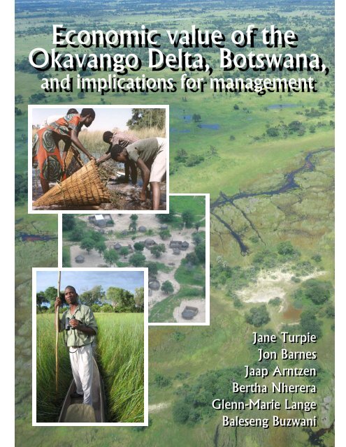
Cover photos: main, inset 2 and 3: J Turpie; inset 1: E. Terry
ACKNOWLEDGEMENTS<br />
This project was funded by the IUCN and supported by the Directorate of <strong>Environmental</strong> Affairs (DEA)<br />
and the Okavango Delta Management Project. Our study team is grateful to the following:<br />
Mokgadi Monamati and Tsalano Kedikilwe of the DEA who worked with the team on the project and<br />
provided considerable support and assistance.<br />
Director of the DEA, Steve Monna, and other staff at the DEA, in particular David Aniku.<br />
The team in the ODMP Office in Maun, in particular Comfort Molosiwa and Portia Segomelo, who<br />
provided the team with strong, essential support and assistance.<br />
All the members on the project reference group.<br />
The enumerators who assisted with the field survey: D. Matswagothata, Julie Moalafi, K Thamuku,<br />
Kgalalelo Die, M. Ntema, Malebogo Pule, Neo Moetapele, S Ketlogetswe and Tiroyaone Habarad.<br />
The members of the community, community representatives, government officers, who provided<br />
assistance and who participated in our focus group discussions and the household survey.<br />
Staff at HOORC, particularly Constance Masalila who provided and assisted with a wealth of GIS<br />
data; private sector and NGO representatives, and others who assisted with information and gave of<br />
their time. Worthy of particular mention are Wilderness Safaris, and in particular Dave van Smeerdijk,<br />
who granted us special access to their operations.<br />
Jeppe Kolding from University of Bergen kindly provided data on fish catches and biomass.<br />
Hannelore and Helmut Bendsen provided us with excellent hospitality on several occasions.<br />
IUCN for inviting us to undertake the study, for funding it, and for the assistance and support provided<br />
by staff at the Botswana Country Office in Gaborone, and the ROSA Office in Harare. We are<br />
particularly grateful to Masego Madswamudse, Tiego Mpho, and Lenka Thamae.<br />
Sandie Fichat and Noah Scovronick provided editing assistance.<br />
___________________________________<br />
i
EXECUTIVE SUMMARY<br />
Introduction<br />
The Okavango Delta, located in north western Botswana, is a renowned natural wonder of<br />
international biodiversity significance that also plays a key role in the economy of Botswana. A large<br />
inland delta, the sink of the Okavango River, the delta is listed as a wetland of international<br />
importance under the Ramsar Convention. The Okavango Delta Management Plan (ODMP) is being<br />
developed in order to ensure the delta’s long term conservation and its provision of benefits to<br />
society.<br />
The ODMP project is trying to assess the fundamental linkages and interdependencies between the<br />
hydrological functioning of the Delta, its ecology and the economy these support. The World<br />
Conservation Union (IUCN) is supporting the development of the ODMP, as part of the Water and<br />
Nature Initiative in Southern Africa. This includes carrying out an economic valuation study of the<br />
Okavango Delta in conjunction with Botswana’s Department of <strong>Environmental</strong> Affairs (DEA).<br />
The overall objective of this study is to determine the economic value of the environmental goods and<br />
services of the Okavango Delta in order to evaluate the implications of a number of management and<br />
resource allocation options for the area. The report also provides recommendations that have a<br />
sound economic basis, which will help ensure future sustainable use of the Okavango Delta. While<br />
this study is not comprehensive, it will provide much of the information required by building on the<br />
considerable existing volume of relevant work that has been carried out on the Okavango Delta.<br />
Study area<br />
The Okavango Delta, situated at the northernmost edge of the Kalahari sandveld in north western<br />
Botswana, is the largest inland wetland in the world. From its headwaters in Angola, the Okavango<br />
River feeds the delta with 5-16 000 Mm 3 (million cubic metres) of water per annum. This study was<br />
confined within the boundaries of the 55 599 km 2 Okavango Delta Ramsar Site, which encompasses<br />
the entire Okavango Delta (wetland area) and the surrounding upland areas.<br />
The study area is, for the most part, a vast, gently undulating plain, apart from the slightly elevated<br />
areas in the extreme west. The semi-arid region is characterized by cold, dry winters and hot, wet<br />
summers with rainfall occurring mainly from November to March. With an average rainfall of only<br />
500mm per annum, evaporation is 5 – 6 times higher and accounts for 95% of the delta’s water loss.<br />
From where it enters Botswana, the Okavango River flows in a south easterly direction for just over<br />
100 km (this section being known as the ‘panhandle’) before fanning out into the delta proper. The<br />
delta’s ecosystems range from perennial swamps to dryland areas, which include a large arid island<br />
(Chief’s Island) in the middle of the delta. Although the zonation of land types has been described in<br />
different ways, the ODMP, which describes the entire Ramsar Site, recognise five land categories:<br />
water, normally flooded, seasonally flooded, occasionally flooded and rarely flooded areas.<br />
The pattern of flooding is roughly inverse to the pattern of rainfall. Floodwaters reach the panhandle<br />
in about April, and take several months to spread through the delta, reaching Maun in about August to<br />
October. As the floodwaters proceed, the inundated area expands from about 5000 km 2 to between<br />
6000 and 12 000 km 2 , depending on the size of the flood. Very little contribution is made by local<br />
rainfall. There have been changes in the distribution and amount of flooding over time, possibly due<br />
to increased evaporation, declining rainfall in the catchment, and tectonic activity.<br />
The soils are predominantly arenosols in the delta and Kalahari sands in the dryland areas. There is<br />
no significant agricultural potential in the Ramsar site. Vegetation of the delta is a mosaic of perennial<br />
swamps, seasonally-flooded open grasslands, woodlands and palm-fringed islands with forests. The<br />
delta is surrounded by mopane woodlands to the north east and acacia woodlands to the south west.<br />
The delta is a low nutrient system, although there are areas of relatively high productivity. Overall<br />
faunal diversity is fairly high, with about 80 species of fish, 115 species of mammals and over 500<br />
species of birds, but few species are endemic to the area. Local level diversity and densities are<br />
ii
#<br />
#<br />
#<br />
#<br />
#<br />
#<br />
#<br />
#<br />
#<br />
#<br />
typically quite low. Nevertheless, the delta supports a high biomass of large herbivores, mainly due to<br />
the high numbers of elephant. Within the Ramsar site, wildlife populations are concentrated in the<br />
delta, primarily in Moremi Game Reserve, which is managed by the Department of Wildlife and<br />
National Parks (DWNP). Several species are largely confined to the delta’s permanently wet areas.<br />
Within the Ramsar site, all but 4.6% of land is under tribal land tenure, the remainder being state land.<br />
Usage rights are granted to Botswana citizens either communally or to individuals, usually for<br />
residential purposes, ploughing or boreholes. These rights are typically passed on through<br />
generations. In addition, citizens and non-citizens can acquire 50-year leases for commercial and<br />
industrial developments. Land cannot be sold, but the improvements or developments can.<br />
Ngamiland District is divided into 52 Controlled Hunting Areas (CHAs), of which 37 fall within the<br />
Ramsar Site. These are zoned as livestock, wildlife or multi-purpose (pastoral/arable/residential)<br />
areas. About half the study area, mainly within the delta, is under wildlife utilisation, with 9.4% in<br />
protected areas and 41.8% designated as Wildlife Management Areas (WMAs). WMAs can be either<br />
commercial (leasehold) or community-based (managed by community trusts), and can be for wildlife<br />
utilisation or photographic purposes. The remaining 48.8% is communal land area containing<br />
settlements, arable lands (mainly subsistence fields) and dominated by grazing lands. The distribution<br />
of cattle is limited by a cordon fence, with most of the delta being a cattle-free zone.<br />
Originally populated by the San, there is considerable ethnic diversity in the study area. The main<br />
groups are the Bayei, primarily fisher-farmers, the Hambukushu, primarily fishers, the Batawana,<br />
mainly livestock and dryland farmers, and the Baherero, primarily pastoralists. Refugees from Angola<br />
have also settled in the area in recent decades, introducing basket-making skills. The population is<br />
concentrated around the edge of the delta, along main roads. Half the population is in Maun and the<br />
remainder is largely concentrated around the Panhandle. There are at least 67 settlements, most of<br />
which contain fewer than 1000 people. In 2001 the population was about 111 000 people in 18 300<br />
households. Children make up 53% and the elderly only 6%. Life expectancy is dropping mainly due<br />
to HIV/AIDS and 55% of households are female-headed. Most people are rural and poor, and have<br />
diversified production systems to reduce risks in an unstable environment.<br />
For the purposes of this study, the study area was divided into five zones, based on consideration of<br />
settlement patterns, land use and natural resource characteristics (Figure I):<br />
Shakawe<br />
#<br />
#<br />
#<br />
#<br />
#<br />
#<br />
# #<br />
#<br />
#<br />
# #<br />
Kauxwhi<br />
#<br />
# #<br />
#<br />
#<br />
# #<br />
#<br />
# #<br />
# #<br />
# Ngarange<br />
#<br />
#<br />
#<br />
#<br />
# #<br />
# #<br />
#<br />
#<br />
#<br />
#<br />
#<br />
#<br />
#<br />
#<br />
#<br />
#<br />
Panhandle<br />
#<br />
# #<br />
#<br />
#<br />
# #<br />
#<br />
#<br />
#<br />
#<br />
#<br />
#<br />
#<br />
#<br />
#<br />
#<br />
#<br />
#<br />
#<br />
#<br />
# #<br />
# #<br />
Central<br />
Sepopa<br />
#<br />
# #<br />
#<br />
#<br />
# #<br />
#<br />
#<br />
#<br />
Jao<br />
#<br />
#<br />
#<br />
#<br />
# #<br />
#<br />
#######<br />
#<br />
#<br />
#<br />
#<br />
#<br />
#<br />
#<br />
Jao<br />
#<br />
#<br />
#<br />
#<br />
#<br />
#<br />
#<br />
#<br />
#<br />
# #<br />
#<br />
#<br />
Gumare<br />
#<br />
#<br />
West<br />
#<br />
# #<br />
#<br />
#<br />
#<br />
# # # #<br />
# #<br />
#<br />
#<br />
# #<br />
#<br />
#<br />
##<br />
# # #<br />
# #<br />
# #<br />
# # # #<br />
#<br />
#<br />
Nokaneng<br />
#<br />
# #<br />
# #<br />
# #<br />
#<br />
#<br />
#<br />
#<br />
#<br />
# #<br />
#<br />
# South-East<br />
#<br />
#<br />
#<br />
# #<br />
#<br />
#<br />
#<br />
# #<br />
# #<br />
#<br />
#<br />
#<br />
#<br />
#<br />
#<br />
#<br />
# #<br />
#<br />
#<br />
#<br />
#<br />
# #<br />
#<br />
# #<br />
# #<br />
#<br />
South-West #<br />
##<br />
# # #<br />
#<br />
#<br />
#<br />
#<br />
# # #<br />
#<br />
#<br />
#<br />
#<br />
#<br />
#<br />
#<br />
#<br />
# #<br />
#<br />
#<br />
#<br />
# #<br />
#<br />
#<br />
#<br />
#<br />
#<br />
#<br />
#<br />
#<br />
# #<br />
#<br />
# #<br />
#<br />
#<br />
# # # #<br />
#<br />
#<br />
#<br />
#<br />
#<br />
#<br />
#<br />
#<br />
#<br />
# #<br />
#<br />
#<br />
# # #<br />
#<br />
# Toteng<br />
#<br />
# #<br />
# #<br />
# #<br />
#<br />
#<br />
#<br />
#<br />
#<br />
#<br />
#<br />
#<br />
#<br />
# # #<br />
#<br />
#<br />
#<br />
#<br />
#<br />
#<br />
# #<br />
#<br />
#<br />
#<br />
#<br />
#<br />
#<br />
#<br />
#<br />
#<br />
#<br />
#<br />
#<br />
# # #<br />
#<br />
#<br />
#<br />
#<br />
#<br />
#<br />
# # #<br />
# Sehithwa<br />
#<br />
# # # #<br />
#<br />
#<br />
#<br />
#<br />
#<br />
#<br />
#<br />
#<br />
# #<br />
#<br />
#<br />
#<br />
#<br />
#<br />
#<br />
#<br />
#<br />
#<br />
Shorobe<br />
Figure I. Five zones defined for the study area<br />
#<br />
Sankuyo<br />
Maun<br />
#<br />
#<br />
iii
The Panhandle zone is characterised by lack of floodplain area, the high numbers of settlements<br />
along the river, and the relatively high density and accessibility of fish and aquatic plant resources.<br />
There is little opportunity for recession agriculture (molapo farming). The West zone is characterised<br />
by numerous settlements and access to wetland and floodplain resources, including molapo farming<br />
areas. The South-west zone is relatively arid and sparsely populated. Its settlements follow what<br />
was formerly the outer margin of the delta, but these are now far from the wetland and floodplain<br />
areas. The South-east area is dominated by Maun and is relatively far from the main wetland areas,<br />
but does have reasonable access to some of the distributaries and floodplain areas. The Central<br />
zone is largely delineated on the basis of the buffalo fence and has wildlife as the main land use. This<br />
zone encompasses most of the wetland area, and there is very little upland area. While dominated by<br />
the Okavango Delta, it also includes the Linyanti-Chobe wetland areas on the north-eastern border of<br />
the study area. There are very few people living in this zone, in a few scattered villages as well as in<br />
association with some of the larger tourist lodges.<br />
The population of each of the zones is summarised in Table I. Ethnic composition differs markedly<br />
between the zones. Based on the sample from this study, the Panhandle is dominated by the<br />
Bahambakushu, the South West is dominated by Batawana and characterised by a high proportion of<br />
Baherero, and the remaining zones (West, Central and South East) are dominated by Bayeyi.<br />
Table I. Population of the zones<br />
Zone Population 2001 Household size<br />
(this study)<br />
Estimated number of<br />
households<br />
Panhandle 25,483 7.2 3,531<br />
West 17,108 8.3 2,056<br />
South West 9,193 7.5 1,226<br />
South East 53,497 8.3 6,412<br />
Central 1,475 7.3 202<br />
Total 106,756 13,427<br />
Approach and valuation framework<br />
The study builds on considerable work that has been carried out in the study area, as well as primary<br />
data collection using surveys. The study was conducted using both a Total Economic Value (TEV)<br />
framework and a National Accounting framework.<br />
The TEV framework was slightly modified to define four different types of values considered in this<br />
study:<br />
• tourism value (both consumptive and non-consumptive direct use value);<br />
• natural resource use by households (a consumptive use value);<br />
• indirect use value (values generated beyond the study area due to services provided by the<br />
study area); and<br />
• non-use value (option and existence value).<br />
Tourism value was estimated on the basis of existing information only. An inventory of tourism<br />
enterprises was compiled. Three types of enterprise models were developed or used in the study: a<br />
typical ecotourism lodge, a safari hunting enterprise, and a CBNRM model in which a tourism<br />
operation enters into agreement with a local community for use of their resources. Using the models<br />
in conjunction with the inventory and expert opinion, three methods were used to estimate turnover in<br />
the accommodation sector which provided a range of plausible estimates. A portion of this was then<br />
attributed to the delta, using defined ratios for different types of enterprises. Turnover values were<br />
divided into non-consumptive tourism, safari hunting tourism and CBNRM. Turnover in related<br />
sectors (e.g. expenditure on airfares) was estimated using ratios from a previous study. Direct value<br />
added was calculated based on the ratios of turnover to direct value added in the enterprise models.<br />
Household use of resources was quantified using primary data collected in a survey of 430<br />
households in all five zones of the study area. The household questionnaire elicited information on<br />
iv
household demographics, the relative importance of different sources of income, the quantities of<br />
natural resources harvested and value added, and on agricultural production. General information on<br />
agriculture and use of natural resources, such as seasonality, input prices etc. was gleaned during<br />
focus group discussions and key informant interviews in each of the zones. Information collected in<br />
the survey was supplemented with existing information and used to construct a household production<br />
model to calculate the gross and net private value of different activities to households in each zone.<br />
Five main ecosystem functions were identified as being important in the generation of indirect use<br />
value: groundwater recharge, wildlife refuge, carbon sequestration, water purification and scientific<br />
and educational value. Recharge value was estimated as the value of groundwater abstraction<br />
immediately around the wetland. Carbon sequestration was estimated using published rates of<br />
sequestration applied to different habitat types, and using published values of carbon. Wildlife refuge<br />
value was estimated by estimating the hunting value of animals that were hunted beyond the delta but<br />
whose presence in those areas was attributed to the delta. Water purification value was estimated by<br />
calculating the input of pollutants and estimating what the treatment cost of this quantity of effluent<br />
would be. Scientific and recreational value was estimated on the basis of the expenditure on these<br />
activities in the study area.<br />
Measurement of option and existence value was beyond the scope of this study, but a short<br />
discussion on these values was included.<br />
A national accounting framework was then used to estimate the impact of the direct use values<br />
described above on the national economy. Total Economic Value was estimated in terms of direct<br />
gross output, direct contribution to national product and economic resource rents. Direct impact on<br />
rural livelihoods in particular was estimated in terms of the income generated by agriculture, natural<br />
resource harvesting and through tourism. The macro-economic impacts were estimated by taking the<br />
backward and forward linkages into account using a Social Accounting Matrix. Finally, the capital<br />
value, or natural asset value, of the Okavango Delta was estimated as the net present value of the<br />
economic rent generated from the natural asset base.<br />
Following the estimation of current value of the study area, a coarse-level scenario analysis was<br />
carried out in order to test the potential implications of different management policies on the economic<br />
value of the study area.<br />
Direct use value: tourism<br />
The wildlife-based tourism industry is now Botswana’s second largest income earner after diamond<br />
mining, contributing 5% of the country’s Gross Domestic Product (GDP) and 40% of employment in<br />
northern Botswana. Botswana’s first Tourism Policy (1990) pursued a high value/low volume tourism<br />
strategy which has been very successful in the north.<br />
Tourism in the Okavango Delta has grown dramatically since the 1970s when it was almost nonexistent.<br />
Tourism is centred on the Moremi Game Reserve and surrounding WMAs, and access is via<br />
Maun. Moremi receives about 40 - 50 000 visitors annually, numbers being influenced by regional<br />
and global politics. Visitors stay in DWNP or private camps. In the WMAs outside Moremi, visitors<br />
stay in photographic safari camps, hunting camps or fishing camps, the first of which are generally the<br />
most luxurious. All the camps are temporary structures. Camp owners either pay a lease (a<br />
percentage of turnover) to the local government land board (for commercial WMAs) or to the<br />
communities, as well as royalties for hunting. Several WMAs were assigned as community<br />
management areas under Botswana’s CBNRM programme. These communities apply to the DWNP<br />
for a hunting quota. The communities then enter into joint venture agreements with commercial<br />
operators, or they may opt to simply auction their hunting quota to safari hunters or companies.<br />
Tourism in the delta is strongly seasonal, with high season being from July to October. This is<br />
reflected in prices and occupancy rates. Overall, the study area is estimated to generate a gross<br />
income of some P1 115 million, making a direct contribution of P401 million in terms of direct value<br />
added to GDP. About 99% of this is attributed to the delta. An estimated 81.0% of tourism value<br />
accrues to photographic tourism companies, 15.5% to hunting safari companies, and 3.5% accrues to<br />
communities through CBNRM arrangements.<br />
v
Direct use value: household use of natural resources<br />
Households in the study area are typically fairly large, with an average of 7.2 to 8.3 people per<br />
household, depending on the zone. About 21-34% of adults are formally employed, with tourism and<br />
DWNP accounting for a large proportion of jobs, particularly in the central zone (60%) and South East<br />
zone (19%). Households have 3 to 4 dwellings on average, a large proportion of which are built with<br />
modern materials (20 – 49%). Most households rely on paraffin for lighting and firewood for cooking.<br />
Most households are engaged in agriculture, either pastoralism, dryland farming, or molapo farming<br />
or a combination. Livestock is considered to be the most important agricultural activity, providing cash<br />
income as well as meat, milk, draught power, wealth store and social status. Livestock tend to be<br />
kept at cattle posts, where they are less susceptible to disease and cause less damage to crops, but<br />
some households keep small herds in the villages. Households with livestock at cattle posts have<br />
larger herds, with an average of 32 cattle, 28 small stock, and 6 donkeys/horses. In comparison,<br />
those that keep their livestock in the village have an average of less than 5 cattle, 16 small stock, and<br />
3 donkeys/horses. Overall, the value of cattle is estimated to be some P29 million in terms of net<br />
income, with an estimated direct economic value of about P34 million. 88% of the net income and<br />
83% of the economic value is derived from cattle posts.<br />
Some 75% of households in the study area are crop farmers. About 47% of households have dryland<br />
fields, and a further 28% have molapo fields, and dryland fields make up about 80% of the area<br />
planted. Production per unit area is considerably higher on molapo fields than on dryland fields. It<br />
was estimated that about 14 500 ha were planted in the study area in the 2004/5 crop season. Note<br />
that this was a dry year, and the area may increase in wetter years. The main crops grown are maize<br />
and sorghum (staples), and millet (mainly for beer brewing), which are sown together with a variety of<br />
other crops such as groundnuts and beans. Dryland and molapo farming are worth about P6.5 million<br />
and P2.6 million in net income to households in the study area, respectively, with relatively little of this<br />
being translated into cash income.<br />
A large number of natural resources are utilised, many of these being used by a high proportion of<br />
households in each area (Table II).<br />
Table II. Percentage of households engaged in different natural resource-related activities (household survey data).<br />
Activity Panhandle West South West South East Central<br />
Firewood 77 86 98 85 96<br />
Wild foods 57 53 64 57 65<br />
Hunting* 36 49 43 42 61<br />
Poles & withies 49 28 34 28 47<br />
Reeds 69 33 7 18 22<br />
Palm leaves 12 42 7 29 41<br />
Wetland grasses 61 21 2 5 18<br />
Upland grasses 8 12 18 16 35<br />
Fish 34 6 4 6 20<br />
Medicinal plants 12 12 19 16 10<br />
Papyrus 10 1 0 1 12<br />
Honey 2 1 1 2 2<br />
Pottery 3 0 2 1 0<br />
Timber 1 1 0 1 0<br />
*assuming a 10% reporting rate<br />
Firewood is the most commonly-used resource, harvested by most households. An estimated 1.76<br />
million bundles are harvested annually. Wild plant and animal foods are next most commonly used<br />
resources, with an estimated total annual harvest of some 280 tonnes of plant foods and 160 tonnes<br />
of wild meat. Raw materials are generally next most important in terms of the proportion of<br />
households involved, particularly poles, reeds, and grasses, which are used in the construction of<br />
household dwellings. Some 276 000 poles, 150 000 bundles of reeds and 174 000 bundles of grass<br />
vi
are harvested annually in the study area, with reeds and a portion of grasses coming from the<br />
wetland. Although locally very abundant in the delta, papyrus is only really accessible to households<br />
in the panhandle and central areas, and is used by relatively few households, with a total harvest of<br />
about 2300 bundles. Palm leaves are harvested by many households, particularly for the production<br />
of crafts. Over 9000 bundles are harvested, and some 36 500 products (mainly baskets) are<br />
produced from a combination of grass and palm leaves as well as natural dyes. Fishing is practiced<br />
by up to 34% of households in the panhandle and central areas. This is the largest fishery in<br />
Botswana, with an estimated total of 3570 fishers and an estimated total catch of about 450 tonnes.<br />
Medicinal plant use is significant but relatively uncommon, and production of timber, pottery and<br />
honey are uncommon.<br />
The total annual private use values derived from agriculture and natural resources in the study area,<br />
including the value added in processing, are summarised in Table III. Seventeen percent of the net<br />
private value of agriculture plus natural resource use can be attributed to the delta. The total direct<br />
use value of the Ramsar site, and the portion of that value that can be attributed to the delta or<br />
wetland area, is summarised in Table IV.<br />
Table III. Summary of the annual private values associated with household natural resources use and agricultural<br />
activities in the five zones of the Ramsar site and the contribution of the wetland itself (Pula, 2005)<br />
Panhandle<br />
West<br />
South<br />
West<br />
South<br />
East<br />
Central<br />
TOTAL<br />
Livestock 9 507 254 17 071 621 9 407 181 25 142 602 37 173 61 165 831<br />
Upland crops 1 797 892 332 514 319 151 1 733 447 14 845 4 197 849<br />
Molapo crops 43 375 1 350 992 129 373 644 534 23 377 2 191 651<br />
Upland resources 3 244 027 2 224 210 1 275 547 6 750 392 170 470 13 664 647<br />
Wetland plants 4 109 695 2 036 774 476 381 4 708 326 90 478 11 421 654<br />
Fish 2 253 711 20 766 10 639 263 441 116 963 2 665 520<br />
Wetland Birds 47 037 48 532 6 090 12 013 -1 236 112 436<br />
Ramsar Site 21 002 991 23 085 410 11 624 362 39 254 755 452 070 95 419 588<br />
Wetland 6 429 094 3 695 934 548 740 5 457 476 216 258 16 347 502<br />
Table IV. Total household direct use value of the Okavango Delta Ramsar Site and of the wetland area<br />
Gross private<br />
value<br />
Net private<br />
value<br />
Cash<br />
Income<br />
Gross<br />
economic<br />
output<br />
Gross value<br />
added<br />
RAMSAR SITE<br />
Livestock production 79 246 782 61 165 831 43 606 492 83 209 121 39 757 628<br />
Crop production 8 629 992 6 389 500 1 061 293 9 030 989 2 768 533<br />
Natural resources 29 099 607 27 864 257 7 290 048 30 554 587 29 183 420<br />
Total 116 976 381 95 419 588 51 957 833 122 794 697 71 709 581<br />
WETLAND<br />
Livestock production 1 604 947 1 205 482 391 050 1 685 195 869 980<br />
Crop production 1 132 546 942 410 96 983 1 189 173 588 568<br />
Natural resources 14 959 880 14 199 610 5 063 923 15 707 874 15 052 296<br />
Total 17 697 373 16 347 502 5 551 956 18 582 242 16 510 844<br />
% contribution by<br />
wetland 15% 17% 11% 15% 23%<br />
Indirect use value<br />
Five main ecosystem services were valued as follows:<br />
vii
Groundwater recharge: The Okavango Delta provides a conduit for the recharge of groundwater<br />
aquifers which are utilised around the perimeter of the wetland. Some 5.8 Mm 3 of groundwater is<br />
extracted from the study area, worth an estimated P16 million.<br />
Carbon sequestration: Vegetation sequesters carbon, which contributes to the amelioration of<br />
damage caused by climate change by reducing atmospheric carbon. Based on published values and<br />
sequestration rates obtained from the literature for different habitat types in the study area, it is<br />
estimated that the carbon sequestration function is worth about P86 million in the delta and<br />
P158 million for the entire Ramsar site.<br />
Wildlife refuge: The Okavango Delta (and Chobe) wetlands provide refuge for certain wildlife species<br />
that migrate to other parts of the Ramsar site and beyond, generating benefits and use value in those<br />
areas. The value of use of these species used beyond the wetland area is estimated to be<br />
P77 million. Of this, use beyond the entire Ramsar site is worth about P30 million.<br />
Water purification: the wetland area has the capacity to absorb or dilute wastewater, thus saving on<br />
treatment costs. Relatively little wastewater finds its way into the wetland, however, and the service is<br />
valued at about P2.2 million.<br />
Scientific and educational value: The wetland and the ODRC are frequently used for research and<br />
educational purposes. Based on the expenditure involved, the annual scientific and educational value<br />
is estimated to be at least P24 million for the Ramsar site, of which P18 million is attributed to the<br />
wetland area.<br />
Option and non-use value<br />
No studies have been conducted to estimate the option and existence value of the study area or the<br />
Okavango Delta. One study has estimated that tourists to the delta have a willingness to pay to<br />
preserve the area of at least P13 million (net present value). However, this provides a very low-end<br />
estimate, since it only includes users. The national and global willingness to pay to preserve this<br />
internationally renowned feature is likely to be orders of magnitude higher. Further research is<br />
needed in order to highlight the full trade-offs made in policy decisions.<br />
The value of the Okavango Delta in the economy of Botswana<br />
The Okavango Delta generates an estimated P1.03 billion in terms of gross output, P380 million in<br />
terms of direct value added to gross national product (GNP) and P180 million in resource rent. The<br />
direct use values of the Okavango Delta are overwhelmingly dominated by the use of natural wetland<br />
assets for tourism activities in the central zone. Households in and around the delta earn a total of<br />
P225 million per year from natural resource use, sales, salaries and wages in the tourism industry,<br />
and rents and royalties in CBNRM arrangements. The total impact of the direct use of the resources<br />
of the Ramsar site is estimated to be P1.18 million in terms of contribution to GNP, of which P0.96<br />
million is derived from use of the wetland itself. Thus the Ramsar site contributes 2.6% of the<br />
country’s GNP, with the wetland contributing most of this (2.1%). The multiplier effect is greater for<br />
the formal sector than for the poorer components in society, because the former activities have<br />
greater backward linkages and households are primarily engaged in subsistence activities. The<br />
natural capital asset value of the Ramsar site is estimated to be about P3.9 billion, of which the<br />
Okavango Delta is worth P3.4 billion.<br />
Implications for future management: a scenario analysis<br />
While an understanding of the total economic value of the delta is potentially useful for lobbying for<br />
conservation support, consideration of how this value might change under different management or<br />
policy scenarios is potentially a far more useful undertaking for decision-makers. A very rough<br />
scenario analysis was undertaken to investigate the implications of some possible future management<br />
options:<br />
1. Agricultural expansion, in which the veterinary fence is moved back and grazing is expanded<br />
into the wetland area, precluding some communal and commercial hunting activities in those<br />
areas;<br />
2. Expanded protection, in which consumptive use of resources is not allowed within the delta<br />
wetland area;<br />
viii
3. Wise use, based on Ramsar planning guidelines, in which resource use is carefully managed<br />
and there is limited tourism expansion;<br />
4. Wise use under a scenario of upstream water abstraction, i.e. as (3) above but with the<br />
impacts of reduced flow in the delta; and<br />
5. Wise use under climate change, i.e. as (3) above but with the much greater impacts of<br />
reduced rainfall in the catchment.<br />
The results of the analysis are summarised in Table V.<br />
Table V. Estimated outcomes in terms of direct value added, or general value, attributable to the Ramsar Site and<br />
the wetland, following five different scenarios. Note that estimates are rough.<br />
Scenario<br />
1.<br />
Agriculture<br />
2.<br />
Protection<br />
3.<br />
Wise use<br />
4.<br />
Abstraction<br />
5.<br />
Climate change<br />
Present<br />
Ramsar site<br />
Tourism 514 100 000 471 100 000 487 920 000 568 545 000 481 850 000 379 030 000<br />
Household use 70 232 000 70 532 000 57 520 000 70 629 000 68 298 000 63 182 000<br />
Indirect use High High V high V high Medium Low<br />
Existence High Medium V high High Medium Low<br />
Wetland<br />
Tourism 461 520 000 431 420 000 463 524 000 519 961 500 438 945 000 346 641 000<br />
Household use 18 990 000 17 937 000 8 190 000 19 389 000 17 753 000 14 485 000<br />
Indirect use High High V high V high Medium Low<br />
Existence High Medium V high High Medium Low<br />
Conclusions and recommendations<br />
Management of the Okavango Delta and the Ramsar Site in general will need to strike a balance<br />
between meeting the needs of the people living in and around the delta and generating its important<br />
contribution to the national economy. People living in the study area derive roughly equal benefits<br />
from natural resources and from tourism, the latter being slightly higher. However, there is an<br />
important difference in the form that these benefits take. Natural resources provide subsistence value<br />
which contributes to peoples’ livelihoods, as well as some cash income. Perhaps more importantly,<br />
they have the capacity to provide a safety-net for households that suffer shocks and provide a riskspreading<br />
mechanism for poor households that are vulnerable to the vagaries of environmental<br />
variability. Tourism, on the other hand, generates hard, reliable cash income to households, providing<br />
the type of income that most households aspire to. Thus both aspects are important. Tourism also<br />
makes a substantial contribution to Botswana’s GNP, which in turn provides more revenue and social<br />
security to households all over the country. In the light of the above findings, it is recommended that<br />
future management of the Okavango Delta is centred on ensuring the sustainability of current<br />
resource use by households so that they can continue to provide the livelihood and other social<br />
benefits into the future, and enhancing the value of the delta for low impact – high value tourism<br />
through maintaining the extent and integrity of the conserved area. The enormous value of tourism in<br />
the Okavango Delta could be turned to greater advantage if policy aimed to reduce the import<br />
component of tourism and to expand the links between tourism and development through CBNRM.<br />
Given the massive potential influence of changes in freshwater inflow into the delta on the capacity to<br />
generate both household and tourism benefits, and the potential effects of climate change in<br />
exacerbating any impacts of upstream water abstraction, it is essential that Botswana works to ensure<br />
adequate flows in future through international agreements.<br />
Finally, we recommend that there is ongoing research on ecosystem functioning of the delta that will<br />
be able to inform our understanding of the value of ecosystem services and the impacts of finer scale<br />
management decisions. Research is needed on tourism in order to understand the mechanisms of<br />
demand and supply and the impacts of various policy decisions. In addition, more research is<br />
required on the non-use value generated by the delta in order to appreciate the impact of changes in<br />
ecosystem health of the delta on the international community.<br />
ix
TABLE OF CONTENTS<br />
1 Introduction......................................................................................................1<br />
1.1 BACKGROUND ...........................................................................................................................1<br />
1.2 AIMS OF THE STUDY ...................................................................................................................2<br />
1.3 LIMITATIONS OF THE STUDY ........................................................................................................4<br />
1.4 STRUCTURE OF THE REPORT ......................................................................................................4<br />
2 Study area ........................................................................................................5<br />
2.1 LOCATION AND EXTENT...............................................................................................................5<br />
2.2 THE PHYSICAL ENVIRONMENT......................................................................................................6<br />
2.2.1 Topography.................................................................................................................6<br />
2.2.2 Climate .......................................................................................................................6<br />
2.2.3 Drainage .....................................................................................................................6<br />
2.2.4 Hydrology ...................................................................................................................7<br />
2.2.5 Soils............................................................................................................................9<br />
2.2.6 Vegetation ..................................................................................................................9<br />
2.2.7 Fish and wildlife ..........................................................................................................9<br />
2.3 LAND USE AND TENURE ............................................................................................................ 10<br />
2.4 POPULATION AND SETTLEMENTS ............................................................................................... 11<br />
2.5 ZONATION USED IN THIS STUDY ................................................................................................. 12<br />
2.6 DEMOGRAPHIC AND SOCIO-ECONOMIC CHARACTERISTICS OF THE ZONES ..................................... 13<br />
3 Valuation framework and methodology......................................................15<br />
3.1 OVERALL APPROACH................................................................................................................ 15<br />
3.2 VALUATION FRAMEWORK .......................................................................................................... 15<br />
3.2.1 Total Economic Value framework ............................................................................. 15<br />
3.2.2 National accounting framework................................................................................. 16<br />
3.3 VALUATION METHODS............................................................................................................... 17<br />
3.3.1 Direct use value: Tourism ......................................................................................... 17<br />
3.3.2 Direct use value: Household use of resources.......................................................... 18<br />
3.3.3 Indirect use values.................................................................................................... 21<br />
3.3.4 Option and existence value....................................................................................... 22<br />
3.4 VALUE OF THE OKAVANGO DELTA IN THE ECONOMY OF BOTSWANA.............................................. 22<br />
3.4.1 Total economic value................................................................................................ 22<br />
3.4.2 Direct impact on rural livelihoods .............................................................................. 22<br />
3.4.3 Macroeconomic impact ............................................................................................. 22<br />
3.4.4 Natural asset value of the Okavango Delta............................................................... 23<br />
3.5 ANALYSIS OF MANAGEMENT SCENARIOS..................................................................................... 23<br />
4 Direct use value: Tourism ............................................................................24<br />
4.1 GENERAL OVERVIEW OF TOURISM ............................................................................................. 24<br />
4.2 SEASONALITY AND PRICES........................................................................................................ 25<br />
4.3 TOURISM ECONOMIC VALUE ...................................................................................................... 26<br />
5 Direct use value: Household use of natural resources.............................28<br />
5.1 HOUSEHOLD CHARACTERISTICS ................................................................................................ 28<br />
5.2 OVERVIEW OF HOUSEHOLD LIVELIHOODS ................................................................................... 29<br />
5.3 AGRICULTURAL ACTIVITIES........................................................................................................ 30<br />
5.3.1 Livestock................................................................................................................... 30<br />
5.3.2 Cropping ................................................................................................................... 33<br />
5.3.3 Summary of agricultural values................................................................................. 35<br />
5.4 USE OF NATURAL RESOURCES .................................................................................................. 36<br />
5.4.1 Participation in natural resource use......................................................................... 36<br />
5.4.2 Clay and pottery........................................................................................................ 36<br />
5.4.3 Grasses .................................................................................................................... 37<br />
5.4.4 Reeds and papyrus................................................................................................... 38<br />
x
5.4.5 Palms........................................................................................................................ 39<br />
5.4.6 Wild foods and medicines ......................................................................................... 42<br />
5.4.7 Woody resources...................................................................................................... 45<br />
5.4.8 Fish...........................................................................................................................47<br />
5.4.9 Honey ....................................................................................................................... 50<br />
5.4.10 Wild animals and birds.............................................................................................. 50<br />
5.4.11 Summary of natural resource use and value............................................................. 52<br />
5.5 THE CONTRIBUTION OF DELTA RESOURCES TO HOUSEHOLD LIVELIHOODS ..................................... 53<br />
6 Indirect use value ..........................................................................................55<br />
6.1 INDIRECT USE VALUES OF WETLANDS......................................................................................... 55<br />
6.2 REPORTED VALUES OF INDIRECT USES OF WETLANDS ................................................................. 55<br />
6.3 INDIRECT USE VALUES IN THE OKAVANGO DELTA RAMSAR SITE ................................................... 57<br />
6.3.1 Introduction............................................................................................................... 57<br />
6.3.2 Groundwater recharge.............................................................................................. 57<br />
6.3.3 Carbon sequestration................................................................................................ 58<br />
6.3.4 Wildlife refuge ........................................................................................................... 60<br />
6.3.5 Purification of water .................................................................................................. 64<br />
6.3.6 Scientific and educational value................................................................................ 66<br />
6.4 OVERALL ESTIMATE OF INDIRECT USE VALUES ............................................................................ 66<br />
7 Option and non-use value ............................................................................68<br />
8 The value of the Okavango Delta in the economy of Botswana ..............69<br />
8.1 TOTAL ECONOMIC VALUE OF THE DELTA IN THE BOTSWANA ECONOMY .......................................... 69<br />
8.2 IMPACT ON RURAL LIVELIHOODS ................................................................................................ 72<br />
8.3 MACROECONOMIC IMPACT ........................................................................................................ 73<br />
8.4 NATURAL ASSET VALUE OF THE OKAVANGO DELTA .................................................................... 75<br />
9 Implications for future management: a scenario analysis .......................76<br />
9.1 INTRODUCTION ........................................................................................................................ 76<br />
9.2 DESCRIPTION OF SELECTED SCENARIOS .................................................................................... 76<br />
9.3 DESCRIPTION OF SELECTED SCENARIOS .................................................................................... 77<br />
9.3.1 Scenario 1. Agricultural expansion............................................................................ 77<br />
9.3.2 Scenario 2. Expanded protection .............................................................................. 77<br />
9.3.3 Scenario 3. Wise use................................................................................................ 78<br />
9.3.4 Scenario 4. Wise use plus upstream abstraction ...................................................... 79<br />
9.3.5 Scenario 5. Wise use plus climate change................................................................ 80<br />
9.4 PARAMETERS UNDER DIFFERENT SCENARIOS ............................................................................. 81<br />
9.5 ECONOMIC IMPLICATIONS OF DIFFERENT SCENARIOS .................................................................. 81<br />
10 Conclusions and recommendations ...........................................................83<br />
11 References .....................................................................................................85<br />
12 Glossary .........................................................................................................89<br />
13 Appendix 1. Itinerary for focus group and household surveys ...............92<br />
14 Appendix 2. Tourism operations in the Okavango Delta ..........................93<br />
15 Appendix 3. The Ecotourism Lodge Model ................................................96<br />
16 Appendix 4. The Safari Hunting Enterprise Model ..................................107<br />
17 Appendix 5. The SAM Model ......................................................................118<br />
xi
LIST OF ABBREVIATIONS AND ACRONYMS<br />
ARB<br />
B&B<br />
Bm³<br />
BNWMP<br />
BoP<br />
CBNRM<br />
CGE<br />
CHA<br />
CMA<br />
CVM<br />
DAHP<br />
DEA<br />
DLUPU<br />
DoT<br />
DTRP<br />
DEA<br />
DWA<br />
DWNP<br />
ERHIP<br />
FAO<br />
FAP<br />
GDP<br />
GEF<br />
GIS<br />
GNP<br />
GoB<br />
GOS<br />
HadCM3<br />
hh<br />
HIV/AIDS<br />
HOORC<br />
IGBP<br />
IPCC<br />
IUCN<br />
IUV<br />
LAI<br />
LSU<br />
NGO<br />
NMPSWW<br />
NPV<br />
NRA<br />
NWDC<br />
OD<br />
ODMP<br />
ORBMP<br />
P<br />
RALE<br />
ROW<br />
SAM<br />
TLB<br />
UAW<br />
UNFCCC<br />
USAID<br />
WMA<br />
WWTW<br />
Agricultural Resources Board<br />
bed-and-breakfast (accommodation)<br />
billion cubic metres<br />
Botswana National Water Master Plan<br />
Balance of payments<br />
community based natural resources management<br />
computable general equilibrium<br />
Controlled Hunting Area<br />
community management area<br />
contingent valuation method<br />
Department of Animal Health and Production<br />
Department of <strong>Environmental</strong> Affairs<br />
District Land Use Planning Unit<br />
Department of Tourism<br />
Department of Town and Regional Planning<br />
Department of <strong>Environmental</strong> Affairs<br />
Department of Water Affairs<br />
Department of Wildlife and National Parks<br />
Every River has its People<br />
Food and Agriculture Organisation of the United Nations<br />
Financial Assistance Program<br />
gross domestic product<br />
Global Environment Facility<br />
Geographic Information System<br />
gross national product<br />
Government of Botswana<br />
gross operating surplus<br />
Hadley Centre Climate Change Model<br />
household<br />
human immunodeficiency virus/acquired immune deficiency syndrome<br />
Harry Oppenheimer Okavango Research Centre<br />
International Geosphere-Biosphere Programme<br />
International Panel on Climate Change<br />
World Conservation Union<br />
Indirect Use Value<br />
leaf area index<br />
large stock unit<br />
non-governmental organisation<br />
National Master Plan for Sanitation and Wastewater<br />
net present value<br />
natural resource account<br />
North West District Council<br />
Okavango Delta<br />
Okavango Delta Management Plan<br />
Okavango River Basin Management Plan<br />
Pula<br />
representative and accountable legal entity<br />
rest of the world<br />
Social Accounting Matrix<br />
Tawana Land Board<br />
unaccounted water<br />
United Nations Framework Convention on Climate Change<br />
United States Agency for International Development<br />
Wildlife Management Area<br />
waste water treatment works<br />
xii
1 INTRODUCTION<br />
1.1 Background<br />
The Okavango river system flows from the Angolan high plateau through Namibia to form the Delta in<br />
Botswana. The river basin is the focus of a number of donor-funded initiatives aimed at ensuring<br />
development in the system is economically and ecologically efficient. The ERHIP Project, based in<br />
Namibia, the GEF/FAO project based in Angola and the USAID-funded ORBMP Project, based in<br />
Botswana, are all contributing to this in a basin-wide context.<br />
Compared with many river basins, that of the Okavango is relatively pristine. However, along its<br />
length, demands on its water and other resources are expected to grow significantly in future. The<br />
impact of these demands will be felt mainly at the downstream end of the river system, in the<br />
Okavango Delta. The Delta’s integrity and the important economic contribution it does and can make<br />
to Botswana’s welfare will be threatened. On the 4 th April 1997, Botswana became a contracting party<br />
of the international ‘Ramsar Convention’ and the Okavango Delta was listed as a wetland of<br />
international importance.<br />
The Okavango Delta plays a key role in the economy of Botswana. A large inland Delta, the sink for<br />
the Okavango river, it supports an ecosystem which is relatively complex and rich in diversity<br />
compared to those on the surrounding land. It provides the focus for agro-pastoral land use, highly<br />
valuable tourism activities, fisheries, wildlife use, and natural plant use, which would not take place<br />
without it. As a natural asset it contributes to a very significant component to Botswana’s economy.<br />
As an internationally renowned object of natural wonder it also generates significant non-use values in<br />
the global context.<br />
In order to ensure the delta’s conservation and wise use, the development of a management plan for<br />
the Okavango Delta is underway. This process is aimed at integration of resource management for<br />
the Okavango Delta that will ensure its long term conservation and that will provide benefits for the<br />
present and future well being of the people, through sustainable use of its natural resources (ODMP<br />
2002).<br />
The strategy for implementation of the Okavango Delta Management Plan (ODMP) involves creating<br />
an improved sense of collective responsibility and accountability among communities and existing<br />
institutions with a mandate to manage the Delta and its resources.<br />
The ODMP has identified twelve different components with their respective responsible institutions as<br />
crucial to this process and they are as follows:<br />
• Policy, planning and strategy including communication is the responsibility of the Department<br />
of <strong>Environmental</strong> affairs (DEA);<br />
• Communication, dialogue and networking by the DEA;<br />
• Hydrology and water resource management by Department of Water Affairs (DWA);<br />
• Sustainable fisheries management by the Division of Fisheries in the Department of Wildlife<br />
and National Parks (DWNP);<br />
• Wildlife management by Department of Wildlife and National Parks (DWNP);<br />
• Sustainable tourism by the Department of Tourism (DoT) in Maun and the North West District<br />
Council (NWDC) Economic Planning Unit (Tourism Section);<br />
• Waste management by the NWDC <strong>Environmental</strong> Health Department (Waste Management<br />
Section);<br />
• Physical planning by the Department of Town and Regional Planning (DTRP);<br />
• Sustainable livestock management by the Department of Animal Health and Production<br />
(DAHP);<br />
• Vegetation resources by the Department of Crop Production (DCP), Ministry of Agriculture<br />
and the Agricultural Resources Board (ARB) and Forestry Division, Ministry of Environment,<br />
Wildlife and Tourism;<br />
1
• Land use planning and land management by Tawana Land Board (TLB) in association with<br />
the District Land Use Planning Unit (DLUPU); and<br />
• Research, data storage and data management by the Harry Oppenheimer Okavango<br />
Research Centre (HOORC).<br />
There is also active stakeholder participation in the main stages, an association of international<br />
stakeholders and an integrated planning process.<br />
The policy, planning and strategy component of the ODMP is designed to provide the framework for<br />
implementation of the management plan; i.e. to integrate and guide sustainable management of the<br />
delta’s resources. This component is vital in providing the inter-sectoral and cross-cutting linkages<br />
that can ensure consistency amongst the different components of the project, in the pursuit of<br />
sustainability principles.<br />
The ODMP is trying to assess the fundamental linkages and interdependencies between the<br />
hydrological functioning of the Delta, its ecology and the economy these support. DWA is currently<br />
modelling the hydrological functioning of the Delta and from this work, planners should be able to<br />
determine how the water flows now, what the extent and shape of flooding is annually and how this<br />
might change under various scenarios, such as climate change, increased abstraction, channel<br />
blockage and clearance etc. Many of the other component parts of the ODMP are also collecting<br />
information on the ecology of the Delta and its economy, e.g. use of veld products, community based<br />
natural resources management (CBNRM), fisheries, tourism, etc.<br />
The World Conservation Union (IUCN) is supporting the development of the ODMP, as part of the<br />
Water and Nature Initiative in Southern Africa. Part of the contribution of IUCN is to provide technical<br />
support to elements of the management plan development exercise, and in particular IUCN is<br />
targeted to provide support towards formulation of a vision, review of policy, and carrying out an<br />
economic valuation study of the Okavango Delta in conjunction with DEA.<br />
1.2 Aims of the study<br />
The economic valuation study is to inform management planning and practice, in the context of<br />
current and future activities being carried out under ODMP and other agencies, working towards<br />
conservation and sustainable management of the Delta’s natural resources, and responding to the<br />
current and future threats to the Delta. These include unsustainable land use and resource<br />
exploitation, inadequate freshwater flows, habitat conversion and modification, invasive species,<br />
inequitable benefit sharing and lack of local economic incentives for conservation, unsupportive<br />
macroeconomic and sectoral policies, insufficient budget and financial support, and so on.<br />
It is anticipated that the results of the economic study will assist the ODMP to:<br />
• strengthen Botswana’s negotiating position with Angola and Namibia regarding water<br />
allocation and river basin options,<br />
• better compare development options (with consideration of environmental costs and values),<br />
• document the different functions of the Delta (production, regulation, generation of<br />
information, cultural, etc),<br />
• undertake lobbying purposes,<br />
• re-evaluate hydrological data and fill in gaps in these data,<br />
• determine the costs and benefits of aquatic weed control,<br />
• determine the extent to which current and future generations depend on resources<br />
• point to incentives to support sustainable management, especially community-level benefits<br />
• determine the value of the use and or sale of the Delta’s plant resources,<br />
• diversify CBNRM beyond wildlife-based tourism, and to identify resources and activities that<br />
have economic potential for CBNRM,<br />
• assess the long-term sustainability of the Delta’s tourism, in the context of global trends in<br />
tourism demand,<br />
• assist in the resolution of conflicts (e.g., between tourism companies and communities),<br />
• determine the degree to which the game reserve underpins tourism,<br />
2
• inform economically efficient pricing of tourism royalties, concession/lease fees and other<br />
charges,<br />
• determine the economic opportunity costs of choosing to use particular areas and resources<br />
in particular ways,<br />
• determine and ameliorate sedimentation effects on Delta values,<br />
• evaluate relationships between wildlife, photography and hunting in Delta<br />
While this study will not carry out all the research required to answer the above questions, it will be<br />
able to provide much of the information required. A considerable volume of work has been done the<br />
past in various contexts to determine the economic value of goods and services associated with the<br />
Okavango Delta. Much of this work is recorded in the grey literature and a specific effort to locate and<br />
secure it will be part of this project. The ODMP economic valuation exercise will build on the data and<br />
literature already available.<br />
The overall objective of this study is to determine the economic value of the environmental goods<br />
and services of the Okavango Delta in order to evaluate the implications of a number of management<br />
and resource allocation options for the area. The project will provide management recommendations<br />
that have a sound economic basis, which will help to ensure future sustainable use of the Okavango<br />
Delta.<br />
The terms of reference for the study were as follows:<br />
a. Conduct a thorough review of all the ecological and economic work that has been carried out<br />
in the Okavango Delta.<br />
b. Determine what the GoB currently spends on management of natural resources in the Delta,<br />
e.g. control of invasive plants, wildlife management, compensation for loss of livestock due to<br />
predation etc.<br />
c. In association with stakeholders, all other ODMP components and other relevant institutions,<br />
construct a conceptual model of the ecological-economic linkages in the Okavango Delta.<br />
d. In association with stakeholders, all other ODMP components and other relevant institutions,<br />
describe the “goods and services” (e.g. fish, water purification) provided by the OD ecosystem<br />
and the “attributes” (e.g. biodiversity, scenic beauty) that contribute to its value.<br />
e. In association with stakeholders, all other ODMP components and other relevant institutions,<br />
compile a comprehensive list of the types of values generated by all of these, following the<br />
Total Economic Value framework (i.e. Direct Use Values, Indirect Use Values, Option Values<br />
and Non-Use (Existence & Bequest) Values).<br />
f. Working with the ODMP project secretariat and other component focal points, particularly the<br />
Department of Water Affairs and their consultants, develop scenarios for possible direct and<br />
indirect future natural and anthropogenic induced effects and management regimes, both<br />
within and upstream of the Delta.<br />
g. Design detailed methodologies for valuation of the types of value described above in such a<br />
way as to make use of existing information, where possible, and inform management issues<br />
through valuation of the above scenarios. In determining valuation methods, account will be<br />
taken of the need to employ different types of methodologies appropriate to different levels of<br />
scale and stakeholders / socio-economic groups, e.g. the use of participatory methods at the<br />
local community level<br />
h. Estimate the direct use values associated with use of ecosystem goods (e.g. resource<br />
harvesting) and enjoyment of ecosystem attributes (e.g. tourism) in terms of private (direct<br />
monetary) and wider economic (including subsistence and non-marketed) measures at<br />
current prices.<br />
i. Estimate the indirect use values of the Okavango Delta in terms of private (direct monetary)<br />
and wider economic (including subsistence and non-marketed) value at current prices.<br />
3
j. Describe the non-use value of the Okavango Delta as far as possible using available<br />
information.<br />
k. Assess the potential changes to the values described above under different management<br />
scenarios.<br />
l. Analyse the distribution of economic values and costs between different groups and sectors,<br />
at different levels, i.e. locally within villages, locally within the Delta, within the district, country,<br />
region etc and with season at present and under the different scenarios. Particular attention<br />
should be paid to poor households, female headed households and HIV/AIDS affected<br />
people.<br />
m. Identify future needs for environmental economic information and studies (e.g. valuation of<br />
the environmental costs of existing and planned activities, such as tourism.<br />
n. Provide "on-the-job training" to DEA staff in delivery of all activities by identifying appropriate<br />
staff in the DEA, involving them and working with them as part of the economic valuation<br />
team.<br />
1.3 Limitations of the study<br />
The study had to be carried out over a very short period, from December 2005 to July 2006, and with<br />
a very limited budget. Primary data collection was therefore highly restricted, and concentrated on<br />
the value gained from the direct consumptive use of delta resources. Estimates of other types of<br />
value, including tourism value, had to be made on the basis of secondary information. Specific<br />
limitations of the different estimates are discussed in more detail under the relevant sections.<br />
1.4 Structure of the report<br />
Chapter 1 outlines the background, objectives and terms of reference of the study.<br />
Chapter 2 provides a description of the study area and its socio-economic context.<br />
Chapter 3 describes the valuation framework and the approach and methods used in the study.<br />
Chapters 4, 5, 6 and 7 describe the different types of values of the Okavango Delta, as well as the<br />
detailed methods used to estimate these. Chapters 4 and 5 describe the direct use value of the delta,<br />
divided into tourism and household use of delta resources. Chapter 6 provides estimates of the<br />
indirect use value of the delta, and chapter 7 very briefly considers the non-use value of the delta, but<br />
does not provide a value estimate.<br />
Chapter 8 provides a synthesis of the above values, estimates their impact on the national economy,<br />
and describes the value of the delta as a national asset.<br />
Chapter 9 evaluates a suite of potential scenarios describing the future management of the delta, and<br />
provides a rough estimation of the way in which these values would be affected.<br />
Chapter 10 provides the conclusion and recommendations based on the overall findings of the study.<br />
4
2 STUDY AREA<br />
2.1 Location and extent<br />
The Okavango Delta is situated at the northern most edge of the Kalahari sandveld in north western<br />
Botswana, below the Caprivi Strip in Namibia. It is the largest inland delta in the world, and contains<br />
95% of Botswana’s surface water. The delta and surrounding area are included in the Okavango<br />
Delta Ramsar Site. The ODMP is concerned with the entire Ramsar Site.<br />
The entire Ramsar site covers a total of 55 599 km 2 (Figure 2-1). The spatial extent of the delta itself<br />
is differently defined. Scudder et al. (1993) define the delta as an area of 16 000 km 2 ; the ODMP<br />
considers the extent of the delta as almost 28 782 km 2 . Note that the ODMP study area also includes<br />
some of the wetland area associated with the Chobe-Linyanti system in the north east of the area.<br />
However, the Delta dominates the wetland area and is the main focus of this study.<br />
Figure 2-1. Boundary of the Okavango Delta Ramsar site<br />
5
The Ramsar site lies entirely within Ngamiland District (Figure 2-1), one of the ten districts of<br />
Botswana, and covers more than half of the area of the district.<br />
While the valuation study considers natural resources throughout the Ramsar site, the primary focus<br />
is on the wetland itself, within the context of the broader study area (the Ramsar Site). Most of the<br />
population that is directly affected by the wetland is within the Ramsar site.<br />
2.2 The physical environment<br />
2.2.1 Topography<br />
The study area is a vast, very gently undulating plain. The only topographic feature which stands out<br />
is the slightly elevated Ghanzi ridge which contains the Tsodilo Hills, in the extreme west of the study<br />
area.<br />
2.2.2 Climate<br />
The Okavango Delta is located in a semi-arid region which has hot, wet summers and cold, dry<br />
winters. The climate varies from being humid in the north, with a significant orographic effect, to semi<br />
arid in the south (TLB 2006). Rainfall occurs mainly in November to March, with an average of<br />
500mm per annum. Evaporation is 5 – 6 times higher than rainfall, and accounts for 95% of the<br />
annual loss of surface water from the delta (Ellery & McCarthy 1994, in TLB 2006). The majority of<br />
rainfall tends to fall over a few days, and thus rainfall is sporadic, and there is a high risk of drought<br />
conditions (Bhalotra 1987 in TLB 2006). Despite the nature of the rainfall, soil erosion is not a major<br />
problem because of the flat topography.<br />
140<br />
120<br />
Rainfall in mm<br />
100<br />
80<br />
60<br />
40<br />
20<br />
0<br />
Jan Feb Mar Apr May Jun Jul Aug Sep Oct Nov Dec<br />
Figure 2-2 Mean monthly rainfall in Maun for the period 1990 to 2004<br />
2.2.3 Drainage<br />
The Okavango Delta is the main physiographic feature in the project area. From where it enters<br />
Botswana, the Okavango River flows in a south easterly direction for just over 100 km before fanning<br />
out into the delta proper. This section of river is known as the Panhandle. After travelling down the<br />
panhandle the water is then distributed over three primary channels (Thaoge, Jao-Boro and<br />
6
Maunachira-Khwai) and thence into numerous smaller channels and floodplain areas. Only a small<br />
portion of the inflow leaves the delta (on average 3% of the inflow; Jacobsen et al. 2005).<br />
The delta is drained by the seasonal Thamalakane River which flows in a south westerly direction<br />
from the north-east, and passes through the town of Maun. This river occasionally flows as far as<br />
Lake Ngami, and into the Boteti River. There is also some outflow from the delta into the Selinda<br />
Spillway and the Linyanti swamps (TLB 2006).<br />
Other major ephemeral rivers in the delta include the Nhabe and Kunyere Rivers. The Thaoge River<br />
once drained the western edge of the delta into Lake Ngami, but has not flowed for a number of years<br />
and is thought to be drying up permanently.<br />
The delta consists of three major ecotypes: permanent swamp (channels and lagoons), seasonally<br />
inundated areas, and drier, higher land masses (Tawana Land Board, TLB 2006). The latter are<br />
savanna habitats commonly known as the “sandveld tongues”, and are found in the southern and<br />
eastern delta. In addition, Chief’s Island is a large arid island in the middle of the delta. These are<br />
focal areas for tourism because of their wildlife, scenery and accessibility.<br />
According to Scudder et al. (1993), the delta is divided into several categories of ‘swamp’ (Table 2-1).<br />
Table 2-1: Different land categories of the Okavango Delta area based on Scudder et al. 1993<br />
Size of area in km 2<br />
Percentage of delta<br />
Perennial swamp 4 887 30.8<br />
Seasonal swamp 3 855 24.3<br />
Seasonal grassland 2 760 17.4<br />
Intermittent flooding 2 502 15.8<br />
Drylands 1 842 11.6<br />
Total 15 846 100<br />
Note: The ODMP hydrological model covers a study area of 27 978 km 2 .<br />
The delta defined by ODMP is much bigger, mostly through the incorporation of more dryland or<br />
rarely flooded areas (over 19 000 km 2 compared to less than 2 000 km 2 dryland in Scudder et al.,<br />
1993). The following categories are distinguished in the hydrological model, and are used in this<br />
study in the estimate of the indirect use value.<br />
Table 2-2: Different land categories of the Okavango Delta based on Jacobson et al. 2005<br />
Land category Area (km 2 )<br />
5 Water-pan handle 1,446<br />
4 Normally flooded area 2,152<br />
3 Seasonally flooded 2,328<br />
2 Occ. Flooded 3,534<br />
1 Rarely flooded 19,322<br />
Total delta 28,782<br />
Note: EAR means estimated annual recharge.<br />
2.2.4 Hydrology<br />
The pattern of flooding is roughly inverse to the pattern of rainfall. Rain falls in the catchment areas<br />
some 600km away during summer, and reaches the top of the panhandle in about April. Some 9.4<br />
cubic kilometres per year reach the delta on average, although this fluctuates widely from year to<br />
year, depending on rainfall in the Angolan catchment area (Mendelsohn & el Obeid 2004). The<br />
floodwaters then encounter tremendous resistance as they enter the papyrus swamps of the<br />
7
panhandle and then fan out into the distributaries and floodplains of the delta. The waters thus take<br />
several months to reach the distal portions of the delta, finally reaching Maun only in the late dry<br />
season (August-October; Mendelsohn & el Obeid 2004, Wolski et al. 2005). As the floodwaters<br />
arrive, the delta expands from about 5000 km 2 to between 6000 and 12000km 2 in extent during<br />
flooding, depending on the size of the flood (Wolski et al. 2005). Very little contribution is made by<br />
local rainfall, but in extremely high rainfall years (>800 mmper annum) rain-induced floods can occur<br />
(Wolski et al. 2005).<br />
Because of its location in semi-arid north-western Botswana, evaporation is about 2100 mm per<br />
annum, and amounts to far more than the average rainfall of 300 – 500 mm per annum. Most of the<br />
water flowing into the delta is thus lost to evaporation or evapotranspiration, with a very small<br />
proportion moving into groundwater aquifers (Jacobsen et al. 2005).<br />
The hydrological model (Jacobsen et al. 2005) showed that most available water evaporates from the<br />
delta. The discharge out of the system is minimal and consequently changes in inflows are mostly<br />
absorbed by changes in subsurface water and groundwater recharge. The Boteti River and Lake<br />
Ngami appear to be drying up, even though the latter briefly held some water in 2004/05. Current<br />
groundwater abstractions do not affect the flood patterns, but may locally cause groundwater mining<br />
(Jacobsen et al. 2005). The average outflow is around 296 Mm 3 per annum (Scudder et al. 1993).<br />
Evapotranspiration is as high as 2 169 mm per annum, but its spatial variation is significant.<br />
Wilson and Dinger (1976) estimated a water balance of 16 billion m 3 or Bm 3 as follows:<br />
Inflow + Precipitation = Evapotranspiration + Outflow + Groundwater outflow<br />
11 Bm 3 + 5 Bm 3 = 15.4 Bm 3 + 0.3 Bm 3 + 0.3 Bm 3 .<br />
The ODMP hydrological and water resource model (Jacobsen et al. 2005) estimates the<br />
following water balance (in mm/ annum):<br />
Inflow + Rainfall = Evapotranspiration + Outflow + Sub surface storage change<br />
324 + 380 = -762 + 2 -58 (water balance error of 2).<br />
A more recent ODMP model, based on results for 1987 to 2002, generates the following balance<br />
(Alisdair Macdonald, ODMP, in litt.):<br />
Inflow + Rainfall = Evapotranspiration + Outflow + Surface change + Sub surface change<br />
282 + 447 = 717 + 5 + 5 + 2.<br />
These balances confirm that evapotranspiration is substantial and outflow small.<br />
The spatial distribution of water within the delta is also important for its value. The spatial distribution<br />
of flow is dynamic, and currently the western side of the delta tends to become drier, reducing habitat<br />
diversity, while the eastern side receives more water. Cyclical patterns appear to exist and tectonic<br />
movement is thought to influence water distribution.<br />
The amount of flooding has been decreasing over time, possibly due to increased evaporation,<br />
declining rainfall in the Angolan highlands or locally, or increased infiltration due to tectonic activity<br />
(Hutchins et al. 1976, in TLB 2006).<br />
8
2.2.5 Soils<br />
The soils of the delta itself are dominated by arenosols, and reflect the organic and sandy sediment<br />
load of the Okavango (Thomas & Shaw 1991, SMEC 1987, in TLB 2006). Around the delta, the<br />
dryland soils are mostly Kalahari sands. There is no commercial agricultural potential in the Ramsar<br />
site (TLB 2006).<br />
2.2.6 Vegetation<br />
The Okavango Delta comprises a mosaic of perennial swamps, seasonally flooded open grasslands,<br />
woodlands and palm-fringed islands with forests. Water flowing down the panhandle still carries a<br />
good nutrient load. Lush forests line the river banks in the upper reaches, and the mid to lower<br />
reaches of the panhandle are dominated by papyrus Cyperus papyrus and Phragmites reeds. Below<br />
the panhandle, the perennial swamps are dominated by Papyrus and the Phoenix palm. The<br />
distribution of palms, which are slower to respond to change than papyrus, reflects the greater extent<br />
of the delta in the past, e.g. along the Thaoge River. By the time the waters fan out into the main<br />
delta, they are depleted of much of their nutrient and sediment loads, and the system is largely<br />
oligotrophic. Towards the south there is more seasonally-flooded habitat characterised by wide<br />
grassy floodplains which border deciduous Kalahari woodlands. Islands within the delta area contain<br />
dryland areas that are a combination of grasslands, forests, woodland and palms, as well as riparian<br />
trees.<br />
The delta is surrounded by mopane woodlands to the north east, dominated by the mopane<br />
Colophospermun mopane, and acacia woodlands to the south west, which are characterised by<br />
Acacia erioloba and A. tortilis (Mendelsohn & el Obeid 2004).<br />
2.2.7 Fish and wildlife<br />
The Okavango Delta is a ‘low nutrient/ productivity system, with small local patches of higher<br />
production, and with good diversity of macro and micro invertebrates but no strong evidence of<br />
endemism (i.e. species unique to the delta area)’ (Scudder et al. 1993, p. 51). Within the Ramsar<br />
Site, fish and wildlife are concentrated in the Okavango Delta.<br />
Over 80 species of fish occur in the Okavango basin, but species diversity is generally fairly low in<br />
any particular area, in the region of 15 to 30 species, and fish numbers tend to be dominated by just a<br />
handful of species (Mendelsohn & el Obeid 2004). In general, the density of fish is highest in the<br />
panhandle, decreasing towards the outer edges of the delta, which are poor in nutrients and hence<br />
food supply. The fish fauna is dominated by bream (Oreochromis andersoni, O. Macrochir, Tilapia<br />
rendalli, Serramnochromis spp), catfish Clarias spp, and tiger fish Hydrocynus vittatus (Mosepele<br />
2005). The floodplains and seasonal swamps are particularly valuable as fish breeding habitat.<br />
These areas provide fish larvae with a food-rich refuge during the flood season. Flooding is thus the<br />
main driving force for fish breeding in the delta. Young fish return to the permanent waters as the<br />
floodwaters recede, but many fish are trapped in pools during this period, providing an important food<br />
resource for both people and animals (Mendelsohn & el Obeid 2004).<br />
There are about 115 species of large mammals in the delta. The area supports a high biomass of<br />
large herbivores, mainly due to the high numbers of elephant and buffalo which account for 73% of<br />
this (Bonyongo 2004 in TLB 2006). The largest wildlife populations are found in Moremi Game<br />
Reserve and the surrounding wildlife management areas (Mendelsohn & el Obeid 2004). Lechwe are<br />
the most abundant large mammals in the delta, with total numbers of about 50 – 60 000. Their<br />
numbers are sensitive to the degree of flooding (Mendelsohn & el Obeid 2004). Some 20 – 30 000<br />
elephants spend the dry season in the delta, their numbers having increased rapidly in recent years.<br />
In addition, the delta supports about 5000 tsessebe, 30 – 40 000 buffalo, 5 – 7000 giraffe 20 000<br />
impala, sitatunga, small numbers of reedbuck, several hundred waterbuck and thousands of<br />
hippopotamus. All large mammals except elephants are restricted in distribution by the veterinary<br />
fences which keep them enclosed in the delta. Certain species such as lechwe, sitatunga, waterbuck,<br />
9
hippo and crocodile are largely confined to the permanently wet areas of the delta. Elephants are<br />
water-dependent but range widely throughout the area, resulting in human-elephant conflicts.<br />
Over 500 species of birds have been recorded in the delta (Mendelsohn & el Obeid 2004), including<br />
rare and endangered species such as Wattled Cranes and Pels’ Fishing Owl. The densities of birds<br />
are relatively low, however, reflecting the low nutrient status and productivity in this ecosystem.<br />
2.3 Land use and tenure<br />
Land in Botswana is under three types of tenure, with Tribal Land making up 71%, State Land<br />
covering 23% and Freehold Land making up 6% of all land in the country. Within the Okavango Delta<br />
Ramsar Site, all but 4.6% of land is under Tribal Land tenure, the remainder being State Land. There<br />
is no Freehold Land in this area. Tribal Land is held in trust for communities by the Land Boards<br />
which are responsible for land administration. Usage rights are granted to Botswana citizens either<br />
communally or to individuals, usually for residential purposes, ploughing or boreholes. These rights<br />
are typically passed on through generations. In addition, citizens and non-citizens can acquire 50-<br />
year leases for commercial and industrial developments. Land cannot be sold, but the improvements<br />
or developments can.<br />
Ngamiland District is divided into 52 Controlled Hunting Areas (CHAs) under the Wildlife Conservation<br />
and National Parks Act 1992. A total of 37 of these are within the Ramsar Site. Based on their<br />
natural resource characteristics, CHAs are zoned, mainly as:<br />
• livestock areas;<br />
• wildlife management areas (WMAs); and<br />
• multi-purpose (pastoral/arable/residential) CHAs.<br />
Thus the CHAs correspond to the Game Reserve and WMA boundaries, and also divide up the multipurpose<br />
communal areas into blocks for the purpose of setting hunting quotas. It is important to note<br />
that the boundaries of these CHAs are not well known at ground level.<br />
About half of the study area is under wildlife utilisation, with 9.4% being within protected areas<br />
(Moremi Game Reserve) and 41.8% being designated as Wildlife Management Areas (WMAs).<br />
Moremi Game Reserve is administered by the Department of Wildlife and National Parks (DWNP).<br />
WMAs are areas that surround protected areas and serve as buffer zones and migratory corridors.<br />
Whereas there is total preservation and protection of wildlife resources within protected areas,<br />
sustainable utilisation of wildlife resources is encouraged in WMAs, and they provide the opportunity<br />
for establishment of Community Based Natural Resource Management (CBNRM) systems. WMAs<br />
can be designated as:<br />
1. Commercial Wildlife Utilsation;<br />
2. Community Wildlife Utilsation;<br />
3. Commercial Photographic area; or<br />
4. Community Photographic area.<br />
The community WMAs are managed by community trusts, while the commercial WMAs are leased by<br />
companies.<br />
The remaining 48.8% of the study area is communal land area which includes settlements, arable<br />
lands and grazing lands. Pastoral lands are dominant, and arable agriculture is mainly for<br />
subsistence. A total of about 48 900 ha are cultivated in the study area, of which about 10 000 ha are<br />
planted per year on average. Some 75% of this is for dryland farming, and 25% is for flood-recession<br />
farming, known as ‘molapo farming’ (Bendsen 2003, in TLB 2006). Cattle are kept around the village<br />
areas and also at cattle posts many of which are quite far from the villages and the delta. This is<br />
made possible by use of boreholes for water supply. However, the traditional separation of village<br />
area, agricultural lands and cattle posts is becoming increasingly blurred. The distribution of cattle is<br />
limited by a cordon fence in order to limit contact between wildlife and cattle, with most of the wetland<br />
area being a cattle free zone. The main veterinary fences are the southern and northern Buffalo<br />
fences which cross the study area.<br />
10
Figure 2-3 Land use categories for each of the Controlled Hunting Areas within the study area. Note: NG41 should<br />
be designated as Community wildlife utilisation (blue).<br />
2.4 Population and settlements<br />
The study area was originally populated by the San, but various tribes have moved into the area in<br />
the last 300 years, creating a high ethnic diversity. The Bayei and the Hambukushu moved into the<br />
area while fleeing the Balozi expansion further north. The Bayei, who are primarily fisher - farmers,<br />
introduced dugout canoes (mokoro) to the delta (TLB 2006). The Hambukushu are primarily fishers,<br />
and less involved in agriculture. The Batawana, mainly livestock and dryland farmers, later expanded<br />
into the area, and became dominant in the administration of the district. The Baherero settled in the<br />
southwestern part of the study area at the turn of the last century, fleeing the Herero-German war.<br />
They are primarily pastoralists, hardly growing crops at all. More recently, refugees of the Namibian<br />
liberation war and Angolan civil war have resulted in the establishment of communities in the area<br />
(the Etsha settlements). These people have introduced basket-making skills to the area (Terry 1984<br />
1986).<br />
The population of the study area is concentrated around the edge of the delta and along the main<br />
roads. There are a few small settlements within the delta. Most settlements are concentrated around<br />
the Panhandle. Half of the population is located in Maun. Of the approximately 67 settlements in the<br />
Ramsar Site, 54 have populations of less than 1000, and 11 of 1000 – 5000. There has also been a<br />
proliferation of ungazetted settlements (TLB 2006).<br />
The total population of the study area in 2001 was estimated to be about 110 852 people in 18 277<br />
households (TLB 2006). Growth rates over the last decade were high: about 4.1% per annum,<br />
compared with 3.4% over the previous decade. Children (0 – 19 years) make up 53% of the<br />
11
population. A total of 56 959 people (53% of the population) are of working age (15 – 64 years).<br />
Older people only make up 6% of the population. Life expectancy is dropping, as a result of<br />
HIV/AIDS and other factors. More than half (55%) of households are female-headed.<br />
The tourism industry is the major employer of labour, with men being employed as polers, drivers,<br />
guides, camp builders and security guards, and women employed as maids, receptionists and in<br />
catering, cleaning and laundry (TLB 2006). Some villages (e.g. Ditshipi, Daonara, Seronga) have<br />
become centres for mekoro-based tourism.<br />
Most people living in the study area are rural and poor. Most households have a diversified<br />
production system which is aimed at reducing risks in an unstable environment. The importance of<br />
different activities varies between households and communities, and between seasons and years, in<br />
response to variations in rainfall, flooding, access to resources, labour and capital and other factors<br />
(Scudder et al. 1993). The main activities are dryland and flood recession agriculture, livestock, wage<br />
labour, a range of commercial activities, fishing, gathering and hunting (Scudder et al. 1993). Cattle<br />
keeping may not benefit more than 20% of the population (Campbell 1976), but is preferred by most<br />
households, who value cattle not only in terms of production but for other reasons including for status<br />
and as a means of saving and investment (Scudder et al. 1993).<br />
2.5 Zonation used in this study<br />
For the purposes of this study, the study area was divided into zones based on consideration of<br />
settlement patterns, land use and natural resource characteristics. Five zones were recognised as<br />
follows (Figure 2-4):<br />
1: Panhandle<br />
This zone is characterised by the lack of floodplain area, the high numbers of settlements along the<br />
river, and the relatively high density and accessibility of fish and aquatic plant resources. There is<br />
little opportunity for recession agriculture (molapo farming).<br />
2. West<br />
This zone lies to the west of the delta proper, and people living here have access to wetland and<br />
floodplain resources, including molapo farming areas.<br />
3. South West<br />
The zone is relatively arid and sparsely populated. Its settlements follow what was formerly the outer<br />
margins of the delta, but these are now far from the wetland and floodplain areas.<br />
4. South East<br />
This area is dominated by Maun and is relatively far from the main wetland areas, but does have<br />
reasonable access to some of the distributaries and floodplain areas.<br />
5. Central<br />
This zone is largely delineated on the basis of the buffalo fence and has wildlife as the main land use.<br />
This zone encompasses most of the wetland area, and there is very little upland area. While<br />
dominated by the Okavango Delta, it also includes the Linyanti-Chobe wetland areas on the<br />
northeastern border of the study area. There are very few people living in this zone, in a few<br />
scattered villages as well as in association with some of the larger tourist lodges.<br />
12
#<br />
#<br />
#<br />
#<br />
#<br />
#<br />
#<br />
#<br />
#<br />
#<br />
Shakawe<br />
#<br />
#<br />
#<br />
#<br />
#<br />
#<br />
# #<br />
#<br />
#<br />
# #<br />
Kauxwhi<br />
#<br />
# #<br />
#<br />
#<br />
# #<br />
#<br />
# #<br />
# #<br />
# Ngarange<br />
#<br />
#<br />
#<br />
#<br />
# #<br />
# #<br />
#<br />
#<br />
#<br />
#<br />
#<br />
#<br />
#<br />
#<br />
#<br />
#<br />
Panhandle<br />
#<br />
# #<br />
#<br />
#<br />
# #<br />
#<br />
#<br />
#<br />
#<br />
#<br />
#<br />
#<br />
#<br />
#<br />
#<br />
#<br />
#<br />
#<br />
#<br />
# #<br />
# #<br />
Central<br />
Sepopa<br />
#<br />
# #<br />
#<br />
#<br />
# #<br />
#<br />
#<br />
#<br />
Jao<br />
#<br />
#<br />
#<br />
#<br />
# #<br />
#<br />
#######<br />
#<br />
#<br />
#<br />
#<br />
#<br />
#<br />
Jao<br />
#<br />
#<br />
#<br />
#<br />
#<br />
#<br />
#<br />
#<br />
#<br />
# #<br />
#<br />
#<br />
Gumare<br />
#<br />
#<br />
West<br />
#<br />
# #<br />
#<br />
#<br />
#<br />
# # # #<br />
# #<br />
#<br />
#<br />
# #<br />
#<br />
#<br />
##<br />
# # #<br />
# #<br />
# #<br />
# # # #<br />
#<br />
#<br />
Nokaneng<br />
#<br />
# #<br />
# #<br />
# #<br />
#<br />
#<br />
#<br />
#<br />
#<br />
# #<br />
#<br />
# South-East<br />
#<br />
#<br />
#<br />
# #<br />
#<br />
#<br />
#<br />
# #<br />
# #<br />
#<br />
#<br />
#<br />
#<br />
#<br />
#<br />
#<br />
# #<br />
#<br />
#<br />
#<br />
#<br />
# #<br />
#<br />
# #<br />
# #<br />
#<br />
South-West #<br />
##<br />
# # #<br />
#<br />
#<br />
#<br />
#<br />
# # #<br />
#<br />
#<br />
#<br />
#<br />
#<br />
#<br />
#<br />
#<br />
# #<br />
#<br />
#<br />
#<br />
# #<br />
#<br />
#<br />
#<br />
#<br />
#<br />
#<br />
#<br />
#<br />
# #<br />
#<br />
# #<br />
#<br />
#<br />
# # # #<br />
#<br />
#<br />
#<br />
#<br />
#<br />
#<br />
#<br />
#<br />
#<br />
# #<br />
#<br />
#<br />
# # #<br />
#<br />
# Toteng<br />
#<br />
# #<br />
# #<br />
# #<br />
#<br />
#<br />
#<br />
#<br />
#<br />
#<br />
#<br />
#<br />
#<br />
# # #<br />
#<br />
#<br />
#<br />
#<br />
#<br />
#<br />
# #<br />
#<br />
#<br />
#<br />
#<br />
#<br />
#<br />
#<br />
#<br />
#<br />
#<br />
#<br />
#<br />
# # #<br />
#<br />
#<br />
#<br />
#<br />
#<br />
#<br />
# # #<br />
# Sehithwa<br />
#<br />
# # # #<br />
#<br />
#<br />
#<br />
#<br />
#<br />
#<br />
#<br />
#<br />
# #<br />
#<br />
#<br />
#<br />
#<br />
#<br />
#<br />
#<br />
#<br />
#<br />
#<br />
Sankuyo<br />
#<br />
Shorobe<br />
Maun<br />
#<br />
#<br />
Figure 2-4 Zonation of the study area for this study<br />
2.6 Demographic and socio-economic characteristics of the zones<br />
Based on GIS population data (note slight discrepancy in total from that reported above), about half of<br />
the population of is concentrated in the South East zone, where Maun is located (Table 2-3). The<br />
Panhandle contains about a quarter of the population. Very few people actually live in the Central<br />
zone (Table 2-3).<br />
Table 2-3 Population of the zones<br />
Zone Population 2001 Household size (this<br />
study)<br />
Estimated number of<br />
households<br />
Panhandle 25483 7.2 3,531<br />
West 17,108 8.3 2,056<br />
South West 9,193 7.5 1,226<br />
South East 53,497 8.3 6,412<br />
Central 1,475 7.3 202<br />
Total 106,756 13,427<br />
Ethnic composition differs markedly between the five zones. Based on the sample from this study,<br />
the Panhandle is dominated by the Bahambakushu, the South West is dominated by Batawana and<br />
13
characterised by a high proportion of Baherero, and the remaining zones (West, Central and South<br />
East) are dominated by Bayeyi (Figure 2-5).<br />
10%<br />
5%<br />
19%<br />
5%<br />
Panhandle<br />
2%<br />
8%<br />
59%<br />
West<br />
5% 5%<br />
1%<br />
6%<br />
6%<br />
5%<br />
13%<br />
72%<br />
19%<br />
1%<br />
4%<br />
1%<br />
11%<br />
92%<br />
Central<br />
54%<br />
Bayeyi<br />
Bahambukushu<br />
Batawana<br />
Baherero<br />
Bakgalagadi<br />
Basarwa<br />
Other<br />
South West<br />
6%<br />
9%<br />
3%<br />
28%<br />
1%<br />
South East<br />
17%<br />
33%<br />
Figure 2-5 Ethnic composition of households sampled in the five zones<br />
About a quarter of adults in the study area are employed, with rates of employment being highest in<br />
the Central and South-East zones (Table 2-4). Tourism and wildlife are the main employers in the<br />
Central zone, are also very important in the South East Zone and are significant in the Panhandle.<br />
Government is the main employer overall, and is particularly important in the West and South West<br />
Zones.<br />
Table 2-4 Percentage of adults that are employed, and the percentage of jobs in different sectors, for households<br />
sampled in each of the zones<br />
Zone<br />
Panhandle<br />
West<br />
South<br />
West<br />
South<br />
East<br />
Central<br />
Overall<br />
% adults employed 24% 21% 19% 29% 32% 25%<br />
% jobs in:<br />
Tourism 4% 0% 1% 15% 51% 13%<br />
DWNP 4% 0% 0% 2% 5% 2%<br />
Other Gov 41% 56% 64% 41% 15% 45%<br />
Farming 15% 12% 1% 1% 0% 6%<br />
Fishing 3% 0% 0% 0% 0% 1%<br />
Trade in natural resources 7% 1% 0% 0% 0% 2%<br />
Trade in agric. products 3% 2% 1% 0% 1% 1%<br />
Other 23% 27% 30% 37% 22% 30%<br />
14
3 VALUATION FRAMEWORK AND METHODOLOGY<br />
3.1 Overall approach<br />
The study builds on considerable work that has been carried out in the study area, as well as primary<br />
data collection using surveys. The study began with an initial review of existing published and<br />
unpublished information and a week-long reconnaissance which included site visits and a fly-over of<br />
the entire delta and panhandle, meetings with stakeholders and researchers, and team discussions<br />
on the ecological-economics linkages and values pertaining to the study. This was followed by<br />
detailed methodological design. An extensive interview survey was conducted of households<br />
throughout the study area and various key informant interviews were held to inform different aspects<br />
of the study. Values were related to the biophysical characteristics and functioning of the delta as far<br />
as possible. The conceptual understanding gained was then used to estimate the implications of<br />
alternative management scenarios relating to water allocation and land-use issues. The study was<br />
also geared to evaluating the level of dependence of different types of activities on ecosystem<br />
functioning and conservation action, and to evaluate further economic potential of the area.<br />
3.2 Valuation framework<br />
3.2.1 Total Economic Value framework<br />
The economic value of the Okavango Delta was studied within the framework of Total Economic<br />
Value, which includes direct use, indirect use and non-use values. The total economic value<br />
generated by the Okavango Delta can be categorised into different types of value (Figure 3-1),<br />
providing a useful framework for analysis.<br />
TOTAL ECONOMIC VALUE<br />
USE VALUE<br />
NON-USE VALUE<br />
Direct Use Values<br />
Consumptive<br />
use value<br />
(e.g. harvesting)<br />
Non-consumptive<br />
use value<br />
(e.g. tourism)<br />
Indirect use<br />
value<br />
(ecosystem<br />
functions)<br />
Option<br />
value<br />
Existence<br />
value<br />
ECOSYSTEM GOODS & SERVICES<br />
Figure 3-1. The classification of ecosystem values that make up Total Economic Value (Turpie et al. 1999).<br />
Direct use values result from economic activity and are generated through the consumptive or nonconsumptive<br />
use of the delta’s natural resources. In the delta, direct use values are generated<br />
through crop production, livestock grazing, fishing, wild plant use and hunting. They are also<br />
15
generated through consumptive (hunting) and non-consumptive (wildlife viewing) tourism. Rather<br />
than separating consumptive and non-consumptive value, as conventionally done within the Total<br />
Economic Value framework, we separate household use (largely consumptive) and tourism use (both<br />
consumptive and non-consumptive), for ease of analysis.<br />
Indirect use values are values generated by outputs from the Okavango Delta system that form<br />
inputs into production by other sectors of the economy, or that contribute to net economic outputs<br />
elsewhere in the economy by saving on costs. These outputs are derived from ecosystem functions,<br />
such as water treatment, flood attenuation, and carbon sequestration. They also include benefits (or<br />
costs) arising from the provision of source areas for wild animal populations.<br />
Non-use values include the value of having the option to use the resources and generate use values<br />
from the Delta in the future (option value), as well as the value of simply knowing that the resources<br />
within the wetland are protected (existence value including specific elements such as cultural,<br />
aesthetic, biodiversity and bequest values). Although far less tangible than the use values, non-use<br />
values are reflected in society’s willingness to pay to conserve these resources, and with appropriate<br />
market mechanisms, can be captured through transfers and converted to income. Non-use values<br />
are measured using survey-based methods, and were beyond the scope of this study.<br />
Direct and indirect use values are of particular importance in the developing country context of<br />
Botswana, for which a critical national objective is to create growth in income and employment.<br />
These values are manifested directly or indirectly in tangible income and employment. Existence<br />
values inherently are not manifested in income and employment, and they are often highest in foreign<br />
countries. Nevertheless, global existence values can be high and the resultant willingness-to-pay can<br />
be captured globally and converted to income within Botswana, for example through grants.<br />
3.2.2 National accounting framework<br />
The values described above can be considered at various scales from local (e.g. contributions to<br />
livelihoods) to national or regional (e.g. effects on national economic growth and employment), as<br />
appropriate. In this study the use values were estimated in a way that ensured compatibility of the<br />
results with the Directorate of <strong>Environmental</strong> Affairs’ natural resource accounting system, and the<br />
national economic accounting system. Thus, while the Total Economic Value framework defines the<br />
types of values to be quantified, the national accounting framework defines the way in which the value<br />
is expressed. Values, as defined above, could be measured at a local, regional or national level, and<br />
from a private (financial) or a social (economic) perspective. National Accounts quantify the value of<br />
production at a national scale and measure the total output in the economy and how this changes<br />
over time or under different policies. It provides the information on the value of production from the<br />
perspective of Botswana’s society as a whole.<br />
In a National Accounting framework, direct and indirect values carry a different meaning from that<br />
described under the Total Economic Value framework. The direct values generated from production,<br />
through direct or indirect use of an ecosystem, are the turnover and net income generated. However,<br />
these values are only part of the total macro-economic impact of the delta. For example, through crop<br />
production or the provision of tourism services, demand is generated for inputs in the rest of the<br />
economy. Thus, in order to provide accommodation services to tourists, hotels and lodges must<br />
purchase goods and services used as inputs to production, such as food, textiles, petroleum products,<br />
thatch for roofing, telecommunications services, etc. Industries supplying these goods and services<br />
must, in turn, employ workers and purchase inputs to produce their goods and services. In addition,<br />
when people are employed and earn wages, those wages are used to purchase consumption goods,<br />
which must be produced, requiring additional employment and generating more income. This indirect<br />
effect is sometimes referred to as the “backward linkage” or “upstream linkage” in the supply chain.<br />
Thus, even though tourism enterprises may operate in remote areas, they have an impact throughout<br />
the entire economy. Similarly, agriculture and other natural-resource-based activities also have<br />
upstream linkages.<br />
The total economy-wide impact of the Okavango Delta is a sum of the direct plus the indirect impacts<br />
(Figure 3-2). The ratio of the total to direct impact (on sectoral output, incomes, employment or any<br />
16
other variable relevant for policy) is called a “multiplier” because it measures how a change (increase<br />
or decrease) in one sector’s level of activity will affect the entire economy.<br />
Direct value added from<br />
use of WETLAND<br />
resources – fish,<br />
reeds, tourism, etc<br />
Direct value added from use of<br />
DRYLAND Ramsar site<br />
resources – upland plant use,<br />
grazing, crops, etc<br />
<br />
Wetland<br />
<br />
Ramsar<br />
site<br />
<br />
LINKAGES<br />
NATIONAL<br />
ECONOMY<br />
Figure 3-2. Direct use values and their impact on the economy<br />
3.3 Valuation methods<br />
3.3.1 Direct use value: Tourism<br />
Recreation and tourism value is often determined using the Travel Cost Method (Bockstael 1995).<br />
This is a data intensive technique requiring surveys of tourists as well as comprehensive data on<br />
visitation rates. No primary data could be collected during this study, and thus estimation of the<br />
tourism value of the delta relied entirely on existing information. This meant that tourism turnover<br />
could be roughly estimated, but consumer surplus was not considered.<br />
Names of tourism enterprises located in the study area were obtained from the Ministry of Tourism.<br />
Details on bed numbers and prices for as many of these enterprises as possible were obtained from<br />
brochures and from the internet.<br />
Three methods were used to estimate turnover in the industry attributable to the delta, as follows, and<br />
the average value was used. The first two were based on the estimated relative size of each<br />
enterprise, and the third was based on estimated occupancy rates.<br />
Three types of enterprise models were used in this study: a typical ecotourism lodge, a safari hunting<br />
enterprise, and a community-based natural resource management (CBNRM) model.<br />
1. The ecotourism lodge model (Appendix 3) is for a typical up-market lodge, and is based on<br />
the model developed in Barnes et al. (2001) with corroboration models developed in FGU-<br />
Kronberg (1988a) and Barnes (1998) with updated values gleaned from tourism operators,<br />
particularly Wilderness Safaris, pers. comm. (2006), as well as from the internet.<br />
2. The safari hunting model (Appendix 4) is based on earlier ones of FGU-Kronberg (1988a) and<br />
Barnes (1998), Unpublished Data, Economics Unit, Ministry of Environment and Tourism,<br />
Windhoek, Namibia (2006), and updated with values from ULG Northumbrian (2001).<br />
3. Barnes’ et al. (2001) CBNRM model and two Caprivi Conservancy models were used to<br />
calculate 'other CBNRM income'.<br />
17
Turnover was estimated as follows:<br />
1. Method 1: Each type of tourism enterprise was allocated a size factor as an estimate of the<br />
level of turnover relative to the typical model, based on general experience of the team.<br />
2. Method 2: As above, except that the size factor was estimated individually for each enterprise<br />
by members of one of the larger tourism companies (Dave van Smeerdijk and colleagues at<br />
Wilderness Safaris).<br />
3. Method 3: Data were gathered on the number of beds, and the average prices of as many of<br />
the enterprises as possible. Average values were interpolated for budget camps, luxury<br />
camps, guesthouses and hunting camps. Occupancy rates were assumed to be 40% for<br />
hotels and budget camps, 35% for hunting camps, and 50 – 85% for luxury camps, based on<br />
discussions with camp operators.<br />
A portion of this turnover was then attributed to the delta. For hotels, this was assumed to be 25%<br />
(since they also attract considerable government business), for guesthouses, 60%, and for camps,<br />
100% (since these are located within the delta). About 50% of turnover by mobile tour operators was<br />
assumed to be attributed to the delta, based on typical itineraries. Turnover values were divided into<br />
non-consumptive tourism, safari hunting tourism, and CBNRM. Total CBNRM turnover includes that of<br />
the lodges, camps in those areas, as well as that of community trusts (listed as 'Other CBNRM'<br />
income).<br />
Turnover in related sectors was estimated using ratios from a previous study of tourism in the area<br />
(FGU-Kronenberg 1988b). These ratios describe turnover of other items relative to camp turnover<br />
(Table 3-1). Direct value added was calculated based on the turnover to direct value added ratios in<br />
the enterprise models.<br />
Table 3-1 Estimated ratio of turnover of different tourism enterprises relative to safari lodges, based on a 1988<br />
study of 70 financial statements in the tourism industry (Barnes et al. 1988)<br />
Type of enterprise<br />
Ratio of turnover relative to safari lodges<br />
Safari lodges 1.00<br />
Mobile safaris 0.10<br />
Tourist motels 0.66<br />
Hotels 4.08<br />
Safari hunting 0.84<br />
Travel agents 2.48<br />
Air charter 1.69<br />
Restaurants 1.29<br />
Bars/bottle stores 1.15<br />
Airlines 12.10<br />
3.3.2 Direct use value: Household use of resources<br />
The consumptive use of resources is usually either assessed by means of surveys of users or using<br />
monitoring data, which seldom exist in reliable form in developing country contexts (Eaton & Sarch<br />
1997, Emerton 1998, Turpie et al. 1999). In this study, direct use values were estimated using social<br />
survey methods in conjunction with existing information in the published and unpublished literature,<br />
and in existing economic models. Questionnaire instruments were prepared in advance and refined<br />
during the planning meeting of February 2006. After the survey instruments were designed, team<br />
members then travelled to Shakawe to undertake a series of focus group meetings in Area 1 at<br />
Shakawe on the 20th of February 2006. Ten enumerators were trained over a period of 2.5 days (21<br />
– 24th February 2006) to carry out the survey. After training, eight were selected to carry out surveys<br />
and a ninth was engaged to translate the questionnaire from English to Setswana and to also assist<br />
with translation in focus group meetings. The questionnaires were tested in Maun and then refined<br />
before data collection commenced. The focus groups and household surveys were undertaken from<br />
26 February to the 8th of March 2006 under the supervision of two of the study team members. The<br />
itinerary for the focus group and household surveys is attached as Appendix 1. Information on<br />
household activities and use of natural resources was collected in three different ways:<br />
18
3.3.2.1 Focus group discussions and key informant interviews<br />
Focus group discussions were held to collect information of a generally applicable nature, e.g. on<br />
seasonality, markets and prices, as well as to collect sufficient information to be able to make a<br />
preliminary quantitative estimates of natural resources harvesting and processing and associated<br />
economic values. Focus group discussions were held on several topics in each zone, as applicable:<br />
• (Men and women) Crops<br />
• (Men) Livestock<br />
• (Men) Fishing<br />
• (Men) Wood products, hunting and honey, and associated products<br />
• (Women) Medicinal and wild food plants, fuelwood, reeds, sedges, grasses, palms, clay and<br />
associated products<br />
Each group consisted of 5 to 6 people involved in the relevant activities. Discussions followed a<br />
questionnaire, but could deviate from this, or concentrate on a particular aspect, as appropriate. The<br />
basic structure of focus group discussions is outlined in Box 1. In addition to, and sometimes instead<br />
of, formal focus group discussions, informal discussions were held with members of the village on a<br />
variety of activities. Table 3-2 provides a summary of discussions held in the different zones.<br />
Box 1. General structure of Focus Group discussions<br />
FOCUS GROUP DISCUSSIONS<br />
A. Introductions<br />
The purpose of the discussion was explained, and members of the group were encouraged to be as<br />
open as possible about the issues to be discussed.<br />
B. Resource description<br />
All species of natural resources were named and described in detail, giving where they occur or are<br />
grown. Their treatment and uses were also described.<br />
C. Rules of access<br />
The group was asked to describe how households gain access to resources, and any limitations on<br />
use.<br />
D. Who is involved<br />
People were asked about the role of men, women and children in the production or harvest of the<br />
resource.<br />
E. Equipment<br />
The group was asked about the type of equipment used, its price, durability, and whether it is shared<br />
among households.<br />
F. Seasonality<br />
The group was usually first asked to describe seasonality in the availability and harvesting of certain<br />
resources. Some groups were also asked about seasonality of different agricultural activities (e.g.<br />
cultivating, harvesting).<br />
G. Returns to effort<br />
The group was asked how much could be harvested in a day or week during different times of year.<br />
H. Prices and inputs<br />
Selling prices were obtained for each resource and for products made from these resources. Natural<br />
resource inputs into crafts and other products were also quantified.<br />
I. Changes in availability<br />
Members of the group were asked to describe and explain changes in availability over time.<br />
19
Topic<br />
Table 3-2 Focus group discussions carried out during the study<br />
Panhandle<br />
Shakawe<br />
West<br />
Gumare<br />
South-west<br />
Sehitwa<br />
South-East<br />
Maun<br />
Crops <br />
Livestock <br />
Fishing<br />
<br />
Natural Resources-Men <br />
Natural Resources –<br />
Women<br />
<br />
Tourism<br />
Central<br />
Sankuyu<br />
<br />
3.3.2.2 Household questionnaires<br />
Quantitative data on natural resource use was obtained by means of an intensive household survey<br />
during March 2006. Household surveys were carried out in five zones. The household questionnaire<br />
served to quantify the use of natural resources, and get quantitative info on agriculture, value added<br />
through processing, and other income generation. The main topics covered in the questionnaire are<br />
described in Box 2 below. The most difficult questions were posed early in the questionnaire, with<br />
agricultural production at the end, to counter the effects of survey fatigue. Questionnaires took just<br />
under an hour to complete (49 ± 66 minutes).<br />
Box 2. General structure of the household surveys<br />
HOUSEHOLD SURVEYS<br />
A. Household information.<br />
Household location<br />
Household size and composition, education, occupations<br />
B. Relative value of household production<br />
Respondents were asked to apportion a pile of beans among different sources of income (crops,<br />
livestock, woodland resources, fish, other wetland resources, other cash income from jobs, trade etc.,<br />
and pensions) to indicate their relative contribution to household income in an average year.<br />
Cash income: from wages, pensions, and absent family members<br />
C. Use of natural resources<br />
Respondents were asked about fishing, wood products, honey, hunting, clay, reeds, papyrus,<br />
grasses, palms, food and medicinal plants. For each resource they are asked about the following, as<br />
applicable:<br />
• Whether they harvest the resource, and in the case of fishing, household fishing effort and<br />
equipment<br />
• amount harvested over the past year,<br />
• amount sold and price per unit<br />
• amount of products produced from natural resources<br />
• amount sold and prices obtained,<br />
D. Crops<br />
• access to fields, total area cultivated, and which crops grown<br />
• amount produced in the last year for each crop<br />
D. Livestock<br />
• numbers of small and large stock<br />
• production over the past year<br />
20
A total of 430 households from 12 villages in five zones were surveyed (Table 3-3).<br />
Area<br />
1. Panhandle<br />
2. West<br />
3. South-west<br />
4. South-east<br />
5. Central<br />
Table 3-3 Number and location of household questionnaires completed<br />
Village<br />
No of questionnaires<br />
administered<br />
Shakawe 34<br />
Ngarange 32<br />
Kauxwi 17<br />
Sepopa 18<br />
Gumare 60<br />
Nokaneng 21<br />
Sehitwa 56<br />
Toteng 38<br />
Shorobe 30<br />
Maun 66<br />
Jao 21<br />
Sankuyu 28<br />
Total for each area<br />
Total 430<br />
109<br />
81<br />
95<br />
96<br />
49<br />
3.3.2.3 Data analysis<br />
The value of each resource was estimated using a spreadsheet model. This model was similar to the<br />
one originally developed by the Namibian Directorate of Environment Affairs (e.g. Ashley et al. 1994,<br />
Barnes & de Jager 1996, Ashley & Barnes 1996, Barnes 1996), and since adapted for use in Turpie<br />
et al. 1999 (Zambezi basin), Turpie 2000 (Rufiji, Tanzania) and Turpie & Egoh 2003 (Caprivi). The<br />
model estimates the current annual financial (private) and economic (societal) costs and returns to<br />
natural resource use and agricultural activities as well as total annual production of each type of<br />
product.<br />
The above model was also designed to estimate total household income and the contribution of<br />
different areas of production (e.g. natural resources) to this income.<br />
3.3.3 Indirect use values<br />
There is a considerable amount of literature that has accumulated on the valuation of wetland<br />
ecosystem services (e.g. Batie & Shabman 1982, Costanza et al. 1989, Barbier 1993, Barbier et al.<br />
1997; Spaninks & Van Beukering 1997, World Bank 1998, Emerton et al. 1999, Turpie et al. 1999,<br />
Acharya 2000, Mitsch & Gosselink 2000). Indirect use values are derived from ecosystem services<br />
and because of their nature they are usually measured in the following ways:<br />
• Damage costs avoided;<br />
• Preventive and mitigation measures,<br />
• Replacement costs; and<br />
• Effects on production (through estimated changes in uses)<br />
The latter is particularly challenging to measure in a static sense, and is better applied to assess how<br />
production changes due to a change in the level or quality of an environmental input. Most studies<br />
arrive at difficulties in the measurement of at least some components of indirect use value because of<br />
the considerable amount of biophysical information that is required. Thus in practice, most empirical<br />
studies do not value all indirect uses, and where they value, they use cost-based methods, and<br />
sometimes the effects on (lost) production.<br />
21
In this study, five main ecosystem functions were identified as being important in the generation of<br />
indirect use value: groundwater recharge, wildlife refuge, carbon sequestration, water purification and<br />
scientific and educational value. Recharge value was estimated as the value of groundwater<br />
abstraction immediately around the wetland. Carbon sequestration was estimated using published<br />
rates of sequestration applied to different habitat types, and using published values of carbon.<br />
Wildlife refuge value was estimated by estimating the hunting value of animals that were hunted<br />
beyond the delta but whose presence in those areas was attributed to the delta. Water purification<br />
value was estimated by calculating the input of pollutants and estimating what the artificial treatment<br />
cost of this quantity of effluent would be. Scientific and recreational value was estimated on the basis<br />
of the expenditure on these activities in the study area.<br />
3.3.4 Option and existence value<br />
Option and existence value are measured using the contingent valuation method (CVM), which<br />
requires extensive data collection, and has many potential problems. Such a study was beyond the<br />
scope of this study, thus option and existence value were not estimated. However, a short discussion<br />
on these values is included in the results sections for completeness.<br />
3.4 Value of the Okavango Delta in the economy of Botswana<br />
This section considers the aggregate effects of the Okavango Delta in terms of the total economic<br />
value of the delta, its impact on rural livelihoods and its macroeconomic impact. We also estimate the<br />
natural asset value of the Okavango Delta using a natural resource accounting approach.<br />
3.4.1 Total economic value<br />
Total economic value of the delta is considered in terms of the direct gross output (= gross value<br />
added), the direct contribution to national product and the economic resource rent generated by each<br />
use. The resource rent is calculated from the resource use enterprise models and data. Resource rent<br />
is economic rent and defined as the gross output less the costs of production plus a reasonable return<br />
to capital. It is commonly referred to as excess profit in the literature. It is used in the calculation of the<br />
value of the Ramsar site and the wetland as natural assets.<br />
3.4.2 Direct impact on rural livelihoods<br />
The direct impact on rural livelihoods was estimated in terms of the income (subsistence and cash<br />
value) generated by agriculture, natural resource harvesting and through tourism. Tourism income<br />
was calculated in terms of the amount of income generated in salaries and wages by tourism<br />
enterprises, as well as the amount paid to local communities in the form of rentals and royalties. The<br />
latter estimates were generated using enterprise models.<br />
3.4.3 Macroeconomic impact<br />
The direct impacts described above were translated into total impacts on the economy, i.e. value<br />
added to gross national product (GNP), using a Social Accounting Matrix (SAM). The SAM is an<br />
economic tool designed for economic impact analysis. The SAM expands the national accounts in<br />
the format of a table that shows the linkages among all components of an economy: production and<br />
generation of income, distribution of income, expenditures, savings and investment, and foreign trade.<br />
Because the SAM provides detailed information about different types of households - how they<br />
receive and spend their income – it is used to analyse the distributional impacts of policy, that is, the<br />
effects on employment, incomes and poverty of different industries and household groups. Botswana<br />
has had several SAM models in the past, most recently for 1995/96. Using the most recent Household<br />
22
Income and Expenditure Survey, a new SAM for 2002/2003 was constructed for Botswana (Thurlow<br />
2006). This basic SAM has been expanded to analyse economic activities in the Okavango Delta for<br />
our study. A detailed description of the SAM framework, our Ramsar site SAM model, and the<br />
mathematical model used for calculations is provided in Appendix 5.<br />
3.4.4 Natural asset value of the Okavango Delta<br />
The approach used in this study is aimed at making the values estimated compatible with the system<br />
of national accounts used in Botswana. As a supplement to the national accounts Botswana has<br />
developed a number of natural resource accounts (NRA) for various natural assets such as water and<br />
minerals. Natural resources are not conventionally included as assets in the national accounts, but<br />
the NRA supplementary data which is very useful to assist with sustainable development planning.<br />
Botswana’s NRA programme follows the approach espoused by the UN (UN, EC, IMF, OECD & WB<br />
2003), described by Lange et al. (2003). NRA consist of two components, the production or flow<br />
accounts, and the asset accounts. The production accounts measure the use value, in terms of the<br />
GNP contribution, of the natural resources each year, and as such are normally included in the<br />
national accounts. The direct economic value of the delta described above represents the production<br />
accounts for 2005 for the natural resources of the Okavango Delta. These show the annual resource<br />
rents generated by each activity. The asset accounts for natural resources measure the value of the<br />
natural resource stocks as capital asset. These are not normally included in the national accounts,<br />
which take account only of owned or produced capital.<br />
In the NRA system of the UN, EC, IMF, OECD & WB (2003), natural assets are valued according to<br />
the predicted flow of economic rent (resource rent) from the asset base. Only those future rents that<br />
are feasible, given economic and policy constraints in the national context are included. NRA are<br />
commonly developed for individual resources, such as fish wildlife and forests, to help with sectoral<br />
planning. However, they can also be approached from the point of view of land accounts or<br />
ecosystem accounts (Weber 2006). We have used this approach to value the natural asset value of<br />
the Ramsar site and the wetland. Thus we have made predictions of the future likely streams of<br />
resource rents from each activity and discounted these streams to get asset value. These were<br />
calculated from enterprise models, using a fixed 30 year time span for the analysis.<br />
3.5 Analysis of management scenarios<br />
Available planning information and stakeholder opinions on the main issues in the study area were<br />
reviewed and a list of simple scenarios was compiled in order to examine the potential impacts of<br />
different scenarios on the economic value of the study area. This was conducted at an extremely<br />
coarse scale. The biophysical changes under the different scenarios were estimated, and the impacts<br />
of these changes were calculated on the basis of simple assumptions on the relationships between<br />
resource characteristics and value.<br />
23
4 DIRECT USE VALUE: TOURISM<br />
4.1 General overview of tourism<br />
The economic growth that has taken place in Botswana since the 1970s, following the discovery of<br />
diamonds, saw improved infrastructure and access and increased investor confidence and paved the<br />
way for the subsequent growth of the tourism industry in the country (Boggs 2005). The wildlifebased<br />
tourism industry is now Botswana’s second largest income earner after diamond mining,<br />
contributing 5.0% to the country’s Gross Domestic Product (Mbaiwa 2005). It accounts for 40% of<br />
employment opportunities in northern Botswana 1 . Botswana’s first Tourism Policy of 1990 pursued a<br />
high value/low volume tourism strategy, which included differential pricing with high prices for<br />
foreigners, limiting park access to 4x4 vehicles, limiting the size of lodges and camps to a maximum<br />
of 16 beds and limiting the number of camp sites inside protected areas. This policy has been<br />
particularly successful in the northern reserves (Moremi and Chobe; Magole & Gojamang 2005).<br />
The Okavango Delta is a unique feature and is Botswana’s major tourist attraction. Tourism in the<br />
area was almost non-existent in the 1970s (Campbell & von Richer 1976). Since then it has grown<br />
dramatically, with the establishment of large numbers of tourism lodges in the area and further use by<br />
numerous mobile safari operators. .<br />
The first photographic safari lodges were established in Botswana in the late 1960s to early 1970s.<br />
Before that Botswana was mainly a hunting safari destination (Magole & Gojamang 2005). Today<br />
there are approximately 2 hotels, 9 guesthouses and 93 lodges/camps in the study area. In addition,<br />
there are at least 70 mobile safari operators leading tours into the area (Appendix 2). Tourism is<br />
centred on the Moremi Game Reserve and the surrounding Wildlife Management Areas, with most<br />
access being mainly via the growing settlement of Maun, where many of the abovementioned<br />
operations are based.<br />
The Moremi Game Reserve, established in 1963, is Botswana’s second most important protected<br />
area in terms of revenue generation, with almost 40 000 visitors in 2003. Tourism use is nonconsumptive,<br />
and includes camping, boating and walking trails as well as conventional game viewing.<br />
The Moremi Game Reserve brought in revenues of P7.335 million in 2003 (Mbaiwa 2005). None of<br />
these revenues are shared with local communities, who are also not involved in the management of<br />
the reserve, although members of the Khwai community were displaced when the reserve was<br />
established (Mbaiwa 2005). Tourist numbers have increased dramatically over the last three decades,<br />
from 4500 people in 1971 (Mbaiwa 2005), and reaching nearly 50 000 visitors in 1998. This trend is<br />
probably true for the area in general, with the slow-down in tourism in the last 7 years being ascribed<br />
to the problems in Zimbabwe, as well as international upsets such as the 2001 bombing of the World<br />
Trade Centre. Facilities in the reserve have also grown over time and now include three safari lodges<br />
(Okuti, Moremi and Moremi Safaris) and 10 private camp sites as well as the four public camping<br />
sites. The reserve accounts for some 30% of visits to national parks in Botswana. Visitors to fixed<br />
lodges accounted for about 40-50% of total visitations to protected areas in 1995 – 2000, but this<br />
proportion has been declining over the past 10 years as the numbers of mobile safari tourists have<br />
increased to 30-40%. Private tourists make up the remainder. Fixed lodge tourists are the highest<br />
income visitors who also spend the most on their visits, compared with mobile safari tourists who are<br />
medium-high income visitors. The loss of exclusivity in protected areas may have caused the elite<br />
tourists to seek fresh destinations elsewhere (Magole & Gojamang 2005).<br />
Moremi captures a fraction of the Okavango Delta tourism business. Outside Moremi, the tourism<br />
industry is centred on photographic safari camps and hunting safari camps in the Wildlife<br />
Management Areas surrounding the game reserve. The photographic safari camps are mostly luxury<br />
tented camps, whereas the hunting camps are often more basic. There are also a handful of fishing<br />
camps in the area. All of the camps within WMAs are temporary structures which may be removed<br />
with very little trace once the leases have expired. Companies owning camps within commercial<br />
1 http://www.safaribwana.com/COUNTRIES/Botswana/indexbwa.htm<br />
24
WMAs pay a lease to the local government land board. This fee is calculated as a percentage of the<br />
company’s turnover. Companies with camps within community WMAs (described below) pay a lease<br />
directly to the community, as well as royalties for hunting.<br />
The Wildlife Conservation and National Parks Act of 1992 gave rise to Botswana’s Community Based<br />
Natural Resource Management (CBNRM) Programme in which the control of natural resources is<br />
devolved to the communities. Between 1993 and 2002, community management areas (CMAs) were<br />
assigned within some of the previously designated wildlife management areas (WMAs), and zoned for<br />
multiple use of natural resources (both consumptive and non-consumptive). Management plans were<br />
produced for each CMA (Boggs 2005). The recipient communities (existing residents or closest<br />
neighbours) were identified, were required to elect a council or board, and register as a trust or<br />
community-based organisation (CBO) as a ‘representative and accountable legal entity’ (RALE). The<br />
community then had to apply to DWNP for a wildlife hunting quota that would be managed by the<br />
RALE (Boggs 2005). Communities were then encouraged to enter into a joint venture agreement<br />
(JVA) with commercial operators, and to enter into 15 year leases with safari operators to manage<br />
photographic or hunting operations. In practice the leases were broken down into short term<br />
contracts of 1 – 5 years. Under these JVAs, communities receive revenues from lease payments and<br />
land rental, wages and rations, community development funds and game quota fees. In some cases,<br />
communities do not enter into JVAs but opt to sell their annual wildlife quota from DWNP on auction<br />
to individual safari hunters and safari companies. For example, the Khwai Development Trust earned<br />
P550 000 to P1.2 million per year in this way from 2000 to 2002, although it is considered that<br />
revenues would be higher under a JVA (Mbaiwa 2005).<br />
The CBNRM programme differs from other regional programmes such as in Zimbabwe and Zambia,<br />
in that most revenue is returned to and controlled by the community rather than the state. It is largely<br />
considered to be successful in Botswana (Arntzen et al. 2003). The benefits from CBNRM in terms of<br />
income generation, employment and local participation in wildlife management are leading to the<br />
development of positive attitudes of local communities towards wildlife conservation and tourism<br />
development in communities such as at Khwai (NG18/19; Mbaiwa 2005). However, it should be<br />
noted that in some cases the income from CBNRM has been sporadic, due to problems associated<br />
with bad relationships between communities and operators, or within communities, and problems are<br />
largely associated with the short duration of the contracts (Boggs 2005).<br />
4.2 Seasonality and prices<br />
Tourism in the Okavango Delta area is strongly seasonal, with the high season being from July to<br />
October, and the low season from November to April, although there is a slight increase in activity<br />
over the Christmas period. Occupancy is reportedly very low during the off season, during which<br />
regional tourists are enticed with cheaper packages. The seasonality is strongly reflected in the price<br />
changes (Figure 4-1).<br />
US$ per person sharing<br />
800<br />
700<br />
600<br />
500<br />
400<br />
300<br />
200<br />
100<br />
0<br />
Dec-05<br />
20Dec-10Jan<br />
Jan-06<br />
Feb-06<br />
Mar-06<br />
Apr-06<br />
May-06<br />
Jun-06<br />
Jul-06<br />
Aug-06<br />
Sep-06<br />
Oct-06<br />
Nov-06<br />
Figure 4-1. Changes in the average price of photographic tourism camps in the Okavango Delta area (n = 26<br />
camps)<br />
25
4.3 Tourism economic value<br />
Tourism in the Okavango Delta Ramsar Site is estimated to generate direct output of P1 115 million,<br />
and directly contributes some P401 million to the GDP (Table 4-1). These values can be compared<br />
with the other direct use values of the delta presented in the following section.<br />
The results in Table 4-1 represent the gross output (turnover) and the gross value added (GDP<br />
contribution) resulting from turnover generated by tourism in the study area. They represent the direct<br />
first-round expenditures of tourists on tourism facilities, as well as associated linkages (see below).<br />
They do not include any indirect impacts, which also result in the broader economy, from these<br />
tourism expenditures due to the multiplier effect. These are discussed in a later chapter.<br />
Table 4-1 Estimated value of annual gross output and gross value added in the Okavango Delta-based tourism<br />
industry using three methods, and average value used in this study (P million, 2005)<br />
Gross<br />
output<br />
Method 1 Method 2 Method 3 Average<br />
Gross<br />
Gross<br />
Gross<br />
Value Gross value Gross value Gross<br />
added output added output added output<br />
Gross<br />
value<br />
added<br />
Non-consumptive tourism 910.8 320.7 853.0 340.8 935.3 270.4 899.7 310.6<br />
Hunting tourism 151.5 58.1 170.9 77.9 195.2 65.5 172.5 67.2<br />
CBNRM tourism 31.3 12.7 46.1 20.0 53.3 17.7 43.6 16.8<br />
TOTAL 1 093.6 403.5 1 070.0 442.9 1 183.8 356.5 1 115.8 401.0<br />
Tables 4-2 and 4-3 show average values of the gross output, gross value added (gross national<br />
product contribution) and economic resource rent produced in Okavango Delta-based tourism broken<br />
down by type of product. The products are the different services that tourists visiting the delta spend<br />
money on, and include accommodation and various linked services. The tables show values for the<br />
Ramsar site as a whole as well as for the wetland part of the site only. It can be seen that the wetland<br />
produced some 90% of the GNP contribution of the Ramsar site as a whole.<br />
Table 4-2 Estimated direct gross output, direct contribution to the gross national product and the economic natural<br />
resource rent produced as a result of tourism activities in the Ramsar site (Pula’000, 2005)<br />
RAMSAR SITE<br />
Direct use values<br />
Direct<br />
gross output<br />
Direct GNP<br />
Contribution<br />
Natural<br />
Resource rent<br />
Tourism accommodation<br />
Lodges/Camps (non-consumptive) 445 580 209 460 102 480<br />
Camps (trophy hunting) 103 190 56 890 29 930<br />
Mobile & self-drive safaris 93 290 43 230 18 660<br />
Guest houses, B&Bs, motels 19 660 12 240 4 520<br />
Hotels 13 640 6 170 2 860<br />
Tourism linked activities<br />
Restaurants/bars (independent) 110 180 15 930 7 710<br />
Transport (air charter, airline, road) 105 480 17 980 8 440<br />
Travel agents, guiding services 47 220 9 470 4 250<br />
Shopping 166 590 24 270 11 660<br />
Additional CBNRM income 10 980 5 330 1 100<br />
TOTAL RAMSAR SITE TOURISM 1 115 810 400 970 191 610<br />
26
Table 4-3 Estimated direct gross output, direct contribution to the gross national product and the economic natural<br />
resource rent produced as a result of tourism activities in the wetland (Pula’000, 2005)<br />
WETLAND<br />
Direct use values<br />
Direct<br />
gross output<br />
Direct GNP<br />
Contribution<br />
Natural<br />
Resource rent<br />
Tourism accommodation<br />
Lodges/Camps (non-consumptive) 422 340 198 520 97 140<br />
Camps (trophy hunting) 73 200 40 290 21 230<br />
Mobile & self-drive safaris 88 340 40 940 17 670<br />
Guest houses, B&Bs, motels 18 180 11 330 4 180<br />
Hotels 12 320 5 510 2 590<br />
Tourism linked activities<br />
Restaurants/bars (independent) 99 470 14 390 6 960<br />
Transport (air charter, airline, road) 95 170 16 230 7 610<br />
Travel agents, guiding services 43 730 9 090 3 940<br />
Shopping 150 460 21 940 10 530<br />
Additional CBNRM income 9 330 4 530 930<br />
TOTAL FOR WETLAND TOURISM 1 012 530 362 760 172 780<br />
27
5 DIRECT USE VALUE: HOUSEHOLD USE OF NATURAL<br />
RESOURCES<br />
5.1 Household characteristics<br />
Average household size in the study area ranged from 7.2 in the Panhandle area to 8.3 in the West<br />
and South-east areas, excluding household members living away from home (Table 5-1).<br />
Table 5-1 Average household size and composition in the different zones of the study area<br />
Panhandle West South West South East Central<br />
Adults living here 3.2 3.7 3.6 4.4 3.5<br />
Adults living away 1.2 1.6 1.6 1.4 1.5<br />
Children 5-17 years 2.9 3.1 2.7 2.8 2.6<br />
Children 0-5 years 1.1 1.5 1.2 1.2 1.3<br />
Total number living here 7.2 8.3 7.5 8.3 7.3<br />
About 21 - 34% of the adults belonging to households in the study area are formally employed (Table<br />
5-2). Tourism and the DWNP account for 60% of jobs in the central (delta) area, and 19% in the<br />
South East (Maun) area, but are relatively small employers to the west of the delta. Government is by<br />
far the main employer in the area, accounting for 40 – 66% of jobs in most areas apart from the<br />
central area. Farming is the next biggest employer in the Panhandle and west areas. The fishing<br />
sector is a very small employer, only in the Panhandle area, and trade in natural and agricultural<br />
products provides employment opportunities to a few (Table 5-2). The “other” category includes<br />
occupations such as cleaner, shop assistant, etc.<br />
There are about 3 to 4 dwellings per household throughout the study area (Table 5-3). The amount of<br />
households that have brick dwellings varies from area to area, from less than half of households in<br />
the panhandle and central areas, and over 70% of household in the remaining areas (Table 5-3).<br />
Nevertheless, brick dwellings only make up about 20 to 50% of dwellings in the different areas, with<br />
the majority of dwellings being made of poles and reeds with mud. Reed structures are most<br />
prevalent in the panhandle area and the adjacent west area where reeds are in greatest abundance<br />
(Table 5-3).<br />
Table 5-2 Percentage of adults in formal employment and the percentage of jobs in different occupations<br />
Panhandle West South West South East Central<br />
% adults in formal employment 26 24 21 31 34<br />
Tourism 4 0 1 16 55<br />
DWNP 4 0 0 3 5<br />
Other Government 41 58 66 43 16<br />
Farming 15 12 1 1 0<br />
Fishing 3 0 0 0 0<br />
Trade in natural resources 7 1 0 0 0<br />
Trade in agric. products 3 2 1 0 1<br />
Other 23 27 31 38 23<br />
28
Table 5-3 Average numbers of dwellings per household, and the percentage of different types of dwellings in each<br />
area<br />
Panhandle West South West South East Central<br />
No. dwellings per hh 4.0 4.0 3.3 4.1 4.2<br />
% households that have<br />
one or more brick houses<br />
45 73 75 85 48<br />
% Brick structures 20 40 42 49 21<br />
% Mud and pole structures 44 42 48 42 54<br />
% Reed structures 35 18 9 9 25<br />
A relatively small proportion of households have electricity as their main source of lighting, and these<br />
areas are mainly in the west and south east areas where there has been significant urban<br />
development. Most households rely on paraffin for lighting, but households of the more remote<br />
Panhandle and Central zones are also fairly reliant on candles for lighting.<br />
Table 5-4 Percentage households with different types of lighting<br />
Panhandle West South West South East Central<br />
Electricity 8 22 17 34 -<br />
Paraffin 33 69 74 57 71<br />
Candles 53 6 7 8 22<br />
Firewood 5 2 1 - 6<br />
Other 1 - - - -<br />
Nearly all households rely on fuelwood as a source of energy for cooking, the fewest being in the<br />
south-east (Maun) where far more households use gas as the main energy source (Table 5-5).<br />
Table 5-5 Percentage households using different sources of energy for cooking<br />
Panhandle West South West South East Central<br />
Firewood 89 84 88 73 92<br />
Gas 7 15 12 25 8<br />
Electricity 3 1 - 2 -<br />
Generator 1 - - - -<br />
5.2 Overview of household livelihoods<br />
Households in the study area traditionally derive their livelihoods from a variety of sources (Rashem<br />
1988, Arntzen 2005):<br />
• gathering, hunting and fishing,<br />
• livestock<br />
• arable farming<br />
• crafts, and<br />
• the formal sector.<br />
This multisectoral livelihood system allows households to spread risk, so that there is something to fall<br />
back on in years of crop failure or livestock death. The livestock sector is by far the most important<br />
contributor to rural subsistence and cash income, although there is some concern that it cannot<br />
maintain this status due to population growth and degradation of pasture lands (Rashem 1988).<br />
29
Arable farming is largely carried out for subsistence purposes, with only 3% of households in the<br />
study area engaged in commercial farming (this study). Farming systems are extensive with minimal<br />
inputs, providing a fair return in good years and no return in bad years, but without incurring massive<br />
losses in years when crops fail (Rashem 1988). Thus several years may go by when households<br />
generate little or no crop outputs. It is estimated that the probability of obtaining no yield from dryland<br />
farming is 60% (Rashem 1988). Arable farming is thus of much less importance than livestock and<br />
other sectors in this area. In this study, revenues from livestock are estimated to be far greater than<br />
those from crops, for the average household. In 1982/3, revenues from livestock were 17 times that<br />
of crops during a drought year (Rashem 1988). However, it should be noted that crops are grown<br />
mainly for subsistence.<br />
In former times, gathering, hunting and fishing may have been the main sources of household<br />
livelihoods, providing as much as 70% of food (Tlou 1984, Rashem 1988). This sector has declined<br />
in importance because of the depletion of resources and loss of natural habitats or access to<br />
resources. This is partly due to the breakdown of traditional systems to protect them, but also due to<br />
population growth and increasing demand for resources (Rashem 1988). Nevertheless, this sector is<br />
still important, especially during drought years. Government support and improved markets for crop<br />
and livestock products has undoubtedly been the major factor in the evolution of the current<br />
household livelihood strategies away from reliance on the natural resource base. Crafts, including<br />
basketry and woodwork, have generally also declined in importance, even though the importance of<br />
some products such as baskets has increased due to external efforts. The general trend is because<br />
of increased availability of substitutes which has decreased local or domestic demand for these<br />
products. Craft-oriented development projects attempt to increase demand for these products from<br />
tourists instead.<br />
The formal sector has become increasingly important in recent years, and is the most desirable to<br />
households in terms of the level and stability of income that it provides (Rashem 1988). However, this<br />
sector can only accommodate a limited number of households. About 17% of households receive<br />
income from the formal sector.<br />
The following sections provide quantitative estimates of the contributions made by agriculture and the<br />
use of natural resources in the study area.<br />
5.3 Agricultural activities<br />
There are three main types of farming practised in the study area (Rashem 1988):<br />
• Pastoralism, practised by most but as a the main activity of the Maherero,<br />
• Dryland farming, practised mainly by the Hambukushu, and<br />
• Molapo farming, practised mainly by the Bayei.<br />
5.3.1 Livestock<br />
Livestock is considered to be the most important agricultural activity. This is the most important<br />
source of cash income, and cattle also provide meat, milk, draught power, wealth store and social<br />
status. Nevertheless, some households are primarily crop farmers and keep only small herds,<br />
primarily for draught power.<br />
Livestock tend to be kept away from villages at cattle posts, which centre around water points, mainly<br />
boreholes. However, some households keep their livestock in the village. It is considered preferable<br />
to keep livestock at cattle posts, where they are less susceptible to disease and cause less damage<br />
to crops. Livestock production is extensive, with very little in the way of inputs.<br />
Households with livestock at cattle posts have larger herds, with an average of 32 cattle, 28 small<br />
stock, and 6 donkeys/horses. In comparison, those that keep their livestock in the village have an<br />
average of fewer than 5 cattle, 16 small stock, and 3 donkeys/horses (Table 5-6).<br />
30
Table 5-6. Average number and production of stock for households with livestock at cattle posts versus those with<br />
livestock kept in village. Production and percentages are relative to standing stock.<br />
Panhandle<br />
West<br />
South<br />
West<br />
South<br />
East Central Overall<br />
Livestock at cattle post<br />
Cattle 37.7 21.7 29.7 42.2 2.0 31.9<br />
% consumed 2.1 2.1 1.7 1.4 - 1.7<br />
% sold 4.3 13.7 9.5 8.1 - 8.8<br />
Small stock (goats + sheep) 15.8 27.5 23.6 38.6 2.0 27.5<br />
% consumed 62.4 47.9 37.4 14.8 - 32.7<br />
% sold 46.2 47.1 66.9 9.0 - 35.9<br />
Donkeys 3.8 4.0 4.1 4.2 0.8 4.0<br />
% consumed 11.3 11.7 5.1 - - 6.0<br />
% sold 22.6 40.8 - - - 13.5<br />
Horses 0.4 1.9 3.3 1.8 - 2.0<br />
Livestock in village<br />
Cattle 4.6 16.9 1.0 2.6 1.1 4.5<br />
% consumed 5.9 1.5 9.5 - - 3.5<br />
% sold 3.2 2.0 14.3 2.9 - 3.0<br />
Small stock (goats + sheep) 6.4 31.4 29.4 16.2 7.3 15.5<br />
% consumed 22.8 12.7 35.2 17.1 30.8 25.3<br />
% sold 54.8 12.7 26.0 - - 22.3<br />
Donkeys 2.8 3.1 2.0 7.0 0.3 2.8<br />
% consumed 20.7 - - - - 8.2<br />
% sold - - - 39.6 - 12.2<br />
Horses 0.3 0.3 0.1 0.2 - 0.2<br />
LSUs at posts 39 630 41 721 30 556 215 357 52 327 316<br />
LSUs in villages 11 416 7 763 2 293 10 898 171 32 540<br />
TOTAL 51 046 49 484 32 849 226 255 223 654 633<br />
There is a known tendency for rural households to underestimate the number of livestock that they<br />
own. However, based on this study, there are a total of about 655 000 Large Stock Units (LSUs) in<br />
the study area, which is more than the numbers of livestock reported preior to the outbreak of cattle<br />
lung disease in 1995-6 (Bendson & Meyer 2002), and from which cattle numbers are reportedly still<br />
recovering (Arntzen 2005). Thus it is possible that these numbers are slight overestimates, or that<br />
they are high because very small scale owners are also included.<br />
Livestock farming is most prevalent in the West, South West and South East of the study area, and in<br />
these areas, at least two thirds of livestock owning households keep their livestock at cattle posts.<br />
While livestock are still prevalent in the panhandle area, more households keep their cattle in the<br />
village areas than out at cattle posts. In the central zone, only about 40% of households have<br />
livestock, and these are mostly kept around the villages.<br />
Livestock kept around villages mostly rely on natural water sources, whereas 65% of households with<br />
cattle at posts rely on boreholes for water supply (Table 5-7).<br />
Livestock kept out at cattle posts tend to be have a larger component of lower-priced stock, but tend<br />
to provide a much larger income per household because of the herd sizes involved (Table 5-8, Table<br />
5-9). Overall, the value of cattle is estimated to be some P29 million in terms of net income, with an<br />
estimated direct economic value of about P34 million. 88% of the net income and 83% of the<br />
economic value is derived from cattle posts.<br />
31
Table 5-7 Percentage livestock farming households that rely on different sources of water, separated into<br />
households that have livestock at cattle posts versus around the villages.<br />
Panhandle West South West South East Central Overall<br />
Livestock at cattle post<br />
Own borehole 19 48 33 31 25 34<br />
Hired borehole 4 - 14 18 - 10<br />
Shared borehole 17 8 33 22 - 21<br />
Natural water source 61 43 20 29 75 35<br />
Dug well - 5 - 3 - 2<br />
Livestock in village<br />
Own borehole - 25 - - 50 9<br />
Shared borehole 3 - 50 - - 4<br />
Natural water source 97 53 50 100 50 82<br />
Dug well - 22 - - - 5<br />
N<br />
W<br />
SW<br />
SE<br />
C<br />
Livestock –<br />
cattle posts<br />
Table 5-8. Estimated value of livestock production at cattle posts.<br />
%<br />
hh<br />
Produced<br />
(LSUs)<br />
Sold<br />
(LSUs)<br />
Price<br />
per<br />
LSU<br />
Gross<br />
private<br />
value<br />
Net<br />
private<br />
value<br />
Cash<br />
Income<br />
Net<br />
economic<br />
value<br />
Per producer hh 25 7 4 1 243 9 756 7 543 4 571 4 977<br />
Total 5 822 3 277 8 690 156 6 719 681 4 072 056 4 433 170<br />
Per producer hh 63 10 7 1 237 13 937 12 148 8 682 9 886<br />
Total 13 427 9 087 18 041 319 15 726 374 11 238 554 12 797 102<br />
Per producer hh 61 8 6 1 423 12 552 10 416 8 066 7 811<br />
Total 5 829 4 212 9 329 464 7 741 785 5 995 213 5 805 771<br />
Per producer hh 61 6 4 1 243 8 868 6 181 4 952 2 876<br />
Total 21 706 15 695 34 942 198 24 356 417 19 512 662 11 333 278<br />
Per producer hh 8 117 -30 - -217<br />
Total 1 963 -508 - -3 648<br />
TOTAL (P, 2005) 43 784 32 271 71 005 101 54 543 748 40 818 484 34 365 674<br />
N<br />
W<br />
SW<br />
SE<br />
C<br />
Livestock –<br />
village areas<br />
Table 5-9. Estimated value of livestock production in villages<br />
Price<br />
per<br />
LSU<br />
Gross<br />
private<br />
value<br />
Net<br />
private<br />
value<br />
Net<br />
economic<br />
value<br />
Produced Sold<br />
Cash<br />
% hh (LSUs) (LSUs)<br />
Income<br />
Per producer hh 36.9 1.25 0.73 1542 2 581 2 137 1 128 1 1875<br />
Total 1 624 955 3 366 472 2 787 572 1 471 885 2 445 526<br />
Per producer hh 14.8 1.92 1.00 1566 5 579 4 417 1 566 3 475<br />
Total 584 305 1 699 270 1 345 247 476 887 1 058 348<br />
Per producer hh 23.40 3.23 1.41 1746 6 284 5 805 2 640 5 429<br />
Total 926 404 1 802 692 1 665 397 705 697 1 557 426<br />
Per producer hh 13.5 0.55 0.09 1652 1 523 905 154 351<br />
Total 482 81 1 321 980 786 185 133 538 304 874<br />
Per producer hh 33 0.38 - 1217 778 572 - 391<br />
Total 10 - 51 267 37 681 - 25 780<br />
TOTAL (P, 2005) 3 626 1 744 8 241 681 6 622 083 2 788 007 5 391 924<br />
32
5.3.2 Cropping<br />
Some 75% of households in the study area are crop farmers. About 47% of households have dryland<br />
fields, and a further 28% have molapo fields. Very few households have both. Fields are small and<br />
dryland and molapo fields were not significantly different in size per household. It was estimated that<br />
about 14 500 ha were planted in the study area in the 2004/5 crop season. Note that this was a dry<br />
year, and the area may increase in wetter years. Most arable agriculture in the study area is dryland<br />
farming, which makes up about 80% of the area planted (Table 5-10). Molapo farming takes place on<br />
seasonally flooded areas or areas that are moistened by rising groundwater.<br />
Table 5-10 Proportion of households with dryland and molapo fields, area planted per household and estimated<br />
total area planted in the different zones during 2004/5.<br />
Panhandle<br />
West East<br />
South South<br />
West<br />
Central Total<br />
% hh with dryland fields 66.1 19.7 43.4 53.8 45.3 46.7<br />
Average dryland area planted 1.90 1.34 1.16 1.71 1.12 1.90<br />
% hh with molapo fields 6.0 55.6 32.1 21.2 30.2 27.8<br />
Average molapo area planted 2.11 0.93 0.83 0.75 0.41 2.11<br />
Dryland area planted (ha) 4 435 543 617 5 899 102 11 596<br />
Molapo area planted (ha) 447 1 063 327 1 019 25 2 881<br />
Total area planted (ha) 4 882 1 606 944 6 918 127 14 477<br />
The main crops grown are maize, millet and sorghum, which are sown together with a variety of other<br />
crops such as groundnuts and beans. Millet and maize are staple foods, whereas sorghum is grown<br />
mainly for brewing beer. Maize is more reliant on water, and tends to fail in poor rainfall years. Maize<br />
production is considerably higher on molapo fields than on dryland fields (Table 5-11, Table 5-12),<br />
while millet, sorghum and bean production is generally higher on dryland fields. Sweet reed<br />
production also tends to be higher on molapo fields. Average yields reported in this study were low,<br />
largely because of the drought and the fact that many households reported failed crops.<br />
Nevertheless, the grain yields found in this study were in the same order of magnitude of yields<br />
reported in Rashem (1988; about 250kg/ha) and for Ngamiland (Agricultural statistics 1968-1998:<br />
about 142 kg/ha).<br />
Table 5-11 Average production per ha of the main crops grown in dryland fields in 2005. Note that the total of all<br />
crops is per ha.<br />
Dryland crop<br />
Unit<br />
Approx. Price<br />
Per unit<br />
Zone 1<br />
N<br />
Zone 2<br />
W<br />
Zone 3<br />
SW<br />
Zone 4<br />
SE<br />
Zone 5<br />
C<br />
Maize Kg 2.4 74.16 152.35 53.25 73.37 48.32<br />
Millet Kg 0.8 74.90 - 0.43 18.91 3.74<br />
Sorghum Kg 0.8 67.75 - 9.81 29.28 4.46<br />
Groundnuts Kg 5.0 7.72 3.43 - 6.85 -<br />
Beans Kg 5.0 10.19 21.79 6.28 15.23 1.69<br />
Melons each 10.0 3.05 2.84 9.21 1.35 0.45<br />
Pumpkins each 12.5 7.09 19.40 0.17 2.93 -<br />
Sweet reeds each 1.0 68.33 31.11 394.01 58.50 147.37<br />
Inputs into farming are small. Most fields are ploughed with donkeys, and relatively few use oxen<br />
(Table 5-13), these households requiring a plough with yokes and chains. A fair proportion of<br />
households use tractors for ploughing, but a significant proportion use only hoes. Some of the<br />
required seed input (10kg per ha) is obtained free from the government, and implements such as<br />
33
ploughs are subsidised by 85%. Molapo farming is reportedly more reliant on livestock than dryland<br />
agriculture (Rashem 1988) but this was not evident in this study.<br />
Table 5-12 Average production per ha of the main crops grown in molapo fields in 2005. Note that the total of all<br />
crops is per ha.<br />
Molapo crop<br />
Unit<br />
Approx. Price<br />
per unit<br />
Panhandle<br />
West<br />
South<br />
West<br />
South<br />
East<br />
Central<br />
Maize Kg 2.4 107.32 285.93 77.23 189.88 101.43<br />
Millet Kg 0.8 47.01 4.60 - 28.40 -<br />
Sorghum Kg 0.8 - 10.29 - 9.38 -<br />
Groundnuts Kg 5.0 - 1.69 1.07 - 1.30<br />
Beans Kg 5.0 4.72 20.45 5.08 14.32 6.62<br />
Melons each 10.0 13.95 2.90 1.60 1.48 0.24<br />
Pumpkins each 12.5 - 43.20 - 35.06 7.33<br />
Sweet reeds each 1.0 47.01 225.67 385.60 452.59 145.06<br />
Table 5-13 Percentage farming households that ploughed with tractors, donkeys, oxen and hoes<br />
Ploughed with Dryland farming Molapo farming<br />
Tractor 13 9<br />
Donkeys 60 68<br />
Oxen 14 4<br />
Hoe 13 19<br />
Dryland and molapo farming are worth about P6.5 million and P2.6 million in net income to<br />
households in the study area, respectively, with relatively little of this being translated into cash<br />
income (Table 5-14, Table 5-15). Dryland farming generates the highest value to households in the<br />
panhandle and Maun areas, of over P1000 per year. Molapo farming generates similar value to<br />
households, being highest in the Maun area. The economic value of arable agriculture in the study<br />
area was estimated to be in the order of P6 million in 2005. However, it should be noted that this was<br />
a drought year, and many households did not harvest that year.<br />
Table 5-14 Average value of production of dryland farming in 2005.<br />
N<br />
W<br />
SW<br />
SE<br />
C<br />
Dryland crops<br />
Gross<br />
private Net private Cash Net economic<br />
% hh value value Income value<br />
Per producer hh 66.1 1 096 771 227 289<br />
Total 2 555 887 1 797 892 528 729 673 987<br />
Per producer hh 19.7 620 820 - 405<br />
Total 431 920 332 514 - 164 070<br />
Per producer hh 43.4 770 600 58 320<br />
Total 409 644 319 151 31 089 170 382<br />
Per producer hh 53.8 745 503 80 114<br />
Total 2 569 663 1 733 447 275 932 391 331<br />
Per producer hh 45.3 318 162 - -28<br />
Total 29 050 14 845 - -2 553<br />
TOTAL (P, 2005) 5 996 164 4 197 846 835 751 1 399 770<br />
34
N<br />
W<br />
SW<br />
SE<br />
C<br />
Table 5-15. Average value of production of molapo farming in 2005.<br />
Molapo crops<br />
Gross<br />
private Net private Cash Net economic<br />
% hh value value Income value<br />
Per producer hh 6.0 473 205 3 22<br />
Total 100 225 43 375 530 4 644<br />
Per producer hh 55.6 1 327 1 182 154 920<br />
Total 1 516 322 1 350 992 176 057 1 050 912<br />
Per producer hh 32.1 462 328 1 14<br />
Total 181 922 129 373 542 5 417<br />
Per producer hh 21.2 594 474 35 210<br />
Total 808 390 644 534 48 209 286 088<br />
Per producer hh 30.2 442 383 3 356<br />
Total 26 968 23 377 203 21 703<br />
TOTAL (P, 2005) 2 633 828 2 191 651 225 542 1 368 763<br />
5.3.3 Summary of agricultural values<br />
Table 5-51 shows the private and economic values associated with household agricultural activities in<br />
the Ramsar site and the wetland. Net private values amounting to P68 million are generated from the<br />
Ramsar site but only P2.2 million of these are attributable to the wetland itself. Most of the values<br />
generated are from livestock. The contribution of agricultural activities in the Ramsar site to the gross<br />
national product amounts to P43 million. P1.5 million of this is derived from the wetland. The wetland<br />
makes a significant contribution to the value of crops in particular (Table 5-51).<br />
Table 5-16 Summary of the private and economic direct use values for agricultural activities in the Ramsar site and<br />
the wetland (Pula, 2005)<br />
RAMSAR SITE<br />
Gross<br />
private<br />
value<br />
Net private<br />
value<br />
Cash<br />
income<br />
Gross<br />
output<br />
Gross<br />
value added<br />
Crops – Molapo 2 633 828 2 191 651 225 542 2 765 519 1 368 763<br />
Crops – Dryland 5 996 164 4 197 849 835 751 6 265 469 1 399 770<br />
Total crops 8 629 992 6 389 500 1 061 293 9 030 989 2 768 533<br />
Livestock – Cattle posts 71 005 101 54 543 748 40 818 484 74 555 356 34 365 674<br />
Livestock – Village 8 241 681 6 622 083 2 788 007 8 653 765 5 391 954<br />
Livestock total 79 246 782 61 165 831 43 606 492 83 209 121 39 757 628<br />
Total Ramsar Site 87 876 774 67 555 331 44 667 784 92 240 110 42 526 161<br />
WETLAND<br />
Crops – Molapo 1 132 546 942 410 96 983 1 189 173 588 568<br />
Crops – Dryland - - - - -<br />
Total crops 1 132 546 942 410 96 983 1 189 173 588 568<br />
Livestock – Cattle posts - - - - -<br />
Livestock – Village 1 604 947 1 205 482 391 050 1 685 195 869 980<br />
Livestock total 1 604 947 1 205 482 391 050 1 685 195 869 980<br />
Total Wetland 2 737 493 2 147 892 488 033 2 874 368 1 458 548<br />
% contribution of wetland<br />
Crops 13% 15% 9% 13% 21%<br />
Livestock 2% 2% 1% 2% 2%<br />
Overall 3% 3% 1% 3% 3%<br />
35
5.4 Use of natural resources<br />
This section describes the use of natural resources within the study area, the degree to which rural<br />
households are involved in harvesting and processing these resources, estimates of quantities of<br />
harvests and production of natural resource products, and their value. Natural resources are<br />
presented roughly in ‘taxonomic’ order (order of organism complexity). The use and value of each of<br />
these products is explained and discussed in detail in the following sections. Quantities and values<br />
are presented in this section at the level of the user or producer household in each area, the<br />
aggregate for the zone, and for the study area as a whole.<br />
5.4.1 Participation in natural resource use<br />
Several natural resources are harvested in the study area, many of which are used or processed by a<br />
high proportion of households in the study area (Table 5-17).<br />
Table 5-17. Percentage of households engaged in different natural resource-related activities (household survey<br />
data).<br />
Activity Panhandle West South West South East Central<br />
Pottery 3 0 2 1 0<br />
Wetland grasses 61 21 2 5 18<br />
Upland grasses 8 12 18 16 35<br />
Reeds 69 33 7 18 22<br />
Papyrus 10 1 0 1 12<br />
Palm leaves 12 42 7 29 41<br />
Wild foods 57 53 64 57 65<br />
Medicinal plants 12 12 19 16 10<br />
Firewood 77 86 98 85 96<br />
Timber 1 1 0 1 0<br />
Poles & withies 49 28 34 28 47<br />
Fish 34 6 4 6 20<br />
Honey 2 1 1 2 2<br />
Hunting* 36 49 43 42 61<br />
*assuming a 10% reporting rate<br />
Several laws regulate the use of natural resources in Botswana. Apart from gazetted forest reserves,<br />
which are governed by the Forest Act, and which do not occur in the study area, veld products such<br />
as thatching grass, reeds and fuel wood are managed by local communities. However, these<br />
management systems have become weak as a result of loss of power of traditional leadership as well<br />
as increasing subsistence and commercial demand for resources. Hunting is a licensed activity<br />
regulated by the Wildlife Conservation and National Parks Act, and penalties are strictly enforced in<br />
Botswana. Fishery resources are regulated by the Fish Protection Act.<br />
Despite this, there is concern that many of the natural resources of the study area are being<br />
overexploited. This is at least partly due to the fact that the poor households in this district have a<br />
high dependency on natural resources. The supply of resources has also been affected by reduction<br />
in the duration and intensity of flooding over the past two decades (TLB 2006, Kgathi et al. 2004).<br />
5.4.2 Clay and pottery<br />
Clay is usually collected from termite mounds around villages, and used in construction or production<br />
of pottery. However, the availability and use of clay is extremely limited in the study area, with only<br />
1.4% of households involved in this activity. A similar trend was reported in Caprivi, where the<br />
36
general consensus was that pottery has died out as a result of the availability of plastic containers and<br />
other merchandise (Turpie & Egoh 2003). In this study, pottery was reported in Zones 1, 3 and 4, but<br />
earned producers only P20 – 50 per annum. Pottery was thus considered to be rather a negligible<br />
activity in terms of income to households from natural resources.<br />
5.4.3 Grasses<br />
Grasses are used extensively throughout the study area for thatching and construction of fences.<br />
Grasses are collected both from upland areas and the wetlands.<br />
Grasses are mainly used for thatching. Based on the number of dwellings thatched in the last year, it<br />
is estimated that roofs are thatched every 8 years on average, though this may vary from area to area<br />
(Table 5-18). The highest frequency of thatching was reported in the Panhandle area (north).<br />
Table 5-18. Frequency with which dwellings are thatched (household survey data)<br />
Panhandle West South-west South-east Central Average<br />
% of dwellings that<br />
were thatched in the 19% 15% 9% 7% 14% 13%<br />
last year<br />
Average interval<br />
between thatching<br />
(years)<br />
5.2 6.7 11.6 14.6 7.4 7.8<br />
A total of 65% and 53% of households in the north (Panhandle) and central (Delta) areas engaged in<br />
grass collecting over the past year, compared with 20 – 30% of households in the other areas. A total<br />
of some 174 000 bundles of grass are harvested from the study area annually. Of this an estimated<br />
48% comes from the wetland. Wetland grass constitutes about 6% to 26% of grass collected in the<br />
SW, SE and central delta areas, but was over 60% of the grass harvested in the N and W areas. This<br />
is an unexpected result for the panhandle (N) area, since there is very limited floodplain in the area,<br />
and could be a function of interview technique (households were asked about wetland grasses first,<br />
and some may have responded about all grasses).<br />
Grass harvesting is worth some P3 million in terms of net private value to households, averaging<br />
about 570 –1200 per household (Table 5-19), but generates very little in terms of cash income. The<br />
gross value added by grass is estimated to be P3.3 million.<br />
N<br />
W<br />
SW<br />
SE<br />
C<br />
Grass %<br />
hh<br />
Table 5-19. Estimated household harvests and value of grass in the study area.<br />
Produced<br />
(bundles)<br />
Sold<br />
(bundles) Price<br />
Gross<br />
private<br />
value<br />
Net<br />
private<br />
value<br />
Cash<br />
Income<br />
Gross<br />
economic<br />
output<br />
Gross<br />
value<br />
added<br />
Per user hh 65 150 8 8 1 212 1 175 74 1 273 1 256<br />
Total 91 847 6 253 1 277 959 1 233 735 97 058 1 341 857 1 321 137<br />
Per user hh 31 60 7 18 1 074 1 037 124 1 128 1 111<br />
Total 21 220 2 359 371 350 358 775 41 593 389 917 384 090<br />
Per user hh 20 117 3 10 1 216 1 179 15 1 277 1 260<br />
Total 18 112 573 120 863 116 165 3 390 126 906 124 777<br />
Per user hh 21 33 1 18 587 569 22 616 608<br />
Total 41 876 762 1 366 288 1 341 187 20 705 1 434 603 1 423 157<br />
Per user hh 53 39 1 20 764 692 26 802 769<br />
Total 828 41 41 731 37 898 1 854 43 818 42 063<br />
TOTAL(P, 2005) 173 883 9 988 3 178 191 3 087 761 164 600 3 337 101 3 295 225<br />
TOTAL (US$) - 588 554 571 808 30 481 617 982 610 227<br />
37
Grass is used as an input into making brooms (as well as baskets, discussed under palms below).<br />
Some 14 000 brooms are produced per year, worth P117 000 to households, but not as a significant<br />
source of cash income (Table 5-20).<br />
N<br />
W<br />
SW<br />
SE<br />
C<br />
Grass brooms %<br />
hh<br />
Table 5-20. Estimated household production of grass products in the study area.<br />
Produced<br />
(brooms)<br />
Sold<br />
(brooms) Price<br />
Gross<br />
private<br />
value<br />
Net<br />
private<br />
value<br />
Cash<br />
Income<br />
Gross<br />
economic<br />
output<br />
Gross<br />
value<br />
added<br />
Per producer hh 9 2 0 10.0 21 20 3 22 22<br />
Total 668 95 6 681 6 340 954 7 015 6 913<br />
Per producer hh 30 4 2 6.3 26 25 10 28 27<br />
Total 2538 939 16 076 15 423 5 948 16 880 16 684<br />
Per producer hh 2 2 0 8.0 12 11 - 13 12<br />
Total 39 0 313 285 - 329 320<br />
Per producer hh 11 15 12 8.8 130 129 108 136 136<br />
Total 10886 9083 95 256 94 469 79 477 100 019 99 783<br />
Per producer hh 18 2 0 8.0 16.89 15 - 18 17<br />
Total 49 0 626 547 - 658 634<br />
TOTAL (P, 2005) 14 181 10 118 118 952 117 064 86 380 124 900 124 333<br />
TOTAL (US$) 22 028 21 678 15 996 23 130 23 025<br />
5.4.4 Reeds and papyrus<br />
Reeds Phragmites australis are a particularly important resource obtained from the delta. Reeds are<br />
used in construction of traditional houses, more so than in other areas because the soils tend to be<br />
sandy and thus generally unsuitable for construction.<br />
Reed harvesting is most important in the panhandle area, where reeds are most accessible to<br />
households, and where about 69% of households harvested reeds in the last year. It is also common<br />
in the other areas apart from the South West, where most households are likely to be very far from<br />
reedbeds. In the South East (which includes Maun), larger quantities are harvested and more is sold.<br />
It is estimated that about 150 000 bundles of reeds are harvested annually from the delta (Table<br />
5-21), contributing over P2.2 million to households. Apart from the SE, most of the harvest is for own<br />
use, and generates very little cash income.<br />
Table 5-21. Estimated household harvests and value of reeds in the study area.<br />
N<br />
W<br />
SW<br />
SE<br />
C<br />
Produced<br />
(bundles)<br />
Sold<br />
(bundles) Price<br />
Gross<br />
private<br />
value<br />
Net<br />
private<br />
value<br />
Cash<br />
Income<br />
Gross<br />
economic<br />
output<br />
Gross<br />
value<br />
added<br />
Per user hh 69 22 2 15.6 344 323 36 362 331<br />
Reeds %<br />
hh<br />
Total 54 243 5727 843 778 791 722 89 079 885 966 810 180<br />
Per user hh 33 20 3 20.0 392 371 57 411 381<br />
Total 13 427 1954 268 550 253 987 39 089 281 977 260 775<br />
Per user hh 7 28 0 15.9 443 422 - 465 434<br />
Total 2 543 0 40 430 38 490 - 42 451 39 627<br />
Per user hh 18 70 18 15.0 1 043 1 022 269 1 095 1 064<br />
Total 78 943 20370 1 184 147 1 160 020 305 554 1 243 354 1 208 228<br />
Per user hh 22 13 0 15.9 200.92 180 - 211 180<br />
Total 452 0 9 106 8 143 - 9 561 8 159<br />
TOTAL (P, 2005) 149 608 28 051 2 346 010 2 252 361 433 723 2 463 311 2 326 969<br />
TOTAL (US$) 434 446 417 104 80 319 456 169 430 920<br />
38
Reed mats are used by a few households for sitting or for grain storage, and are produced mainly in<br />
the Panhandle area by a small percentage of households, generating a total value of about P7000<br />
(Table 5-22). The production of reed fishing gear, mainly by households in the panhandle area,<br />
contributes a further net benefit of P3000 to households (Table 5-23). This probably includes the<br />
production of traditional Hambukushu fishing baskets from a reed-like grass.<br />
Table 5-22. Estimated household production and value of reed mats in the study area.<br />
Gross Net<br />
Gross<br />
Reed mats % Produced Sold<br />
private private Cash economic Gross value<br />
hh (mats) (mats) Price value value Income output added<br />
N Per producer hh 5 2 1 20.0 44 43 20 46 46<br />
TOTAL (P, 2005) 350 159 6 999 6 776 3 181 7 349 7 290<br />
TOTAL (US$) - - - - 1 296 1 255 589 1 361 1 350<br />
N<br />
W<br />
Table 5-23. Estimated household production and value of reed fishing gear in the study area.<br />
Produced<br />
(traps or<br />
baskets)<br />
Sold<br />
(traps or<br />
baskets) Price<br />
Gross<br />
private<br />
value<br />
Net<br />
private<br />
value<br />
Cash<br />
Income<br />
Gross<br />
economic<br />
output<br />
Gross value<br />
added<br />
Per producer hh 15 2 0 20.0 32 6 - 33 7<br />
Reed fish gear %<br />
hh<br />
Total 859 0 17 180 3 031 - 18 039 3 890<br />
Per producer hh 2 2 0 20.0 30 5 - 32 7<br />
Total 76 0 1 523 269 - 1 599 345<br />
TOTAL (P, 2005) 935 - 18 703 3 300 - 19 638 4 235<br />
TOTAL (US$) - 3 463 611 - 3 637 784<br />
Reeds have been depleted in some areas, particularly where flooding no longer occurs in the lower<br />
delta, and are reportedly increasingly scarce (Kgathi et al. 2002). There is also pressure from some<br />
communities (e.g. Ditshiping – NG 32) to harvest reeds and grass in Moremi game reserve. The<br />
dwindling supply in relation to demand has led to premature harvesting of reeds and grasses. This<br />
demand is fuelled not only by construction needs but the possibility of generating cash income.<br />
Reeds and grasses are ideally harvested from the beginning July, after their seeds have matured.<br />
However the traditional rules are not adhered to and the local conservation committees are ineffective<br />
(TLB 2006).<br />
Papyrus Cyperus papyrus is found in the permanently inundated channels and pools of the delta, and<br />
is used mainly to make sleeping mats. Although this is one of the most abundant resources of the<br />
delta, it is not that accessible to households around the delta, apart from those living close to these<br />
permanently flooded areas. No papyrus is collected by households in the South West zone. Most<br />
papyrus collection is by households in the panhandle and central delta area, though this is still only by<br />
about 10% of households per year (Table 5-24). Almost none of this is for sale. Nearly all<br />
households that harvest papyrus also produce mats, worth about P100 – 125 apiece. This generates<br />
a total benefit to households of some P100 000, with about half of that being cash income to<br />
households.<br />
5.4.5 Palms<br />
Leaves of the Mokola palm Hyphaenae ventricosa are harvested mainly for the manufacture of<br />
baskets, handbags and other crafts. This palm is typically associated with floodplains and fringes the<br />
myriad islands in the delta area. The young leaves are collected and dried before being used or<br />
packaged in very small bundles for sale. Dried leaves used in basketry are dyed using natural dyes<br />
such as from Eucla divinorum and Berchemia discolour (Terry 1984; Table 5-26). Baskets are made<br />
by wrapping the palm leaves around grass Eragrostis pallens or vine (Menispermancene) to produce<br />
a coil (Terry 1984).<br />
39
Table 5-24. Estimated household harvests and value of papyrus in the study area.<br />
N<br />
W<br />
SE<br />
C<br />
Papyrus<br />
Gross<br />
private<br />
value<br />
Net<br />
private<br />
value<br />
Gross<br />
economic<br />
output<br />
Produced Sold<br />
Cash<br />
% hh (bundles) (bundles) Price<br />
Income<br />
Per user hh 10 6 - 10 63 46 - 66<br />
Total - 2 195 - - 21 952 16 119 - 23 049<br />
Per user hh 1 1 - 10 10 -7 - 11<br />
Total - 25 - - 254 -169 - 267<br />
Per user hh 1 1 - 10 10 -7 - 11<br />
Total - 67 - - 668 -445 - 701<br />
Per user hh 12 8 - 10 80 47 - 84<br />
Total - 17 - - 1 978 1 154 - 2 077<br />
TOTAL (P, 2005) - 2 304 - - 24 851 16 658 - 26 094<br />
TOTAL (US$) - - - - 4 602 3 085 - 4 832<br />
Table 5-25. Estimated household production and value of papyrus mats in the study area.<br />
N<br />
W<br />
SE<br />
C<br />
Produced<br />
(mats)<br />
Sold<br />
(mats) Price<br />
Gross<br />
private<br />
value<br />
Net<br />
private<br />
value<br />
Cash<br />
Income<br />
Gross<br />
economic<br />
output<br />
Gross<br />
value<br />
added<br />
Per producer hh 9 2 1 114.0 228 227 101 239 239<br />
Papyrus mats %<br />
hh<br />
Total 636 283 72 536 72 089 32 238 76 163 76 045<br />
Per producer hh 1 5 0 115.0 575 574 - 604 603<br />
Total 127 0 14 595 14 559 - 15 325 15 315<br />
Per producer hh 1 2 2 100 200 199 200 210 210<br />
Total 134 134 13 358 13 264 13 358 14 025 14 001<br />
Per producer hh 16 1 0 125 172 170 31 180 180<br />
Total 3 1 5 665 5 619 1 030 5 948 5 936<br />
TOTAL (P, 2005) 900 417 106 154 105 531 46 626 111 461 111 297<br />
TOTAL (US$) 1 202 - 19 658 19 543 8 634 20 641 20 611<br />
Upland or<br />
wetland<br />
Table 5-26 Plants mentioned in focus group discussions that are used for dyeing baskets<br />
Part Species Local price per unit Availability Trend<br />
Wetland Roots/bulb Kgopane<br />
P1 /tube about 10cm<br />
long<br />
Scarce<br />
Decreasing and also<br />
destroyed by<br />
elephants<br />
Wetland Bark Motsintala Pounded: P2/cup Scarce decreasing<br />
Upland and<br />
wetland<br />
Bark<br />
Mothakula<br />
P20 per bundle 10cm<br />
diameter and 20 cm<br />
long<br />
Scarce<br />
Decreasing<br />
Upland Bark Mokolhe Pounded: P2/cup Scarce Unknown<br />
Basket making was introduced to the area by the Hambukushu, who had fled from Angola to<br />
Botswana in the 1960s and settled in the thirteen villages of Etsha, which is in the West area. They<br />
were not allowed to seek formal employment, but they were encouraged to practice basketry. Much<br />
effort has been made to support this activity, including marketing of the products by non-government<br />
organisations.<br />
In this study, a fairly high proportion of households collected palm leaves, with almost none of this<br />
being for sale. Over 40% of households in the west and central areas collected palm leaves, the<br />
smallest involvement being in the SW area, as expected. Dried palm leaves fetch a reasonably high<br />
40
price, and the resource generates some P1.8 million for households (Table 5-27). The production of<br />
baskets and other palm products is high in the West and particularly in the South East area, with<br />
households in both these areas generating about P1500 in benefits per producer household (Table<br />
5-28). A higher proportion of baskets were sold in the SE area (which includes Maun). Palm leaves<br />
and basketry together contribute a net private value of some P3.3 million.<br />
Though focus group discussions indicated that this resource is plentiful, they did also note that it is<br />
decreasing in abundance. Indeed, it was already noted in the 1970s and 1980s that the supply of<br />
palm leaves around villages was becoming a problem due to overexploitation (Terry 1984).<br />
N<br />
W<br />
SW<br />
SE<br />
C<br />
Table 5-27. Estimated household harvests and value of palm leaves in the study area. Note the price is for the<br />
equivalent of a harvesting bundle, not a selling bundle<br />
Produced<br />
(bundles)<br />
Sold<br />
(bundles) Price<br />
Gross<br />
private<br />
value<br />
Net<br />
private<br />
value<br />
Cash<br />
Income<br />
Gross<br />
economic<br />
output<br />
Gross<br />
value<br />
added<br />
Per user hh 12 3 0 570.0 1 754 1 753 5 1 841 1 841<br />
Palm leaves %<br />
hh<br />
Total 1273 3 725 338 724 821 1 909 761 605 761 217<br />
Per user hh 42 4 0 240.0 840 839 - 882 881<br />
Total 3021 0 724 932 723 854 - 761 179 760 370<br />
Per user hh 7 1 0 240.0 309 307 - 324 323<br />
Total 117 0 28 166 28 052 - 29 574 29 489<br />
Per user hh 29 2 0 65.2 156 155 2 164 163<br />
Total 4475 51 291 788 289 451 3 339 306 378 304 624<br />
Per user hh 41 5 0 58.3 265.36 263 1.00 279 277<br />
Total 268 1 21 866 21 660 82 22 959 22 805<br />
TOTAL (P, 2005) 9 153 56 1 792 090 1 787 837 5 331 1 881 695 1 878 505<br />
TOTAL (US$) 4 688 331 869 331 081 987 348 462 347 871<br />
Table 5-28. Estimated household production and value of palm products (mainly baskets) in the study area.<br />
Palm products %<br />
hh Produced Sold<br />
N<br />
W<br />
SW<br />
SE<br />
C<br />
Average<br />
Price<br />
Gross<br />
private<br />
value<br />
Net<br />
private<br />
value<br />
Cash<br />
Income<br />
Gross<br />
economic<br />
output<br />
Gross<br />
value<br />
added<br />
Per producer hh 6.3 7 4 17 34 99 33 108 107<br />
Total 1 591 827 22 927 21 989 7 254 24 074 23 825<br />
Per producer hh 9.9 49 39 31 506 1 514 1 187 1 595 1 594<br />
Total 10 026 7 843 308 389 307 533 240 975 323 808 323 582<br />
Per producer hh 1.1 10 - 41 137 407 - 432 430<br />
Total 130 - 5 359 5 304 - 5 627 5 613<br />
Per producer hh 11.5 34 32 53 530 1 587 1 482 1 671 1 669<br />
Total 24 912 23 175 1 168 887 1 165 791 1 088 897 1 227 332 1 226 513<br />
Per producer hh 20.4 6 4 53 107 316 208 336 335<br />
Total 133 88 13 197 13 023 8 580 13 857 13 811<br />
TOTAL (P, 2005) 36 792 31 934 1 518 759 1 513 640 1 345 705 1 594 697 1 593 344<br />
TOTAL (US$) 281 252 280 304 249 205 295 314 295 064<br />
41
5.4.6 Wild foods and medicines<br />
Wild foods and medicines are harvested by the majority of households in the study area. Although<br />
this includes both rich and poor households, according to focus group discussions, poor households<br />
tend to harvest more. Women from all types of households tend to harvest fruits and leaves for food,<br />
whilst men also harvest medicinal plants.<br />
Some 23 of the more common wild food plants used in the study area are listed in Table 5-29 (based<br />
on focus group discussions). Only three of these come from the wetland, one of which (Tswii or water<br />
lily) is highly important. Focus groups differed in their perception of the contribution of wetland versus<br />
upland wild food plants, with estimates being in the range of 2-7%, apart from one group that claimed<br />
it was 85% (Gumare). The latter is highly implausible, however.<br />
Use of wild foods various through the year, mainly due to the availability of these foods, rather than a<br />
particular period of household shortage of food or income. According to focus groups, fruits are<br />
mainly harvested during March – July and December – January (Figure 5-1). Wild vegetables tend to<br />
be harvested while they are available during December-January, during the rainy season (Figure 5-1).<br />
The availability of wild foods from year to year is also strongly dependent on rainfall (Table 5-29).<br />
% annual harvest<br />
35<br />
30<br />
25<br />
20<br />
15<br />
10<br />
5<br />
Sehitwa: fruits and roots<br />
Maun: fruits<br />
% annual harvest<br />
60<br />
50<br />
40<br />
30<br />
20<br />
10<br />
Sejotwa: vegetables<br />
Maun: vegetables<br />
Gumare: wild foods<br />
-<br />
-<br />
Jan<br />
Feb<br />
Mar<br />
Apr<br />
May<br />
Jun<br />
Jul<br />
Aug<br />
Sep<br />
Oct<br />
Nov<br />
Dec<br />
Jan<br />
Feb<br />
Mar<br />
Apr<br />
May<br />
Jun<br />
Jul<br />
Aug<br />
Sep<br />
Oct<br />
Nov<br />
Dec<br />
Figure 5-1 Relative use of wild foods over the year<br />
A few of the medicinal plants harvested by ordinary households are listed in Table 5-30. It should be<br />
noted that the list harvested by traditional healers would be much longer, but a detailed study of<br />
medicinal plant use was beyond the scope of this study. One of the six medicinal plants mentioned<br />
was a wetland species, the remainder being obtained in the uplands. It was difficult to obtain a<br />
reasonable assessment of value and availability in these groups.<br />
The results of this study suggest that 53 – 65% of households in the study area harvested wild foods<br />
in the past year. Not all households provided data on the amount of use, however. Based on the<br />
data obtained, it is estimated that at least 75 tons of wild foods are harvested from the wetland per<br />
year, with less than 20% of this being traded (Table 5-31). This yields a net private value of just under<br />
P100 000 to households, though the value is very small at a household level (Table 5-31). In<br />
comparison, over 200 tons are harvested from the uplands, with a similar proportion being sold (Table<br />
5-32). Upland foods are worth some P1.3 million to households. Thus wetland foods contribute<br />
about 7% of the value of wild foods.<br />
Relatively few households harvested medicines, probably based primarily on household needs.<br />
Indeed, most of the harvest is for own use, with only about 23% being sold. Medicinal plants are<br />
worth in the order of P280 000 to households in the study area (Table 5-33). The contribution by<br />
wetlands was not established and is expected to be smaller than for foods.<br />
Many households in the study area use the fruits harvested together with sorghum to brew Kgadi beer<br />
(Table 5-34). Those households that do produce beer do so on a regular basis and produce fairly<br />
42
large quantities. This is a very important cash-generating activity, and over 90% of the beer produced<br />
is sold. Producer households may earn over P2500 per year from this activity, with a total value of<br />
P2.4 million to households in the study area (Table 5-34).<br />
Upland or<br />
wetland<br />
Wetland<br />
Upland<br />
Part<br />
used<br />
Bulb<br />
Fruits<br />
Fruits<br />
Leaves<br />
Roots<br />
Roots<br />
Table 5-29 Details of food plants provided during focus group discussions<br />
Species<br />
Local price<br />
per unit<br />
Availability<br />
Trend<br />
Tswii<br />
P2- P5 Scarce to enough;<br />
Bulb or cooked rainfall-dependent<br />
Depends on rainfall<br />
Moxinga P1 - 2 per cup Constant<br />
Enough<br />
Constant- but elephants<br />
Mxumi P.10/fruit<br />
cattle and donkey destroy<br />
this tree.<br />
Motsentsila<br />
Mmupudu<br />
Moretologa<br />
Mokgomphate<br />
Motetlwa P1.00 per cup<br />
Scarce to enough; Decreasing due to veld fires<br />
rainfall-dependent and low rains<br />
Motsaudi<br />
Mochaba<br />
Mokuchumo<br />
Motopi<br />
Mogwana<br />
Mokgalo<br />
Mutsanga<br />
Enough<br />
Decreasing<br />
Murama<br />
Leketa<br />
P1-2 per cup Scarce to enough; Decreasing, have to travel<br />
(dried)<br />
rainfall-dependent far to get it<br />
Thepe Dried P1/cup<br />
Decreasing, have to travel<br />
far to get it<br />
Delele<br />
P1 per cup<br />
(dried)<br />
Enough<br />
Dikouyama Not sold<br />
Decreasing<br />
Legonyana<br />
Monoga Not sold Enough Decreasing<br />
Mosvegapoo<br />
Upland or<br />
wetland<br />
Table 5-30 Details of medicinal plants provided during focus group discussions<br />
Part used Species Local price per<br />
unit<br />
Availability<br />
Trend<br />
Wetland Root Mbodzi Not sold Enough Decreasing<br />
Upland<br />
Root<br />
Mophane<br />
Mogonono<br />
Sitsi<br />
Devils Claw Not sold Enough Decreasing<br />
Fruit<br />
Thulathulani<br />
43
N<br />
W<br />
SW<br />
SE<br />
C<br />
Table 5-31. Estimated household harvests and value of wetland foods in the study area.<br />
Wetland foods %<br />
hh<br />
Gross<br />
private<br />
value<br />
Net<br />
private<br />
value<br />
Gross<br />
economic<br />
output<br />
Gross<br />
value<br />
added<br />
Harvested<br />
Average<br />
Cash<br />
(kg) Sold Price<br />
Income<br />
Per user hh 57 22 6 1 29 29 6 30 30<br />
Total 44 651 12 248 - 57 178 57 178 12 248 60 037 60 037<br />
Per user hh 53 17 1 1 21 21 2 22 22<br />
Total 18 301 1 345 - 22 917 22 917 1 974 24 063 24 063<br />
Per user hh 64 No data<br />
Total<br />
Per user hh 57 3 - 1 5 5 - 5 5<br />
Total 10 719 - - 16 755 16 755 - 17 593 17 593<br />
Per user hh 65 13 - 1 18 18 - 19 19<br />
Total 1 487 - - 2 357 2 357 - 2 475 2 475<br />
TOTAL (P, 2005) 75 159 13 594 99 207 99 207 14 222 104 168 104 168<br />
TOTAL (US$) 18 372 18 372 2 634 19 290 19 290<br />
N<br />
W<br />
SW<br />
SE<br />
C<br />
Table 5-32. Estimated household harvests and value of upland foods in the study area.<br />
Upland foods %<br />
hh<br />
Gross<br />
private<br />
value<br />
Net<br />
private<br />
value<br />
Gross<br />
economic<br />
output<br />
Gross<br />
value<br />
added<br />
Harvested<br />
Average<br />
Cash<br />
(kg) Sold Price<br />
Income<br />
Per user hh 57 33 1 5 190 190 2 200 200<br />
Total 65 357 1 273 - 381 674 381 674 4 136 400 758 400 758<br />
Per user hh 53 25 4 3 67 67 14 71 71<br />
Total 27 223 4 848 - 73 445 73 445 15 524 77 117 77 117<br />
Per user hh 64 21 1 4 89 89 4 94 94<br />
Total 16 769 848 - 69 906 69 906 2 983 73 401 73 401<br />
Per user hh 57 25 8 7 204 204 47 214 214<br />
Total 92 651 29 587 - 748 298 748 298 172 429 785 713 785 713<br />
Per user hh 65 48 - 5 247 247 - 259 259<br />
Total 5 559 - - 32 560 32 560 - 34 188 34 188<br />
TOTAL (P, 2005) 207 560 36 555 1 305 883 1 305 883 195 072 1 371 177 1 371 177<br />
TOTAL (US$) 241 830 241 830 36 124 253 922 253 922<br />
Table 5-33. Estimated household harvests and value of medicinal plants in the study area<br />
Harvested<br />
(kg)<br />
Sold<br />
(kg) Price<br />
Gross<br />
private<br />
value<br />
Net<br />
private<br />
value<br />
Cash<br />
Income<br />
Gross<br />
economic<br />
output<br />
Gross<br />
value<br />
added<br />
Per user hh 11.7 18.8 10.1 70.0 231.0 229.1 103.1 242.6 240.6<br />
Medicinal plants %<br />
hh<br />
N<br />
W<br />
SW<br />
SE<br />
C<br />
Total 7 764.2 4 167.6 - 95 537.4 94 749.6 42 630.7 100 314.3 99 487.1<br />
Per user hh 12.3 17.8 1.3 70.0 326.5 324.6 50.0 342.8 340.8<br />
Total 4 518.1 317.3 - 82 874.8 82 391.3 12 691.4 87 018.5 86 510.9<br />
Per user hh 19.1 7.8 - 70.0 99.5 95.7 - 104.5 100.5<br />
Total 1 823.6 - - 23 360.7 22 466.5 - 24 528.7 23 589.8<br />
Per user hh 15.6 5.2 - 70.0 79.4 77.5 - 83.3 81.3<br />
Total 5 246.2 - - 79 510.8 77 602.6 - 83 486.4 81 482.7<br />
Per user hh 10.2 2.9 - 70.0 29.0 25.2 - 30.5 26.5<br />
Total 91.6 - - 598.2 519.8 - 628.2 545.8<br />
TOTAL (P, 2005) 19 443.7 4 484.9 281 881.9 277 729.8 55 322.1 295 976.0 291 616.3<br />
TOTAL (US$) 52 200.4 51 431.4 10 244.8 54 810.4 54 003.0<br />
44
N<br />
W<br />
SW<br />
SE<br />
C<br />
Table 5-34. Estimated household production and value of fruit-based beverages in the study area<br />
%<br />
hh<br />
Produced<br />
(litres)<br />
Sold<br />
(litres) Price<br />
Gross<br />
private<br />
value<br />
Net<br />
private<br />
value<br />
Cash<br />
Income<br />
Gross<br />
economic<br />
output<br />
Gross<br />
value<br />
added<br />
Per producer hh 16 1 206 993 1 1 582 1 582 1 302 1 661 1 661<br />
Fruit-based<br />
drinks<br />
Total 690 713 568 405 - 906 053 906 053 745 613 951 356 951 356<br />
Per producer hh 9 36 26 2 78 78 55 82 82<br />
Total 6 447 4 569 - 13 815 13 815 9 791 14 506 14 506<br />
Per producer hh 21 625 594 1 910 910 864 955 955<br />
Total 162 931 154 794 - 237 279 237 279 225 430 249 143 249 143<br />
Per producer hh 7 1 536 1 531 2 2 645 2 645 2 635 2 777 2 777<br />
Total 718 302 715 631 - 1 236 677 1 236 677 1 232 078 1 298 511 1 298 511<br />
Per producer hh 12 414 414 1 518 518 518 544 544<br />
Total 6 097 6 097 - 12 798 12 798 12 798 13 438 13 438<br />
TOTAL (P, 2005) 1 584 491 1 449 496 2 406 624 2 406 624 2 225 709 2 526 955 2 526 955<br />
TOTAL (US$) 445 671 445 671 412 168 467 955 467 955<br />
5.4.7 Woody resources<br />
Woody resources in the study area are used for fuel, building materials, fencing material and wooden<br />
canoes. Most households are reliant on fuel wood for cooking and harvest fuel wood on a regular<br />
basis. The reliance is almost 100% in the more remote south-west and central areas, and slightly<br />
lower in the other areas where there is significant urbanisation. It is estimated that almost 1.8 million<br />
bundles are harvested per annum, of which less than 10% is traded (Table 5-35). The total harvest is<br />
worth some P8.6 million to households in the study area, translating to between P400 and P1000 per<br />
household per year. Mogothlo and Mogonono are the most important species for firewood, and focus<br />
groups did not perceive any problem with availability of this resource (Table 5-36).<br />
A fairly large proportion of households collect poles and withies (thin poles) for house and fence<br />
construction. It is estimated that at least 276 000 poles were collected in the last year, worth some<br />
P1.7 million to households, or about P200 – 900 per user household. Very little cash income is<br />
generated from this activity (Table 5-37).<br />
Table 5-35. Estimated household harvests and value of fuel wood in the study area<br />
N<br />
W<br />
SW<br />
SE<br />
C<br />
Produced<br />
(bundles)<br />
Sold<br />
(bundles) Price<br />
Gross<br />
private<br />
value<br />
Net<br />
private<br />
value<br />
Cash<br />
Income<br />
Gross<br />
economic<br />
output<br />
Gross<br />
value<br />
added<br />
Per user hh 77 116 5 5 582 561 26 611 580<br />
Firewood %<br />
hh<br />
Total 318 617 14 444 1 593 085 1 534 945 72 218 1 672 739 1 588 094<br />
Per user hh 86 209 43 5 1 043 1 022 215 1 096 1 065<br />
Total 370 792 76 402 1 853 959 1 816 202 382 011 1 946 657 1 891 687<br />
Per user hh 98 110 9 5 552 531 44 580 549<br />
Total 132 510 10 562 662 548 637 055 52 811 695 675 658 561<br />
Per user hh 85 169 10 5 845 824 51 887 857<br />
Total 925 745 56 102 4 628 726 4 512 348 280 509 4 860 162 4 690 730<br />
Per user hh 96 87 - 5 437 416 - 459 428<br />
Total 15 065 - 84 586 80 471 - 88 815 82 824<br />
TOTAL (P, 2005) 1 762 729 157 510 8 822 904 8 581 022 787 548 9 264 049 8 911 897<br />
TOTAL (US$) 1 633 871 1 589 078 145 842 1 715 565 1 650 351<br />
45
Species<br />
Table 5-36 Main species used for fuelwood according to focus group discussions<br />
Gumare<br />
% contribution<br />
Sehitwa<br />
Availability<br />
Trend<br />
Mogotlho 80 22% plenty constant<br />
Mogonono 9 66% plenty constant<br />
Mosu (Acacia) 8 12% plenty constant<br />
Mudubane 3 scarce decreasing<br />
N<br />
W<br />
SW<br />
SE<br />
C<br />
Poles+withies %<br />
hh<br />
Table 5-37. Estimated household harvests and value of poles in the study area<br />
Produced<br />
(poles)<br />
Sold<br />
(poles) Price<br />
Gross<br />
private<br />
value<br />
Net<br />
private<br />
value<br />
Cash<br />
Income<br />
Gross<br />
economic<br />
output<br />
Gross<br />
value<br />
added<br />
Per user hh 49 47 2 12 290 265 10 304 270<br />
Total - 80 585 3 881 - 497 577 455 651 17 571 522 456 464 260<br />
Per user hh 28 66 1 12 447 423 6 470 436<br />
Total - 38 379 508 - 261 087 246 840 3 414 274 142 254 365<br />
Per user hh 34 139 0 12 968 943 1 1 017 982<br />
Total - 58 196 78 - 403 972 393 391 344 424 170 409 618<br />
Per user hh 28 54 - 12 339 315 - 356 323<br />
Total - 97 109 - - 612 170 568 162 - 642 778 581 693<br />
Per user hh 47 34 - 12 207 181 - 217 182<br />
Total - 1 908 - - 19 582 17 179 - 20 561 17 256<br />
TOTAL (P, 2005) - 276 178 4 467 - 1 794 388 1 681 222 21 329 1 884 108 1 727 193<br />
TOTAL (US$) - - - - 332 294 311 337 3 950 348 909 319 850<br />
Almost no households claimed to have harvested any timber in the past year, with the total estimated<br />
harvest amounting to some 2300 trees (Table 5-38). This is a relatively valuable activity, however, in<br />
that it generates considerable income to user households of up to P12 000 per year, and a total value<br />
of some P570 000 to households. It is possible that this survey did not capture some of the more<br />
commercial timber producers.<br />
Table 5-38. Estimated household harvests and value of timber in the study area<br />
N<br />
W<br />
SW<br />
Produced<br />
(logs)<br />
Sold<br />
(logs) Price<br />
Gross<br />
private<br />
value<br />
Net<br />
private<br />
value<br />
Cash<br />
Income<br />
Gross<br />
economic<br />
output<br />
Gross<br />
value<br />
added<br />
Per user hh 1 50 20 245 12 250 12 223 4 900 12 863 12 827<br />
Timber %<br />
hh<br />
Total - 1 591 636 - 389 721 388 872 155 889 409 207 408 084<br />
Per user hh 1 3 3 245 735 708 735 772 736<br />
Total - 76 76 - 18 656 17 979 18 656 19 589 18 693<br />
Per user hh 1 10 - 245 2 450 2 423 - 2 573 2 537<br />
Total - 668 - - 163 630 161 847 - 171 812 169 453<br />
TOTAL (P, 2005) - 2 356 712 - 572 008 568 697 174 545 600 608 596 230<br />
TOTAL (US$) - - - - 105 927 105 314 32 323 111 224 110 413<br />
A great deal more households (10 – 22%) claimed to make various wood products from timber,<br />
however. Households manufacture furniture items, various items used in production such as hoe<br />
handles and yokes, as well as items such as musical instruments (Table 5-39).<br />
46
Table 5-39 Relative proportion of different types of products made from timber in the study area.<br />
Type % of all products Type % of all products<br />
Axe/hoe handles 29% Window frames 4%<br />
Yokes 18% Sleighs 2%<br />
Tables 11% Milking pots 2%<br />
Doors 10% Musical instruments 2%<br />
Chairs 9% Paddles 1%<br />
Pounding pots & sticks 7% Stools 1%<br />
Ladles 5%<br />
Most production is for sale, and in this case the sales over the last year exceeded production! It is<br />
possible that some of these sales were of second-hand goods. The production of wood items thus<br />
yields a total value of at least P190 000 to households (Table 5-40).<br />
N<br />
W<br />
SW<br />
SE<br />
C<br />
Table 5-40. Estimated household production and value of wood products in the study area<br />
Wood products %<br />
hh Produced Sold<br />
Average<br />
Price<br />
Gross<br />
private<br />
value<br />
Net<br />
private<br />
value<br />
Cash<br />
Income<br />
Gross<br />
economic<br />
output<br />
Gross<br />
value<br />
added<br />
Per producer hh 20 5 10 53 237 202 268 249 222<br />
Total - 3 722 6 776 - 165 904 141 524 187 828 174 199 155 251<br />
Per producer hh 22 2 1 44 61 31 38 64 41<br />
Total - 939 660 - 27 870 14 332 17 485 29 264 18 808<br />
Per producer hh 13 3 5 85 275 246 317 289 266<br />
Total - 430 769 - 43 067 38 430 49 611 45 220 41 639<br />
Per producer hh 20 1 1 57 32 -3 10 33 6<br />
Total - 1 132 735 - 40 363 -3 839 12 677 42 382 8 029<br />
Per producer hh 10 1 0 55 30 6 6 31 12<br />
Total - 48 8 - 618 122 114 648 253<br />
TOTAL (P, 2005) - 6 272 8 948 - 277 822 190 569 267 715 291 713 223 981<br />
TOTAL (US$) - - - - 51 448 35 291 49 577 54 021 41 478<br />
5.4.8 Fish<br />
The Okavango Delta supports the largest fishery in Botswana (Mmopelwa et al. 2005). It is believed<br />
to have been fished for centuries. Traditional fishing gear (hook and line, baskets, spears and traps)<br />
is still widely used in the delta (Mmopelwa et al. 2005), but modern gear (gill nets and powered boats)<br />
was introduced in the 1980s through the provision of government grants and credit schemes. Several<br />
projects were implemented in the 1980s to train fishers to use modern gear, and to help them form<br />
groups or syndicates to finance fishing operations (mainly under the Financial Assistance Program<br />
(FAP). More recently, FAP projects have concentrated on fish marketing in the region. Twenty years<br />
on, much of the gear has degraded or broken down altogether, with little or no reinvestment, and<br />
many have left the fishery (focus group discussions). Little is known of the value of the fishery<br />
(Mmopelwa et al. 2005).<br />
Mosepele (2001, in Mosepele 2005), estimated there to be about 3243 fishers in the delta, comprising<br />
hook & line fishers (46%) basket fishers (42%), gillnet fishers (14%), spear fishers (9%) and trap<br />
fishers (6%) (Mosepele 2005).<br />
Gillnet fishers may be subsistence or commercial fishers, the latter being characterised by higher<br />
fishing effort (>200 settings per annum) and more modern equipment (such as boats and freezers).<br />
These constituted about 41 of the estimated 241 gillnet fishers (Mosepele 2005). In reality there is a<br />
continuum between these two categories, and in this study we did not distinguish between<br />
subsistence and commercial gillnet fishers.<br />
47
It should also be noted that estimates of the number of fishers in the delta range widely, from 700 to<br />
12 000. Part of the reason for this undoubtedly lies in the definition of a fisher, which may vary from<br />
occasional to seasonal or professional (Norfico 1986). Fishing effort varies seasonally as well as<br />
inter-annually, with more fishers purportedly fishing in higher flood years (Mosepele 2005). In this<br />
study a fisher is defined as anyone who has fished in the past year.<br />
In this study, we estimated the total number of fishers to be 3574 (Table 5-41), which is similar to<br />
Mosepele’s estimate given above. 61% of these considered themselves modern fishers as opposed<br />
to traditional fishers, and all of these belonged to households that had one or more gillnets. Thus the<br />
proportion of gillnet fishers estimated in this study is far higher than in Mosepele’s (op cit) study.<br />
Traditional<br />
Modern (gillnet)<br />
Table 5-41 Estimated number of fishers in the study area based on this study<br />
North West<br />
South- Southwest<br />
east<br />
Central TOTAL<br />
Men 318 25 0 0 0 344<br />
Women 700 127 0 0 0 827 1387<br />
Child 191 0 26 0 0 217<br />
Men 923 51 26 334 58 1391<br />
Women 255 0 13 67 12 347<br />
Children 223 25 0 200 0 448<br />
Total 2609 228 65 601 70 3574<br />
2186<br />
While fishing takes place throughout the delta, the upper delta is hydrologically more stable, supports<br />
a higher abundance and diversity of fish, and the highest density of fishers (Mosepele 2005).<br />
Moreover, there are relatively few opportunities for fishing in the lower delta, because fishing is<br />
banned in Moremi Game Reserve, and in many private tourism concession areas. Most of the FAP<br />
funded fishing projects have taken place in the western Okavango.<br />
The main targeted species are three-spot tilapia Oreochromis andersonii, green-head tilapia O.<br />
macrochir, large-mouth speckle-face tilapia Serranochromis angusticeps, red-breast tilapia Tilapia<br />
rendalli, sharp-tooth catfish Clarias gariepinus, blunt-tooth catfish C. ngamensis and tigerfish<br />
Hydrocynus vittatus (Mosepele 2005). Demand for catfish and tigerfish is low because of religious<br />
and cultural taboos. Bream species (tilapia) are thus the main exploited species and make up most of<br />
the catch weight. Sliver catfish Schilbe intermedius, squeakers Synodontis spp and other small<br />
species comprise a large proportion of the fish biomass in the system, but catches of these are very<br />
low (Merron & Bruton 1988, 1995).<br />
The catch composition of the gillnet fishery resembles that of findings of Mosepele (2005) for the<br />
period 1996 – 2002, with bream dominating, followed closely by catfish, except in 2001/2 when<br />
catches of catfish were very low. The main difference is that the estimates of total catch for the gillnet<br />
fishery are far higher. In this study, the estimated catch is about 323 tons in the modern fishery and a<br />
further 130 tons in the traditional fishery (Table 5-42).<br />
Table 5-42 Estimated total catches of different types of fish in the traditional and modern fishery (this study)<br />
Traditional Modern (gillnet) Total<br />
Catfish 58.7 125.0 183.8<br />
Bream 20.3 135.9 156.2<br />
Silver catfish 29.9 26.4 56.4<br />
Tigerfish 11.6 32.5 44.1<br />
Other 9.0 3.3 12.3<br />
Total 129.5 323.2 452.7<br />
48
Mosepele (2005) recorded a fairly constant catch of bream of about 80 tons, and the estimated total<br />
catch of this fishery is generally under 200 tons based on recorded landings. The difference is to be<br />
expected because of the discrepancy in the number of players in the fishery. Indeed, earlier<br />
estimates of the total fishery range up to 1200 tons, much larger than the estimated total catch of 450<br />
tons obtained in this study. Murray (2005) estimated a total annual catch of 295 tons, based on data<br />
from Mosepele (2001). While much of the focus is on the gillnet fishery, this study suggests that the<br />
traditional fishers are responsible for a large proportion of the total catch.<br />
The traditional fishery is centred mainly in the panhandle region, and to some extent, the west. Total<br />
value of this fishery is estimated to be about P660 000 to households, with just over 10% of this being<br />
realised as cash income (Table 5-43). The gillnet fishery is particularly important in the panhandle<br />
and delta areas, where about 20% of households are engaged in fishing. Households derive a total<br />
value of about P2 million, with about 65% of this value being realised as cash income (Table 5-44).<br />
Note that these values would be expected to fluctuate markedly as effort and productivity changes<br />
between different rainfall years.<br />
N<br />
W<br />
SW<br />
SE<br />
C<br />
Traditional fishing %<br />
hh<br />
Table 5-43. Estimated household production and value of the traditional fishery<br />
Produced<br />
(kg)<br />
Sold<br />
(kg) Price<br />
Gross<br />
private<br />
value<br />
Net<br />
private<br />
value<br />
Cash<br />
Income<br />
Gross<br />
economic<br />
output<br />
Gross<br />
value<br />
added<br />
Per fishing hh 15 227 23 6 1 282 1 165 131 1 346 1 341<br />
Total - 122 998 12 536 - 693 317 630 268 70 661 727 983 725 146<br />
Per fishing hh 5 63 - 5 320 273 - 336 334<br />
Total - 6 350 - - 32 448 27 727 - 34 070 33 918<br />
Per fishing hh 1 10 - 3 24 4 - 25 24<br />
Total - 125 - - 313 53 - 329 310<br />
Per fishing hh - - - - - - - - -<br />
Total - - - - - - - - -<br />
Per fishing hh 2 - - - - -40 - - -6<br />
Total - - - - - -165 - - -25<br />
TOTAL (P, 2005) - 129 473 12 536 - 726 079 657 883 70 661 762 382 759 349<br />
TOTAL (US$) - - - - 134 459 121 830 13 085 141 182 140 620<br />
N<br />
W<br />
SW<br />
SE<br />
C<br />
Table 5-44. Estimated household production and value of the gillnet fishery (subsistence and commercial)<br />
Gillnet fishing %<br />
hh<br />
Gross<br />
private<br />
value<br />
Net<br />
private<br />
value<br />
Gross<br />
economic<br />
output<br />
Gross<br />
value<br />
added<br />
Sold<br />
Cash<br />
Produced (kg) (kg) Price<br />
Income<br />
Per fishing hh 19 360 228 7 2 593 2 430 1 646 2 722 2 708<br />
Total - 240 238 152 523 - 1 732 044 1 623 443 1 099 644 1 818 646 1 808 905<br />
Per fishing hh 2 10 - 7 69 -137 - 72 71<br />
Total - 522 - - 3 499 -6 961 - 3 674 3 598<br />
Per fishing hh 3 47 8 7 343 271 58 360 358<br />
Total - 1 836 312 - 13 423 10 587 2 282 14 095 13 993<br />
Per fishing hh 11 88 40 7 600 359 272 630 601<br />
Total - 64 366 29 238 - 440 687 263 441 200 184 462 721 441 232<br />
Per fishing hh 20 394 25 8 3 062 2 843 194 3 215 3 187<br />
Total - 16 226 1 027 - 126 149 117 128 7 982 132 457 131 325<br />
TOTAL (P, 2005) - 323 188 183 100 - 2 315 803 2 007 637 1 310 092 2 431 593 2 399 054<br />
TOTAL (US$) - - - 428 852 371 785 242 610 450 295 444 269<br />
The fishery is relatively small in relation to the size of the delta. One reason is that the delta may be<br />
comparably less productive than other systems because of its nutrient poor status. Another<br />
49
contributing factor is undoubtedly the relative wealth of the inhabitants compared to other countries.<br />
Fishing is usually one of a variety of household activities that reduces risk and provides a social safety<br />
net. Thus it is to be expected that fishing activity would be lower in wealthier areas.<br />
The sustainability of the fishery is unknown, although fishers perceive that the fish stocks are still in<br />
abundance (Kgathi et al. 2002). While fisheries were formerly governed under traditional law of the<br />
Bayei and Hambukushu people, with villages having exclusive fishing rights to designated areas<br />
(Campbell 1976, Tlou 1985), the fishery is effectively unregulated today, with neither regulation nor a<br />
national fisheries policy (Mosepele 2005). The fishery is consequently an open access one, leading<br />
to concerns about the sustainability of the commercial fishery in particular. The recreational fishers<br />
report declining stocks which they blame on the commercial (gillnet) fishing. However a number of<br />
other factors may have played a role, including drought in the 1980s, spraying against tsetse fly, and<br />
burning or other ecological factors (Merron 1993, Merron & Bruton 1988, Skelton et al. 1985). Indeed<br />
fishers argue that catches are correlated to the extent of flooding (Ramberg & van der Waal 1997), a<br />
fact which is consistent with findings in many large wetland systems (Welcomme 1992, Kolding 1994).<br />
There is considerable friction between fishers and tour operators in the delta. Fishers argue that tour<br />
operators, particularly within the WMAs, claim exclusive fishing rights within their concessions, but the<br />
law and policy regarding this issue is ambiguous (Mosepele 2005). Tourism operators wish to<br />
exclude fishers in order to maintain a pristine environment. There are also conflicts between<br />
recreation and subsistence/commercial fishing, and even between subsistence and commercial<br />
fishers (Mosepele 2005). While the conflict rages mostly in the panhandle area, both subsistence and<br />
commercial fishing are strictly prohibited within concessions in the lower delta.<br />
5.4.9 Honey<br />
A very small proportion of households collect wild honey in the study area, with an estimated total<br />
production of only 421 litres per year. This resource is valued at about P1000 overall, and it thus not<br />
particularly significant.<br />
Table 5-45. Estimated household harvest and value of wild honey<br />
N<br />
W<br />
SW<br />
SE<br />
C<br />
Produced<br />
(litres)<br />
Sold<br />
(litres) Price<br />
Gross<br />
private<br />
value<br />
Net<br />
private<br />
value<br />
Cash<br />
Income<br />
Gross<br />
economic<br />
output<br />
Gross<br />
value<br />
added<br />
Per user hh 2 3 - 3 10 9 - 10 9<br />
Honey %<br />
hh<br />
Total - 207 - - 620 560 - 651 588<br />
Per user hh 1 5 - 3 15 14 - 16 15<br />
Total - 127 - - 381 357 - 400 374<br />
Per user hh 1 0 - 3 1 -0 - 1 -0<br />
Total - 3 - - 10 -3 - 10 -3<br />
Per user hh 2 1 - 3 2 1 - 2 1<br />
Total - 80 - - 240 113 - 252 119<br />
Per user hh 2 1 - 3 3 1 - 3 1<br />
Total - 4 - - 12 5 - 13 5<br />
TOTAL (P, 2005) - 421 - - 1 264 1 031 - 1 327 1 083<br />
TOTAL (US$) - - - - 234 191 - 246 201<br />
5.4.10 Wild animals and birds<br />
Hunting is a traditional activity that has been performed by inhabitants of the study area for centuries.<br />
Traditionally, people have migrated into the inner parts of the delta during the dry season when<br />
animals were concentrated around the water, and moved away to upland areas during the rainy<br />
season when wildlife fruits were available everywhere. Hunting activity was concentrated in the dry<br />
season. Now hunting is supposed to be carried out under licence, based on citizen hunting quotas.<br />
50
The regulation of hunting stripped many rural inhabitants of their special game licences and what<br />
most of the population considered to be their birthright (Boggs 2005). Hunting restrictions affected<br />
both the spiritual aspect of residents and other related socioeconomic and cultural traditions such as<br />
acquisition of skin clothing (Mbaiwa 2005). Restrictions on hunting and the establishment of<br />
permanent settlements changes this lifestyle, changing to crop farming, but this is still not very<br />
feasible due to crop damage and predation by wild animals (Mbaiwa 2005). Many resorted to hunting<br />
illegally to sustain their livelihoods. This was reiterated both in focus group discussions and in<br />
discussions with tourism operators.<br />
In this study we estimate that some 36 – 61% of households in the different areas have members who<br />
engage in hunting. This is somewhat lower than the estimated 85% of households in the nearby<br />
region around Lake Liambezi (Turpie & Egoh 2003). Based on limited household data, the total catch<br />
is estimated to be in the order of 100 tons per annum, worth some P283 000 to households. Hunting<br />
was dominated by small animals such as hare, spring hare, porcupines and small antelope.<br />
Table 5-46. Estimated household harvest and value of wild animals<br />
N<br />
W<br />
SW<br />
SE<br />
C<br />
Produced<br />
(kg)<br />
Sold<br />
(kg) Price<br />
Gross<br />
private<br />
value<br />
Net<br />
private<br />
value<br />
Cash<br />
Income<br />
Gross<br />
economic<br />
output<br />
Gross<br />
value<br />
added<br />
Per hunting hh 36 73 - 4 256 242 - 268 231<br />
Wild animals %<br />
hh<br />
Total - 92 897 - - 325 139 308 277 - 341 396 294 391<br />
Per hunting hh 49 6 - 4 21 8 - 22 -15<br />
Total - 6 092 - - 21 322 7 869 - 22 388 -15 115<br />
Per hunting hh 43 3 - 4 11 -3 - 11 -26<br />
Total - 1 565 - - 5 477 -1 434 - 5 751 -13 516<br />
Per hunting hh 42 0.6 - 3.5 2 -11 - 2 -35<br />
Total - 1 687 - - 5 905 -29 865 - 6 201 -93 517<br />
Per hunting hh 61 - - 4 - -13 - - -37<br />
Total - - - - - -1 638 - - -4 566<br />
TOTAL (P, 2005) - 102 241 - - 357 843 283 209 - 375 735 167 677<br />
TOTAL (US$) - - - - 66 267 52 446 - 69 580 31 051<br />
Households also hunt birds, both in the uplands (mainly partridge) and wetlands (ducks and other<br />
waterfowl). Some 60 000 birds are estimated to be hunted per year, of which about 12 000 are<br />
wetland birds. Upland and wetland birds contribute about P763 000 in terms of net private value to<br />
households (Table 5-47).<br />
Table 5-47. Estimated household harvest and value of birds<br />
N<br />
W<br />
SW<br />
SE<br />
C<br />
Birds % Produced Sold<br />
Gross Net<br />
Gross Gross<br />
private private Cash economic value<br />
hh (birds) (birds) Price value value Income output added<br />
Per hunting hh 36 10 - 29 145 125 - 152 92<br />
Total - 12 726 - - 183 885 158 434 - 193 079 116 726<br />
Per hunting hh 49 25 5 29 354 334 72 372 312<br />
Total - 24 875 5 077 - 359 446 339 139 73 356 377 418 316 499<br />
Per hunting hh 43 21 - 29 300 280 - 315 255<br />
Total - 10 823 - - 156 392 145 960 - 164 211 132 916<br />
Per hunting hh 42 4 - 29 54 34 - 57 -3<br />
Total - 10 124 - - 146 286 92 294 - 153 601 -8 377<br />
Per hunting hh 61 17 5 29 241 221 72 253 193<br />
Total - 1 417 425 - 29 768 27 296 8 930 31 256 23 840<br />
TOTAL (P, 2005) - 59 964 5 502 - 875 776 763 123 82 287 919 565 581 604<br />
TOTAL (US$) 162 181 141 319 15 238 170 290 107 704<br />
51
5.4.11 Summary of natural resource use and value<br />
The direct private and economic direct use values derived from use of natural resources in the<br />
Ramsar site are summarised in Table 5-48. In total households derive a net private value of about<br />
P27 million from natural resources harvesting and processing in the study area. These activities<br />
contribute P29 million in gross value added to the gross national product. The delta contributes about<br />
37% of natural resource value to households and almost half of the cash income generated from<br />
natural resources (Table 5-48).<br />
Table 5-48 Summary of the total direct use values derived from natural resource use in the study area (Pula, 2005)<br />
Aggregate<br />
values (Pula)<br />
Gross private<br />
value<br />
Net private<br />
value<br />
Cash Income<br />
Gross<br />
economic<br />
output<br />
Gross value<br />
added<br />
Clay pots 151 416 149 492 - 158 987 157 833<br />
Upland grass 1 636 657 1 600 496 45 406 1 718 489 1 702 171<br />
Wetland grass 1 541 534 1 487 264 119 193 1 618 611 1 593 054<br />
Grass brooms 118 952 117 064 86 380 124 900 124 333<br />
Reeds 2 346 010 2 252 361 433 723 2 463 311 2 326 969<br />
Reed mats 6 999 6 776 3 181 7 349 7 290<br />
Reed fish gear 18 703 3 300 - 19 638 4 235<br />
Papyrus 24 851 16 658 - 26 094 22 407<br />
Papyrus mats 106 154 105 531 46 626 111 461 111 297<br />
Palm leaves 1 792 090 1 787 837 5 331 1 881 695 1 878 505<br />
Palm products 1 518 759 1 513 640 1 345 705 1 594 697 1 593 344<br />
Wetland veg 43 579 43 579 12 756 45 758 45 758<br />
Wetland fruits 55 628 55 628 1 466 58 409 58 409<br />
Upland veg 1 084 129 1 084 129 117 700 1 138 335 1 138 335<br />
Upland fruits 221 755 221 755 77 372 232 842 232 842<br />
Fruit-based drinks 2 406 624 2 406 624 2 225 709 2 526 955 2 526 955<br />
Medicinal plants 281 882 277 730 55 322 295 976 291 616<br />
Firewood 8 822 904 8 581 022 787 548 9 264 049 8 911 897<br />
Poles & withies 1 794 388 1 681 222 21 329 1 884 108 1 727 193<br />
Timber 572 008 568 697 174 545 600 608 596 230<br />
Wood products 277 822 190 569 267 715 291 713 223 981<br />
Traditional fishing 726 079 657 883 70 661 762 382 759 349<br />
Modern fishing 2 315 803 2 007 637 1 310 092 2 431 593 2 399 054<br />
Honey 1 264 1 031 - 1 327 1 083<br />
Wild animals 357 843 283 209 - 375 735 167 677<br />
Upland birds 707 014 650 687 23 602 742 364 573 384<br />
Wetland birds 168 763 112 436 58 685 177 201 8 220<br />
Total Upland 14 139 727 13 664 647 2 226 125 14 846 713 14 131 124<br />
Total Wetland 14 959 880 14 199 610 5 063 923 15 707 874 15 052 296<br />
TOTAL 29 099 607 27 864 257 7 290 048 30 554 587 29 183 420<br />
% from wetland 51% 51% 69% 51% 52%<br />
52
5.5 The contribution of delta resources to household livelihoods<br />
Table 5-49 summarises the aggregate net private values associated with consumptive uses of natural<br />
resources by households in the different zones of the study area. Agriculture and natural resource<br />
use generates a total of over P95 million to households in the study area, of which over P16 million<br />
(17%) is attributed to the wetland. Crops and livestock typically provide at least half of the overall<br />
value derived from these sources and natural resources make up from over half to less than a quarter<br />
of the income derived from agriculture plus natural resource use (Figure 5-3). However, households<br />
in the Panhandle and Central zones derive a much greater proportion of value from natural resources,<br />
with wetland resources playing a major role.<br />
Table 5-49 Summary of the annual private values associated with household agricultural activities and natural<br />
resource use in the five zones of the Ramsar site and the contribution of the wetland itself (Pula, 2005)<br />
Panhandle<br />
West<br />
South<br />
West<br />
South<br />
East<br />
Central<br />
TOTAL<br />
Livestock 9 507 254 17 071 621 9 407 181 25 142 602 37 173 61 165 831<br />
Upland crops 1 797 892 332 514 319 151 1 733 447 14 845 4 197 849<br />
Molapo crops 43 375 1 350 992 129 373 644 534 23 377 2 191 651<br />
Upland resources 3 244 027 2 224 210 1 275 547 6 750 392 170 470 13 664 647<br />
Wetland plants 4 109 695 2 036 774 476 381 4 708 326 90 478 11 421 654<br />
Fish 2 253 711 20 766 10 639 263 441 116 963 2 665 520<br />
Wetland Birds 47 037 48 532 6 090 12 013 -1 236 112 436<br />
Total Ramsar Site 21 002 991 23 085 410 11 624 362 39 254 755 452 070 95 419 588<br />
Total Delta 6 429 094 3 695 934 548 740 5 457 476 216 258 16 347 502<br />
Panhandle<br />
9%<br />
11%<br />
10%<br />
West<br />
9%<br />
1% 6%<br />
Southwest<br />
11% 4%<br />
20%<br />
45%<br />
15%<br />
74%<br />
3% 1% 81%<br />
17%<br />
12%<br />
Southeast<br />
1%<br />
4% 2% 64%<br />
26%<br />
20%<br />
Central<br />
3% 5% 8%<br />
38%<br />
Upland crops<br />
Molapo crops<br />
Livestock<br />
Upland resources<br />
Wetland plants<br />
Fish<br />
Wetland Birds<br />
Figure 5-2 Estimated percentage contribution to net private income from agriculture and natural resources.<br />
Households derive an average of about P2 – 11 000 per household per annum from agriculture and<br />
natural resource use in the different zones, with the value of these activities being lowest in the<br />
Central zone. The wetland contributes the most in the Panhandle and West zones (about P1800 per<br />
household per year), and least in the South West zone (Table 5-50).<br />
53
Table 5-50 Average net private values per household per year from agriculture and natural resource use in the<br />
study area, and the amount of this value that is derived from the wetland (Pula, 2005)<br />
Panhandle<br />
West<br />
South<br />
West<br />
South<br />
East<br />
Central<br />
RAMSAR SITE<br />
Livestock 2692 8303 7675 3921 184<br />
Crops 521 819 366 371 189<br />
Natural resources 2734 2106 1443 1830 1866<br />
Total 5948 11 228 9484 6122 2239<br />
WETLAND<br />
Livestock 0 491 0 31 0<br />
Crops 5 283 45 43 50<br />
Natural resources 1815 1024 402 777 1021<br />
Total 1821 1798 448 851 1071<br />
It should be noted that there are also costs associated with the delta that have not been quantified<br />
explicitly, but which are accounted for in the above values. These include the transmission of disease<br />
and predation on livestock, and the loss of crops to wild animals (see Barnes 2006).<br />
The findings of this study corroborate largely with Rashem’s description of household livelihoods, with<br />
livestock providing by far the most important contribution to total and cash income. However, this<br />
does not correspond well to the perception of relative value of the households themselves (Figure<br />
5-3). Households generally perceived the value of livestock to be slightly greater than that of crops,<br />
whereas the estimated value of livestock was far greater than that of crops. It may also be that the<br />
perception of the value of crops is overstated because of their fundamental importance in providing a<br />
means of survival. In reality, most farming is purely for subsistence purposes, yields are low and only<br />
about 10% of farmers are able to meet their household food needs (Bendsen & Meyer 2002). Figure<br />
5-3 also shows perceived importance to household livelihoods of income from pensions, employment<br />
and other business not related to own agriculture and natural resources production. The latter were<br />
generally perceived to be more important than wetland resources.<br />
Panhandle<br />
14%<br />
26%<br />
15%<br />
West<br />
20%<br />
15%<br />
South West<br />
18%<br />
11%<br />
15%<br />
14%<br />
6%<br />
15%<br />
18%<br />
10%<br />
1%<br />
11%<br />
17%<br />
21%<br />
1%<br />
5%<br />
22%<br />
25%<br />
South East<br />
15%<br />
15%<br />
Central<br />
11%<br />
19%<br />
Crops<br />
Livestock<br />
Upland<br />
21%<br />
8%<br />
Wetland<br />
25%<br />
21%<br />
Fish<br />
4%<br />
2%<br />
22%<br />
16%<br />
15%<br />
Other business, jobs<br />
Pensions, compensation<br />
6%<br />
Figure 5-3 Average household perception of the relative value of different sources of income in each zone.<br />
54
6 INDIRECT USE VALUE<br />
6.1 Indirect use values of wetlands<br />
Ecosystem functions may either generate outputs that form inputs into production processes<br />
elsewhere (in other words the benefits are realised off-site), or they result in engineering cost savings<br />
by performing functions that would otherwise require costly infrastructure or man-made processes.<br />
The output of these services is the indirect value of ecosystems, and is generally positively related to<br />
their health or integrity.<br />
The literature reflects a great degree of consensus about the types of indirect uses of wetlands and<br />
the importance of indirect uses as compared to other use components. The following indirect uses<br />
are commonly distinguished:<br />
1. Flood attenuation and control, which reduces the risks of and damage caused by floods;<br />
2. Groundwater recharge, where the wetland enhances groundwater recharge, which<br />
becomes available for abstraction;<br />
3. Waste treatment and water purification, where the wetland absorbs pollution and waste<br />
and purifies the water. This use is also called nutrient cycling;<br />
4. Support the micro climate around the wetland, which is essential for direct uses;<br />
5. Sediment retention, where the wetland retains fertile sediment for the benefit of arable<br />
production and the capacity and lifetime of any downstream dam;<br />
6. Habitat for species breeding and nursery. This use is closely linked to biodiversity<br />
maintenance;<br />
7. Chemical cycling or carbon sequestration. Wetlands are carbon sinks and therefore<br />
contribute towards reducing carbon emissions;<br />
The estimation of indirect use values requires in-depth understanding of the ecosystem under review,<br />
and inadequate ecological knowledge is often a constraint for their estimate. In the absence of the<br />
required ecological knowledge, assumptions need to be made in order to estimate values.<br />
6.2 Reported values of indirect uses of wetlands<br />
A brief review of the literature showed that indirect uses are less tangible and more difficult to value<br />
than direct uses. Many valuation studies omit indirect use values entirely or only cover a few of them.<br />
However, the available studies suggest that indirect use values are significant and often similar to or<br />
sometimes even larger than the direct use values.<br />
In southern Africa, the Zambezi River Basin study estimated the value of five indirect uses: flood<br />
attenuation, groundwater recharge, sediment retention, water purification and shore line protection<br />
(Turpie et al. 1999). Details of the estimated indirect use values are given in Table 6-1. The indirect<br />
use values are significant, but they are lower than the direct use values. Studies for other parts of the<br />
world also demonstrate the significance of indirect use values. In New Zealand, Waikato region, the<br />
value of ecosystem services was estimated to be $9.4 billion and equalled GDP. The indirect use<br />
values of wetlands were estimated to be $1.2 billion or $39 800/ha (the highest land value after<br />
estuaries). Water based ecosystems contributed twice the value of land based systems. The indirect<br />
uses of wetlands are; storm protection, flood control, habitat, nutrient recycling and waste treatment<br />
(Waikato Regional Council 2006 (www.ew.govt.nz).<br />
Pushpam (2001) finds that the value of ecological functions of a wetland (3250 ha of floodplains near<br />
New Delhi) was very high at Rs. Lakhs 1452 per annum or around Pula 210 per annum (direct and<br />
some indirect use values). Sathirathai (not dated) found that in southern Thailand conversion of<br />
mangrove wetlands into fish farms is financially viable but economically unviable because of the high<br />
indirect use values of mangroves. In addition, conversion raises equity concerns as only a few fish<br />
farmers benefit, and local communities carry the costs.<br />
55
Table 6-1. Net present value of estimated indirect use values of the Zambezi River basin<br />
Indirect use Method Coverage Estimated value<br />
Flood attenuation Damage costs<br />
Agriculture<br />
Infrastructure<br />
Over US $ 3.1 million<br />
Personal losses<br />
Groundwater recharge Replacement costs<br />
Boreholes and<br />
shallow dug wells<br />
Over US$ 16.4 million<br />
Sediment retention<br />
Damage costs avoided for<br />
infrastructure<br />
At least US $ 8.9 million<br />
Water purification<br />
Replacement costs and costs<br />
of up-grading existing<br />
Waste and pollution US$ 44 million<br />
infrastructure<br />
Shore line protection Damage costs avoided<br />
Carbon sequestration<br />
Total<br />
Source: Turpie et al. 1999, p. 209.<br />
US$ 110 million<br />
Over US$ 182.4 million<br />
In Bintuni Bay, Indonesia, the annual average household income from mangrove wetland sources<br />
amounted to Rupee (Rp 2 ) nine million or around Pula 5 340 (Barbier et al. 1997); the bulk (RP 6.5<br />
million) was derived from traditional uses such as fishing, hunting, gathering and manufacturing. Two<br />
indirect use values were estimated:<br />
• Erosion control based on its value to support local agricultural production. Rp 1.9 million per<br />
household per annum;<br />
• Biodiversity (Rp 0.6 million), captured through aid flows and international transfers for<br />
conservation projects.<br />
The estimates of indirect use values from the literature are summarised in Table 6-2.<br />
Table 6-2. Indirect use values associated with different ecosystem functions<br />
Indirect Use Estimated value Sources<br />
Flood<br />
attenuation<br />
and control<br />
Global costs of flooding US$ 27.3 billion in 2002<br />
Beneifts of flood control of wetlands exceed US$ 1750/ha.<br />
Flood control damage in Zambezi River basin US$ 3 million SIWI 2004<br />
Groundwater<br />
recharge<br />
Waste<br />
treatmentwater<br />
purification<br />
Carbon<br />
sequestration<br />
Aggregate<br />
indirect use<br />
values of<br />
wetlands<br />
Flood control value of wetland near Washington-USA is US$ 10 to<br />
50 000/ha<br />
Flood control in Vientiane- Laos estimated at US$ 2 million p.a.<br />
Zambezi River Basin: US$ 16 million<br />
Value of mangrove wetlands is US$ 5 820/ha<br />
Water purification in the Zambezi River basin estimated to be<br />
US$45 million<br />
Mangrove wetlands carbon sink of 36 to 220 tonnes/ha<br />
Cost of Co2 is US$ 20/ton<br />
Swamps and flood plains:<br />
Mangrove wetlands<br />
Lakes and rivers:<br />
US$ 9 990/ha/annum<br />
US$ 6 075/ha/annum<br />
US$ 19 580/ha/annum<br />
Uganda: indirect use value of inland water resources is estimated<br />
to be US$ 300 million per annum (forest catchment protection,<br />
erosion control, water purification)<br />
Total indirect use value of Zambezi River basin is US$ 64 million<br />
Turpie et al. 1999; SIWI<br />
2004.<br />
Leschine et al. 1997<br />
Turpie et al. 1999; SIWI<br />
2004.<br />
Lal 1990 quoted in<br />
Spannink and van<br />
Beukering 1997<br />
Turpie et al. 1999; SIWI<br />
2004<br />
Spannink and van<br />
Beukering 1997<br />
Spannink and van<br />
Beukering 1997<br />
SIWI 2004<br />
SIWI 2004.<br />
Turpie et al. 1999; SIWI<br />
2004.<br />
2 1 Pula = Indonesian Rp 1685; 1 Pula = Thais Baht 7 (exchange rates June 2006).<br />
56
6.3 Indirect use values in the Okavango Delta Ramsar site<br />
6.3.1 Introduction<br />
A review of the different indirect use values led to the conclusion that five indirect uses are most<br />
important. These are groundwater recharge, wildlife refuge, carbon sequestration, water purification<br />
and scientific and educational value. The value of flood attenuation is minimal, as the delta has the<br />
capacity to absorb high water levels internally without significant outflows. Even if outflows would<br />
occur, it is expected that very little damage will occur downstream as there are hardly any vulnerable<br />
settlements and pieces of infrastructure (e.g. bridges, roads, power lines). Most of the outflow would<br />
be channelled into the Boteti River and lake Ngami, both of which have been dry mostly since the<br />
1990s. They would be able to absorb most outflows that might emerge from the delta. Similarly, the<br />
value of sedimentation retention is minimal as the outflow is minimal, and virtually all sedimentation is<br />
retained inside the delta, mostly in the channels (Jacobson et al. 2005). Sedimentation is estimated<br />
to be 209 000 t/ annum of clastic 3 sedimentation (170 000 t/annum of bed load) on the upper fan and<br />
381 000 t/annum of dissolved load on the lower fan (Jacobsen et al. 2005, p. 2 app.3). Bed load is<br />
only transported in the primary channels and other loads through channels and overland flows. All<br />
sedimentation stays in the swamps.<br />
Below, the estimates of the five remaining indirect uses are discussed prior to the integral discussion<br />
of the indirect use value of the delta.<br />
6.3.2 Groundwater recharge<br />
The Okavango Delta provides a conduit for the recharge of groundwater aquifers which are utilised<br />
around the perimeter of the wetland. Since most of the population of the Ramsar site is concentrated<br />
close to the perimeter of the wetland it is reasonable to assume that the groundwater used by these<br />
communities has been replenished from the delta. The value of groundwater abstraction in the study<br />
area is thus attributed to the delta.<br />
The recharge value is estimated as follows. Firstly, the actual amount of groundwater abstraction has<br />
been estimated. Next, the unit value of groundwater has been estimated. Multiplication of both<br />
figures gives the indirect use value of groundwater recharge. Groundwater is abstracted in<br />
settlements for domestic use, businesses and government. It is also used for livestock. Other uses<br />
are minimal and have not been included. The estimate of groundwater abstraction for settlements<br />
has been derived from the Ramsar site land use plan (Plantec et al. 2006). Groundwater abstraction<br />
for livestock has been estimated using the livestock figures for Ngamiland and standard daily water<br />
consumption per type of livestock 4 . The groundwater abstraction is estimated to be 5.8 Mm 3 for the<br />
entire Ramsar site (Table 6-3). This amounts to around five percent of the estimated annual<br />
recharge. The remaining 95% of recharge evaporates, serves the ecosystem, or is available for<br />
future use (option value).<br />
Table 6-3. Estimated annual groundwater abstraction<br />
Category of use Details Annual GW consumption (in Mm 3 ) Ramsar site<br />
Domestic use and businesses Maun 2.3<br />
other settlements 1.3<br />
Livestock Cattle 1.5<br />
Goats 0.1<br />
Sheep 0.0<br />
Donkeys 0.6<br />
Total groundwater consumption per year 5.8<br />
3 clastic sediment—rock and soil eroded from the land<br />
4<br />
It has been assumed that livestock relies on groundwater for ten months per year.<br />
57
Ideally, the resource rent should be used as the water value. However, data are scanty, and the<br />
valuation options were limited. Therefore, the marginal production costs of groundwater water were<br />
used as an estimate of the value. The unit value of water was derived from the Maun Groundwater<br />
Development Project MGDP (2005), which can be considered as the marginal supply costs of<br />
groundwater in the southern part of the delta. The following assumptions were made:<br />
• Water reticulation system has a lifetime of twenty five years;<br />
• The average inflation rate for that period equals the discount rate (8 to 12%; Planning Officers<br />
manual);<br />
• Actual abstraction equals the recommended pumping rates.<br />
The unit water costs are estimated to be P2.76/m 3 . Mmopelwa et al. (2005) found that in one ward in<br />
Maun, residents were willing to pay P77 per month into a fund for a more reliable water supply. Using<br />
the average monthly water consumption, this would amount to P1.88/m 3 in addition to the current<br />
payments which are on average P2/m 3 5 . Therefore, the total willingness to pay could be estimated to<br />
be in the order of P2.50-3.00/m 3 or around the marginal supply costs. This figure is not necessarily<br />
representative for the Maun population as only one ward was covered.<br />
Given these figures, a value of P2.75/m 3 has been used to determine the unit value of groundwater.<br />
Thus the delta is estimated to provide a groundwater recharge service to the value of some P16<br />
million.<br />
6.3.3 Carbon sequestration<br />
Vegetation captures carbon dioxide, mitigating global warming. Differences and changes in<br />
vegetation and land use practices alter carbon sequestration. For example, the carbon sequestration<br />
of the delta is expected to differ from that of semi-arid dry lands. As established earlier, where carbon<br />
sequestration is included in valuation studies, its value is significant in comparison with other indirect<br />
use values. Most valuation studies apply a simple estimation method based on the damage and/or<br />
mitigation costs. The standard method is to estimate the carbon sequestration of land (in tons/ha)<br />
and multiply this by the estimated value of a captured ton of carbon.<br />
This method has been used for this study too. However, it must be recognised that the estimation of<br />
both figures for the delta is fraught with uncertainty, as no reliable estimates are available for the<br />
carbon sink function of the different land categories within the delta.<br />
Furthermore, no correction has been possible for the emission of CO 2 through bush fires. Bush fires<br />
are common and generate significant CO 2 emissions. It is in fact necessary to look at net carbon<br />
sequestration, i.e. capturing minus emissions through fires etc. However, it was not possible to<br />
estimate the CO 2 emissions associated with fires in the delta. Instead, the CO 2 figure used is a net<br />
figure, correcting for bush fires etc. in general (see below).<br />
Carbon sink of savannas and the wetland<br />
The literature on carbon sink is specialised, and rapidly developing. For this study, a rapid review of<br />
the literature has been made through existing networks and contacts (e.g. UNFCC, IPCC and IGBP).<br />
This review showed that tropical forests have received most attention as terrestrial carbon sinks due<br />
to their high CO 2 sequestration capacity (36-393 tons/ha; Turpie et al. 1999, De Jongh & de Leeuw<br />
2004). However, the importance of savannas is increasingly recognised despite the relatively low<br />
carbon sink per ha. The importance is derived from their size and condition (Jose & Montes 2001).<br />
Carbon sequestration is highly variable seasonally and annually (e.g. fires or not) and also depends<br />
on the state of savannas (Abril & Bucher 2001, Kirschbaum 2003). Overgrazing and land degradation<br />
reduce the carbon sink capacity, possibly even more than the conversion of savannas into agricultural<br />
land (Abril & Bucher 2001). Jose and Montes (2001) estimate for savannas in Venezuela that the<br />
gross sink function is 192 TgC/annum but the net sink function (minus emissions) at around ten<br />
percent at 17.5 Tg C/annum (27463158 ha). Beringer et al. (forthcoming and pers. communication)<br />
5 This assumes a loss (or unaccounted water UAW)) rate of 20%. The actual UAW figure is currently much higher, and needs<br />
urgent and significant reduction!<br />
58
estimate the net carbon sink of Australian savannas at 0.5 to 1.5 tons/ ha/ annum. The figures for<br />
carbon sinks that prevail in the literature vary significantly reflecting differences in vegetation<br />
conditions and measurements (net sink or storage).<br />
The carbon sink capacity appears associated with biomass. No biomass estimates for the delta could<br />
be obtained 6 . The ODMP-vegetation study had at the time of this study not yet provided biomass<br />
estimates. In the absence of biomass data, the leave area (or LAI) index has been used to assess<br />
the relative weight of each land category as a carbon sink. This LAI was developed and estimated for<br />
the hydrological model (period 2000-2004; Jacobson et al. 2005; GRAS 2004). It has been assumed<br />
that rarely flooded areas are similar to semi-arid rangelands. The latter are assumed to capture on<br />
average net one T/ha. Based on data for semi-arid Australian rangelands, the sink figures for the<br />
other land categories is proportional to the LAI value (Table 6-4). Table 6-4 shows that sequestration<br />
increases with flooding and the highest value is achieved in the seasonally flooded areas. The LAI in<br />
the panhandle is marginally higher than in rarely flooded areas due to the presence of papyrus.<br />
Table 6-4 The leaf area index (LAI) by land category (average for 2000-04).<br />
Area (km 2 ) Leaf area index Carbon sink (T/ha)<br />
1 water-pan handle 1 446 1.0810 1.0810<br />
2 normally flooded area 2 152 1.3510 1.3510<br />
3 seasonally flooded 2 328 1.3920 1.3920<br />
4 Occasionally flooded 3 534 1.3580 1.3580<br />
5 rarely flooded 19 322 1.0000 1.0000<br />
6 Total 28 782<br />
Source: based on data provided by Mc.Donald and Moalafhi, DWA.<br />
The costs of carbon<br />
In the past, the value of one ton of carbon sunk was mostly through the mitigation and/or damage<br />
costs of global warming. A recent IPCC study has estimated the costs of carbon capturing and<br />
storage associated with power plants (IPCC 2005). The development of carbon trading has opened<br />
the opportunity of using market prices (de Jongh and de Leeuw 2005). Trading prices show a wide<br />
range depending on the type of projects (for example: compliant with the Kyoto Protocol or not), the<br />
nature of mitigation methods and market conditions (e.g. risks associated with the country involved).<br />
Examples of value estimates and values are provided in Table 6-5. It appears that reforestation and<br />
carbon trading are cheaper than technological mitigation measures with costs well below US$ 10/ ton<br />
C. Moreover, the costs of carbon capturing are less than those of carbon removal.<br />
Table 6-5. Cost estimates of one ton of carbon (in US$).<br />
Type of costs Cost estimate Literature source<br />
Damage costs<br />
US$ 13-20/ton C<br />
Turpie et al. 1999<br />
US$ 1-30/ton C<br />
Mitigation costs Reforestation: US$ 1.20-2.83/ton C De Jongh and de Leeuw<br />
2004<br />
Carbon capturing<br />
Carbon removal<br />
US$ 12-44/ton C; mean of US$26<br />
US$ 15-53 ton C mean of US$ 33<br />
IPCC 2005<br />
IPCC 2005<br />
Carbon trading prices US$ 0.5-9/ ton C for compliant projects compliant<br />
with the Kyoto Protocol (KP)<br />
US$ 0.5-2/ ton C for KP non-compliant projects.<br />
US$ 3-30/ton C<br />
De Jongh and de Leeuw<br />
2004<br />
Ruitenbeek, pers. Com.<br />
6<br />
The on-going vegetation study of the delta may yield biomass estimates at a later stage.<br />
59
Conservatively assuming that the sequestration value of the delta is based on the lower costs, it<br />
appears reasonable to value one ton of carbon at US$ 5 in this study (or Pula 27 using an exchange<br />
rate of 1US$ = Pula 5.4). This value is therefore used in the valuation.<br />
The value of carbon sequestration<br />
Based on the above, the value of carbon sequestration was computed. The estimated value of<br />
carbon sequestration is P85.9 million per annum for the delta and P158 million for the entire Ramsar<br />
site. Comparing the value of the delta with that of semi-arid dry lands, it was found that the extra value<br />
of the delta was modest at P8.2 million for the wetland and the Ramsar site. This is less than 10%<br />
extra carbon sequestration value.<br />
The results are very sensitive to the figures used for the carbon sink and the value of a sequestered<br />
ton of carbon. Sensitivity analysis has been carried out for two alternative values (US$10 and US$27)<br />
and three carbon sink figures (0.5 T/ha and 1.5 T/ha), all taken from the literature. The results of the<br />
sensitivity analysis are summarised in Table 6-6. The carbon sink value of the wetland ranges from a<br />
minimum of P43 million to a maximum of 645. The range for the entire Ramsar site is from P79 million<br />
to 1.2 billion. Our baseline assumptions are on the lower side of the range of the sensitivity analysis<br />
and appear reasonable. Given the uncertainty of the data used, the estimates are indicative and<br />
need to be used with caution.<br />
Table 6-6. Indirect use values with different assumptions<br />
Value US$ 5/ha Value US$ 10/ha Value US$ 27/ha<br />
Wetland<br />
Sink 1 86 172 428<br />
Sink 2 129 258 645<br />
Sink 3 43 86 215<br />
Ramsar site<br />
Sink 1 158 316 791<br />
Sink 2 237 475 1 187<br />
Sink 3 79 158 396<br />
Note: Sink 1: 1 T/ha for semi-arid rangelands; sink 2 : 1.5 and sink 3 0.5 T/ha of semi-arid rangeland<br />
6.3.4 Wildlife refuge<br />
Wildlife is the key resource for tourism and hunting in the wetland and Ramsar site. The Okavango<br />
Delta also provides refuge for wildlife that migrate to other parts of the Ramsar site and beyond,<br />
generating benefits and use value in the form of ecotourism and hunting in those areas. This is not<br />
covered under the direct use value (chapter 4 and 5), and therefore treated as an indirect use value.<br />
The delta (and Chobe) is the major wildlife area in northern Botswana and species such as buffalo<br />
and elephant move in and out of these areas depending on rainfall and range conditions. The recently<br />
re-introduced white rhinos have moved over long distances towards the west and south-east. The<br />
buffalo fence on the western and southern sides of the delta has restricted movements towards the<br />
south and west. Elephants and buffalo move towards the north-east and east (towards Caprivi) while<br />
wildebeest and zebra move towards the west and south east (Makgadikgadi Pans; KCS 1983).<br />
In consultation with a group of wildlife experts 7 , the following method was employed:<br />
• Identification of the valuable migratory wildlife species;<br />
• Estimation of their use for tourism and hunting outside the Ramsar site and wetland; and<br />
• Valuation of related eco-tourism and hunting.<br />
The IUV of wildlife refuge was calculated both for the wetland itself (as defined under the hydrological<br />
model) and for the entire Ramsar site. The external wildlife refuge value of the wetland includes<br />
wildlife values realised inside the Ramsar site but outside the wetland. The indirect use value of the<br />
wetland’s wildlife refuge is therefore higher than that of the entire Ramsar site.<br />
7 The method and estimates have benefited from inputs and comments by Dr. C. Taolo, Dr.D. Gibson, Dr. J. Perkins and J.<br />
Broekhuis.<br />
60
Valuable migratory wildlife species<br />
The main species that generate value outside the wetland were identified from the literature and<br />
discussions with experts. The following species were identified as most important:<br />
• Mammals: elephant, buffalo, lion, wildebeest; and zebra. While wild dogs are also considered<br />
important, their number is very small, and they do not feature in aerial surveys;<br />
• Bird species: the wattle crane and slated egret.<br />
DWNP aerial surveys provided figures regarding the number of animals in the wetland. The<br />
importance of the wetland for elephant and buffalo is clearly illustrated by the aerial surveys (Table<br />
6.7). In addition, Ngamiland accounts for almost half of the country’s lion population.<br />
The comparison of wet and dry season resources (1999) demonstrates the mobility of elephants and<br />
buffalo in and around the wetland. During the wet season, numbers are less than half of the dry<br />
season when animals converge in search of water and grazing. The mobility of buffalo appears<br />
highest followed by elephants and (much less) wildebeest. The dry season location of elephant and<br />
buffalo is shown in Figure 6-1 and Figure 6-2.<br />
Table 6-7. Numbers of selected species in the delta, Chobe and Botswana at large.<br />
1999D 1999W 2001 2002 2003 2004<br />
Elephants<br />
Delta 30 971 12 847 18 175 28 550 19 079 27 917<br />
Moremi 5 442 2 499 6 048 9 562 5 862 9 143<br />
Ngamiland 50 056 67 808 65 438 57 381 74 885<br />
Chobe 22 053 21 486 33 219 31 598 30 348 32 263<br />
Botswana total 120 604 106 494 116 988 123 152 109 471 151 000<br />
Buffalo<br />
Delta 63 965 13 767 41 373 31 252 15 233 8 748<br />
Moremi 40 160 260 23 044 4 585 597 1 089<br />
Ngamiland 15 110 62 695 36 985 17 697 15 457<br />
Chobe 4 903 862 1 788 252 5 304 10 603<br />
Botswana total 93 766 18 239 73 254 40 871 33 305 31 615<br />
Wildebeest<br />
Delta 14 080 14 720 3 970 8 446 3 076 2 248<br />
Moremi 4 429 2 597 6 292 6 109 236 980<br />
Ngamiland 17 986 11 201 14 065 5 765 5 359<br />
Chobe 0 34 188 147 0 145<br />
Botswana total 46 741 30 533 26 870 46 681 45 858 35 088<br />
Lion<br />
Delta<br />
Moremi<br />
Ngamiland 98 77 231 91 258<br />
Chobe<br />
Botswana total 1 517 518 405 621<br />
Note: figures for 2000 up to 2003 refer to dry season surveys. Surveys were last done in both the wet and dry season in 1999<br />
(1999D and 1999W respectively).<br />
Source: DWNP wildlife aerial surveys.<br />
61
19<br />
20<br />
21<br />
22<br />
23<br />
24<br />
-20<br />
-19<br />
-18<br />
-18<br />
-19<br />
-20<br />
Elephants<br />
Elephant density<br />
-21<br />
High<br />
Low<br />
None<br />
N<br />
100 0 100 200 Kilometers<br />
-21<br />
19<br />
20<br />
21<br />
22<br />
23<br />
24<br />
Figure 6-1. Dry season distribution of elephant. Source: ODMP data base<br />
550 000<br />
600000<br />
65000 0<br />
700000<br />
750 0 0 0<br />
800000<br />
85000 0<br />
7850000<br />
790 0000<br />
7950000<br />
8000000<br />
8000000<br />
7950000<br />
7900000<br />
7850000<br />
Buffalo<br />
Buffalo Density<br />
N<br />
7800000<br />
0<br />
High<br />
50 0 50 100 Kilometers<br />
7800000<br />
550 000<br />
600000<br />
65000 0<br />
700000<br />
750 0 0 0<br />
800000<br />
85000 0<br />
Figure 6-2. Dry season distribution of buffalo. Source: ODMP data base<br />
62
External wildlife uses<br />
In order to estimate the indirect use value, the external areas needed to be defined first:<br />
• External to the wetland: around half of the (drier) parts of the Ramsar site, all of Ngamiland<br />
outside the Ramsar site and Central district (concession areas);<br />
• External to the Ramsar site: all of Ngamiland outside Ramsar site and Central District<br />
(concession areas).<br />
It has been assumed that all hunting quotas in these areas could be attributed to wildlife associated<br />
with the wetland. Hunting and eco tourism are the most important uses of migratory wildlife outside<br />
the wetland. The hunting quotas for the species outside the wetland were obtained for the years 2005<br />
and the on-going hunting season 2006. While the total number of hunting quotas decreased from<br />
2005 to 2006, the quotas for valuable species such as elephant increased. The number of quotas is<br />
relatively small, but their value is significant as elephant, lion and buffalo are high value species.<br />
These species account for the bulk of the income of the hunting industry (ULG 2001). Data on<br />
ecotourism are scarce, and the value of ecotourism has been determined as a percentage of hunting.<br />
Species values<br />
The species values have been derived from the ‘model hunts’ used in the 2000 review of the hunting<br />
industry (ULG 2001). For example, a model hunt of five elephants was assumed to take twenty one<br />
days at a price of US$ 221 000, or 44 200 per elephant. The latter is equivalent to P 221 000, using<br />
the exchange rate of US$ 1- Pula 5.4. The estimated indirect value associated with hunting would be<br />
in the order of P 30.3 million per annum for the Ramsar site and P 51.2 million for the wetland. Over<br />
eighty percent is attributed to elephant hunting.<br />
Species<br />
Table 6-8. Estimated indirect use value of wildlife related to hunting (2005)<br />
Other Ramsar site and rest of<br />
Central<br />
value in Pula<br />
Ngamiland<br />
Total value (million P)<br />
Quota<br />
quota<br />
Wetland area<br />
Buffalo 78300 71.25 8 6.2<br />
Elephant 238680 149.4 29 42.6<br />
Lion 127980 12.1 3 1.9<br />
Wildebeest,<br />
blue 5130 53.75 3 0.3<br />
Zebra 5000 37.2 6 0.2<br />
Total 51.2<br />
Ramsar site<br />
Buffalo 78300 21 8 2.3<br />
Elephant 238680 82.4 29 26.6<br />
Lion 127980 6.1 3 1.1<br />
Wildebeest,<br />
blue 5130 29.75 3 0.2<br />
Zebra 5000 24.2 6 0.2<br />
Total 30.3<br />
Note: wildebeest and zebra only license and trophy value.<br />
Source: DWNP hunting quota 2005; ULG 2001.<br />
Data for the estimates for the off-site value of eco-tourism are scarce and incomplete. Therefore, the<br />
value of off-site tourism has been estimated as a fraction of the hunting income. DWNP data on<br />
royalties of concession holders were used to estimate the ratio of gross incomes of the hunting and<br />
ecotourism sub-sectors. The share of tourism was roughly half that of the hunting sector. It is further<br />
assumed that the indirect use value of valuable birds such as the slated eagle and the wattle crane is<br />
included in this estimate. Therefore, the indirect value of off-site tourism is estimated to be P25.6<br />
million for the wetland area and P15.2 million for the Ramsar site. The total value is estimated in<br />
Table 6-9. The indirect use value of wildlife refuge has increased in 2006, mostly due to an increase<br />
in elephant hunting quotas.<br />
63
Table 6-9. Estimated IUV for wildlife refuge for the wetland and Ramsar site<br />
2005 2006<br />
Wetland 68.5 76.8<br />
Ramsar site 33.4 45.5<br />
An attempt was made to assign indirect use values of wildlife refuge to the different land categories,<br />
based on their importance as wildlife refuge. While most wildlife resources are found in the southern<br />
part of the delta, the normally flooded areas and the panhandle ultimately determine the fate of wildlife<br />
species 8 , and therefore the weight of both areas is relatively high. Each category has been given a<br />
weight of 0.3, indicative of the fact that most wildlife would not survive without these areas. The other<br />
categories are considered to be equally important for wildlife and therefore have been given weights<br />
of 0.1333 each.<br />
Table 6-10. Indirect use value of delta wildlife by land category (Pula million; 2005).<br />
Land category area (km 2 ) Hunting value Eco tourism value total value<br />
1 water-pan handle 1,446 15.4 7.7 23.1<br />
2 normally flooded area 2,152 15.4 7.7 23.1<br />
3 seasonally flooded 2,328 6.8 3.4 10.2<br />
4 occasionally flooded 3,534 6.8 3.4 10.2<br />
5 rarely flooded 19,322 6.8 3.4 10.2<br />
Total 28,782 51.2 25.6 76.8<br />
Table 6-10 clearly shows that the panhandle and the normally flooded areas are most valuable for<br />
wildlife. The growth of the tourism sector is expected to lead to an increase in the indirect use value of<br />
the wetland’s wildlife. Assuming that tourism would be at par with hunting, the value would increase to<br />
P 48.8 million.<br />
6.3.5 Purification of water<br />
The environment has the natural ability to absorb some pollution without a cost to society (e.g. water<br />
treatment costs). Purification of water is therefore an indirect use value.<br />
The study looked primarily at wastewater generated by the domestic sector, businesses and<br />
government and in tourism camps.<br />
The population density in and around the wetland is very low. Most people live in Maun and in a<br />
cluster of villages in the panhandle. There are very few commercial sources of pollution. The use of<br />
pesticides and fertilisers in agriculture is minimal, and no significant industries that could cause<br />
significant pollution appear to occur in the Ramsar site. Villages and the growing number of tourist<br />
camps are probably the main sources of pollution.<br />
In order to value the water purification function, the types and amount of pollution were estimated<br />
together with the value their natural purification.<br />
Pollution sources and types<br />
Most villages have a water reticulation system which offers three forms of access to water: 1.<br />
standpipes in villages; 2. a water connection inside the yard; and 3. a house connection. Water from<br />
standpipes is free of charge, but households are charged for yard and house connections proportional<br />
to the monthly use. Due to rising living standards, private connections in the yard or house are<br />
increasing. According to the National Master Plan for Sanitation and Wastewater, only 26.8% of<br />
domestic water use is linked to waterborne sanitation, and only 10% of that is connected to the<br />
sewage system; ninety percent ends up in septic tanks and soak ways.<br />
7 Personal communication Dr. J. Perkins.<br />
64
Sanitary facilities are poorer. Almost half of the households in Ngamiland and Chobe do not have<br />
access to a toilet facility (own or communal). Just over ten percent has a flush toilet and almost thirty<br />
percent has a pit latrine; the remaining ten percent uses a communal facility. Sewage systems (with<br />
oxidation ponds) exist in Maun and Gumare. Shakawe is planned to have a sewage system in future.<br />
Therefore, most wastewater will be collected in septic tanks. The District Council empties septic<br />
tanks, but access to sanitation facilities is considered to be dismal (Plantec Africa et al. 2006, p. 130).<br />
Household waste is typically dumped and burned in a rubbish pit (63%). Only 10.9% of the waste is<br />
regularly collected. The rest is dumped along the roads or incinerated.<br />
Most lodges have a system of septic tanks and soak away. The Prison in Maun has water treatment<br />
schemes whose outflow is used for irrigation. The outflow of the treatment works in Maun is unlikely to<br />
affect the wetland as it is located south of the wetland.<br />
Tourism camps, village septic tanks and uncontrolled waste disposal are considered to be the largest<br />
pollution risks.<br />
Pollution estimates<br />
Regarding domestic wastewater generation, water consumption for house and yard connection were<br />
estimated using average water consumption figures. It was assumed that:<br />
• Houses with a house connection would return 80% of their water consumption. In Maun and<br />
Gumare, 90% of that would flow into septic tanks and 10% into wastewater treatment works.<br />
In other villages all water would flow into the septic tank and soak ways.<br />
• Houses with a yard connection would use pit latrines, and not generate overflow from septic<br />
tanks.<br />
The estimated amount of generated effluent through WWTW and septic tanks would be in the order of<br />
0.6 Mm 3 per annum. It is difficult to estimate how much ends up in the wetland (if any). We have used<br />
the rough population weight and a wetland entry weight to estimate the effluent that might end up in<br />
the wetland and be cleaned. The closer one is to the wetland and the wetter the area is, the higher<br />
the risk of effluent filtering into the wetland. Therefore, it was assumed that 40% of the effluent from<br />
the panhandle could end up in the wetland and nothing from the rarely flooded areas. The areas with<br />
a different flood regime would have a percentage in between the minimum and maximum.<br />
At present, there are sixty-two camps in and around the wetland with an estimated total of around four<br />
hundred room and eight hundred beds (source: ODMP data base). Most camps get water from the<br />
river/lagoons or from well and boreholes where camps are further away from surface water. Camps<br />
typically have septic tanks and soak ways, posing some danger of nitrogen and phosphate pollution.<br />
DWA did assess the water quality around camps in 2003, but the results are not yet available.<br />
According to DWA, there is need for more extensive and regular monitoring. Pollution may also occur<br />
from car washing and maintenance and solid waste. In principle, organic waste is usually<br />
decomposed in a pit, while other waste is burnt or returned to Maun. A review of the Camp inspection<br />
visits (source: ODMP data base) show regular violations of lease agreements and sub-standard<br />
waste disposal. Sub-standard waste disposal increases the risks of pollution of the wetland and its<br />
water resources. Car maintenance and (used) oil sites were often not bunded, increasing the risks of<br />
oil entering the wetland. Moreover, waste disposal in the camp and workers quarters was often found<br />
to be inadequate. It must be emphasized that management practices vary widely from camp to camp.<br />
An estimate was made of the wastewater from camps (tourists and workers). Assuming an average<br />
bed occupancy rate of 40%, over 110 000 overnights would annually occur. Camp-based<br />
employment, including guides, is estimated to be two hundred and fifty. Assuming a daily water<br />
consumption of 70 litres/tourist/day and 16.5 litres/worker/day, the total water annual consumption<br />
would be 9 450 m 3 .<br />
Cost of wastewater treatment<br />
Treatment costs have been estimated from the NMPSWW (SMEC and Sinham 2003) and based on<br />
the average of the treatment costs of Maun and Gumare (i.e. P 6/m 3 ).<br />
65
Value of water purification<br />
The value of purification of domestic effluent could be around P1 million. Assuming the same value for<br />
government and institution, the water purification value could be around P2 million excluding camps.<br />
Using a high cost estimate of water treatment in the camps of P20/m 3 and assuming that most effluent<br />
will end up in the Okavango, the purification value would not exceed P200 000.<br />
Even if all domestic effluent would filter into the wetland, the mitigation costs would be estimated at<br />
only P 4.0 million (assuming no irreversible damage was done to the wetland). Clearly, the water<br />
purification value is currently modest in comparison to other indirect use values.<br />
6.3.6 Scientific and educational value<br />
The wetland and the ODRC are frequently used for research and educational purposes. The<br />
establishment of the Harry Oppenheimer Research Station (HOORC), the Wildlife Training Centre<br />
(WTC) and the large number of international research projects concentrated on the wetland<br />
demonstrate the research and information value of the delta. Moreover, a range of films have been<br />
produced about the delta.<br />
The scientific and educational value is estimated by valuing the research, filming and educational<br />
activities associated with the delta. These are gross values as they reflect the budget of the activities,<br />
and costs are not intermediate costs deducted. An inventory was made of the Okavango activities of<br />
HOORC, DWNP, ODMP, private sector and NGOs. The results are summarised in Table 6-11.<br />
These figures are conservative as no figures could be obtained for some of the activities.<br />
The annual scientific and educational value is estimated to be P24 million for the Ramsar site and<br />
P18 million for the wetland. Even without ODMP, the S & E value would be P17 million for the Ramsar<br />
site and P13 million for the wetland. The private sector (research and films) and NGOs account for<br />
the largest value.<br />
Table 6-11. Scientific and educational value (in P million)<br />
Category ODRC Wetland<br />
HOORC 6.4 6.2<br />
DWNP 0.5 0.5<br />
ODMP 6.9 5.7<br />
Private/ NGOs 10.1 6.1<br />
Total 24 18.5<br />
Sources: HOORC Annual report 2004/05; ODMP inception report and data provided by researchers.<br />
Research is the most important component, accounting for around eighty percent of the estimated<br />
value. Education, including films, makes up the remainder.<br />
An effort was made to establish whether international or national funding was used. The inventory<br />
shows that around two-thirds of the funding is international and one third domestic.<br />
6.4 Overall estimate of indirect use values<br />
The results of the estimated indirect use values are brought together in Table 6-12. The indirect use<br />
value of the wetland is estimated to be P199 million, compared to P230 million for the entire Ramsar<br />
site. Carbon sequestration accounts for the largest component of the indirect use value followed by<br />
wildlife refuge, scientific and educational value, groundwater recharge and water purification. The<br />
wetland is critical to the indirect use value, as can be seen from the much higher indirect use value:<br />
the average IUV per ha is about P69 for the wetland and P41 for the Ramsar site as a whole.<br />
66
Service<br />
Table 6-12. Summary of estimated indirect use values for the Ramsar site and the wetland (2005 Pula)<br />
Wetland<br />
Rest of<br />
Ramsar site<br />
Whole<br />
Ramsar site<br />
Groundwater recharge P16 million 0 P16 million<br />
Carbon sequestration P86 million 72 P158 million<br />
Wildlife refuge P77 million 0 P77 million<br />
Water purification P2.2 million 0 P2.2 million<br />
Scientific and educational value P18 million 6 P24 million<br />
Total P199.2 million P31 million P230.2 million<br />
Area 28 782 km 2 26 765 km 2 55 547 km 2<br />
Average per ha P69 P29 P41<br />
The results show that carbon sequestration and wildlife refuge are the most valuable indirect uses<br />
accounting together for over eighty percent of the indirect use value of the wetland and Ramsar site.<br />
The scientific and educational value is significant, and exceeds that of groundwater recharge and<br />
water purification. The wetland and Ramsar site is a major focal point for research, documentaries<br />
and education.<br />
If one compares the indirect use value of the wetland with that of the surrounding semi-arid savannas<br />
within the Ramsar site, the extra or marginal indirect use value of the wetland is considerably lower.<br />
This is the ‘premium value’ of the delta. The marginal indirect use value of the wetland is more than<br />
half of its full IUV. Wildlife refuge, water purification and groundwater recharge are wetland functions,<br />
whereas carbon sequestration and scientific and educational value is provided by both wetland and<br />
upland areas.<br />
Given the many assumptions that were made and the use of ‘soft data’, it may be more informative for<br />
policy makers to know the range of indirect use values (Table 6-13).<br />
Table 6-13. Range of estimated indirect use values (Pula million 2005).<br />
Wetland<br />
Ramsar site<br />
Carbon sequestration 50 to 250 80 to 350<br />
Groundwater recharge 12 to 20 12 to 20<br />
Water purification 3 to 5 3 to 5<br />
Wildlife refuge 60 to 80 30 to 45<br />
Scientific and educational value 15 to 20 20 to 25<br />
Total, incl. carbon sequestration P 140 to 375 million P 145 to 445 million<br />
Total, excl. carbon sequestration P 90 to 125 million P 65 to 95 million<br />
The estimated indirect use values are well below the values of average swamps and wetlands.<br />
According to Costanza (quoted in SIWI 2004) the average indirect use value of swamps is US$9 990/<br />
ha compared to our result of US$12 for the wetland and US$ 8/ha for the Ramsar site. The estimated<br />
indirect use value per hectare is also considerably lower than that of the Zambezi 9 . The relatively low<br />
value can be attributed to two main factors:<br />
1. Unlike in most wetlands, flood attenuation and sediment retention is of low importance in<br />
the wetland. Flood attenuation and sediment retention represent significant values in<br />
other studies;<br />
2. The value of water purification and groundwater recharge is relatively small because of<br />
the low population density and human influence on most of the wetland: waste generation<br />
is small and so is groundwater abstraction.<br />
Interestingly, the indirect use values prove to be higher than the direct use value, if tourism is not<br />
considered. In contrast, the direct use values in the Zambezi valuation exceeded the indirect use<br />
values. The difference is caused by the relatively un-spoilt nature of the Okavango Delta associated<br />
with low levels of direct use, low population density and large distances to non-tourism markets.<br />
9 This study used NPV, which is not directly comparable with annual values.<br />
67
7 OPTION AND NON-USE VALUE<br />
Option value is the ‘future use value” that could be derived from the area, but which as yet to be<br />
realised. Maintaining biodiversity is believed to retain the option to generate such values in future.<br />
These values could be, for example, from the exploitation of hitherto unexploited species, the<br />
discovery of important genetic material of use in the pharmaceutical industry, or the future tourism or<br />
development potential of the area. It is not possible to measure option value, since no-one can<br />
predict the future, but it is important to bear this in mind as a potential opportunity cost of degradation.<br />
Existence value is the appreciation people derive from the knowledge that something exists, while<br />
bequest value is the value derived from knowing that one’s children will be able to enjoy something in<br />
the future. The growing popularity of the environmental movement indicates the substantial worth of<br />
biodiversity, particularly verified by people’s willingness to donate to help protect species and<br />
ecosystems they have never, and will never, directly interact with. The Okavango Delta contains<br />
noteworthy biodiversity, although it is not particularly well endowed with endemism. Perhaps the<br />
greatest attribute of the delta in this regard is its extent and intactness as a wilderness area. Anything<br />
that impinges on this pristine character is likely to affect the utility derived by people from this area.<br />
Value may also be placed on the intactness of traditional peoples and practices. Much of the<br />
traditional culture persists and is a source of pride. Degradation of the wetland and its resources<br />
might ultimately lead to some degree of cultural decay. This decay could result from the loss of<br />
traditional plants for food and medicine, for example. Other more abstract impacts may result from<br />
the breakdown of gender roles without re-enforcement of such activities as hunting and collecting or a<br />
widening rich-poor disparity.<br />
Estimating the existence value (including bequest value) of the Okavango Delta would require a<br />
substantial undertaking, involving the use of contingent valuation, a survey based method (Arrow et<br />
al. 1993). It would involve eliciting a willingness to pay from all those who derive such utility from the<br />
area. Since the Okavango Delta is of world renown, this should ideally be a global study. It is<br />
probable that the existence value among the international community far exceeds that of Botswana<br />
nationals’ existence value of the delta, or their ‘willingness to pay’ for its continued existence.<br />
The measurement of existence value was beyond the scope of this study. However, at least two<br />
studies have considered this problem at some level. Barnes (1996) surveyed visitors to Botswana<br />
and ascertained the amount they were willing to pay towards a conservation fund for Botswana’s<br />
wildlife. Tourists were willing to pay P125 on average, suggesting a total aggregate willingness to pay<br />
(WTP) among users alone of some P8 million (equivalent to about $4 million at the time).<br />
Mmopelwa (2005) conducted a contingent valuation survey in the Delta area in which both resident<br />
households and visitors were asked what they would be willing to pay to a conservation fund to<br />
ensure conservation of the Okavango Delta. Households were allowed to express this in terms of<br />
livestock or produce. Seventy percent of households and 33.3% of tourists had a positive WTP.<br />
Households had a mean WTP of just under P50, amounting to a total of about P53 000. Tourists had<br />
a mean WTP of about P1050, amounting to an estimated total of P13 million. Note that in both of<br />
these studies this is a once-off payment, and not an annual value.<br />
These estimates greatly underestimate the existence value of the delta, however, as they only reveal<br />
the WTP of those that people that happened to be visiting the delta in a particular year. In this regard,<br />
one could assume that similar WTP prevails for each new visitor to the delta, and given that most<br />
visits are once-off, that the values could be assumed to be annual as a minimum estimate. However,<br />
this still only considers visitors to the delta. There are a great deal more people, including many who<br />
cannot afford to visit the area, who would express a willingness to pay for conservation of this area.<br />
This would include both Botswana nationals and the global community. For example, the existence<br />
value of South African biodiversity is estimated to be at least $263 million per year to South Africans<br />
alone (Turpie 2003). Indeed, many studies have found that existence value exceeds the direct use<br />
value of ecosystems. Thus there is a strong case for conducting a proper study of the existence<br />
value of the Okavango Delta that takes the non-user community into account.<br />
68
8 THE VALUE OF THE OKAVANGO DELTA IN THE<br />
ECONOMY OF BOTSWANA<br />
The results and discussions presented above cover the components of total economic value referred<br />
to in Chapter 3. This chapter summarises these findings, and examines the economic values of the<br />
study in the context of the economy of Botswana. It provides an opportunity to compare the different<br />
values, to measure the impact of the study area on rural livelihoods, to measure the impact of the<br />
study area on the broader economy, and to measure the value of the study area as a natural asset.<br />
8.1 Total economic value of the delta in the Botswana economy<br />
Tables 8.1 and 8.2 contain summaries of all the direct use values of the study area. In Table 8.1, the<br />
values for the whole Ramsar Site are included, while Table 8.2 only includes those values attributable<br />
the wetland.<br />
In terms of direct use value, by far greatest values in Tables 8.1 and 8.2 are those for the use of the<br />
natural resource base for tourism. The gross output associated with tourism in the Ramsar site is<br />
estimated to be P1.1 billion, compared with P92 million for agricultural activities and P32 million for<br />
natural resource harvesting and processing. Most of the very high tourism output is attributable to the<br />
wetland (P1 billion). Nearly all the agricultural output in the Ramsar site is attributable to the upland<br />
areas, and only one thirtieth, P2.8 million, of it is attributable to the presence of the wetland. About<br />
half (P17 million) of the natural resource harvesting and processing output is attributable to the<br />
wetland.<br />
Tourism in the Ramsar site directly contributes an estimated P400 million to the Gross National<br />
Product (GNP) and most of this, some P363 million, is attributable to the actual wetland. Agricultural<br />
resource use, overwhelmingly dominated by livestock production in the Ramsar site, contributes an<br />
estimated P43 million to the gross national product. The contribution of the wetland to this is small,<br />
only P1.4 million. Natural resource use (harvesting and processing) in the Ramsar site contributes an<br />
estimated P29 million to the gross national product. The wetland contributes about half of this, or<br />
P15 million.<br />
In Chapter 6 we attempted to value the ecological services provided by the Ramsar site and the<br />
wetland. Only some of these indirect use values would be reflected in the conventional measures of<br />
the national economy. Thus, the value of the delta as a refuge for wildlife which is used off-site,<br />
specifically outside the Ramsar site, for tourism can be considered to contribute amounts to the gross<br />
national product that are additional to the tourism values described in Tables 8.1 and 8.2. Thus from<br />
Table 6-9, it can be seen that some P33 million of the trophy hunting turnover generated outside the<br />
Ramsar site is attributed to the presence of the delta. This would generate an estimated P18 million<br />
in gross value added to the national product.<br />
The effects of other ecological service values and the option and non-use values associated with the<br />
delta on the economy of Botswana are very difficult to estimate. Those that can be captured though<br />
appropriate international markets, such as carbon sequestration services, and the willingness to pay<br />
for delta preservation (option and existence values) can ultimately contribute to national income.<br />
69
Table 8-1 Summary of the direct economic use value of the Okavango Delta Ramsar site (P’000, 2005)<br />
RAMSAR SITE Direct Direct GNP Natural<br />
Gross output Contribution resource rent<br />
Tourism accommodation 675 360 327 990 158 450<br />
Lodges/Camps (non-consumptive) 445 580 209 460 102 480<br />
Camps (trophy hunting) 103 190 56 890 29 930<br />
Mobile & self-drive safaris 93 290 43 230 18 660<br />
Guest houses, B&Bs, motels 19 660 12 240 4 520<br />
Hotels 13 640 6 170 2 860<br />
Tourism-linked activities 440 450 72 980 33 160<br />
Restaurants/bars (independent) 110 180 15 930 7 710<br />
Transport (air charter, airline, road) 105 480 17 980 8 440<br />
Travel agents, guiding services 47 220 9 470 4 250<br />
Shopping 166 590 24 270 11 660<br />
Additional CBNRM income 10 980 5 330 1 100<br />
Subtotal Tourism 1 115 810 400 970 191 610<br />
Crop production 9 030 2 770 320<br />
Crops – molapo 2 770 1 370 190<br />
Crops – dryland 6 270 1 400 130<br />
Livestock production 83 210 39 760 950<br />
Livestock - cattle posts 74 560 34 370 0<br />
Livestock - village 8 650 5 390 950<br />
Subtotal agriculture 92 240 42 530 1 270<br />
Natural resource harvesting 25 719 24 434 16 420<br />
Fishing 3 194 3 158 690<br />
Firewood 9 264 8 912 7 870<br />
Poles, withies 1 884 1 727 1 600<br />
Timber 601 596 340<br />
Grass 3 337 3 295 2 480<br />
Reeds 2 463 2 327 1 380<br />
Papyrus 26 22 10<br />
Palm leaves 1 882 1 879 1 050<br />
Veld foods 1 475 1 475 830<br />
Medicines 296 292 170<br />
Birds 920 582 0<br />
Other wildlife 376 168 0<br />
Natural resource processing 4 836 4 749 680<br />
Craft products 2 017 1 998 280<br />
Food products 2 527 2 527 350<br />
Wood products 292 224 40<br />
Subtotal natural resource use 30 555 29 183 17 090<br />
TOTAL Ramsar direct use values 1 238 600 472 680 209 980<br />
70
Table 8-2 Summary of the direct economic use value of the Okavango Delta wetland (P’000, 2005)<br />
OKAVANGO DELTA WETLAND Direct Direct GNP Natural<br />
gross output Contribution resource rent<br />
Tourism accommodation 614 380 296 580 142 800<br />
Lodges/Camps (non-consumptive) 422 340 198 520 97 140<br />
Camps (trophy hunting) 73 200 40 290 21 230<br />
Mobile & self-drive safaris 88 340 40 940 17 670<br />
Guest houses, B&Bs, motels 18 180 11 330 4 180<br />
Hotels 12 320 5 510 2 590<br />
Tourism-linked activities 398 150 66 180 29 980<br />
Restaurants/bars (independent) 99 470 14 390 6 960<br />
Transport (air charter, airline, road) 95 170 16 230 7 610<br />
Travel agents, guiding services 43 730 9 090 3 940<br />
Shopping 150 460 21 940 10 530<br />
Additional CBNRM income 9 330 4 530 930<br />
Subtotal Tourism 1 012 530 362 760 172 780<br />
Crop production 1 190 590 80<br />
Crops – molapo 1 190 590 80<br />
Crops – dryland 0 0 0<br />
Livestock production 1 690 870 190<br />
Livestock - cattle posts 0 0 0<br />
Livestock - village 1 690 870 190<br />
Subtotal agriculture 2 870 1 460 270<br />
Natural resource harvesting 12 226 11 603 6 760<br />
Fishing 3 194 3 158 690<br />
Firewood 1 853 1 782 1 570<br />
Poles, withies 377 345 320<br />
Timber 120 119 70<br />
Grass 1 619 1 593 1 510<br />
Reeds 2 463 2 327 1 380<br />
Papyrus 26 22 10<br />
Palm leaves 1 882 1 879 1 050<br />
Veld foods 104 104 60<br />
Medicines 148 146 80<br />
Birds 177 8 0<br />
Other wildlife 264 118 0<br />
Natural resource processing 3 481 3 450 490<br />
Craft products 1 907 1 889 270<br />
Food products 1 516 1 516 210<br />
Wood products 58 45 10<br />
Subtotal natural resource use 15 708 15 052 7 240<br />
TOTAL wetland direct use values 1 031 110 379 270 180 290<br />
71
8.2 Impact on rural livelihoods<br />
The direct use values of the Okavango Delta are overwhelmingly dominated by the use of natural<br />
wetland assets for tourism activities in the central zone. The tourism activities generate income<br />
(value added) which accrues to earners of salaries and wages, investors and government. The next<br />
section examines the allocation of income resulting from use of the delta in the broader economic<br />
context. But it is interesting to measure the impact that these activities have directly on local<br />
livelihoods.<br />
That component of value added by use of the resources of the Ramsar site and the wetland, which<br />
accrues directly to local low-income households, is estimated in Table 8.3 and Figure 8-1. In the<br />
Ramsar site as a whole, local communities earn significant amount in profits from direct use of natural<br />
resources. Significant amounts are profits in-kind (consumed directly) while in the case of livestock,<br />
and in particular cattle post livestock, important cash profits are also earned from sales. Local lowincome<br />
households earn comparable amounts through salaries and wages earned in the direct use of<br />
the delta’s resource for tourism activities. Low income communities also derive income collectively<br />
through rentals and royalties from CBNRM joint ventures in the tourism sector.<br />
Table 8-3 Estimated direct contribution of the Okavango Delta Ramsar site and wetland to the livelihoods of low<br />
income rural households in Ngamiland (P’000, 2005)<br />
RAMSAR SITE<br />
Profits<br />
in-kind<br />
Profits<br />
cash<br />
Salaries<br />
& wages<br />
Rentals &<br />
royalties<br />
Non-consumptive tourism services 0 0 72 800 18 990<br />
Hunting tourism services 0 0 13 410 5 650<br />
Tourism linked activities 0 0 5 080 0<br />
Additional CBNRM income 0 3 180 1 320 0<br />
Subtotal Tourism 0 3 180 92 620 24 640<br />
Crop production 5 330 1 060 1 150 0<br />
Livestock production 17 560 43 610 7 820 0<br />
Subtotal Agriculture 22 890 44 670 8 980 0<br />
Natural Resource Use 21 070 7 340 150 0<br />
TOTAL LIVELIHOOD CONTRIBUTION 43 950 55 190 101 750 24 640<br />
WETLAND<br />
Profits<br />
in-kind<br />
Profits<br />
cash<br />
Salaries<br />
& wages<br />
Rentals &<br />
royalties<br />
Non-consumptive tourism services 0 0 68 830 18 060<br />
Hunting tourism services 0 0 9 520 4 320<br />
Tourism linked activities 0 0 4 610 0<br />
Additional CBNRM income 0 2 710 1 120 0<br />
Subtotal Tourism 0 2 710 84 080 22 380<br />
Crop production 850 100 140 0<br />
Livestock production 810 390 310 0<br />
Subtotal Agriculture 1 660 490 450 0<br />
Natural Resource Use 9 840 5 110 150 0<br />
TOTAL LIVELIHOOD CONTRIBUTION 11 500 8 300 84 680 22 380<br />
72
Ramsar site<br />
Wetland<br />
Rentals &<br />
royalties<br />
11%<br />
Profits inkind<br />
19%<br />
Rentals &<br />
royalties<br />
18%<br />
Profits inkind<br />
9% Profits cash<br />
7%<br />
Salaries &<br />
Profits cash<br />
24%<br />
wages<br />
46%<br />
Salaries &<br />
wages<br />
66%<br />
Figure 8-1. Relative contribution of different sources of natural resource-related income to poor households<br />
Since much of the agricultural and natural resource harvesting/processing pursuits carried out by local<br />
households takes place in upland parts of the Ramsar site, outside of the actual wetland, the<br />
contribution of the wetland to household livelihoods is overwhelmingly dominated by tourism salaries,<br />
wages and rentals/royalties.<br />
8.3 Macroeconomic impact<br />
Using our Ramsar site SAM model and the mathematical model described in Appendix 5, the impact<br />
of economic activities in the Okavango Delta on the national economy was calculated for two<br />
scenarios: one associated with the entire Ramsar site and one restricted to the wetlands only, as<br />
explained above.<br />
Table 8.4 shows the total impact of Okavango Delta activities on the Botswana’s national income as<br />
measured by the Central Statistics Office (2006): the direct contribution to GNP is P475 million for the<br />
entire Ramsar site and P380 million for the wetlands alone, roughly 1.04% and 0.84% of national<br />
GNP in 2005. But the total contribution to GNP is much higher: total income generated ranged was<br />
P1 182 million and P964 million, respectively, or 2.6% and 2.1% of national GNP. The GNP multiplier<br />
- the indirect stimulus from Delta activities to the rest of the economy - is roughly 2.5 (slightly higher<br />
for the wetlands). That means, for every P1.00 of income generated from direct services provided to<br />
tourists or agriculture, an additional P1.50 of income will be generated because of the demand for<br />
products to produce those services, and the products households buy with their additional income.<br />
The GNP multipliers for household agricultural and natural resource harvesting/processing activities<br />
are 2.03 for the Ramsar site and 1.64 for the wetland. These are lower than those for tourism,<br />
because the household activities are mainly subsistence-based, with relatively small inputs from other<br />
sectors of the economy.<br />
The total income shown in Table 8.4 is paid out to different ‘factors of production,’ that are necessary<br />
for production. These factors include skilled and unskilled labour, returns to capital invested in a<br />
business (gross operating surplus - GOS), rents for the use of traditional lands for tourism, taxes on<br />
production activities (including royalties to government agencies for use of government land) and<br />
taxes on products sold. 10 The distribution of income by factors is the first step toward understanding<br />
10 The taxes paid on production and products do not include income taxes, property taxes, or business profit<br />
taxes. These taxes are represented in another part of the model, as part of the expenditures of households and<br />
businesses. This is explained in Appendix 5.<br />
73
how much income each household receives. Table 8.5 shows a summary of the distribution of income<br />
as it accrues to the factors of production.<br />
Table 8-4. The total impact of direct use of the natural resources of the Ramsar site and the wetland on the national<br />
economy (P’000, 2005)<br />
Direct GNP GNP multiplier Total GNP<br />
RAMSAR SITE<br />
Tourism 400,970 2.58 1,032,870<br />
Agriculture/natural resource use 73,600 2.03 149,340<br />
TOTAL 474,570 1,182,210<br />
Percent of total national GNP 1.04% 2.60%<br />
WETLAND<br />
Tourism 362,540 2.58 936,190<br />
Agriculture/natural resource use 16,990 1.64 27,810<br />
TOTAL 379,530 964,000<br />
Percent of total national GNP 0.84% 2.12%<br />
In Table 8.5 the payments to gross operating surplus for communities, and the payments to unskilled<br />
labour represent payments to the poor elements of society, and thus the contribution of the resource<br />
use activities towards poverty alleviation. These payments include the returns to investment by rural<br />
households, rentals/royalties paid to communities, and salaries and wages accruing to low income<br />
workers. They amount to 31% of direct income, and 18% of total income, for the Ramsar site, and<br />
23% of direct income, and 14% of total income, for the wetland. The other payments in Table 8.5<br />
accrue either to the formal sector or to government. They cover the formal sector costs of capital,<br />
including payments for investment in, and depreciation of, capital stock, and they also cover<br />
payments of profit tax and other taxes to government.<br />
Table 8-5 Distribution of factor income from use of resources in the Ramsar site and wetland (P’000, 2005)<br />
Direct<br />
Total<br />
GNP % GNP %<br />
RAMSAR SITE<br />
Gross operating surplus communities 89,000 19% 89,000 8%<br />
Unskilled labour 57,510 12% 118,060 10%<br />
Gross operating surplus other 236,990 50% 727,710 62%<br />
Skilled labour 82,920 17% 225,990 19%<br />
Taxes on products 8,160 2% 21,460 2%<br />
TOTAL 474,570 100% 1,182,210 100%<br />
WETLAND<br />
Gross operating surplus communities 32,470 9% 32,470 3%<br />
Unskilled labour 52,200 14% 102,020 11%<br />
Gross operating surplus other 214,600 57% 616,570 64%<br />
Skilled labour 74,860 20% 195,960 20%<br />
Taxes on products 5,400 1% 16,980 2%<br />
TOTAL 379,530 100% 964,000 100%<br />
It is clear from Table 8.5 that the multiplier effect is greater for the formal sector than for the poorer<br />
components in society. This makes sense considering that the formal sector activities have greater<br />
backward linkages, and the community household activities (represented by the traditional agriculture<br />
sector in the SAM) tend to be primarily aimed at subsistence.<br />
74
The SAM can also provide an indication of the degree to which the economic activities resulting from<br />
the use of the natural resource of the Okavango Delta stimulate imports from other countries. Such<br />
information can be important in the formulation of policy to reduce dependence on imports, and there<br />
by increase the multiplier effects described above. In a small, open economy like Botswana, many<br />
goods and services are imported. Generally, imports do not benefit the domestic economy, because<br />
they represent demand for production in other countries.<br />
Table 8.6 shows calculated import multipliers for economic activities in the Ramsar site and the<br />
wetland. The relatively high import multipliers, above 3, reflect the nature of the tourism industry.<br />
While the direct tourism purchases are of domestic services, a lot of the inputs for these services are<br />
imported. With the exception of petroleum products, it is likely that many of the imports are obtained<br />
from other countries in the region, especially South Africa. So, although the imports may not benefit<br />
Botswana, they may benefit the region. Further analysis of imported commodities and the origin of<br />
these imports would identify regional benefits from the Okavango Delta economy.<br />
Table 8-6 Import multipliers for economic activities in the Ramsar site and wetland (P’million)<br />
Ramsar site<br />
Wetland<br />
Imports, direct 199 170<br />
Imports, direct + indirect 669 551<br />
Import multiplier 3.36 3.24<br />
8.4 Natural asset value of the Okavango Delta<br />
Table 8.7 shows the results of the asset value calculation. Given the considerable uncertainty<br />
regarding future discount rates, it was necessary to conduct sensitivity analysis with these. The<br />
values differ considerably with different rates, but if, as seems likely, discount rates of around 6% will<br />
prevail, then the Ramsar site would have an asset value of some P3,9 billion, and the wetland would<br />
have an asset value of some P3.3 billion.<br />
Table 8-7 The value of the Okavango Delta as a natural capital asset (P’000, 2005)<br />
Discount rate<br />
Asset value<br />
RAMSAR SITE ASSET VALUE<br />
Land and wetland asset value @ 2% 6 844 740<br />
Land and wetland asset value @ 4% 5 093 790<br />
Land and wetland asset value @ 6% 3 915 630<br />
Land and wetland asset value @ 8% 3 101 010<br />
Land and wetland asset value @ 10% 2 522 500<br />
WETLAND ASSET VALUE<br />
Wetland asset value @ 2% 5 928 390<br />
Wetland asset value @ 4% 4 408 840<br />
Wetland asset value @ 6% 3 386 780<br />
Wetland asset value @ 8% 2 680 390<br />
Wetland asset value @ 10% 2 178 980<br />
75
9 IMPLICATIONS FOR FUTURE MANAGEMENT: A<br />
SCENARIO ANALYSIS<br />
9.1 Introduction<br />
While an understanding of the total economic value of the delta is potentially useful for lobbying for<br />
conservation support, consideration of how this value might change under different management or<br />
policy scenarios is potentially a far more useful undertaking for decision-makers. Numerous<br />
development options have been considered for this area in the past, such as irrigation schemes and<br />
water transfers out of the Okavango. Various management options have been considered which<br />
affect the location and extent of veterinary fences and wildlife management areas, or consumptive or<br />
non-consumptive use of wildlife, the density of tourism developments, etc. In addition, it would be<br />
prudent to consider the effect of matters beyond local control, namely climate change which threatens<br />
to alter rainfall patterns and flooding of the Okavango. This chapter considers a handful of feasible<br />
scenarios in order to investigate how the economic value of the Okavango Delta would be affected.<br />
It should be emphasised that this entire study was carried out as a brief exercise where the main<br />
emphasis was on deriving the current value of the delta. This scenario analysis is purely a desktop<br />
analysis, and essentially a back-of-the-envelope exercise designed to explore the possible types of<br />
outcomes under different scenarios. Spatial data on values are not detailed enough to allow accurate<br />
calculation of scenario impacts. Thus estimates of biophysical changes that would lead to changes in<br />
economic value were made on the basis of educated subjective estimates made by team members. If<br />
these outcomes are of particular interest it would be worthwhile investigating the assumptions further<br />
in a dedicated study.<br />
9.2 Description of selected scenarios<br />
The scenarios considered here were developed based on scenarios that have already been<br />
considered for the delta at one stage or another, or that would illustrate an extreme case. The<br />
proposed scenarios were discussed in a stakeholder workshop during an early part of the study. The<br />
list of scenarios considered here is not comprehensive, however. For example, it has been argued<br />
that Moremi should be opened up to CBNRM to reduce conflicts between Khwai residents and the<br />
wildlife tourism sector, since the establishment of Moremi ain 1963 led to displacement of Khwai<br />
residents from their land, and affected the Basarwa’s hunting and gathering economy (Mbaiwa 2005).<br />
We have not considered such a scenario.<br />
The present situation is described in detail in Chapter 2. The following potential future scenarios were<br />
investigated, each of which is described in more detail below:<br />
1. Agricultural expansion<br />
2. Expanded protection<br />
3. Wise use<br />
4. Wise use plus abstraction<br />
5. Wise use plus climate change<br />
The planning document by Plantec et al. (2006) was used to guide the wise use scenarios.<br />
76
9.3 Description of selected scenarios<br />
9.3.1 Scenario 1. Agricultural expansion<br />
In this scenario the veterinary fence is moved back and grazing is expanded into the wetland area.<br />
Existing photographic tourism activities in and around Moremi continue and expand into a buffer area<br />
around the reserve, replacing commercial hunting to the west of the reserve. Commercial and<br />
communal hunting activities are precluded in the expanded grazing area.<br />
This may be somewhat different from Plantec et al.’s (2006) Option 1, in which land use is driven by<br />
comparative advantage of the different resources. The latter did not explicitly include shifting the<br />
veterinary fence, although it considered options for expanding economic growth without being<br />
hindered by current legislative constraints. Plantec et al.’s (2006) Option 1 basically follows existing<br />
land use in the Ramsar site, but emphasises the use of the rich natural resource base of the area in<br />
zoning land for various land use activities, with emphasis on economic growth.<br />
$<br />
#<br />
$<br />
#<br />
# #<br />
#<br />
# #<br />
#<br />
# #<br />
$<br />
$<br />
#<br />
# # $<br />
#<br />
#<br />
$<br />
#<br />
# #<br />
#<br />
$ $<br />
#<br />
$ $<br />
#<br />
#<br />
#<br />
#<br />
$<br />
$ $<br />
#<br />
#<br />
#<br />
$<br />
# #<br />
#<br />
$<br />
$ #<br />
#<br />
# # $<br />
#<br />
#<br />
#<br />
$<br />
#<br />
# $ #<br />
#<br />
# #<br />
# # $<br />
#<br />
$ $<br />
#<br />
# #<br />
$<br />
$ $ $ $<br />
$ $<br />
$ # $<br />
#<br />
## ## #######<br />
$ $ $<br />
$ $<br />
#<br />
#<br />
#<br />
$<br />
$ $<br />
#<br />
$<br />
$<br />
$ $ #<br />
$$$<br />
#<br />
#<br />
#<br />
#<br />
$<br />
$<br />
$<br />
$<br />
#<br />
#<br />
#<br />
$<br />
$<br />
#<br />
#<br />
$<br />
$ # #<br />
#<br />
$<br />
#<br />
#<br />
$<br />
$<br />
$<br />
$<br />
$<br />
$ $<br />
# #<br />
# #<br />
#<br />
$ $ $<br />
$ $ $<br />
#<br />
$<br />
#<br />
#<br />
$<br />
$<br />
$<br />
#<br />
#<br />
$ $ $<br />
$<br />
$<br />
$ $<br />
$ $<br />
#<br />
$<br />
# # #<br />
# #<br />
$<br />
# #<br />
#<br />
$<br />
#<br />
#<br />
#<br />
#<br />
$ # #<br />
#<br />
#<br />
#<br />
# #<br />
#<br />
#<br />
#<br />
#<br />
$<br />
# #<br />
#<br />
#<br />
#<br />
# #<br />
#<br />
#<br />
#<br />
#<br />
#<br />
#<br />
# # #<br />
# $ $$ $<br />
#<br />
#<br />
# $<br />
# #<br />
#<br />
#<br />
#<br />
#<br />
#<br />
#<br />
# #<br />
#<br />
#<br />
#<br />
# # #<br />
#<br />
#<br />
#<br />
##<br />
#<br />
#<br />
#<br />
#<br />
# # #<br />
#<br />
#<br />
# #<br />
#<br />
#<br />
#<br />
#<br />
# #<br />
#<br />
#<br />
#<br />
#<br />
# #<br />
# #<br />
#<br />
# #<br />
#<br />
#<br />
#<br />
#<br />
# #<br />
#<br />
$<br />
#<br />
#<br />
#<br />
# #<br />
#<br />
#<br />
#<br />
#<br />
# #<br />
# #<br />
Adjusted vet fence.shp<br />
Vet_fence_ngamiland.shp<br />
$ Camp_lodge_ngamiland.shp<br />
# Pop_by_settlement_study area.shp<br />
Ramsar_site_border.shp<br />
Moremi_game_reserve.shp<br />
Contr_hunting_border_ngamiland.shp<br />
Flora_generalised_okavango.shp<br />
Cloud and shadow/Unclassified<br />
Dry Floodplains and Island interiors<br />
Grassed Shrubland in Dune Valleys with Terminalia and Baphia<br />
Shrubbed Grassland on former Floodplain<br />
Shrubbed Grassland with Sagebush<br />
Shrubbed Woodland of Riparian zones<br />
Shrubbed Woodland with mixed Mophane<br />
Shrubland towards Dune Crests with Burkea and Baikiae<br />
Swamp vegetation with fringing emergents<br />
Treed Grassland on former Floodplain<br />
Treed Shrubland with Acacia<br />
N<br />
100 0 100 Kilometers<br />
W<br />
S<br />
E<br />
Figure 9-1. Change in position of the veterinary fences under Scenario 1. Expanded agriculture<br />
9.3.2 Scenario 2. Expanded protection<br />
This scenario places emphasis on the conservation of the Ramsar site, with particular emphasis on<br />
the delta wetlands as the most sensitive area. The delta wetland area is proclaimed as a national<br />
park, but lodges are located both within and around the park, as at present. The main difference from<br />
present is that there is no consumptive use of resources (e.g. reed collection, fishing or hunting)<br />
within the national park. Throughout the rest of the Ramsar site, use of natural resources will be<br />
controlled at sustainable levels.<br />
In Scenario 2b, we consider no hunting throughout the Ramsar site.<br />
77
Note that this is somewhat different from the rather unlikely scenario presented as Option 2 in Plantec<br />
et al. 2006, in which the extreme conservation scenario involves no consumptive use throughout the<br />
Ramsar site, and all lodges within the delta wetland area being moved to the periphery.<br />
9.3.3 Scenario 3. Wise use<br />
This scenario is based on the land use plan as recommended by Plantec et al. 2006. This is largely<br />
based on the Ramsar planning guidelines for wetland ecosystems. Emphasis is on sustainable<br />
resource use, such that utilisation is within the regeneration capacity of resources and does not alter<br />
the ecological balance of the delta. Land uses in ecologically vulnerable areas, such as molapo<br />
farming and resource harvesting, would be subject to more intensive management, monitoring and<br />
enforcement. Existing lodges would continue, but new ones would only be allowed if this is within the<br />
carrying capacity of the delta. We assume that new photographic lodges are established in the buffer<br />
zone to the west of Moremi. There is emphasis on balancing the need for protection and tourism use,<br />
and the avoidance of disruption of livelihood strategies.<br />
The main differences from present are:<br />
• Part of the commercial and community wildlife utilisation areas are zoned for commercial and<br />
community photographic areas, in order to create a buffer around Moremi;<br />
• The northern most controlled hunting area is changed from undesignated to community<br />
managed photographic area;<br />
• A tourism development area is proposed alongside the wetland below the panhandle in the<br />
Etsha area; and<br />
• Within Moremi, tourism use is zoned into low and medium density and wilderness zone.<br />
Figure 9-2. Land use under Scenario 3. Wise Use<br />
78
9.3.4 Scenario 4. Wise use plus upstream abstraction<br />
Extreme hydrological development upstream (Angola dams, irrigation in Namibia, and delta<br />
abstraction)<br />
This scenario is based on the wise use scenario plus upstream water resources development as<br />
described in Scanagri et al. (December 2005). The water resources developments are as follows:<br />
• Development of ten dams for hydropower in Angola, changing the distribution of flow and<br />
altering sedimentation into the delta;<br />
• Irrigated area of 54 500 ha in Angola and 7500 ha Namibia, creating an irrigation demand of<br />
15 000 m 3 /ha/annum;<br />
• Abstractions of surface water in the Delta for domestic supply, livestock, small scale irrigation<br />
and construction. The modelled amount is a total abstraction of 68 000 m 3 /day, as the<br />
projected demand in 2025 (current use is about 46 540 m3/day; Scanagri et al. 2005).<br />
Scanagri et al. (2005) predicted the impacts on flow based on the above scenarios, and how these<br />
would affect the areas of five types of flood area ranging from permanently flooded to rarely flooded<br />
areas (Figure 9-3). Note that the rarely flooded area includes large parts of what is woodland today.<br />
The delta wetland area can be considered as the first four areas, but it should be noted that molapos<br />
and some minor wetlands and floodplain areas are situated in the fifth zone.<br />
Figure 9-3 Different categories of flooding area in the Okavango Delta (Scanagri et al. 2005)<br />
We used the average results over the three periods predicted by Scanagri et al. (2005). Under the<br />
abstraction scenario, the delta proper is reduced in area by 10%. This reduction is fairly uniform<br />
across the different flood zones (Figure 9-4).<br />
79
3,000.0<br />
2,500.0<br />
92%<br />
Baseline<br />
Abstraction<br />
2,000.0<br />
1,500.0<br />
93%<br />
89%<br />
91%<br />
1,000.0<br />
82%<br />
500.0<br />
-<br />
Rarely<br />
flooded<br />
Occasionally<br />
flooded<br />
Seasonally<br />
flooded<br />
Normally<br />
flooded<br />
Panhandle<br />
Figure 9-4. Predicted change in area for each of the types of flooding area in the Delta under a water abstraction<br />
scenario (based on Scanagri et al. 2005)<br />
9.3.5 Scenario 5. Wise use plus climate change<br />
Climate change is likely to have an impact on the delta due to its effects on catchment and local<br />
rainfall. Several climatic models have been built to predict the impacts of climate change, but their<br />
predictions vary greatly depending on the assumptions made, among other considerations. One of<br />
the most widely accepted models is the HadCM3. Scanagri et al. (2005) used the predictions of<br />
changed precipitation and temperature under this model to modify the flows into the delta for the year<br />
2025. The result was a highly significant change in runoff and flooding of the delta, with inflows being<br />
reduced by 38% and local precipitation by 9%. These effects are compounded by a temperature<br />
increase of 2.2°C.<br />
Under this scenario, the delta proper is reduced in area to 65% of its current size. The more<br />
occasionally flooded areas are the most impacted, but even the Panhandle is greatly affected (Figure<br />
9-5).<br />
3,000.0<br />
2,500.0<br />
34%<br />
Baseline<br />
Climate change<br />
2,000.0<br />
1,500.0<br />
52%<br />
65%<br />
75%<br />
1,000.0<br />
68%<br />
500.0<br />
-<br />
Rarely<br />
flooded<br />
Occasionally<br />
flooded<br />
Seasonally<br />
flooded<br />
Normally<br />
flooded<br />
Panhandle<br />
Figure 9-5. Predicted change in area for each of the types of flooding area in the Delta under a climate change<br />
scenario (based on Scanagri et al. 2005)<br />
80
9.4 Parameters under different scenarios<br />
In the absence of an ecological model of the delta, the hydrological model results were used to guide<br />
estimates of the changes in various biophysical parameters under the different scenarios, in<br />
conjunction with the expected change in land use under each scenario (Table 9-1). These estimates<br />
are rough and require further investigation, but are probably sufficiently indicative to allow a reliable<br />
ranking of the scenarios.<br />
Table 9-1. Estimated percentage relative to present for different parameters under the five scenarios<br />
Scenario<br />
1.<br />
2.<br />
3.<br />
4.<br />
5.<br />
Agriculture Protection Wise use Abstraction Climate ch.<br />
External factors: Present Present Present Abstraction<br />
Climate<br />
change<br />
Land Use: Development Protection Wise use Wise use Wise use<br />
Surface water supply 100 100 100 90 68<br />
Grazing resources 120 70 100 90 68<br />
Area of molapos 110 97.5 100 92 34<br />
Fish stocks 100 85 90 90 65<br />
Wetland grass stocks 80 90 110 90 65<br />
Reed and sedge stocks 80 90 110 90 65<br />
Delta area mammals 80 90 110 90 65<br />
Wetland birds 80 90 110 90 65<br />
Wetland food plants 80 90 110 90 65<br />
Non-consumptive tourism 100 120 120 100 80<br />
Hunting tourism 60 0 75 70 50<br />
Groundwater supply m 3 100 100 100 90 50<br />
Carbon sink 100 100 100 100 110<br />
Wildlife refuge 75 110 110 90 65<br />
Water purification 100 100 100 95 65<br />
Scientific/education value 90 100 100 95 80<br />
Option value Medium V high High Medium Low<br />
Existence value Medium V high High Medium Low<br />
9.5 Economic implications of different scenarios<br />
The economic implications are described in Table 9.2 and Figure 9-6, in terms of expected changes in<br />
direct value added from the Ramsar Site and the wetland itself. In estimating the impacts, the<br />
proportion of different types of value that are attributable to the wetland were taken into account, as<br />
well as the extent to which the value would be affected under the different scenarios.<br />
With no change in external factors, the most favourable scenario in terms of direct use values is the<br />
Wise Use scenario (3). This suggests that current land use plans are optimal, and more economically<br />
efficient than options which give more emphasis to conservation and agricultural expansion. It<br />
illustrates the complementary nature of current land use in the delta. The values for the Wise Use<br />
Scenario are compromised somewhat under the Abstraction scenario (4) and severely under the<br />
Climate Change (5) scenario (Table 9-2). Indeed the values for the less desirable scenarios (1 and 2)<br />
would be similarly affected. In reality, the impacts resulting from external factors in scenarios 4 and 5<br />
impacts might be mitigated to some extent by adaptation.<br />
The impacts of the scenarios on the indirect use values (ecological service values) estimated in this<br />
study are difficult to quantify and these values have been given ratings only. The Protection and Wise<br />
Use scenarios would appear to result in the highest values. The values would again be reduced under<br />
the effects of external factors such as abstraction and Climate Change. While non-use values such as<br />
81
existence value are unknown, it is reasonable to assume that they are correlated with biodiversity.<br />
Thus the Protection scenario is likely to rate highest in terms of existence value. The Climate Change<br />
scenario will have the greatest impact on this value.<br />
Table 9-2 Estimated outcomes in terms of direct value added, or general value, attributable to the Ramsar Site and<br />
the wetland, following five different scenarios. Note that estimates are rough.<br />
1.<br />
Agriculture<br />
2.<br />
Protection<br />
3.<br />
Wise use<br />
4.<br />
Abstraction<br />
5.<br />
Climate change<br />
Scenario<br />
Present<br />
Ramsar site<br />
Tourism 514 100 000 471 100 000 487 920 000 568 545 000 481 850 000 379 030 000<br />
Household use 70 231 769 70 532 221 57 520 039 70 629 294 68 297 910 63 181 679<br />
Indirect use High High V high V high Medium Low<br />
Existence High Medium V high High Medium Low<br />
Wetland<br />
Tourism 461 520 000 431 420 000 463 524 000 519 961 500 438 945 000 346 641 000<br />
Household use 18 989 980 17 936 907 8 189 818 19 389 135 17 753 028 14 484 703<br />
Indirect use High High V high V high Medium Low<br />
Existence High Medium V high High Medium Low<br />
700<br />
600<br />
500<br />
P million<br />
400<br />
300<br />
200<br />
100<br />
0<br />
Present<br />
values<br />
1.<br />
Agriculture<br />
2.<br />
Protection<br />
3. Wise use 4.<br />
Abstraction<br />
5. Climate<br />
change<br />
Scenario<br />
Figure 9-6. Overall outcomes of the different scenarios.<br />
82
10 CONCLUSIONS AND RECOMMENDATIONS<br />
This study has attempted to value the Okavango Delta and the Ramsar site as a whole within the<br />
context of total economic value which includes direct use values, indirect use (or ecological services)<br />
values, option and non-use values. Option and non-use values have not been included in this<br />
analysis for budgetary and time reasons. The values are made with the intention that they should be,<br />
as far as possible, compatible with the national accounts of Botswana and the natural resource<br />
accounting procedures being practised by the Department of <strong>Environmental</strong> Affairs. Values have also<br />
been made for the whole Ramsar site, which includes some surrounding drylands as well as the delta<br />
wetlands, as well as for just the wetlands component of the site (i.e. Okavango Delta). Values are<br />
estimated for 2005 in Pula, which at the time was worth US$0.19.<br />
Direct use values associated with the Okavango Delta Ramsar site include those generated by nonconsumptive<br />
tourism, hunting tourism, household livestock production, household crop production,<br />
and household harvesting and processing of natural resource products. The values are<br />
overwhelmingly dominated by those generated by tourism, which takes place in the central zone, and<br />
which contributes P401 million annually to the GNP. Eighty percent of the tourism direct value is from<br />
non-consumptive activities. Ninety percent of tourism is attributable to the actual wetland within the<br />
Ramsar site,<br />
Agricultural pursuits take place mainly in the northern, western and southern zones, and contribute<br />
P42 million annually to the GNP. Ninety three percent of this is from livestock, and only 3% of it is<br />
derived from the wetland itself. Household harvesting and processing of natural resources also takes<br />
place in the north west and south, and contributes P29 million annually to GNP. Fifty three percent of<br />
this derived from the wetland.<br />
Indirect use values or ecosystem services in the form of carbon sequestration, groundwater recharge,<br />
water purification, wildlife refuge functions and provision of scientific and educational value, are<br />
provided by the Ramsar site. These were estimated to amount to some P230 million, dominated by<br />
the carbon sequestration and wildlife refuge functions. The indirect use value of the delta is estimated<br />
to be P199 million. Estimates for these values are difficult to make and are thus fairly uncertain.<br />
As stated, option and non-use values were excluded from the study. Given the high profile of the<br />
Okavango Delta, these values are expected to be very high internationally. These values require<br />
specific study. With appropriate market mechanisms, they could be captured to contribute<br />
significantly to Botswana’s income. Planning for the delta needs to ensure that these values are<br />
preserved.<br />
The direct use values generated by the Ramsar site also have a wider impact on Botswana’s<br />
economy through the multiplier. A modified social accounting matrix (SAM) model of the Botswana<br />
economy was used to determine that for every P1.00 that direct uses contribute to the GNP, another<br />
P1.50 in GNP contribution is generated in the wider economy through demand created in backward<br />
linkages. Thus, the Ramsar site has a total annual impact on the GNP amounting to P1.2 billion, or<br />
2.6% of the total national GNP. Eighty one percent of this total impact is contributed by the wetland.<br />
The multiplier effect is higher for formal tourism sector activities than for household agriculture and<br />
natural resource use. However, policies aimed at reducing the fairly high import component of<br />
tourism linkages, might increase the multiplier effects.<br />
The Ramsar site contributes to livelihoods of its people through profits (both cash and in-kind) from<br />
agricultural and natural resource use, through wages and salaries in the tourism sector and from<br />
rentals and royalties in the tourism sector. Poor households in the study area benefit from profits<br />
amounting to P99 million, from wages and salaries amounting to P102 million, and from rentals and<br />
royalties amounting to an estimated P25 million. The wetland contributes less than 3% of profits, but<br />
nearly all the wages and royalty benefits. Of the direct contribution made to the national GNP by the<br />
Ramsar site (P472 million per annum), 31% accrues to low income elements of society. In the total<br />
(both direct and indirect) contribution made to the national GNP by the Ramsar site, this figure is<br />
lower, being some 18%.<br />
83
In the natural resource accounting framework, the Ramsar site and the wetland were treated in the<br />
form of land or ecosystem accounts. The direct use values measured in this study represent the<br />
production or flow accounts. The asset value, measured as the 2005 value of the expected future<br />
flow of resource rents from the land, was estimated at P3.9 billion for the Ramsar site and P3.4 billion<br />
for the wetland.<br />
We examined the likely effects of three future land use options on the direct use values. These<br />
involved the currently proposed land use plan, a second option where the emphasis was put on the<br />
expansion of agricultural lands, and a third option where the emphasis was put on protection of the<br />
natural assets of the delta. The currently proposed land use plan, which gives emphasis to<br />
complementary land use and wise use of the resources, emerged as the most economically efficient.<br />
This plan thus appears optimal for the Ramsar site. The likely effects of external factors, involving<br />
water extraction plans and climate change predictions were tested in two further scenarios. These<br />
factors, particularly climate change, will reduce the value of the Ramsar site. Attention should be<br />
given in planning to any possible ways of ameliorating these effects.<br />
Management of the Okavango Delta and the Ramsar Site in general will need to strike a balance<br />
between meeting the needs of the people living in and around the delta and generating its important<br />
contribution to the national economy. People living in the study area derive roughly equal benefits<br />
from natural resources and from tourism, the latter being slightly higher. However, there is an<br />
important difference in the form that these benefits take. Natural resources provide subsistence value<br />
which contributes to peoples’ livelihoods, as well as some cash income. Perhaps more importantly,<br />
they have the capacity to provide a safety-net for households that suffer shocks and provide a riskspreading<br />
mechanism for poor households that are vulnerable to the vagaries of environmental<br />
variability. Tourism, on the other hand, generates hard, reliable cash income to households, providing<br />
the type of income that most households aspire to having. Thus both aspects are important. Tourism<br />
also makes a substantial contribution to Botswana’s GNP, which in turn provides more revenue and<br />
social security to households all over the country. In light of the above findings, it is recommended<br />
that future management of the Okavango Delta is centred on ensuring the sustainability of current<br />
resource use by households so that they can continue to provide the livelihood and other social<br />
benefits into the future, and enhancing the value of the delta for low impact – high value tourism<br />
through maintaining the extent and integrity of the conserved area. The enormous value of tourism in<br />
the Okavango Delta could be turned to greater advantage if policy aimed to reduce the import<br />
component of tourism and to expand the links between tourism and development through CBNRM.<br />
Given the massive potential influence of changes in freshwater inflow into the delta on the capacity to<br />
generate both household and tourism benefits, and the potential effects of climate change in<br />
exacerbating any impacts of upstream water abstraction, it is essential that Botswana works to ensure<br />
adequate flows in future through international agreements.<br />
Finally, we recommend that there is ongoing research on ecosystem functioning of the delta that will<br />
be able to inform our understanding of the value of ecosystem services and the impacts of finer scale<br />
management decisions. Research is needed on tourism in order to understand the mechanisms of<br />
demand and supply and the impacts of various policy decisions. In addition, more research is<br />
required on the non-use value generated by the delta in order to appreciate the impact of changes in<br />
ecosystem health of the delta on the international community.<br />
84
11 REFERENCES<br />
Abril, A & Bucher, E.H. 2001. Overgrazing and soil carbon dynamics in western Cahco of Argentina.<br />
Applied Soil Ecology 16: 243-249.<br />
Acharya, G. 2000. Approaches to valuing the hidden hydrological services of wetland ecosystems.<br />
Ecological Economics 35: 63-74.<br />
Arntzen, J. 1998. Economic valuation of communal rangelands in Botswana: a case study. CREED<br />
Working Paper No. 17, International Institute for Environment and Development (IIED),<br />
London, UK, and Institute for <strong>Environmental</strong> Studies (IVM), Amsterdam, Holland. 47pp.<br />
Arntzen, J. 2003. An economic view of wildlife management areas in Botswana. Occasional Paper<br />
No. 10, IUCN/SNV CBNRM Support Programme, Gaborone, Botswana. 36pp.<br />
Arntzen, J.W., Molokomme, D.L., Terry, M.E., Moleele, N., Tshosa, O. & Mazambani, D. 2003. Final<br />
report of the review of community-based natural resource management in Botswana (2<br />
volumes). National CBNRM Forum, Maun, Botswana. 240pp.<br />
Arntzen, J. 2005. Livelihoods and biodiversity in the Okavango Delta, Botswana. Report prepared for<br />
the <strong>PDF</strong>-B stage of the GEF project ‘Building local capacity for conservation and sustainable<br />
use of biodiversity in the Okavango Delta’. Centre for Applied Research.<br />
Arrow, K., Solow, R., Portney, P.R., Learner, E.E., Radner, R. & Schuman, H. 1993. Report of the<br />
National Oceanic and Atmospheric Administration (NOAA) panel on Contingent Valuation.<br />
National Oceanic and Atmospheric Administration, Washington D.C., 64 pp.<br />
Ashley, C. & Barnes, J. 1996. Wildlife use for economic gain: the potential for wildlife to contribute to<br />
development in Namibia. In: Smith, F.D.M (Ed.). <strong>Environmental</strong> sustainability: practical global<br />
implications. St. Lucie Press. Delray Beach, Florida. USA. pp163-191.<br />
Ashley, C., Barnes, J. & Healy, T. 1994. Profits, equity, growth and sustainability: the potential role of<br />
wildlife enterprises in Caprivi and other communal areas of Namibia. Research Discussion<br />
Paper No. 2. Directorate of <strong>Environmental</strong> Affairs. Ministry of Environment and Tourism.<br />
Windhoek, Namibia. 26pp.<br />
Barbier, E.B. 1993. Sustainable use of wetlands - Valuing tropical wetland benefits: economic<br />
methodologies and applications. The Geographical Journal 159: 22-32.<br />
Barbier, E., Acreman, M. & Knowler, D. 1997. Economic valuation of wetlands: a guide for policy<br />
makers and planners. Ramsar Convention Bureau, Switzerland.<br />
Barnes, J.I. 1988. Wildlife conservation and utilization as complements to agriculture in southern<br />
African development. DEA Research Discussion paper 27. 20pp.<br />
Barnes, J.I. 1995. Economic analysis of community-based wildlife utilisation initiatives in Botswana.<br />
Development Southern Africa 12: 783-803.<br />
Barnes, J.I. 1996. Economic characteristics of the demand for wildlife viewing tourism in Botswana.<br />
Development Southern Africa 13: 377-397.<br />
Barnes, J.I. 1998. Wildlife economics: a study of direct use values in Botswana’s wildlife sector. PhD<br />
Thesis, University College, University of London, London, UK. 370pp.<br />
Barnes, J.I. 2006. Economics analysis of human – elephant conflict in the Okavango Delta Ramsar<br />
site, Botswana. Unpublished report.<br />
Barnes, J.I., Cannon, J. & Morrison, K. 2001. Economic returns to selected land uses in Ngamiland,<br />
Botswana. Unpublished Report, Conservation International, Washington, DC, USA. 166pp.<br />
Barnes J.I. & de Jager, J.L.V. 1996. Economic and financial incentives for wildlife use on private land<br />
in Namibia and the implications for policy. South African Journal of Wildlife Research. 26: 37-<br />
46.<br />
Barnes, J.I., MacGregor, J. & Weaver, L.C. 2002. Economic efficiency and incentives for change<br />
within Namibia’s community wildlife use initiatives. World Development 30: 667-681.<br />
Batie, S. & Shabman L.A. 1982. Estimating the Economic Value of Wetlands: Principles, Methods and<br />
Limitations. Coastal Zone Management Journal 10: 255-278.<br />
Bendsen, H. & Meyer, T. 2002. The dynamics of the land use systems in Ngamiland, Botswana:<br />
changing livelihood options and strategies. Okavango Report Series No.1, <strong>Environmental</strong><br />
Monitoring of Tropical and Subtropical Wetlands, Proceedings of a Conference in Maun,<br />
Botswana December 4-8, 2002. 278-304.<br />
Beringer, J., Hutley, L., Tapper, N. & Cernusak, L.A. forthcoming. Savanna fires and their impact on<br />
net ecosystem productivity in north Australia.<br />
85
Bockstael, N. E. 1995. Travel cost methods. Handbook of environmental economics. D. W. Bromley.<br />
Oxford, Blackwell Publishers.<br />
Boggs, L. 2004. Community-based natural resource management in the Okavango Delta. Pp 146-159<br />
in Fabricius, C. & Koch, E. (eds.) Rights, resources & rural development: community based<br />
natural resource management in Southern Africa. Earthscan, London.<br />
Campbell, A.C. & von Richter, W. 1976. The Okavango Delta and tourism. pp 245-248 in:<br />
Proceedings of the symposium on the Okavango Delta and its future utilisation, Gaberone,<br />
Botswana, Aug 30 – Sep 2, 1976. Published by the Botswana Society.<br />
Campbell, A.C. 1976. Traditional utilisation of the Okavango Delta, pp 163-173 in: Proceedings of the<br />
symposium on the Okavango Delta and its future utilisation, Gaberone, Botswana, Aug 30 –<br />
Sep 2, 1976. Published by the Botswana Society.<br />
Central Statistics Office. 2006. GDP in 2004/2005: National Accounts. Central Statistics Office,<br />
Ministry of Finance and Development Planning, Gaborone, Botswana.<br />
Costanza, R., Farber, S. C. & Maxwell, J. 1989. Valuation and management of wetland ecosystems.<br />
Ecological Economics 1: 335-361.<br />
de Jong, J. & van der Leeuw, K. 2004. The potential for implementing carbon sequestration projects<br />
in the Philippines: two case studies. Vrije Universiteit, The Netherlands.<br />
Department of Tourism 2000. A statistical review of tourism 1998-2000. Department of Tourism.<br />
Botswana: Gaborone: Ministry of Commerce and Industry. 46pp.<br />
Department of Tourism 2006. Draft report on the findings from the 2005 visitor expenditure survey.<br />
Research and Statistics Unit, Department of Tourism. Botswana: Gaborone: Ministry of<br />
Environment, Wildlife and Tourism. Commerce and Industry. 37pp.<br />
Eaton, D. & Sarch, M.-T. 1997. The economic importance of wild resources in the Hadejia-Nguru<br />
Wetlands, Nigeria. Amsterdam, Vrije Universiteit, Amsterdam: 1-41.<br />
Emerton, L., 1998. Economic tools for valuing wetlands in eastern Africa. Biodiversity Economics for<br />
eastern Africa. IUCN, Kenya.<br />
Emerton, L., L .Iyango, P. Luwum & A. Malinga, 1999. The present economic value of Nakivubo urban<br />
wetland, Uganda.<br />
FGU-Kronberg. 1988a. Review of wildlife utilisation in Botswana and proposals for the development of<br />
projects and programmes in this field. Ministry of Commerce and Industry, Gaborone,<br />
Botswana. 186pp.<br />
FGU-Kronberg. 1988b. The contribution of wildlife to the economy of Botswana. Ministry of<br />
Commerce and Industry, Gaborone, Botswana. 67pp.<br />
GRAS, 2004. Quality assessment of LAI products: data to be used for the hydrological model.<br />
Hoekstra, A.Y., Savenije, H.H.G.& Chapagain, A.K. 2001. An integrated approach towards assessing<br />
the value of water: a case study on the Zambezi basin. Integrated Assessment: 2: 199-208.<br />
IPCC, 2005. Carbon dioxide capture and storage. Special report of IPCC working group 3.<br />
Jacobsen, T., MacDonald, A. & Enggrob, H. 2005. ODMP Hydrology and water resources: integrated<br />
hydrological model. DWA and DANIDA. 64pp<br />
KCS, 1983. Which way Botswana’s wildlife: proceedings of a symposium.<br />
Kgathi, D.L., Bendsen, H., Blaikie, P., Mbaiwa, J., Ngwenya, B. & Wilk, J. 2004. Rural livelihoods,<br />
indigenous knowledge systems and political economy of access to natural resources in the<br />
Okavango Delta, Botswana. University of Botswana, Maun.<br />
Kgathi, D.L., Mmopelwa, G. & Mosepele, K. 2002. Assessing natural resource scarcity in the<br />
Okavango Delta: case studies of key resources. Okavango Report Series No.1,<br />
<strong>Environmental</strong> Monitoring of Tropical and Subtropical Wetlands, Proceedings of a Conference<br />
in Maun, Botswana December 4-8, 2002. 278-304.<br />
Kirschbaum, M.U.F. 2003. Can trees buy time An assessment of the role of vegetation sinks as part<br />
of the global carbon cycle. Climatic Change 58:47-71.<br />
Kolding, J. 1994. On the ecology and exploitation of fish in fluctuating tropical freshwater systems.<br />
Dr. Scient. Thesis. Department of Fisheries and marine Biology, University of Bergen,<br />
Norway. 185 pp.<br />
Lange, G-M., Hassan, R. & Hamilton, K. (Eds.). 2003. <strong>Environmental</strong> accounting in action: case<br />
studies from southern Africa. Edward Elgar Publishing, Cheltenham, UK. 223pp.<br />
Leschine T.M., Wellman, K.F. & Green, T.H. 1997. The economic value of wetlands: wetlands’ role in<br />
flood protection in western Washington. Washington State Department of Ecology, Ecology<br />
Publication No. 97-100.<br />
MGDP 2005 Maun groundwater development project.<br />
Magole, L.I. & Gogamang, O. 2005. The dynamics of tourist visitation to national parks and game<br />
reserves in Botswana. Botswana Notes and Records 37: 80 – 96.<br />
86
Mbaiwa, J.E. 2002. The socio-economic and environmental impacts of tourism development in the<br />
Okavango Delta, Botswana: a baseline study. Harry Oppenheimer Okavango Research<br />
Centre, University of Botswana, 144 pp.<br />
Mbaiwa, J.E. 2005. Wildlife resource utilisation at Moremi Game Reserve and Khwai community area<br />
in the Okavango Delta, Botswana. Journal of <strong>Environmental</strong> Management 77: 144-156.<br />
Mendelsohn, J. & el Obeid, S. 2004. Okavango River – the flow of a lifeline. Struik Publishers, Cape<br />
Town. 176pp.<br />
Merron, G.S. 1993. Pack-hunting in two species of catfish, Clarias gariepinus and C. ngamensis, in<br />
the Okavango Delta, Botswana. Journal of Fish Biology 43: 575-584.<br />
Merron, G.S. & Bruton, M.N. 1995. Community ecology and conservation of the fishes of the<br />
Okavango Delta, Botswana. <strong>Environmental</strong> Biology of Fishes 43: 109-119,<br />
Merron, G.S. & Bruton, M.N. 1988. The ecology and management of the fishes of the Okavango<br />
Delta, Botswana, with special reference to the role of the seasonal floods. JLB Smith Institute<br />
of Ichthyology, Grahamstown, South Africa. Investigational Report No 29. 291pp.<br />
Mitsch, W.J. & Gosselink, J.G. 2000. The value of wetlands: importance of scale and landscape<br />
setting. Ecological Economics 35: 25-33.<br />
Mmopelwa, G, D.l. Kgathi, W.R.L. Masamba and A. Thukuza, 2005. Household Willingness to pay for<br />
reliability of water supply and quality in Chobe suburb of Maun: an application of the CVM<br />
method. Botswana Notes and Records. 37: 97-107.<br />
Mmopelwa, G. 2005, The value of the Okavango Delta: a natural resource accounting approach. PhD.<br />
Thesis, University of Pretoria.<br />
Mmopelwa, G., Raletsatsi, S. & Mosepele, K. 2005. Cost benefit analysis of commercial fishing in<br />
Shakawe, Ngamiland. Botswana Notes & Records 37: 11-21.<br />
Mosepele, K. 2005. Trends in fisheries development and fish utilisation in the Okavango Delta. Work<br />
package 4 of: Water and ecosystem resources in regional development: balancing societal<br />
needs and wants and natural resource system sustainability in international river basis. Harry<br />
Oppenheimer Okavango Research Centre, University of Botswana.<br />
Murray, M.I. Relative profitability and scale of natural-resource-based livelihoods in the Okavango<br />
Delta. Report prepared for the <strong>PDF</strong>-B stage of the GEF project “Building local capacity or<br />
conservation and sustainable use of biodiversity in the Okavango Delta”.<br />
NORFICO 1986. Botswana Fisheries: Fishing Gear and technology – A report from a consultancy in<br />
gear technology in Botswana in the period August – October 1986. Report to the Republic of<br />
Botswana, Ministry of Agriculture. Norwegian Agency for International Development. 100 pp.<br />
Plantec Africa, MTK Planning Solutions and Lesedi Consulting, 2006. Okavango Delta RAMSAR Site<br />
land use and land management plan (2005-2029). Prepared for the Tawana land Board.<br />
Pushpam, K., 2001. Costs of wetland conversion: a case study of the floodplain wetland ecosystem<br />
along the Yamuna River corridor of the Delhi region. Open Science meeting, GEC Research<br />
Community, Rio de Janeiro.<br />
Pyatt, G. & Round, J. 1985 (eds). Social accounting matrices: A basis for planning. World Bank,<br />
Washington, DC:<br />
Ramberg, L. & van der Waal, B. (eds). 1997. Fisheries management in the Okavango Delta. A<br />
workshop organised by fisheries section, Ministry of Agriculture, Botswana. 48pp.<br />
Rashem, K. 1988. Dryland and molapo farming systems of western Ngamiland: economic findings<br />
and results. Agricultural Development Ngamiland Technical Report no. 5. Department of<br />
Agricultural Research, Ministry of Agriculture, Botswana.<br />
San Jose, J.J. & Montes, R.A. 2001. Management effects on carbon stocks and fluxes across the<br />
orinos savannas. Forest Ecology and Management 150: 293-311.<br />
Sathirathai, S. not dated. Economic valuation of mangroves and the roles of local communities in the<br />
conservation of natural resources: case study of Surat Thani, South Thailand. Report<br />
prepared for IDRC.<br />
Scanagri et al, 2005. Analysis of water resources scenarios. Okavango Delta Management Plan.<br />
Hydrology and Water Resources. DWA and DANIDA.<br />
Scudder, T., Manley, R.E., Coley, R.W., Davis, R.K., Green, J., Howard, G.W., Lawry, S.W., Martz,<br />
D., Rogers, P.P., Taylor, A.R.D., Turner, S.D., White, G.F. & Wright, E.P. 1993. The IUCN<br />
Review of the SOIWDP. IUCN Wetlands Programme.<br />
SIWI, 2004. Making water a part of economic development. Studies in Methods Series F No. 61,<br />
Statistics Division, United Nations Department of Economic and Social Affairs, United<br />
Nations, New York, European Commission, Brussels, International Monetary Fund,<br />
Washington, DC, Organisation for Economic Co-operation and Development, Paris, and<br />
World Bank, Washington DC. 572pp.<br />
87
Skelton, P.H., Bruton, M.N., Merron, G.S. & van der Waal, B.C.W. 1985. The fishes of the Okavango<br />
drainage system in Angola, South West Africa (now Namibia) and Botswana: taxonomy and<br />
distribution. Ichthyological Bulletin. J.L.B. Smith Institute of Ichthyology, Grahamstown, South<br />
Africa, No. 50. 21pp.<br />
SMEC & Ninham Shand, 2003. Botswana National Master Plan for wastewater and sanitation.<br />
Department of Sanitation and Waste Management.<br />
Spaninks, F. & van Beukering, P. 1997. Economic valuation of mangrove ecosystems: potential and<br />
limitations. CREED Working Paper No. 14. IIED and IVM-VU.<br />
Tawana Land Board 2006. Okavango Delta Ramsar Site Land Use and Land Management Plan<br />
(2005 – 2029). Final report. Prepared by Plantec Africa in association with MTK Planning<br />
Solutions and Lesedi Consulting Engineers.<br />
Terry, E. 1984. A survey of basket makers, Etsha, Ngamiland, Botswana. Botswana Marketing<br />
Company and Ministry of Commerce and Industry. 62pp.<br />
Terry, E. 1986. The basket industry of Gomare and Tubu. Botswana Marketing Company and Ministry<br />
of Commerce and Industry. 62pp.<br />
Thurlow, J. 2006. A 2002/03 social accounting matrix for Botswana. International Food Policy<br />
Research Institute, Washington, DC, USA.<br />
Tlou, T. 1985. A history of Ngamiland – 1750 to 1906 – the formation of an African state. Macmillan,<br />
Gaborone, Botswana.<br />
Turpie, J.K. 2000. The use and value of natural resources of the Rufiji floodplain and delta, Tanzania.<br />
Unpublished Report. IUCN- East Africa. Regional Office. Nairobi, Kenya. 108pp.<br />
Turpie, J. K. 2003. The existence value of biodiversity in South Africa: how interest, experience,<br />
knowledge, income and perceived level of threat influence local willingness to pay. Ecological<br />
Economics 46: 199-216.<br />
Turpie, J.K. & Egoh, B. 2003. Contribution of natural resources to rural livelihoods around Lake<br />
Liambezi and Bukalo Channel, eastern Caprivi and impacts of proposed agricultural<br />
developments and artificial recharge of the lake. Report to Afridev, for the Government of<br />
Namibia<br />
Turpie, J., Smith, B., Emerton, L., & Barnes, J. 1999. Economic value of the Zambezi basin wetlands.<br />
Report to IUCN.<br />
ULG Northumbrian Ltd. 2001. Economic analysis of commercial consumptive use of wildlife in<br />
Botswana. Botswana Wildlife Management Association (BWMA), Maun, Botswana. 49pp.<br />
UN, EC, IMF, OECD & WB. 2003. Integrated environmental and economic accounting, final draft.<br />
Weber, J-L. 2006. Implementation of land and ecosystem accounts at the European Environment<br />
Agency. Unpublished Paper, <strong>Environmental</strong> Accounting & Spatial Assessment, European<br />
Environment Agency, Copenhagen, Denmark. 20pp.<br />
Welcomme, R.K. 1992. The conservation and environmental management of fisheries in inland and<br />
coastal waters. Netherlands Journal of Zoology 42: 176-189.<br />
Wilson, B.H. & T. Dincer, 1976. An introduction to hydrology and hydrography of the Okavango Delta.<br />
In Botswana Society, 1976. Proceedings of the Symposium on the Okavango Delta, pp. 33-<br />
47.<br />
Wolski, P., Murray-Hudson, M., Savenije, H., & Gumbricht, T. 2005. Modelling of the hydrology of the<br />
Okavango Delta. Water and Ecosystem Resources for Regional Development. Harry<br />
Oppenheimer Okavango Research Centre, University of Botswana.<br />
World Bank 1998 Economic analysis and environmental assessment. <strong>Environmental</strong> Assessment<br />
Sourcebook Update 23: 14.<br />
88
12 GLOSSARY<br />
Abstraction – pumping water from a borehole or surface water body<br />
Allocate – to award a certain quantity of a 'resource' (such a land or water) to various users or to<br />
different uses.<br />
Aquifer – a reserve of water underground. The 'aquifer' is in fact spaces between grains of sand or in<br />
cracks or cavities within rock that are filled with water.<br />
Biodiversity – the variability among living organisms from all sources including terrestrial, marine and<br />
other aquatic ecosystems, and the ecological complexes of which they are part; this includes<br />
diversity within and among species and diversity within and among ecosystems.<br />
Carbon sequestration – the process of capturing carbon and keeping it from entering the<br />
atmosphere for some period. Carbon is sequestered in carbon sinks, such as forests, soils or<br />
oceans.<br />
Carrying capacity – a biological term that indicates the ability or capacity of an area to support or<br />
‘carry’ plant and animal life. In human terms it is the number of people that can be supported<br />
by an area.<br />
Catchment – the area that receives or ‘catches’ the rain that flows into a particular river<br />
Consumer surplus – a net benefit realised by consumers when they buy a good at the prevailing<br />
market price. It is the difference between the maximum price consumers would be willing to pay<br />
and that which they actually pay for the units of the good purchased.<br />
Contingent valuation – the use of questionnaires about valuation to estimate the willingness of<br />
respondents to pay for public projects or programmes<br />
Molapo – a grass-covered depression that fills with water during the wet season. Also called a<br />
‘dambo’.<br />
Delta – the area where a river approaches the sea or inland depression, spreads out and branches,<br />
and deposits most of its sediment load.<br />
Direct use value: - within the 'total economic value framework', the benefits derived from the goods<br />
and services provided by an 'ecosystem' that are used directly by an economic agent. These<br />
include consumptive uses (e.g. harvesting goods) and non-consumptive uses (e.g. enjoyment<br />
of scenic beauty).<br />
Discount rate - the interest rate at which future payments or income are discounted in a multi-period<br />
model. Reflects the time preference between consumption or income now or in the future.<br />
Discounting – the process of applying a 'discount rate'. The rate of interest to cost and benefit flows<br />
that is used to find the equivalent value today of sums receivable or payable in the future.<br />
Diversity – the total number of different organisms or species found in an area.<br />
Economic growth – the percentage change in the 'national income', resulting from investment,<br />
increases in trade, size or scale effects, or technological progress.<br />
Ecosystem – all the living organisms and the physical environment in an area, as well as all the<br />
processes that link them together.<br />
Ecosystem function – an intrinsic 'ecosystem' characteristic related to the existence of conditions<br />
and processes whereby an ecosystem maintains its integrity, such as primary productivity,<br />
predation, decomposition, nutrient cycling.<br />
Ecosystem services – the benefits people obtain from 'ecosystems', including provisioning of food<br />
and water, regulation of disease and flooding, spiritual, recreational and cultural benefits.<br />
Effluent – polluted waste water that comes from an industrial process or sewage system<br />
Endemic – a species native to a specific location and occurring nowhere else<br />
Eutrophication – the excessive growth of water pants, usually algae, due to an excess of nutrients.<br />
Evapotranspiration – loss of water through evaporation and transpiration.<br />
Existence value - the value that individuals may attach to the mere knowledge of the existence of<br />
something, as opposed to having direct use thereof. Part of non-use value.<br />
Exports - goods or services produced in one country and sold or consumed in another.<br />
Flow accounts - Used here to refer to production accounts in 'natural resource accounts', valued in<br />
terms of annual contribution to national income.<br />
Gillnet – a type of fishing net that catches fish at their gills as they swim through it.<br />
Gross domestic product (GDP) – the measure of total 'value added' (total value of all the goods and<br />
services produced in an economy, less raw materials, and other goods and services used in<br />
89
the production process) in all resident producing units, during some accounting period, usually<br />
a year. See 'national income'.<br />
Gross fixed capital formation (GFCF) - the total value of a producer's acquisitions, less disposals,<br />
of fixed assets during the accounting period, usually a year. Conventionally excludes natural<br />
assets which are not man-made and/or owned.<br />
Gross income - 'Gross revenue', 'turnover', usually a private measure.<br />
Gross national product (GNP) - the same as GNP except that it includes income earned abroad by<br />
nationals, and excludes income transferred abroad by foreign owners. See 'national income'.<br />
Gross national income (GNI) - the measure of the income earned, whether domestically or abroad,<br />
by factors of production owned by residents. See 'national income'.<br />
Gross operating surplus - that part of 'value added' that is not payments for labour or taxes on<br />
production.<br />
Gross output - 'gross revenue' in economic terms, commonly the aggregate of all gross revenues in<br />
the economy.<br />
Gross revenue – in general terms, equal to the unit price multiplied by the quantity of units sold by a<br />
production unit. Here used as a private value.<br />
Imports - goods or services consumed in one country which have been brought from another country.<br />
Indirect use value – the benefits derived from the goods and services provided by an ecosystem that<br />
are used indirectly by an economic agent. For example, an agent at some distance from an<br />
ecosystem may derive benefits from drinking water that has been purified as it passed through<br />
the ecosystem.<br />
Multiplier - the amount by which equilibrium output of the economy changes when aggregate<br />
demand – as caused for example by the expenditure by a development project – increases by<br />
one unit. As those receiving the initial round of income generated are likely to consume a<br />
portion of the additional income, this subsequent expenditure will lead to additional ripple<br />
effects of rounds of income and consumption throughout the economy. The net effect of these<br />
increases in output is the multiplier effect of the initial expenditure, measured as a proportion of<br />
the initial expenditure. Multipliers can be measured with respect to income, value added,<br />
imports, production, etc.<br />
National accounts – the compilation of accounts to derive estimates of the 'national income'.<br />
National income - the total net earnings of labour and property employed in the production of goods<br />
and services in a nation during some accounting period, usually a year. Commonly measured<br />
by the 'gross domestic product' (GDP) the 'gross national product' (GNP), and the 'gross<br />
national income' (GNI). Measured either as the value of all expenditure on final goods and<br />
services, the value of all payments to factors of production, or the value of all value added by<br />
producing units.<br />
Natural asset value – capital value of the stock of a natural resource. This is the present value of the<br />
stream of future 'economic rents' ('resource rents') that a natural resource will generate.<br />
Present values are typically obtained by 'discounting' future benefits and costs.<br />
Natural resource accounts - the compilation of asset and 'flow accounts' for natural assets, to<br />
complement the 'national accounts'. Asset accounts are valued in terms of 'natural asset value',<br />
flow accounts are valued in terms of 'national income'.<br />
Net income - 'profit', a private value.<br />
Net national income - 'Gross national income' less depreciation of assets.<br />
Net present value – the present value of an investment, found by 'discounting' all current and future<br />
streams of income or expenditure by a 'discount rate'.<br />
Non-use value – see ‘existence value’<br />
Open access resource – a good or service over which no property rights are recognised.<br />
Opportunity cost – the benefits foregone by undertaking one activity instead of another.<br />
Option value – the value of preserving the option to use services in the future.<br />
Precautionary approach - according to the Rio Declaration on Environment and Development<br />
(1992) where there are threats of serious or irreversible damage, lack of full scientific certainty<br />
shall not be used as a reason for postponing cost-effective measures to prevent environmental<br />
degradation.<br />
Private costs and benefits – costs and benefits directly felt by individual economic agents or groups<br />
as seen from their perspective. Costs and benefits are valued at the prices actually paid or<br />
received by the group, even if those prices are highly distorted. Sometimes termed ‘financial’<br />
costs and benefits.<br />
Production unit - an entity engaged in a productive activity, here describing an enterprise, commonly<br />
a household or a firm.<br />
90
Profit - the difference between 'gross revenue' generated in a production unit and the costs of<br />
production. Used here as a private accounting measure.<br />
Ramsar Convention – The convention for the Conservation of Wetlands of International Importance,<br />
Especially as Waterfowl Habitat, also called ‘the wetland treaty’. It is named after a town in Iran<br />
where the agreement was first drawn up.<br />
Recession agriculture - a system of agriculture that depends on the moisture of the soil as the flood<br />
recedes. It takes place in floodplains, where flooding is seasonal.<br />
Resource – something that can be used. Natural resources include things like water, wood, or<br />
minerals. Human resources refer to the skills and capabilities that people have.<br />
Resource rent or economic rent - the return a factor of production receives in excess of the<br />
minimum required to bring forth the service of the factor, or the surplus available in a<br />
'production unit' after accounting for the costs of production including a reasonable return to<br />
capital. Resource rent is the economic rent generated from use of a natural resource.<br />
Scenario – a plausible and often simplified description of how the future may develop, based on a<br />
coherent and internally consistent set of assumptions about key driving forces and<br />
relationships. Scenarios are neither predictions nor projections.<br />
Social accounting matrix (SAM) - an economic input-output model of the national economy, used as<br />
a tool for impact analysis. Expands the national accounts to show the linkages between<br />
production and generation of income and distribution of income<br />
Social costs and benefits – costs and benefits as seen from the perspective of society as a whole.<br />
These differ from private costs and benefits in being more inclusive (all costs and benefits<br />
borne by some member of society are taken into account) and in being valued at social<br />
opportunity cost rather than market prices, where these differ. Sometimes termed ‘economic’<br />
costs and benefits.<br />
Sustainable – something that can carry on indefinitely.<br />
Sustainable development – development that can support people now and carry on supporting<br />
people for a long time into the future, without having effects that threaten the livelihoods of<br />
future generations<br />
Swamp – a marsh or waterlogged, well vegetated 'wetland'.<br />
Total economic value framework – a widely used framework to disaggregate the components of<br />
utilitarian value, including 'direct' and 'indirect use value', 'option value' and 'existence value'.<br />
Commonly applied to natural resources.<br />
Turnover – 'gross revenue', 'gross income'.<br />
Value added - the amount of economic value generated by the activity carried on within each<br />
'production unit' in the economy, the difference between the 'gross revenue' of the production<br />
unit and the inputs purchased from outside the production unit. When aggregated for the whole<br />
economy becomes a measure of 'national income'.<br />
Wetland – an area where the soil is continually wet or under water for long periods.<br />
91
13 APPENDIX 1. ITINERARY FOR FOCUS GROUP AND<br />
HOUSEHOLD SURVEYS<br />
Date Time Site Activity<br />
19 Feb - Sunday 1.00pm Shakawe-<br />
A1<br />
-Travel from Maun to Drotsky Camp<br />
-Meeting with key informant –Commercial fishing<br />
20 Feb Focus Group Discussions<br />
8.30 Meeting with Elders<br />
9.30 Fishers<br />
10.30 Livestock Farmers<br />
11.30 Crop Farmers<br />
12.30 Natural Resource Users<br />
21 Feb- Tuesday 8.00 am Travel back to Maun<br />
25 Feb-Saturday 9.00 am Shakawe- Travel from Maun and camp at Shakawe<br />
A1<br />
26 Feb- Sunday 9.00 am Ngarange-<br />
A1<br />
-Introduce Team to Elders<br />
-Household surveys<br />
27 Feb- Monday 8.30 am Shakawe-A1 -Introduce Team to Elders<br />
-Household surveys<br />
28 Feb- Tuesday 9.00 am Gumare-A2<br />
Jao-A2<br />
-Household survey (Jao)<br />
- Travel and Camp<br />
- Meeting with Elders<br />
1 March -Wednesday 8.30 am Gumare-A2 - Focus Group Discussions<br />
8.30 - Livestock Farmers<br />
10.30- Crop Farmers<br />
11.30- Natural Resources Users<br />
- 8.30 Household Surveys<br />
- Camp in Nokaneng<br />
2 March - Thursday 8.30 am Nokaneng-<br />
A2<br />
3 March- Friday 8.00 am Sehithwa-<br />
A3<br />
4 March -Saturday 8.30 am Sehithwa-<br />
A3<br />
-Introduce Team to Elders<br />
-Household surveys<br />
- Travel and Camp<br />
- Meeting with Elders<br />
- Focus Group Discussions<br />
8.30 - Livestock Farmers<br />
10.30- Crop Farmers<br />
11.30- Natural Resources Users<br />
- 8.30 am Household Surveys<br />
5 March -Sundays 8.30 am Toteng- A3 -Introduce Team to Elders<br />
-Household surveys<br />
Back to Maun<br />
6 March - Monday 8.30 am Sankuyu Focus Group Discussions<br />
8.30 Meeting with Elders<br />
9.30 Livestock Farmers<br />
10.30 Crop Farmers<br />
11.30 Natural Resource Users<br />
- 8.30 am Household Surveys<br />
7 March Tuesday 8.30 am Shorobe Introduce Team to Elders<br />
- Household surveys<br />
8 March - Tuesday 8.30 am Maun - Focus Group Discussions<br />
8.30 Meeting with Elders<br />
9.30 Livestock Farmers<br />
10.30 Crop Farmers<br />
11.30 Natural Resource Users<br />
Introduce Team to Elders<br />
-Household surveys<br />
92
14 APPENDIX 2. TOURISM OPERATIONS IN THE<br />
OKAVANGO DELTA<br />
HOTELS<br />
1 Rileys Hotel<br />
2 Sedia Hotel<br />
GUEST HOUSES<br />
1 Alfa Go Tia Alfa Lodge<br />
2 Botshelo Guest House/Spyra<br />
3 Discovery Bed & Breakfast<br />
4 Dreadnought Investment - Kigiso<br />
G/H<br />
5 Lethaka Cabins<br />
6 Maduo Guest House<br />
7 Marina's Backpackers<br />
8 Matsaudi Guest House<br />
9 Maun Lodge<br />
CAMPS<br />
1 Abercrombie and Kent t/a Piajo<br />
2 Abercrombie and Kent t/a Piajo<br />
Chief's Island<br />
3 African Field and Sports T/A<br />
Joverega<br />
4 African Field and Sports T/A Mababe<br />
5 African Field and Sports T/A Mogotlo<br />
6 African Horseback Safaris<br />
(Burnbury)<br />
7 Antique Africa Holdings t/a Crocodile<br />
camp<br />
8 Audi Camp<br />
9 Bird Safaris - Splash<br />
10 Bird Safaris - Tsum Tsum<br />
11 Bukakhwe Cultural (Gudigwa)<br />
12 Cgaecgae Tlhabololo Trust<br />
13 Conservation Corporation<br />
Botswana/Southern<br />
14 Crocodile Camp Safaris<br />
15 Desert & Delta - Savuti Safari Lodge<br />
16 Desert & Delta - Camp Moremi<br />
17 Destination South - Tenunga<br />
18 Elephant Back Safaris - Abu Camp<br />
19 Elephant Back Safaris - Selby's ng26<br />
20 Flamingo Investments - Chitabe<br />
21 Game Trackers - Khwai River Lodge<br />
22 Game Trackers - Savuti Elephant<br />
Lodge<br />
23 Game Trackers - Xaxaba<br />
Camp/Eagle Island<br />
24 Great Explorations - Xigera Camp<br />
25 Guma Island Lodge<br />
26 Gunn's Camp<br />
27 Heart & Soul - Pompom Camp<br />
28 Island Safari Lodge<br />
29 Johan Calitz Hunting Safaris -<br />
Stanleys Camp<br />
30 Johan Calitz Hunting Safaris -<br />
Namakusi Camp<br />
31 Johan Calitz Hunting Safaris -<br />
Savory Camp<br />
32 Johan Calitz Hunting Safaris -<br />
Sigonkwe<br />
33 Johan Calitz Hunting safaris T/A<br />
Baines<br />
34 Ker & Downey - Machaba Camp<br />
ng19<br />
35 Kgori Safaris ng43/Kwatale<br />
36 Komtsa Adventure Safaris<br />
37 Kwando Kwara Camp ng20<br />
38 Kwando Lagoon Camp<br />
39 Kwando Lebala Camp ng14<br />
40 Letsatsi Safaris & Lodge<br />
41 Linyanti Investments - Sable Safaris<br />
42 Linyanti Investments - Dumatau<br />
43 Linyanti Investments - Savuti<br />
44 Linyanti Investments T/A Tented<br />
Camp<br />
45 Linyanti Investments - Kings Pool<br />
46 Lloyds Camp t/a Savuti Safari<br />
Lodge-Desert & Delta<br />
47 Lodges of Botswana - Delta Camp<br />
48 Lodges of Botswana - Oddballs<br />
49 Macanteer Photo CCCamp - Safari<br />
South<br />
50 Modumo K & M Safaris & Lodge<br />
51 Moremi Safaris and Tours<br />
52 Nemesis - Masame Camp<br />
53 Ngamiland Adventure - Jao<br />
54 Ngamiland Adventure - Jacana<br />
55 Ngamiland Adventure - Kwetsani<br />
56 Ngamiland Adventure Safaris - Tubu<br />
Tree<br />
57 Okavango Dev. Safari South Xudom<br />
Camp ng29<br />
58 Okavango Dev./Safari South<br />
Macateer camp<br />
59 Okavango Fishing Safaris/Shakawe<br />
lodge<br />
60 Okavango Horse Safaris - Kuwana<br />
61 Okavango River Lodge<br />
62 Okavango Wilderness - Duba<br />
63 Okavango Wilderness - Linyanti<br />
64 Okavango Wilderness - Little<br />
Vumbura<br />
65 Okavango Wilderness - Vumbura<br />
93
66 Okavango Wilderness SAFA Mombo<br />
67 Okuti Safaris/Camp Okuti<br />
68 Penduka<br />
69 Rann Hunting Safaris - Gubanare<br />
camp<br />
70 Rann Hunting Safaris - Sahile Camp<br />
71 Rann Hunting Safaris - Ranns Camp<br />
72 Rann Hunting Safaris - Kiri Camp<br />
73 Rising With The Sun Safaris<br />
74 SE Contractors T/A SE Game<br />
Ranching<br />
75 Safari Botswana Bound<br />
76 Sankuyo Tswaragano Man.<br />
Trust/Santawani<br />
77 Sankuyo Tswaragano Man.<br />
Trust/Kazikili<br />
78 Sankuyo Tswaragano Man.<br />
Trust/Sahandeteka<br />
79 Sepopa Swamp Stop Fishing Camp<br />
80 Seteba Weila Signs<br />
81 Slow But Sure<br />
82 Southern Quest - Chitabe North<br />
83 Squacco Heron Projects T/A<br />
Wildscenes<br />
84 Tenacia Enterprises t/a Starling<br />
85 Thamalakane Properties T/A Maun R<br />
86 The African Safaris Company<br />
87 Wagon Wheel Farm<br />
88 Wagon Wheel T/A Motsentsele<br />
Lodge<br />
89 Xakanaka Camp - Moremi Safaris<br />
90 Xaxaba Camp T/A Game Trackers<br />
91 Xugana Island Lodge T/A Desert and<br />
Delta<br />
92 Xyga Fishing Resort<br />
93 Okavango Dev. Safari South<br />
Mastsebe Camp<br />
MOBILE SAFARIS<br />
1 Afro Trek<br />
2 Bahati Safaris<br />
3 BK & Nande (Pty) Ltd<br />
4 Botswana Safaris and Tours<br />
5 Brigade Safaris (Pty) Ltd<br />
6 Bush Camp Safaris<br />
7 Bush Travellers<br />
8 Bushlife Safaris<br />
9 Camel Ride Safaris<br />
10 Capricorn Safaris<br />
11 Capture Africa<br />
12 Chanduga Safaris<br />
13 Custro's Safaris (PTY) Ltd<br />
14 Daphne Wilmot Safaris<br />
15 Dave Baker Exclusive<br />
Safaris/Northward Holdings<br />
16 Davey's Enterprises<br />
17 David Goliath T/A Kalahari Kavango<br />
18 Delta Cruisers<br />
19 Delta Rain<br />
20 Destination Africa<br />
21 Drifters Safaris<br />
22 Eco Africa Botswana (Pty) Ltd<br />
23 FPB Safaris - Green Bream<br />
24 Free As The Wind<br />
25 Game Trails<br />
26 Geo Joy Investments<br />
27 Get Up And Go safaris<br />
28 Goshawk Ventures<br />
29 Hawkers SAOS<br />
30 Jo-Ann Safari Services - Drumbeat<br />
Safari<br />
31 Karibu Safaris<br />
32 Kgori Safaris<br />
33 Linga Longa Safaris (Pty) Ltd<br />
34 Lloyd Wilmot Safaris<br />
35 Local Adventure safaris<br />
36 Map Supplies & Safaris<br />
37 Masson Safaris<br />
38 Mickey Mafne Adventure Safaris<br />
39 Naga Safaris<br />
40 Naga Tours and Safaris<br />
41 New Moon<br />
42 Ngami Marine/Consolidates Services<br />
43 No Name Africa Adventure<br />
44 Nxamaseri Fishing Camp<br />
45 Oasis Safaris<br />
46 Okavango Trail (Pty) Ltd<br />
47 Okavango Voyages<br />
48 Okavango Wilderness Safaris<br />
49 Penduka Safaris (Ensign Agencies)<br />
50 Phakawe Safaris<br />
51 Pick-up Investments Africa Calls<br />
52 Planet Okavango t/a Calypso<br />
Agencies<br />
53 Reeds And Grass Safaris Lodge<br />
54 Rover Agencies Birding Botswana<br />
55 Safari Drive<br />
56 Safari Unlimited/Warthog<br />
57 Scotts Holdings (Pty) Ltd<br />
58 Sedia In-House Quadrum<br />
59 Shangara Safaris<br />
60 Shifting Sands t/a Bushway Safaris<br />
61 Skatul Safaris T/A Penitone Safaris<br />
62 Soren Lindstrom Safaris<br />
63 Specialised Adventure Safaris t/a/<br />
Gitar<br />
64 Tebeleopele Community<br />
Trust/Kuchaa<br />
65 U-nique Adventure Safaris<br />
66 Veld Adventure Safari Lodge<br />
67 Water Berry Safaris<br />
68 Wild Life Styles<br />
94
69 Wilderness Dawning<br />
70 Wilmot Safaris<br />
TRAVEL AGENCIES<br />
1 African Pride<br />
2 Okavango Tours and Safaris<br />
3 Rover Agencies/ Bona Safari<br />
Services<br />
4 Tete Store t/a Tete Travel & Tours<br />
5 Time travel<br />
6 Travel News Botswana<br />
7 Bathusi Travel & Tours<br />
8 Hartleys Safaris<br />
9 Merlin Travel<br />
10 The Booking Company<br />
11 Travel Wild<br />
95
15 APPENDIX 3. THE ECOTOURISM LODGE MODEL<br />
DELTA STUDY<br />
FINANCIAL/ECONOMIC MODEL - HIGH QUALITY AREA TOURISM - NGAMILAND 2006 - BASE CASE<br />
ASSUMPTIONS*<br />
Production System: 18 bed, up-market lodge offering all inclusive, guided, wildlife viewing.<br />
Site:<br />
High quality, unfenced area with river/floodplain frontage and mixed population of<br />
northeastern woodland species.<br />
Game Density: 100% 6.23 LSU Equivalents/Sq. Km. or, 16 Hectares per LSU Equivalent<br />
Carrying Capacity: 100% 0.125 Tourist Beds/Sq. Km. or, 800 Ha. per Tourist Bed<br />
Concession Size: 14400 Hectares or, 144 Square Kilometres<br />
Tourist Category: Overseas 80% Regional 10% Resident 5% Citizen 5%<br />
Adults 90% Children 10%<br />
Occupancy Rate: 100% 57.5% Average Length of Stay: 4 Days<br />
Daily Tariffs (P): 100% Overseas 2486 Regional 2486 Resident 2486 Citizen 2486<br />
Children 100% of Adult Price<br />
Capital Item Prices: 100% (Variation from Normal for Sensitivity Analysis)<br />
Capital Sources: 100% Loan = 25% Equity = 75% and: 100% Foreign 25% Domestic 75%<br />
Interest Rates: 100% Rate for Capital Loans: 10% Rate for Working Capital Loans: 15%<br />
Working Capital as Proportion of Annual Operating Costs: 20%<br />
Park Entry Fees: 100% Fee per Tourist Night/Day: P 30.00<br />
Land Rental and Resource Royalty (P): 100% Rental: 17.10 per Ha. 100% Royalty: 4% of Turnover<br />
Manpower Needs: 100% Managers 6 Skilled Labour 7 Unskilled Labour 15<br />
100% Management: Foreign 50% Citizen 50%<br />
Shadow Wage Adjustment: 100% Managers 1.00 Skilled Labour 1.00 100% Unskilled Labour 0.50<br />
Foreign Exchange Premium: 100% 6% Adjustment Factor = 1.06<br />
Tax Adjustments: 100% General Sales Tax: 11% Import Taxes: from SACU: 0% to SACU: n/a<br />
Discount Rates: 100% Financial Discount Rate: 8% Economic Discount Rate: 8%<br />
Opportunity Cost of Capital: 100% 8%<br />
Static models depict enterprise at full production. Static financial model includes interest, amortisation<br />
government fees, royalties and land rentals. Static economic model takes foreign<br />
inflows and outflows into account, excludes other interest and transfers and values<br />
enterprise in economic prices before land and government costs<br />
Dynamic models presented over 5 and 10 years, to measure IRR and NPV. Financial dynamic model, at constant<br />
prices, excludes interest and depreciation, and includes asset residual values.<br />
Economic model includes foreign inflows and outflows, and measures value of enterpise<br />
in economic prices before inclusion of land costs and public expenditures.<br />
* Shaded cells indicate degree of conformity with base case values. Underlined shaded cells can be changed<br />
96
FINANCIAL/ECONOMIC MODEL - HIGH QUALITY AREA TOURISM - NGAMILAND 2006 - BASE CASE<br />
TABLE 1: CAPITAL REQUIREMENTS<br />
ITEM QUANT. PRICE FINAN. LIFE AMORT. DEPREC- ECON. FOREX TAX ECON.<br />
PULA COST Years + INT. IATION DEPR. ADJ. ADJ. COST<br />
FIXED CAPITAL<br />
DOMESTIC ITEMS<br />
Houses Manager 3 162180 486541 40 57149 12164 10826 1.00 0.89 433021<br />
Houses Labour 18 24388 438984 40 51563 10975 9767 1.00 0.89 438984<br />
Storerooms 1 243880 243880 40 28646 6097 5426 1.00 0.89 217053<br />
Tourist Lodges 1 3182634 3182634 40 373831 79566 70814 1.00 0.89 2832544<br />
Borehole 0 304850 0 40 0 0 0 1.00 0.89 0<br />
Reservoir (Whole Water System) 1 792610 792610 40 93100 19815 17636 1.00 0.89 705423<br />
Reticulation/Pans 0 5460 0 40 0 0 0 1.00 0.89 0<br />
Firebreaks 0.00 7462 0 40 0 0 0 1.00 0.89 0<br />
Hiking Trails 0.00 1092 0 40 0 0 0 1.00 0.89 0<br />
Power/Road to Site 1 60970 60970 40 7162 1524 1357 1.00 0.89 54263<br />
CONTINGENCIES @ 5% 260281 40 30573 6507 5791 1.00 0.89 231650<br />
SUBTOTAL DOMESTIC ITEMS 5465900 4912939<br />
TRADABLE ITEMS<br />
Boma 0 63882 0 20 0 0 0 1.06 0.89 0<br />
Hiker Camps 0 0 0 15 0 0 0 1.06 0.89 0<br />
Pump/Windmill 1 118300 118300 15 15553 7887 7440 1.06 0.89 111604<br />
Fencing Perimeter 0.00 106707 0 15 0 0 0 1.06 0.89 0<br />
Fencing Internal 0.00 97006 0 15 0 0 0 1.06 0.89 0<br />
CONTINGENCIES @ 5% 5915 15 778 394 372 1.06 0.89 5580<br />
SUBTOTAL TRADABLES 124215 117184<br />
SUBTOTAL- FIXED CAPITAL 5590115 5030123<br />
MOVABLE CAPITAL<br />
TRADABLE ITEMS<br />
Land Cruisers/Trucks/Vans 4 245045 980179 4 309218 245045 231175 1.06 0.89 924701<br />
Tools/Office Equipment 1 54054 54054 6 12411 9009 8499 1.06 0.89 50995<br />
Lodge Equipment 1 71171 71171 6 16341 11862 11190 1.06 0.89 67143<br />
Boats 3 12012 36036 6 8274 6006 5666 1.06 0.89 33996<br />
CONTINGENCIES @ 10% 114144 6 26208 19024 17947 1.06 0.89 107683<br />
SUBTOTAL TRADABLES 1255584 1184518<br />
DOMESTIC ITEMS<br />
Capture: Small Antelope 0 0 0 40 0 1.00 0.89 0<br />
: Large Antelope 0 0 0 40 0 1.00 0.89 0<br />
: Ostrich 0 0 0 40 0 1.00 0.89 0<br />
: Other Animals 0 0 0 40 0 1.00 0.89 0<br />
Horses and Donkeys 0 0 0 40 0 1.00 0.89 0<br />
CONTINGENCIES @ 10% 0 40 0 1.00 0.89 0<br />
SUBTOTAL- DOMESTIC ITEMS 0 0<br />
SUBTOTAL- MOVABLE CAPITAL 1255584 1184518<br />
WORKING CAPITAL LOAN INTEREST<br />
VARIABLE 775808 116371 1.06 1.00 822356<br />
OVERHEAD 582828 87424 1.06 1.00 617798<br />
SUBTOTAL- WORKING CAPITAL 1358636 203795 1440154<br />
TOTALS 8204335 203795 1030806 435874 403907 7654795<br />
97
FINANCIAL/ECONOMIC MODEL - HIGH QUALITY AREA TOURISM - NGAMILAND 2006 - BASE CASE<br />
TABLE 2: STOCK COMPOSITION BY SPECIES AT FULL PRODUCTION<br />
ITEM HEAD LSU FACTOR LSU<br />
Baboon 6 0.00 0<br />
Black Rhinoceros 0 1.50 0<br />
Buffalo 45 1.00 45<br />
Burchells Zebra 12 0.63 8<br />
Bushbuck 5 0.14 1<br />
Bushpig 12 0.20 2<br />
Cheetah 2 0.00 0<br />
Crocodile 3 0.00 0<br />
Duiker 8 0.07 1<br />
Eland 7 1.00 7<br />
Elephant 225 3.33 749<br />
Giraffe 9 1.43 13<br />
Hippo 23 1.50 34<br />
Impala 38 0.14 5<br />
Kudu 30 0.40 12<br />
Lechwe 15 0.16 2<br />
Leopard 5 0.00 0<br />
Lion 2 0.00 0<br />
Oribi 2 0.08 0<br />
Ostrich 8 0.26 2<br />
Reedbuck 8 0.14 1<br />
Roan 3 0.65 2<br />
Sable 12 0.40 5<br />
Sitatunga 6 0.16 1<br />
Spotted Hyaena 5 0.00 0<br />
Steenbok 8 0.06 0<br />
Tsessebe 4 0.26 1<br />
Warthog 23 0.20 5<br />
Waterbuck 0 0.37 0<br />
Wildebeest 3 0.40 1<br />
TOTAL 524 897<br />
GAME DENSITY: 6.23 LSU PER SQ.KM.; CONCESSION SIZE: 14400 HECTARES<br />
TABLE 3: SALES AT FULL PRODUCTION<br />
ITEM VISITOR DAYS @ RATE FINANCIAL FOREX TAX ECON.<br />
P/Day VALUE ADJ. ADJ. VALUE<br />
Overseas Adults 2720 @ 2486 6761532 1.06 1.00 7167224<br />
Regional Adults 340 @ 2486 845192 1.06 1.00 895903<br />
Resident Adults 170 @ 2486 422596 1.06 1.00 447952<br />
Citizen Adults 170 @ 2486 422596 1.00 1.00 422596<br />
Overseas Children 302 @ 2486 751281 1.06 1.00 796358<br />
Regional Children 38 @ 2486 93910 1.06 1.00 99545<br />
Resident Children 19 @ 2486 46955 1.06 1.00 49772<br />
Citizen Children 19 @ 2486 46955 1.00 1.00 46955<br />
Optional Excursions 0 1.06 1.00 0<br />
Bar 0 1.06 1.00 0<br />
Crafts/Curios 56666 1.06 1.00 60066<br />
TOTALS 3778 GROSS INCOME 9447683 9986371<br />
98
FINANCIAL/ECONOMIC MODEL - HIGH QUALITY AREA TOURISM - NGAMILAND 2006 - BASE CASE<br />
TABLE 4: VARIABLE EXPENDITURE AT FULL PRODUCTION<br />
ITEM FINANCIAL VALUES FOREX TAX ECONOMIC VALUES<br />
P/LSU P/HA. VALUE ADJ. ADJ. P/LSU P/HA. VALUE<br />
TRADABLE ITEMS 0.25<br />
2361921<br />
Marketing Costs: Advertising 1053.25 65.61 944768 1.06 0.89 993.63 61.90 891294<br />
: Agents Fees 1579.87 98.41 1417152 1.06 0.89 1674.66 104.32 1502182<br />
Lodge Running Costs : Accomodation 153.30 9.55 137510 1.06 0.89 144.62 9.01 129727<br />
: Transport 42.31 2.64 37953 1.06 0.89 39.92 2.49 35805<br />
: Optional Activ. 0.00 0.00 0 1.06 0.89 0.00 0.00 0<br />
: Bar 107.31 6.68 96257 1.06 0.89 101.24 6.31 90809<br />
: Crafts/Curios 63.62 3.96 57067 1.06 0.89 60.02 3.74 53837<br />
Fodder and Supplements 0.00 0.00 0 1.06 0.89 0.00 0.00 0<br />
Offtake Costs: Ammunition 0.00 0.00 0 1.06 0.89 0.00 0.00 0<br />
: Supplies and Packaging 0.00 0.00 0 1.06 0.89 0.00 0.00 0<br />
: Transport 0.00 0.00 0 1.06 0.89 0.00 0.00 0<br />
: Live Game Distribution 0.00 0.00 0 1.06 0.89 0.00 0.00 0<br />
: Biltong Distribution 0.00 0.00 0 1.06 0.89 0.00 0.00 0<br />
Fuels, Oils and Miscellaneous Costs 39.86 2.48 35753 1.06 0.89 37.60 2.34 33729<br />
SUBTOTAL TRADABLES 3039.51 189.34 2726460 3051.69 190.10 2737382<br />
DOMESTIC ITEMS<br />
Veterinary and Medicine Costs 0.00 0.00 0 1.00 0.89 0.00 0.00 0<br />
Licence Fees: Park Entrance Fees 126.35 7.87 113333 1.00 1.00 0.00 0.00 0<br />
: Hunting Licences 0.00 0.00 0 1.00 1.00 0.00 0.00 0<br />
Sales Tax 1158.57 72.17 1039245 1.00 1.00 0.00 0.00 0<br />
SUBTOTAL DOMESTIC ITEMS 1284.92 80.04 1152578 0.00 0.00 0<br />
TOTAL VARIABLE EXPENDITURE 4324.43 269.38 3879038 3051.69 190.10 2737382<br />
TABLE 5: OPERATING OVERHEAD EXPENDITURE AT FULL PRODUCTION<br />
ITEM FINANCIAL VALUES FOREX TAX ECONOMIC VALUES<br />
P/LSU P/HA. VALUE ADJ. ADJ. P/LSU P/HA. VALUE<br />
DOMESTIC ITEMS 0.25<br />
2369640<br />
Salaries and Wages: Unskilled Labour 340.87 21.23 305760 0.29 1.00 1.00 340.87 21.23 152880<br />
: Skilled Labour 596.52 37.16 535080 1.00 1.00 596.52 37.16 476221<br />
: Managers 1704.34 106.17 1528800 1.00 1.00 1704.34 106.17 1528800<br />
Administration 79.13 4.93 70980 1.00 0.89 79.13 4.93 63172<br />
Maintenance and Repairs 146.30 9.11 131236 1.00 0.89 146.30 9.11 116800<br />
Insurance 381.59 23.77 342285 1.00 0.89 381.59 23.77 304634<br />
Travelling 0.00 0.00 0 1.00 0.89 0.00 0.00 0<br />
TOTAL OPERATING OVERHEAD EXPEND. 3248.74 202.37 2914141 3248.74 202.37 2642507<br />
99
FINANCIAL/ECONOMIC MODEL - HIGH QUALITY AREA TOURISM - NGAMILAND 2006 - BASE CASE<br />
TABLE 6: STATIC FINANCIAL MODEL (AT FULL PRODUCTION)<br />
ITEM UNITS TOTAL<br />
Concession Extent Hectares 14400<br />
Concession Stock Large Stock Units (LSU) 897<br />
Total Capital Requirement PULA 8204335<br />
P/LSU P/HECTARE PULA<br />
GROSS INCOME 10532.46 656.09 9447683<br />
VARIABLE COSTS 4324.43 269.38 3879038<br />
GROSS MARGIN 6208.04 386.71 5568645<br />
OVERHEAD COSTS<br />
Overhead Operating Costs 3248.74 202.37 2914141<br />
Loan Amortisation and Interest 287.29 17.90 257702<br />
Provisions for Capital Replacement 364.44 22.70 326906<br />
Interest on Variable Working Capital 129.73 8.08 116371<br />
Interest on Overhead Working Capital 97.46 6.07 87424<br />
Land Rental 274.52 17.10 246245<br />
Resource Royalty 421.30 26.24 377907<br />
TOTAL OVERHEAD COSTS 4823.49 300.46 4326696<br />
NET CASH INCOME 1384.55 86.25 1241949<br />
NET CASH INCOME/P100 TOTAL CAPITAL INVESTMENT 15.14<br />
"TOTAL BENEFITS"*/P100 TOTAL CAPITAL INVESTMENT 65.68<br />
"TOTAL BENEFITS"*/HECTARE 374.19<br />
* "Total Benefits" = all of Net Cash Income, Salaries and Wages, Licences and Duties, Rental and Royalties.<br />
100
FINANCIAL/ECONOMIC MODEL - HIGH QUALITY AREA TOURISM - NGAMILAND 2006 - BASE CASE<br />
TABLE 7: STATIC ECONOMIC MODEL (AT FULL PRODUCTION)<br />
ITEM UNITS TOTAL<br />
Concession Extent Hectares 14400<br />
Concession Stock Large Stock Units (LSU) 897<br />
Total Capital Requirement PULA 7654795<br />
Economic Depreciation Cost PULA 403907<br />
Foreign Financing (Prorated) PULA 115507<br />
Foreign Amortisation PULA 28877<br />
Foreign Capital Replacement Provision PULA 86630<br />
Foreign Interest Cost PULA 211663<br />
Domestic Interest Cost PULA 634989<br />
ECONOMIC BENEFITS P/LSU P/HECTARE PULA<br />
Gross Income 11133.00 693.50 9986371<br />
ECONOMIC COSTS<br />
DOMESTIC COMPONENT<br />
Shadow Unskilled Citizen Wages 170.43 10.62 152880<br />
Other Citizen Wages 1383.07 86.15 1240621<br />
Opportunity Cost of Capital 682.70 42.53 612384<br />
Other Domestic Economic Costs 540.25 33.65 484606<br />
SUBTOTAL DOMESTIC COMPONENT 2776.45 172.95 2490491<br />
TRADABLE COMPONENT<br />
Foreign Remuneration 852.17 53.08 764400<br />
Foreign Services 2134.64 132.97 1914781<br />
Foreign Interest 235.97 14.70 211663<br />
Foreign Lease Payments 0.00 0.00 0<br />
Foreign Rentals 0.00 0.00 0<br />
Foreign Net Income 366.91 22.86 329117<br />
Other Tradable Economic Costs 917.05 57.13 822602<br />
SUBTOTAL TRADABLE COMPONENT 4506.73 280.73 4042562<br />
TOTAL ECONOMIC COSTS 7283.18 453.68 6533053<br />
GROSS VALUE ADDED TO NATIONAL INCOME 3849.83 239.81 3453318<br />
NET VALUE ADDED (Excluding Depreciation) 3399.54 211.76 3049412<br />
STATISTICAL GROSS VALUE ADDED 5403.33 336.58 4846820<br />
DOMESTIC RESOURCE COST RATIO = 0.53<br />
NET VALUE ADDED/P100 TOTAL CAPITAL COST = 39.84<br />
CAPITAL COST/EMPLOYMENT OPPORTUNITY CREATED = 273386<br />
NUMBER OF EMPLOYMENT OPPORTUNITIES/1000 HA. 1.94<br />
101
FINANCIAL/ECONOMIC MODEL - HIGH QUALITY AREA TOURISM - NGAMILAND 2006 - BASE CASE<br />
TABLE 8: CAPITAL PHASING, DEPRECIATION SCHEDULE AND CALCULATION OF RESIDUAL VALUE (PULA)<br />
ITEM LIFE Year Year Year Year<br />
(Yrs) 0 1 2 3<br />
Year Year Year Year Year Year Year<br />
4 5 6 7 8 9 10<br />
DEPRECIABLE ASSETS<br />
"Forty Year" Items 40<br />
Total Expenditure 5465900<br />
Phased Expenditure 3279540 2186360 0 0<br />
Depreciation 81988 136647 136647 136647<br />
Residual value 3279540 5383911 5247264 5110616<br />
0 0 0 0 0 0 0<br />
136647 136647 136647 136647 136647 136647 136647<br />
4973969 4837321 4700674 4564026 4427379 4290731 4154084<br />
"Twenty Year" Items 20<br />
Total Expenditure 0<br />
Phased Expenditure 0 0 0 0<br />
Depreciation 0 0 0 0<br />
Residual value 0 0 0 0<br />
0 0 0 0 0 0 0<br />
0 0 0 0 0 0 0<br />
0 0 0 0 0 0 0<br />
"Fifteen Year" Items 15<br />
Total Expenditure 124215<br />
Phased Expenditure 74529 49686 0 0<br />
Depreciation 4969 8281 8281 8281<br />
Residual value 74529 119246 110965 102684<br />
"Six Year" Items 6<br />
Total Expenditure 275405<br />
Phased Expenditure 192784 82622 0 0<br />
Depreciation 32131 45901 45901 45901<br />
Residual value 192784 243275 197374 151473<br />
0 0 0 0 0 0 0<br />
8281 8281 8281 8281 8281 8281 8281<br />
94403 86122 77841 69560 61279 52998 44717<br />
6<br />
275405<br />
0 0 192784 82622 0 0 0<br />
45901 45901 45901 45901 45901 45901 45901<br />
105572 59671 206554 243275 197374 151473 105572<br />
"Four Year" Items 4<br />
Total Expenditure 980179<br />
Phased Expenditure 980179 0 0 0<br />
Depreciation 245045 245045 245045 245045<br />
Residual value 980179 735134 490090 245045<br />
980179 980179<br />
980179 0 0 0 980179 0 0<br />
245045 245045 245045 245045 245045 245045 245045<br />
980179 735134 490090 245045 980179 735134 490090<br />
NON DEPRECIABLE ASSETS<br />
Stock -<br />
Phased Expenditure 0 0 0 0<br />
Residual value 0 0 0 0<br />
Working Capital -<br />
Phased Expenditure 1358636 0 0 0<br />
0 0 0 0 0 0 0<br />
0 0 0 0 0 0 0<br />
0 0 0 0 0 0 0<br />
TOTAL PHASED CAPITAL EXPENDITURE<br />
Domestic Component 3279540 2186360 0 0<br />
Tradable Component 1247492 132308 0 0<br />
Total Financial Value 4527032 2318667 0 0<br />
Total Economic Value 4095674 2070679 0 0<br />
0 0 0 0 0 0 0<br />
980179 0 192784 82622 980179 0 0<br />
980179 0 192784 82622 980179 0 0<br />
924701 0 181872 77945 924701 0 0<br />
TOTAL ASSET RESIDUAL VALUE<br />
Domestic Component 3279540 5383911 5247264 5110616<br />
Tradable Component 1247492 1097655 798429 499202<br />
Financial Value 4527032 6481566 6045692 5609818<br />
Economic Value 4095674 5827209 5423302 5019395<br />
4973969 4837321 4700674 4564026 4427379 4290731 4154084<br />
1180155 880928 774485 557880 1238832 939606 640379<br />
6154123 5718249 5475158 5121906 5666211 5230337 4794463<br />
5540190 5136283 4914249 4588287 5109081 4705175 4301268<br />
102
FINANCIAL/ECONOMIC MODEL - HIGH QUALITY AREA TOURISM - NGAMILAND 2006 - BASE CASE<br />
TABLE 9: LOAN FINANCING SCHEDULE (PULA)<br />
ITEM PERIOD Year Year Year Year<br />
(Yrs) 0 1 2 3<br />
Year Year Year Year Year Year Year<br />
4 5 6 7 8 9 10<br />
LONG TERM LOANS<br />
TWENTY YEAR LOAN 20<br />
Total Expenditure 1366475<br />
Loan Disbursements 819885 546590 0 0<br />
Loan Payments 96303 160506 160506 160506<br />
Amortisation 40994 68324 68324 68324<br />
Interest Payments 55309 92182 92182 92182<br />
Loans Outstanding 819885 1325481 1257157 1188833<br />
0 0 0 0 0 0 0<br />
160506 160506 160506 160506 160506 160506 160506<br />
68324 68324 68324 68324 68324 68324 68324<br />
92182 92182 92182 92182 92182 92182 92182<br />
1120509 1052186 983862 915538 847214 778891 710567<br />
FIFTEEN YEAR LOAN 15<br />
Total Expenditure 31054<br />
Loan Disbursements 23290 7763 0 0<br />
Loan Payments 3062 4083 4083 4083<br />
Amortisation 1553 2070 2070 2070<br />
Interest Payments 1509 2013 2013 2013<br />
Loans Outstanding 23290 29501 27431 25361<br />
SIX YEAR LOAN 6<br />
Total Expenditure 68851<br />
Loan Disbursements 48196 20655 0 0<br />
Loan Payments 11066 15809 15809 15809<br />
Amortisation 8033 11475 11475 11475<br />
Interest Payments 3033 4334 4334 4334<br />
Loans Outstanding 48196 60819 49343 37868<br />
FOUR YEAR LOAN 4<br />
Total Expenditure 245045<br />
Loan Disbursements 245045 0 0 0<br />
Loan Payments 77304 77304 77304 77304<br />
Amortisation 61261 61261 61261 61261<br />
Interest Payments 16043 16043 16043 16043<br />
Loans Outstanding 245045 183784 122522 61261<br />
0 0 0 0 0 0 0<br />
4083 4083 4083 4083 4083 4083 4083<br />
2070 2070 2070 2070 2070 2070 2070<br />
2013 2013 2013 2013 2013 2013 2013<br />
23290 21220 19150 17080 15009 12939 10869<br />
6<br />
68851<br />
0 0 48196 20655 0 0 0<br />
15809 15809 15809 15809 15809 15809 15809<br />
11475 11475 11475 11475 11475 11475 11475<br />
4334 4334 4334 4334 4334 4334 4334<br />
26393 14918 51638 60819 49343 37868 26393<br />
245045 245045<br />
245045 0 0 0 245045 0 0<br />
77304 77304 77304 77304 77304 77304 77304<br />
61261 61261 61261 61261 61261 61261 61261<br />
16043 16043 16043 16043 16043 16043 16043<br />
245045 183784 122522 61261 245045 183784 122522<br />
SHORT TERM LOANS<br />
Working Capital 1<br />
Overdraft 1358636 1358636 1358636 1358636<br />
Interest Payments 203795 203795 203795 203795<br />
TOTAL LONG TERM LOAN DISBURSMENTS<br />
1358636 1358636 1358636 1358636 1358636 1358636 1358636<br />
203795 203795 203795 203795 203795 203795 203795<br />
Domestic Component 852312 431257 0 0<br />
Foreign Component * 301150 152377 0 0<br />
183784 0 36147 15492 183784 0 0<br />
64937 0 12772 5474 64937 0 0<br />
TOTAL LONG TERM LOAN AMORTISATION<br />
Domestic Component 83881 107348 107348 107348<br />
Foreign Component * 29638 37930 37930 37930<br />
107348 107348 107348 107348 107348 107348 107348<br />
37930 37930 37930 37930 37930 37930 37930<br />
TOTAL INTEREST PAYMENTS<br />
Domestic Component 209768 238775 238775 238775<br />
Foreign Component * 74118 84367 84367 84367<br />
238775 238775 238775 238775 238775 238775 238775<br />
84367 84367 84367 84367 84367 84367 84367<br />
TOTAL LOANS OUTSTANDING<br />
Domestic Component 852312 1199688 1092340 984992<br />
Foreign Component * 301150 423890 385960 348031<br />
1061428 954080 882879 791023 867459 760111 652763<br />
375038 337108 311951 279495 306502 268573 230643<br />
* Economic Values<br />
103
FINANCIAL/ECONOMIC MODEL - HIGH QUALITY AREA TOURISM - NGAMILAND 2006 - BASE CASE<br />
TABLE 10: FINANCIAL ANALYSIS - 5 YEARS (PULA)<br />
ITEM Year 0 Year 1 Year 2 Year 3<br />
Year 4 Year 5<br />
EXPENDITURE<br />
Capital Expenditure 4527032 2318667 0 0<br />
Variable Expenditure 387904 2327423 3879038 3879038<br />
Overhead Expenditure 3538293 3538293 3538293 3538293<br />
TOTAL EXPENDITURE 8453229 8184383 7417331 7417331<br />
INCOME<br />
Gross Income 0 4723842 8502915 9447683<br />
Asset Residual Value 0 0 0 0<br />
TOTAL INCOME 0 4723842 8502915 9447683<br />
NET BENEFIT/COST -8453229 -3460542 1085584 2030352<br />
980179 0<br />
3879038 3879038<br />
3538293 3538293<br />
8397510 7417331<br />
9447683 9447683<br />
0 5718249<br />
9447683 15165932<br />
1050173 7748601<br />
FINANCIAL RATE OF RETURN (FRR) OVER 5 YEARS =<br />
NET PRESENT VALUE (NPV) @ 8.00% =<br />
0.00%<br />
-2842117<br />
TABLE 11: FINANCIAL ANALYSIS - 7 YEARS (PULA)<br />
ITEM Year 0 Year 1 Year 2 Year 3<br />
Year 4 Year 5 Year 6 Year 7<br />
EXPENDITURE<br />
Capital Expenditure 4527032 2318667 0 0<br />
Variable Expenditure 387904 2327423 3879038 3879038<br />
Overhead Expenditure 3538293 3538293 3538293 3538293<br />
TOTAL EXPENDITURE 8453229 8184383 7417331 7417331<br />
INCOME<br />
Gross Income 0 4723842 8502915 9447683<br />
Asset Residual Value 0 0 0 0<br />
TOTAL INCOME 0 4723842 8502915 9447683<br />
NET BENEFIT/COST -8453229 -3460542 1085584 2030352<br />
980179 0 192784 82622<br />
3879038 3879038 3879038 3879038<br />
3538293 3538293 3538293 3538293<br />
8397510 7417331 7610115 7499953<br />
9447683 9447683 9447683 9447683<br />
0 0 0 5121906<br />
9447683 9447683 9447683 14569589<br />
1050173 2030352 1837568 7069636<br />
FINANCIAL RATE OF RETURN (FRR) OVER 7 YEARS =<br />
NET PRESENT VALUE (NPV) @ 8.00% =<br />
4.72%<br />
-1553875<br />
TABLE 12: FINANCIAL ANALYSIS - 10 YEARS (PULA)<br />
ITEM Year 0 Year 1 Year 2 Year 3<br />
Year 4 Year 5 Year 6 Year 7 Year 8 Year 9 Year 10<br />
EXPENDITURE<br />
Capital Expenditure 4527032 2318667 0 0<br />
Variable Expenditure 387904 2327423 3879038 3879038<br />
Overhead Expenditure 3538293 3538293 3538293 3538293<br />
TOTAL EXPENDITURE 8453229 8184383 7417331 7417331<br />
INCOME<br />
Gross Income 0 4723842 8502915 9447683<br />
Asset Residual Value 0 0 0 0<br />
TOTAL INCOME 0 4723842 8502915 9447683<br />
NET BENEFIT/COST -8453229 -3460542 1085584 2030352<br />
980179 0 192784 82622 980179 0 0<br />
3879038 3879038 3879038 3879038 3879038 3879038 3879038<br />
3538293 3538293 3538293 3538293 3538293 3538293 3538293<br />
8397510 7417331 7610115 7499953 8397510 7417331 7417331<br />
9447683 9447683 9447683 9447683 9447683 9447683 9447683<br />
0 0 0 0 0 0 4794463<br />
9447683 9447683 9447683 9447683 9447683 9447683 14242146<br />
1050173 2030352 1837568 1947731 1050173 2030352 6824815<br />
FINANCIAL RATE OF RETURN (FRR) OVER 10 YEARS =<br />
NET PRESENT VALUE (NPV) @ 8.00% =<br />
8.11%<br />
71758<br />
104
FINANCIAL/ECONOMIC MODEL - HIGH QUALITY AREA TOURISM - NGAMILAND 2006 - BASE CASE<br />
TABLE 13: ECONOMIC ANALYSIS - 5 YEARS (PULA)<br />
ITEM Year 0 Year 1 Year 2 Year 3<br />
Year 4 Year 5<br />
ECONOMIC COSTS<br />
Capital Expenditure 4095674 2070679 0 0<br />
Unskilled Wages 152880 152880 152880 152880<br />
Other Domestic Costs 1380182 1725227 1725227 1725227<br />
Tradable Costs 347291 2083743 3472906 3472906<br />
Foreign Amortisation 29638 37930 37930 37930<br />
Foreign Profits 0 23038 263293 329117<br />
Foreign Loans Outst. 0 0 0 0<br />
TOTAL COSTS 6005664 6093498 5652236 5718059<br />
924701 0<br />
152880 152880<br />
1725227 1725227<br />
3472906 3472906<br />
37930 37930<br />
329117 329117<br />
0 337108<br />
6642760 6055168<br />
ECONOMIC BENEFITS<br />
Gross Income 0 4993186 8987734 9986371<br />
Asset Residual Value 0 0 0 0<br />
Foreign Financing 301150 152377 0 0<br />
TOTAL BENEFITS 301150 5145563 8987734 9986371<br />
NET BENEFIT/COST -5704514 -947935 3335498 4268312<br />
9986371 9986371<br />
0 5136283<br />
64937 0<br />
10051308 15122654<br />
3408548 9067487<br />
ECONOMIC RATE OF RETURN (ERR) OVER 5 YEARS =<br />
NET PRESENT VALUE (NPV) @ 8.00% =<br />
36.28%<br />
7724359<br />
TABLE 14: ECONOMIC ANALYSIS - 10 YEARS (PULA)<br />
ITEM Year 0 Year 1 Year 2 Year 3<br />
Year 4 Year 5 Year 6 Year 7 Year 8 Year 9 Year 10<br />
ECONOMIC COSTS<br />
Capital Expenditure 4095674 2070679 0 0<br />
Unskilled Wages 152880 152880 152880 152880<br />
Other Domestic Costs 1380182 1725227 1725227 1725227<br />
Tradable Costs 347291 2083743 3472906 3472906<br />
Foreign Amortisation 29638 37930 37930 37930<br />
Foreign Profits 0 23038 263293 329117<br />
Foreign Loans Outst. 0 0 0 0<br />
TOTAL COSTS 6005664 6093498 5652236 5718059<br />
924701 0 181872 77945 924701 0 0<br />
152880 152880 152880 152880 152880 152880 152880<br />
1725227 1725227 1725227 1725227 1725227 1725227 1725227<br />
3472906 3472906 3472906 3472906 3472906 3472906 3472906<br />
37930 37930 37930 37930 37930 37930 37930<br />
329117 329117 329117 329117 329117 329117 329117<br />
0 0 0 0 0 0 230643<br />
6642760 5718059 5899931 5796004 6642760 5718059 5948702<br />
ECONOMIC BENEFITS<br />
Gross Income 0 4993186 8987734 9986371<br />
Asset Residual Value 0 0 0 0<br />
Foreign Financing 301150 152377 0 0<br />
TOTAL BENEFITS 301150 5145563 8987734 9986371<br />
NET BENEFIT/COST -5704514 -947935 3335498 4268312<br />
9986371 9986371 9986371 9986371 9986371 9986371 9986371<br />
0 0 0 0 0 0 4301268<br />
64937 0 12772 5474 64937 0 0<br />
10051308 9986371 9999143 9991845 10051308 9986371 14287639<br />
3408548 4268312 4099212 4195841 3408548 4268312 8338937<br />
ECONOMIC RATE OF RETURN (ERR) OVER 10 YEARS =<br />
NET PRESENT VALUE (NPV) @ 8.00% =<br />
41.17%<br />
16617402<br />
105
FINANCIAL/ECONOMIC MODEL - HIGH QUALITY AREA TOURISM - NGAMILAND 2006 - BASE CASE<br />
TABLE 15: SUMMARY OF RESULTS<br />
ITEM UNITS TOTAL<br />
Concession Extent Hectares 14400<br />
Concession Stock Large Stock Units (LSU) 897<br />
Annual Visitor Days (VD) Number 3778<br />
ITEM % of TCI P/VISITOR DAY P/LSU P/HECTARE PULA<br />
Total Financial Capital (TCI) - 2171.75 9146.35 569.75 8204335<br />
Financial Gross Income 115.15% 2500.88 10532.46 656.09 9447683<br />
Variable Financial Costs - 1026.81 4324.43 269.38 3879038<br />
Fixed Financial Costs - 1145.31 4823.49 300.46 4326696<br />
Net Cash Income 15.14% 328.75 1384.55 86.25 1241949<br />
Local Community Cash Income 14.85% 322.61 1358.68 84.64 1218747<br />
Land Rental - 65.18 274.52 17.10 246245<br />
Resource Royalty - 100.04 421.30 26.24 377907<br />
FRR (@ 10 Years) - - - - 8.11%<br />
FNPV (@ 8%, @ 10 Years) - - - 4.98 71758<br />
Total Economic Capital - 2026.28 8533.72 531.58 7654795<br />
Economic Gross Income 130.46% 2643.47 11133.00 693.50 9986371<br />
Economic Costs 85.35% 1729.35 7283.18 453.68 6533053<br />
Incremental Gross Value Added 45.11% 914.12 3849.83 239.81 3453318<br />
Incremental Net Value Added 39.84% 807.20 3399.54 211.76 3049412<br />
Statistical Gross Value Added 63.32% 1282.99 5403.33 336.58 4846820<br />
ERR (@ 10 Years) - - - - 41.17%<br />
ENPV (@ 8%, @ 10 Years) - - - 1153.99 16617402<br />
Economic Capital Cost/Job - - - - 273386<br />
Domestic Resource Cost Ratio - - - - 0.53<br />
Policy Analysis Matrix : Effects of Policy / Market Imperfections : on Output -538688<br />
: on Tradable Inputs 1316102<br />
: on Domestic Factors -2584876<br />
: Net Effects of Policy / Market Imperfections : on Annual Net Income -1807462<br />
: on Net Present Value (10 Years) -16545644<br />
106
16 APPENDIX 4. THE SAFARI HUNTING ENTERPRISE<br />
MODEL<br />
DELTA STUDY<br />
FINANCIAL/ECONOMIC MODEL - HIGH QUALITY AREA SAFARI HUNTING - NGAMILAND 2006 - BASE CASE<br />
ASSUMPTIONS*<br />
Production System: 8 bed, up-market lodge offering all inclusive, guided, wildlife hunts.<br />
Site:<br />
High quality, unfenced area with riparian, wetland and woodland setting and mixed population of<br />
Okavango delta species on quota.<br />
Game Density: 100% 6.41 LSU Equivalents/Sq. Km. or, 16 Hectares per LSU Equivalent<br />
Carrying Capacity: 100% 0.010 Tourist Beds/Sq. Km. or, 10000 Ha. per Tourist Bed<br />
Concession Size: 80000 Hectares or, 800 Square Kilometres (Share of larger area)<br />
Tourist Category: Overseas 95% Regional 5% Resident 0% Citizen 0%<br />
Average Group Size: 1.5 Hunters 1 Observers 0.5<br />
Occupancy Rate: Overall 18% No. of 12 to 21 Day Hunts = 16 Total = 241 Hunter Days<br />
Daily Tariffs (N$): 100% Overseas 8736 Regional 8736 Resident 8736 Citizen 8736<br />
Observer's Tariff as Percent of Full Price: 50%<br />
Capital Item Prices: 100% (Variation from Normal for Sensitivity Analysis)<br />
Capital Sources: 100% Loan = 25% Equity = 75% and: 100% Foreign 25% Domestic 75%<br />
Interest Rates: Rate for Capital Loans: 10% Rate for Working Capital Loans: 15%<br />
Working Capital as Proportion of Annual Operating Costs: 20%<br />
Park Entry Fees: 100% Fee per Tourist Night/Day: N$ 0.00<br />
Land Rental and Resource Royalty (N$): 100% Rental: 2.75 per Ha. 100% Royalty: 4% of Turnover<br />
Personpower Needs: 100% Managers 3 Skilled Labour 4 Unskilled Labour 5<br />
100% Management: Foreign 50% Citizen 50%<br />
Shadow Wage Adjustment: 100% Managers 1.00 Skilled Labour 1.00 100% Unskilled Labour 0.50<br />
Foreign Exchange Premium: 100% 6% Adjustment Factor = 1.06<br />
Tax Adjustments: 100% General Sales Tax: 11% Import Taxes: from SACU: 0% to SACU: n/a<br />
Discount Rates: 100% Financial Discount Rate: 8% Economic Discount Rate: 8%<br />
Static models depict enterprise at full production. Static financial model includes interest, amortisation<br />
government fees, royalties and land rentals. Static economic model takes foreign<br />
inflows and outflows into account, excludes other interest and transfers and values<br />
enterprise in economic prices before land and government costs<br />
Dynamic models presented over 5 and 10 years, to measure IRR and NPV. Financial dynamic model, at constant<br />
prices, excludes interest and depreciation, and includes asset residual values.<br />
Economic model includes foreign inflows and outflows, and measures value of enterpise<br />
in economic prices before inclusion of land costs and public expenditures.<br />
* Shaded cells indicate degree of conformity with base case values. Underlined shaded cells can be changed<br />
107
FINANCIAL/ECONOMIC MODEL - HIGH QUALITY AREA SAFARI HUNTING - NGAMILAND 2006 - BASE CASE<br />
TABLE Sa1: CAPITAL REQUIREMENTS<br />
ITEM QUANT. PRICE FINAN. LIFE AMORT. DEPREC- ECON. FOREX TAX ECON.<br />
N$ COST Years + INT. IATION DEPR. ADJ. ADJ. COST<br />
FIXED CAPITAL<br />
DOMESTIC ITEMS<br />
Houses Manager 3 0 0 40 0 0 0 1.00 0.89 0<br />
Houses Labour 9 0 0 40 0 0 0 1.00 0.89 0<br />
Storerooms 0 200000 0 40 0 0 0 1.00 0.89 0<br />
Tourist Lodges 1 337500 337500 40 39643 8438 7509 1.00 0.89 300375<br />
Boreholes/Wells 1 625000 625000 40 73412 15625 13906 1.00 0.89 556250<br />
Reservoir (Whole Water System) 1 138500 138500 40 16268 3463 3082 1.00 0.89 123265<br />
Reticulation/Pans 0 7500 0 40 0 0 0 1.00 0.89 0<br />
Firebreaks 0.00 10250 0 40 0 0 0 1.00 0.89 0<br />
Hiking Trails 0.00 1500 0 40 0 0 0 1.00 0.89 0<br />
Power/Road to Site 1 20000 20000 40 2349 500 445 1.00 0.89 17800<br />
CONTINGENCIES @ 5% 56050 40 6584 1401 1247 1.00 0.89 49885<br />
SUBTOTAL DOMESTIC ITEMS 1177050 1047575<br />
TRADABLE ITEMS<br />
Boma 0 67500 0 20 0 0 0 1.06 0.89 0<br />
Hiker Camps 0 0 0 15 0 0 0 1.06 0.89 0<br />
Pump/Windmill 1 650000 650000 15 85458 43333 40881 1.06 0.89 613210<br />
Fencing Perimeter 0.00 112750 0 15 0 0 0 1.06 0.89 0<br />
Fencing Internal 0.00 102500 0 15 0 0 0 1.06 0.89 0<br />
CONTINGENCIES @ 5% 32500 15 4273 2167 2044 1.06 0.89 30661<br />
SUBTOTAL TRADABLES 682500 643871<br />
SUBTOTAL- FIXED CAPITAL 1859550 1691445<br />
MOVABLE CAPITAL<br />
TRADABLE ITEMS<br />
Land Cruisers/Trucks/Vans 3 106400 319200 4 100698 79800 75283 1.06 0.89 301133<br />
Tents 10 30000 300000 6 68882 50000 47170 1.06 0.89 283020<br />
Tools/Equipment 1 327080 327080 6 75100 54513 51428 1.06 0.89 308567<br />
Boats 0 110000 0 6 0 0 0 1.06 0.89 0<br />
CONTINGENCIES @ 10% 94628 6 21727 15771 14879 1.06 0.89 89272<br />
SUBTOTAL TRADABLES 1040908 981993<br />
DOMESTIC ITEMS<br />
Capture: Small Antelope 0 300 0 40 0 1.00 0.89 0<br />
: Large Antelope 0 300 0 40 0 1.00 0.89 0<br />
: Ostrich 0 300 0 40 0 1.00 0.89 0<br />
: Other Animals 0 300 0 40 0 1.00 0.89 0<br />
Horses and Donkeys 0 300 0 40 0 1.00 0.89 0<br />
CONTINGENCIES @ 10% 0 40 0 1.00 0.89 0<br />
SUBTOTAL- DOMESTIC ITEMS 0 0<br />
SUBTOTAL- MOVABLE CAPITAL 1040908 981993<br />
WORKING CAPITAL LOAN INTEREST<br />
VARIABLE 359164 53875 1.06 1.00 380714<br />
OVERHEAD 288698 43305 1.06 1.00 306020<br />
SUBTOTAL- WORKING CAPITAL 647862 97179 686734<br />
TOTALS 3548320 97179 494394 275011 257874 3360171<br />
108
FINANCIAL/ECONOMIC MODEL - HIGH QUALITY AREA SAFARI HUNTING - NGAMILAND 2006 - BASE CASE<br />
TABLE Sa2: STOCK COMPOSITION BY SPECIES AT FULL PRODUCTION<br />
ITEM HEAD OFFTAKE FIN. LSU FACTOR LSU<br />
% NO. PRICE VALUE<br />
Baboon 67 3.00% 2.00 1820 3640 0.00 0<br />
Black Rhinoceros 0 0.00% 0.00 168000 0 1.50 0<br />
Buffalo 563 1.60% 9.00 18200 163800 1.00 563<br />
Burchells Zebra 208 2.88% 6.00 7280 43680 0.63 131<br />
Bushbuck 0 2.16% 0.00 1819 0 0.14 0<br />
Bushpig 0 1.18% 0.00 1212 0 0.20 0<br />
Cheetah 0 0.00% 0.00 24248 0 0.00 0<br />
Crocodile 33 3.00% 1.00 6552 6552 0.00 0<br />
Duiker 0 0.54% 0.00 728 0 0.07 0<br />
Eland 0 1.44% 0.00 13832 0 1.00 0<br />
Elephant 714 0.70% 5.00 138320 691600 3.33 2379<br />
Gemsbok 0 2.88% 0.00 8736 0 0.40 0<br />
Giraffe 0 0.00% 0.00 12124 0 1.50 0<br />
Hartebeest 1032 1.55% 16.00 6552 104832 0.26 268<br />
Impala 926 2.16% 20.00 2912 58240 0.14 130<br />
Klipspringer 0 2.69% 0.00 1516 0 0.07 0<br />
Kudu 556 1.44% 8.00 9464 75712 0.40 222<br />
Lechwe 1157 2.16% 25.00 6552 163800 0.16 185<br />
Leopard 0 0.00% 5.00 29848 149240 0.00 0<br />
Lion 67 3.00% 2.00 40040 80080 0.00 0<br />
Mountain Zebra 0 3.00% 0.00 9237 0 0.63 0<br />
Ostrich 100 2.00% 2.00 3276 6552 0.26 26<br />
Reedbuck 463 2.16% 10.00 4732 47320 0.14 65<br />
Roan 0 1.44% 0.00 30310 0 0.65 0<br />
Sable 69 1.44% 1.00 23296 23296 0.40 28<br />
Spotted Hyaena 167 3.00% 5.00 3640 18200 0.00 0<br />
Springbok 0 2.57% 0.00 2184 0 0.08 0<br />
Steenbok 1639 0.12% 2.00 728 1456 0.06 98<br />
Tsessebe 1597 1.44% 23.00 5824 133952 0.26 415<br />
Warthog 1017 1.18% 12.00 2184 26208 0.20 203<br />
Waterbuck 0 1.44% 0.00 9464 0 0.37 0<br />
Wildebeest 1032 1.55% 16.00 6916 110656 0.40 413<br />
TOTAL 0 0 11408 170 1908816 5126<br />
GAME DENSITY ON LAN 6.41 LSU PER SQ.KM.; CONCESSION SIZE: 80000 HECTARES<br />
TABLE Sa3: SALES AT FULL PRODUCTION<br />
ITEM VISITOR DAYS @ RATE (N$/Day) FINANCIAL FOREX TAX ECONOMIC<br />
VALUE ADJ. ADJ. VALUE<br />
0.12<br />
Overseas Hunters 229 @ 8736 N$/Day = 2000107 4349072 1.06 0.89 1886901<br />
Regional Hunters 12 @ 8736 N$/Day = 105269 1.06 0.89 99311<br />
Resident Hunters 0 @ 8736 N$/Day = 0 1.06 0.89 0<br />
Citizen Hunters 0 @ 8736 N$/Day = 0 1.00 0.89 0<br />
Overseas Observers 114 @ 4368 N$/Day = 500027 526344 1.06 0.89 471725<br />
Regional Observers 6 @ 4368 N$/Day = 26317 1.06 0.89 24828<br />
Resident Observers 0 @ 4368 N$/Day = 0 1.06 0.89 0<br />
Citizen Observers 0 @ 4368 N$/Day = 0 1.00 0.89 0<br />
Trophy Fees 1908816 1.06 0.89 1800777<br />
Dip and Pack 145600 1.06 0.89 137359<br />
Other (Gun Hire, Tips, etc.) 189280 1.06 0.89 178567<br />
TOTALS 362 GROSS INCOME 4875416 4599467<br />
109
FINANCIAL/ECONOMIC MODEL - HIGH QUALITY AREA SAFARI HUNTING - NGAMILAND 2006 - BASE CASE<br />
TABLE Sa4: VARIABLE EXPENDITURE AT FULL PRODUCTION<br />
ITEM FINANCIAL VALUES FOREX TAX ECONOMIC VALUES<br />
N$/LSU N$/HA. VALUE ADJ. ADJ. N$/LSU N$/HA. VALUE<br />
TRADABLE ITEMS 0.25<br />
1218854<br />
Marketing Costs: Advertising 47.55 3.05 243771 5.00% 1.06 0.89 44.86 2.87 229973<br />
: Agents Fees 190.21 12.19 975083 20.00% 1.06 0.89 179.45 11.50 919893<br />
Lodge Running Costs : Accomodation 11.65 0.75 59720 1.22% 1.06 0.89 10.99 0.70 56340<br />
: Transport 14.11 0.90 72345 1.48% 1.06 0.89 13.31 0.85 68250<br />
: Optional Activ. 0.00 0.00 0 1.06 0.89 0.00 0.00 0<br />
: Bar 0.00 0.00 0 0.00% 1.06 0.89 0.00 0.00 0<br />
: Crafts/Curios 0.13 0.01 672 0.01% 1.06 0.89 0.12 0.01 634<br />
Fodder and Supplements 0.00 0.00 0 1.06 0.89 0.00 0.00 0<br />
Offtake Costs: Ammunition 0.00 0.00 0 1.06 0.89 0.00 0.00 0<br />
: Supplies and Packaging 10.21 0.65 52360 1.07% 1.06 0.89 9.64 0.62 49396<br />
: Transport 0.00 0.00 0 1.06 0.89 0.00 0.00 0<br />
: Live Game Distribution 0.00 0.00 0 1.06 0.89 0.00 0.00 0<br />
: Biltong Distribution 0.00 0.00 0 1.06 0.89 0.00 0.00 0<br />
Fuels, Oils and Miscellaneous Costs 7.90 0.51 40488 0.83% 1.06 0.89 7.45 0.48 38196<br />
SUBTOTAL TRADABLES 281.77 18.06 1444439 29.63% 265.82 17.03 1362684<br />
DOMESTIC ITEMS<br />
Veterinary and Medicine Costs 0.00 0.00 0 1.00 0.89 0.00 0.00 0<br />
Licence Fees: Park Entrance Fees 0.00 0.00 0 1.00 1.00 0.00 0.00 0<br />
: Hunting Licences 0.00 0.00 0 1.00 1.00 0.00 0.00 0<br />
Sales Tax 68.55 4.39 351381 1.00 1.00 68.55 4.39 351381<br />
SUBTOTAL DOMESTIC ITEMS 68.55 4.39 351381 68.55 4.39 351381<br />
TOTAL VARIABLE EXPENDITURE 350.32 22.45 1795820 334.37 21.43 1714065<br />
TABLE Sa5: OPERATING OVERHEAD EXPENDITURE AT FULL PRODUCTION<br />
ITEM FINANCIAL VALUES FOREX TAX ECONOMIC VALUES<br />
N$/LSU N$/HA. VALUE ADJ. ADJ. N$/LSU N$/HA. VALUE<br />
DOMESTIC ITEMS 0.31<br />
1254400<br />
Salaries and Wages: Unskilled Labour 17.48 1.12 89600 1.00 1.00 17.48 1.12 44800<br />
: Skilled Labour 69.91 4.48 358400 1.00 1.00 69.91 4.48 318976<br />
: Managers 157.31 10.08 806400 1.00 1.00 157.31 10.08 806400<br />
Administration 7.02 0.45 36000 0.74% 1.00 0.89 7.02 0.45 32040<br />
Maintenance and Repairs 15.81 1.01 81050 1.00 0.89 15.81 1.01 72134<br />
Insurance 6.13 0.39 31441 1.00 0.89 6.13 0.39 27982<br />
Travelling 7.92 0.51 40600 1.00 0.89 7.92 0.51 36134<br />
TOTAL OPERATING OVERHEAD EXPENDITU 281.59 18.04 1443491 281.59 18.04 1338467<br />
110
FINANCIAL/ECONOMIC MODEL - HIGH QUALITY AREA SAFARI HUNTING - NGAMILAND 2006 - BASE CASE<br />
TABLE Sa6: STATIC FINANCIAL MODEL (AT FULL PRODUCTION)<br />
ITEM UNITS TOTAL<br />
Concession Extent Hectares 80000<br />
Concession Stock Large Stock Units (LSU) 5126<br />
Total Capital Requirement N$ 3548320<br />
N$/LSU N$/HECTARE N$<br />
GROSS INCOME 951.07 60.94 4875416<br />
VARIABLE COSTS 350.32 22.45 1795820<br />
GROSS MARGIN 600.75 38.49 3079596<br />
OVERHEAD COSTS<br />
Overhead Operating Costs 281.59 18.04 1443491<br />
Loan Amortisation and Interest 24.11 1.54 123599<br />
Provisions for Capital Replacement 40.24 2.58 206258<br />
Interest on Variable Working Capital 10.51 0.67 53875<br />
Interest on Overhead Working Capital 8.45 0.54 43305<br />
Land Rental 42.92 2.75 220000<br />
Resource Royalty 38.04 2.44 195017<br />
TOTAL OVERHEAD COSTS 445.85 28.57 2285543<br />
NET CASH INCOME 154.90 9.93 794052<br />
NET CASH INCOME/N$100 TOTAL CAPITAL INVESTMENT 22.38<br />
"TOTAL BENEFITS"*/N$100 TOTAL CAPITAL INVESTMENT 79.33<br />
"TOTAL BENEFITS"*/HECTARE 35.19<br />
* "Total Benefits" = all of Net Cash Income, Salaries and Wages, Licences and Duties, Rental and Royalties.<br />
111
FINANCIAL/ECONOMIC MODEL - HIGH QUALITY AREA SAFARI HUNTING - NGAMILAND 2006 - BASE CASE<br />
TABLE Sa7: STATIC ECONOMIC MODEL (AT FULL PRODUCTION)<br />
ITEM UNITS TOTAL<br />
Concession Extent Hectares 80000<br />
Concession Stock Large Stock Units (LSU) 5126<br />
Total Capital Requirement N$ 3360171<br />
Economic Depreciation Cost N$ 257874<br />
Foreign Financing (Prorated) N$ 72878<br />
Foreign Amortisation N$ 18219<br />
Foreign Capital Replacement Provision N$ 54658<br />
Foreign Interest Cost N$ 83889<br />
Domestic Interest Cost N$ 251667<br />
ECONOMIC BENEFITS N$/LSU N$/HECTARE N$<br />
Gross Income 897.23 57.49 4599467<br />
ECONOMIC COSTS<br />
DOMESTIC COMPONENT<br />
Shadow Unskilled Citizen Wages 8.74 0.56 44800<br />
Other Citizen Wages 140.88 9.03 722176<br />
Other Domestic Economic Costs 32.83 2.10 168291<br />
SUBTOTAL DOMESTIC COMPONENT 182.45 11.69 935267<br />
TRADABLE COMPONENT<br />
Foreign Remuneration 78.65 5.04 403200<br />
Foreign Services 213.09 13.65 1092374<br />
Foreign Interest 16.36 1.05 83889<br />
Foreign Lease Payments 0.00 0.00 0<br />
Foreign Rentals 0.00 0.00 0<br />
Foreign Net Income 41.05 2.63 210424<br />
Other Tradable Economic Costs 52.73 3.38 270310<br />
SUBTOTAL TRADABLE COMPONENT 401.89 25.75 2060197<br />
TOTAL ECONOMIC COSTS 584.34 37.44 2995463<br />
GROSS VALUE ADDED TO NATIONAL INCOME 312.90 20.05 1604004<br />
NET VALUE ADDED (Excluding Depreciation) 262.59 16.83 1346130<br />
STATISTICAL GROSS VALUE ADDED 462.52 29.64 2370980<br />
DOMESTIC RESOURCE COST RATIO 0.47<br />
NET VALUE ADDED/N$100 TOTAL CAPITAL COST 40.06<br />
CAPITAL COST/EMPLOYMENT OPPORTUNITY CREATED 280014<br />
NUMBER OF EMPLOYMENT OPPORTUNITIES/1000 HA. 0.15<br />
112
FINANCIAL/ECONOMIC MODEL - HIGH QUALITY AREA SAFARI HUNTING - NGAMILAND 2006 - BASE CASE<br />
TABLE Sa8: CAPITAL PHASING, DEPRECIATION SCHEDULE AND CALCULATION OF RESIDUAL VALUE<br />
ITEM LIFE Year Year Year Year Year Year Year Year Year Year Year<br />
(Yrs) 0 1 2 3 4 5 6 7 8 9 10<br />
DEPRECIABLE ASSETS<br />
"Forty Year" Items 40<br />
Total Expenditure 1177050<br />
Phased Expenditure 706230 470820 0 0 0 0 0 0 0 0 0<br />
Depreciation 17656 29426 29426 29426 29426 29426 29426 29426 29426 29426 29426<br />
Residual value 706230 1159394 1129968 1100542 1071116 1041689 1012263 982837 953411 923984 894558<br />
"Twenty Year" Items 20<br />
Total Expenditure 0<br />
Phased Expenditure 0 0 0 0 0 0 0 0 0 0 0<br />
Depreciation 0 0 0 0 0 0 0 0 0 0 0<br />
Residual value 0 0 0 0 0 0 0 0 0 0 0<br />
"Fifteen Year" Items 15<br />
Total Expenditure 682500<br />
Phased Expenditure 409500 273000 0 0 0 0 0 0 0 0 0<br />
Depreciation 27300 45500 45500 45500 45500 45500 45500 45500 45500 45500 45500<br />
Residual value 409500 655200 609700 564200 518700 473200 427700 382200 336700 291200 245700<br />
"Six Year" Items 6 6<br />
Total Expenditure 721708 721708<br />
Phased Expenditure 505196 216512 0 0 0 0 505196 216512 0 0 0<br />
Depreciation 84199 120285 120285 120285 120285 120285 120285 120285 120285 120285 120285<br />
Residual value 505196 637509 517224 396939 276655 156370 541281 637509 517224 396939 276655<br />
"Four Year" Items 4<br />
Total Expenditure 319200 319200 319200<br />
Phased Expenditure 319200 0 0 0 319200 0 0 0 319200 0 0<br />
Depreciation 79800 79800 79800 79800 79800 79800 79800 79800 79800 79800 79800<br />
Residual value 319200 239400 159600 79800 319200 239400 159600 79800 319200 239400 159600<br />
NON DEPRECIABLE ASSETS<br />
Stock -<br />
Phased Expenditure 0 0 0 0 0 0 0 0 0 0 0<br />
Residual value 0 0 0 0 0 0 0 0 0 0 0<br />
Working Capital -<br />
Phased Expenditure 0 0 0 0 0 0 0 0 0 0 0<br />
TOTAL PHASED CAPITAL EXPENDITURE<br />
Domestic Component 706230 470820 0 0 0 0 0 0 0 0 0<br />
Tradable Component 1233896 489512 0 0 319200 0 505196 216512 319200 0 0<br />
Total Financial Value 1940126 960332 0 0 319200 0 505196 216512 319200 0 0<br />
Total Economic Value 1792602 880836 0 0 301133 0 476602 204258 301133 0 0<br />
TOTAL ASSET RESIDUAL VALUE<br />
Domestic Component 706230 1159394 1129968 1100542 1071116 1041689 1012263 982837 953411 923984 894558<br />
Tradable Component 1233896 1532109 1286524 1040939 1114555 868970 1128581 1099509 1173124 927539 681955<br />
Financial Value 1940126 2691503 2416492 2141481 2185670 1910659 2140844 2082345 2126535 1851524 1576513<br />
Economic Value 1792602 2477252 2219378 1961504 2004764 1746890 1965617 1912001 1955261 1697387 1439513<br />
113
FINANCIAL/ECONOMIC MODEL - HIGH QUALITY AREA SAFARI HUNTING - NGAMILAND 2006 - BASE CASE<br />
TABLE Sa9: LOAN FINANCING SCHEDULE<br />
ITEM PERIOD Year Year Year Year Year Year Year Year Year Year Year<br />
(Yrs) 0 1 2 3 4 5 6 7 8 9 10<br />
LONG TERM LOANS<br />
TWENTY YEAR LOAN 20<br />
Total Expenditure 294263<br />
Loan Disbursements 176558 117705 0 0 0 0 0 0 0 0 0<br />
Loan Payments 20738 34564 34564 34564 34564 34564 34564 34564 34564 34564 34564<br />
Amortisation 8828 14713 14713 14713 14713 14713 14713 14713 14713 14713 14713<br />
Interest Payments 11911 19851 19851 19851 19851 19851 19851 19851 19851 19851 19851<br />
Loans Outstanding 176558 285435 270722 256008 241295 226582 211869 197156 182443 167730 153017<br />
FIFTEEN YEAR LOAN 15<br />
Total Expenditure 170625<br />
Loan Disbursements 127969 42656 0 0 0 0 0 0 0 0 0<br />
Loan Payments 16825 22433 22433 22433 22433 22433 22433 22433 22433 22433 22433<br />
Amortisation 8531 11375 11375 11375 11375 11375 11375 11375 11375 11375 11375<br />
Interest Payments 8293 11058 11058 11058 11058 11058 11058 11058 11058 11058 11058<br />
Loans Outstanding 127969 162094 150719 139344 127969 116594 105219 93844 82469 71094 59719<br />
SIX YEAR LOAN 6 6<br />
Total Expenditure 180427 180427<br />
Loan Disbursements 126299 54128 0 0 0 0 126299 54128 0 0 0<br />
Loan Payments 28999 41427 41427 41427 41427 41427 41427 41427 41427 41427 41427<br />
Amortisation 21050 30071 30071 30071 30071 30071 30071 30071 30071 30071 30071<br />
Interest Payments 7949 11356 11356 11356 11356 11356 11356 11356 11356 11356 11356<br />
Loans Outstanding 126299 159377 129306 99235 69164 39093 135320 159377 129306 99235 69164<br />
FOUR YEAR LOAN 4<br />
Total Expenditure 79800 79800 79800<br />
Loan Disbursements 79800 0 0 0 79800 0 0 0 79800 0 0<br />
Loan Payments 25175 25175 25175 25175 25175 25175 25175 25175 25175 25175 25175<br />
Amortisation 19950 19950 19950 19950 19950 19950 19950 19950 19950 19950 19950<br />
Interest Payments 5225 5225 5225 5225 5225 5225 5225 5225 5225 5225 5225<br />
Loans Outstanding 79800 59850 39900 19950 79800 59850 39900 19950 79800 59850 39900<br />
SHORT TERM LOANS<br />
Working Capital 1<br />
Overdraft 647862 647862 647862 647862 647862 647862 647862 647862 647862 647862 647862<br />
Interest Payments 97179 97179 97179 97179 97179 97179 97179 97179 97179 97179 97179<br />
TOTAL LONG TERM LOAN DISBURSMENTS<br />
Domestic Component 382969 160867 0 0 59850 0 94724 40596 59850 0 0<br />
Foreign Component * 135316 56840 0 0 21147 0 33469 14344 21147 0 0<br />
TOTAL LONG TERM LOAN AMORTISATION<br />
Domestic Component 43769 57082 57082 57082 57082 57082 57082 57082 57082 57082 57082<br />
Foreign Component * 15465 20169 20169 20169 20169 20169 20169 20169 20169 20169 20169<br />
TOTAL INTEREST PAYMENTS<br />
Domestic Component 97918 108501 108501 108501 108501 108501 108501 108501 108501 108501 108501<br />
Foreign Component * 34598 38337 38337 38337 38337 38337 38337 38337 38337 38337 38337<br />
TOTAL LOANS OUTSTANDING<br />
Domestic Component 382969 500067 442985 385903 388671 331589 369231 352745 355513 298431 241349<br />
Foreign Component * 135316 176690 156521 136352 137330 117161 130462 124637 125615 105446 85277<br />
* Economic Values<br />
114
FINANCIAL/ECONOMIC MODEL - HIGH QUALITY AREA SAFARI HUNTING G - NGAMILAND 2006 - BASE CASE<br />
TABLE Sa10: FINANCIAL ANALYSIS - 5 YEARS (N$, 2006)<br />
ITEM Year 0 Year 1 Year 2 Year 3<br />
Year 4 Year 5<br />
EXPENDITURE<br />
Capital Expenditure 1940126 960332 0 0<br />
Variable Expenditure 179582 1077492 1795820 1795820<br />
Overhead Expenditure 1858507 1858507 1858507 1858507<br />
TOTAL EXPENDITURE 3978215 3896332 3654327 3654327<br />
INCOME<br />
Gross Income 0 2437708 4387874 4875416<br />
Asset Residual Value 0 0 0 0<br />
TOTAL INCOME 0 2437708 4387874 4875416<br />
NET BENEFIT/COST -3978215 -1458624 733547 1221089<br />
319200 0<br />
1795820 1795820<br />
1858507 1858507<br />
3973527 3654327<br />
4875416 4875416<br />
0 1910659<br />
4875416 6786075<br />
901889 3131748<br />
FINANCIAL RATE OF RETURN (FRR) OVER 5 YEARS =<br />
NET PRESENT VALUE (NPV) @ 8.00% =<br />
2.58%<br />
-866875<br />
TABLE Sa11: FINANCIAL ANALYSIS - 7 YEARS (N$, 2006)<br />
ITEM Year 0 Year 1 Year 2 Year 3<br />
Year 4 Year 5 Year 6 Year 7<br />
EXPENDITURE<br />
Capital Expenditure 1940126 960332 0 0<br />
Variable Expenditure 179582 1077492 1795820 1795820<br />
Overhead Expenditure 1858507 1858507 1858507 1858507<br />
TOTAL EXPENDITURE 3978215 3896332 3654327 3654327<br />
INCOME<br />
Gross Income 0 2437708 4387874 4875416<br />
Asset Residual Value 0 0 0 0<br />
TOTAL INCOME 0 2437708 4387874 4875416<br />
NET BENEFIT/COST -3978215 -1458624 733547 1221089<br />
319200 0 505196 216512<br />
1795820 1795820 1795820 1795820<br />
1858507 1858507 1858507 1858507<br />
3973527 3654327 4159523 3870840<br />
4875416 4875416 4875416 4875416<br />
0 0 0 2082345<br />
4875416 4875416 4875416 6957761<br />
901889 1221089 715893 3086922<br />
FINANCIAL RATE OF RETURN (FRR) OVER 7 YEARS =<br />
NET PRESENT VALUE (NPV) @ 8.00% =<br />
8.07%<br />
14570<br />
TABLE Sa12: FINANCIAL ANALYSIS - 10 YEARS (N$, 2006)<br />
ITEM Year 0 Year 1 Year 2 Year 3<br />
Year 4 Year 5 Year 6 Year 7 Year 8 Year 9 Year 10<br />
EXPENDITURE<br />
Capital Expenditure 1940126 960332 0 0<br />
Variable Expenditure 179582 1077492 1795820 1795820<br />
Overhead Expenditure 1858507 1858507 1858507 1858507<br />
TOTAL EXPENDITURE 3978215 3896332 3654327 3654327<br />
INCOME<br />
Gross Income 0 2437708 4387874 4875416<br />
Asset Residual Value 0 0 0 0<br />
TOTAL INCOME 0 2437708 4387874 4875416<br />
NET BENEFIT/COST -3978215 -1458624 733547 1221089<br />
319200 0 505196 216512 319200 0 0<br />
1795820 1795820 1795820 1795820 1795820 1795820 1795820<br />
1858507 1858507 1858507 1858507 1858507 1858507 1858507<br />
3973527 3654327 4159523 3870840 3973527 3654327 3654327<br />
4875416 4875416 4875416 4875416 4875416 4875416 4875416<br />
0 0 0 0 0 0 1576513<br />
4875416 4875416 4875416 4875416 4875416 4875416 6451929<br />
901889 1221089 715893 1004576 901889 1221089 2797601<br />
FINANCIAL RATE OF RETURN (FRR) OVER 10 YEARS =<br />
NET PRESENT VALUE (NPV) @ 8.00% =<br />
11.86%<br />
1106156<br />
115
FINANCIAL/ECONOMIC MODEL - HIGH QUALITY AREA SAFARI HUNTING G - NGAMILAND 2006 - BASE CASE<br />
TABLE Sa13: ECONOMIC ANALYSIS - 5 YEARS (N$,2006)<br />
ITEM Year 0 Year 1 Year 2 Year 3<br />
Year 4 Year 5<br />
ECONOMIC COSTS<br />
Capital Expenditure 1792602 880836 0 0<br />
Unskilled Wages 44800 44800 44800 44800<br />
Other Domestic Costs 712373 890467 890467 890467<br />
Tradable Costs 174766 1048598 1747664 1747664<br />
Foreign Amortisation 15465 20169 20169 20169<br />
Foreign Profits 0 14730 168339 210424<br />
Foreign Loans Outst. 0 0 0 0<br />
TOTAL COSTS 2740007 2899600 2871439 2913524<br />
301133 0<br />
44800 44800<br />
890467 890467<br />
1747664 1747664<br />
20169 20169<br />
210424 210424<br />
0 117161<br />
3214657 3030685<br />
ECONOMIC BENEFITS<br />
Gross Income 0 2299734 4139521 4599467<br />
Asset Residual Value 0 0 0 0<br />
Foreign Financing 135316 56840 0 0<br />
TOTAL BENEFITS 135316 2356573 4139521 4599467<br />
NET BENEFIT/COST -2604691 -543026 1268082 1685944<br />
4599467 4599467<br />
0 1746890<br />
21147 0<br />
4620614 6346357<br />
1405958 3315672<br />
ECONOMIC RATE OF RETURN (ERR) OVER 5 YEARS =<br />
NET PRESENT VALUE (NPV) @ 8.00% =<br />
28.47%<br />
2414862<br />
TABLE Sa14: ECONOMIC ANALYSIS - 10 YEARS (N$, 2006)<br />
ITEM Year 0 Year 1 Year 2 Year 3<br />
Year 4 Year 5 Year 6 Year 7 Year 8 Year 9 Year 10<br />
ECONOMIC COSTS<br />
Capital Expenditure 1792602 880836 0 0<br />
Unskilled Wages 44800 44800 44800 44800<br />
Other Domestic Costs 712373 890467 890467 890467<br />
Tradable Costs 174766 1048598 1747664 1747664<br />
Foreign Amortisation 15465 20169 20169 20169<br />
Foreign Profits 0 14730 168339 210424<br />
Foreign Loans Outst. 0 0 0 0<br />
TOTAL COSTS 2740007 2899600 2871439 2913524<br />
301133 0 476602 204258 301133 0 0<br />
44800 44800 44800 44800 44800 44800 44800<br />
890467 890467 890467 890467 890467 890467 890467<br />
1747664 1747664 1747664 1747664 1747664 1747664 1747664<br />
20169 20169 20169 20169 20169 20169 20169<br />
210424 210424 210424 210424 210424 210424 210424<br />
0 0 0 0 0 0 85277<br />
3214657 2913524 3390125 3117781 3214657 2913524 2998800<br />
ECONOMIC BENEFITS<br />
Gross Income 0 2299734 4139521 4599467<br />
Asset Residual Value 0 0 0 0<br />
Foreign Financing 135316 56840 0 0<br />
TOTAL BENEFITS 135316 2356573 4139521 4599467<br />
NET BENEFIT/COST -2604691 -543026 1268082 1685944<br />
4599467 4599467 4599467 4599467 4599467 4599467 4599467<br />
0 0 0 0 0 0 1439513<br />
21147 0 33469 14344 21147 0 0<br />
4620614 4599467 4632937 4613811 4620614 4599467 6038980<br />
1405958 1685944 1242812 1496030 1405958 1685944 3040180<br />
ECONOMIC RATE OF RETURN (ERR) OVER 10 YEARS =<br />
NET PRESENT VALUE (NPV) @ 8.00% =<br />
34.51%<br />
5709412<br />
116
FINANCIAL/ECONOMIC MODEL - HIGH QUALITY AREA SAFARI HUNTING - NGAMILAND 2006 - BASE CASE<br />
TABLE Sa15: SUMMARY OF RESULTS<br />
ITEM UNITS TOTAL<br />
Concession Extent Hectares 80000<br />
Concession Stock Large Stock Units (LSU) 5126<br />
Annual Visitor Days (VD) Number 362<br />
ITEM % of TCI N$/VD N$/LSU N$/HECTARE N$<br />
Total Financial Capital (TCI) - 9815.55 692.18 44.35 3548320<br />
Financial Gross Income 137.40% 13486.63 951.07 60.94 4875416<br />
Variable Financial Costs - 4967.69 350.32 22.45 1795820<br />
Fixed Financial Costs - 6322.39 445.85 28.57 2285543<br />
Net Cash Income 22.38% 2196.55 154.90 9.93 794052<br />
Land Rental - 608.58 42.92 2.75 220000<br />
Resource Royalty - 539.47 38.04 2.44 195017<br />
FRR (@ 10 Years) - - - - 11.86%<br />
FNPV (@ 8%, @ 10 Years) - - - 13.83 1106156<br />
Total Economic Capital - 9295.08 655.48 42.00 3360171<br />
Economic Gross Income 136.88% 12723.28 897.23 57.49 4599467<br />
Economic Costs 89.15% 8286.21 584.34 37.44 2995463<br />
Incremental Gross Value Added 47.74% 4437.08 312.90 20.05 1604004<br />
Incremental Net Value Added 40.06% 3723.74 262.59 16.83 1346130<br />
Statistical Gross Value Added 70.56% 6558.73 462.52 29.64 2370980<br />
ERR (@ 10 Years) - - - - 34.51%<br />
ENPV (@ 8%, @ 10 Years) - - - 71.37 5709412<br />
Economic Capital Cost/Job - - - - 280014<br />
Domestic Resource Cost Ratio - - - - 0.47<br />
Policy Analysis Matrix : Effects of Policy / Market Imperfections : on Output 275949<br />
: on Tradable Inputs 615758<br />
: on Domestic Factors -1443784<br />
: Net Effects of Policy / Market Imperfections : on Annual Net Income -552078<br />
: on Net Present Value (10 Years) -4603255<br />
117
17 APPENDIX 5. THE SAM MODEL<br />
The SAM framework<br />
The framework for the Social Accounting Matrix (SAM) was first developed in the 1950s as an<br />
extension of the core national accounts in order to integrate economic and social aspects of<br />
development (Pyatt & Round 1985). The SAM began to be more widely used for policy in the<br />
1970s when it became clear that economic development, measured by growth in GDP, could<br />
not ensure poverty reduction, and that a tool to monitor income distribution was needed. The<br />
SAM is now included as part of the 1993 revision of the System of National Accounts, the<br />
framework used by virtually all countries for compiling national accounts (UN 1993).<br />
The SAM is a comprehensive, economy-wide database using a double-entry bookkeeping<br />
approach to present the data in a square table format. Data from the National Accounts and<br />
statistics about households and other institutions are used to construct accounts for<br />
• Supply of products from imports and domestic production<br />
• Production structure of each industry<br />
• Generation of income by each industry<br />
• Redistribution of incomes among institutions, for example transfers among different<br />
groups of households, transfers from government to households, taxes paid by<br />
households and enterprises to government, etc.<br />
• Detailed expenditure patterns of households and other institutions<br />
• Saving and investment<br />
• Transactions with the rest of the world (ROW), imports and exports<br />
Each account is represented by a row and column, as seen in Figure 1: reading the SAM<br />
across a row shows the incomes or sales revenue of an account, while reading the SAM<br />
down a column shows the expenditures or outlays of that account. The principle of<br />
accounting requires that total revenue (row total) equals total expenditure (column total). A<br />
Basic SAM was constructed for Botswana for the year 2002-2003 (Thurlow 2006). The Basic<br />
SAM has been modified for the analysis of economic activities in the Okavango Delta by<br />
expanding the number of Agricultural activities from 3 industries to 8 and expanding tourism<br />
related activities from 1 to 12.<br />
Two additional categories of income were added in order to better represent the benefits of<br />
local communities from the resources of the Delta: rents and royalties for use of traditional<br />
land for tourism, and mixed income from agriculture in the Delta communal land. These are<br />
described below.<br />
118
Table A5.1 Structure of a Social Accounting Matrix<br />
PRODUCTION<br />
PRODUCTION ACCOUNTS PRIMARY<br />
INCOME<br />
Commodities Activities Factor<br />
Payments<br />
Commodities Trade margins Intermediate<br />
use of<br />
commodities<br />
Activities<br />
Domestic<br />
supply<br />
Households<br />
Household<br />
Consumption<br />
Expenditure<br />
INSTITUTION ACCOUNTS<br />
Enterprises Government<br />
Government<br />
Consumption<br />
Expenditure<br />
CAPITAL<br />
ACCOUNT<br />
Investment &<br />
Change in<br />
Inventories<br />
REST OF<br />
WORLD<br />
ACCOUNT<br />
Exports<br />
TOTAL<br />
INCOMES<br />
Total use of<br />
commodities<br />
Domestic<br />
supply of<br />
commodities<br />
INSTITUTIONS<br />
Factors Net Value<br />
Added<br />
Households Labour<br />
incomes<br />
Enterprises Undistributed<br />
profits<br />
Government<br />
Taxes less<br />
subsidies on<br />
products<br />
Taxes less<br />
subsidies on<br />
production<br />
CAPITAL ACCOUNT Consumption<br />
of Fixed<br />
Capital<br />
REST OF WORLD<br />
ACCOUNT<br />
TOTAL<br />
EXPENDITURES<br />
Taxes on<br />
labour and<br />
profits<br />
Imports Factor<br />
payments<br />
abroad<br />
Total<br />
Commodity<br />
Supply<br />
Total<br />
domestic<br />
output<br />
Total factor<br />
outlay<br />
Interhousehold<br />
transfers<br />
Taxes on<br />
household<br />
income &<br />
property<br />
Household<br />
Saving<br />
Remittances<br />
abroad<br />
Household<br />
expenditure<br />
Enterprise<br />
income<br />
distributed to<br />
households<br />
Direct taxes<br />
on Enterprises<br />
Enterprise<br />
savings<br />
Transfers<br />
abroad<br />
Enterprise<br />
Expenditure<br />
Government<br />
Transfers to<br />
Households<br />
Transfers to<br />
Enterprises<br />
Government<br />
Saving<br />
Transfers<br />
abroad<br />
Government<br />
expenditure<br />
Capital<br />
expenditure<br />
Factor Income Factor income<br />
from Abroad<br />
Remittances Household<br />
from Abroad income<br />
Enterprise<br />
Income from<br />
abroad<br />
Government<br />
Income from<br />
World<br />
Capital<br />
Account BoP<br />
Total exports<br />
Enterprise<br />
Income<br />
Government<br />
revenue<br />
Total savings<br />
Total imports<br />
119
Explanation of main accounts of the SAM<br />
The detailed components of the SAM are listed in Table A1. This section also includes a description<br />
of how the Basic SAM was modified for the Ramsar site analysis.<br />
Table A5.2 Detailed components of the SAM<br />
Component<br />
Products (48)<br />
Activities (38)<br />
Factors of production<br />
(11)<br />
Institutions (13)<br />
Capital (1)<br />
Rest of World (1)<br />
Extended SAM for Ramsar site<br />
4 Agricultural products<br />
5 Agricultural products produced in the Delta<br />
1 Mining<br />
18 Manufactured goods, utilities & construction<br />
9 Services (excluding services related to the Delta)<br />
10 Products related to tourism in the Delta, mainly accommodation and<br />
transportation services<br />
Trade margins<br />
3 Agricultural activities<br />
5 Agricultural activities in the Delta<br />
1 Mining<br />
12 Manufacturing, utilities & construction<br />
7 Services (excluding services related to the Delta)<br />
10 Activities related to tourism in the Delta, mainly accommodation and<br />
transportation services<br />
6 Labour<br />
• City skilled labour, unskilled labour<br />
• Village skilled labour, unskilled labour<br />
• Rural skilled labour, unskilled labour<br />
Gross operating surplus, mining<br />
Gross operating surplus, non-mining<br />
Taxes net of subsidies on production<br />
Mixed Income in Traditional Agriculture and natural-resource based<br />
activities<br />
Rents & royalties on traditional land used for tourism<br />
9 Households:<br />
• City, 3 income groups<br />
• Town, 3 income groups<br />
• Rural, 3 income groups<br />
3 Enterprises: mining, public, private (non-mining)<br />
Government<br />
Savings & Investment<br />
Imports & Exports<br />
Products and Activities. The SAM distinguishes products (markets for the goods and services) from<br />
activities, that is, the domestic production of commodities by industries. This distinction is important in<br />
some economies because some activities may produce more than one commodity. For example,<br />
farming activities may produce both livestock and crop products, or the fishing industry may produce<br />
both fish and processed fish products. Reading down the column of the commodity account shows<br />
how much of each commodity is supplied by domestic activities (the detailed SAM will show this for<br />
each activity or industry) and how much is imported from the Rest of the World (ROW). There are two<br />
additional entries in this column:<br />
• Trade margin, which is the difference between the price received by the producer and the<br />
price paid by the purchaser. This difference is the ‘markup’ added by wholesale or retail<br />
traders. Similar margins for transportation from producer to purchaser and other associated<br />
services (insurance) are also included, reflecting the cost of moving a product from the<br />
producer (or, in the case of imports, from the border) to the purchaser.<br />
• Taxes less subsidies on products include taxes like the fuel levy or import tariffs on specific<br />
products.<br />
120
The sum of this column is the total supply of commodities available in the economy, valued at the<br />
prices purchasers pay. Reading across the row shows the uses for all commodities: as inputs to<br />
domestic production activities, and to final users including households, government, investment and<br />
ROW (exports). Total use of commodities is equal to total supply.<br />
The activity accounts show production by domestic industry: across the activity account rows, the<br />
amount of each commodity an industry supplies, down the activity account column, the cost of<br />
production which includes the inputs required for production, ‘factor inputs’ and taxes on production.<br />
Both product and activity accounts are extended from the Basic SAM by including<br />
Agricultural activities and products<br />
• Dryland crop farming<br />
• Molapo crop farming<br />
• Livestock in villages<br />
• Livestock in cattle posts<br />
• Other natural-resource based activities (pottery, fuelwood, grass and thatch, etc.)<br />
Tourism-related activities and products<br />
• Lodges<br />
• Hunting camps<br />
• Mobile safaris<br />
• Guest houses<br />
• Hotels in the Delta<br />
• Restaurants & Bars in the Delta<br />
• Transportation (air charter)<br />
• Travel agent services<br />
• Shopping by tourists<br />
• Other CBNRM-related goods produced in the Delta and purchased by tourists<br />
These have been described in greater detail earlier in the report.<br />
Factor accounts. Factor accounts consist of factor inputs to production: labour, capital/mixed income,<br />
and rent on property. Labour is disaggregated into 6 types by skill level and location. Skilled labour<br />
consists of those classified as Professionals, Managerial workers and Clerical workers. Unskilled<br />
workers include those classified as Manual and Unskilled workers. Workers are further differentiated<br />
by place of employment: City, Town or Rural.<br />
Income to capital distinguishes the gross operating surplus (GOS) of Mining enterprises and GOS of<br />
Non-mining enterprises. The earnings of the self-employed, such as farmers, are called ‘mixed<br />
income’ because the surplus of sales revenue over input costs includes both a payment for their own<br />
labour as well as a payment for capital inputs. The Ramsar site SAM includes a category of mixed<br />
income for farmers and other producers in the Okavango Delta. An additional category of income is<br />
created to represent the rent and royalties received by local communities and government agencies<br />
for use of their land for tourism.<br />
Institution accounts. There are three major categories of institutions: households, enterprises and<br />
government. Households obtain income (across the row) by supplying labour as a factor in<br />
production, but also receive transfers from other households, from government, from ROW, and<br />
distributed earnings (interest and dividend payments) from enterprises. The expenditure of<br />
households (down the column) includes purchases of goods and services for consumption, transfers<br />
made to other households, taxes paid to government, remittances to ROW and savings. The Basic<br />
SAM distinguished 30 types of household by income decile (10) and location (3). These were<br />
aggregated into 9 types of households for the Ramsar site SAM, 3 income groups for each of the 3<br />
locations (City, Town, and Village). Low income households cover those falling into the first 3 income<br />
deciles; middle income include those in deciles 4-7, and high income households include those in<br />
deciles 8-10.<br />
Enterprises receive income from factor markets for the capital they provide and use the income by<br />
distributing it to households and ROW, paying taxes, and saving (retained earnings). Three types of<br />
enterprises are represented here: Mining, Non-mining, and Public enterprises. Government receives<br />
121
income from various kinds of taxes and transfers from ROW, which include development assistance;<br />
like the other institutions, government uses its income for purchases of goods and services, transfers,<br />
and saving.<br />
Capital account. The capital account consists of Savings across the row and expenditures for<br />
Investment down the column.<br />
Rest of the World account. The economy’s interactions with ROW are represented in the last row and<br />
column. ROW obtains income from sales of imports (of goods, services and factors) to the domestic<br />
economy; ROW spends income in the domestic economy from its purchase of Botswana’s exports,<br />
the use of Botswana factors of production (labour and capital), transfers and foreign net<br />
borrowing/lending, which constitutes the balance of payments.<br />
Data sources for the SAM<br />
The data sources, adjustments and assumptions used to construct the Basic SAM are described in<br />
(Thurlow 2006). Here, the data used for the expansion of the Basic SAM into the Ramsar site SAM<br />
are described. The Ramsar site SAM required additional data about Agricultural activities and<br />
Tourism activities. Most of this information was collected by surveys described earlier in the report.<br />
The Basic SAM included only one type of accommodation, which was combined with Restaurants, in<br />
the single product/activity category, Hotels & restaurants. This industry, Hotels & restaurants, was<br />
split by estimating the input structures for each component based on analysis done for a similar<br />
Namibian study. Then input structures for the remaining categories of tourism-related activities were<br />
estimated partly from surveys conducted in the Delta and partly based on more detailed information<br />
collected in an earlier Namibian survey by Anton Cartwright for a study of Community-Based Natural<br />
Resources Management. The input structures provided information on intermediate consumption of<br />
goods and services, as well as labour inputs, operating surplus, and rents/royalties paid to<br />
communities for use of land in communal areas.<br />
SAM Multiplier Model for Tourism<br />
The SAM itself is simply a database that provides a ‘snapshot’ of the economy at a point in time. To<br />
use this database for analysis, the SAM must be transformed into a model. SAMs are used in many<br />
types of economic models, but the two most common approaches to SAM-based modelling are<br />
multiplier analysis and computable general equilibrium (CGE) modelling. Multiplier analysis is used<br />
either to analyse the present economy to gain a better understand of the linkages, or for impact<br />
analysis of the effect of policy change under the assumption that prices, consumption and trade<br />
coefficients remain constant. For analysis of changes or estimates of policy impacts, multiplier<br />
analysis can also be useful, although CGE models are often used because they are better able to<br />
estimate the behavioural response of different groups to changes.<br />
For this study, the contribution of Okavango Delta activities to the Botswana economy in 2005,<br />
multiplier analysis is appropriate. The multiplier analysis used accounting multipliers (Pyatt & Round<br />
1985):<br />
(1) x = Ax + y<br />
−1<br />
(2) x = ( I − A)<br />
y<br />
Where<br />
x is a vector of outputs for every component of the SAM<br />
y is a vector of exogenous demands for goods and services. Enterprises, government, investment<br />
and exports are treated as exogenous sectors.<br />
I is an identity matrix, a square matrix with 1’s along the diagonal and 0’s everywhere else<br />
A is a matrix of coefficients for the endogenous sectors. Coefficients are calculated by dividing each<br />
entry in a given SAM column, j, by the sum for that column, (x j ). This matrix includes all income<br />
122
generation and household expenditure, so the induced effects of incomes can be included in the<br />
multiplier analysis.<br />
Equation 1 says that output, x, for each sector is the sum of all goods needed to satisfy endogenous<br />
demands (Ax) plus exogenous demand (y).<br />
Equation 2 is used to calculate the impacts of exogenous demand, y. In this case, the level of<br />
Ramsar site Expenditures for Tourism and Agricultural production is treated as an exogenous<br />
expenditure. This allows one to calculate all the impacts of Ramsar site Expenditures independently<br />
from any other exogenous expenditure in the economy.<br />
123


