

Part 1 - Palmerston North City Council
Part 1 - Palmerston North City Council
Part 1 - Palmerston North City Council

You also want an ePaper? Increase the reach of your titles
YUMPU automatically turns print PDFs into web optimized ePapers that Google loves.
gemconsulting<br />
by PMB Landco Ltd are addressed in separate resource consent applications that have been prepared by<br />
Kevin O'Connor and Associates Ltd.<br />
As described, the activities of the three organisations are interrelated and dependent on each other for the<br />
project to proceed. The PNCC, having initiated and approved Plan Change 2, is relying on the MWRC and<br />
PMB Landco Ltd to carry out the physical works to stabilise the cliff. PMB Landco Ltd has agreed to help<br />
fund the realignment of the river but in doing so needs the certainty that the land will be able to be<br />
developed so that it can expect some return on its investment. PMB Landco Ltd is also reliant on the<br />
MWRC to carry out the river realignment so that it can then batter the cliff from the new river channel with<br />
assurance that it will not be eroded away. The MWRC is, to some extent, reliant on PMB Landco Ltd to<br />
carry out its proposed works to batter the cliff so that the erosion control and safety benefits of the river<br />
realignment can be fully realised.<br />
Once the project is completed, the <strong>Palmerston</strong> <strong>North</strong> community can expect a comprehensive and longterm<br />
solution to the erosion issues at the ANZAC Park Cliff which will result in an environment where the<br />
river water quality is improved through reduced sediment discharge, the river can be safely enjoyed and<br />
where the threat to homes and flood protection infrastructure has been significantly reduced.<br />
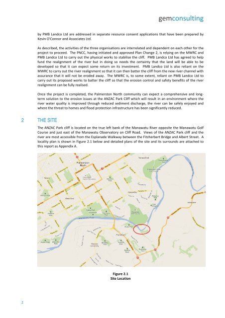
2 THE SITE<br />
The ANZAC Park cliff is located on the true left bank of the Manawatu River opposite the Manawatu Golf<br />
Course and just east of the Manawatu Observatory on Cliff Road. Views of the ANZAC Park cliff and the<br />
river are most accessible from the Esplanade Walkway between the Fitzherbert Bridge and Albert Street. A<br />
locality plan is shown in Figure 2.1 below and detailed plans of the site and its surrounds are attached to<br />
this report as Appendix A.<br />
Figure 2.1<br />
Site Location<br />
2


