

subsurface geology and coal resources of the pennsylvanian system ...
subsurface geology and coal resources of the pennsylvanian system ...
subsurface geology and coal resources of the pennsylvanian system ...

Create successful ePaper yourself
Turn your PDF publications into a flip-book with our unique Google optimized e-Paper software.
46 ILLINOIS BASIN COAL RESOURCES<br />
quired to clarify regional drainage relations<br />
<strong>and</strong> <strong>the</strong> importance <strong>of</strong> pre-Pennsylvanian<br />
deformation as a factor controlling pre-<br />
Pennsylvanian erosion.<br />
The regional thickening <strong>of</strong> <strong>the</strong> pre-Mc-<br />
Leansboro deposits from <strong>the</strong> northwestern<br />
part <strong>of</strong> <strong>the</strong> county, where <strong>the</strong>y are thinnest<br />
over <strong>the</strong> lower to middle Kinkaid upl<strong>and</strong><br />
(T. 5 N., R. 5 E.), is to <strong>the</strong> east-sou<strong>the</strong>ast.<br />
This is shown by <strong>the</strong> widening <strong>of</strong> <strong>the</strong> interval<br />
above <strong>the</strong> middle to lower Kinkaid<br />
upl<strong>and</strong> surface segments fro~n 660 to 1040<br />
feet in this direction. The regional thickening<br />
from 725 to 880 feet due south along<br />
<strong>the</strong> western border od <strong>the</strong> county across <strong>the</strong><br />
upper Kinkaid is less pronounced.<br />
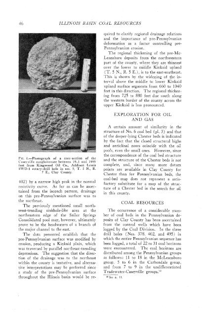
FIG. 6.-Photograph <strong>of</strong> a core-section <strong>of</strong> <strong>the</strong><br />
Caseyville conglomerate between 19,l <strong>and</strong> 1999<br />
feet from Kingwood Oil Co., Addison Lewis<br />
SWD-1 rotary-drill hole in sec. 9, T. 5 N., R.<br />
7 E., Clay County.<br />
$02) by a narrow high ~ eak in <strong>the</strong> normal<br />
resistivity curve. As far as can be ascertained<br />
from <strong>the</strong> isopach pattern, drainage<br />
on this pre-Pennsylvanian surface was to<br />
<strong>the</strong> nor<strong>the</strong>ast.<br />
The previously mentioned small northwest-trending<br />
sinkhole-like area at <strong>the</strong><br />
nor<strong>the</strong>astern edge <strong>of</strong> <strong>the</strong> Sailor Springs<br />
Consolidated pool may, however, ultimately<br />
prove to be <strong>the</strong> headwaters <strong>of</strong> a branch <strong>of</strong><br />
<strong>the</strong> major channel to <strong>the</strong> east.<br />
The data presented establish that <strong>the</strong><br />
pre-Pennsylvanian surface was modified by<br />
erosion, producing a Kinkaid plain, which<br />
was traversed by parallel nor<strong>the</strong>ast-trending<br />
depressions. The suggestion that <strong>the</strong> dire&<br />
tion <strong>of</strong> <strong>the</strong> drainage was to <strong>the</strong> nor<strong>the</strong>ast<br />
within <strong>the</strong> county is tentative, <strong>and</strong> alternative<br />
interpretations may be preferred since<br />
a study <strong>of</strong> <strong>the</strong> pre-Pennsylvanian surface<br />
throughout <strong>the</strong> Illinois basin would be re-<br />
EXPLORATION FOR OIL<br />
AND GAS<br />
A certain amount <strong>of</strong> similarity in <strong>the</strong><br />
structure <strong>of</strong> No. 6 <strong>coal</strong> bed (PI. 3) <strong>and</strong> that<br />
<strong>of</strong> <strong>the</strong> deeper-lying Chester beds is indicated<br />
by <strong>the</strong> fact that <strong>the</strong> closed structural highs<br />
<strong>and</strong> anticlinal noses coincide with <strong>the</strong> oil<br />
pools, even <strong>the</strong> small ones. However, since<br />
<strong>the</strong> correspondence <strong>of</strong> <strong>the</strong> <strong>coal</strong> bed structure<br />
<strong>and</strong> <strong>the</strong> structure <strong>of</strong> <strong>the</strong> Chester beds is not<br />
complete, <strong>and</strong>, since many more datum<br />
points are available in Clay County for<br />
Chester than for Pennsylvanian beds, <strong>the</strong><br />
<strong>coal</strong>-bed map does not represent a satisfactory<br />
substitute for a map <strong>of</strong> <strong>the</strong> structure<br />
<strong>of</strong> a Chester bed in <strong>the</strong> search for oil<br />
in this county.<br />
COAL RESOURCES<br />
The occurrence <strong>of</strong> a considerable number<br />
<strong>of</strong> <strong>coal</strong> beds in <strong>the</strong> Pennsylvanian deposits<br />
<strong>of</strong> Clay County has been ascertained<br />
from <strong>the</strong> control wells which have been<br />
logged by <strong>the</strong> Coal Division. In <strong>the</strong> three<br />
drill holes (Nos. 378, 402, <strong>and</strong> 495) in<br />
which <strong>the</strong> entire Pennsylvanian sequence has<br />
been logged, a total <strong>of</strong> 22 to 31 <strong>coal</strong> horizons<br />
were encountered.<br />
The <strong>coal</strong> horizons are<br />
distributed among <strong>the</strong> Pennsylvanian groups<br />
as follows : 11 to 18 in <strong>the</strong> McLeansboro<br />
group, 5 to 6 in <strong>the</strong> Carbondale group,<br />
<strong>and</strong> from 7 to 9 in <strong>the</strong> undifferentiated<br />
Tradewater-Caseyville group^.^"<br />
l5 See p. 11.


