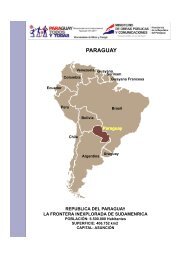
Geology and Mineral Resources of Paraguay A Reconnaissance
Geology and Mineral Resources of Paraguay A Reconnaissance
Geology and Mineral Resources of Paraguay A Reconnaissance
- No tags were found...

You also want an ePaper? Increase the reach of your titles
YUMPU automatically turns print PDFs into web optimized ePapers that Google loves.
INTRODUCTION(1947, 1952) are the only <strong>Paraguay</strong>an writers who havecontributed materially to the literature; each <strong>of</strong> theirpapers supplies data on areas or on phases <strong>of</strong> the geologythat are not to be found elsewhere.Information gleaned from the literature on <strong>Paraguay</strong>has been supplemented in part by unpublished factsgenerously furnished by various individuals who havevisited parts <strong>of</strong> <strong>Paraguay</strong>. Another valuable source <strong>of</strong>information is, <strong>of</strong> course, the literature on the geology<strong>of</strong> the neighboring countries. The summary works <strong>of</strong>Ahlfeld (1946) on Bolivia, <strong>of</strong> Oliveira <strong>and</strong> Leonardos(1943) on Brazil, <strong>and</strong> <strong>of</strong> Stappeiibeck (1926) on Argentinaare particularly helpful in underst<strong>and</strong>ing <strong>and</strong>collating the relatively few scattered bits <strong>of</strong> knowledgeon <strong>Paraguay</strong> itself.MAPS OF PARAGUAYBase maps on a scale sufficiently large to use fordetailed geologic mapping are not available for any part<strong>of</strong> <strong>Paraguay</strong>. There are, however, several sets <strong>of</strong> mapsthat are adequate for reconnaissance investigations.The Mapa Provisional de la Republica del <strong>Paraguay</strong>,published in 1945 by the Institute Geogrdfico Militar,is the best base map produced in <strong>Paraguay</strong>. Publishedon a scale <strong>of</strong> 1:1,000,000 (1 cm=10 km) as well as onseveral smaller scales, it can be purchased from theInstitute <strong>and</strong> from several book stores in Asunci6n.Though very generalized in many places, it is particularlyuseful for its delineation <strong>of</strong> all roads <strong>and</strong> trails inthe country <strong>and</strong> for location <strong>of</strong> towns <strong>and</strong> settlements<strong>and</strong> <strong>of</strong>ficial spelling <strong>of</strong> their names. It contains noinformation as to altitudes, but the main topographicfeatures are shown by shading.Various sheets <strong>of</strong> the Carta Aeronautica de la RepriblicaArgentina, published by the Institute GeograficoMilitar <strong>of</strong> Argentina in 1945 <strong>and</strong> succeedingyears, cover the entire Republic <strong>of</strong> <strong>Paraguay</strong>. Onscales <strong>of</strong> both 1:500,000 <strong>and</strong> 1:1,000,000, they are noteasily available in <strong>Paraguay</strong> but can be purchased"over the counter" from the Institute GeograficoMilitar <strong>of</strong>fices in Buenos Aires. Like the <strong>Paraguay</strong>anmap described above, their portrayal <strong>of</strong> many natural<strong>and</strong> cultural features is much generalized, but theyhave great usefulness because <strong>of</strong> then* detailed data onaerial navigation. Perhaps even more important to thegeologist, they show the elevations <strong>of</strong> many points <strong>and</strong>portray the shape <strong>of</strong> the l<strong>and</strong> by means <strong>of</strong> reasonablyaccurate contours at intervals <strong>of</strong> 100, 200, 500, <strong>and</strong> 1,000meters.The Asimcidn, Corumba, Rio Apa, Rio Pilcomayo,Sucre, <strong>and</strong> Tucuman sheets <strong>of</strong> the World Map, <strong>of</strong> theAmerican Geographical Society published in 1940 <strong>and</strong>succeeding years on a scale <strong>of</strong> 1:1,000,000, with topog-465871 59 2raphy shown in colors by 100-meter intervals, wereused extensively for checking place names <strong>and</strong> topographicrelationships.A set <strong>of</strong> preliminary base maps published in 1949<strong>and</strong> succeeding years by the U. S. Aeronautical ChartService cover all <strong>of</strong> <strong>Paraguay</strong> except two small areasone along the Cordillera de Amambay in the northeasterncorner, <strong>and</strong> the other along the upper reaches<strong>of</strong> the Rio <strong>Paraguay</strong>, near the common junction <strong>of</strong><strong>Paraguay</strong> with Bolivia <strong>and</strong> Brazil. These maps, ona scale <strong>of</strong> 1:500,000 (1 cm=5 km), are not readilyavailable to the public, but can be obtained for <strong>of</strong>ficialuse from the Headquarters, Aeronautical Chart Service,Washington 25, D. C. Prepared from trimetrogonaerial photographs with little or no ground control orfield checking, they are inadequate as to identification<strong>of</strong> towns <strong>and</strong> other human features. Their portrayal<strong>of</strong> roads is even more inaccurate, particularly as totheir classification <strong>and</strong> usability. On the other h<strong>and</strong>,the natural features such as streams <strong>and</strong> swamps areshown far more accurately than they are on anyother maps known to the author. L<strong>and</strong> elevationsare shown by 1,000-foot (300 meters) contours <strong>and</strong>by many point elevations. The detailed portrayal onmost <strong>of</strong> the sheets <strong>of</strong> forested <strong>and</strong> cultivated l<strong>and</strong>s aswell as <strong>of</strong> swamps <strong>and</strong> other features is <strong>of</strong> incalculablevalue to the reconnaissance geologist, not only becausethey help to solve problems <strong>of</strong> location but becauseall these features have geologic meaning when properlyinterpreted.In addition to the base maps mentioned ajaove, thereare aerial photographs for most <strong>of</strong> the country. Thoseknown to the author are the trimetrogon photographs,taken by the U. S. Air Force in 1943 through 1945,which were used in compilation <strong>of</strong> the preliminarybase maps described above. The pictures were takenat altitudes <strong>of</strong> 20,000 feet, <strong>and</strong> cover virtually all thecountry except the northeastern corner. The strips<strong>of</strong> vertical pictures were extremely useful in both field<strong>and</strong> <strong>of</strong>fice for studying <strong>and</strong> mapping geology. Theoblique pictures were also useful in studying generalrelations, but they are not easily adapted to fieldmapping without special trimetrogon stereoscopicequipment that was not available in <strong>Paraguay</strong> at thetime <strong>of</strong> this investigation. Complete sets <strong>of</strong> prints<strong>of</strong> the trimetrogon pictures are available for <strong>of</strong>ficialuse in Washington, D. C., in the <strong>of</strong>fices <strong>of</strong> the AeronauticalChart Service <strong>and</strong> in Asuncion in the InstituteGeografico Militar. In 1952, an exasperatingly incompleteset <strong>of</strong> prints was also available in the Asuncion<strong>of</strong>fice <strong>of</strong> the Institute <strong>of</strong> Inter-American Affairs.All the maps <strong>and</strong> pictures described above <strong>and</strong> muchmaterial from other sources were used in compiling the