Orestimba Creek Hydrology - Stanislaus County
Orestimba Creek Hydrology - Stanislaus County
Orestimba Creek Hydrology - Stanislaus County
- No tags were found...

Create successful ePaper yourself
Turn your PDF publications into a flip-book with our unique Google optimized e-Paper software.
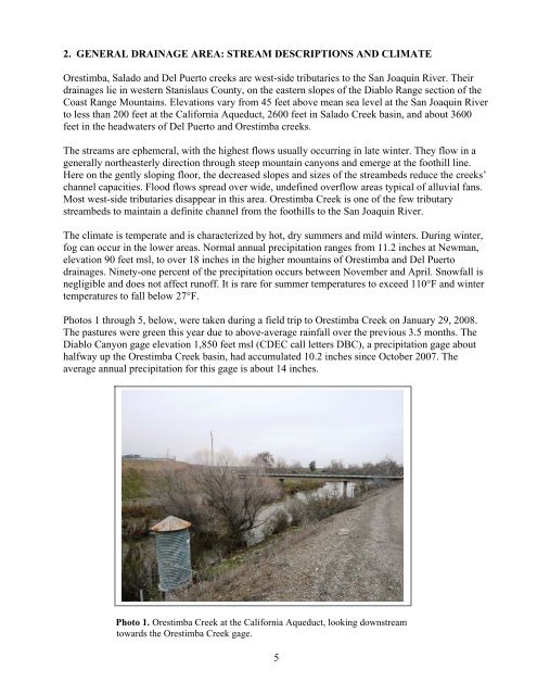
2. GENERAL DRAINAGE AREA: STREAM DESCRIPTIONS AND CLIMATE<strong>Orestimba</strong>, Salado and Del Puerto creeks are west-side tributaries to the San Joaquin River. Theirdrainages lie in western <strong>Stanislaus</strong> <strong>County</strong>, on the eastern slopes of the Diablo Range section of theCoast Range Mountains. Elevations vary from 45 feet above mean sea level at the San Joaquin Riverto less than 200 feet at the California Aqueduct, 2600 feet in Salado <strong>Creek</strong> basin, and about 3600feet in the headwaters of Del Puerto and <strong>Orestimba</strong> creeks.The streams are ephemeral, with the highest flows usually occurring in late winter. They flow in agenerally northeasterly direction through steep mountain canyons and emerge at the foothill line.Here on the gently sloping floor, the decreased slopes and sizes of the streambeds reduce the creeks’channel capacities. Flood flows spread over wide, undefined overflow areas typical of alluvial fans.Most west-side tributaries disappear in this area. <strong>Orestimba</strong> <strong>Creek</strong> is one of the few tributarystreambeds to maintain a definite channel from the foothills to the San Joaquin River.The climate is temperate and is characterized by hot, dry summers and mild winters. During winter,fog can occur in the lower areas. Normal annual precipitation ranges from 11.2 inches at Newman,elevation 90 feet msl, to over 18 inches in the higher mountains of <strong>Orestimba</strong> and Del Puertodrainages. Ninety-one percent of the precipitation occurs between November and April. Snowfall isnegligible and does not affect runoff. It is rare for summer temperatures to exceed 110°F and wintertemperatures to fall below 27°F.Photos 1 through 5, below, were taken during a field trip to <strong>Orestimba</strong> <strong>Creek</strong> on January 29, 2008.The pastures were green this year due to above-average rainfall over the previous 3.5 months. TheDiablo Canyon gage elevation 1,850 feet msl (CDEC call letters DBC), a precipitation gage abouthalfway up the <strong>Orestimba</strong> <strong>Creek</strong> basin, had accumulated 10.2 inches since October 2007. Theaverage annual precipitation for this gage is about 14 inches.Photo 1. <strong>Orestimba</strong> <strong>Creek</strong> at the California Aqueduct, looking downstreamtowards the <strong>Orestimba</strong> <strong>Creek</strong> gage.5