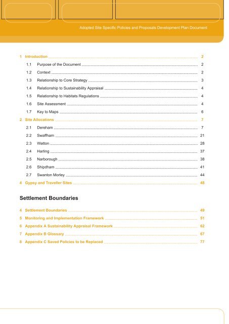
Adopted Site Specific Policies and Proposals Development Plan ...
Adopted Site Specific Policies and Proposals Development Plan ...
Adopted Site Specific Policies and Proposals Development Plan ...

Create successful ePaper yourself
Turn your PDF publications into a flip-book with our unique Google optimized e-Paper software.
<strong>Adopted</strong> <strong>Site</strong> <strong>Specific</strong> <strong>Policies</strong> <strong>and</strong> <strong>Proposals</strong> <strong>Development</strong> <strong>Plan</strong> Document1 Introduction1.1 Purpose of the Document1.2 Context1.3 Relationship to Core Strategy1.4 Relationship to Sustainability Appraisal1.5 Relationship to Habitats Regulations1.6 <strong>Site</strong> Assessment1.7 Key to Maps2 <strong>Site</strong> Allocations2.1 Dereham2.2 Swaffham2.3 Watton2.4 Harling2.5 Narborough2.6 Shipdham2.7 Swanton Morley4 Gypsy <strong>and</strong> Traveller <strong>Site</strong>s222344467721283738414448Settlement Boundaries4 Settlement Boundaries5 Monitoring <strong>and</strong> Implementation Framework6 Appendix A Sustainability Appraisal Framework7 Appendix B Glossary8 Appendix C Saved <strong>Policies</strong> to be Replaced4951626777
<strong>Adopted</strong> <strong>Site</strong> <strong>Specific</strong> <strong>Policies</strong> <strong>and</strong> <strong>Proposals</strong> <strong>Development</strong> <strong>Plan</strong> Document1 Introduction1.1 Purpose of the Document1.2 ContextWhat is the <strong>Site</strong> <strong>Specific</strong>s <strong>Policies</strong> <strong>and</strong> <strong>Proposals</strong> <strong>Development</strong> <strong>Plan</strong> Document?1.1 The Local <strong>Development</strong> Framework (LDF) for Breckl<strong>and</strong> will replace the existing Local <strong>Plan</strong> which wasadopted in September 1999. It is being prepared under the relevant legislation for development plans in Engl<strong>and</strong>.The LDF comprises a number of <strong>Development</strong> <strong>Plan</strong> Documents (DPDs) that set out policies <strong>and</strong> proposals forthe development <strong>and</strong> use of l<strong>and</strong> in the district, the first DPDs cover the period to 2026. The adopted Breckl<strong>and</strong>LDF Core Strategy (2009) includes a Spatial vision for the future of Breckl<strong>and</strong> <strong>and</strong> objectives <strong>and</strong> targets, whichdevelopments must meet to secure that vision. The <strong>Site</strong> <strong>Specific</strong>s <strong>Policies</strong> <strong>and</strong> <strong>Proposals</strong> <strong>Development</strong> <strong>Plan</strong>Document has been prepared in accordance with this Core Strategy.1.2 The <strong>Site</strong> <strong>Specific</strong>s <strong>Policies</strong> <strong>and</strong> <strong>Proposals</strong> DocumentTakes account of national, regional <strong>and</strong> strategic planning policies;Identifies sites for, <strong>and</strong> requirements of, major development to deliver the adopted Spatial Strategy <strong>and</strong>Core Strategy policy;Provides the framework of policies for assessing planning applications on allocated sites;Enables infrastructure <strong>and</strong> service providers to bring forward their services when needed by newdevelopment;Enables the public to be fully involved in developing local policies <strong>and</strong> proposals; <strong>and</strong>Is accompanied by an updated <strong>Proposals</strong> Map including revised settlement boundaries in accordance withthe adopted Core Strategy.1.3 The <strong>Site</strong> <strong>Specific</strong>s <strong>Policies</strong> <strong>and</strong> <strong>Proposals</strong> DPD covers the whole of the District with the exception ofThetford <strong>and</strong> Attleborough <strong>and</strong> Snetterton Heath where two separate Area Action <strong>Plan</strong>s are being prepared.Community Involvement1.4 The <strong>Site</strong> <strong>Specific</strong> <strong>Policies</strong> <strong>and</strong> <strong>Proposals</strong> DPD has been prepared following a programme of consultation<strong>and</strong> public participation. Consultation with the community on the <strong>Site</strong> <strong>Specific</strong>s in Breckl<strong>and</strong> began in the Summerof 2008 with the publication of an Issues <strong>and</strong> Options document, following a formal call for sites in March/April2008. This Issues <strong>and</strong> Options consultation took place over a 12 week period. This was followed by a 6 weekfurther Issues <strong>and</strong> Options consultation in Spring 2009 to publicise additional sites received during the first Issues<strong>and</strong> Options period. Following the adoption of the Core Strategy in December 2009 the Council proceeded inJune/July 2010 to a consultation on a Preferred Options document which gave people the opportunity to commenton how the local planning authority should approach the final content of the document. The Preferred Optiondocument focused on preferred sites <strong>and</strong> settlement boundaries together with the opportunity to comment onreasonable alternatives.1.5 The Pre-Submission document was published in January 2011 <strong>and</strong> was subject to a six-week longpublication period, allowing people to make representations which were considered through the Examinationprocess. A number of representations were received that sought the inclusion of additional, alternative oramended site allocations <strong>and</strong> settlement boundaries through the updated <strong>Proposals</strong> Map. The DPD was thensubmitted to the Secretary of State in April 2011. Further information on the plan preparation process can befound on the Council's website: www.breckl<strong>and</strong>.gov.uk.2
<strong>Adopted</strong> <strong>Site</strong> <strong>Specific</strong> <strong>Policies</strong> <strong>and</strong> <strong>Proposals</strong> <strong>Development</strong> <strong>Plan</strong> Document1.6 A Glossary of Technical <strong>and</strong> Other Terms is to be found at the back of this document. (MM01)1.3 Relationship to Core Strategy1.7 Following the adoption of the Core Strategy <strong>and</strong> <strong>Development</strong> Control <strong>Policies</strong> on 17th December 2009,the <strong>Site</strong> <strong>Specific</strong> <strong>Policies</strong> <strong>and</strong> <strong>Proposals</strong> DPD allocates l<strong>and</strong> as required by the housing <strong>and</strong> employment figureswithin the Core Strategy, which details the way in which the District is expected to develop. The Core Strategy<strong>and</strong> <strong>Development</strong> Control DPD provides the overarching strategy for the District, <strong>and</strong> is the document that allother documents need to be in conformity with. This will provide a key test at the examination in public. A DPDwhich is found at examination to be incoherent or inconsistent with the adopted Core Strategy would be found"unsound" <strong>and</strong> be rejected by an independent Government <strong>Plan</strong>ning Inspector.1.8 <strong>Specific</strong>ally, the Core Strategy sets out the following proposals for development across the district:Thetford will be the focus for growth within Breckl<strong>and</strong> 6,000 new homes will be provided between 2001<strong>and</strong> 2021, with a further 1,500 between 2021 <strong>and</strong> 2026. In addition to this, up to 5,000 net new jobs will beprovided to 2026 <strong>and</strong> a total of 9,400 sqm of food <strong>and</strong> non-food retailing floorspace. The Thetford AreaAction <strong>Plan</strong> will facilitate this growth.Away from Thetford, Attleborough will be the main focus of growth, accommodating in the range of 4,500new homes over the plan period. Attleborough in combination with Snetterton between 1,500 <strong>and</strong> 2,000net new jobs to 2021. Additionally 4,800 sqm of food <strong>and</strong> non-food retailing will be provided.Dereham will provide up to 2,000 new homes <strong>and</strong> between 900 <strong>and</strong> 1,800 net new jobs over the planperiod. Retail floorspace in Dereham will increase 12,500 sqm over the plan period.The mid-sized market towns of Swaffham <strong>and</strong> Watton will experience lower levels of growth. Swaffhamwill provide approximately 600 houses <strong>and</strong> 300 - 650 new jobs over the remainder of the plan period.Watton will provide 350-500 new houses <strong>and</strong> 250 new jobs over the same period. Additionally, Watton willdeliver 300 sqm <strong>and</strong> Swaffham 850 sqm of food <strong>and</strong> non-food retailing.Fourteen Local Service Centre villages have been identified, of which four will accommodate growth ofbetween 50 <strong>and</strong> 100 dwellings. These are:HarlingNarboroughShipdhamSwanton MorleySnetterton Heath employment area will increase by 20 ha, <strong>and</strong> in combination with Attleborough will providebetween 600 <strong>and</strong> 1,700 new jobs. This will be dealt with within the Attleborough <strong>and</strong> Snetterton Heath AreaAction <strong>Plan</strong>.Rural settlements, away from the Local Service Centres, are expected to see limited growth over the planperiod.3
<strong>Adopted</strong> <strong>Site</strong> <strong>Specific</strong> <strong>Policies</strong> <strong>and</strong> <strong>Proposals</strong> <strong>Development</strong> <strong>Plan</strong> Document1.4 Relationship to Sustainability Appraisal1.9 Local authorities are required under Section 39 of the <strong>Plan</strong>ning <strong>and</strong> Compulsory Purchase Act (2004) toproduce a Sustainability Appraisal (SA) in conjunction with its <strong>Development</strong> <strong>Plan</strong> Documents. The SA will ensurethat the key aims of sustainable development are taken into account, whilst also incorporating the requirementsof the of the European Strategic Environmental Assessment (SEA) Directive. The key aims of the SA are: socialprogress that recognises the needs of everyone; effective protection of the environment; the prudent use ofnatural resources; <strong>and</strong> the maintenance of high <strong>and</strong> stable levels of economic growth <strong>and</strong> employment. In doingso, it will provide an opportunity to consider ways in which the plan or strategy can contribute to improvementsin environmental, social <strong>and</strong> economic conditions as well as a means of identifying <strong>and</strong> addressing any adverseeffects the policies <strong>and</strong> proposals might have.1.10 As the <strong>Site</strong> <strong>Specific</strong> <strong>Policies</strong> <strong>and</strong> <strong>Proposals</strong> is a development plan document, it has required the preparationof a Sustainability Appraisal Report. This will provide an opportunity to assess the extent to which emergingpolicies <strong>and</strong> proposals help to achieve the relevant environmental, social <strong>and</strong> economic objectives.1.11 The SEA is a requirement of European Directive 2001/42/EC needed for all plans begun after July 2004,that will have a significant effect upon the environment. The SEA is distinct from the SA in that it focuses solelyon environmental concerns.1.12 The SA, which will incorporate the SEA, has been made for representations to be made on its contentover the same period as the publication for this document.1.5 Relationship to Habitats Regulations1.13 Regulation 102 of the Conservation of Habitats <strong>and</strong> Species Regulations (2010) requires plan makingauthorities to determine whether a plan is likely to have a significant effect upon any European <strong>Site</strong>. A European<strong>Site</strong> can include sites designated as Special Areas of Conservation (SACs) for their species <strong>and</strong> habitats, <strong>and</strong>Special Protection Areas (SPAs) designated for the protection pf birds. In considering the implications of the <strong>Site</strong><strong>Specific</strong> <strong>Policies</strong> <strong>and</strong> <strong>Proposals</strong> document, an Initial Appropriate Assessment Report has been undertaken inorder to comply with the Habitat Regulations at this preferred sites stage. This document is available to view onthe Breckl<strong>and</strong> website.1.14 In light of the findings of the Appropriate Assessment, mitigation measures may need to be put in placeto remove any significant effects that the plan might have on a European <strong>Site</strong>. Mitigation measures includeamendments made to policies/sites to remove elements that could have an effect, or to require other actionsthat can eliminate any effects.1.6 <strong>Site</strong> Assessment1.15 <strong>Site</strong>s allocated for development within the <strong>Site</strong> <strong>Specific</strong> <strong>Policies</strong> <strong>and</strong> <strong>Proposals</strong> DPD will have to be inconformity with the adopted Breckl<strong>and</strong> Core Strategy, which itself needs to be in conformity with regional <strong>and</strong>national planning policies.1.16 The sites proposed for development within this document are considered to be both the most sustainableoptions for development <strong>and</strong> also the most likely to be delivered within the plan period.1.17 Each site has been the subject of a comprehensive desk-based assessment using information held onthe Council's GIS (i.e. archaeological records, flood risk, l<strong>and</strong> quality etc). The desk based assessments havebeen augmented by site visits. <strong>Site</strong> visits have also enabled greater consideration to be given to the impact ofneighbouring uses, environmental <strong>and</strong> transport issues specific to the site <strong>and</strong> l<strong>and</strong>scape <strong>and</strong> amenity assessmentsto be made. The number of sites, likely to satisfy all of the objectives is quite minimal. The assessment questionsthat the sites have been compared to, include:4
<strong>Adopted</strong> <strong>Site</strong> <strong>Specific</strong> <strong>Policies</strong> <strong>and</strong> <strong>Proposals</strong> <strong>Development</strong> <strong>Plan</strong> DocumentWill the allocation for development be in accordance with the strategies <strong>and</strong> policies contained within theBreckl<strong>and</strong> Core Strategy?Will the site facilitate the use of brownfield l<strong>and</strong>? Will the allocation for development limit the loss of highgrade agricultural l<strong>and</strong>?Could the development allocation impact on European <strong>and</strong> International environmental designations (i.e.Ramsar, SAC, SPA)Could the development allocation impact upon other environmental designations (e.g. SSSI, Local NatureReserve, County Wildlife <strong>Site</strong> etc.)Will the allocation be at risk from flooding, or will it increase flood risk within the locality?Is the site well related to the existing settlement, services <strong>and</strong> facilities?Is the site deliverable (market viability, desirability, contaminated l<strong>and</strong>)Will the development improve the quality, quantity <strong>and</strong> accessibility of open space? Could the allocationresult in a loss of open accessible open space? (e.g. Playing fields, play areas, amenity green spcaes,allotments)Will the development increase the vitality <strong>and</strong> viability of existing town centres?Could the allocation help people gain access to satisfying work, appropriate to their skills, potential <strong>and</strong>place of residence?Improve the efficiency, competitiveness <strong>and</strong> adaptability of the local economy?Would the allocation site for development result in a loss of employment l<strong>and</strong>?Would the allocation site impact upon local biodiversity.Could the allocation impact upon the historic environment?Could the allocation have a detrimental impact on the l<strong>and</strong>scape/townscapeWill the allocation have an impact on on infrastructure capacity? (e.g. Water, drainage, sewage, schools,health services) Can this impact on infrastucture be overcome?Will the development have an impact on amenity? (e.g. Overlooking, noise <strong>and</strong> light pollution)Could the allocation for development impact upon the local highways network?1.18 All site options <strong>and</strong> changes to settlement boundaries have also been tested through the SustainabilityAppraisal criteria. The framework for testing the options can be found in 6 'Appendix A Sustainability AppraisalFramework'5
<strong>Adopted</strong> <strong>Site</strong> <strong>Specific</strong> <strong>Policies</strong> <strong>and</strong> <strong>Proposals</strong> <strong>Development</strong> <strong>Plan</strong> Document1.7 Key to Maps6
<strong>Adopted</strong> <strong>Site</strong> <strong>Specific</strong> <strong>Policies</strong> <strong>and</strong> <strong>Proposals</strong> <strong>Development</strong> <strong>Plan</strong> Document2 <strong>Site</strong> Allocations2.1 Dereham2.1 Dereham is identified in the Breckl<strong>and</strong> Core Strategy as a Market Town which will see moderate levels ofgrowth over the period to 2026. The town will provide an additional 1,971 new homes over the plan period, <strong>and</strong>approximately 5-10 hectares of employment l<strong>and</strong> plus additional retail floorspace. Of the 2,010 new homes,1,476 already have the benefit of planning permission or have been completed at 31st March 2010. Therefore,as per the Core Strategy l<strong>and</strong> for an additional 600 homes is to be allocated in the period up to 2026.2.2 Evidence to support the housing numbers for Dereham in the adopted Core Strategy suggests that thereis broadly sufficient infrastructure capacity to accommodate the proposed level of growth, although some localinfrastructure will require upgrading such as sewerage pipes, as well as transport improvements. In terms ofcommunity infrastructure, it is likely that improvements will be needed to rural bus services in <strong>and</strong> around Derehamin common with other market towns being identified for growth. New development will have to contribute to theexpansion of primary <strong>and</strong> nursery schools <strong>and</strong> primary healthcare provision will need to be slightly exp<strong>and</strong>ed.2.3 The town’s employment areas are located in close proximity to the A47 trunk road <strong>and</strong> include the threekey employment areas at Yaxham Road, Rash’s Green <strong>and</strong> Dereham Business Park. These employment areasinclude some larger enterprises as well as a range of small to medium size enterprises, with stock of a range ofages. The Breckl<strong>and</strong> Employment L<strong>and</strong> Review (2006) recognises Dereham as having good potential for economicgrowth in the plan period <strong>and</strong> this is reflected in the area to be allocated.2.4 The Dereham stream (a tributary of the River Wensum) flows through the town <strong>and</strong> is culverted througha large part of the urban area. To the south of the town, the River Tud flows west to east on to Badley Moorwhich is a European protected site(SAC). There are a number of areas to the west of the town (towards ScarningParish) that are at risk of fluvial flooding. Furthermore, the Breckl<strong>and</strong> Strategic Flood Risk Assessment hasidentified previous events of localised sewer flooding around Norwich Road, Swanton Road <strong>and</strong> across theToftwood area.2.5 To meet the Core Strategy requirement for new housing it is necessary to identify a number of new sitesfor development in this document, the majority of which will be on greenfield l<strong>and</strong>. The agricultural l<strong>and</strong> surroundingDereham is predominantly grade 3, but does include some limited pockets of grade 2.2.6 In considering l<strong>and</strong>scape character, the town is bordered by two l<strong>and</strong>scape character types spread overfive areas as identified in the Breckl<strong>and</strong> L<strong>and</strong>scape Character Assessment settlement fringe study. The majorityof the town is classified as being at a moderate-high sensitivity to built development, with an area to the southeast of the town (Old Hall tributary Farml<strong>and</strong>) identified as moderate sensitivity to built development. Derehamalso has a number of important green corridors that run through a number of areas of the town linking key areasof importance, particularly for biodiversity <strong>and</strong> these have been highlighted in the Dereham Green InfrastructureStudy.2.7 Dereham is an historic market town with a wealth of historic buildings, spaces <strong>and</strong> interlinking streetscapes.The quality of its historic environment can be best qualified by its numerous historic assets, spanning severalcenturies, including an extensive conservation area <strong>and</strong> numerous listed buildings including the Parish churchof St. Nicholas with its detached bell tower <strong>and</strong> the Bishop Bonner museum which is adjacent to it.2.8 Delivery of housing in Dereham is directly linked to the waste water infrastructure <strong>and</strong> in particular capacitywithin the local waste water treatment network. Capacity issues at Dereham reflect constraints on the ability totreat additional volumes of water to a quality capable of being discharged into the River Wensum (which is aEuropean protected SAC site). The detailed Water Cycle Study (2010) identified that a manageable solution forwaste water in Dereham could include a phased approach to housing delivery which reflects demographicalchanges within the existing urban area (decreasing average household occupation) <strong>and</strong> thus enables additional7
<strong>Adopted</strong> <strong>Site</strong> <strong>Specific</strong> <strong>Policies</strong> <strong>and</strong> <strong>Proposals</strong> <strong>Development</strong> <strong>Plan</strong> Documentdischarge to be accommodated (MM10). This approach has been accepted elsewhereby OFWAT - the regulatorybody. As a consequence, the detailed Water Cycle Study recommends an annual housing delivery rate of upto 80 homes <strong>and</strong> to ensure this is achieved policies in relation to sites D1 <strong>and</strong> D2 include the need to phase thedelivery of these sites to a timeframe where capacity is available in the Dereham Waste Water Treatment Works.2.9 Further options for Dereham’s waste water solution may identify earlier opportunities to bring developmentforward where there is agreement from Anglian Water <strong>and</strong> the Environment Agency <strong>and</strong> this will be negotiatedon a case by case basis. Initial option work has identified that a deliverable solution to release capacity atDereham WwTW is available by utilising an alternative Waste Water Treatment Works in a neighbouring catchmentimmediately to the east of the town that may be able to accommodate additional flows. Both the EnvironmentAgency <strong>and</strong> Anglian Water are responsive to developing this option to support delivery of the allocations in thisdocument.8
Dereham AllocationsYaxhamTO FTWO ODMOO RGATESOUTH GREENWard BdyGolf Cours eIndus trial EstateNeatherd MoorYaxham RoadRas h's G reenWork sWalnut TreeQuebec WoodSewage WorksEstateRas h'sToftw ood Infant SchoolChes tnut FarmDepotCric ket GroundIndus trialRiv er TudCentreVale FarmPotter's FenScarning FenCem eteryRec reation GroundSports GroundFred Nic holsonLakeDEREHAMAlotm ent GardensSchoolSwanton Road FarmNorthgate High SchoolDereham HospitalNurs eriesGardensAlotm entNorthal Green FarmNorthgatePlaying FieldQuebec Hal BungalowsNorthal GreenDum pling GreenSlough <strong>Plan</strong>tationFarmBridgeGreenHillsideHom e FarmThe BeaverJubilee ParkEASTYardYorkLy nnClubLy nn HilWalkChurc hi lSufolkBellOld QuarryDillington HalOrchard EndChurc hOld Hall FarmWayEck ling GrangeHum bletoftFlorenc e WalkOakl<strong>and</strong>sNurs ery BuildingsHallCliftonStPeter' s C hurchCattle Arc hBungalowsHigh SchoolTerrac eBrec kl<strong>and</strong> garden CentreSteadingsDereham , Toftw oodFrogs Hall FarmJunior SchoolLloydMalthous e Terrac eMilwrights Arm sWillowWatering Farm HouseQuebec FarmHeathfieldBuilders M erc hantCollegeGlencoeRom e WalkFlorenc eMulberry FarmMaltings FarmCourtCom munityBruc es FarmGreen FarmYaxham HouseStationLodgeGaleym oor FarmStation Road FarmDereham , StNic holasAbbey FarmGames CourtKes trel Clos eCedar CourtPark Farm C ottagesNurs eryPark FarmBorrow HalPlacePic nic <strong>Site</strong>Herne CottagesHoe Lodge CottagesA47Prim ros e FarmReads NurseriesWest ViewRailway FarmM orgate Co tagesMil View Farm(Mid-N orfolk Railway)Ros e FarmDaleDerehamEas t ViewMarketHoe1TelOffic eFWDefWBPWTower1WellPsL ColsTA CentreETLFSPsWater Tow erLBPos tsPpL ColBell TowerFB12.75DoodleLCWk sPros pec tTC BC operSPSBDEFPos tESSCLO SEOldfieldCPCSDOWLIN G52.4mPolice45.7m54.6m48.5m52.1m47.5m52.8m43.9m47.9m48.2m48.8m49.1m61.9m61.6m61.4m61.0m49.4m46.6m60.0m59.4m52.7m58.7m58.3m57.6m57.5m46.0m39.0m49.7m57.3m57.0m50.0m53.3m56.5m56.4m55.5m50.6m55.2m54.9m40.5m42.4m50.9m51.2m51.9m54.3m54.0m43.0m53.9m51.5m53.8m53.6m44.5m51.8m46.4m47.2m45.4m50.3m47.8mPC46.3m49.6m47.6m53.0m56.7m44.2m44.4m65.8m44.7m42.7m65.5m57.4m45.5m67.1m66.6m62.8m46.5m46.2m45.8m46.1m64.0m59.2m66.2m63.6m60.2m62.4m62.7mCDBLACKBE RY CLO SECRWt TwrPondsSilosGPSportsGVC1. 2m BPage's YardPOFoot BridgeAVEN UETennis CourtsCHE RY DRIFTRos e C otageNORWICH RO ADDorisCHE RY DRIVEPondED &Cros singCottagesGOLF LANETe nis CourtED & Ward BdyWindpumpWASHBR ID GE(Path)SuperstoreTH OMPSO N WAYHopperLevel Cros singTH OMPSO N WAYLetterPipe LineElAms terdamMP 9.75Rec toryThe YardTheMP 10MP 12MP 13Pum pConglPipeline1. 2m RHBird's LaneRam pPpg StaSpelmansC Tk1.83m RHTrackSubRom ney WalkBeech CourtLeisure CentrePp HoCopenhagen WalkMP .25Park er' s YardPres by teryWar MemlAshley Walk1. 2m Tk HSpringStWithburga' sSwim ming PoolNels on Plac eRev enueCouncil H ousesVillasFootball GroundTk SGeneva WalkClub Hous eTk DShelterChapelConv ey orPlay AreaSquareBowling GreenTkPerk insQuebec HalGarageGroundBkDorrington H ous eMP .5The Sac red HeartCinemaRolingpin LaneHotelEas t O ak sMeadow Hous eSurgeryBowlingEl Sub StaSub StaBYRONAmbulanc e StationMemlB 10Pum ping StationAdultTrainingSim laPlaygroundPylonFire StationGwersy ltBaptis t Churc hRailway (dis us ed)PleasantPHRHJohn DuiganDis mantled R ailwayMSLay-byStaDarw in WalkLibraryMalthous eWAYCarSundayNew tonPav ilionUndNew I nMon(um )Corn MillCar ParkPathPath (um )MastMoatPAVILIO N WAYBankDrainDiaryB 135O fic esGATESTILWE L DRB 146WATERSFIELD WAYPARKToftw odKEATSBATESWI LOWBAYFIELD AVEA TL EZAR AWAYVIEWHarv eyWAVE L RO ADLADISLAWWAPLES WAYA1075WestPAG ETSaw M illMortuaryELVIN6MATSE L WAY60cSTEWARD WAY327SALT LAKEYEATS WAY14BERTIE WARD WAYWI LIAM WAY15FARM WAYGENEVA WALK54564512811087367546916591606391709574327b724WISTERIA CLOSEWH EATCR OFT WAYSARDIS WAY1 6235251LI TLEFIELDS234266028274875126131 2ROSAVE LABELG RAVEWestc roftWest LodgeBULWERSTATION RO ADRos eWILLIAMA LW OD AVENUEBEATRICE AVENUEVA LEYTuffleyTED E LIS WALKBE CLESGATEPOWELL CTGA LO WAY CLOSEACACI AVENUECAPTAIN FOR D WAYLYDG ATE CLOSEWR IG HT'S WALKHI L FIELDSYA R OWW ODFIELDToly moreDRIVEGEORG ELIO TWAYWI LOW GROV EALBERTMayFAREBR OTHER WAYOSIERCHAPEL WALKTouc hngoPARK R OADLESLEY WALKWeldon LodgeCECIL RO ADBE L CLO SEKEVIN WALKOLD BE CLESGATEKIN G'S PARKCLLO WICK CLOS EWESTFIELD ROADPHILIPALDI S AVENUETEASELBRIDGETAVERN LANEBATH AVENUEGILPIN' S RIDEWeydorClos eW ODVIC ARAGERIVERSIDE CLOSELILA CLOSEWR IG HT DRIVETudor LodgeWR IG HT AVENU ECOVERTCASTE L ROADCARL CLO SELINESIDECARTLED GEPI PINMILTONLongfieldsTH EATRE STR ETMA TISH A L ROADSTHILDA CLOSEWARN ERTank sCOPSEY WALKQuebec LodgeCARLTON CLO SESNOWHI L DRIFTWESTFIELD LAN EOAKW ODPLACETH E BR OADWAYHOLT RO ADROWANHI LCREST AVENUEOAKA PLEDi dos faWaters ideWO RDSWORTH DR IVEBRAILSFOR D CLOSEDIANA C LO SEAldissWO LASTON AVENUEVuePo pyfieldACORN WAYRECREATION ROADBRIAR CLO SEJUBIL E AVENU EWestleaELM PAR KPetersfieldSTPETER' S CLOSEB AAMBA SADO R WAYSTG EORGE' S DRIVERAMILLIES CLFO XGLOVE DRIVEE s exWA R EN PLAC EPRIOR' S GROVEWoodl<strong>and</strong>sRodm ereRideSECKARROSE DRIVEDORO TH EADR IVEFir AcreLAVENDER G ROVELARKS PLACEHOWLE T CLDE HAVI LANDWashbridgeHedgesBR OKS DR IV ECHRISTIE C LSTIG AND' SLIM A SOL R OADSWANTO N DRIVEPETER S C LO SECOWPE ROADSWANTO N AVENU ETwy fordFEATHERSTO NE CTHEIDI C LO SEWIND MI LK EPERS CLO SESUNSALVE RIDEELIZABETH CLOSEQuebecSWAN RO ADGR ENFIELDSCABINET C LO SEANDREW G O DA L CLOSEROGE R ID EPO TERS BARSTHILDAMASEFIELDNEVI LE CLOSETIPTON C LO SENORTHG ATELIM E D RIVEWood FarmR EDER CLOSEElm sideGEORG E BO RO WRes ourc eDREIBHOLZWELDENHICKS DRIVEHO LY CLOSEAshfieldRos edaleROADSHELD RICK PLAC EORCHID AVENUESWANTO NA ple Tr e Co tageFensideGORSEGEORG ESHom efieldsBULSTRO DE AVEN UEMI LERDALE RO ADM O RGATE ROADLIM E TREE CLOSECOLLINS CLOS EThe Sc otsThe Ac ornsBLUEBE LApplebyCU THROAT15 to 19The Ros eEas tfieldsMETAMEC DR IVEELDER BE RYGIRLIN G ROADGROVE CLOSEThe YewsMARION WALKWE LINGTON RO ADSTWITHBURG ALANEHAZEL GR OVEGR ENFIELDS ROADTR IN ITY CLOSEGreenfieldsBOTON DRIVENORWICH STR ETBANYARD PLAC EWALNUTRodingsEATON G ARDENSBeestonSHE DICKNEATH ERDDANESFORTSEDGE ROADSWANTO N GRO VECotes de VilleThe B echesSWANTO N ROADMI LWestv ileSpencerBay TreesMEADO WSGEORG ES ROADWestw ood StudK epers CotageBR OK G ROVEB ECH DRIVEHom efieldDAIRY C RESCENTSelacsCO L EN C LO SEBRETON CLOSECHARLES W OD RO ADNEATH ERD ROADSWA FHAM ROADBRUNSWICKHANDEL D RIVECHAPEL M EWSBOSTON CLOSEBOYD AVENUEREGENT CLOSEConc ordHELSINKIALEXAND ERLISBON R OADTE BU TBRU SELSDRAYTO NHA LANECHARLES CLO SEHAIG CLOSEFenl eASCOT GARDEN SPRIMRO SECU THROAT LAN EHE FER C LO SEOldencroftGreenfieldLARN ER'S RO ADCotage RoseSpion KopHIGHFIELD R OADMEADO WTR IN ITYE s cot H ouseHEATHLinks LodgeKingsc lereSTR ASBOURGBIR CHCO MERCIAL ROADPIN E G ROVEPaddoc kOldCROWN RO ADKIN GS ROADLARN ERS ROADCRESCENTJENTIQUE CLO SEOLD ORCHAR D CLOSEMayes Terac eSTO NE ROADCotsBeechdaleCHAPE LANEPorts w odB eleighPem berleySpringfieldGablesAmbros e H ous eJubileeBACK LANETH E W ODLANDSTH E SIDING SRedm ay esVeronaHA LAN EBISH OPTYNE AVEN UEStA nesCOURTENAYBANYARD COUR TWy nde-mereWestv iewKingsm eadeB echgateMARG ARETFER N CLO SEWillowc roftREDFERNKIN GSTON RO ADCOURTRU SETSeptem ber HouseRos emarieOLD HA LDoneCEMETERY RO ADEdburoLARKSPU R COURTRO LING PIN LAN ESCH O LANE(disus ed)Dorm erQUEBEC RO ADBloomfield C ourtBARNABY CLOSEGR ENS RO ADCROWN GAR DENSGARDENSPippinsJOH N GOSHAWK RO ADMITCHE LThe CroftWendy leaRec ueilRiv ersideGr enridgeKingsm eadORCHAR DFour-G' sBram blesHIGH STR ETWillowsTH E G ROVE37a23aCASAUBON CLO SE18aHUMBLETOFT ROADBRAMLEY ROADThe Elm sAmberleyMALTH OUSE COU RTSnojemFernco teFEN R OADNEATH ERD M ORSax on LodgeSTEPH EN BEAUMO NT WAYTO WN SHEND RO ADWhiteBLACKTHO RNBURTONTYNE AVENUEField CottageGlebel<strong>and</strong>sEMELSON CLOSEPark LodgePerk sMeadow LodgeTH E C RESCENTCow perCHASEPOND RO ADCRANEStone CottagesStoneDE-NARDEHAWTHO RNQuebec Farm CottagesCadidThe GablesDov egateLANERASH'S G R ENBay Tree C ottageTH ORPBOUNDAR Y C LO SEBlomfield MewsCYGNET ROADFox bowYAXH AM ROADRey donCHESTNUT CLOSEMI DLEMAR CH ROADRUSHM EADOW ROADWellingtonDUNLOP ROADCottageBrookCANONS CLOS ECelbornStWals tan' sSHARON CLOS EV<strong>and</strong>y keSMITHTYNE AVEN UETU DORHighfieldsCOLIN MCLEAN RO ADIv ym oorChes tnut LodgeHoly LodgeAshThe Birc hesBURNS CLOSERow an LodgeSpring FieldCoac h House Clos eSANDY LAN EASTThe Bram blesTwo OaksHom eSyc am oreLy ndonEndDIRTYLANE (Trac k)Wis teriaGORD ONLook EastThe Dodm ansHO LAN D CTMOU NTBA TENGreenwood CottageGig CottageDEREHAM R OADGRANDLedburyCherry Tree CottageKhediv eWhite Co tageHONEYSUC KLE DR IVEARMSTRO NG DROak Tree Hous eKE NEDY CLOSESYCAMO RESThe FirsStam mersInfants Sc hoolUNION DRIFTOnsFenac reEdovaleAcorn CottageViewThe CottageHUMBLETOFTStone CottageBelmontCedarBond H ouseLO NDON RO ADLunes daleNIDUS GARDEN SCHE RY LANEHors eshoe Far mSHIPDHAM RO ADCAMPIONSev en SpringsThe Old VicarageBirc hw odRiv erside CentreJasm ineNU N' S WAYITunaGingerbread CottageCHURCH STR ETKEMPFarm C ottagesRiv ersdaleFellows hipBrendonKenerneGreenacreLy ndalePeartree CottageWillow CottageMonc riefHornigold CottagesFen ViewSanford Hous ePum p HouseSOUTH GR EN GARDENSMeadowcroftGlendowerThe Engin ers HouseHous eCum BedlamThe White HouseTudMeadowThe Chas eDanesGreenwood FarmGrove Hous eHYDE ROADBowling AleyInfant SchoolEl SubThe Gatehous eTH E H OME CLO SEMARY UNWIN RO ADLO NDON RDRos e H ilSANDY LAN EV<strong>and</strong>y kAldiss ParkSmith' s Farmhous eThe HolliesRam eldaDUMPLIN G R ENGlendaleHOE ROAD SO UTHHolliesWillow Pond FarmPound Co tGR EN LANE (Trac k)NORM AN CLOSELUXEM BOUR GGlenacreWillow HouseRabbits Foot B arnCHE RY LANE (Trac k)LavencorrochShardaloesGarden C ottageBennetts HouseKyreNEW I N LANECHURCH FARM LAN EELMKelmaiRus hmeadowOakm orAshdownSpinneysMI LANE(trac k)The Ros aryDAPHNECons table CourtAcacia H ouseGartrefMilfieldEnterpris e CourtHA RYSmith' s FarmCom munity SchoolCorner Hous eCroy de BayEsra Hous eStoneyTwinFairsteadSherbourneKings HeadAlendaWis teria CourtOrchard CottageMoorgate HouseThe LaurelsCherry deneHERNE LANEMother'sAnc horShalom etKev in WalkSouthendThe OaksThe Div otCHESTNUTMaplesErdeanSangar eCottage Mus eumKiln C otageLane EndStim leyQuerusGreenbanksUNION SQU ARELaurelsLinks H ouseLinks ViewMoleChim ney Pot Stable1aSOUTHENDBrac kendaleThe ShielingMalthous e Co tagesGrangeDrift HoMeadow-sw eetOaktree HousePym ontThe OrchardReav eyChes tnut PlaceOrchard View(Track )The PrioryStFranc is CtYDderwenPenangNook9aSANDYElm s BarnBoroniaDeltaDev aLinksClay C otageDarom yStWithburgaGlenroyCars tonChurc h CottageSouth ViewStNic holas Hous eMeadow ViewHeatherdeneGrange Farm4aChurc h of Engl<strong>and</strong>Far EndCHURCH LANEPinebanksSheriBULR USHJOH NSONOrchardHURN RO ADHum bletoft BarnHollyhock sGrans ton Hous eBlack downLaurel EndHundon CottageElizabeth Hous eLink houseOld Hall CottageFoundrySanfeliuMaytree CottageGreenbankGreenwaysBarwellsMuirfieldLangthorneAstra C ourtLa HermOak ViewHollies BungalowCum briaThe BungalowBax ter RowNew H ouseAl<strong>and</strong>aleCorner BungalowHeritage CourtChurc h Hi l Co tagesChurc h ViewManor Co tageHeathfield BungalowCornerwaysSouthPark ViewGuildhall GardensJOH NBric k Kiln FarmBix leyAv onhurstGladwin HouseWhitehal(Nurs ing hom e)NightingalesKarleis haJumeirahPenmar-PhilSylvi-KenSundownLa CasitaRes t HarowMon ParadisLorinaKabilaApiaryThe MaltingsChurc h FarmClearviewSax onDunbheaganCrow nNew O rchardOverdunitBungalowHide-AwayChaletVillaLy n Hil Hous eHolm hurstThornhamNev erl<strong>and</strong>Mountain AshPark LaneBac k Lane (Path)Mil Hous eEvatonMichael Mo um ent CourtS<strong>and</strong>alPenrynChes tnut BarnChurc h HoSouthbankShangri LaNurs ery <strong>and</strong> InfantSkate ParkDonaraNurs ery BungalowMil ViewMe rywindsChaplinMilgateHaideryBarton BrayOld HallMichael ChaplinYaxham BarnLaurel BankFairviewThe GranaryCrafnantFairwaysGiov anniFurniture(PH)Northal FarmMwaiseniMilbank sBarnPark hurs tHollyDruryNU N' SBrylinBiliwix BarnMorayChalizMunroNorthal BarnEri naOaklynMauleyHav aletKarinyaAnlauryHam araHynewnCantivv yHaw thornNutk in Barnc1WAKES LANE1 to 1MA LAR D WAYWi liam1 to 41toStWithburgas1a3 to 75 to 81 to 812WA LACE CLOSE1 to 4161 to 5181 to 36 to 75 to 76 to 91 to 614171b15 131910Ly nton9 to 176 to 26 to 151 to 161 to 681 to 107 to 1328a to 28c1 to 151 to 43HOWARD CRESSmithdaleWithanee24c28 to 3114 to 1516 to 2010 to 1310 to 1614 to 1630 to 4116 to 2962 to 653 to 57WhitewaterTuctawayGr entilesDors etCo tageFourways101 to 168Oak Lodgel3Cym ara1-13Hainsworth H ous e1to41to8Me ryl<strong>and</strong>Courtl<strong>and</strong>sQuorn Cotagel7STANTONRos e D ean9to1230 32STNICH OLA STR ET5to1213to1617to2021to2416to17RED LIO N ST39to43aCherry TreeRehoboth5339188429211936561689527117344120255038913137493040359632102475367658791b4246a15874 64622aa21a8646462588270989389104151 137806a24613a12935a2742 01592b877810816551a16a12a106907217153a18317391a14135b1251 313525a1531431482803a28Clairwood16424a29a10110315439a2 813627a15a2021 510a169138136a36b10712815015697175139 105b1232642381312161522768515726820645b43a25269a24bLeneen37b14093a14613431a34a1761 01 82a67a8a8b28a1459412410b8392865-671-18CBelvedereFO X RD21344015182287LO NDON RO AD2515218Pond18Pond1131. 2m B13Path (um )12312771332GlenroyHall9511726FW1643Shelter18110105322515421652.1m6ESS355Path (um )4185Drain24253155147.2m115The Firs12128A47526399534089131513225Sta59.4m24A471035752PondBankPond2Drain501Pond1210363673110272527ETL1341938162120619532a23Drain234221Riv er Tud84430Pond916928261Churc h1216710ROAD26LaurelsLBGP13to161Hum bletoft35Sub Sta1028524271225216549.4m4667301914547.5m9ElETL16137126331216457Pond201851644Pond2751.2mLB246925CL108STPETER' S CLOSE52.7m2589CLO SE75Lay-by47Drain691342711DRIVE1Track2113Pond1923028435321El Sub Sta9PondPond141Pros pec t17672124173395301393Sub8Northal FarmPos tsSub Sta425341a112837850.6m71025GP45.5m447169241Drain3811Pos ts129Indus trial Estate752.7m323913820276LBWard Bdy24838306161Pos tsThe Bungalow52.7m15147433121427ClubPond1535Drain1212CP122A10751291255744.5mSTATION RO ADPond34452529148283931DefPond3445326LB781ElB 13543205BR OKS DR IV E112a29145410HO LAN D CTCourt9227112012713153921112149.4m2Drain411153.6m153DefPondFB143013281010B 10Pos ts126CO MERCIAL ROADEl1611414DrainPlaygroundPondEl Sub Sta82El Sub Sta51382320864.0m112152322The3145210793127551861025Drain1241Riv er Tud14Track2371Ward Bdy12Drain26438DrainPondSub1421to4PHDrain1Sta5El Sub Sta1a670201Old Hall3023CSDefFarmPlayground60Car Park2093Drain4Pond392515983Bram bles581921141225Drain18DRIVE9Drain1937143Cottage46518471421531734Track17371Tk S42Drain13653Path (um )334963Pond601342715275Yaxham23116255381RH1039Pond15Path (um )15214Path (um )6169BULR USH121 to 345TC B23676DrainPond151482Def143121310173214C Tk1DRIVE1151139131010Drain51414Hous e105921691223CDEl Sub Sta1981210342737a1261421Cattle Arc h824501347139Pond112514651El Sub StaEl51313152720331181552517GR ENFIELDS19291552SANDY LAN E201. 2m RHCotage3170778Def2323291DrainPond3201053032514141CLO SE1745914131Pond1PondPond251010542151Surgery5PondCar Park74Greenways52711438Playing Field71819246 361TheDef2Track13426Lodge26694253.3m152410982021271Foot Bridge461El Sub Sta243522723Bax ter Row118LBWork sPondPlaying Field19141716113162314Drain1591aLodgePondPond218Pos tsPav ilion1832451466854818861733Track122473115843191Drain82018415314137431127Drain28093737349301213264DrainSHIPDHAM RO AD2551351DefTC BPos tsED & Ward Bdy3129154113El Sub StaCourt79171527141045RH39A1075211a1039El Sub Sta538Drain1El Sub Sta5395Pond171518HERNE LANE21563519Pond1012012Pond1SANDY LAN E13578151829371514Ward Bdy28715282161Sta1Pond28241538208367SWANTO N ROADPath (um )151Drain614a1348282513253HallPos ts15146.3m10231B 13534Cadid129Pond5153.0m12211714272ESS1302756554181824Def447148417985Pond5171226Sta319123829421DrainHous e35122PondClub37LB1910225291Pond1445313231452039821151351.9m4922414351341451647124261125182120771725501717626Stone52Pond1Def10352958124Path121715144El112Def193Def572FBDrain21Track46361128Lodge61454.3m623816Playground353113ED & Ward BdyPond811331712NORWICH RO AD883049.4m1364Drain5012a178Pond50.6m2651.2mCP8313813El Sub Sta49501ESS45Drain51110483223395417361LB311DefCRROAD25Path28222563325158401a7Ponds9218FF151661El321293117Pond1947513761949.7mRiv er Tud2Potter's Fen19178TrackPond30121420Drain53183050Pond29674Pond2153301219982944The Firs281. 2m RH2062712El Sub StaPond101DrainElEl Sub Sta62Track1847.2m2Pond104447.9m3591to42730The BungalowBowling115311614213Pond1558Track2861057115131015431252329173412141Drain11225Council H ouses1Pond10432El5New H ouse30Foot Bridge101272161.6m1112ESSDrain61234Pos tsCR551141Depot1415LB10Track1. 2m RH171Junior School9312A4761. 2m RH235Drain64TH E BR OADWAY54.3mUnd126116318834628DRIVE2302Def14816237124El Sub Sta12646MI DLEMAR CH ROAD1WAY1024121723815218950.6m19194127A47Def334272232713117232425Ward Bdy767LB167243050.9m17267Pond5134162435148.5mDrain3Well27612385Neatherd Moor12115122436Drain2F41Def51253114261369PlaceEl Sub Sta66263010153192913Ponds1921624573374242CR3151661CourtWAVE L RO AD81457102TrackEl Sub Sta182a16El Sub Sta3162El Sub Sta18MI DLEMAR CH ROAD28MI DLEMAR CH ROAD2925128Car Park559Pond241LBPond1Track49107El Sub Sta1144Drain14El Sub Sta2El Sub Sta28510628Alotm ent Gardens13Car ParkDrain112TrackDefLBCR16Drain42Pos tPlayground49.4m40513TH EATRE STR ET131SHE DICKPlaygroundNurs ery3811721218139DrainSta24Hall4CS55.2m1312El Sub StaDEREHAM R OAD14NORWICH RO ADDUMPLING G REENPW37El Sub StaTennis Courts8Def2341817Drain2529341732771Ponds64441Drain1112610512106Path (um )7Place224112161521182BEATRICE AVENUE2737Path (um )31754.9mSOUTH GR EN1335210Track1012PondRUSHM EADOW ROAD1621DerehamA1075753El9GPDrain416663Pond53414148654LANE27941Drain2450108El Sub Sta292A10754114Drain1757.0m56Def1214CS4632Pond821. 2m RH873384Drain3511042950.0m19Work s471562131PondPond6Bank27924262253Hotel8El Sub Sta532893111221352Pond69El1218322027357ED & Ward Bdy181616El3713El Sub Sta165.2m129PondFarm40Track216535810A4719481028616202627132A47A LW OD AVENUE28CourtDefWard Bdy16Pond23107185719Drain7114436Nurs eries27631HA LAN E23a3817113Club2Drain2949258926Pond1Track9Pond21217153836861424940217318131819LB1Track2ED & Ward Bdy222241814267Pond145231529Hilside414151518322WAY27137135452.1m37923L Cols38Drain5LB5 to 865El Sub Sta657119155191271475143731213Vi la502819Hall2429191225Drain3715550.9mAVEN UE1SOUTH GR EN6a519172421Path (um )El495128Pos ts11439UndShelter151661.9m3211349El Sub Sta61Churc h519101581GPLB4714Drain14SOUTHEND49171541716047ED & Ward Bdy22021ElFB4214235SOUTH GR EN GARDENS37Playing Field40737182869Track4510Track171559Pond61SANDY LAN E1DRIVE48.5m44Track47YAXH AM ROAD131GP2141012a5151526139CRFB9ROAD442Pond92108The Cottage1223a49.1m3Drain12241038Club1314971. 2m RH7ED & Ward Bdy1291165177536Garage121277196ED & Ward Bdy52.7m123528PH7194917Def1Drain877GR EN LANE (Trac k)415239238677272239913121212Heathfield1437218LB792418Superstore18Pond522623511Drain5DrainDrain1ROAD12169BOYD AVENUEPos ts13Track27Pos t51087Lay-byPond437CS2214372El Sub Sta71743Pond6Lay-by2025511291731454.6mDef49546El242306Sub1119211423B 1030702152171512Track14RH66121438224CD1212938Pos tsUnd21Pond1111a3113Car Park53Drain19LodgeTrackCourt8PondTrack8Path1314546Pond2120721205Und715919DrainLB6681817569314Pond191112579295618Dale5Pond26PondPond97916352Pond1128351218HALL LAN E51771181012ElPos ts23218TrackPos ts193247323927332106264416082447.9m2510121156Pond14161Drain17A47Pond4171219106Hal137DRIVE52621220TO FTWO OD72113FEN R OAD103910569151123PH1219501624Pond59FWPondPath4Pos ts1116121812166228579PondSpring3523173152.7m552.1mETL10119Pond116362El Sub Sta2746Pond241Hotel166Bax ter Row7Pos ts1913281638427El2224CRLB10a718862312505Tk S363214Ward BdyCLO SE91681FB382918123032742961916ED & Ward BdyDrain25Path (um )12279241161a1169103220WAYPondCD1TC B14Def281 to 493291ED & Ward Bdy3262534CRPW12295967110291. 2m RHPav ilion4174313914Playground1553.9m1856El Sub StaNORWICH RO ADPond319Drain81GP23838157767151249LB67El Sub Sta426563Track415LB11212Path (um )128ED & Ward Bdy1. 2m RH12140DrainEl Sub StaEl Sub Sta52.1m2551a174251721Sta211ED & Ward BdyWAYDef28391Pos t381 223Ward Bdy143651139152435Drain5716434820El63125615454FBPlaygroundSWANTO N ROAD1026(Track )CSLBCLO SE1539121827817Pond41Def481655447.9m15PlaygroundPondSub Sta521401Alotm ent Gardens389ED & Ward Bdy43352412712Track11Drain1a851El102872137Pond36Pos ts525252442269Pond115512161766a1Pond13518GPClos e1620993Pond24812El Sub Sta618116110162253285El Sub Sta1173123ED & Ward Bdy2112Oak View284042242331624149121PathDrain2Pond16211a323147.9m1239Hous e26Path (um )PondTC B52151Drain15150.0m287322Pond1314CLO SE47DrainThe129135Eck ling Grange53.3m174aTrack43141355172375144Pond8204011291Drain43Drain140Path (um )12121428711921Drain15321115116402513512231133Pos ts1166053.0m1991712a37121161610DRIVE4245Pond71ED & Ward Bdy31195Pond1Corner Hous e3750.9m24757Walk1412202713DRIVE19Path (um )17ED & Ward Bdy49.1m51 02181053.9m21413116B 13520311157017DEREHAM R OAD722681515618Sports Ground106231152LB38Cem etery74GATEDrain37243El Sub Sta82Alotm ent Gardens56.4m11a4DRIVE1132Lay-by391259FB1314127Churc h1141681Cottage37Pond23896419Track12ED & Ward Bdy410117697LB91. 2m RH5171FB128WAY27Track15651410419282315571053.0mYard133821593402CS7237645.4m547112307Alotm ent Gardens1041Mast1595SB143137Pond10Silos212a71252102710El Sub Sta3615182026241LB7172040WR IG HT'S WALKPath141811117El Sub Sta6724141The Gables18El Sub StaCLO SE21364PondC TkPond28648110Hal1. 2m RH3560PondPond54421012391063Drain1614117141Ponds311725101151051.8m31426503CS142Links LodgePond737BOYD AVENUE2CSDrainCLO SE1941Path (um )67Drain312319724Games Court5745El Sub Sta6829TC B57.3m94294591252Path (um )4Drain284YAXH AM ROAD4361El Sub Sta1421EndTrack216118Track11439Drain28510FB1CLO SE454Northal Green19Drain52.7mBOYD AVENUE2376Pond51Ward Bdy22414231921848.5m16El231ROAD4192191814EMELSON CLOSE629CLO SE129105Pond20Shelter131223594236337Und1721684262835711. 2m RH6Ward Bdy422313641118CD211031Pos ts68151358Garage2142327918Playground1520Drain31811Nurs ery Bungalow5Track8ESS16126131416Pond52Pond13121PC2349.7m212723Track13Drain1462El10Ppg StaTrack2467132FB7WAY29311PondQUEBEC RO AD441225416Lay-by4307411441011Track3730116Track87Pond215137WAY1540293239Pond972ED & Ward Bdy219Drain11213254267Pond150.3m173634Meadow Lodge2202173101218Pond191a2El5317343112Track301732Chapel915Drain37TrackTrack8121521231528378El Sub Sta5CLO SE18TrackCD603250.6m19Neatherd Moor14816256174913814021ESS1Pond7281495Playing Field1Pav ilion183170744.5m7Pond3012095713DEREHAM R OAD1101281852135151012624Drain948L Cols257PH10El Sub StaPondHall18251.2m37448718Surgery698HI LCREST AVENUE206PondFB41121193621440Drain2117374755.2m2113Drain11622147Drain4829SHIPDHAM RO AD1846Path (um )Work sFWEl Sub Sta858041081718Track1321Pos ts15747177212447141024215150.0m8161 to 150.3m30Farm194943051Pond41FW9371058Track2242537836PondLC22Drain1194156ED & Ward Bdy308520314Foot Bridge12319521734841203814126336TC B2726191281981PondPond21Sub Sta18141141220El Sub StaCR1023Drain3Drain302144.5mPos ts23Drain2Drain1554.9m6Track174348114659181131. 2m Ba3Car ParkPond336176181168CLO SE828511752LBTk S159PondDrain21132aCD4Track1a61346El Sub Sta102DrainED & Ward BdySta274Drain131FB4717Pond1115128PH2Pond12614915623Pond151678121514Playing Field1911BR OKS DR IV E51516LI TLEFIELDS601PondCourt1Pos ts61057.6mDrain1515136231721Lay-by51195084ED & Ward BdyPond743036383152053243Pond451051CS63HEIDI C LO SE2Pond14Pos tsClub18121428ElPav ilion621Def4231a31aPav ilionThe Firs165201421Car Park611Path (um )PondPond16Path51.5m21B 101414a254115472563246716261.6m108New H ousePonds120211395TC BDrain1611226Drain218HalDefPond645Tennis CourtsEl10B 135727125This map is reproduced from Ordnance Survey material with the permission of Ordnance Survey on behalf of the Controller of Her Majesty's Stationery Office © Crown copyright.Unauthorised reproduction infringes Crown copyright <strong>and</strong> may lead to prosecution or civil proceedings. Breckl<strong>and</strong> District Council licence no.100019535. Published 2005.D1D2D3D4D5D6D7Map 2.1 Dereham9<strong>Adopted</strong> <strong>Site</strong> <strong>Specific</strong> <strong>Policies</strong> <strong>and</strong> <strong>Proposals</strong> <strong>Development</strong> <strong>Plan</strong> Document
<strong>Adopted</strong> <strong>Site</strong> <strong>Specific</strong> <strong>Policies</strong> <strong>and</strong> <strong>Proposals</strong> <strong>Development</strong> <strong>Plan</strong> DocumentThe Old Maltings, Norwich RoadPolicy D1The Old MaltingsL<strong>and</strong> amounting to 6 hectares is allocated for residential development of approximately 180 dwellings. Atleast 0.1 hectares of children’s play space will be provided within the site including a LEAP. <strong>Development</strong>will be permitted subject to compliance with adopted Core Strategy <strong>Policies</strong> <strong>and</strong> the following criteria:a. Principal access to the site is provided from Norwich Road, with secondary access provided ontoGreenfields Road;b. The scheme design, whilst preserving <strong>and</strong> enhancing, is complementary to the special interest of theexisting heritage assets. The scheme design proposal will be informed via a detailed appraisal of theassets significance;c. <strong>Development</strong> respects the amenity of the existing dwellings within or adjoining the site;d. Important trees on site are retained <strong>and</strong> included as part of the l<strong>and</strong>scaping scheme;e. Dedicated pedestrian <strong>and</strong> cycle links are provided to Norwich Road <strong>and</strong> to Greens Road; <strong>and</strong>f. Suitable upgrades to the foul sewerage network are secured.<strong>Development</strong> of this site is phased for delivery in the period between 2014 <strong>and</strong> 2019 in order to secure acontinuous supply of housing l<strong>and</strong> over the <strong>Plan</strong> period <strong>and</strong> allow for necessary improvements to strategicinfrastructure including confirmation of capacity at an appropriate Waste Water Treatment Works <strong>and</strong>suitable sewerage network. The release of the site will also be subject to the preparation <strong>and</strong> agreementof a masterplan with the Local <strong>Plan</strong>ning Authority.The Council will, in consultation with the Highway Authority, seek appropriate contributions for off-sitehighway improvements along Norwich Road.Reasoned Justification2.10 The site comprises approximately 6 hectares of previously-developed l<strong>and</strong> which includes the formerMaltings at Norwich Road, Dereham. The site is located close to the town centre <strong>and</strong> is an area of primarilyvacant <strong>and</strong> derelict l<strong>and</strong> that includes areas of remaining hard st<strong>and</strong>ing <strong>and</strong> the foundations of previous structures.The eastern extent of the site includes some existing low-intensity industrial activities taking place as well as arange of dated agricultural/ industrial buildings which are currently still occupied. The maltings buildings are bothan important heritage asset <strong>and</strong> a prominent st<strong>and</strong>ing record of the town’s industrial past. The maltings aredescribed in the statutory listing as being ‘a very complete rare survival of a medium sized maltings’; this rarityis confirmed by the listing at grade II*.2.11 The main component of the site includes l<strong>and</strong> associated with the former Maltings which is currentlyaccessed from Norwich Road by a single track roadway adjacent to the former Maltings building itself. Anadditional access point to the east of the site exists which is currently used by the existing engineering <strong>and</strong>haulage operators. The site also includes a number of areas of mature tree borders that segregate parts of thesite, some of which separate the areas of the site that are currently in different ownerships. These borders alsoform key l<strong>and</strong>scape corridors through the site. There are also a number of existing dwellings within <strong>and</strong> adjacentto the site <strong>and</strong> it is important that the amenity of those residents is not adversely affected by the development.10
<strong>Adopted</strong> <strong>Site</strong> <strong>Specific</strong> <strong>Policies</strong> <strong>and</strong> <strong>Proposals</strong> <strong>Development</strong> <strong>Plan</strong> Document2.12 The provision of safe Highway access is a key requirement for development <strong>and</strong> the access point toNorwich Road will require upgrading to enable two-way traffic. An alternative secondary access will be requiredto the eastern extent of the site on to Greenfields Road. However, the existing Norwich Road access could formthe principal access, although it is expected that this should also deliver a safe pedestrian/ cycle link from thesite to the town centre to be secured at this point.2.13 The site has some contamination issues as a result of it's previous uses. These include a brewery, filledquarry, brick manufacturing, <strong>and</strong> a tannery. However, although remediation will be required, this will enable asafe <strong>and</strong> viable development to take place. The Dereham Stream also flows through the site although this isculverted <strong>and</strong> will need to be taken in to account in any redevelopment scheme. <strong>Development</strong> should ensurethat surface water disposal does not result in harm to the stream, <strong>and</strong> as a result the receiving watercourse.11
<strong>Adopted</strong> <strong>Site</strong> <strong>Specific</strong> <strong>Policies</strong> <strong>and</strong> <strong>Proposals</strong> <strong>Development</strong> <strong>Plan</strong> DocumentL<strong>and</strong> off Greenfields RoadPolicy D2L<strong>and</strong> off Greenfields RoadL<strong>and</strong> amounting to approximately 12 hectares is allocated for residential development of 220 dwellings. Aminimum of 1.32 hectares of open space will be provided on site including the provision of 2 x LEAPs <strong>and</strong>an area for outdoor sports. Residential development will be permitted subject to compliance with adoptedpolicies in the Core Strategy <strong>and</strong> the following criteria:a. <strong>Development</strong> shall provide a vehicular link between Greenfields Road <strong>and</strong> Wheatcroft Way;b. The layout of the site <strong>and</strong> provision of open space will have regard to the Dereham Green InfrastructureStudy <strong>and</strong> the setting of the Dereham windmill to protect the interest of the heritage asset;c. Appropriate noise attenuation measures are provided at the border of the site with the A47 trunk road,if required; <strong>and</strong>d. Suitable upgrades to the foul sewerage network are secured.<strong>Development</strong> of this site is phased for delivery in the period between 2013 <strong>and</strong> 2018 in order to secure acontinuous supply of housing l<strong>and</strong> over the <strong>Plan</strong> period <strong>and</strong> allow for necessary improvements to strategicinfrastructure including confirmation of capacity at an appropriate Waste Water Treatment Works <strong>and</strong>suitable sewerage network.The Council will in conjunction with the Highway authority seek contributions for any necessary off-sitehighway improvements to minimise the impact of the development.Reasoned Justification2.14 The site comprises an area of agricultural l<strong>and</strong> extending to approximately 12 hectares which is locatedbetween Greenfields Road, Wheatcroft Way <strong>and</strong> the A47 trunk road to the east of Dereham. The site is flat <strong>and</strong>open with views across from the Dereham windmill to the border of recent developments at Rowan Drive/ FernClose. The curtilage of the Listed Dereham Windmill represents a key green space within the wider site.2.15 The site has vehicular highway access from the east <strong>and</strong> west via the existing residential developmentsat Greenfields Road <strong>and</strong> Wheatcroft Way. <strong>Development</strong> of the site should provide for the joining of the existingaccess roads <strong>and</strong> will enable the site to achieve two points of access on to Norwich Road. This will ensure thatthe highway access is delivered in accordance with the requirements of Norfolk County Council's st<strong>and</strong>ards.Providing two points of access will also enhance opportunities for improved public transport, walking <strong>and</strong> cyclinglinks to this area <strong>and</strong> development should make appropriate provision for these modes through the site layout.The Council will also consider the need for any appropriate traffic calming measures, the need for which will beconsidered through a Transport Assessment.2.16 The site has few physical constraints present; however, it is expected that some noise attenuationmeasures bordering the A47 may be required as has been the case for adjacent development at Rowan Drive/Fern Close. This may affect the form of any development on site <strong>and</strong> it is expected that this will be consideredthrough the subsequent detailed site layout as part of future <strong>Plan</strong>ning Applications. The Council may also seekappropriate off-site highway contributions to improve access points on Norwich Road to provide for the additionaltraffic created by the development. The detail of any requirements will be considered at the detailed <strong>Plan</strong>ningApplication stage <strong>and</strong> assessed through a Transport Assessment.12
<strong>Adopted</strong> <strong>Site</strong> <strong>Specific</strong> <strong>Policies</strong> <strong>and</strong> <strong>Proposals</strong> <strong>Development</strong> <strong>Plan</strong> Document2.17 The Water Cycle Study indicates that development in this area will require new strategic sewerageinfrastructure off-site, <strong>and</strong> development will be expected to provide appropriate upgrades to the local seweragenetwork.13
<strong>Adopted</strong> <strong>Site</strong> <strong>Specific</strong> <strong>Policies</strong> <strong>and</strong> <strong>Proposals</strong> <strong>Development</strong> <strong>Plan</strong> DocumentL<strong>and</strong> east of Windmill AvenuePolicy D3L<strong>and</strong> east of Windmill AvenueL<strong>and</strong> amounting to 8.8 hectares is allocated for residential development of approximately 200 dwellings.Provision shall be made for at least 1.15 hectares of open space on site including the provision of 2 x LEAPs<strong>and</strong> an area for outdoor sports. <strong>Development</strong> will be permitted subject to compliance with adopted policiesin the Core Strategy <strong>and</strong> the following criteria:a. Principal highway access will be provided on to Norwich Road between Windmill Avenue <strong>and</strong> DerehamTown Football Club;b. The open space requirement shall be set out in a manner which maximises opportunities to enhancebiodiversity corridors including the setting of Shilling Lane; <strong>and</strong>c. Suitable upgrades to the foul sewerage network are secured.The Council will in conjunction with the Highway authority seek contributions for any necessary off sitehighway improvements at Norwich Road to minimise the impact of the development.Reasoned Justification2.18 The site comprises an area of agricultural l<strong>and</strong> to the east of Dereham situated between existingdevelopment at Windmill Avenue, Dereham Town Football Club with the historic Shilling Lane to the north. Thesite is a flat <strong>and</strong> open arable field with hedging that includes a number of mature trees on its borders. The sitehas an existing access directly on to Norwich Road <strong>and</strong> has good visibility in both directions allowing for safeaccess <strong>and</strong> egress. The site is bisected by overhead power cables that run from north to south, <strong>and</strong> developmentwill need to take this into account by providing underground or other solutions.2.19 The site adjoins Shilling Lane to the north which is recognised in the Dereham Green Infrastructure Studyas an important corridor between Neatherd <strong>and</strong> Etling Green. <strong>Development</strong> to the east of Windmill Avenue shouldnot only protect this corridor but enhance it by securing appropriate green space to the north of the site.2.20 The relationship of the site to Dereham Town Football Club means that the detailed site layout shouldhave regard to possible light pollution from this surrounding use, <strong>and</strong> solutions developed to mitigate any potentialimpact on residential amenity. <strong>Development</strong> of this site may also require off-site highway improvements incombination with other proposed allocations in the east of Dereham, <strong>and</strong> as such, the Council may seekappropriate contributions if necessary.2.21 The Water Cycle Study indicates that development in this area will require new strategic sewerageinfrastructure, although it should be noted that this not unique to this site. Any development in Dereham willtherefore impact upon the waste water network as well as requiring appropriate contributions for communityinfrastructure but these issues are not site specific <strong>and</strong> as such are not highlighted as a risk to development inisolation.14
<strong>Adopted</strong> <strong>Site</strong> <strong>Specific</strong> <strong>Policies</strong> <strong>and</strong> <strong>Proposals</strong> <strong>Development</strong> <strong>Plan</strong> DocumentL<strong>and</strong> at Rash's Green Industrial EstatePolicy D4L<strong>and</strong> at Rash's Green Industrial EstateL<strong>and</strong> amounting to 3.1 hectares is allocated for employment development (Use Classes B1, B2 <strong>and</strong> B8)off Rash’s Green Industrial Estate. <strong>Development</strong> will be permitted subject to compliance with adoptedpolicies in the Core Strategy <strong>and</strong> the following criteria:a. Principal highway access is provided from Rash’s Green;b. All important boundary trees are retained, <strong>and</strong> where possible included within detailed site layout;c. Appropriate boundary treatments are provided bordering existing residential development; <strong>and</strong>d. Suitable noise attenuation measures are provided to avoid harm to residential amenity (if necessary).The Council will impose suitable conditions on development limiting the hours of operation of employmentuses to avoid harm to the amenity of surrounding residential properties.Reasoned Justification2.22 The site comprises an area of undeveloped l<strong>and</strong> located off Rash’s Green Industrial Estate which iswell-related to the A47 Trunk road <strong>and</strong> the A1075 which links the north <strong>and</strong> south of the District. The area iscurrently underused albeit with visible evidence of use as informal open space. The site is surrounded by lowdensity housing on two sides <strong>and</strong> industrial development to the remainder. The site is predominantly industrialin character <strong>and</strong> this impression is compounded by the surrounding employment uses. There are a number ofmature trees on the site's borders, <strong>and</strong> the Council wishes to see important specimens retained <strong>and</strong> incorporatedwithin the future layout of the site.2.23 The principal highway access to the site is to be delivered from Rash’s Green which will enable commercialtraffic to utilise the existing industrial estate roads without the need for additional upgrading.2.24 The surrounding industrial development at Rash's Green has been developed over a considerable numberof years <strong>and</strong> the activities taking place on the estate have not been restricted by any hours of operation conditions.The proximity of residential development means that the use of this site for industrial development should notadversely affect the amenity of those properties at Westfield Road. Therefore, the Council will impose appropriateconditions on detailed development proposals limiting hours of operation to ensure that residential amenity isnot harmed.2.25 <strong>Development</strong> proposals on this site for use within class B1(a) of the Use Classes Order (as amended)will be subject to the provisions of the adopted Core Strategy <strong>and</strong> National <strong>Plan</strong>ning Policy (1) including thesequential approach except where this is an ancillary element of a wider proposal for industrial development.1 currently PPS4, or a successor document15
<strong>Adopted</strong> <strong>Site</strong> <strong>Specific</strong> <strong>Policies</strong> <strong>and</strong> <strong>Proposals</strong> <strong>Development</strong> <strong>Plan</strong> DocumentL<strong>and</strong> at Dereham Business ParkPolicy D5L<strong>and</strong> east of Dereham Business ParkL<strong>and</strong> amounting to 3.1 hectares is allocated for employment use (within Classes B1, B2 <strong>and</strong> B8 of the UseClasses Order, as amended) to the east of Dereham Business Park. <strong>Development</strong> will be permitted subjectto compliance with adopted policies in the Core Strategy <strong>and</strong> the following criteria:a. Vehicular access is provided via Kingston Road/ Walpole Loke, <strong>and</strong> should include the provision ofnecessary highway improvements to ensure highway safety;b. Appropriate footpaths <strong>and</strong> cycleways are provided linking the site with existing footways at YaxhamRoad as well as a footway to the north through to Cherry Lane;c. Suitable noise attenuation measures (which could include building design measures, screening,fencing or bunding) are provided to avoid harm to surrounding residential amenity;d. Important boundary trees are retained as part of detailed l<strong>and</strong>scaping schemes;e. Existing boundary screening is retained <strong>and</strong> enhanced to include new structural l<strong>and</strong>scaping to minimisethe visual impact of development <strong>and</strong> extent of new build development into the open countryside;f. <strong>Development</strong> is laid out in a manner that does not preclude the potential for future development inthe vicinity;<strong>and</strong>g. Appropriate sustainable surface water attenuation measures are provided, <strong>and</strong> where possible includedas part of l<strong>and</strong>scaping schemes.The Council will consider the need to impose appropriate conditions limiting the hours of operation ofbusinesses to ensure the amenity of any proximate residential development is not harmed.Reasoned Justification2.26 This site comprises an area of agricultural l<strong>and</strong> located to the east of Dereham, east of the existingDereham Business Park. The site is bordered by existing development at Walpole Loke, including the Breckl<strong>and</strong>Council Offices. The site has limited screening at the eastern boundary <strong>and</strong> development would represent a newedge to the built form of Dereham.2.27 <strong>Proposals</strong> for development on this site within Classes B1, B2 <strong>and</strong> B8 of the Use Classes Order 1987 (asamended) will be permitted subject to the above policy <strong>and</strong> the provisions of the adopted Core Strategy to meetpart of the strategic requirement for new employment l<strong>and</strong> in Dereham.2.28 The site is to be accessed via Kingston Road/ Walpole Loke <strong>and</strong> the Local <strong>Plan</strong>ning Authority will, inconjunction with the Highway Authority, seek appropriate contributions for enhancements to the local highwaynetwork should these be required. The development should also provide suitable footpath <strong>and</strong> cycle provisionto link the site to Yaxham Road to enable greater opportunities to access the site by these modes. Detailedproposals should also make appropriate provision of a footway/ cycle link from the development north to CherryLane. This will enable enhanced opportunities for sustainable movements between new employment allocations<strong>and</strong> residential development to the east of Dereham.2.29 New structural l<strong>and</strong>scaping shall be provided to the eastern boundary of the site in order to minimise thevisual impact of new built development on the open countryside. This is essential as the site will form a newedge to the settlement, which can currently be viewed from a number of important routes to the east of the town.16
<strong>Adopted</strong> <strong>Site</strong> <strong>Specific</strong> <strong>Policies</strong> <strong>and</strong> <strong>Proposals</strong> <strong>Development</strong> <strong>Plan</strong> DocumentA structural l<strong>and</strong>scaping scheme shall be provided as part of any detailed proposal <strong>and</strong> delivered prior to thecompletion of any commercial units. This will ensure that visual impact is minimised, but could also form part ofa sustainable drainage scheme.2.30 In order to ensure that the amenity of surrounding residential development is not adversely affected bythe development of this allocation for employment use, the Local <strong>Plan</strong>ning Authority will consider the need toimpose conditions on subsequent <strong>Plan</strong>ning Applications so that proposals include appropriate noise attenuationmitigation measures if required. These measures could include building design measures, screening, fencingor bunding which can control noise, although this will depend on the precise uses proposed.17
<strong>Adopted</strong> <strong>Site</strong> <strong>Specific</strong> <strong>Policies</strong> <strong>and</strong> <strong>Proposals</strong> <strong>Development</strong> <strong>Plan</strong> DocumentDereham Retail AllocationPolicy D6Dereham Retail Allocation - Georges Road/ Nunn’s Way to Cowper RoadL<strong>and</strong> extending between Georges Road/ Nunn’s Way to Cowper Road is identified to accommodate abalance of around 4,900m 2 (net) comparison goods floor space, <strong>and</strong> 1,800m 2 (net) convenience floor spacein Dereham to 2021. <strong>Development</strong> will be permitted subject to compliance with adopted policies in the CoreStrategy <strong>and</strong> the following criteria:a. Prior to the submission of any <strong>Plan</strong>ning Application, a <strong>Development</strong> Brief or Masterplan for the siteshall be produced <strong>and</strong> agreed by the Local <strong>Plan</strong>ning Authority;b. <strong>Development</strong> proposals should respect the setting, integrity <strong>and</strong> character of the Heritage Assetswithin <strong>and</strong> adjacent to the site;c. <strong>Proposals</strong> should have regard to the preservation <strong>and</strong> enhancement of the Conservation Area;d. <strong>Proposals</strong> should ensure that suitable areas for the servicing of new development are provided;e. Schemes enhance pedestrian access to the High Street, Norwich Street <strong>and</strong> to Wrights Walk <strong>and</strong>give full regard to the need to enhance footfall.f. <strong>Proposals</strong> provide appropriate enhancements to local public transport infrastructure.The Local <strong>Plan</strong>ning Authority will expect that the redevelopment/ reorganisation of parking provision toaccommodate the intensification of retail development is consistent with adopted Core <strong>Policies</strong> <strong>and</strong> anyother relevant parking strategies for the town.Reasoned Justification2.31 Dereham is a key location in the shopping hierarchy in Breckl<strong>and</strong>, <strong>and</strong> as such, the scale of new retaildevelopment was identified as part of the Core Strategy. The area is currently comprised of a number of parcelsof l<strong>and</strong> used as both formal <strong>and</strong> informal car parking, with some existing businesses <strong>and</strong> the Dereham TerritorialArmy Centre. The area lies partly within <strong>and</strong> adjacent the Conservation Area <strong>and</strong> also contains a Listed formerengineering works at the corner of Cowper Road/ Georges Road. Within this area there are opportunities toextend the retail area of Dereham town centre.2.32 The adopted Core Strategy identifies Dereham for additional comparison retail development of between7,750-8,500m 2 up to 2018, <strong>and</strong> was drawn from evidence contained in the Breckl<strong>and</strong> Retail <strong>and</strong> Town CentreStudy (2007). The Council's latest Retail <strong>and</strong> Town Centre Study (2010) indicates the need to plan for an additional1,700m 2 (net) comparison floorspace to 2016, <strong>and</strong> 4,931m 2 (net) by 2021. This level of floorspace can beaccommodated within Dereham town centre <strong>and</strong> will deliver the strategic requirement for the town. The site alsohas potential to accommodate a further convenience (food) floorspace over the plan period as the Retail studyindicates the need to plan for around 1,800m 2 convenience floorspace by 2021. This could include the provisionof a small foodstore within the wider site area.2.33 The area is within the identified ‘town centre’ boundary as set out in the adopted <strong>Proposals</strong> Map <strong>and</strong> assuch is first preference for the location of additional retail development using the sequential approach as set outby PPS4. Part of the area could fall within the ‘Primary Shopping Area’ as indicated on the current adopted<strong>Proposals</strong> Map, although this would be dependant on scheme design.2.34 The Council will expect the production of a <strong>Development</strong> Brief for the wider site in order to enable adetailed underst<strong>and</strong>ing of the proposed layout of development in the area. The redevelopment of any existingcar parking shall have regard to the wider availability of parking in Dereham town centre <strong>and</strong> the findings of the18
<strong>Adopted</strong> <strong>Site</strong> <strong>Specific</strong> <strong>Policies</strong> <strong>and</strong> <strong>Proposals</strong> <strong>Development</strong> <strong>Plan</strong> DocumentCouncil’s Parking Task <strong>and</strong> Finish group. Although a Listed Building lies within the wider site, a sensitive schemedesign should be developed that would ensure that the inclusion <strong>and</strong> retention of this building does notfundamentally constrain the intensification of this area.2.35 <strong>Development</strong> should also ensure that the intensification of the area for retail development providesopportunities to enhance pedestrian footfall to the area as well as securing appropriate access to allow forcirculation routes to the wider town centre area.19
<strong>Adopted</strong> <strong>Site</strong> <strong>Specific</strong> <strong>Policies</strong> <strong>and</strong> <strong>Proposals</strong> <strong>Development</strong> <strong>Plan</strong> DocumentDereham Open Space AllocationPolicy D7Dereham Open Space AllocationApproximately 4.5 hectares of l<strong>and</strong> is allocated as Open Space for a new Cemetery on l<strong>and</strong> to the east ofDereham Town Football Club. <strong>Plan</strong>ning permission for Open Space for a cemetery <strong>and</strong> ancillary buildingswill be permitted subject to the following:a. Access to the site shall be provided from Norwich Road or B1110;b. Ancillary buildings associated with cemetery use will be acceptable provided these are sympatheticallydesigned <strong>and</strong> compatible with l<strong>and</strong>scape character;c. New structures do not result in the coalescence of built development with Etling Green; <strong>and</strong>d. <strong>Development</strong> does not adversely affect groundwater resources.Improvements to enhance access to the site by foot <strong>and</strong> cycle will be sought as part of detailed <strong>Plan</strong>ningApplications. The Local <strong>Plan</strong>ning Authority will seek a planning obligation or legal agreement to ensure thatimprovements to footpaths <strong>and</strong> cycling are delivered.The Local <strong>Plan</strong>ning Authority will require the submission of a risk assessment to ensure the safety ofgroundwater resources as part of detailed proposals for cemetery use.Reasoned Justification2.36 This site is allocated for Open Space for a new Dereham town cemetery. The site is currently an arablefield to the eastern extent of the town <strong>and</strong> forms an important undeveloped area between the built form ofDereham <strong>and</strong> the hamlet of Etling Green. The identification of the site for open space <strong>and</strong> resultant minimall<strong>and</strong>scape impact of a cemetery would maintain the undeveloped separation between the town <strong>and</strong> Etling Green.Use of the site for a cemetery will also result in limited traffic movements to <strong>and</strong> from the site which would havelimited highway access issues.2.37 There are no constraints to the identification of this l<strong>and</strong> as open space for cemetery use, although detailedproposals would be expected to give consideration to means of access which is currently constrained. However,the low traffic movements generated by cemetery use, combined with the proximity of a nearby bus stop couldovercome this.2.38 Dereham Town Council are the burial authority in this area. Supporting evidence commissioned byDereham Town Council reveals that the l<strong>and</strong> has suitable natural drainage properties ensuring that there will beno adverse impacts on groundwater as a result of burials. This supporting evidence has been endorsed by theEnvironment Agency. The delivery of a cemetery in this location is likely <strong>and</strong> Dereham Town Council as burialauthority has confirmed funding in place to acquire the l<strong>and</strong>. The Local <strong>Plan</strong>ning Authority will, in conjunctionwith the strategic advice of the Environment Agency, require the submission of a risk assessment to ensurecemetery development will not adversely affect groundwater resources.20
<strong>Adopted</strong> <strong>Site</strong> <strong>Specific</strong> <strong>Policies</strong> <strong>and</strong> <strong>Proposals</strong> <strong>Development</strong> <strong>Plan</strong> Document2.2 Swaffham2.39 Swaffham is identified in the Breckl<strong>and</strong> Core Strategy as a Market Town which will see modest levels ofgrowth over the period to 2026. The town will provide an additional 749 new homes over the remainder of theplan period, at least 5 hectares of employment l<strong>and</strong> <strong>and</strong> approximately 1,000 sqm of non-food retailing. Of the749 new homes, 499 have already have the benefit of planning permission. Therefore l<strong>and</strong> for an additional250 homes will need to be allocated.2.40 Evidence to date suggests that there is sufficient infrastructure capacity to accommodate the proposedlevel of growth. The detailed Water Cycle Study states that there are no strategic sewers to the west of thetown however there is a strategic sewer network serving the north <strong>and</strong> east of the town. As a result of this thestudy recommends that development should not go to the west of the town. It is likely that improvements will beneeded to rural bus services in <strong>and</strong> around Swaffham. New development will have to contribute to the expansionof primary <strong>and</strong> nursery schools <strong>and</strong> primary healthcare will need to be slightly exp<strong>and</strong>ed.2.41 The town’s employment areas are concentrated in the north of the town with the principal location beingthe Eco-Tech employment area. This employment area has good links to the A47 <strong>and</strong> Swaffham is served bythe X1 bus service which provides half-hourly links between Lowestoft <strong>and</strong> Peterborough. The EmploymentL<strong>and</strong> Review (2006) recognises this area as having the greatest potential for economic growth in the town.2.42 The town has no watercourses <strong>and</strong> as such is not affected by fluvial flooding. However, the Breckl<strong>and</strong>Strategic Flood Risk Assessment has identified previous events of localised sewer flooding around West AcreRoad, Sporle Road <strong>and</strong> New Sporle Road.2.43 There are a small number of sites within the established built up area of Swaffham which may becomeavailable for development in future years, but none are of sufficient size to accommodate the number of dwellingsrequired. To meet the Core Strategy requirement for new housing it will therefore be necessary to identify newgreenfield sites for development. The agricultural l<strong>and</strong> surrounding Swaffham is predominantly Grade 3. Thereis an area of Grade 2 agricultural l<strong>and</strong> to the east of Swaffham. The proposed allocations are all on grade 3l<strong>and</strong>.2.44 The town is bordered by three l<strong>and</strong>scape character areas as identified in the Breckl<strong>and</strong> L<strong>and</strong>scapeCharacter Assessment. To the north west of the town is plateau farml<strong>and</strong>, to the west is the Brecks l<strong>and</strong>scapecharacter <strong>and</strong> to the east <strong>and</strong> south the l<strong>and</strong>scape character consists of settled tributary farml<strong>and</strong>. The plateaufarml<strong>and</strong> <strong>and</strong> the Brecks l<strong>and</strong>scape character areas are identified in the Breckl<strong>and</strong> L<strong>and</strong>scape Settlement FringeAssessment as having a greater sensitivity to change. The Breckl<strong>and</strong> L<strong>and</strong>scape Settlement Fringe Assessmentstates there is limited potential for expansion to the west of the town.2.45 Swaffham has a rich historic environment with a Conservation Area, historic market place <strong>and</strong> a significantnumber of Listed Buildings in the centre of the town. The key gateways on Norwich Road <strong>and</strong> North PickenhamRoad have a historical value with the Manor House <strong>and</strong> grounds on Norwich Road <strong>and</strong> a couple of listedfarmhouses on North Pickenham Road. Therefore these gateways have an inherent sensitivity to change <strong>and</strong>new development.2.46 To the south of Swaffham lie parcels of the Breckl<strong>and</strong> SPA which accommodate Stone Curlews. Thefindings of the Habitats Regulations Assessment on the Core strategy suggest that development within 1,500mof these areas could have a significant impact on the Stone Curlew. Future development in Swaffham will haveto avoid these areas.21
49.8m62.4mTkPondA 47A 47Stanfield HousePond51.5m123a3461.7mTrack626876233533171531Ppg Sta461325SHO E M AK E R'S LA NE29ESS3497Snails Pit Farm6(T rack)2418363216469.8mSnails' Pit(Water)60.7mSilosOrchardKeepersHouseWayTrackLY NN RO ADHighbankThe Hawthorns1660.0m14The Four Bells ParkTrackAllotmentGardensTrackTrack151324AllotmentGardens46357751AllotmentGardensTrack1410WAY8363.0mA 47Dismantled Railway2074.1m1615101412A126297341RiseVort Hjem1121863Sub6142AllotmentGardens24Castlewellan145953353543A 47Lindl ey49445Water TowerAllotmentGardensET L74.9mThe Barn1419Pond1412a1233a331273.8m5431a29a522275.1m3648236Football Ground74.3m253123239Wind E lectricity G enera tor86278aPlaying FieldFireROA DBowlingPavilion88281Tower3013875.4mBeech Farm69.3mHawthornsGarageChiffchaff7aPavilion67.4mGP69.8mMillfield3419Iona172174153068637Playing Field113174.6m2767.5m69.4m39LB2453066.0m16665a1122Ecotech CentreBeaconHouseBreckl<strong>and</strong> ParkSchoolBroydenPa th (um )Ct Ho114117312514392PoliceSunset14597828564034112147674.9mSO UTH LA NDS12515185169.6m15703317628a912011475.5mRecreation Ground1932296760Club129142612454El Sub StaCOP P E R H AL L27Copper Hall12a71592832149 to 12131019124626321121034610844LB4495137532220TelEl75.6mPostsRoman HouseHyrenia81 to 89253387Rivende lInglenook8121713 to 16731391252242694521319951362454215719Telephone65 to 71El Sub StaTCB49231295513012Tennis46924505412972.5m102UPT ON41SO UTH LA NDS5236341172431251518226424El Sub Sta11184044392598216908915SuperstoreStaStationTennis39SP INNE RSHighSchool6PaddocksBasmarTHE PA DDO CK SHAS P A LLS R OA D65651528682172914101TCB2851409214703710Garage237331211572Mews12126124257413852ESS338 92463Surgery321771781241747IceniPHWarehouseBRO CK S R OA DEl Sub Sta345232812aHo lywe lST E E PL E VIE W3934207143427141574.4m18 19LB8432863268144161561519131216202371387141aHouseLB62282216 15331SP INNE RS C LOS EPlaying Field61292943a4727134a9 8MarketPlace31cCrownTouristCentreGRE E NHO E PLA CE66818910238Works1441031529911514194014WaterDepotCar Park2522826813142413126101812830109FactoryWaterAmbulancePCTheOasis Centre9 7a22MILLNewFILB Y10222bYard74.3mStoreMP67.7m68.2m68.1mGlen Dale1a5 to 6TheShamblesCAS T LE A CRE R OA D72.2mMILL FA RM NU RSE RIES211023221111638721916342050WorksDepot323881213918105TCBCornHallWarSub StaCrossESS69.2mCar ParkSA LH OUS E D RIV E18127Po nd334444619211125364038BelvedereHavacre69.9mCate ryn e C ourt8169TCBLBMarketPlace5423421104418172115A 1065471554A 106548Church2121350320104442a42401030 32143a72.6m71.4 mGPMindello1c2Rock1 to 371a362615266761921127151b8224175765338 to 43171317 1610WILS ON43GP88New41412Close59ST G UTH LA C C LOS E49Church68.8m2770.1m8A 106527a83Pit73.5m29 to 32121El6Suffield192a121321to1477Club46Ba nk1to6251923LB10181213a1b1872016131711551a4211834PH1457TOW E R M E A DOW37222621210Po sts414151Cem ete ry2112716109514281071 to 6311to14BeechHotelPHTown26322PH3519201ElSta12171105310Church13436523PW72.8mPosts74.0 mHAS P A LLS4A 47CemeteryHamond'sHigh SchoolDepot68.9mSt Peter <strong>and</strong>St Paul'sChurch74.5 mCOURTFIELDSWorksConvent of theSacred Heart71.2mChapelSwimming PoolBA RT ON CLO SEFILB Y RO ADDRTHE SP LA S HE SRegalCottage21712323238512130136315423 2217732114382CLGables7 to 1The Ol d Ma nsionCHURCH M E WS2351723a82513274881103131083WorkstoClub3565535115860a60bLB66986791ROA D812184Library74.1mGLO BEHICK LING512189a4162338284911164122242328462561.0mBirchesCourtsST RE E TPIT LA NE19918682124912145Hilton477LBPondSta74127El1481AuronGreen72.3m10098a(S cho ol)PostLeisureSwaffhamC E VCJunior School8539832778149Hamond's71059223916157137563933540105571051a73117El Sub Sta1392Pennyfarthings136257171121WestburySurgery3Cemy1279aGarage3861261219177Duart Hou se421171479Garden LodgeLowthers6a1261.5mAvellan16512973a469.0mHawthorns19 23Allotment GardensNorthwellPoolMedical CentreSt Peter <strong>and</strong>St Paul's ChurchGainfordGoodrichShirehall1621953133El Sub Sta2573.4m141Point65.0m61.7mSchool House2672811410112060.4m2HallESS16013231TheMarlow175Bl ake1Ambleside565416114Harmony65.5mCommunity Centre5917143579aVine1115Track9623713129210921388165Track36SwaffhamCE VCInfant School478WALK217333BlakeCourt111CygnetWalk31254Iolaire1ConifersVicaragePlayingField71211781Pa th451191512GeevaBi rch woodBromley2TA Centre12Manor FarmSWAFFHAM9110208162192231318Mill House14LB67.3m2016103411822121710Ashcroft2314236245Three71.7m12Westend HouseBay TreeThe Meadows231612110266432113133612ElSchiehallion2222243529ViewLaurels61.2mCromwell Cottage913Sub Sta28Sta71581482873922127232757193412430a596154321a302312153039The CroftHolmwood292065.7m21El Sub StaRivingtonKE S T REL CLO S E71363338El Sub StaTumbler HouseHigh View9401553317819a2834Hotel11933Ashridge125Barn17aElSub69Playground2534171381191341925Seasons3549Lodge60.1m64.2m69.8m7563.5m116745OAKS2133404451122LBTCB30Hillcrest351431Flintwood44456592767.2mWoodl<strong>and</strong>s53OA K S472141406478249TRA CKKeeper's Cottage60.2mDesford Magnolia House44417918Playground5747532712464416251446148Pond45758TrackAllotment GardensPond21Pond8A 4719Newl<strong>and</strong>s9632215571911053527438Garage1Iono75Oakwood House24486965.0m7135715A 4741313410Manor HouseCourtl<strong>and</strong>sRIS EClub House95MeadowRugby GroundTumbletoft62.4mAM HE RS T CLO S E167352717023017El Sub Sta1613DRIV E1Sunnymead1747984454457.6m11063021393363.9m1696159104229110652666LB6316ValeNEL S ON54491052343121237Pa thEl Sub12504(u m)5.8mGrasmereWi l ow58381440135747064El Sub11507571671282518102ICE NI19171259.0m4218217Pond108547551168DRIV E51632aMSVIKIN G1120130512862.8m1CL301LONG FIELDS54510186Tudorwood861Long LaneRookery FarmPondRookeryFarm55.0m60Rookery Hill49.6m58.9mSporle Road HouseThe Rookery48.0mPondValleyFarmWind GeneratorWood FarmBarnwood61.1mOldGreenacre BarnClarence HillsLBDovehouse Row55.2m19Swaffham AllocationsSW2LOW RO A DLOW RO A DSW3HIG HFIELD A V EN UELAW RE NCEOA K LE IG H D RIV EWE S T A CRE ROA DMO UNT CLO S EWHITS A NDSPo lice HouseTURB INE W AYBE A R'S LA NEHote lTOW E RLY NN STRE E TCORO NAT IO NGRE E N WAYCannon Ho useEl S ub StaAS H CLO S ESTA TION YA RDJA CK BODDY WAYBA CK TE RRA CEProvi dence Te raceSTA TION S TR EE TST G UTH LA C C LOS ENORT HFIELD ROA DTOW E R M E A DOWNORT HWE LLEl S ub StaPL AC ENORT HWE LL POO LBreckla ndsCom mu nityRushm orePE DL AR' S GR OV EHi lsi deMea dow RiseThe Bunga lowOrchard EndTUM B LE R HILLNEW S P O RLE R OA DCOUHE CLO SESP O RLE R OA DMi zp ahPL AC ETe rb arORF ORD RO ADMA NO R W AYMon k's P athLONG FIELDSTrackTrackBo x' s Lan eSP O RLE R OA DDism antled Rail waySP O RLEThurn e Ho useBri dlewa ySHO ULDH AMTrackTo wer V ie wLoke En dPRINCE ST RE E TKING S TR EE TFlor-E nce34 to 4042 to 48QUE E NWHITS A NDS ME W SWHITS A NDS ROA DSu rg eryThe Ol d Ma lti ngs1 to 24Su rg eryPl owrigh t PlaceRoom sBa nkCorn Ha l<strong>and</strong> DC O ficeBa nk15LB3544771623644537926201926332524El Sub Sta2Pond<strong>Adopted</strong> <strong>Site</strong> <strong>Specific</strong> <strong>Policies</strong> <strong>and</strong> <strong>Proposals</strong> <strong>Development</strong> <strong>Plan</strong> DocumentThis map is reproduced from Ordnance Survey material with the permission of Ordnance Survey on behalf of the Controller of Her Majesty's Stationery Office © Crown copyright.Unauthorised reproduction infringes Crown copyright <strong>and</strong> may lead to prosecution or civil proceedings. Breckl<strong>and</strong> District Council licence no.100019535. Published 2005.Pa th (um )El S ub StaTUM B LE R HILLPa th (um )TrackLONG FIELDSSu nsetBa nkA 1065A 1065A 1065LONDO NA 1065THE PIGH TLECAM P ING LA NDNORW ICH RO A DLyd ney C loseLOV E L AN ENORW ICH RO A DCAP TA INS C LOS ELaneBo x' s50 to 5666 to 7233 to 39 57 to 63ORCHA RD P LA CE74.4 m74.9 m24 to 27THE AT RESu field Co urtPa th (um )Donthorn CourtCLOS EAp pledo reHafo dOld AcreWA RS TAD E WA YCLE Y RO ADPA DDO CKSWestfie ldsWE S TF IE LD RO ADHo ly CtBri dewe lCharnwo odLONDO N STRE E TSt Jo hn's CtWHITE CROS S ROA DThe CrescentThe Shann ocksHILL SIDE5 to 8 1 to 4PL EA S A NT RO WMO NTA GU CLO S EBE A CHA M WE LL RO ADMILLLA NEOA K LA NDSNICH OLA SHAM ILTO NB 107 7Te ra ceWAYSu b S taBO TW RIG HTDULGA TE LA NEST RAT TO N CLOS ECopperBreyd onHouseEl S ub StaCRE SGRE E NHO ECOURT FIELDSPO IN T DRBRA ND ON ROA DSO UTH LA NDSAV E NUESO UTH LA NDSSO UTH LA NDSSO UTH LA NDSSO UTH LA NDSMILL FA RM NU RSE RIESVale nti ne Ba rke rA 1065A 1065BRA ND ON CLME RRY W EA THE RMA G DA LE NCAR TE RWAT TO N RO A DLE E WA RNE ROA DSA NDR ING HA MB 107 7B 107 7PA RTRIDG E G ROV ECROM WE L LPA RTRIDG EHEA TH LA NDSAL DIS SHEA TH LA NDSCOURTWAT TO N RO A DCLOS EADM IRA LS C OURTFOL DCRE SDULGA TE LA NETrackBRA NC AS T E R W AYWOL FE RTO N DRIV EWRO XH AM A V EN UESW1CLE Y RO ADBUC KE NH AM CLO SESUT TO NRAN WO RTHROCK LA ND CLO S EROLL ES B Y RO A DORM E S BY DRIVESUR LIN GHA MOULTO NBRA ND ON ROA DMap 2.2 Summary of Swaffham Allocations22
<strong>Adopted</strong> <strong>Site</strong> <strong>Specific</strong> <strong>Policies</strong> <strong>and</strong> <strong>Proposals</strong> <strong>Development</strong> <strong>Plan</strong> DocumentPolicy SW1L<strong>and</strong> to the east of Br<strong>and</strong>on Road <strong>and</strong> north of the Former Redl<strong>and</strong> Tiles <strong>Site</strong>L<strong>and</strong> amounting to approximately 10 hectares is allocated for a residential development of 250 dwellings.A minimum of 0.96 hectares of outdoor sport provision <strong>and</strong> 0.48 hectares of children’s play space will beprovided on site along with related l<strong>and</strong>scaping <strong>and</strong> facilities. <strong>Development</strong> will be subject to compliancewith adopted Core Strategy policies <strong>and</strong>:a. provision of safe access from Br<strong>and</strong>on Road with highways improvements as required;b. retention <strong>and</strong> enhancement of perimeter hedgerows <strong>and</strong> trees;c. provision of adequate planting <strong>and</strong> l<strong>and</strong>scaping on the southern part of the eastern boundary;d. protection <strong>and</strong> enhancement of the existing right of way to south of the site;e. provision of pedestrian/cycle links to the right of way <strong>and</strong> residential development to the south;f. the layout of the development will have regard to the future potential of l<strong>and</strong> to the east of the siteincluding the potential to deliver strategic open space <strong>and</strong> highway links to Watton Road;g. the development of the site will be subject of a masterplan agreed with the Local <strong>Plan</strong>ning Authorityprior to the submission of a planning application.Reasoned Justification2.47 This site covers one arable field <strong>and</strong> a small portion of another to the east of the A1065 Br<strong>and</strong>on Road.The site respects existing field boundaries in the northern section <strong>and</strong> historic field boundaries by the southernsection. The allocation of the combined sites will improve the relationship of the residential development to thesouth on the former Redl<strong>and</strong> Tiles site with the rest of the settlement. The northern field is contained by existinglow-level hedgerows, the southern field is much larger <strong>and</strong> the development of the site would need to re-establishhistoric field boundaries though l<strong>and</strong>scaping <strong>and</strong> planting. When the residential development to the south of thesite is complete, the site will be bordered on three sides by residential development. To the east of the site arearable fields which rise in height above the level of Watton Road (B1077). The site is in close proximity to localschools <strong>and</strong> is approximately 1,200 metres from the town centre. There is currently a bus service to the towncentre <strong>and</strong> Eco-Tech employment area from the road frontage on Br<strong>and</strong>on Road. This service will be improvedas a result of <strong>Plan</strong>ning Obligation from the Redl<strong>and</strong> Tiles residential development.2.48 The site has a gentle slope downwards to the south east. There are few features of interest on the siteapart from the existing hedgerows on the field boundaries. Safe access can be achieved to the site alongBr<strong>and</strong>on Road. It is likely that some highway improvements will be needed such as a right h<strong>and</strong> lane turn intothe site <strong>and</strong> extension to footpaths on the eastern side of Br<strong>and</strong>on Road.2.49 In terms of infrastructure, an existing sewer runs under the site. However, evidence from the detailedWater Cycle Study suggests improvements may be necessary to deliver the number of dwellings proposed onthe site <strong>and</strong> these will be secured through the planning process. Any planning application submitted for the sitewill provide evidence that the proposal has been developed through close working with Anglian Water to ensurethat water efficiency measures, as per the requirements of policy CP8 of the adopted Core Strategy, demonstratethat the development can proceed within available waste water capacity.23
<strong>Adopted</strong> <strong>Site</strong> <strong>Specific</strong> <strong>Policies</strong> <strong>and</strong> <strong>Proposals</strong> <strong>Development</strong> <strong>Plan</strong> Document2.50 The Breckl<strong>and</strong> L<strong>and</strong>scape Settlement Fringe study identifies the l<strong>and</strong>scape area as having a moderatesensitivity to change. Despite this, development on the site is unlikely to have a detrimental impact on the widerl<strong>and</strong>scape as it is surrounded by development on three sides. The hedgerows <strong>and</strong> trees on the field boundariesshould be retained as they provide a valuable contribution to the local l<strong>and</strong>scape character.2.51 Any phasing of the site will be addressed as part of negotiations in the grant of planning permission.This negotiation will also include any provision for the delivery of key infrastructure <strong>and</strong> services, including theprovision of open space <strong>and</strong> affordable housing in accordance with the <strong>Development</strong> <strong>Plan</strong>.24
<strong>Adopted</strong> <strong>Site</strong> <strong>Specific</strong> <strong>Policies</strong> <strong>and</strong> <strong>Proposals</strong> <strong>Development</strong> <strong>Plan</strong> DocumentPolicy SW2L<strong>and</strong> to the North of the Eco-Tech CentreL<strong>and</strong> amounting to approximately 3 hectares is allocated for employment development. The developmentwill provide a mix of B class units only. <strong>Development</strong> will be subject to compliance with adopted CoreStrategy policies <strong>and</strong>:a. access provided only from the Eco-Tech Employment Area;b. provision of l<strong>and</strong>scape buffer between the development <strong>and</strong> the A47 trunk road;c. development will not commence until vacant, developable l<strong>and</strong> in the existing Eco-Tech centre hasbeen developed.Reasoned Justification2.52 The site is a small arable field, between the Eco-Tech Employment Area <strong>and</strong> the A47 trunk road. Thesite is screened by trees <strong>and</strong> hedges on the western, eastern <strong>and</strong> southern boundaries. The development ofthe site would form a natural extension to the existing employment area. The site is approximately 3 hectaresin size <strong>and</strong> will contribute to the employment needs for Swaffham as identified in the Core Strategy. The Eco-Techemployment area is served by a local bus service.2.53 The site is of an irregular shape which will limit opportunities for large industrial units. Although employmentuses are not regarded as noise sensitive developments in PPG24, in the interests of amenity a l<strong>and</strong>scape bufferof planting should screen the development from the A47 trunk road.2.54 There are currently a number of trees on the southern boundary of the site where the only safe point ofaccess is located. Some of these trees will need to be removed in order to achieve a suitable access. The onlysafe point of access is through the existing employment area. This would involve road construction over Breckl<strong>and</strong>Council <strong>and</strong> potentially third party l<strong>and</strong>. These ownership constraints could affect the delivery of the site. However,they are not seen as insurmountable. There are still a number of vacant lots in the existing employment area.It is important to ensure that these lots are brought forward prior to the release of this site for employment l<strong>and</strong>.2.55 The site is well related to the A47 <strong>and</strong> the location is concluded by Breckl<strong>and</strong> Council's Employment L<strong>and</strong>Review as being attractive to the market.25
<strong>Adopted</strong> <strong>Site</strong> <strong>Specific</strong> <strong>Policies</strong> <strong>and</strong> <strong>Proposals</strong> <strong>Development</strong> <strong>Plan</strong> DocumentPolicy SW3L<strong>and</strong> to the West of the Eco-Tech Employment AreaL<strong>and</strong> amounting to approximately 5.8 hectares is allocated for employment development. The developmentwill provide a mix of B class units only. <strong>Development</strong> will be subject to compliance with adopted CoreStrategy policies <strong>and</strong>:a. access is provided only from the Eco-Tech Employment Area;b. provision of adequate planting <strong>and</strong> l<strong>and</strong>scaping on exposed boundaries of the site;c. the layout <strong>and</strong> design of the site will have regard to the potential of adjoining l<strong>and</strong> to the north of thesite providing a long term option for employment development beyond 2026;d. provision of pedestrian/cycle access from West Acre Road;e. investigation <strong>and</strong> remediation of possible ground contamination;f. development will not commence until the l<strong>and</strong> allocated by Policy SW2 has been implemented.Reasoned Justification2.56 The site consists of part of a larger arable field to the west of the Eco-Tech Employment Area. The sitealso covers a smaller field to the south-east corner of the allocation. The site is bounded by some dispersedresidential development to the south on Bears Lane <strong>and</strong> to the west on West Acre Road but is otherwise locatedbetween employment development at Ecotech <strong>and</strong> the A47 bypass. Careful consideration will be given to theproposed employment uses on this site where they abut adjoining residential properties <strong>and</strong> regard will be givento amenity in the context of <strong>Development</strong> <strong>Plan</strong> policy <strong>and</strong> the content of PPS23 'Pollution' <strong>and</strong> PPG24 'Noise'.2.57 Access to the site will need to be secured through the existing Ecotech site as the highway network fromWest Acre Road <strong>and</strong> Bears Lane is unacceptable for the potential traffic generated. Access onto both BearsLane <strong>and</strong> West Acre Road will be limited to pedestrian <strong>and</strong> cycle access, given the benefit of providing a direct<strong>and</strong> attractive route from the site to the town centre.2.58 The boundary between the site <strong>and</strong> the employment area consists of trees, hedges <strong>and</strong> fencing. Thesite has hedges on its boundary against West Acre Road <strong>and</strong> Bears Lane. There are also a number of smalltrees <strong>and</strong> hedging on the boundaries of the smaller field within the site. There is no planting or physical boundaryto the site to the north. Therefore as part of any development proposal, l<strong>and</strong>scaping <strong>and</strong> planting on the northernboundary would be required. However, the l<strong>and</strong>scaping should not sterilise the potential for future expansionof the employment area to the north of the site. To the north <strong>and</strong> west of the site are arable fields. To the southof the site beyond Bears Lane is the dismantled railway line which provides a physical buffer to the residentialestates to the south.2.59 The development of the site would form an extension to the existing employment area. The site isapproximately 5.8 hectares in size <strong>and</strong> will contribute to the employment needs for Swaffham identified in theCore Strategy.2.60 The Breckl<strong>and</strong> L<strong>and</strong>scape Character Assessment states that the l<strong>and</strong> in this area, between the north ofthe town <strong>and</strong> the A47 has lower sensitivity to change than the rest of the character area due to the urbanisinginfluence of adjacent employment areas. Therefore with appropriate screening to the north, impact on the26
<strong>Adopted</strong> <strong>Site</strong> <strong>Specific</strong> <strong>Policies</strong> <strong>and</strong> <strong>Proposals</strong> <strong>Development</strong> <strong>Plan</strong> Documentl<strong>and</strong>scape will be minimal. There are a number of trees on the site <strong>and</strong> on the boundary. Some of these mayhave to be removed to achieve access to the site. However, any mature or valuable trees should be maintainedas part of detailed proposals.2.61 The detailed Water Cycle Study identifies that there is a lack of strategic sewer provision in this part ofthe town. This could be a constraint to the type of industry that could be developed on the site <strong>and</strong> detaileddiscussions with Anglian Water are encouraged prior to the submission of any <strong>Plan</strong>ning Application. There areno known energy constraints in bringing this site forward.2.62 The ultimate delivery of the site will be dependant upon market conditions. In order to ensure theunnecessary early loss of undeveloped l<strong>and</strong>, development will not commence on this site until the l<strong>and</strong> allocatedfor employment under Policy SW2 has been been brought forward by virtue of a detailed <strong>Plan</strong>ning Application.If there are material reasons why development cannot take place on SW2 first, development on this site will beconsidered for early release.2.63 Part of the site is on a potentially backfilled quarry. Before planning permission can be granted a deskstudy <strong>and</strong> full site investigation including gas monitoring will be needed.2.64 The site is well related to the A47 <strong>and</strong> the location is concluded by the Employment L<strong>and</strong> Review asbeing attractive to the market.27
<strong>Adopted</strong> <strong>Site</strong> <strong>Specific</strong> <strong>Policies</strong> <strong>and</strong> <strong>Proposals</strong> <strong>Development</strong> <strong>Plan</strong> Document2.3 Watton2.65 Watton has been identified as a Market Town in the Core Strategy which will accommodate modesthousing <strong>and</strong> employment growth arising from predominantly local need so as to reduce the volume of outcommuting <strong>and</strong> the potential relocation of existing businesses. The Core Strategy originally required thatallocations are made for approximately 300 dwellings in Watton. This figure should be reduced to account for61 dwellings that have been approved on sites outside of the existing settlement boundary for Watton prior tothe adoption of this document. Therefore, the scale of housing allocation will be reduced. The capacity of theidentified sites is 214 units which enables development on these sites to come forward at a density in line withlocal character. Housing need within the town will be further met extant <strong>Plan</strong>ning Permissions which total 497homes within the existing settlement boundary as of 1st April 2011. The Core Strategy requires that sites arewell integrated with the established built up area of the town in order to minimise the impact on the countryside<strong>and</strong> local wildlife, particularly Wayl<strong>and</strong> Wood <strong>and</strong> the Breckl<strong>and</strong> SPA.2.66 Whilst identified as a market town, limited housing growth is being proposed in order to reflect the levelof services <strong>and</strong> facilities available. Additionally, evidence indicates that there is limited potential for furthereconomic growth in Watton <strong>and</strong> that the town mainly supports local businesses. Large scale growth runs therisk of undermining the small market town character of Watton which is derived from the historic <strong>and</strong> attractivenature of the town centre <strong>and</strong> from the varied countryside that surrounds the town. Particular concerns wouldaccompany any growth to the west <strong>and</strong> south-west of the town because of the impact on European protectedHabitats (the Breckl<strong>and</strong> SPA).2.67 Evidence to date demonstrates that the preferred development sites in Watton are deliverable <strong>and</strong> thatthere is sufficient infrastructure capacity to accommodate the proposed 250 new dwellings. Whilst they willrequire localised upgrades to the utility networks, there are no critical capacity issues or insurmountable barriersto development of this scale. In terms of community infrastructure there will be a need to upgrade PrimarySchool education provision <strong>and</strong> health care provision to meet the exp<strong>and</strong>ed population. The scale of the upgradesis incremental <strong>and</strong> involves exp<strong>and</strong>ing existing provision rather than new facilities. Therefore contributions fromdevelopment will be sought to secure off-site provision in accordance with Policy CP5 of the Core Strategy. Theexisting Secondary School (Wayl<strong>and</strong> High) is considered to have sufficient capacity to absorb the anticipatedgrowth in population.2.68 All proposed development areas in Watton would drain to Watton Waste Water Treatment Works (WWTW).Initial Stage 1 of the Water Cycle Study (WCS) states that in terms of waste water network capacity is bestlocated to the west of the town. However this is not possible due to the proximity of the SPA. Further Stage 2of the WCS identifies sufficient capacity to accommodate the projected growth up to 2026, although someextension would be required at the WWTW to treat additional load generated from proposed development. Withregard to water resources there are no deficits in the supply/dem<strong>and</strong> balance of water in Watton to the end ofthe plan period. Furthermore, there will be no requirement for a new water resource schemes in order to satisfygrowth in the town. The refurbishment of the Carbrooke borehole source near Watton will meet any extra dem<strong>and</strong>exerted by the proposed developments. However, it is expected that whilst there is adequate water supplyinfrastructure, developers would be responsible for funding local connections.2.69 There are a small number of sites within the established built up area of Watton which may becomeavailable for development in future years, but none of sufficient size to accommodate the number of dwellingsrequired. To meet the Core Strategy requirement for new housing it will therefore be necessary to identify newgreenfield sites for development.2.70 The north-west of the town <strong>and</strong> parts of the south-west are at risk from fluvial flooding. There are largeareas of flood zone 3a which cover a number of promoted sites. There have been a number of historic sewerflooding events in <strong>and</strong> around the town centre. <strong>Development</strong> to the east of the town could exacerbate theseissues unless suitable sewer infrastructure is delivered <strong>and</strong> appropriate measures are introduced to limit foulwater entering the sewers.28
<strong>Adopted</strong> <strong>Site</strong> <strong>Specific</strong> <strong>Policies</strong> <strong>and</strong> <strong>Proposals</strong> <strong>Development</strong> <strong>Plan</strong> Document2.71 The findings of the Habitats Regulations Assessment <strong>and</strong> the adverse effects of development on theBreckl<strong>and</strong> Special Protection Area means that development towards the west of Watton is not acceptable.29
<strong>Adopted</strong> <strong>Site</strong> <strong>Specific</strong> <strong>Policies</strong> <strong>and</strong> <strong>Proposals</strong> <strong>Development</strong> <strong>Plan</strong> DocumentPolicy W1L<strong>and</strong> to west of A1075 <strong>and</strong> adjacent Wayl<strong>and</strong> High SchoolL<strong>and</strong> amounting to approximately 6 hectares is allocated for a residential development of 100 dwellingstogether with 2.42 hectares for additional facilities <strong>and</strong> access to Wayl<strong>and</strong> High School. A minimum of 0.2hectares of children’s play space will be provided on site along with related l<strong>and</strong>scaping <strong>and</strong> facilities.<strong>Development</strong> will be subject to compliance with adopted Core Strategy policies <strong>and</strong> the following criteria:a. density of development will be directed by the local character of the area;b. vehicular access to the site will be provided from the A1075.c. retention <strong>and</strong> enhancement of perimeter hedgerows <strong>and</strong> trees, <strong>and</strong> enhancement of existing vegetationon adjacent l<strong>and</strong> to the south of the site;d. provision of significant internal open space, hedgerows <strong>and</strong> tree planting within the site;e. agreement of a scheme to secure the appropriate management of the adjacent pond;f. provision of 2.42 hectares to facilitate the future expansion <strong>and</strong> enhancement of Wayl<strong>and</strong> High School;g. provision of a pedestrian/cycleway to provide access to the high school <strong>and</strong> town centre along thenorthern boundary of the site.Reasoned Justification2.72 The site comprises an area of agricultural l<strong>and</strong> to the south of Watton along the A1075. Significantl<strong>and</strong>scaping can be found on site <strong>and</strong> important l<strong>and</strong>scaping is present on l<strong>and</strong> to the south. The A1075 liesdirectly adjacent to the eastern boundary of the site <strong>and</strong> the agricultural l<strong>and</strong> acts as a buffer from the nearbySSSI Wayl<strong>and</strong> Wood to the south-east. Wayl<strong>and</strong> High School <strong>and</strong> associated playing fields are situated to thewest of the site whilst to the north are residential properties leading back to the town centre. To the north-eastof the site are residential properties <strong>and</strong> a petrol station <strong>and</strong> arable farml<strong>and</strong> to the south, although there is alsoa small commercial site (Barn Ruche) in this direction. Densities of up to 35 dwellings per hectare could beaccommodated towards the northern boundary of the site, whereas densities slightly below the 30 per hectarewould be acceptable along the eastern <strong>and</strong> southern boundaries of the site in order to respect the character ofthe area.2.73 The site is level, predominantly in arable use <strong>and</strong> lacks any specific topographical features, however itis expected that the design solution <strong>and</strong> layout of any future planning application/s will take in to considerationthe substantial trees <strong>and</strong> hedgerows along the majority of the four major boundaries of the site, including theTree Preservation Orders (TPO’s) along the western <strong>and</strong> north-eastern boundaries. Additionally, a pond potentiallycontaining Great Crested Newts lies immediately adjacent to the west of the site. The Council will seek a wildlifesurvey to ensure appropriate mitigation measures to ensure that the pond is not affected by any futuredevelopment. L<strong>and</strong>scaping on l<strong>and</strong> adjacent to the south of the site would need to be increased to screen anyresidential development.2.74 The principal access will be along Thetford Road (A1075) within the 30 mph limit away from the sharpbend at Barn Ruche with a link to the existing footway provision opposite. Whilst the visibility from Merton Roadonto Memorial Way is good the visibility from Churchill Close onto Merton Road is subst<strong>and</strong>ard <strong>and</strong> not suitableto cater for any increase in vehicular movements. There is no scope to improve the visibility from Churchill Closeonto Merton Road within the public highway <strong>and</strong> pedestrian or cycle access is currently not available from thissite to Churchill Close. This is as a result of planning application 3PL/2010/0474/F to form a shared footway<strong>and</strong> cycle way facility which closes Churchill close off by a fencing <strong>and</strong> l<strong>and</strong>scaping scheme.31
<strong>Adopted</strong> <strong>Site</strong> <strong>Specific</strong> <strong>Policies</strong> <strong>and</strong> <strong>Proposals</strong> <strong>Development</strong> <strong>Plan</strong> DocumentPolicy W2L<strong>and</strong> to south of Norwich Road – Former RAF Officers MessL<strong>and</strong> amounting to approximately 10.55 hectares is allocated for residential development of 72 dwellings<strong>and</strong> open space provision within the site occupied by the former RAF Officers Mess. The site is split intothree separate sections with the northern <strong>and</strong> southern sections allocated for residential development <strong>and</strong>the central section allocated for open space provision. <strong>Development</strong> will be subject to compliance withadopted Core Strategy policies <strong>and</strong> the following criteria:L<strong>and</strong> amounting to approximately 2.25 hectares is allocated for residential development of 22dwellings to the south of Norwich Road <strong>and</strong> west of Trenchard Crescent.a. requisite 0.17 hectares of open space will be provided on l<strong>and</strong> west of Beverley <strong>and</strong> Sunderl<strong>and</strong> Close;b. principal access to the site will be provided from Norwich road;c. pedestrian <strong>and</strong> cycle access will be provided to link Elworthy Close with Norwich road (via the easternboundary of the open space allocation allocation, west of Beverley <strong>and</strong> Sunderl<strong>and</strong> Close;d. regard shall be had to the character of the existing Norwich Road frontage;e. density of the development shall have regard to existing dwellings at Trenchard Crescent.L<strong>and</strong> amounting to approximately 3.3 hectares is allocated for residential development ofapproximately 50 dwellings on the site occupied by former MOD buildings between Portal Avenue<strong>and</strong> Dowding Road.f. requisite 0.28 hectares of open space will be provided on l<strong>and</strong> west of Beverley <strong>and</strong> Sunderl<strong>and</strong> Close;g. principal access to the site will be provided from Norwich Road with a secondary access for emergencyvehicles via Portal Avenue;h. enhancements to pedestrian/cycle links to Norwich Road <strong>and</strong> Elworthy Close to Tedder Close;i. density of development shall have regard to the character of surrounding residential developments;L<strong>and</strong> amounting to approximately 5 hectares is allocated as open space for outdoor sports, children’splay <strong>and</strong> amenity space provision on l<strong>and</strong> to the west of Beverley <strong>and</strong> Sunderl<strong>and</strong> Close.j. a Locally Equipped Area for Play (LEAP) shall be provided in the western part of this central openspace allocation;k. appropriate footpaths <strong>and</strong> cycle ways are provided to link the site with existing footways at ElworthyClose <strong>and</strong> Norwich Road along the eastern boundary of the site;<strong>Development</strong> will be subject to a comprehensive masterplan agreed with the Local <strong>Plan</strong>ning Authority priorto the submission of any planning application. The masterplan will include appropriate pedestrian, cycle<strong>and</strong> vehicle links <strong>and</strong> enhancements to the surrounding networks. All existing protected <strong>and</strong> significanttrees on site will retained <strong>and</strong> included within the detailed site design.Appropriate contributions for maintenance of the open space shall be secured in accordance with theprovisions of the adopted Core Strategy policy.32
<strong>Adopted</strong> <strong>Site</strong> <strong>Specific</strong> <strong>Policies</strong> <strong>and</strong> <strong>Proposals</strong> <strong>Development</strong> <strong>Plan</strong> DocumentReasoned Justification2.75 The site comprises the former RAF Officers Mess of approximately 10.55 hectares <strong>and</strong> is a mix of privatelyowned open space <strong>and</strong> brownfield l<strong>and</strong>. The site is split into three separate sections with l<strong>and</strong> to the south ofNorwich Road <strong>and</strong> west of Trenchard Crescent, <strong>and</strong> the site occupied by former MOD buildings between PortalAvenue <strong>and</strong> Dowding Road allocated for residential development.2.76 The central section of l<strong>and</strong> to the west of Beverley <strong>and</strong> Sunderl<strong>and</strong> Close is allocated for open spaceprovision to serve requirements arising from housing developments of W2,<strong>and</strong> other consented residentialdevelopment that require off-site provision.2.77 There are no fundamental constraints to the identification of this l<strong>and</strong> for residential <strong>and</strong> open spacedevelopment, although, development of this site will need be treated in a comprehensive manner to ensureappropriate pedestrian, cycle <strong>and</strong> vehicle links <strong>and</strong> enhancements to the surrounding networks, including accessimprovements to <strong>and</strong> through existing residential developments of TedderClose on the RAF technical site.2.78 Any scheme would be expected to retain all protected trees including significant mature trees found alongthe northern <strong>and</strong> western boundaries of the site in order to enhance to improve the visual amenity of the area.New structural l<strong>and</strong>scaping shall be provided along the southern boundary in order to minimise the visual impactof new built development on the open countryside required to create a strong field boundary in accordance withthe Breckl<strong>and</strong> District Fringe Settlement L<strong>and</strong>scape Assessment.33
<strong>Adopted</strong> <strong>Site</strong> <strong>Specific</strong> <strong>Policies</strong> <strong>and</strong> <strong>Proposals</strong> <strong>Development</strong> <strong>Plan</strong> DocumentPolicy W3L<strong>and</strong> to north of Norwich Road <strong>and</strong> south of Watton GreenL<strong>and</strong> amounting to approximately 1.85 hectares is allocated for a residential development of approximately25 dwellings together with a minimum of 500 m2 of children’s play space provided on site. <strong>Development</strong>will be subject to compliance with adopted Core Strategy policies <strong>and</strong> the following criteria:a. principal access will be provided on to Norwich Road with no vehicular access provided on to WattonGreen;b. density of development will be directed by the local character of the area by ensuring that only lowdensity housing with rear gardens backing onto Watton Green will be permitted;c. perimeter hedgerows <strong>and</strong> trees, especially along the northern boundary of the site are retained <strong>and</strong>enhanced;d. new provision of internal open space, hedgerows <strong>and</strong> tree planting within the site;e. agreement of a scheme to secure the appropriate management of the lightly wooded area to the westof the site <strong>and</strong> of the ditch to the east of the site, in the interests of biodiversity;f. provision of pedestrian <strong>and</strong> cycle links through the site to Norwich Road <strong>and</strong> onto Watton town centre<strong>and</strong> local schools;g. relocation of the attenuation pond to contain the critical 1 in 100 year plus climate change storm event;h. provision of on site children’s play area in close proximity to the existing planning permission to thesouth of the site.Reasoned Justification2.79 This is an area of tree lined arable l<strong>and</strong> to the east of Watton where planning permission has alreadybeen granted for the erection of a crèche/nursery facility <strong>and</strong> 67 dwellings on the southern section of the site.Residential properties can be found to the north of the site along Watton Green <strong>and</strong> to the east of the site. Tothe north-west of the site is a large dwelling <strong>and</strong> to the south-west of the site are vacant buildings that werepreviously used as a children’s centre. To the south of the site, on the opposite side of Norwich Road, areresidential estates.2.80 Density shall reflect the rural character of the area where is should be significantly lower towards itsnorthern boundary. Whilst the approved development to the south ofthe site includes housing of a relativelyhigh density, the northern section of the site would lie in close proximity to existing, low density housing alongWatton Green. To maintain the rural feel along this road, any housing in close proximity to the northern sectionof the site would have to be at a low density to protect the form <strong>and</strong> character of the area.2.81 It's rural character <strong>and</strong> l<strong>and</strong>scape features play an important part in shaping the delivery of this allocation.At the detailed <strong>Plan</strong>ning Application stage, the scheme design should give full regard <strong>and</strong> protection to theprotected tree along the western boundary of the site <strong>and</strong> the mature hedgerow along the northern boundary ofthe site, an important rural feature along the southern side of Watton Green. An initial wildlife survey indicatesthat a small wooded area to the west of the site, <strong>and</strong> a ditch to the east of the site, could be of importance tobiodiversity.2.82 Further growth in residential properties would have to take account of the current planning permissionwhich includes provision of an attenuation pond to contain the critical 1 in 100 year plus climate change stormevent.34
<strong>Adopted</strong> <strong>Site</strong> <strong>Specific</strong> <strong>Policies</strong> <strong>and</strong> <strong>Proposals</strong> <strong>Development</strong> <strong>Plan</strong> Document2.83 The provision of safe access is a key requirement with access being restricted to Norwich Road onlyusing the layout <strong>and</strong> highways scheme which gained residential planning approval on the southern section ofthis site. Carbrooke Road is considered inadequate <strong>and</strong> subst<strong>and</strong>ard to cater for additional traffic movements.Access from Norwich Road provides the utilisation of existing foot ways improved walking <strong>and</strong> cycling to WattonTown Centre <strong>and</strong> local schools in accordance with the requirements of Norfolk County Council's st<strong>and</strong>ards.Accessfrom Norwich Road will include improvements to the existing highway to allow for improved walking <strong>and</strong> cyclingto Watton Town Centre <strong>and</strong> local schools at a st<strong>and</strong>ard acceptable to the Local Transport Authority(MM30) Thesite lies within the 40 mph limit <strong>and</strong> the 30 mph limit to the west may be needed to be moved to cover this accesspoint.2.84 A 225 DIA pumped Sewer runs along the southern boundary of the site <strong>and</strong> it is expected that a contributiontowards infrastructure would be required in this area.35
<strong>Adopted</strong> <strong>Site</strong> <strong>Specific</strong> <strong>Policies</strong> <strong>and</strong> <strong>Proposals</strong> <strong>Development</strong> <strong>Plan</strong> DocumentPolicy W4L<strong>and</strong> adjacent to Swaffham RoadL<strong>and</strong> amounting to approximately 1 hectare is allocated for a residential development of approximately 17dwellings. <strong>Development</strong> will be subject to compliance with adopted Core Strategy policies <strong>and</strong> the followingcriteria:a. utilisation of existing vehicular access on to Swaffham Road;b. density of development will be directed by the local character of the area;c. provision of a pedestrian crossing point to link the site to the existing footway on Swaffham Roadpedestrian access way onto Three Post Road;d. agreement of a scheme to secure the appropriate protection of any bats on site;e. all existing protected <strong>and</strong> significant trees <strong>and</strong> hedges on site will retained <strong>and</strong> included within thedetailed site design.The Council will seek appropriate on site open space <strong>and</strong> affordable housing requirements secured incompliance with the provisions of the adopted Core Strategy policies.Reasoned Justification2.85 The site comprises an area of l<strong>and</strong> of approximatly 1 hectare located on l<strong>and</strong> to the north-west of Wattoninside the existing built up area. The site is surrounded by existing residential development consisting of primarilydetached dwellings with generous amenity l<strong>and</strong>. The site was previously allocated for open space in the Breckl<strong>and</strong>Local <strong>Plan</strong> (1999), however was not implemented.2.86 The site has few physical constraints. <strong>Plan</strong>ning permission has been granted for the erection of 8dwellings <strong>and</strong> a new roadway to the south-east corner of the site. This will provide the vehicular access into siteW4.2.87 The Council will expect a l<strong>and</strong>scaping scheme to be provided as part of any detailed proposal to ensureprotection to existing protected trees <strong>and</strong> mature hedges on site. Furthermore, a scheme to secure the appropriateprotection of any potential bats on site will be required.36
<strong>Adopted</strong> <strong>Site</strong> <strong>Specific</strong> <strong>Policies</strong> <strong>and</strong> <strong>Proposals</strong> <strong>Development</strong> <strong>Plan</strong> Document2.4 Harling2.88 Harling has been identified as one of four larger villages in the District which will accommodate modestestate scale growth. The Core Strategy states that Harling will receive an allocation of 50 new homes. TheCore Strategy requires that sites are well integrated with the established built up area of the village in order tominimise the impact on the countryside. This figure has since been achieved by decisions of the Local <strong>Plan</strong>ningAuthority to approve <strong>Plan</strong>ning Applications for residential development in Harling in advance of this <strong>Site</strong> <strong>Specific</strong>sdocument. A total of 65 homes have been approved in Harling since early 2009. This has been achieved inpart through the grant of permission on the preferred site for residential development at Kenninghall Road for40 dwellings in 2010.However, prior to this decision the Local <strong>Plan</strong>ning Authority had granted planning permissionson two separate but adjoining schemes (10 <strong>and</strong> 15 dwellings) at Lopham Road on a site identified at the PreferredOptions stage as a reasonable alternative site. All of these proposals were outside the existing settlementboundary <strong>and</strong> approved under provisions in PPS3 'Housing' which required the favourable consideration ofresidential proposals in the absence of a five year l<strong>and</strong> supply. As a consequence there is no need to allocatel<strong>and</strong> through this <strong>Development</strong> <strong>Plan</strong> Document to meet the requirements of the Core Strategy for Harling.2.89 Given that development has formally commenced at the Lopham Road site for 10 dwellings the settlementboundary has been amended to include this site. The adjoining site for 15 dwellings is excluded from thesettlement boundary as the site was permitted at a time of acute shortage of housing l<strong>and</strong> which will be addressedby the progression of this <strong>Site</strong> <strong>Specific</strong>s document <strong>and</strong> by the decision to permit 40 dwellings on the Council'spreferred site at Kenninghall Road. Accordingly the settlement boundary will also be amended to include theplanning permission at Kenninghall Road. These amendments are shown on the accompanying <strong>Proposals</strong> Map.Further reviews of this document will reflect any further changes at Lopham Road should the site for 15 dwellingsbe implemented. However, the site for 15 dwellings occupies a peripheral location, distant from services <strong>and</strong>facilities. Amending the settlement boundary to include this site will limit the Local <strong>Plan</strong>ning Authority's abilityto reconsider the site against any improvements to the housing l<strong>and</strong> supply position in Breckl<strong>and</strong>.2.90 During the preparation of the Core Strategy it became established that there are no known capacity issuesrelating to the services <strong>and</strong> infrastructure in Harling for the allocated growth. Through the recent planningpermissions it is evident that the scale of growth in Harling can be accommodated within existing water <strong>and</strong>electricity infrastructure <strong>and</strong> school <strong>and</strong> doctor capacity. Local balance between homes <strong>and</strong> jobs will be securedthrough the continued provision of services in the village <strong>and</strong> the retention of the nearby Roudham IndustrialEstate as a protected General Employment Area. In addition to these core services, the village also contains asport <strong>and</strong> social club <strong>and</strong> a village hall. Furthermore, limited growth in Harling is considered acceptable becauseof the access from the B1111 to the A11 <strong>and</strong> the commuter rail service from Harling Road station to Norwich.The local bus service includes a route to Norwich with one return service a day.2.91 There are no known water <strong>and</strong> utilities capacity issues in Harling. With regard to flood risk, the RiverThet flows to the west of the village <strong>and</strong> there are areas of Flood Zone 3a to the south <strong>and</strong> west of Harling.2.92 The Council's L<strong>and</strong>scape Character Assessment indentifies East Harling Fen to the north of the villageas having a high l<strong>and</strong>scape character area sensitivity, the middle Harling open Valley Floor as having amoderate/high l<strong>and</strong>scape character area sensitivity <strong>and</strong> the East Harling heathl<strong>and</strong>s that immediately surroundmost of the village <strong>and</strong> extend to the east as having a moderate l<strong>and</strong>scape character area sensitivity. Areas ofhigh biodiversity importance lie to the north of the village (East Harling Common SSSI) <strong>and</strong> to the south (MiddleHarling Fen SSSI).37
<strong>Adopted</strong> <strong>Site</strong> <strong>Specific</strong> <strong>Policies</strong> <strong>and</strong> <strong>Proposals</strong> <strong>Development</strong> <strong>Plan</strong> Document2.5 Narborough2.93 Narborough has been identified in the Core Strategy as a Local Service Centre with a positive allocationfor new housing in the period up to 2026. The village has been identified for 50 new homes in this period <strong>and</strong> itis expected that development would come forward within the early part of this period (to 2014).2.94 The evidence base underpinning the allocation for the village does not indicate that there any infrastructureconstraints that would affect the delivery of new homes in the village. The village also has a Primary School, ashop, employment opportunities <strong>and</strong> is located on the X1 Bus Route. However, any development would beexpected to provide contributions to education, open space as appropriate <strong>and</strong> this will be dependant on anyavailable capacity.2.95 The built form of the village has grown over time with two distinct components of the wider village; thenorthern section which is characterised by older pre-20th century development <strong>and</strong> contains a number of ListedBuildings <strong>and</strong> a Conservation Area designation, <strong>and</strong> the southern component which is characterised by 20thcentury residential development.2.96 The River Nar is found in the northern part of the village <strong>and</strong> there is a large area of l<strong>and</strong> around theriver identified as being at high risk of flooding. The River Nar is also identified as a SSSI.2.97 The two component areas of the village are effectively separated by a relatively undeveloped area withinwhich the church <strong>and</strong> vicarage is located. This undeveloped area also includes important gaps <strong>and</strong> views throughthe parkl<strong>and</strong> l<strong>and</strong>scape surrounding Narborough Hall.38
2168525106144447194354423521Water11132383113138CHALK LANE20282EASTFIELDS3953186152127415179<strong>Adopted</strong> <strong>Site</strong> <strong>Specific</strong> <strong>Policies</strong> <strong>and</strong> <strong>Proposals</strong> <strong>Development</strong> <strong>Plan</strong> DocumentNarborough AllocationOld Spruce <strong>Plan</strong>tationThis map is reproduced from Ordnance Survey material with the permission of Ordnance Survey on behalf of the Controller of Her Majesty's Stationery Office © Crown copyright.Unauthorised reproduction infringes Crown copyright <strong>and</strong> may lead to prosecution or civil proceedings. Breckl<strong>and</strong> District Council licence no.100019535. Published 2005.DrainDrainTk DCo Const, CP & ED BdyChestnutWaterWaterDrainWaterFish FarmWater10.5mAllotGdnsWaterDrainSpruce<strong>Plan</strong>tation10.4mThe PotteryPondLBThe ShipInnSlSlBelgraveBankLodgeTudno LodgeGarageWatersideWaterDrainDrainWaterWaterWaterWaterDrainFBFBDrainUndFBThe MaltingsThe GrangeFBWaterFish House<strong>Plan</strong>tationRiver NarFBSurgeryDairyFBSluiceBlanche's<strong>Plan</strong>tationMAIN10.4mMillFBWaterROADFBBoat HouseLittle NarsideNarsidePathPath (um)PalisaPark CottageNarborough HallWillowRIVER CLOSEThe LodgeCamphill <strong>Plan</strong>tationWaysideFortPondChapel CottageTrackMeal HouseStack Yard4Church Farm BarnsClestrain1Church Farm12.7mAll Saint's ChurchNarford Lane <strong>Plan</strong>tationPath (um)PondNarborough14.0mDismantled RailwayThe VicaragePavilion28Cricket FieldFour Seasons17.1m2235El Sub871681367710096OLD92PARK5743PagetHamlynMAIN ROADForgeEdgeTurangiShelterIcehouse16.4mSchoolHouse11El Sub Sta1017671676650Wagtails4BLACKSMITHS WAYElThe Sorrels14.0m15.4mMacs Shelter2Narborough105Church of Engl<strong>and</strong>Voluntary ControlledPrimary SchoolBO OTH CLOSE1413AllotmentGardens28DENNY'S WALK118TCB315.3m110913PO11Br<strong>and</strong>ymelSwaffham Lane <strong>Plan</strong>tationBrock House30Gate363031Tel Ex45SWAFFHAM RO ADThe GrangeClaremarlyn443544403932MEADOW CLOSE291CHALK LANE55107MITCHELLS WAY8281Pp HoChalk HouseSub136470861419ElSta9297101898587610111314WESTFIELDS7576816060493515.0m31El Sub Sta7868Portl<strong>and</strong>7139109117S<strong>and</strong>toft70Drain43104103Capel CottagePond232430Playing Field1412a127Butler's BarnNAR.1CentrePondButler'sCarrMap 2.4 Summary of Narborough Allocations39
<strong>Adopted</strong> <strong>Site</strong> <strong>Specific</strong> <strong>Policies</strong> <strong>and</strong> <strong>Proposals</strong> <strong>Development</strong> <strong>Plan</strong> DocumentPolicy NAR.1Residential Allocation - L<strong>and</strong> west of Chalk LaneL<strong>and</strong> amounting to approximately 2.3 hectares is allocated for a residential development of approximately50 dwellings (average density 25 dwellings per hectare). A minimum of 0.12 hectares of children’s playspace will be provided along with related l<strong>and</strong>scaping <strong>and</strong> facilities. <strong>Development</strong> will be subject tocompliance with adopted Core Strategy policies <strong>and</strong> the following criteria:a. The principal access is provided from Chalk lane;b. New structural l<strong>and</strong>scaping is provided on the southern boundary of the site to minimise the impactof the new settlement edge formed by the development;c. Important boundary trees are retained within the detailed site design; <strong>and</strong>d. Suitable improvements to pedestrian <strong>and</strong> cycle links from the site to the village along Chalk Lane areprovided.The precise provision of open space shall be considered having regard to the proximity of the site to thevillage playing field. The Council will consider flexibility of open space provision where this would result inqualitative <strong>and</strong> quantitative benefits to the community.Reasoned Justification2.98 The existing use of the site is for agriculture <strong>and</strong> the proposed allocation abuts the current settlementboundary to the south of the village off Chalk Lane. The site lies within 800m of Narborough Primary School,<strong>and</strong> approximately 500m from a bus stop. The site is also directly opposite the village playing fields <strong>and</strong> thecommunity centre.2.99 The identified area for allocation is largely flat <strong>and</strong> site levels are not dissimilar to adjacent developmentat Westfields. The identification of the site for residential allocation would extend the built form of the settlementin line with the existing community centre. The presence of the community centre lends a ‘developed’ feel to theedge of the village when viewed from Chalk Lane. The site has a good relationship to existing development <strong>and</strong>brings with it an opportunity to redefine <strong>and</strong> enhance the settlement edge in this part of the village.2.100 The site benefits from very limited constraints although it is noted that the site is in close proximity tothe Narborough Railway Embankment SSSI, but not adjacent to it. As a result of the distance from the SSSI, itis considered that there are unlikely to be any detrimental effects on the SSSI as a result of the identification ofthis site. The remaining part of the former railway line backs on to the site <strong>and</strong> is of some biodiversity interest,although it is considered that this is not an overriding constraint to development provided that the detailed sitedesign has regard to this important feature.40
<strong>Adopted</strong> <strong>Site</strong> <strong>Specific</strong> <strong>Policies</strong> <strong>and</strong> <strong>Proposals</strong> <strong>Development</strong> <strong>Plan</strong> Document2.6 Shipdham2.101 Shipdham has been identified in the Core Strategy as a Local Service Centre with a positive allocationfor new housing in the period up to 2026. The village has been identified for 100 new homes in this period <strong>and</strong>it is expected that development would come forward within the early part of this period (to 2014).2.102 Evidence to date suggests that there is sufficient infrastructure capacity to accommodate the proposedmodest level of growth. The village Primary School currently has a limited amount of capacity <strong>and</strong> newdevelopment will have to make contributions to primary school facilities. There are a number of services in thevillage, including a doctors surgery, two village shops, <strong>and</strong> a post office. Most of the facilities are located in thecentre of the village near the village green. The village also has three garages providing local employment <strong>and</strong>Shipdham Airfield Employment Area is 4km north east from the village centre on the Letton Road.2.103 The River Blackwater flows to the south-west of the village <strong>and</strong> associated areas of fluvial Flood Zones3a <strong>and</strong> Flood Zone 2 come close to the edge of the village. There are other small areas of fluvial flood riskassociated with Watery Lane Drain <strong>and</strong> Parkl<strong>and</strong> Stream. The Strategic Flood Risk Assessment reports a historicinstance of internal sewer flooding in Chapel Street. There is an hourly bus service to Dereham which runsalong the main road (A1075).2.104 The agricultural l<strong>and</strong> surrounding Shipdham is entirely grade 3. There are a number of brownfieldopportunities on the edge of the village <strong>and</strong> some undeveloped l<strong>and</strong> within the centre of the village. Thereforeit is likely that the loss of greenfield l<strong>and</strong> outside the settlement to development will be minimal.2.105 The village is bordered by two l<strong>and</strong>scape character areas as identified in the Breckl<strong>and</strong> L<strong>and</strong>scapeCharacter Assessment. The majority of the village is surrounded by plateau farml<strong>and</strong> with a small area to thesouth west within tributary farml<strong>and</strong>. The plateau farml<strong>and</strong> has the higher sensitivity to change. Many of theexisting edges to the settlement are open <strong>and</strong> exposed <strong>and</strong> much of the surrounding l<strong>and</strong>scape is exposed innature.2.106 Shipdham has a historically linear character with the centre of the village exerting the most valuablehistorical assets. Most of the centre of the village is covered by a conservation area which contains a numberof Listed Buildings.2.107 <strong>Plan</strong>ning Permission has recently been granted (January 2011) for residential development on l<strong>and</strong> offParkl<strong>and</strong>s Estate. The release of this site prior to the adoption of the <strong>Site</strong> <strong>Specific</strong> <strong>Policies</strong> <strong>and</strong> <strong>Proposals</strong> documentreduces the remaining number of houses to be allocated to 85. The <strong>Plan</strong>ning Permission is now reflected by achange to the settlement boundary instead of an allocation.41
1.22m RHShipdham AllocationsPondPondCourt Yard CottagePondPondWood FarmSilosNurseryPuddleMill FarmNurseryRivingtonFarron Cottage68.3mPondAllotment GardensPondMeadowbrookBoundary<strong>Plan</strong>tationSaetrTCB The GreenWoodcrest ViewMill RoadEstateBirdsBoundaryTennis<strong>Plan</strong>tationPlaygroundPavilionRecreation GroundChapelCemeteryTelephoneExchangeBlackmoor RowNurseryModel FarmMi l Hi l <strong>Plan</strong>tationHall FarmBarnham FarmSchoolLaurel FarmThomas BullockPondsPrimary SchoolMeadowBlackmoor FarmChurchKing'sHeadThree OaksWellFBWBPitWLBPpPondsSewage <strong>Plan</strong>tDr ainPondCo tage271529224261614232111672652012711181910322127313341472458628253547880167223036Ponds32638113Two20aDefIs suesMethodis t68.0mRisdenTCBCrosswaysMill House69.5m70.1m61.9m61.6m62.8m67.7m71.0m64.3m66.1m66.7m68.6m66.4m70.4m69.5m69.8mUnison71.6m68.9mPumpPO25Pond29IlexEVA CLOSEWAYMastGPEAS TGATEME ADOW CLOS EPath (um )UndLE TTON CLDr ainWar d B dy1.22m69.2mStoneCoal YardGarageThe OldHorses69.2mCroftFieldAllotmentGardensSWA N LANELodgeMA RK ET S TREE TLongfieldsOldInnCr owsWATERY LANEBRICK KILN LA NECHA PE L ST RE ETLock er bieWhite LodgePis e De Te reMidwaySurgerySpinneyKeystonePondRusseneRobinsonsRosel<strong>and</strong>sTetherdownNE W ROA DPA RK HIGHATT DRIV EGar ageCLOS EStoney LodgeEss ex LodgeChe ry Tree LodgeTr eesPlayfairMILL ROA DRICHARDPondDenePolywoodManorGoldenSteps CornerDog(PH)Cedar House66.1mCongregationalPondPondLorien64.3mGlebe BarnPondAll SaintsHomestal CottageWar MemlPointGlebe HouseChurchFernThree Bears CottageShrub HousePondDenStreetCoach HouseFarmShipdhamParkDepotRectoryStablesShipdhamPlacePondThe Bungalow Lomond HouseArdwyn63.7mPondBarnsdownHedleeRos Mia West EndPond67.4mRobiniaThe Beeches65.5mHotelHallWrens NestHideawayLironTythePetinaFair ViewAsh Tree HouseAshdownScains RestGlebe CottageRingersHIGH S TREE TMILL CLOSEThe Co tageTouc hwoodTamariskHom es teadTheCUS HING CLOS EEl S ub S taTO WNSHE ND P LACEME WS COURTGREE NW OODSycamoreRO ADMill LodgeBridlewaysCostalotCottageBlackmoor CottageBramble CottageSpring CottageThe White HouseClematis Co tageHE NRY CRO SSHogger yPOUND GREE N CLOS EAm alfiViewThe Old W hite HorseBRADE NHA M ROA DFEN FOLGATEPA RK E STATEOLD P OST OF FICE STRE ETTr ac kPA RKLA NDSParksideFieldviewWatery LaneGurdon Farm CottagesLindenClarenceHouseIvy CottagePondRoan Co tageBewickSunny sideApplegarthGreenleaBulv er s Co tageBreck l<strong>and</strong>POUND GREE N LA NEEast ViewOreganAidaWaithl<strong>and</strong>sPound Green HotelGreen GatesA 1075WATTONLong Meadow Barn AnnexeHighgroveCHURCH LA NEMeadow ViewEuphem iaThreewaysGarageValhavenThe ChaletLong Meadow BarnMeadWATTON RO ADGaretbryManorThe MallardsHo2612374734448595065715245446441511373519178552Peny gar nCharterArdenc luthaMass inghamSundialNewbySunvilleShrubl<strong>and</strong> BungalowThe HaybarnThe GranaryWestShirladr iaWi low Co tNorthviewMyholmRack co tsCo tPilgrim sQua r yCatkins9.59574a312223965232035230Pond201381210103441339a135333371740a40424491150544Tr ac kTr ac kLB41a58a52b28 6640to4618a1.22m RHEl S ub S taNurseryPondPondPondEl S ub S taPondsWar d B dyThe OaksPondPondPondTCBPondFBLB173426A 1075Dr ain51811241917Pond1143221233097831Pond151914285551241212945231142183519773225Dr ainTr ac kThe CottagePond66.7mTr ac kPondTr ac kDr ain1.22m RHThe Old S choolDr ainThe Co tagePondPond7975Bluebe l Co tagePrimr os eWHITE HORSE CLO SEShipdhamRuswin12aWes tcotSunny deneHi lsideHo lyPond49 to 54BakeryThreeways40A 1075PondsKeystonePondPond8Dr ain511Dr ain9191328211135204158281013Dr ainDr ainPondA 1075Dr ainTr ac kDr ainPondPondPondDr ainPondPondPondPondPondPondPondTr ac k1.22m RHThe Co tageDefEl S ub S taEl S ub S taChurchDr ainPondPondPond68.0mGP6201114211Dr ain21Tr ac k1112081418102Dr ain2312121713143502862135462411210311212211498101151122615161Dr ainPondIssuesFBDr ainPondWellDr ain1.22m RHThe GreenCo tageCLOS EPondWest EndPondDr ainTr ac kDr ain61.6mWellFBPpDr ainDr ainPondPondPondPond70.1mPondGP144LB482Dr ain<strong>Adopted</strong> <strong>Site</strong> <strong>Specific</strong> <strong>Policies</strong> <strong>and</strong> <strong>Proposals</strong> <strong>Development</strong> <strong>Plan</strong> DocumentDr ainCOPYRIGHT This map is reproduced from Ordnance Survey material with the permission of Ordnance Survey on behalf of the Controller of Her Majesty's Stationery Office © Crown copyright.Unauthorised reproduction infringes Crown copyright <strong>and</strong> may lead to prosecution or civil proceedings. Breckl<strong>and</strong> District Council licence no.100019535. Published 2005.PondSH1A 1075Dr ainTr ac kDr ainTr ac kDr ainTr ac k/0 175 350 700 1,050 1,400MetersMap 2.5 Summary of Shipdham Allocations42
<strong>Adopted</strong> <strong>Site</strong> <strong>Specific</strong> <strong>Policies</strong> <strong>and</strong> <strong>Proposals</strong> <strong>Development</strong> <strong>Plan</strong> DocumentPolicy SH1Residential Allocation - Coal Yard <strong>and</strong> associated buildings, north of Chapel StreetL<strong>and</strong> amounting to approximately 4.2 hectares is allocated for a residential development of 85dwellings(average density 20 dph). A Locally Equipped Area for Play (LEAP) will be provided on site along withrelated l<strong>and</strong>scaping <strong>and</strong> facilities. <strong>Development</strong> will be subject to compliance with adopted Core Strategypolicies <strong>and</strong>:a. provision of safe highway access from Chapel Street with appropriate improvements to ensure safety;b. provision of safe pedestrian <strong>and</strong> cycle access to Chapel Street;c. provision of a safe pedestrian access to Brick Kiln Lane:d. facilitate the relocation of a safe crossing point on Chapel Street;e. retention <strong>and</strong> enhancement of perimeter hedgerows <strong>and</strong> trees;f. provision of adequate planting <strong>and</strong> l<strong>and</strong>scaping on the eastern boundary in order to create a moreintegrated edge to the settlement;g. investigation <strong>and</strong> remediation of any ground contamination: <strong>and</strong>h. an area of retail will be retained within the site to accommodate the replacement of existing activities.The Council in conjunction with the Highway Authority will seek to secure necessary contributions to enhanceaccess at Chapel Street, including off-site works.Reasoned Justification2.108 The site consists of a coal yard <strong>and</strong> small areas of arable fields. As such the site offers the opportunityfor the redevelopment of brownfield l<strong>and</strong>. The southern boundary of the site fronts on to Chapel Street <strong>and</strong>consists of a garage, residential property, parts of the coal yard <strong>and</strong> retail including a chip shop. It is located isin the centre of Shipdham <strong>and</strong> has very good access to local shops, primary health care, public transport <strong>and</strong>the primary school. To the west <strong>and</strong> east <strong>and</strong> north of the site are arable fields. Screening of the site to thewest is good due to mature trees <strong>and</strong> hedges. The site is screened less well to the east, therefore the existinguse forms a visual detraction to the settlement edge. Residential development on the site could improve thissettlement edge.2.109 The site has very few constraints. The existing industrial use of the site may mean there is relatedground contamination which will need remediation. The site has access on to Chapel Street. In order to achievesafe access it may be necessary to remove some of the buildings on the street front.2.110 The Breckl<strong>and</strong> Settlement Fringe L<strong>and</strong>scape Assessment identified the site as being in a l<strong>and</strong>scapewith moderate/high sensitivity to change. The development of the site could also affect the linear character ofthe settlement. However, given that the the site is partially developed, the additional impact on the l<strong>and</strong>scapewill be minimal. The residential development of the site could improve the settlement edge <strong>and</strong> improve localamenity.43
<strong>Adopted</strong> <strong>Site</strong> <strong>Specific</strong> <strong>Policies</strong> <strong>and</strong> <strong>Proposals</strong> <strong>Development</strong> <strong>Plan</strong> Document2.7 Swanton Morley2.111 Swanton Morley is identified in the adopted Core Strategy as one of the fourteen Local Service Centrevillages within Breckl<strong>and</strong>. As one of the larger local service centre villages within the Core Strategy, SwantonMorley has been designated with a positive housing allocation, for 50 new houses. These will be deliveredbetween 2009 <strong>and</strong> 2026. The Core Strategy requires the role <strong>and</strong> function of Local Service Centre villages tobe protected <strong>and</strong> enhanced with new development being well integrated into the village <strong>and</strong> its facilities.2.112 Swanton Morley is situated in the north east of the district, positioned along the B1147. Settlementpattern in the village has a dispersed nature with the majority of development focused around Greengate <strong>and</strong>extending to Town Street <strong>and</strong> the old village green which is the historic core of the village. To the south ofSwanton Morley there is the detached hamlet of Woodgate which needs to be protected as a distinct characterarea <strong>and</strong> community. To the north of the village is the former RAF base which is now the Robertson Barracks.The housing around Hannah Road has its own defined settlement boundary.2.113 One of the key considerations when designating a positive housing allowance was service provision<strong>and</strong> capacity. Swanton Morley does not have any capacity issues, relating to services. In addition to this, SwantonMorley contains a village hall, 2 public houses, a primary school, garage, butchers, bakers <strong>and</strong> a shop with apost office, which offer both important services <strong>and</strong> employment opportunities. In addition to employmentopportunities within the village, Swanton Morley is connected to both Dereham <strong>and</strong> Norwich by a half-hourly busservice, with the Core Strategy designating three protected General Employment Areas within Dereham.2.114 There is no known water or utility capacity issues within Swanton Morley. The majority of the village lieswithin flood zone 1 although the River Wensum flows through the north <strong>and</strong> east of the parish. However, it isdistant from the built up settlement <strong>and</strong> presents no risk to the options presented.2.115 Breckl<strong>and</strong>’s Settlement Fringe L<strong>and</strong>scape Character Assessment has classified the parish as displayingthree unique character areas. The majority of the settlement is situated within the moderate sensitivity NorthallGreen enclosed farml<strong>and</strong>. To the east <strong>and</strong> north east of the main settlement <strong>and</strong> enveloping the hamlet ofWoodgate, is the character area classified as Woodgate Enclosed Tributary Farml<strong>and</strong> which has a moderate tohigh sensitivity. To the north of the village is Castle Farm Valley Floor, this is an area of high l<strong>and</strong>scape sensitivity,which borders the Wensum. In conjunction with these character areas, the County Wildlife <strong>Site</strong> Swanton MorleyMeadow lies to the north east of Town Street, whilst the River Wensum SAC <strong>and</strong> SSSI lie to the north of thesettlement. The l<strong>and</strong>scape character assessment stated that the l<strong>and</strong> to the north of the settlement is inherentlysensitive to change, whilst there should be an avoidance of exacerbating any coalescence between SwantonMorley <strong>and</strong> Woodgate.2.116 Due to a lack of l<strong>and</strong> availability within the current settlement boundary, allocations are likely to includegreenfield l<strong>and</strong>. The majority of l<strong>and</strong> surrounding Swanton Morley has an agricultural l<strong>and</strong> grade 3. However,there is a small section of agricultural l<strong>and</strong> which is classified as grade 2, situated to the north <strong>and</strong> west ofSwanton Morley primary school, but none of the assessed sites fall within this grade.44
3448.3mPo ndGP47.8m48.7mPo nd57.2mThe BramblesHig hfieldsPo ndLittle Ha ze BarnPo nd1.22m RHLittle Ha zeSw anley H ouseWellWen sum PlaceSw anton Morley VCPrim ary SchoolPo ndCrom well H ousePo ndEa ster BarnMedena49.2mSw im ming Po olPo ndAn gelPlayin g FieldDefLodge16101An gel C ottage1915The AngelPa vNew OrchardHig hfields642FlintHome Farm58.7m51.5m626LincolnsBa rnViewPo nd76GP667028277TCBCarston7480b411612GP43.4m7818084153717Greenfields C ottage3Roygbiv82Well863942241191Strudwick828Sw anley134754915The13231Rose View2405112142148El SubCemeteryLINCOLN C LOSE39231151Po nd3125471593622442611The Map les65HarrowsChapelFarm2379145119345157.9m9143082523581036LBTCB10193011TCB11LB1a21419181Po nd1582182So uthfie lds46.4m22AslanPlayin g Field612282721201El4917133LincolnHouseJoben da8Old Rectory11147ElSta19Cartw heel Cottage11719Hig hfieldSw anton Morley Village H allGreengateGreengateHouseFarm14229121171WEN SUM GDNSSw anton MorleySu rgeryESS151911161712750.2mSw antonMorleyPo nd2236613263Drifters121HollyJacobsHig h BroomCottageLilac Mews3Po nd810112117RobinsGablecroft48.0mCrispins25Derw entPo ndBa rnTrackHill BungalowKe smark HouseHopperPo ndPleasantnessClo ndalkinWOODGATE ROADGP49.4mWorksSu nflow ersAp plede nePe ttycurMeadowsBe ech TreeSilverAtlastPa ddock WaysBu ngalo w Fa rmRiyanClo vellyAshdeneThe ElmsWh ite FriarsPa ntilesMalab arThe Papermakers(PH)JourneymansOlde Ro se C ottageNewl<strong>and</strong>sTeuto burgeNew H ouseJonnireyHillcrestLynhurstMill HouseFre shfieldsWalnutMistletoeWoo dgateSh emondaSm ithyTreeGarageJanlynPo ndGPOctagon39.0mLBForge HouseFlint C ourtBo wlingWoo d HouseOldHouseSt IvesPo ndWarPo stChrismattThe PippinsGPPO21.1mHillhouseFarmChurchGreenl<strong>and</strong>sMurrelIssues36.6m47.3mHartingtonWoo dgate HallFarm36.8mWh ite H ouseHolmleaTCBPp gPH23Wh ite538.2mHorseshoePo ndIssuesGlensheeThe N estNestIssuesHazelde ne BarnWalnut LeaWellWoo dgateFarm40.6mRed Hou seFarmTelephoneFBThe GlenLBHospital Farm42.7mHazelde neFarmPo nd46.1mWoo dgateThe StablesBa rnDrainSe wagePu mpingSta tionIssuesGPThe H awthornsTadpo le C ottageFro gsha ll BarnPo ndPo ndDrain40.2mPo nd<strong>Adopted</strong> <strong>Site</strong> <strong>Specific</strong> <strong>Policies</strong> <strong>and</strong> <strong>Proposals</strong> <strong>Development</strong> <strong>Plan</strong> DocumentSwanton Morley AllocationsThis map is reproduced from Ordnance Survey material with the permission of Ordnance Survey on behalf of the Controller of Her Majesty's Stationery Office © Crown copyright.Unauthorised reproduction infringes Crown copyright <strong>and</strong> may lead to prosecution or civil proceedings. Breckl<strong>and</strong> District Council licence no.100019535. Published 2005.WORTHIN G R OADMILL STREETDrainPR IMROSE LANEDrainDrain17B 1147DrainWARD CRESC EN THANNAHPR IMROSE SQU AREDrainGR AY DRIVEDrainMILL STREETTHOMPSON CL OSEDrainMIDDLETON AVENUEB 1147Su bRECTORY ROADHOE ROAD NORTHPa th (um)HOE ROAD EASTSM1TrackSu b StaJacks Co tageEd ies Co tageLay-byTOWN STR EETHARKER'S LANE(Track)MANN'S LANEGR EEN LANE (Track)The C o tageTheHazelde neB 1147DrainMANN'S LANEGOOSEBER RY HILLTrackPYE'S LANEMontrose29 25Be rnkastelLanteglosCol<strong>and</strong>riaFARROWLOOMBE CLOSEWOODGATE LANEMASON ROADHOWARD CLOSEGR EEN GATEBED INGFIELDAIN SWOR THHILTONROADTrackSu b StaCLOSEHARRISMERRYFI EL DWOODGATE ROADCo fee Pot C o tageVer<strong>and</strong>a Co t ageHOE ROAD SOU THFROG'S HALLBrookfie ldRoseveliaNorth ViewBAN HAM DRB 1147BEN NETT80a80cCULLU M CLOSEInter N osMagnoliaRayner D rivePa th (um)HOE ROAD SOU THDefAvonhurstDEREHAM R OADJASMIN E WALKCHERR Y M EWSTrackMap 2.6 Summary of Swanton Morley Allocations45
<strong>Adopted</strong> <strong>Site</strong> <strong>Specific</strong> <strong>Policies</strong> <strong>and</strong> <strong>Proposals</strong> <strong>Development</strong> <strong>Plan</strong> DocumentPolicy SM1Residential Allocation - L<strong>and</strong> at Rectory RoadL<strong>and</strong> amounting to 2.4 hectares is allocated for residential development of 50 dwellings (average density22 dwellings per hectare). A minimum of 0.12 hectares of children’s play space will be provided on sitealong with related l<strong>and</strong>scaping. <strong>Development</strong> will be subject to compliance with adopted Core Strategypolicies <strong>and</strong>:a. Provision of safe highway access onto Rectory Road;b. Suitable improvements to pedestrian <strong>and</strong> cycle links from the site to the village including a link toHarkers Lane to enable a safe route to the Primary School <strong>and</strong> village hall;c. Provision of new structural l<strong>and</strong>scaping to the northern <strong>and</strong> eastern boundary of the site; <strong>and</strong>d. The layout <strong>and</strong> design of the site will provide an appropriate response to the established pattern ofdevelopment at Town Street including any required noise attenuation measures to protect the amenityof residents from adjoining commercial operations.The precise provision of open space shall be considered having regard to the proximity of the Town Streetplay area <strong>and</strong> the village hall playing field. The Council will consider flexibility of open space provisionwhere this would result in qualitative <strong>and</strong> quantitative benefits to the community.Reasoned Justification2.117 The site consists of part of a larger arable field, which is approximately 2.4 hectares in size <strong>and</strong> locatedto the north of the village. The site has frontage onto both Rectory Road <strong>and</strong> Harkers Lane. This site slopesdown from Hoe Road East in a south easterly direction towards Harkers Lane. The site is well screened to thesouth of the site, with views across to the church in a north easterly direction.2.118 The site is located in an area of moderate to high sensitivity l<strong>and</strong>scape, with the l<strong>and</strong>scape characterassessment stating that this northern section of the village, would be more sensitive to change. However thesite is screened to the south by mature hedgerows <strong>and</strong> is shielded by existing development to the west. Thesite avoids the more prominent western edge of the field which would have an adverse impact on the Wensumvalley <strong>and</strong> the setting of the Grade 1 listed Church of All Saints. The topography of the site <strong>and</strong> presence ofl<strong>and</strong>scaping to the south <strong>and</strong> development to the west will limit impact.2.119 The site lies within 800m of Swanton Morley Primary School <strong>and</strong> the village hall, <strong>and</strong> is approximately400m from a bus stop. The site has the potential for good footway links to the majority of village facilities, inparticular the village shop, butchers <strong>and</strong> a public house. Securing a high quality pedestrian route from thedevelopment through to the village green at Town Street will be a priority. Additionally the site offers the potentialto maximise the use of Harkers Lane as a safe off-road route to both the primary school <strong>and</strong> village hall. Thehighways authority states that neither Harkers Lane or Hoe Road East would be suitable for the increasedvehicular movement that residential development on this site would generate. Access will be achieved fromRectory Road but improvements will be required to the junction with B1147 Mill Street (these improvements arecurrently in programme with Norfolk County Council). Footpath upgrades along Rectory Road into Town Street<strong>and</strong> to Hoe Road East would be required46
<strong>Adopted</strong> <strong>Site</strong> <strong>Specific</strong> <strong>Policies</strong> <strong>and</strong> <strong>Proposals</strong> <strong>Development</strong> <strong>Plan</strong> Document2.120 The site has very few constraints. The Highways Authority have commented that whilst improvementswould be needed to Rectory Road/Mill Street junction, it should be possible to provide adequate access to thesite. It is not considered that the cost of these improvements will adversely affect the viability of the site. Thesite is in a l<strong>and</strong>scape which is of moderate-high sensitivity. However, the topography of the site <strong>and</strong> the presenceof l<strong>and</strong>scaping to the south <strong>and</strong> development to the west will limit impact. The policy makes provision for structurall<strong>and</strong>scaping along the site boundary to the north <strong>and</strong> east. Additionally, the site adjoins a small commercialarea adjacent to the Mill House. One of the operations on the site is a steel cladding business which is classifiedas a B2 general industry in terms of l<strong>and</strong>-use planning. The site is within the settlement boundary <strong>and</strong> could beredeveloped but alternatively it could accommodate an alternative <strong>and</strong> similar commercial use. The policy makesreference to the provision of noise attenuation within the scheme which may reduce the net developable areaof the site.47
<strong>Adopted</strong> <strong>Site</strong> <strong>Specific</strong> <strong>Policies</strong> <strong>and</strong> <strong>Proposals</strong> <strong>Development</strong> <strong>Plan</strong> Document4 Gypsy <strong>and</strong> Traveller <strong>Site</strong>s4.1 Breckl<strong>and</strong> has a requirement to provide 15 permanent pitches by 2011 as set out in the Regional SpatialStrategy Review (adopted May 2008). The adopted Core Strategy Policy CS2 states that the search for permanentpitch provision to 2011 will be focused along the A11 corridor. Recent encampments at Attleborough indicatethat there is a need in the area for authorised <strong>and</strong> managed provision. This will be considered as part of theAttleborough <strong>and</strong> Snetterton Heath Area Action <strong>Plan</strong>.4.2 Away from the A11 corridor, Gypsy <strong>and</strong> Traveller provision has been made on the A47. A permanentsite at Swaffham Splashes provides for 23 pitches <strong>and</strong> this site attracts regular visitors who often camp at locationsin the town outside of the authorised site. Additionally, there have been occasional incidences of unauthorisedGypsy <strong>and</strong> Traveller encampments in Dereham, including new age travellers. These tend to be temporary visitswhich nonetheless indicate that there is some need for future provision along the A47.4.3 The Regional Spatial Strategy states that after 2011, local planning authorities should plan for a 3%annual increase in pitch provision over the period to 2021. This equates to an additional 16 pitches in Breckl<strong>and</strong>between 2011 <strong>and</strong> 2021. The Regional Spatial Strategy is due to be abolished <strong>and</strong> further Gypsy <strong>and</strong> TravellerAccommodation Assessment work will inform where the additional provision post 2011 needs to be made.Therefore, it is too premature at this stage to identify the location of provision post 2011, without the appropriatelyrobust evidence, as part of this <strong>Site</strong> <strong>Specific</strong>s document. The <strong>Site</strong> <strong>Specific</strong> document is scheduled within theLocal <strong>Development</strong> Scheme to be reviewed on a 3 yearly basis. If at the point of review the need <strong>and</strong> locationfor a gypsy <strong>and</strong> traveller site is confirmed then the review process can facilitate this.48
<strong>Adopted</strong> <strong>Site</strong> <strong>Specific</strong> <strong>Policies</strong> <strong>and</strong> <strong>Proposals</strong> <strong>Development</strong> <strong>Plan</strong> Document4 Settlement BoundariesPolicy SB.1Settlement BoundariesSettlement boundaries are identified on the Proposal Maps for the following settlement areas:AshillBanhamBawdeswellBeestonBeetleyBintreeBradenhamBrisleyCarbrookeCastonCockley CleyColkirkCroxtonDerehamEast TuddenhamFouldenFoxleyGarboldishamGarvestoneGooderstoneGreat DunhamGreat EllinghamGressenhallLonghamLyngMattishallMilehamMundfordNarboroughNectonNew BuckenhamNorth ElmhamNorth LophamNorth PickenhamOld BuckenhamRockl<strong>and</strong>sSaham ToneyScarningShipdhamShrophamSparhamSporleStanfieldStow BedonSwaffhamSwanton Morley49
<strong>Adopted</strong> <strong>Site</strong> <strong>Specific</strong> <strong>Policies</strong> <strong>and</strong> <strong>Proposals</strong> <strong>Development</strong> <strong>Plan</strong> DocumentAshillGristonGuistHarlingHockeringHockhamIckburghKenninghallLitchamLonghamThompsonTittleshallWattonWeasenhamWeetingWhissonsettYaxham (Clint Green)YaxhamLittle CressinghamDecisions on the type <strong>and</strong> scale of development within <strong>and</strong> outside of settlement boundaries will be basedon the policies contained within the adopted Breckl<strong>and</strong> Core Strategy <strong>Development</strong> <strong>and</strong> Control <strong>Policies</strong>DPD.Reasoned Justification4.1 The outgoing Breckl<strong>and</strong> Local <strong>Plan</strong> (adopted 1999) contained 83 rural settlement boundaries <strong>and</strong> thesewere rolled forward into the <strong>Proposals</strong> Map that accompanied the adoption of the Core Strategy in 2009. Themajority of these rural settlement boundaries were taken from maps of village guidelines prepared in the mid-1980sprepared in line with the then Norfolk County Structure <strong>Plan</strong> policy. In some cases the adopted Local <strong>Plan</strong>settlement boundary simply carried over the former village guideline. In other cases, the preparation of the Local<strong>Plan</strong> enabled the authority <strong>and</strong> l<strong>and</strong>owners/developers the opportunity to present amended settlement boundaries.In a minority of cases, some village guidelines were removed <strong>and</strong> not replicated in the Local <strong>Plan</strong>.4.2 The Core Strategy <strong>and</strong> <strong>Development</strong> Control <strong>Policies</strong> <strong>Development</strong> <strong>Plan</strong> Document confirm that SettlementBoundaries remain a valid policy response in Breckl<strong>and</strong> to achieve the twin objectives of focusing the majorityof development towards existing settlements whilst simultaneously protecting the surrounding countryside. PolicyCP14 of the adopted Core Strategy sets out the strategic planning approach for sustainable rural communitiesin Breckl<strong>and</strong>. This approach proposes that Settlement Boundaries will be defined for rural communities wherethere are key local services; food shop, post office, pub, doctor’s surgery, primary school, <strong>and</strong> good publictransport links or local employment opportunities. Policy CP14 commits Breckl<strong>and</strong> to review Settlement Boundariesin the <strong>Site</strong> <strong>Specific</strong> <strong>Policies</strong> <strong>and</strong> <strong>Proposals</strong> Document. Policy CP14 also requires amendments in the review toresult in logical <strong>and</strong> defensible Settlement Boundaries.4.3 Therefore, the settlement boundaries as identified on the Proposal Maps have been prepared in accordancewith the Core Strategy <strong>and</strong> spatially define where particular policies will be applied.50
<strong>Adopted</strong> <strong>Site</strong> <strong>Specific</strong> <strong>Policies</strong> <strong>and</strong> <strong>Proposals</strong> <strong>Development</strong> <strong>Plan</strong> Document5 Monitoring <strong>and</strong> Implementation Framework5.1 Monitoring <strong>and</strong> implementation is one of the key elements within the planning system <strong>and</strong> the preparation of Local <strong>Development</strong> Frameworks.The policies within this document reflect the targets <strong>and</strong> objectives of the Core Strategy <strong>and</strong> <strong>Development</strong> Control <strong>Policies</strong> DPD, whilst themonitoring <strong>and</strong> implementation framework aims to provide information on the implementation of these proposals.5.2 Whilst it is expected for the sites to conform with the policies within the Core Strategy <strong>and</strong> <strong>Development</strong> Control <strong>Policies</strong> DPD, the keytargets <strong>and</strong> indicators within this document, relate to the delivery of the specific sites. Once the <strong>Site</strong> <strong>Specific</strong> <strong>Policies</strong> <strong>and</strong> <strong>Proposals</strong> DPD isadopted, the performance of each of the site allocations <strong>and</strong> the changes to the settlement boundaries will be monitored in regards to the targets<strong>and</strong> indicators of the monitoring <strong>and</strong> implementation framework. Through the Annual Monitoring Report, the information provided will allow theCouncil to either enhance or review the <strong>Site</strong> <strong>Specific</strong> document as appropriate.<strong>Site</strong> Allocations for TownsDerehamPolicyReferenceProposalKey indicatorsTargetsResponsible BodiesD1Residentialdevelopment onpreviouslydeveloped l<strong>and</strong> atthe Old Maltings,Norwich RdProvision of a masterplan for sitePhased development of the site priorto 2019Provision of on-site open spaceMasterplan agreed by LPAPhased delivery of 180dwellings in accordance withmaster plan0.35ha on-site open space,including a LEAPBreckl<strong>and</strong> Council,L<strong>and</strong>owners, Private SectorDeveloper, HousingAssociationProvision of pedestrian <strong>and</strong> cycle linksto Green Rd <strong>and</strong> Norwich RdSecured pedestrian <strong>and</strong> cyclelinks through a legalagreementRetention of all important treesL<strong>and</strong>scaping schemeapproved by the LPADesign respects setting of listedbuilding (The Maltings) <strong>and</strong> existingdwellingsMasterplan agreed by LPA51
<strong>Adopted</strong> <strong>Site</strong> <strong>Specific</strong> <strong>Policies</strong> <strong>and</strong> <strong>Proposals</strong> <strong>Development</strong> <strong>Plan</strong> DocumentPolicyReferenceD2D3D4ProposalKey indicatorsTargetsResponsible BodiesResidentialdevelopment ongreenfield l<strong>and</strong> atGreenfields RdPhased development of the site priorto 2019Phased delivery of 220dwellings, including 150 by2014 in accordance with theSHLAA, with the remainderbefore 2019Breckl<strong>and</strong> Council, PrivateSector Developer, HousingAssociationProvision of on-site open space1.38ha of on-site open spaceincluding 2 LEAPsNoise attenuation measures along theborder of the A47Secured through planningpermissionVehicular link between GreenfieldsRoad <strong>and</strong> Wheatcroft WaySecured vehicular linksthrough a legal agreementResidentialdevelopment ongreenfield l<strong>and</strong> tothe east of WindmillAvenuePhased development of the site priorto 2014Phased delivery of 200dwellings, including 2014Breckl<strong>and</strong> Council, PrivateSector Developer, HousingAssociation, Dereham TownProvision of on-site open space 1.15ha on-site open space, Council (enhancement ofincluding 2 LEAPs <strong>and</strong> an green infrastructure)area for outdoor sportsEnhancement of biodiversity corridors Secured green space to thenorth of the development toprotect <strong>and</strong> enhancebiodiversity corridor atShillings Lane by legalagreement.Access onto Norwich Rd, betweenWindmill Avenue <strong>and</strong> Dereham TownFootball ClubSecured vehicular access bya legal agreementEmploymentdevelopment offRash’s GreenProvision of 3.1ha of employment l<strong>and</strong>Take up of l<strong>and</strong> with useclasses B1(b)(c), B2 <strong>and</strong> B8.Industrial Estate Vehicular access via Rash’s Green Secured by a legalagreementBreckl<strong>and</strong> Council, Privatesector developers52
<strong>Adopted</strong> <strong>Site</strong> <strong>Specific</strong> <strong>Policies</strong> <strong>and</strong> <strong>Proposals</strong> <strong>Development</strong> <strong>Plan</strong> DocumentPolicyReferenceD5D6ProposalKey indicatorsTargetsProvision of boundary treatments onareas bordering residentialdevelopmentSecured by a legalagreementTiming of employment l<strong>and</strong> delivery<strong>Plan</strong>ning Permission grantedprior to 2016 or review of thisDPD whichever is the sooner.Retention of all important boundarytreesL<strong>and</strong>scaping scheme agreedby the LPAEmployment development to theProvision of 3.1ha of employment l<strong>and</strong> Take up of l<strong>and</strong> with useclasses B1(b)(c), B2 <strong>and</strong> B8.east of DerehamBusiness Park Vehicular access via Kingston Vehicular access secured byRoad/Walpole Lokea legal agreementProvision of footways <strong>and</strong> cycle waysto join with those on Yaxham Road<strong>and</strong> a footway to Cherry LaneSecured pedestrian <strong>and</strong> cyclelinks through a legalagreementRetention <strong>and</strong> enhancement ofexisting boundary screeningL<strong>and</strong>scaping scheme agreedby the LPARetail developmentextending fromGeorgesRoad/Nunn's Way toCowper RoadProvision of 4,900m2 of comparisongoods floor spaceProvision 1,800m2 of conveniencefloorspaceTake up of l<strong>and</strong> with useclass A1Take up of l<strong>and</strong> with useclass A1Provision of foot ways for pedestrianaccess to the High Street, NorwichStreet <strong>and</strong> Wrights WalkSecured pedestrian linksthrough a legal agreementParking provision should meetst<strong>and</strong>ards in Core StrategySecured through the planningpermissionResponsible BodiesBreckl<strong>and</strong> Council, Privatesector developersBreckl<strong>and</strong> Council, Privatesector developers53
<strong>Adopted</strong> <strong>Site</strong> <strong>Specific</strong> <strong>Policies</strong> <strong>and</strong> <strong>Proposals</strong> <strong>Development</strong> <strong>Plan</strong> DocumentPolicyReferenceProposalKey indicatorsTargetsD7Cemetery provision on l<strong>and</strong> to the east4.5ha of l<strong>and</strong> for a new cemetery Secured through planningpermission.of Dereham TownFootball Club Access to the site from Norwich Road Vehicular access secured byor B1110a legal agreementTable 5.1 Monitoring <strong>and</strong> Implementation Framework for DerehamSwaffhamPolicyReferenceProposalKey IndicatorsTargetsSW1Residentialdevelopment ongreenfield l<strong>and</strong> tothe east ofBr<strong>and</strong>on Rd <strong>and</strong>to the north of theProvision of a masterplan for the siteVehicular access to the site from Br<strong>and</strong>onRoadMasterplan agreed by LPAby 2013Access secured by a legalagreementRedl<strong>and</strong>s tile site Protection <strong>and</strong> enhancement of right of way Secured by a legalagreementPedestrian <strong>and</strong> cycle links to right of way<strong>and</strong> to development to the south of site.Access to pedestrian <strong>and</strong>cycle links secured by alegal agreementLayout of development has regard to futurepotential of siteMasterplan agreed by theLPAPhased development of the site prior to2016Delivery of 240 dwellings by2016 with 150 dwellingsprior to 2014Provision of on-site open space0.96ha of on-site openspaceResponsible BodiesBreckl<strong>and</strong> Council, DerehamTown CouncilResponsible BodiesBreckl<strong>and</strong> Council, privatesector developers, housingassociation54
<strong>Adopted</strong> <strong>Site</strong> <strong>Specific</strong> <strong>Policies</strong> <strong>and</strong> <strong>Proposals</strong> <strong>Development</strong> <strong>Plan</strong> DocumentPolicyReferenceSW2SW3ProposalKey IndicatorsTargetsEmploymentdevelopment tothe north of theProvision of 3ha of employment l<strong>and</strong>Take up of l<strong>and</strong> with useclasses B1(b)(c), B2 <strong>and</strong> B8EcoTech centre Access provided from the EcoTech centre Access secured via a legalagreementL<strong>and</strong>scape buffer between A47 <strong>and</strong>employment developmentL<strong>and</strong>scaping schemeapproved by the LPATiming of employment l<strong>and</strong> delivery <strong>Plan</strong>ning Permissiongranted prior to 2016 orreview of this DPDwhichever is the sooner.Prior to development, l<strong>and</strong> between site<strong>and</strong> EcoTech is developedSecured by a legalagreementEmploymentdevelopment onl<strong>and</strong> to the west ofthe EcoTechcentreProvision of 5.8ha of employment l<strong>and</strong>L<strong>and</strong>scaping <strong>and</strong> planting on exposedboundariesTake up of l<strong>and</strong> with useclasses B1(b)(c), B2 <strong>and</strong> B8L<strong>and</strong>scaping schemeapproved by the LPAVehicular access provided from theEcoTech employment areaVehicular access to the siteis site is secured by a legalagreement.Timing of employment l<strong>and</strong> delivery <strong>Plan</strong>ning Permissiongranted prior to 2016 orreview of this DPDwhichever is the sooner.Provision of pedestrian <strong>and</strong> cycle accessto West Acre RdSecured by a legalagreementResponsible BodiesBreckl<strong>and</strong> Council, Privatesector developersBreckl<strong>and</strong> Council, Privatesector developers55
<strong>Adopted</strong> <strong>Site</strong> <strong>Specific</strong> <strong>Policies</strong> <strong>and</strong> <strong>Proposals</strong> <strong>Development</strong> <strong>Plan</strong> DocumentPolicyReferenceProposalKey IndicatorsTargetsL<strong>and</strong> is not developed until after SW2Phasing agreement agreedby LPATable 5.2 Monitoring <strong>and</strong> Implementation Framework for SwaffhamWattonPolicyReferenceProposalKey IndicatorsTargetsW1Residentialdevelopment ongreenfield l<strong>and</strong> tothe west of theA1075 <strong>and</strong>adjacent Wayl<strong>and</strong><strong>Development</strong> of the site prior to 2015Principal access via A1075.Phased delivery of 100dwellings prior to 2015Vehicular access securedby a legal agreementHigh School Provision on on-site open space0.2ha of on-site childrensplayRetention <strong>and</strong> enhancement of allperimeter hedgerows <strong>and</strong> treesL<strong>and</strong>scaping schemeapproved by the LPAProvision of pedestrian <strong>and</strong> cycle ways toWayl<strong>and</strong> High SchoolSecured by legal agreementManagement scheme for adjacent pondScheme agreed by the LPAW2Residentialdevelopment ongreenfield l<strong>and</strong>the former RAFOfficers Mess<strong>Development</strong> of the site prior to 2015Vehicular access to the site from NorwichRd <strong>and</strong> Portal Avenue<strong>Development</strong> of 72dwellings on site by 2015Vehicular access securedvia a legal agreementPedestrian <strong>and</strong> cycle links to be providedto link Elworthy Rd with Norwich RdSecured by a legalagreementResponsible BodiesResponsible BodiesBreckl<strong>and</strong> Council, privatesector developers, housingassociationBreckl<strong>and</strong> Council, privatesector developers, housingassociation56
<strong>Adopted</strong> <strong>Site</strong> <strong>Specific</strong> <strong>Policies</strong> <strong>and</strong> <strong>Proposals</strong> <strong>Development</strong> <strong>Plan</strong> DocumentPolicyReferenceW3ProposalResidentialdevelopment ongreenfield l<strong>and</strong> atWatton Green<strong>and</strong> Norwich RdKey IndicatorsRetention of all protected trees on siteDensity to have regard to existingdevelopment at Trenchard CrescentOpen space to meet commitments for sitesW2 <strong>and</strong> existing requirements<strong>Development</strong> of site prior to 2015Provision of on-site open space to thesouth of the siteRetention <strong>and</strong> enhancement of perimeterhedgerows <strong>and</strong> treesNo access to the site from Watton GreenLow density housing along Watton Greenwith, with no housing fronting onto the roadProvision of pedestrian <strong>and</strong> cycle links toNorwich Rd, Watton town centre <strong>and</strong> localschoolsManagement schemes for theenhancement of biodiversityRelocation of attenuation pond for 1 in100yr floodTargetsL<strong>and</strong>scaping schemeagreed by the LPAAgreed as part of planningpermission5ha of open space, includinga LEAP, children’splayspace <strong>and</strong> outdoorsports pitches<strong>Development</strong> of 25dwellings by 2015500m² of childrensplayspaceL<strong>and</strong>scaping scheme to beagreed by the LPASecured by a legalagreementSecured through planningpermissionSecured by a legalagreementSecured by a legalagreementSecured by a legalagreementResponsible BodiesBreckl<strong>and</strong> Council, privatesector developers, housingassociation57
<strong>Adopted</strong> <strong>Site</strong> <strong>Specific</strong> <strong>Policies</strong> <strong>and</strong> <strong>Proposals</strong> <strong>Development</strong> <strong>Plan</strong> DocumentPolicyReferenceProposalKey IndicatorsW4Residentialdevelopment ongreenfield l<strong>and</strong>adjacent toSwaffham Road<strong>Development</strong> of site prior to 2015Provision of a crossing point to linkSwaffham Rd <strong>and</strong> create pedestrian accessto Three Post RdVehicular access onto Swaffham RdRetention <strong>and</strong> enhancement of perimeterhedgerows <strong>and</strong> treesProvision of a Bat protection schemeTable 5.3 Monitoring <strong>and</strong> Implementation Framework for Watton<strong>Site</strong> Allocations for Local Service CentresNarboroughPolicyReferenceProposalKey IndicatorsNAR.1Residentialdevelopment ongreenfield l<strong>and</strong> tothe west of ChalkLane<strong>Development</strong> of the site by 2014Principal access along Chalk LaneRetention of all boundary trees <strong>and</strong> newl<strong>and</strong>scaping to the south of the sitePedestrian <strong>and</strong> cycle links from Chalk l<strong>and</strong>to villageTargets<strong>Development</strong> of 17dwellings by 2015Secured by a legalagreementSecured by a legalagreementL<strong>and</strong>scaping scheme to beagreed by the LPAScheme to be agreed by theLPATargets<strong>Development</strong> of 50dwellings by 2014Secured by legal agreementL<strong>and</strong>scaping scheme to beagreed by the LPASecured by legal agreementResponsible BodiesBreckl<strong>and</strong> Council, privatesector developers, housingassociationResponsible bodiesBreckl<strong>and</strong> Council, Privatesector developers, housingassociation58
<strong>Adopted</strong> <strong>Site</strong> <strong>Specific</strong> <strong>Policies</strong> <strong>and</strong> <strong>Proposals</strong> <strong>Development</strong> <strong>Plan</strong> DocumentPolicyReferenceProposalKey IndicatorsProvision of on-site open spaceTable 5.4 Monitoring <strong>and</strong> Implementation Framework for NarboroughShipdhamPolicyReference<strong>Proposals</strong>Key IndicatorsSH1Residentialdevelopment onpreviouslydeveloped l<strong>and</strong> atthe Coal Yard,north of ChapelStreet<strong>Development</strong> of the site by 2015Provision of on-site open spacePrinciple access via Chapel StreetPedestrian <strong>and</strong> cycle access to ChapelStreet, <strong>and</strong> a safe crossing point at ChapelStreetRetention <strong>and</strong> enhancement of perimeterhedgerows <strong>and</strong> treesRetention of an area of retail within the siteto accommodate existing activitiesTable 5.5 Monitoring <strong>and</strong> Implementation Framework for ShipdhamTargetsMinimum of 0.12ha openspace for children’s playTargets<strong>Development</strong> of 85dwellings by 2015Minimum of a LEAP to besecured through a legalagreement.Secured by legal agreementSecured by legal agreementL<strong>and</strong>scaping schemeagreed by the LPASecured through planningpermissionResponsible bodiesResponsible BodiesBreckl<strong>and</strong> Council, Privatesector developers, housingassociation59
<strong>Adopted</strong> <strong>Site</strong> <strong>Specific</strong> <strong>Policies</strong> <strong>and</strong> <strong>Proposals</strong> <strong>Development</strong> <strong>Plan</strong> DocumentSwanton MorleyPolicyReference<strong>Proposals</strong>Key IndicatorsSM1Residentialdevelopment ongreenfield l<strong>and</strong> onsouth of RectoryRoad<strong>Development</strong> of site by 2015Provision of on-site spaceAccess onto Rectory RoadRetention <strong>and</strong> enhancement of perimeterhedgerow <strong>and</strong> treesEnhancement of pedestrian <strong>and</strong> cycle linksto village hall <strong>and</strong> primary schoolTable 5.6 Monitoring <strong>and</strong> Implementation Framework for Swanton MorleyAccess <strong>and</strong> Bird Monitoring Implementation FrameworkLocation(s)Access <strong>and</strong>MonitoringMeasuresFunding /TimescalesDeliveryNAR 1 – Chalk Lane, Narborough (50homes)SW1 –Br<strong>and</strong>onRoad, Swaffham(250homes)MonitoringAnnual monitoring ofaccess levels acrossthe Breckl<strong>and</strong> SPA(Woodlark & Nightjar)£25,000Start for2012/13breedingsession <strong>and</strong>Short term – Seekcontributionsthrough S106agreement inaccordance withPolicy CP5 ofadopted CoreStrategy.TargetsResponsible Bodies<strong>Development</strong> of 50 housesby 20150.12 ha of children’s playspace in accordance withNPFA st<strong>and</strong>ardsBreckl<strong>and</strong> Council, Privatesector developers, housingassociationSecured by a legalagreementL<strong>and</strong>scaping scheme to beapproved by LPASecured by a legalagreementRisksContingencyResponsibilityLack of jointworking betweenLocal <strong>Plan</strong>ningAuthorities <strong>and</strong>key partners todevelop access<strong>and</strong> birdmonitoringstrategy within theSPA.Re-run visitorsurvey work toascertain changesin patterns ofaccess.Review of CoreStrategy.ForestryCommissionNatural Engl<strong>and</strong>RSPBBreckl<strong>and</strong> Council60
<strong>Adopted</strong> <strong>Site</strong> <strong>Specific</strong> <strong>Policies</strong> <strong>and</strong> <strong>Proposals</strong> <strong>Development</strong> <strong>Plan</strong> DocumentW1 –Thetford Road,Watton (100homes)W3 –Norwich Road,Watton (25 homes)W4 –SwaffhamRoad, Watton (17homes)Table 5.7Biennial monitoring ofWoodlark <strong>and</strong> NightjarpopulationsMitigationPromoting access fordog-walkers <strong>and</strong>cyclists away fromnesting habitatsCreation of permanentareas of habitatsuitable for Woodlark<strong>and</strong> Nightjar in areaswith low levels ofaccessMobile wardens <strong>and</strong>rangers to promoteresponsible accesscover aperiod of 15years.>£500,000Start in2012 tocover aperiod of 15years.Long term(beyond 2014) –CILShort term – Seekcontributionsthrough S106agreement inaccordance withPolicy CP5 ofadopted CoreStrategy.Long term(beyond 2014) –CILMonitoring resultsindicate increasedlevels ofdisturbance whichrequire significantmitigation.A lack of progresson a CIL DPD asa mechanism tofund delivery willlimit opportunitiesfor the LPA tocollectcontributions fromdevelopment tofund monitoring<strong>and</strong> mitigation.Forest HeathDistrict CouncilKing’s Lynn &West NorfolkBorough CouncilSt EdmundsburyBorough Council61
<strong>Adopted</strong> <strong>Site</strong> <strong>Specific</strong> <strong>Policies</strong> <strong>and</strong> <strong>Proposals</strong> <strong>Development</strong> <strong>Plan</strong> Document6 Appendix A Sustainability Appraisal Framework6.1 The table below shows the Sustainability Appraisal Framework against which site allocation options havebeen tested.Sustainability Appraisal Objective1. Minimise the irreversible loss ofundeveloped l<strong>and</strong> <strong>and</strong> productiveagricultural holdings.2. Limit water consumption to thecapacity of natural processes <strong>and</strong>storage systems.3. Reduce contributions to climatechange.Detailed <strong>Site</strong> <strong>Specific</strong> AppraisalQuestions?Is the l<strong>and</strong> mostly brownfield/previouslydeveloped? (yes=+, no=-)Is the site on high grade l<strong>and</strong> (1,2,3)? (yes=-,no =+)Would the development of the site have thepossibility to harm a protected aquifer? (y=-,n=+)Is it in a AQMA (y=-, n=0)(does not apply to open space allocationproposals)Is the site within 800m of a school? (y=+, n=-)(Residential allocations only)Is the site within 300m of convenienceshopping? (y=+, n=-) (Residential allocationsonly) (figure from PPS6)Is the site within 800m of employmentopportunities? (y=+, n=-) (Residentialallocations only)Is the site within 800m of primary health carefacilities? (y=+, n=-) (Residential allocationsonly)Is the site within 800m of residential areas?(y=+, n=-) (not applicable to residentialallocation proposals)Is the site connected by cycle links? (y=+, n=-)Is the site accessible by regular (daily) publictransport? (y=+, n =-)Is the site within 30 minutes public transporttime of retail provision, employment areas,<strong>and</strong> primary health care facilities?(Residential allocations only) (y=+,n=-)62
<strong>Adopted</strong> <strong>Site</strong> <strong>Specific</strong> <strong>Policies</strong> <strong>and</strong> <strong>Proposals</strong> <strong>Development</strong> <strong>Plan</strong> DocumentSustainability Appraisal Objective4. Minimise waste production <strong>and</strong>support the recycling of waste.5. To avoid, reduce <strong>and</strong> manage floodrisk.Detailed <strong>Site</strong> <strong>Specific</strong> AppraisalQuestions?Is the site 2km from a household wasterecycling plant? (y=+, n=0)Is the site within EA flood zone 2 or 3 or aSFRA defined flood zone (1 in 100yr risk)?(y=-, n=+)Is the site adjacent to EA flood zone 2 or 3or a SFRA defined flood zone (1 in a 100yrrisk)? (y=-, n=+)6. Protect, conserve, enhance <strong>and</strong>exp<strong>and</strong> biodiversity.Would it result in a direct loss of all or part ofthe designated site? (y=-, n=0)(for SPA,SAC<strong>and</strong> Ramsar designations, HRA applies)Is the site adjacent to a designated site?(y=-, n=0) (for SPA,SAC <strong>and</strong> Ramsar, HRAapplies)Will it involve the loss of trees <strong>and</strong>hedgerows? (y=-, n=0)Will it involve the loss of a NorfolkBiodiveristy Action <strong>Plan</strong> habit? (y=-,n=0)Will it enhance connectivity of habitats(consistent with Norfolk Econets project)?(y=+,n=0)7. Maintain, enhance <strong>and</strong> preserve thedistinctiveness <strong>and</strong> diversity ofl<strong>and</strong>scape <strong>and</strong> townscape character.Is the site within a l<strong>and</strong>scape that hasmoderate-high or high sensitivity to changeas defined in the Breckl<strong>and</strong> Settlement FringeL<strong>and</strong>scape Assessment ? (y=-, n=+)Will it damage the character of thel<strong>and</strong>scape/townscape? (y=-,n=+)Does it involve the re-use or re-developmentof derelict buildings? (y=+, n=-)Would it involve the loss of designated openspace?(y=-, n=+)8. Conserve <strong>and</strong> where appropriateenhance the historic environment.*Will it result in a loss of or damage to a listedbuilding or damage to a setting of a listedbuilding? (y=-, n=+)Would it lead to a loss or damage to a historicpark <strong>and</strong> garden or damage to the setting ofa historic park <strong>and</strong> garden? (y=-, n=+)63
<strong>Adopted</strong> <strong>Site</strong> <strong>Specific</strong> <strong>Policies</strong> <strong>and</strong> <strong>Proposals</strong> <strong>Development</strong> <strong>Plan</strong> DocumentSustainability Appraisal ObjectiveDetailed <strong>Site</strong> <strong>Specific</strong> AppraisalQuestions?Would it fail to preserve or enhance aconservation area or the setting of aconservation area? (y=-/?, n=0)Would it result in a loss of, or damage to aScheduled Ancient Monument or the settingof a Scheduled Ancient Monument? (y=-,n=0)Would it lead to a loss of or damage to adesignated geological site? (RIGS) (y=-, n=0)Would it lead to loss of or damage to apotential archaeological site? (y=-, n=0)9. Improve the health <strong>and</strong> well beingof the population.Is the site within a AQMA? (y=-, n=0)Is it within or adjacent to a HazardousInstallation Consultation Area? (y=-,n=0)Is the site within 1200m of outdoor playingspace or sports facilties? (y=+, n=-) (NPFAst<strong>and</strong>ards)Is the site within 30 minutes public transporttime or walking time of a primary health carefacility? (y=+, n=0) (Norfolk LTP)Would it result in a loss of outdoor playingspace or sport facility? (y=-, n=0)Would it lead to an increase in outdoorplaying space or sport facility? (y=+,n=0)Is the site within walking distance of a schoolor place of employment (1000m max)?(y=+,n=-) (residential allocation proposalsonly)10. Reduce <strong>and</strong> prevent crime, <strong>and</strong>reduce the fear of crime.11. Improve the quality <strong>and</strong> quantity ofaccessible open space.n/a dependent on type <strong>and</strong> design ofdevelopment not locationIs it within 1200m of a residential area? (foroutdoor playing space allocation proposalsonly) (y=+,n=-)Is it within 1200m of outdoor playing space?(for residential allocation proposals only)(y=+,n=-)64
<strong>Adopted</strong> <strong>Site</strong> <strong>Specific</strong> <strong>Policies</strong> <strong>and</strong> <strong>Proposals</strong> <strong>Development</strong> <strong>Plan</strong> DocumentSustainability Appraisal ObjectiveDetailed <strong>Site</strong> <strong>Specific</strong> AppraisalQuestions?Would it involve an increase in open spaceprovision? (y=+, n=0)Would it involve a decrease in open spaceprovision? (y=-, n=+)12. Improve the quality, range <strong>and</strong>accessibility of essential services <strong>and</strong>facilities.Is it within walking distance (1000m) or 75minute public transport of a high school ?(y=+,n=-)Is it within walking distance (1000m) or 30minute public transport of a doctors surgery?(y=+,n=-)Is it within 1000m of a primary school? (y=+,n=-)Will it increase provision of local services?(y=+,n=0)Is it within walking distance (300m) or 30minutes public transport of a conveniencestore? (y=+, n=-) (residential allocationproposals only)Is it within walking distance (300m) or 30minutes public transport of a town centre?(y=+, n=-) (residential allocation proposalsonly)Is it in the town centre? (y=+, n=-) (retailallocations only)13. Redress inequalities related to age,gender, disability, race, faith, location<strong>and</strong> income.Is it connected to public transport <strong>and</strong> within30 minutes public transport time of retailprovision, <strong>and</strong> employment? (y=+, n=-)Will it increase services in a ward within the20% most deprived wards in Engl<strong>and</strong>? (y=+,n=0)14. Ensure all groups have access toaffordable, decent <strong>and</strong> appropriatehousing.*Is it an allocation for housing? (y=+,n=0)Will it involve the redevelopment of unfithomes? (y=+,n=0)Is the allocation for a gypsy <strong>and</strong> travellersite? (y=+,n=0)65
<strong>Adopted</strong> <strong>Site</strong> <strong>Specific</strong> <strong>Policies</strong> <strong>and</strong> <strong>Proposals</strong> <strong>Development</strong> <strong>Plan</strong> DocumentSustainability Appraisal Objective15. Increase the vitality <strong>and</strong> viability ofexisting town centres.Detailed <strong>Site</strong> <strong>Specific</strong> AppraisalQuestions?Is it in the town centre? (y=+,n=0)Is it in the town centre? (retail <strong>and</strong> leisureallocations only) (y=+,n=-)Is it within 300m or 30 minute public transporttime of the town centre? (residentialallocation proposals only) (y=+,n=0)16. Help people gain access tosatisfying work appropriate to theirskills, potential <strong>and</strong> place of residence.Is the allocation for an educationalestablishment? (y=+, n=0)Is the allocation proposal for employmentl<strong>and</strong>? (y=+, n=0)Is the site within 800m or 30 minute publictransport time of residential areas? (foremployment use allocation proposals only)(y=+,n=-)Is the site within 800m or 30 minute publictransport time of residential areas? (forresidential) allocation proposals only)(y=+,n=-)17. Improve the efficiency,competitiveness <strong>and</strong> adaptability of thelocal economy.Is it in an area with a deficiency ofemployment l<strong>and</strong>? (for employment useallocation proposals only) (y=+,n=0)Is the allocation proposal for employmentl<strong>and</strong>? (y=+, n=0)Would it result in a loss of employment l<strong>and</strong>?(y=-,n=+)Is the allocation proposal within a town orlocal service centre or accessible by publictransport? (y=+,n=-)Is the allocation in the rural area?(employment <strong>and</strong> tourism proposals only)(y=+,n=0)Table 6.166
<strong>Adopted</strong> <strong>Site</strong> <strong>Specific</strong> <strong>Policies</strong> <strong>and</strong> <strong>Proposals</strong> <strong>Development</strong> <strong>Plan</strong> Document7 Appendix B GlossaryAdoptionThe final confirmation of a development plan or Local <strong>Development</strong> Document as having a statutory status bya Local <strong>Plan</strong>ning Authority (LPA).Affordable HousingThere is no simple definition of affordable housing, but it's generally thought to mean low-cost housing for rent,often from a housing association, to meet the needs of local people who cannot afford accommodation throughthe open market. It can be delivered through social renting, shared ownership or low-cost housing on the openmarket. Affordable housing usually involves some form of subsidy. In the case of affordable housing providedthrough planning obligations, much of the subsidy is provided by the developer. This is understood in terms ofdwellings that have to be sold at a rate lower than what the developer would achieve on the open market.AllocationAn area of l<strong>and</strong> identified in a development plan. The allocation will indicate the Council’s preferred use for thel<strong>and</strong>.Ancient Woodl<strong>and</strong>sWoodl<strong>and</strong> that is believed to have existed from at least medieval times.Annual Monitoring Report (AMR)A report produced each financial year to indicate the progress of production of the local development framework<strong>and</strong> effectiveness of policies contained within the plan. The report will outline action that may need to be takento meet targets or if policies need to be replaced. Changes will be implemented through a revised localdevelopment scheme.Area Action <strong>Plan</strong>s (AAP)<strong>Plan</strong>s for areas of change or conservation. Their purpose is to deliver planned growth, stimulate regeneration,<strong>and</strong> protect areas sensitive to change through conservation policies, make proposals for enhancement <strong>and</strong>resolve conflicting objectives in areas where there is significant development pressure. Area action plans are<strong>Development</strong> <strong>Plan</strong> Documents, which means they carry the full weight of the planning system in determiningplanning applications.BiodiversityThe whole variety of live encompassing all genetics, species <strong>and</strong> ecosystem variation including plants <strong>and</strong>animals.Brief / <strong>Plan</strong>ning BriefA planning brief can include site-specific development briefs, design briefs, development frameworks <strong>and</strong> masterplans that seek to positively shape future development.67
<strong>Adopted</strong> <strong>Site</strong> <strong>Specific</strong> <strong>Policies</strong> <strong>and</strong> <strong>Proposals</strong> <strong>Development</strong> <strong>Plan</strong> DocumentBrownfield L<strong>and</strong> or <strong>Site</strong>Brownfield l<strong>and</strong> is another term for previously developed l<strong>and</strong>, or l<strong>and</strong> that contains or contained a permanentstructure <strong>and</strong> associated infrastructure. Brownfield l<strong>and</strong> occurs in rural <strong>and</strong> urban areas, but does not includeagricultural or forestry l<strong>and</strong> or buildings. The definition laid down in Government policy, which all local planningauthorities should follow, is in Annex B of PPS3: Housing.Community ForestA large area of l<strong>and</strong> transformed into a wooded l<strong>and</strong>scape by a partnership of local authorities, national/agencies<strong>and</strong> private, voluntary <strong>and</strong> community organisations to support employment, recreation, education <strong>and</strong> wildlife.Community StrategyA strategy prepared by a community to help deliver local aspirations, under the Local Government Act 2000.Comparison ShoppingThe provision of retail items not obtained on a frequent basis, for example televisions <strong>and</strong> white goods.Compulsory Purchase Order (CPO)An order issued by the Government or a local authority to acquire l<strong>and</strong> or buildings for public interest purposes.For example the redevelopment of certain brownfield sites.Conservation AreaAn area of special architectural or historic interest, designated under the <strong>Plan</strong>ning (Listed Buildings & ConservationAreas) Act 1990, whose character <strong>and</strong> appearance it is desirable to preserve <strong>and</strong> enhance. There are specialrules on some development in conservation areas.Core StrategyThe Core Strategy is one of the <strong>Development</strong> <strong>Plan</strong> Documents forming part of a Local Authority's Local<strong>Development</strong> Framework. It should set out the vision, spatial strategy <strong>and</strong> core policies for the spatial developmentof the area.County Wildlife <strong>Site</strong>A site of important nature conservation value within a County context but which are not protected under theWildlife <strong>and</strong> Countryside ActDensityIn the case of residential development, a measurement of either the number of habitable rooms per hectare orthe number of dwellings per hectare.Design guideA document providing guidance on how development can be carried out in accordance with the design policiesof a local authority or other organisation often with a view to retaining local distinctiveness.68
<strong>Adopted</strong> <strong>Site</strong> <strong>Specific</strong> <strong>Policies</strong> <strong>and</strong> <strong>Proposals</strong> <strong>Development</strong> <strong>Plan</strong> DocumentDesign statementA design statement can be made at a pre-planning application stage by a developer, indicating the designprinciples upon which a proposal is to be based. It may also be submitted in support of a planning application.<strong>Development</strong><strong>Development</strong> is defined under the 1990 Town <strong>and</strong> Country <strong>Plan</strong>ning Act as "the carrying out of building,engineering, mining or other operation in, on, over or under l<strong>and</strong>, or the making of any material change in theuse of any building or other l<strong>and</strong>." Most forms of development require planning permission (see also “permitteddevelopment”).<strong>Development</strong> ControlThe process whereby a local planning authority manages, shapes, <strong>and</strong> considers the merits of a planningapplication <strong>and</strong> whether it should be given permission with regard to the <strong>Development</strong> <strong>Plan</strong>.<strong>Development</strong> <strong>Plan</strong> (DP)The approved or adopted statutory l<strong>and</strong> use <strong>and</strong> spatial plans for an area. The <strong>Development</strong> <strong>Plan</strong> sets a Local<strong>Plan</strong>ning Authority's policies <strong>and</strong> proposals for the development, conservation <strong>and</strong> use of l<strong>and</strong> <strong>and</strong> buildings inthe Authority's area. Under the present planning system, the development plan generally includes the structureplan <strong>and</strong> the minerals <strong>and</strong> waste local plans prepared by the County Council <strong>and</strong> the Local <strong>Plan</strong> prepared bythe district council - or the single unitary development plan prepared by unitary councils.The <strong>Plan</strong>ning <strong>and</strong> Compulsory Purchase Act 2004 replaces this system with a Regional Spatial Strategy preparedby the regional assembly <strong>and</strong> a local development framework prepared by district or unitary councils.The <strong>Development</strong> <strong>Plan</strong> - with it’s polices <strong>and</strong> proposals - is the most important consideration for Local <strong>Plan</strong>ningauthorities when they make a decision on a planning application.<strong>Development</strong> <strong>Plan</strong> Document (DPD) - Under the new system of local planning brought in under the <strong>Plan</strong>ning &Compulsory Purchase Act 2004, the term 'development plan document' covers any Local <strong>Development</strong> Documentthat is part of the <strong>Development</strong> <strong>Plan</strong>. A <strong>Development</strong> <strong>Plan</strong> Document has to be independently tested by aGovernment inspector <strong>and</strong> carries full weight in relation to planning applications, which distinguishes it from asupplementary planning document. <strong>Development</strong> <strong>Plan</strong> Documents include the Local <strong>Plan</strong>ning Authority's CoreStrategy, Area Action <strong>Plan</strong>s <strong>and</strong> <strong>Proposals</strong> Map.Examination in Public (EIP)A term given to the examination of the Regional Spatial Strategy, or Structure <strong>Plan</strong>s under transitionalarrangements.Environment AgencyGovernment appointed body responsible for pollution control <strong>and</strong> water quality.Environmental Impact Assessment (EIA)EIA is a procedure that must be followed for certain types of development before they are granted permission.The procedure requires the developer to compile an Environmental Statement (ES) describing the likely significanteffects of the development on the environment <strong>and</strong> proposed mitigation measures.69
<strong>Adopted</strong> <strong>Site</strong> <strong>Specific</strong> <strong>Policies</strong> <strong>and</strong> <strong>Proposals</strong> <strong>Development</strong> <strong>Plan</strong> DocumentEvidence baseThe information <strong>and</strong> data gathered by Local Authorities to justify the ‘soundness’ of the policy approach set outin Local <strong>Development</strong> Documents, including physical, social <strong>and</strong> economic characteristics of an area.Flood plainGenerally flat-lying areas adjacent to a watercourse, tidal lengths of a river or the sea where water flows in timesof flood or would flow but for the presence of flood defences.Flood Risk AssessmentAn assessment of the likelihood of flooding in a particular area so that development needs <strong>and</strong> mitigation measurescan be carefully considered.General ConformityA process by which Regional <strong>Plan</strong>ning Bodies consider whether a <strong>Development</strong> <strong>Plan</strong> Document is in “generalconformity” with the Regional Spatial Strategy. Also, all other DPDs must conform to a Core Strategy DPD.General Employment AreasExisting employment sites which have been identified to be protected for employment uses including business,general industrial <strong>and</strong> storage/distribution uses.Government Offices (GOs)Representatives of central Government in the regions, bringing together the work of ten government departments.Greenfield <strong>Site</strong>L<strong>and</strong> that has not previously been used for urban development. It is usually l<strong>and</strong> last used for agriculture <strong>and</strong>located next to or outside existing built-up areas of a settlement.Government <strong>Plan</strong>ning Policy / PPGs / PPSsNational <strong>Plan</strong>ning <strong>Policies</strong> that regional planning bodies <strong>and</strong> local planning authorities need to take into accountwhen drawing up development plans <strong>and</strong> other documents <strong>and</strong> making decisions on planning applications.Government <strong>Plan</strong>ning Policy guidance is set out in a series of <strong>Plan</strong>ning Policy guidance notes (PPG’s). Thesepolicies are produced by the Office of the Deputy Prime Minster. As a result of the Government's planning greenpaper in 2001, many of the PPG’s are being revised <strong>and</strong> renamed <strong>Plan</strong>ning Policy statements (PPS’s). Thesefocus on stating Government policy; whilst good practice guidance for local authorities is set out in separatedocuments accompanying the PPS’s.HabitatThe natural home of an animal or plant, often designated as an area of nature conservation interest.Historic Parks <strong>and</strong> Gardens:Parks <strong>and</strong> gardens which are of historic value <strong>and</strong> have been included on the national Register of Parks <strong>and</strong>Gardens of special historic interest in Engl<strong>and</strong> based on an assessment by English Heritage.70
<strong>Adopted</strong> <strong>Site</strong> <strong>Specific</strong> <strong>Policies</strong> <strong>and</strong> <strong>Proposals</strong> <strong>Development</strong> <strong>Plan</strong> DocumentHuman Rights ActThe Human Rights Act 1998 incorporated provisions of the European Convention on Human Rights (ECHR) intoUK law. The general purpose of the ECHR is to protect human rights <strong>and</strong> fundamental freedoms <strong>and</strong> to maintain<strong>and</strong> promote the ideals <strong>and</strong> values of a democratic society. It sets out the basic rights of every person togetherwith the limitations placed on these rights in order to protect the rights of others <strong>and</strong> of the wider community.The specific Articles of the ECHR relevant to planning include, Article 6 (Right to a fair <strong>and</strong> public hearing), Article8 (Right to respect for private <strong>and</strong> familylife, home <strong>and</strong> correspondence), Article 14 (Prohibition of discrimination)<strong>and</strong> Article 1 of Protocol 1 (Right to peaceful enjoyment of possessions <strong>and</strong> protection of property).Independent ExaminationThe process by which an Independent <strong>Plan</strong>ning Inspector may publicly examine a ‘<strong>Development</strong> <strong>Plan</strong> Document’or a ‘Statement of Community Involvement’, <strong>and</strong> any representations, before issuing a binding report.InfrastructureThe physical features (for example roads, rails, <strong>and</strong> stations) that make up the transport network.Inspector’s ReportA report issued by an Independent <strong>Plan</strong>ning Inspector regarding the planning issues debated at the independentexamination of a development plan or a planning inquiry. Reports into DPDs will be binding upon local authorities.Issues, Options <strong>and</strong> Preferred OptionsThe ‘pre-submission’ consultation stage of DPD’s with the objective of gaining public consensus over proposalsahead of submission to Government for independent examination.L<strong>and</strong>scape Character AssessmentA tool to identify <strong>and</strong> underst<strong>and</strong> the factors that give character to the l<strong>and</strong>scape <strong>and</strong> to help inform policy <strong>and</strong>decisions about how the l<strong>and</strong>scape may change in the future.Listed BuildingA building or other Structure of Special Architectural or Historic Interest included by the Government on a statutorylist <strong>and</strong> assigned a grade (I, II* or II).Local <strong>Development</strong> Document (LDD)(1) <strong>Development</strong> <strong>Plan</strong> Documents (DPDs) – these are the statutory planning documents that the Council mustproduce under the legislation <strong>and</strong> include:(2) Supplementary <strong>Plan</strong>ning Documents (SPDs) – documents that will provide additional <strong>and</strong> supporting detailfor policies <strong>and</strong> proposals, where necessary. Whilst the community will be consulted on their content, thesedocuments will not be subject to independent scrutiny.Local <strong>Development</strong> Framework (LDF)A portfolio or folder of Local <strong>Development</strong> Documents collectively setting out the Spatial <strong>Plan</strong>ning Strategy fora Local <strong>Plan</strong>ning Authority area. As a result of the <strong>Plan</strong>ning & Compulsory Purchase Act 2004, it replaces localplans <strong>and</strong> unitary development plans. Local <strong>Development</strong> Scheme (LDS) – A public statement setting out a71
<strong>Adopted</strong> <strong>Site</strong> <strong>Specific</strong> <strong>Policies</strong> <strong>and</strong> <strong>Proposals</strong> <strong>Development</strong> <strong>Plan</strong> Documentproject plan for how all parts of the local development framework will come together. It lists the documents tobe produced <strong>and</strong> the timetable for producing them. Every Local <strong>Plan</strong>ning Authority's Local <strong>Development</strong> Schememust be approved by the Secretary of State.Local Nature Reserve (LNR)Area designated under the National Parks <strong>and</strong> Access to the Countryside Act 1949 as being of particularimportance to nature conservation <strong>and</strong> where public underst<strong>and</strong>ing of nature conservation issues is encouraged.Local <strong>Plan</strong>An old-style development plan prepared by District <strong>and</strong> other Local <strong>Plan</strong>ning Authorities. These plans will continueto operate for a time after the commencement of the new development plan system, by virtue of specific transitionalprovisions.Local <strong>Plan</strong>ning Authority (LPA)The Local Government body responsible for formulating <strong>Plan</strong>ning <strong>Policies</strong> (in a Local <strong>Development</strong> Framework),controlling development through determining planning applications <strong>and</strong> taking enforcement action when necessary.This is either a District Council, Unitary Authority, Metropolitan Council or National Park Authority. For thepurposes of development concerned with minerals or waste, the County Council or Unitary Authority is normallythe Local <strong>Plan</strong>ning Authority - <strong>and</strong> is also referred to as the Minerals <strong>Plan</strong>ning Authority or the Waste <strong>Plan</strong>ningAuthority.Local Transport <strong>Plan</strong> (LTP)A five-year integrated transport strategy, prepared by local authorities in partnership with the community, seekingfunding to help provide local transport projects. The plan sets out the resources predicted for delivery of thetargets identified in the strategy. Local transport plans should be consistent with the policies <strong>and</strong> priorities setout in the Regional Transport Strategy as an integral part of the RSS.Material ConsiderationA matter that should be taken into account in deciding on a planning application or on an appeal against aplanning decision.Mixed use (or mixed use development)Provision of a mix of complementary uses, such as say residential, community <strong>and</strong> leisure uses, on a site orwithin a particular area.Nature ConservationThe protection, management <strong>and</strong> promotion of wildlife habitat for the benefit of wild species, as well as thecommunities that use <strong>and</strong> enjoy them.National Nature Reserve (NNR)Area designated by Natural Engl<strong>and</strong> to protect <strong>and</strong> conserve nationally important areas of wildlife habitat <strong>and</strong>geological formations <strong>and</strong> to promote scientific research.Neighbourhood CentreA number of shops serving a local neighbourhood sometimes referred to as a Local Centre.72
<strong>Adopted</strong> <strong>Site</strong> <strong>Specific</strong> <strong>Policies</strong> <strong>and</strong> <strong>Proposals</strong> <strong>Development</strong> <strong>Plan</strong> DocumentOpen SpaceOpen space is defined in the Town <strong>and</strong> Country <strong>Plan</strong>ning Act 1990 as 'l<strong>and</strong> laid out as a public garden, or usedfor the purposes of public recreation, or l<strong>and</strong> which is a disused burial ground'. Open space should be taken tomean all open space of public value, including not just l<strong>and</strong>, but also areas of water such as rivers, canals, lakes<strong>and</strong> reservoirs which offer important opportunities for sport <strong>and</strong> recreation <strong>and</strong> can also act as a visual amenity.<strong>Plan</strong>ning <strong>and</strong> Compulsory Purchase Act 2004The <strong>Plan</strong>ning <strong>and</strong> Compulsory Purchase Act 2004 is the latest piece of planning legislation. It amends much ofthe Town <strong>and</strong> Country <strong>Plan</strong>ning Act 1990. In particular, the 2004 act has made major changes to the system ofdevelopment plans <strong>and</strong> introduced sustainable development, as defined by Government policy, as an objectiveof the planning system.<strong>Plan</strong>ning Obligations <strong>and</strong> AgreementsA legal agreement between planning authority <strong>and</strong> a developer, or offered unilaterally by a developer ensuringcertain works related to a development are undertaken or contributions made to the provision of infrastructureor facilities (Sometimes called a section 106 agreement).<strong>Plan</strong>ning permissionFormal approval sought from a Council, often granted with conditions, allowing a proposed development toproceed. Permission may be sought in principle through outline plans, or be sought in detail through full plans.Previously Developed L<strong>and</strong>Previously Developed L<strong>and</strong> is another term for brownfield l<strong>and</strong>, or l<strong>and</strong> that contains or contained a permanentstructure <strong>and</strong> associated infrastructure. Brownfield l<strong>and</strong> occurs in rural <strong>and</strong> urban areas, but does not includeagricultural or forestry l<strong>and</strong> or buildings. The definition laid down in Government policy, which all local planningauthorities should follow, is in Annex B of PPS3: Housing.Protected Species<strong>Plan</strong>ts <strong>and</strong> animal species afforded protection under certain Acts of Law <strong>and</strong> Regulations.Ramsar siteArea identified under the internationally agreed Convention on Wetl<strong>and</strong>s of International Importance (signed atRamsar in Iran), focusing on the ecological importance of wetl<strong>and</strong>s generally.RegenerationThe economic, social <strong>and</strong> environmental renewal <strong>and</strong> improvement of rural <strong>and</strong> urban areas.Regionally Important Geological/Geomorphological <strong>Site</strong>s (RIGS)Non-statutory sites of regional importance recognised by Natural Engl<strong>and</strong> <strong>and</strong> local authorities.73
<strong>Adopted</strong> <strong>Site</strong> <strong>Specific</strong> <strong>Policies</strong> <strong>and</strong> <strong>Proposals</strong> <strong>Development</strong> <strong>Plan</strong> DocumentRegional <strong>Plan</strong>ning Body (RPB) / Regional AssemblyEach of the English regions outside of London has a Regional Chamber that the regions generally call “RegionalAssemblies” (not to be confused with the term “Elected Regional Assemblies”). They are responsible for developing<strong>and</strong> co-ordinating a strategic vision for improving the quality of life in a region. The Assembly is responsible forsetting priorities <strong>and</strong> preparing certain regional strategies, including Regional Spatial Strategies. For example,in the East of Engl<strong>and</strong> the RPB is the East of Engl<strong>and</strong> Regional Assembly (EERA).Regional Spatial Strategy (RSS)Statutory regional spatial strategies will replace non-statutory regional planning guidance notes produced foreach English region. Regional spatial strategies will be part of the development plan. As a consequence, theyare likely to be more detailed <strong>and</strong> will carry much more weight in relation to determining planning applications.In London, the spatial development strategy prepared by the mayor forms the regional spatial strategy.Roadside Nature ReserveFragments of unimproved, semi-natural grassl<strong>and</strong> verges containing plant species that are now rare or scarceat the national or county level. To help to protect them, these sensitive sites are designated Roadside NatureReserves (RNRs) by Norfolk Wildlife Trust, <strong>and</strong> are individually managed to ensure the survival of the speciesfor which they are designated.Saved <strong>Policies</strong> /Saved <strong>Plan</strong><strong>Policies</strong> within Unitary <strong>Development</strong> <strong>Plan</strong>s, Local <strong>Plan</strong>s, <strong>and</strong> Structure <strong>Plan</strong>s that are saved for a time periodduring replacement production of Local <strong>Development</strong> Documents.Scheduled AncientMonumentA structure placed on a schedule compiled by the Department of National Heritage in Engl<strong>and</strong> for protectionunder the Ancient Monuments <strong>and</strong> Archaeological Areas Act.ScopingThe process of working out the issues, environmental impacts, alternatives <strong>and</strong> depth of investigation which anenvironmental impact assessment or strategic environmental assessment should go into.Section 106 AgreementA legal agreement under section 106 of the 1990 Town & Country <strong>Plan</strong>ning Act. See also: <strong>Plan</strong>ning Obligations<strong>and</strong> Agreements.Sequential approach / sequential testA planning principle that seeks to identify, allocate or develop certain types or locations of l<strong>and</strong> before theconsideration of others. For example, ensuring l<strong>and</strong> with no e flood risk is developed before l<strong>and</strong> with flood risk.<strong>Site</strong> of Special Scientific Interest (SSSI)A site of special scientific interest is identified by English Nature under section 28 of the Wildlife & CountrysideAct as requiring protection from damaging development on account of its flora, fauna, geological<strong>and</strong>/orphysiological features.74
<strong>Adopted</strong> <strong>Site</strong> <strong>Specific</strong> <strong>Policies</strong> <strong>and</strong> <strong>Proposals</strong> <strong>Development</strong> <strong>Plan</strong> Document<strong>Site</strong>s of Archaeological & Historic Interest:This designation applies to a site at Mundford Road, Thetford which is widely regarded as being linked toBouddicca, Queen of the Iceni. The site is currently being considered for Scheduled Ancient Monument statusby English Heritage.SoundnessA term referring to the justification of a <strong>Development</strong> <strong>Plan</strong> Document. A DPD is considered “sound” <strong>and</strong> basedupon good evidence unless it can be shown to be unsound.Spatial <strong>Plan</strong>ningSpatial planning goes beyond traditional l<strong>and</strong> use planning to bring together <strong>and</strong> integrate policies for thedevelopment <strong>and</strong> use of l<strong>and</strong> with other policies <strong>and</strong> programmes which influence the nature of places <strong>and</strong> howthey function. That will include policies which can impact on l<strong>and</strong> use, for example by influencing the dem<strong>and</strong>son, or needs for, development, but which are not capable of being delivered solely or mainly through the grantingor refusal of planning permission <strong>and</strong> which may be implemented by other means.Special Areas of Conservation (SACs)Protected sites designated under the EC Habitats Directive.Special Protection Area (SPAs)Protected sites classified under the EC Directive on the conservation of wild birds, the Birds Directive.Statement of Community Involvement (SCI)Every local planning authority has to prepare a statement of community involvement. Its aim is to specify howthe authority will try to achieve consensus on emerging local development documents <strong>and</strong> major planningapplications <strong>and</strong> how it will engage the public in the process.Statement of Consultation / Statement of ComplianceA report or statement issued by local planning authorities explaining how they have complied with their SCIduring consultation on Local <strong>Development</strong> Documents.Strategic Environmental Assessment (SEA)An assessment of the environmental effects of a draft plan or programme, which is open to public consultation.SustainableMeeting peoples needs now, socially, environmentally <strong>and</strong> economically, without jeopardising the needs of futuregenerations.Sustainability Appraisal (SA)To identify <strong>and</strong> evaluate what the effects of the strategy or plan are likely to be on social, environmental <strong>and</strong>economic conditions of the strategy or plan area.75
<strong>Adopted</strong> <strong>Site</strong> <strong>Specific</strong> <strong>Policies</strong> <strong>and</strong> <strong>Proposals</strong> <strong>Development</strong> <strong>Plan</strong> DocumentSubmission DocumentA <strong>Development</strong> <strong>Plan</strong> Document submitted to the Secretary of State for independent examination before aGovernment appointed <strong>Plan</strong>ning Inspector.Supplementary <strong>Plan</strong>ning Guidance/ Supplementary <strong>Plan</strong>ningDocuments Supplementary planning guidance, which is set to be renamed 'supplementary planning documents',can give further context <strong>and</strong> detail to local development plan policies. It is not part of the statutory developmentplan. Therefore, it does not have the same weight when local planning authorities are considering planningapplications.Sustainable <strong>Development</strong>Sustainable development is an approach towards development that tries to make sure people satisfy their basicneeds <strong>and</strong> enjoy a good quality of life without compromising the quality of life for future generations. TheGovernment will try to achieve that through five principles:Living within environmental limitsEnsuring a strong, healthy <strong>and</strong> just societyAchieving a sustainable economyPromoting good governanceUsing sound science responsiblySustainable travel / Sustainable TransportOften meaning walking, cycling <strong>and</strong> public transport (<strong>and</strong> in some circumstances “car sharing”), which is consideredto be less damaging to the environment <strong>and</strong> which contributes less to traffic congestion than one-person carjourneysTraffic Impact Assessment (TIA)An assessment of the effects upon the surrounding area by traffic as a result of a development, such as increasedtraffic flows that may require highway improvements.Tree Preservation Order (TPO)A mechanism for securing the preservation of single or groups of trees of acknowledged amenity value. A treesubject to an order may not normally be topped, lopped or felled without the consent of the Local <strong>Plan</strong>ningAuthority76
<strong>Adopted</strong> <strong>Site</strong> <strong>Specific</strong> <strong>Policies</strong> <strong>and</strong> <strong>Proposals</strong> <strong>Development</strong> <strong>Plan</strong> Document8 Appendix C Saved <strong>Policies</strong> to be Replaced8.1 The Breckl<strong>and</strong> District Local <strong>Plan</strong> was adopted in 1999. In 2007, Breckl<strong>and</strong> Council made representationsto the Secretary of State to save a number of policies from the adopted Breckl<strong>and</strong> Local <strong>Plan</strong> (1999) beyond thetransition period from the implementation of the <strong>Plan</strong>ning <strong>and</strong> Compulsory Purchase Act (2004). These policieswere saved through the adopted Core Strategy <strong>and</strong> <strong>Development</strong> Control <strong>Policies</strong> DPD (2009).8.2 The policies in the <strong>Site</strong> <strong>Specific</strong>s <strong>Policies</strong> <strong>and</strong> <strong>Proposals</strong> document can supersede saved policies from theLocal <strong>Plan</strong>. Having assessed the remaining saved policies from the Local <strong>Plan</strong>, the Council wishes to replacethe following policies through this document as set out in Table C.1 below.8.3 Table C.1 – Breckl<strong>and</strong> Local <strong>Plan</strong> policies to be saved or replacedSaved Local <strong>Plan</strong> Policy025(001) L<strong>and</strong> at Rash’s Green, Dereham - Allocation ofsite E1 (Dereham) for general industrial development104(013) L<strong>and</strong> south of Swaffham Road, Watton –Allocation of site OS.1 open SpaceLocal <strong>Plan</strong> <strong>Policies</strong> to be saved or replaced by<strong>Site</strong> <strong>Specific</strong> <strong>Policies</strong> <strong>and</strong> <strong>Proposals</strong> DPDTo be replaced by Policy D4To be replaced by Policy W5Table 8.18.4 In addition to the contents of Table C.1 above, it should be noted that the Council no longer wishes to saveor replace Breckl<strong>and</strong> Local <strong>Plan</strong> Policy (107)001 – Identify l<strong>and</strong> for Industrial <strong>Development</strong> at Weeting. Thispolicy was presented to be saved in Appendix A of the <strong>Adopted</strong> Breckl<strong>and</strong> Core Strategy (2009). However,Breckl<strong>and</strong> Council, through preparing this document, has determined that such a policy would no longer besound <strong>and</strong> should not be saved.77