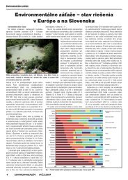
Annex I - âDescription of Workâ - Hlandata
Annex I - âDescription of Workâ - Hlandata
Annex I - âDescription of Workâ - Hlandata

You also want an ePaper? Increase the reach of your titles
YUMPU automatically turns print PDFs into web optimized ePapers that Google loves.
CIP-ICT PSP-2009-3Pilot BHLANDATAfunctionalities such as the visualization <strong>of</strong> the Land Cover / Land Use layer, the overlay <strong>of</strong> theown information to other sources, spatial and temporal analysis and downloads <strong>of</strong> the data indifferent formats.• High-level users: They carry out high-level analysis by making use <strong>of</strong> GIS tools. Possibly theservices to be created are not sufficient for their needs, but they will be able to get Land Coverand Land Use layers through downloading applications in order to incorporate them to theirGIS.As said, the potential users <strong>of</strong> the services which are going to be launched by the pilot project are theintermediate level users.Some examples <strong>of</strong> some <strong>of</strong> these users’ specific demands and <strong>of</strong> the response given to such demandscould be the following:• A request (done by these end-users to the information owners) <strong>of</strong> the Land Use and LandCover information in different formats (for example CAD). This request is in many timesdone through e-mail gateways.• In some other cases (being the Regional Administration and Regional Public Entities the endusers) Land Cover and Land Use layers are managed through desktop viewers with somelimitations regarding its non-universal use (its installation requires a commercial licence) andthe lack <strong>of</strong> spatial and temporal analysis functions and <strong>of</strong> download applications.Thanks to this pilot, the intermediate-level users will be provided some added-value services andfunctionalities allowing them to fulfil needs such as the ones described above. For example, thefunctionalities provided by the pilot project will allow the intermediate level users to make theselection <strong>of</strong> a concrete Land area in an autonomous way, making the election <strong>of</strong> the thematic variables<strong>of</strong> interest for them, allowing to process the data selected together with other data, and to thedownload and print the obtained results. In addition, the pilot project will allow making thisinformation available and to place it at the disposal <strong>of</strong> a significantly bigger amount <strong>of</strong> users.The pilot to be implemented will be based on advanced web services which will allow users to makeadvanced analysis <strong>of</strong> the Land use and Land Cover datasets with information coming from differentsources at a European level. The next are the main advanced functionalities which will be provided bythe project:• Advanced Visualization <strong>of</strong> the information layers:o Visualization <strong>of</strong> the “Land Use/Land Cover” layers to different scales thanks tozooming tools (in and out); pan; screening fine-tuning, etc.o Search and localization tool in screen <strong>of</strong> the requested land item (such as thebinoculars visor).o Surface and distance measuring tools in the screen.o Consultation tool, “Query” type, allowing to select part <strong>of</strong> the layer according to theestablished criteria and to visualize and work only with the selected area. It could bedownloaded to different formats.o Thematization <strong>of</strong> the “Land Use/Land Cover” layer by means <strong>of</strong> an attribute linked tothe layers.o Possibility <strong>of</strong> modifying the symbols <strong>of</strong> the thematic layer.o Labelling function (direct introduction <strong>of</strong> by loading a file with coordinates andassociated labels).o Editing function starting from the thematic layer including the legend, title and othertitle page items.o Thematic map printing and editing with selection <strong>of</strong> formats and output scale.o Layers’ metadata consultations.o Dynamic visualization <strong>of</strong> the Land Use layer.23/03/10 v11 13