

Coastal Resource Guide Pleasant Bay and ... - Town to Chatham
Coastal Resource Guide Pleasant Bay and ... - Town to Chatham
Coastal Resource Guide Pleasant Bay and ... - Town to Chatham

Create successful ePaper yourself
Turn your PDF publications into a flip-book with our unique Google optimized e-Paper software.
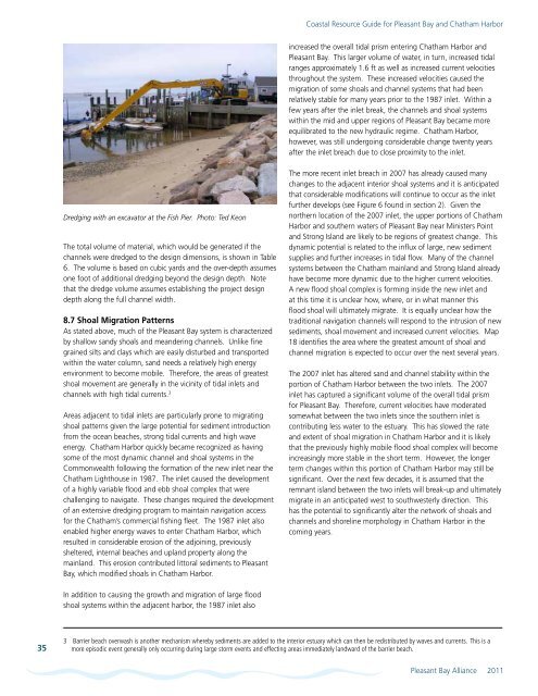
<strong>Coastal</strong> <strong>Resource</strong> <strong>Guide</strong> for <strong>Pleasant</strong> <strong>Bay</strong> <strong>and</strong> <strong>Chatham</strong> Harborincreased the overall tidal prism entering <strong>Chatham</strong> Harbor <strong>and</strong><strong>Pleasant</strong> <strong>Bay</strong>. This larger volume of water, in turn, increased tidalranges approximately 1.6 ft as well as increased current velocitiesthroughout the system. These increased velocities caused themigration of some shoals <strong>and</strong> channel systems that had beenrelatively stable for many years prior <strong>to</strong> the 1987 inlet. Within afew years after the inlet break, the channels <strong>and</strong> shoal systemswithin the mid <strong>and</strong> upper regions of <strong>Pleasant</strong> <strong>Bay</strong> became moreequilibrated <strong>to</strong> the new hydraulic regime. <strong>Chatham</strong> Harbor,however, was still undergoing considerable change twenty yearsafter the inlet breach due <strong>to</strong> close proximity <strong>to</strong> the inlet.Dredging with an excava<strong>to</strong>r at the Fish Pier. Pho<strong>to</strong>: Ted KeonThe <strong>to</strong>tal volume of material, which would be generated if thechannels were dredged <strong>to</strong> the design dimensions, is shown in Table6. The volume is based on cubic yards <strong>and</strong> the over-depth assumesone foot of additional dredging beyond the design depth. Notethat the dredge volume assumes establishing the project designdepth along the full channel width.8.7 Shoal Migration PatternsAs stated above, much of the <strong>Pleasant</strong> <strong>Bay</strong> system is characterizedby shallow s<strong>and</strong>y shoals <strong>and</strong> me<strong>and</strong>ering channels. Unlike finegrained silts <strong>and</strong> clays which are easily disturbed <strong>and</strong> transportedwithin the water column, s<strong>and</strong> needs a relatively high energyenvironment <strong>to</strong> become mobile. Therefore, the areas of greatestshoal movement are generally in the vicinity of tidal inlets <strong>and</strong>channels with high tidal currents. 3Areas adjacent <strong>to</strong> tidal inlets are particularly prone <strong>to</strong> migratingshoal patterns given the large potential for sediment introductionfrom the ocean beaches, strong tidal currents <strong>and</strong> high waveenergy. <strong>Chatham</strong> Harbor quickly became recognized as havingsome of the most dynamic channel <strong>and</strong> shoal systems in theCommonwealth following the formation of the new inlet near the<strong>Chatham</strong> Lighthouse in 1987. The inlet caused the developmen<strong>to</strong>f a highly variable flood <strong>and</strong> ebb shoal complex that werechallenging <strong>to</strong> navigate. These changes required the developmen<strong>to</strong>f an extensive dredging program <strong>to</strong> maintain navigation accessfor the <strong>Chatham</strong>’s commercial fishing fleet. The 1987 inlet alsoenabled higher energy waves <strong>to</strong> enter <strong>Chatham</strong> Harbor, whichresulted in considerable erosion of the adjoining, previouslysheltered, internal beaches <strong>and</strong> upl<strong>and</strong> property along themainl<strong>and</strong>. This erosion contributed lit<strong>to</strong>ral sediments <strong>to</strong> <strong>Pleasant</strong><strong>Bay</strong>, which modified shoals in <strong>Chatham</strong> Harbor.The more recent inlet breach in 2007 has already caused manychanges <strong>to</strong> the adjacent interior shoal systems <strong>and</strong> it is anticipatedthat considerable modifications will continue <strong>to</strong> occur as the inletfurther develops (see Figure 6 found in section 2). Given thenorthern location of the 2007 inlet, the upper portions of <strong>Chatham</strong>Harbor <strong>and</strong> southern waters of <strong>Pleasant</strong> <strong>Bay</strong> near Ministers Point<strong>and</strong> Strong Isl<strong>and</strong> are likely <strong>to</strong> be regions of greatest change. Thisdynamic potential is related <strong>to</strong> the influx of large, new sedimentsupplies <strong>and</strong> further increases in tidal flow. Many of the channelsystems between the <strong>Chatham</strong> mainl<strong>and</strong> <strong>and</strong> Strong Isl<strong>and</strong> alreadyhave become more dynamic due <strong>to</strong> the higher current velocities.A new flood shoal complex is forming inside the new inlet <strong>and</strong>at this time it is unclear how, where, or in what manner thisflood shoal will ultimately migrate. It is equally unclear how thetraditional navigation channels will respond <strong>to</strong> the intrusion of newsediments, shoal movement <strong>and</strong> increased current velocities. Map18 identifies the area where the greatest amount of shoal <strong>and</strong>channel migration is expected <strong>to</strong> occur over the next several years.The 2007 inlet has altered s<strong>and</strong> <strong>and</strong> channel stability within theportion of <strong>Chatham</strong> Harbor between the two inlets. The 2007inlet has captured a significant volume of the overall tidal prismfor <strong>Pleasant</strong> <strong>Bay</strong>. Therefore, current velocities have moderatedsomewhat between the two inlets since the southern inlet iscontributing less water <strong>to</strong> the estuary. This has slowed the rate<strong>and</strong> extent of shoal migration in <strong>Chatham</strong> Harbor <strong>and</strong> it is likelythat the previously highly mobile flood shoal complex will becomeincreasingly more stable in the short term. However, the longerterm changes within this portion of <strong>Chatham</strong> Harbor may still besignificant. Over the next few decades, it is assumed that theremnant isl<strong>and</strong> between the two inlets will break-up <strong>and</strong> ultimatelymigrate in an anticipated west <strong>to</strong> southwesterly direction. Thishas the potential <strong>to</strong> significantly alter the network of shoals <strong>and</strong>channels <strong>and</strong> shoreline morphology in <strong>Chatham</strong> Harbor in thecoming years.In addition <strong>to</strong> causing the growth <strong>and</strong> migration of large floodshoal systems within the adjacent harbor, the 1987 inlet also353 Barrier beach overwash is another mechanism whereby sediments are added <strong>to</strong> the interior estuary which can then be redistributed by waves <strong>and</strong> currents. This is amore episodic event generally only occurring during large s<strong>to</strong>rm events <strong>and</strong> effecting areas immediately l<strong>and</strong>ward of the barrier beach.<strong>Pleasant</strong> <strong>Bay</strong> Alliance 2011


