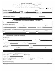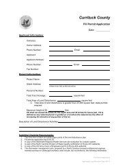
Administrative Adjustment - Currituck County Government
Administrative Adjustment - Currituck County Government
Administrative Adjustment - Currituck County Government

You also want an ePaper? Increase the reach of your titles
YUMPU automatically turns print PDFs into web optimized ePapers that Google loves.
after ocean over wash or periods of heavy rains that my impede access to the individual home sites.It is the sole responsibility of the owners to provide an improved access to their properties.”14. Stormwater Improvements Engineer CertificationIn the subdivision entitled, stormwater drainage improvements have been installed(1) according to plans and specifications prepared by , or (2) according to the as-built plansubmitted by. <strong>Currituck</strong> <strong>County</strong> assumes no responsibility for the esign,maintenance, or the guaranteed performance of the storm water drainage improvements and theireffects.Date Registered Land Surveyor/Civil Engineer Registration Number15. Stormwater StatementNo more than %* of any lot shall be covered by impervious structures and materials, includingasphalt, gravel, concrete, brick stone, slate, or similar material, not including wood decking or thewater surface of swimming pools. This covenant is intended to ensure compliance with theStormwater Permit number issued by the State of North Carolina. The covenant may not bechanged or deleted without the consent of the State. Filling in or piping of any vegetativeconveyances (ditches, swales, etc.) associated with this development, except for average drivewaycrossings, is strictly prohibited by any person. The lot coverage allowance provided in the <strong>Currituck</strong><strong>County</strong> UDO may be different than the NC State Stormwater Permit . The most restrictive lotcoverage shall apply.16. Survey and Accuracy CertificateI hereby certify that this map (drawn by me) (drawn under my supervision) from (an actual surveymade by me) (an actual survey made under my supervision) (a deed description recorded in Book, Page of the <strong>County</strong> Registry) (other); that the error of closure as calculated bylatitudes and departures is 1: ; that the boundaries not surveyed are shown as broken linesplotted from information found in Book , Page and that this map wasprepared in accordance with G. S. 47-30, as amended. Witness my original signature, registrationnumber and seal this day of 20 _.(Seal or Stamp)Registered Land SurveyorRegistration Number___ The survey creates a subdivision of land in an area covered by a subdivision ordinance.___ The survey is of land in an unregulated area.___ The survey is of an existing parcel or parcels and does not create a new street or change inan existing street.___ The survey is of another category, such as the recombination of existing parcels or a courtorderedsurvey, or other exception to the definition of a subdivision.From the information available, the surveyor is unable to make a determination of the aboveprovisions.17. Wetlands StatementProperty on this plat may contain 404 wetlands and may require U.S. Corp of Engineers approvalprior to development of the property.<strong>Administrative</strong> ManualPage 3.21Major Subdivision Staff Review ChecklistPage 9 of 9