Proposed Limpopo West Mine Concept Study ... - SRK Consulting
Proposed Limpopo West Mine Concept Study ... - SRK Consulting
Proposed Limpopo West Mine Concept Study ... - SRK Consulting
Create successful ePaper yourself
Turn your PDF publications into a flip-book with our unique Google optimized e-Paper software.
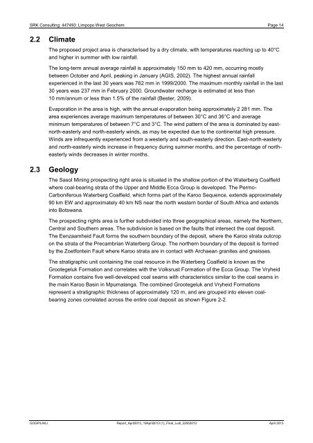
<strong>SRK</strong> <strong>Consulting</strong>: 447493: <strong>Limpopo</strong> <strong>West</strong> Geochem Page 142.2 ClimateThe proposed project area is characterised by a dry climate, with temperatures reaching up to 40°Cand higher in summer with low rainfall.The long-term annual average rainfall is approximately 150 mm to 420 mm, occurring mostlybetween October and April, peaking in January (AGIS, 2002). The highest annual rainfallexperienced in the last 30 years was 762 mm in 1999/2000. The maximum monthly rainfall in the last30 years was 237 mm in February 2000. Groundwater recharge is estimated at less than10 mm/annum or less than 1.5% of the rainfall (Bester, 2009).Evaporation in the area is high, with the annual evaporation being approximately 2 281 mm. Thearea experiences average maximum temperatures of between 30°C and 36°C and averageminimum temperatures of between 7°C and 3°C. The wind pattern of the area is dominated by eastnorth-easterlyand north-easterly winds, as may be expected due to the continental high pressure.Winds are infrequently experienced from a westerly and south-easterly direction. East-north-easterlyand north-easterly winds increase in frequency during summer months, and the percentage of northeasterlywinds decreases in winter months.2.3 GeologyThe Sasol Mining prospecting right area is situated in the shallow portion of the Waterberg Coalfieldwhere coal-bearing strata of the Upper and Middle Ecca Group is developed. The Permo-Carboniferous Waterberg Coalfield, which forms part of the Karoo Sequence, extends approximately90 km EW and approximately 40 km NS near the north western border of South Africa and extendsinto Botswana.The prospecting rights area is further subdivided into three geographical areas, namely the Northern,Central and Southern areas. The subdivision is based on the faults that intersect the coal deposit.The Eenzaamheid Fault forms the southern boundary of the deposit, where the Karoo strata outcropon the strata of the Precambrian Waterberg Group. The northern boundary of the deposit is formedby the Zoetfontein Fault where Karoo strata are in contact with Archaean granites and gneisses.The stratigraphic unit containing the coal resource in the Waterberg Coalfield is known as theGrootegeluk Formation and correlates with the Volksrust Formation of the Ecca Group. The VryheidFormation contains five well-developed coal seams with characteristics similar to the coal seams inthe main Karoo Basin in Mpumalanga. The combined Grootegeluk and Vryheid Formationsrepresent a stratigraphic thickness of approximately 120 m, and are grouped into eleven coalbearingzones correlated across the entire coal deposit as shown Figure 2-2.GOGP/LAKJ Report_April2013_19April2013 (1)_Final_Ludi_22052013 April 2013


