Proposed Limpopo West Mine Concept Study ... - SRK Consulting
Proposed Limpopo West Mine Concept Study ... - SRK Consulting
Proposed Limpopo West Mine Concept Study ... - SRK Consulting
You also want an ePaper? Increase the reach of your titles
YUMPU automatically turns print PDFs into web optimized ePapers that Google loves.
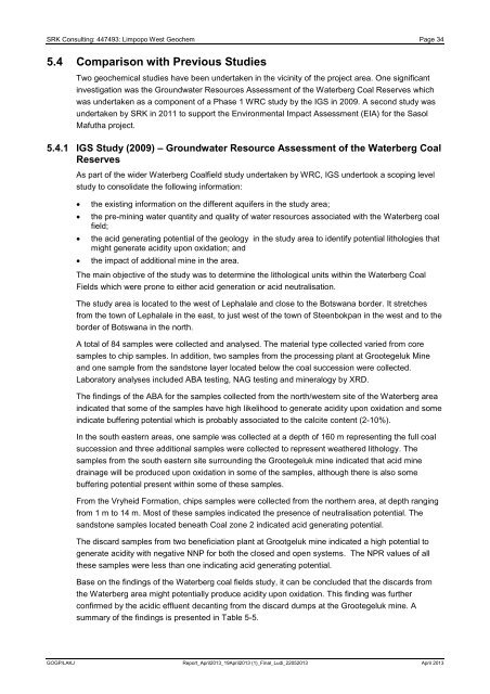
<strong>SRK</strong> <strong>Consulting</strong>: 447493: <strong>Limpopo</strong> <strong>West</strong> Geochem Page 345.4 Comparison with Previous StudiesTwo geochemical studies have been undertaken in the vicinity of the project area. One significantinvestigation was the Groundwater Resources Assessment of the Waterberg Coal Reserves whichwas undertaken as a component of a Phase 1 WRC study by the IGS in 2009. A second study wasundertaken by <strong>SRK</strong> in 2011 to support the Environmental Impact Assessment (EIA) for the SasolMafutha project.5.4.1 IGS <strong>Study</strong> (2009) – Groundwater Resource Assessment of the Waterberg CoalReservesAs part of the wider Waterberg Coalfield study undertaken by WRC, IGS undertook a scoping levelstudy to consolidate the following information:the existing information on the different aquifers in the study area;the pre-mining water quantity and quality of water resources associated with the Waterberg coalfield;the acid generating potential of the geology in the study area to identify potential lithologies thatmight generate acidity upon oxidation; andthe impact of additional mine in the area.The main objective of the study was to determine the lithological units within the Waterberg CoalFields which were prone to either acid generation or acid neutralisation.The study area is located to the west of Lephalale and close to the Botswana border. It stretchesfrom the town of Lephalale in the east, to just west of the town of Steenbokpan in the west and to theborder of Botswana in the north.A total of 84 samples were collected and analysed. The material type collected varied from coresamples to chip samples. In addition, two samples from the processing plant at Grootegeluk <strong>Mine</strong>and one sample from the sandstone layer located below the coal succession were collected.Laboratory analyses included ABA testing, NAG testing and mineralogy by XRD.The findings of the ABA for the samples collected from the north/western site of the Waterberg areaindicated that some of the samples have high likelihood to generate acidity upon oxidation and someindicate buffering potential which is probably associated to the calcite content (2-10%).In the south eastern areas, one sample was collected at a depth of 160 m representing the full coalsuccession and three additional samples were collected to represent weathered lithology. Thesamples from the south eastern site surrounding the Grootegeluk mine indicated that acid minedrainage will be produced upon oxidation in some of the samples, although there is also somebuffering potential present within some of these samples.From the Vryheid Formation, chips samples were collected from the northern area, at depth rangingfrom 1 m to 14 m. Most of these samples indicated the presence of neutralisation potential. Thesandstone samples located beneath Coal zone 2 indicated acid generating potential.The discard samples from two beneficiation plant at Grootgeluk mine indicated a high potential togenerate acidity with negative NNP for both the closed and open systems. The NPR values of allthese samples were less than one indicating acid generating potential.Base on the findings of the Waterberg coal fields study, it can be concluded that the discards fromthe Waterberg area might potentially produce acidity upon oxidation. This finding was furtherconfirmed by the acidic effluent decanting from the discard dumps at the Grootegeluk mine. Asummary of the findings is presented in Table 5-5.GOGP/LAKJ Report_April2013_19April2013 (1)_Final_Ludi_22052013 April 2013


