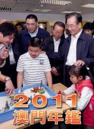
- Page 3 and 4:
Cover: The New Hengqin Campus of th
- Page 6:
Editor’s noteEditor’s noteThe M
- Page 9 and 10:
Macao Yearbook 201311. Media, Commu
- Page 11 and 12:
Macao Yearbook 2013Population and H
- Page 13 and 14:
Macao Yearbook 2013Standing Council
- Page 15 and 16:
Macao Yearbook 2013Long-term mechan
- Page 18 and 19:
Administrative Priorities in 2013To
- Page 20 and 21:
Administrative Priorities in 201340
- Page 22:
CALENDAR OF EVENTSIN 2012
- Page 25 and 26:
Macao Yearbook 2013February4 Chief
- Page 27 and 28:
Macao Yearbook 201310 A new round o
- Page 29 and 30:
Macao Yearbook 201326 Chief Executi
- Page 31 and 32:
Macao Yearbook 2013The verdict in t
- Page 33 and 34:
Macao Yearbook 2013transport servic
- Page 35 and 36:
Macao Yearbook 201313 Chief Executi
- Page 37 and 38:
Macao Yearbook 201316 Guangdong and
- Page 39 and 40:
Macao Yearbook 2013controversial pr
- Page 41 and 42:
Macao Yearbook 2013on the Sai Van L
- Page 43 and 44:
Macao Yearbook 201317 The second pl
- Page 45 and 46:
Macao Yearbook 201321 DecemberPremi
- Page 47 and 48:
Macao Yearbook 20138 MarchChief Exe
- Page 49 and 50:
Macao Yearbook 201319 SeptemberThe
- Page 51 and 52:
Macao Yearbook 201319 JanuarySelect
- Page 53 and 54:
Macao Yearbook 201330 AprilThe Budd
- Page 55 and 56:
Macao Yearbook 201324 JulyTyphoon V
- Page 57 and 58:
Macao Yearbook 2013
- Page 60 and 61:
Overview of the Macao Special Admin
- Page 62 and 63:
Overview of the Macao Special Admin
- Page 64 and 65:
Overview of the Macao Special Admin
- Page 66 and 67:
Overview of the Macao Special Admin
- Page 68 and 69:
Overview of the Macao Special Admin
- Page 70 and 71:
Overview of the Macao Special Admin
- Page 72 and 73:
Overview of the Macao Special Admin
- Page 74 and 75:
Overview of the Macao Special Admin
- Page 76 and 77:
Overview of the Macao Special Admin
- Page 78 and 79:
Overview of the Macao Special Admin
- Page 80 and 81:
Overview of the Macao Special Admin
- Page 82 and 83:
Overview of the Macao Special Admin
- Page 84 and 85:
Overview of the Macao Special Admin
- Page 86 and 87:
Overview of the Macao Special Admin
- Page 88 and 89:
Overview of the Macao Special Admin
- Page 90 and 91:
Overview of the Macao Special Admin
- Page 92:
POLITICAL SYSTEM AND ADMINISTRATION
- Page 95 and 96:
Macao Yearbook 2013and the MSAR.The
- Page 97 and 98:
Macao Yearbook 2013them are elected
- Page 99 and 100:
Macao Yearbook 2013In indirect elec
- Page 101 and 102:
Macao Yearbook 2013- Law of the Peo
- Page 103 and 104:
Macao Yearbook 2013In addition, the
- Page 105 and 106:
Macao Yearbook 2013rights, freedom,
- Page 107 and 108:
Macao Yearbook 2013In 2012, the off
- Page 109 and 110:
Macao Yearbook 2013during the Chine
- Page 111 and 112:
Macao Yearbook 201398 and 99 of the
- Page 113 and 114:
Macao Yearbook 2013Award of Decorat
- Page 115 and 116:
Macao Yearbook 2013Office for Perso
- Page 117 and 118:
Macao Yearbook 2013114
- Page 119 and 120:
Macao Yearbook 2013
- Page 122 and 123:
The Legal System and the JudiciaryT
- Page 124 and 125:
The Legal System and the JudiciaryP
- Page 126 and 127:
The Legal System and the Judiciary3
- Page 128 and 129:
The Legal System and the Judiciaryp
- Page 130 and 131:
The Legal System and the Judiciary
- Page 132 and 133:
The Legal System and the JudiciaryT
- Page 134 and 135:
The Legal System and the Judiciaryt
- Page 136 and 137:
The Legal System and the JudiciaryR
- Page 138:
EXTERNAL RELATIONS
- Page 141 and 142:
Macao Yearbook 2013of China were on
- Page 143 and 144:
Macao Yearbook 2013●●●●●
- Page 145 and 146:
Macao Yearbook 2013to the Council a
- Page 147 and 148:
Macao Yearbook 2013attended the eve
- Page 149 and 150:
Macao Yearbook 2013
- Page 152 and 153:
EconomyEconomyAlthough Macao has a
- Page 154 and 155:
EconomyCoverage of Interest Subsidy
- Page 156 and 157:
EconomyThe Banking SystemThe primar
- Page 158 and 159:
Economylinked insurance products to
- Page 160 and 161:
EconomyUnemployment and Underemploy
- Page 162 and 163:
Economythe general comprehensive go
- Page 164 and 165:
EconomyTaxable annual revenueRevenu
- Page 166 and 167:
EconomyRegistered Auditors and Acco
- Page 168 and 169:
EconomyMacao and mainland China.Int
- Page 170 and 171:
Economyspeaking Countries - Sal Isl
- Page 172 and 173:
Economy• Species regulated by the
- Page 174 and 175:
Economytrademarks; the names and lo
- Page 176 and 177:
EconomyMonetary PolicyCapital flows
- Page 178 and 179:
Economyeconomic authorities of the
- Page 180 and 181:
Economyincentives for operating an
- Page 182 and 183:
Economy1. Continuing Development Se
- Page 184 and 185:
EconomyResurgence of Qipao Fashion
- Page 186 and 187:
Economy• To help enterprises prof
- Page 188 and 189:
EconomyStatistics on Vocational Tra
- Page 190 and 191:
EconomySkills EvaluationIn 2012, th
- Page 192 and 193:
EconomyIn 2012 the Labour Inspectio
- Page 194 and 195:
Economy(Cont.)Unit in chargeSite in
- Page 196 and 197:
EconomyOf these applications, 15,36
- Page 198 and 199:
Economyprotection, the council has
- Page 200 and 201:
EconomyCooperation between China an
- Page 202 and 203:
EconomyFashion ShowFashion Design a
- Page 204 and 205:
Economy201
- Page 206:
THE GAMING INDUSTRY
- Page 209 and 210:
Macao Yearbook 2013Under its franch
- Page 211 and 212:
Macao Yearbook 2013and conducting r
- Page 213 and 214:
Macao Yearbook 2013As a result of m
- Page 215 and 216:
Macao Yearbook 2013cooperation with
- Page 217 and 218:
Macao Yearbook 2013analysed and exa
- Page 219 and 220:
Macao Yearbook 2013Enhancingcompeti
- Page 221 and 222:
Macao Yearbook 2013
- Page 224 and 225:
TourismTourismTourism is the backbo
- Page 226 and 227:
TourismIn 2012, 9,122,332 tourists
- Page 228 and 229:
TourismInformation CountersThe MGTO
- Page 230 and 231:
TourismIn the main chapel stands a
- Page 232 and 233:
Tourismand backgrounds they represe
- Page 234 and 235:
TourismThe Formula Three race of th
- Page 236 and 237:
TourismGrand Prix MuseumThe Grand P
- Page 238:
PUBLIC ORDER
- Page 241 and 242:
Macao Yearbook 2013and arranges for
- Page 243 and 244:
Macao Yearbook 2013Public Security
- Page 245 and 246:
Macao Yearbook 2013ambulance team c
- Page 247 and 248:
Macao Yearbook 2013Handling Enquiri
- Page 249 and 250:
Macao Yearbook 2013Returning to Soc
- Page 251 and 252:
Macao Yearbook 2013Police Dog TeamE
- Page 253 and 254:
Macao Yearbook 2013
- Page 256 and 257:
EducationEducationSince its establi
- Page 258 and 259:
EducationThe Government further inc
- Page 260 and 261:
Educationthe Secondary Students Pop
- Page 262 and 263:
EducationIn 2012, the DSEJ organise
- Page 264 and 265:
Educationtertiary students were als
- Page 266 and 267:
Educationof Humanities and Social S
- Page 268 and 269:
EducationNew Hengqin Campusof the U
- Page 270 and 271:
Education267
- Page 272:
CULTURE AND SPORTS
- Page 275 and 276:
Macao Yearbook 2013Festival partici
- Page 277 and 278:
Macao Yearbook 2013Affairs Bureau l
- Page 279 and 280:
Macao Yearbook 2013Urban Park and i
- Page 281 and 282:
Macao Yearbook 2013the years, inclu
- Page 283 and 284:
Macao Yearbook 2013the play New Ten
- Page 285 and 286:
Macao Yearbook 2013complex theatre,
- Page 287 and 288:
Macao Yearbook 2013such as the Work
- Page 289 and 290:
Macao Yearbook 2013At the centre of
- Page 291 and 292: Macao Yearbook 2013288
- Page 294 and 295: Health and Social WelfareHealth and
- Page 296 and 297: Health and Social WelfareExpenses f
- Page 298 and 299: Health and Social Welfareoffer vari
- Page 300 and 301: Health and Social WelfareGreen Week
- Page 302 and 303: Health and Social Welfarepersonnel
- Page 304 and 305: Health and Social WelfareSocial Wel
- Page 306 and 307: Health and Social Welfare80,000 vol
- Page 308 and 309: Health and Social Welfare305
- Page 310: MEDIA, COMMUNICATIONS AND INFORMATI
- Page 313 and 314: Macao Yearbook 2013to provide satel
- Page 315 and 316: Macao Yearbook 2013academic institu
- Page 317 and 318: Macao Yearbook 2013Legislative Asse
- Page 319 and 320: Macao Yearbook 2013- High-priority
- Page 321 and 322: Macao Yearbook 2013Telecomunicacoes
- Page 323 and 324: Macao Yearbook 20131798, when sea m
- Page 325 and 326: Macao Yearbook 20132012, more than
- Page 327 and 328: Macao Yearbook 2013324
- Page 329 and 330: Macao Yearbook 2013
- Page 332 and 333: Land, Infrastructure, Housing and P
- Page 334 and 335: Land, Infrastructure, Housing and P
- Page 336 and 337: Land, Infrastructure, Housing and P
- Page 338 and 339: Land, Infrastructure, Housing and P
- Page 340 and 341: Land, Infrastructure, Housing and P
- Page 344 and 345: Land, Infrastructure, Housing and P
- Page 346 and 347: Land, Infrastructure, Housing and P
- Page 348 and 349: Land, Infrastructure, Housing and P
- Page 350 and 351: Land, Infrastructure, Housing and P
- Page 352 and 353: Land, Infrastructure, Housing and P
- Page 354: TRANSPORT
- Page 357 and 358: Macao Yearbook 2013transportation s
- Page 359 and 360: Macao Yearbook 2013(Cont.)Public Ca
- Page 361 and 362: Macao Yearbook 2013Cross-border Tra
- Page 363 and 364: Macao Yearbook 2013To streamline th
- Page 365 and 366: Macao Yearbook 2013repairs, it is r
- Page 367 and 368: Macao Yearbook 2013(Cont.)Signatori
- Page 369 and 370: Macao Yearbook 2013The main fire st
- Page 371 and 372: Macao Yearbook 2013Public bus servi
- Page 373 and 374: Macao Yearbook 2013
- Page 376 and 377: Geography, Environment and Populati
- Page 378 and 379: Geography, Environment and Populati
- Page 380 and 381: Geography, Environment and Populati
- Page 382 and 383: Geography, Environment and Populati
- Page 384 and 385: Geography, Environment and Populati
- Page 386 and 387: Geography, Environment and Populati
- Page 388 and 389: Geography, Environment and Populati
- Page 390 and 391: Geography, Environment and Populati
- Page 392 and 393:
Geography, Environment and Populati
- Page 394 and 395:
Geography, Environment and Populati
- Page 396 and 397:
Geography, Environment and Populati
- Page 398 and 399:
Geography, Environment and Populati
- Page 400 and 401:
Geography, Environment and Populati
- Page 402 and 403:
Geography, Environment and Populati
- Page 404 and 405:
Geography, Environment and Populati
- Page 406:
RELIGION AND CUSTOMS
- Page 409 and 410:
Macao Yearbook 2013There are more t
- Page 411 and 412:
Macao Yearbook 20131990, and compri
- Page 413 and 414:
Macao Yearbook 2013Feast of the Imm
- Page 415 and 416:
Macao Yearbook 2013412
- Page 418 and 419:
HistoryHistoryMacao Has Been Part o
- Page 420 and 421:
Historyand the Prime Minister of th
- Page 422 and 423:
HistoryMandarin’s HouseThe Mandar
- Page 424:
WINNERS OF THE “PRECIOUS MOMENTS
- Page 427 and 428:
Macao Yearbook 2013424
- Page 430 and 431:
AppendicesAppendix 1Principal Offic
- Page 432 and 433:
AppendicesAppendix 3Members of the
- Page 434 and 435:
AppendicesSecretary:Members:Mr Ung
- Page 436 and 437:
AppendicesMr Chan Wai ChiMr Tong Io
- Page 438 and 439:
AppendicesMs Ip Sio FanMs Kan Cheng
- Page 440 and 441:
AppendicesMs Leong Vai ChengMs Chon
- Page 442 and 443:
AppendicesOffice of the Secretary f
- Page 444 and 445:
AppendicesCourt of First InstanceLo
- Page 446 and 447:
AppendicesUnitary Police ServiceCom
- Page 448 and 449:
AppendicesPolicy Research OfficeDir
- Page 450 and 451:
AppendicesMacao Economic and Trade
- Page 452 and 453:
AppendicesReal Estate RegistryRegis
- Page 454 and 455:
AppendicesLaw Reform and Internatio
- Page 456 and 457:
AppendicesStatistics and Census Ser
- Page 458 and 459:
AppendicesSupporting Office to the
- Page 460 and 461:
AppendicesMacao PrisonDirector: Mr
- Page 462 and 463:
AppendicesGovernment Tourist Office
- Page 464 and 465:
AppendicesMacau Grand Prix Committe
- Page 466 and 467:
AppendicesCartography and Cadastre
- Page 468 and 469:
AppendicesTransport BureauDirector:
- Page 470 and 471:
AppendicesAppendix 7Representative
- Page 472 and 473:
AppendicesAustraliaAddress: Level 1
- Page 474 and 475:
AppendicesAppendix 8Countries Exerc
- Page 476 and 477:
AppendicesCountryEuropeMacao SAR Pa
- Page 478 and 479:
AppendicesCountryAmericaMacao SAR P
- Page 480 and 481:
AppendicesAppendix 10Countries/Terr
- Page 482 and 483:
AppendicesEurope(Cont.)CountrySwede
- Page 484 and 485:
AppendicesAppendix 11Multilateral T
- Page 486 and 487:
AppendicesIV - Economic and Financi
- Page 488 and 489:
AppendicesChemicals and Pesticides
- Page 490 and 491:
Appendices97. Protocol on Prohibiti
- Page 492 and 493:
Appendices128. International Covena
- Page 494 and 495:
AppendicesArticles Revision Convent
- Page 496 and 497:
Appendices183. Convention concernin
- Page 498 and 499:
Appendices213. Protocol of 1978 rel
- Page 500 and 501:
Appendices243. General Regulations
- Page 502 and 503:
Appendices(* 1 ) Not yet in force i
- Page 504 and 505:
AppendicesMedal of Merit - Educatio
- Page 506 and 507:
AppendicesAppendix 13Macao SAR Budg
- Page 508 and 509:
AppendicesAppendix 14External Trade
- Page 510 and 511:
AppendicesAppendix 16Exports to Maj
- Page 512 and 513:
AppendicesAppendix 18Tourism Statis
- Page 514 and 515:
AppendicesAppendix 20Statistics on
- Page 516 and 517:
AppendicesAppendix 22Monetary and F
- Page 518 and 519:
AppendicesAppendix 24Public Finance
- Page 520 and 521:
AppendicesStock, Flows and Income o
- Page 522 and 523:
AppendicesAppendix 27Demographic St
- Page 524 and 525:
AppendicesAppendix 29Labour and Emp
- Page 526 and 527:
AppendicesLabour and Employment Sta
- Page 528 and 529:
AppendicesAppendix 31Statistics on
- Page 530 and 531:
AppendicesAppendix 33Regular and Co
- Page 532 and 533:
AppendicesAppendix 35Transport Stat
- Page 534 and 535:
AppendicesAppendix 36Communications
- Page 536 and 537:
AppendicesLiquid and Gaseous Fuel S
- Page 539 and 540:
Macao Yearbook Editorial TeamChief
- Page 541 and 542:
HE ZHOUGUANG XIQING YUANHE YUANWU Z