The First International Conference on Marine Mammal Protected Areas
The First International Conference on Marine Mammal Protected Areas
The First International Conference on Marine Mammal Protected Areas

You also want an ePaper? Increase the reach of your titles
YUMPU automatically turns print PDFs into web optimized ePapers that Google loves.
• Important issues for possible MMPA database design and management issues<br />
are: the requirement for minimum core fields; determining who will manage and<br />
update the database; making it simple for people to c<strong>on</strong>tribute to; and keeping up<br />
with technological advances.<br />
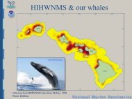
• Globally, cetacean “hotspots” do not often overlap with existing MPAs,<br />
particularly <strong>on</strong> the high seas but also in nati<strong>on</strong>al waters. <str<strong>on</strong>g>The</str<strong>on</strong>g> workshop<br />
c<strong>on</strong>cluded that <strong>on</strong>ly a tiny percentage of the world’s critical habitat for cetaceans<br />
is effectively protected in MPAs.<br />
Strategies for identifying critical habitat for cetaceans: from GAM-based spatial modeling to mapping<br />
areas of overlap between wildlife and anthropogenic activities<br />
Rob Williams<br />
• A number of opti<strong>on</strong>s are available for researchers aiming to identify high-density<br />
or preferred habitats for cetaceans, ranging from opportunistic sightings<br />
databases to density surface modeling from systematically collected line transect<br />
survey data. Each method has its strengths and weaknesses. Generally (but not<br />
always), there is a tradeoff between cost of data acquisiti<strong>on</strong> and the ability to<br />
make sound inferences from the sample. Studies that aim to estimate distributi<strong>on</strong><br />
can benefit from being designed in the c<strong>on</strong>text of estimating abundance, because<br />
<strong>on</strong>e aspect of the habitat’s “criticalness” demands an estimate of populati<strong>on</strong> size<br />
– i.e., <strong>on</strong>e metric of habitat importance is a measure of the proporti<strong>on</strong> of the<br />
populati<strong>on</strong> that uses it.<br />
• Low-cost, small-boat surveys can be used to collect data <strong>on</strong> distributi<strong>on</strong> and<br />
abundance, but close attenti<strong>on</strong> needs to be paid to survey design and protocols.<br />
It is always preferable to follow a systematic rather than haphazard design,<br />
especially when the area is new to science. Time invested at the design stage<br />
saves time at the analysis stage and usually results in gains in precisi<strong>on</strong> and<br />
statistical power. For example, the results of <strong>on</strong>e low-cost, small-boat survey in<br />
British Columbia (BC) (for which 10% of the overall budget was allocated to<br />
survey design) produced line transect and mark-recapture estimates of abundance<br />
that compared well with the estimates derived from annual censuses by the<br />
Department of Fisheries and Oceans.<br />
• Recording behavior as well as sighting locati<strong>on</strong>s makes it possible to identify not<br />
<strong>on</strong>ly the area used preferentially by the animals, but also the subset of habitat<br />
they use for different behavior and the type of behavior in which they are most<br />
vulnerable to human activities.<br />
• Social, cultural, political, and ec<strong>on</strong>omic factors should be taken into account<br />
when designing MMPAs. In the case of Robs<strong>on</strong> Bight (a killer whale sanctuary in<br />
BC), the process of identifying and protecting the habitat was driven by the local<br />
whalewatching and research communities.<br />
• Combining data <strong>on</strong> habitat use by cetaceans with data <strong>on</strong> human activities and<br />
threats can help elucidate critical habitat (e.g., overlap between GAM-based<br />
density surface models and data <strong>on</strong> shipping intensity was used to identify areas<br />
where cetaceans are most susceptible to ship strikes and oil spills).<br />
ICMMPA <str<strong>on</strong>g>C<strong>on</strong>ference</str<strong>on</strong>g> Proceedings<br />
67