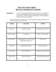
Action Plan for the Town of Chatham Ponds
rev 3a report.pdf - Town to Chatham
rev 3a report.pdf - Town to Chatham

You also want an ePaper? Increase the reach of your titles
YUMPU automatically turns print PDFs into web optimized ePapers that Google loves.
List <strong>of</strong> Tables<br />
Page<br />
Table 1. Data Sources Used to Develop <strong>Chatham</strong> <strong>Ponds</strong> <strong>Action</strong> <strong>Plan</strong> ............................... 5<br />
Table 2. Trophic State and Indicator Parameters............................................................. 7<br />
Table 3. Ecoregional Criteria ........................................................................................ 7<br />
Table 4. Status <strong>of</strong> <strong>Chatham</strong> <strong>Ponds</strong>, based on Ecoregional Criteria .................................... 8<br />
Table 5. Summary <strong>of</strong> Physical Characteristics: <strong>Chatham</strong> <strong>Ponds</strong> ..................................... 10<br />
Table 6. Potential <strong>for</strong> Sediment Phosphorus to Enter Photic Zone during Summer .......... 12<br />
Table 7. Summary <strong>of</strong> Trophic State Parameters, <strong>Chatham</strong> <strong>Ponds</strong> ................................... 13<br />
Table 8. Summary <strong>of</strong> Current Water Quality Conditions and Use Attainment ................. 13<br />
Table 9. Nitrogen: Phosphorus Ratios, <strong>Chatham</strong> Freshwater <strong>Ponds</strong> ................................ 15<br />
Table 10. Summary <strong>of</strong> Major Findings and Recommendations <strong>for</strong> <strong>Chatham</strong> <strong>Ponds</strong> ........... 17<br />
List <strong>of</strong> Figures<br />
Page<br />
Figure 1. Freshwater <strong>Ponds</strong>, <strong>Town</strong> <strong>of</strong> <strong>Chatham</strong>, MA. ....................................................... 2<br />
Figure 2. Algal bloom in Perch Pond (left) and clear waters <strong>of</strong> White Pond (right) ............. 3<br />
Figure 3. Aerial photograph <strong>of</strong> Goose Pond illustrating hydrologic isolation <strong>of</strong><br />
kettle ponds..................................................................................................... 4<br />
Figure 4. Maximum Depth and Extent <strong>of</strong> Anoxia ........................................................... 11