Weather and Climate Extremes in a Changing Climate. Regions of ...
Weather and Climate Extremes in a Changing Climate. Regions of ...
Weather and Climate Extremes in a Changing Climate. Regions of ...

You also want an ePaper? Increase the reach of your titles
YUMPU automatically turns print PDFs into web optimized ePapers that Google loves.
to calibrate aga<strong>in</strong>st exist<strong>in</strong>g techniques, <strong>and</strong><br />
with poor documentation where such calibrations<br />
were done. Thus the available tropical<br />
cyclone data conta<strong>in</strong> an <strong>in</strong>homogeneous mix <strong>of</strong><br />
changes <strong>in</strong> quality <strong>of</strong> observ<strong>in</strong>g systems, report<strong>in</strong>g<br />
policies, <strong>and</strong> the methods utilized to analyze<br />
the data. As one example, the Dvorak technique<br />
– a subjective method that is rout<strong>in</strong>ely applied<br />
<strong>in</strong> all ocean bas<strong>in</strong>s to estimate tropical cyclone<br />
<strong>in</strong>tensity us<strong>in</strong>g satellite imagery – was not<br />
<strong>in</strong>troduced until the early 1970s <strong>and</strong> has evolved<br />
markedly s<strong>in</strong>ce then. The technique orig<strong>in</strong>ally<br />
utilized visible satellite imagery <strong>and</strong> was based<br />
on subjective pattern recognition. At that time,<br />
<strong>in</strong>tensity estimates could only be made dur<strong>in</strong>g<br />
daylight hours. In the early- to mid 1980s, the<br />
Dvorak technique was significantly modified to<br />
<strong>in</strong>clude digital <strong>in</strong>frared satellite imagery (which<br />
is available 24 hours per day), <strong>and</strong> has become<br />
the de facto method for estimat<strong>in</strong>g <strong>in</strong>tensity <strong>in</strong><br />
the absence <strong>of</strong> aircraft reconnaissance. (See<br />
Chapter 4 for suggested measures to improve<br />
consistency).<br />
Insufficient efforts <strong>in</strong> re-exam<strong>in</strong><strong>in</strong>g <strong>and</strong> quality<br />
controll<strong>in</strong>g the tropical cyclone record on a year<br />
to year basis, particularly outside the Atlantic<br />
<strong>and</strong> eastern North Pacific regions, have resulted<br />
<strong>in</strong> substantial uncerta<strong>in</strong>ties when us<strong>in</strong>g best<br />
track data to calculate changes over time. Efforts<br />
are ongo<strong>in</strong>g to reanalyze the historic best<br />
track data, but such a posteriori reanalyses are<br />
less than optimal because not all <strong>of</strong> the orig<strong>in</strong>al<br />
data that the best track was based on are readily<br />
available.<br />
Compared to earlier periods, tropical cyclonecounts<br />
are acceptable for application to<br />
long-term trend studies back to about 1945 <strong>in</strong><br />
the Atlantic <strong>and</strong> 1970 <strong>in</strong> the Eastern Pacific<br />
(e.g., Holl<strong>and</strong> <strong>and</strong> Webster, 2007 <strong>and</strong> references<br />
there<strong>in</strong>), <strong>and</strong> back to about 1975 for the Western<br />
<strong>and</strong> Southern Pacific bas<strong>in</strong>s, thanks to earthorbit<strong>in</strong>g<br />
satellites (e.g., Holl<strong>and</strong>, 1981). Until<br />
the launch <strong>of</strong> MeteoSat-7 <strong>in</strong> 1998, the Indian<br />
Oceans were seen only obliquely, but storm<br />
counts may still be expected to be accurate<br />
after 1977. In earlier periods, it is more likely<br />
that storms could be missed entirely, especially<br />
if they did not pass near ships at sea or l<strong>and</strong><br />
masses. For the North Atlantic, it is likely that<br />
up to 3 storms per year were miss<strong>in</strong>g before<br />
1900, dropp<strong>in</strong>g to zero by the early 1960s<br />
<strong>Weather</strong> <strong>and</strong> <strong>Climate</strong> <strong>Extremes</strong> <strong>in</strong> a Chang<strong>in</strong>g <strong>Climate</strong><br />
<strong>Regions</strong> <strong>of</strong> Focus: North America, Hawaii, Caribbean, <strong>and</strong> U.S. Pacific Isl<strong>and</strong>s<br />
(Holl<strong>and</strong> <strong>and</strong> Webster, 2007; Chang <strong>and</strong> Guo,<br />
2007). Estimates <strong>of</strong> the duration <strong>of</strong> storms are<br />
considered to be less reliable prior to the 1970s<br />
due particularly to a lack <strong>of</strong> good <strong>in</strong>formation<br />
on their time <strong>of</strong> genesis. S<strong>in</strong>ce the 1970s, storms<br />
were more accurately tracked throughout their<br />
lifetimes by geostationary satellites.<br />
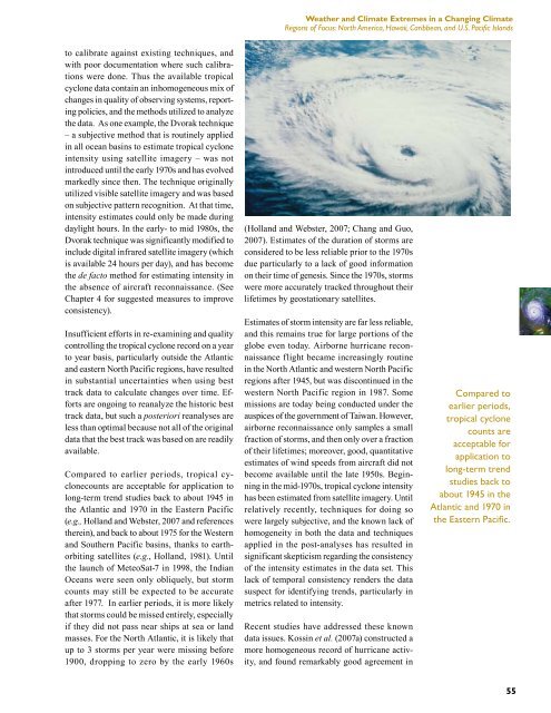
Estimates <strong>of</strong> storm <strong>in</strong>tensity are far less reliable,<br />
<strong>and</strong> this rema<strong>in</strong>s true for large portions <strong>of</strong> the<br />
globe even today. Airborne hurricane reconnaissance<br />
flight became <strong>in</strong>creas<strong>in</strong>gly rout<strong>in</strong>e<br />
<strong>in</strong> the North Atlantic <strong>and</strong> western North Pacific<br />
regions after 1945, but was discont<strong>in</strong>ued <strong>in</strong> the<br />
western North Pacific region <strong>in</strong> 1987. Some<br />
missions are today be<strong>in</strong>g conducted under the<br />
auspices <strong>of</strong> the government <strong>of</strong> Taiwan. However,<br />
airborne reconnaissance only samples a small<br />
fraction <strong>of</strong> storms, <strong>and</strong> then only over a fraction<br />
<strong>of</strong> their lifetimes; moreover, good, quantitative<br />
estimates <strong>of</strong> w<strong>in</strong>d speeds from aircraft did not<br />
become available until the late 1950s. Beg<strong>in</strong>n<strong>in</strong>g<br />
<strong>in</strong> the mid-1970s, tropical cyclone <strong>in</strong>tensity<br />
has been estimated from satellite imagery. Until<br />
relatively recently, techniques for do<strong>in</strong>g so<br />
were largely subjective, <strong>and</strong> the known lack <strong>of</strong><br />
homogeneity <strong>in</strong> both the data <strong>and</strong> techniques<br />
applied <strong>in</strong> the post-analyses has resulted <strong>in</strong><br />
significant skepticism regard<strong>in</strong>g the consistency<br />
<strong>of</strong> the <strong>in</strong>tensity estimates <strong>in</strong> the data set. This<br />
lack <strong>of</strong> temporal consistency renders the data<br />
suspect for identify<strong>in</strong>g trends, particularly <strong>in</strong><br />
metrics related to <strong>in</strong>tensity.<br />
Recent studies have addressed these known<br />
data issues. Koss<strong>in</strong> et al. (2007a) constructed a<br />
more homogeneous record <strong>of</strong> hurricane activity,<br />
<strong>and</strong> found remarkably good agreement <strong>in</strong><br />
Compared to<br />
earlier periods,<br />
tropical cyclone<br />
counts are<br />
acceptable for<br />
application to<br />
long-term trend<br />
studies back to<br />
about 1945 <strong>in</strong> the<br />
Atlantic <strong>and</strong> 1970 <strong>in</strong><br />
the Eastern Pacific.<br />
55