

Part 1 – A Rapid Participatory Biodiversity Assessment - IUCN
Part 1 – A Rapid Participatory Biodiversity Assessment - IUCN
Part 1 – A Rapid Participatory Biodiversity Assessment - IUCN

Create successful ePaper yourself
Turn your PDF publications into a flip-book with our unique Google optimized e-Paper software.
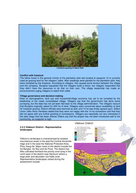
Livestock grazing in fallow field<br />
Conflict with livestock<br />
The fallow forest in the general vicinity of the plantation pilot site located at waypoint 12 is currently<br />
used as grazing land for the villagers’ cattle. After seedlings were planted for the plantation pilot, they<br />
were trampled by the livestock. According to villagers, this caused some tension between the village<br />
and the company. Burapha requested that the villagers build a fence, but villagers responded that<br />
they didn’t have the resources to do that on their own. The village leadership has made an<br />
announcement urging villagers to watch their cattle.<br />
Village governance and decision-making<br />
Data on demographics, land use and household/village economy has yet to be compiled by the<br />
leadership of the newly consolidated village. Villagers say that the government has done some<br />
surveying, but the data has not yet been fed back to the village administration. The villagers recount<br />
that Burapha originally asked for 200 ha of land. Villagers were concerned about availability of land<br />
for livestock grazing. District officials were alarmed as well, and 14 ha was finally agreed upon. Elders<br />
Union (Neo Hom) members stated that they were not happy with the 14 ha concession and that they<br />
did not agree with any further granting of concessions. Villagers are reportedly not very interested in<br />
the daily wage that has been offered. Elders say that the project has not been introduced well to the<br />
community, so suspicion is high.<br />
2.3.3 Vilabouri District - Representative<br />
landscapes<br />
Vilibouri’s landscape is characterised by isolated<br />
mountainous areas in the east the Central Annamite<br />
ridge and in the west the National Protected Area,<br />
Phou Xang He. Major rivers in the district include the<br />
Xe Bangfai, Xe Noy and Xe Pone. The district has<br />
little cultivated farmland the priority zone lying in the<br />
north-west of the district near Nanioum where a<br />
large plain and abundant rice fields exist.<br />
Representative landscapes visited during the<br />
assessment include:<br />
14


