


You also want an ePaper? Increase the reach of your titles
YUMPU automatically turns print PDFs into web optimized ePapers that Google loves.
<strong>QGIS</strong> <strong>for</strong> <strong>Archaeologists</strong> <strong>–</strong> A <strong>Basic</strong> <strong>Guide</strong><br />
Figure 12: Layers rearranged<br />
4.4. 19BWorking with Layers<br />
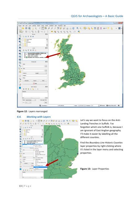
Let’s say we want to focus on the Anti-<br />
Landing Trenches in Suffolk. I’ve<br />
<strong>for</strong>gotten which one Suffolk is, because I<br />
am ignorant of East Anglian geography.<br />
I’ll make it easier by labelling all the<br />
different counties.<br />
Find the Boundary Line Historic Counties<br />
layer properties by right-clicking where<br />
it’s listed in the layer menu and selecting<br />
properties.<br />
Figure 13: Layer Properties<br />
13 | P age