


You also want an ePaper? Increase the reach of your titles
YUMPU automatically turns print PDFs into web optimized ePapers that Google loves.
<strong>QGIS</strong> <strong>for</strong> <strong>Archaeologists</strong> <strong>–</strong> A <strong>Basic</strong> <strong>Guide</strong><br />
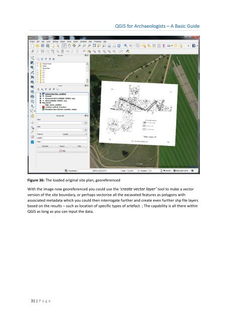
Figure 36: The loaded original site plan, georeferenced<br />
With the image now georeferenced you could use the ‘create vector layer’ tool to make a vector<br />
version of the site boundary, or perhaps vectorise all the excavated features as polygons with<br />
associated metadata which you could then interrogate further and create even further shp file layers<br />
based on the results <strong>–</strong> such as location of specific types of artefact ; The capability is all there within<br />
<strong>QGIS</strong> as long as you can input the data.<br />
31 | P age