


You also want an ePaper? Increase the reach of your titles
YUMPU automatically turns print PDFs into web optimized ePapers that Google loves.
<strong>QGIS</strong> <strong>for</strong> <strong>Archaeologists</strong> <strong>–</strong> A <strong>Basic</strong> <strong>Guide</strong><br />
Use the add vector data tool in the left hand toolbar, and point it at “\Sutton Hoo\Sutton Hoo Vector<br />
Data\OSOpenMapLocal (ESRI Shape File) TM\data”<br />
Set the file type selector (to the right of the file name bar) to ESRI Shapefiles, and select all the files<br />
in this folder.<br />
Things just got a lot busier.<br />
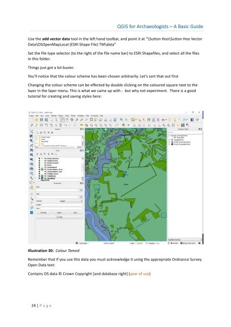
You’ll notice that the colour scheme has been chosen arbitrarily. Let’s sort that out first<br />
Changing the colour scheme can be effected by double clicking on the coloured square next to the<br />
layer in the layer menu. This is what we came up with - but why not experiment. There is a good<br />
tutorial <strong>for</strong> creating and saving styles here:<br />
Illustration 30: Colour Tamed<br />
Remember that if you use this data you must acknowledge it using the appropriate Ordnance Survey<br />
Open Data text:<br />
Contains OS data © Crown Copyright [and database right] (year of use)<br />
24 | P age