
You also want an ePaper? Increase the reach of your titles
YUMPU automatically turns print PDFs into web optimized ePapers that Google loves.
adventure<br />
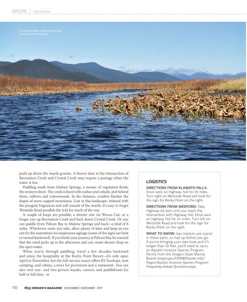
The breeze often creates wind-driven<br />
currents in the afternoon.<br />
push up above the marsh grasses. A beaver dam at the intersection of<br />
Recreation Creek and Crystal Creek may require a portage when the<br />
water is low.<br />
Paddling south from Malone Springs, a mosaic of vegetation flanks<br />
the western shore. The creek is lined with rushes and cattails, and behind<br />
them, willows and cottonwoods. In the distance, conifers blanket the<br />
slopes of snow-capped mountains. Lost in this landscape, imbued with<br />
the pungent fragrances and soft sounds of the marsh, it’s easy to forget<br />
Westside Road parallels the trail for much of the way.<br />
A couple of loops are possible, a shorter one via Wocus Cut, or a<br />
longer one up Recreation Creek and back down Crystal Creek. Or you<br />
can paddle from Pelican Bay to Malone Springs and back—a total of 8<br />
miles. Whichever route you take, allow plenty of time and keep an eye<br />
out for the sometimes inconspicuous signage (some of the signs are bent<br />
or turned backward). If you finish your journey at Pelican Bay, be warned<br />
that the wind picks up in the afternoon and can create decent chop on<br />
the open water.<br />
When you’re through paddling, travel a few decades backward<br />
and enjoy the hospitality at the Rocky Point Resort—it’s only open<br />
April to <strong>Nov</strong>ember, but the full-service resort offers RV hookups, tent<br />
camping, and cabins, a store for provisions and a restaurant. You can<br />
also rent one- and two-person kayaks, canoes, and paddleboats for<br />
half or full days.<br />
LOGISTICS<br />
DIRECTIONS FROM KLAMATH FALLS:<br />
Drive west on Highway 140 for 25 miles.<br />
Turn right on Westside Road and look for<br />
the sign for Rocky Point on the right.<br />
DIRECTIONS FROM MEDFORD: Take<br />
Highway 62 east until you reach the<br />
intersection with Highway 140. Drive east<br />
on highway 140 for 44 miles. Turn left on<br />
Westside Road and look for the sign for<br />
Rocky Point on the right.<br />
WHAT TO KNOW: Gas stations are scarce<br />
in these parts, so fuel up before you go.<br />
If you’re bringing your own boat and it’s<br />
longer than 10 feet, you’ll need to carry<br />
an Aquatic Invasive Species Program<br />
Permit from the Oregon State Marine<br />
Board: oregon.gov/OSMB/boater-info/<br />
Pages/Aquatic-Invasive-Species-Program-<br />
Frequently-Asked-Questions.aspx<br />
110 <strong>1859</strong> OREGON’S MAGAZINE NOVEMBER | DECEMBER <strong>2017</strong>