Making City Arnavutköy, Istanbul

You also want an ePaper? Increase the reach of your titles
YUMPU automatically turns print PDFs into web optimized ePapers that Google loves.
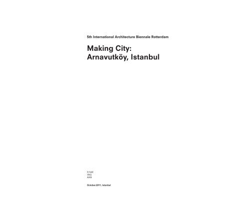
5th International Architecture Biennale Rotterdam<br />
<strong>Making</strong> <strong>City</strong>:<br />
<strong>Arnavutköy</strong>, <strong>Istanbul</strong><br />
51N4E<br />
HNS<br />
AWB<br />
October.2011, <strong>Istanbul</strong>
Contents<br />
I. Project Attitude<br />
Tensions Used Constructively<br />
Prioritized Readings<br />
Considering multiple scales<br />
II. Project Summary<br />
Looking at the full watercycle<br />
Water; the missing link<br />
An interactive system<br />
Appendix 1: Design Principles Pilot Sites<br />
Site Selection<br />
Pilot #01: Hadimköy Ridge <strong>City</strong><br />
Pilot #02: <strong>Arnavutköy</strong> Ecological Corridor<br />
Pilot #03: <strong>Arnavutköy</strong> Ridge <strong>City</strong><br />
Pilot #04: <strong>Arnavutköy</strong> Agricultural Suburb<br />
Appendix 2: Implementation methods<br />
How to make an integral system<br />
Urban and landscape qualities<br />
How to start a process
I. Introduction:<br />
From <strong>Arnavutköy</strong> Municipality<br />
to Productive Landscape
North Istanbu: the natural resource<br />
South <strong>Istanbul</strong>: the mega city
A Strategic Vision<br />
Project origin, set-up, scope<br />
The present booklet is the summary of a study initiated jointly by the<br />
International Architecture Biennale of Rotterdam and the Municipality of<br />
<strong>Arnavutköy</strong>, <strong>Istanbul</strong>.The multiple agenda of the result reflects the double<br />
scope of the study.<br />
If the questions of the study brief are formulated by the issues and<br />
dilemmas that a developing municipality at the edge of large metropolis is<br />
facing, the answers are sought through palpitating the <strong>Istanbul</strong> condition<br />
itself. On one hand confronted with the same issues as most mega cities<br />
around the world today, Istnabul is at the same time a very specific place,<br />
with its specific qualities, opportunities and dangers. By prioritizing the<br />
aspect of sustainable urban development, the study vision bypasses the<br />
dilemma between preservation and growth, and focuses on a scenario<br />
where ostensibly conflicting dynamics become mutually dependent and<br />
reinforcing.<br />
The development pressure in <strong>Arnavutköy</strong> represents the dilemma rapidly<br />
growing metropolises like <strong>Istanbul</strong> are in. On the one hand they have to<br />
accommodate the increase of population consuming ever more space; on<br />
the other hand they have to provide the necessary resources to provide this<br />
population with all the essentials of life: food, water, mobility…<br />
In <strong>Arnavutköy</strong>, the conflict is crystallizing between the growth of the city<br />
and the supply of water. <strong>Arnavutköy</strong>, and more specifically the Sazlidere<br />
basin, is one of the 7 important water catchment areas of the Metropolitan<br />
municipality of <strong>Istanbul</strong>.<br />
Already today, the importance of the water supply is taken very seriously.<br />
ISKI, the water management company, focuses strongly on protecting<br />
the water basin. A very clear zoning logic has been installed: urbanization<br />
and agricultural use of the land decreases as one gets closer to the basin,<br />
minimizing the impact of human occupation on the quality of the water.<br />
Although the principles of these zones are very clear, it seems difficult<br />
to cope with the incremental and informal consumption of the land. The<br />
zoning logic exists in plan, but is not materialized on site. Maintaining the<br />
zoning principle requires constant control, has to be enforced with authority<br />
and often results in conflicts. In this strategic vision, we propose a more<br />
productive mode of coexistence between the water basin and the city. To<br />
do so, the ISKI zoning logic is taken as starting point, further developed and<br />
refined.
The Question: <strong>Arnavutköy</strong> today<br />
How to develop? How to preserve?<br />
The burning questions for the Municipality of <strong>Arnavutköy</strong> as reflected<br />
in a map of potential points of intervention around the Municipality<br />
territory: natural creek zones crossing the grounds of the town, while<br />
new neighbourhoods develop(ed) around, existing villages situated<br />
in direct or close proximity to the protected drinking water reservoir,<br />
places strategically located in proximity to planned regional road<br />
infrastructure facing development pressure etc. The dilemma<br />
between preservation and development becomes manifest.
<strong>Arnavutköy</strong> & drinking water reservoirs<br />
Natural resources as a main identity feature<br />
The Municipality of <strong>Arnavutköy</strong> happens to partly contain 3 water<br />
reservoirs providing the entire <strong>Istanbul</strong> city with drinking water. This<br />
gives the municipality territory a distinct identity feature, an asset to<br />
develop upon as much as a responsibility towards the metropolitan<br />
region that contains it.
<strong>Istanbul</strong> & drinking water reservoirs<br />
Current supply resources<br />
The Metropolitan Municipality of <strong>Istanbul</strong> contains 7 natural drinking<br />
water reservoirs, all of them by now under a strict protection regime.<br />
The supply from these reservoirs currently covers the needs of the<br />
entire broader <strong>Istanbul</strong>. According to predictions (based on the<br />
consumption rhythm of today), it will continue to do so until the point<br />
the city growth surpasses a population of 15 million people.
<strong>Istanbul</strong> Water Management<br />
Alternative water supply plan<br />
The <strong>Istanbul</strong> strategy for water management includes on one hand<br />
strict protection measures of the existing reservoirs, purification<br />
units, existing and planned but also a plan to import water from<br />
nearby territories in order to respond to the augmenting demand<br />
within its own borders This scenario, although based on a realistic<br />
view of the <strong>Istanbul</strong> future, will create a dependence of the city on<br />
territories out of its direct control, even out of the national control.<br />
The present study supports the argument that this condition should<br />
be postponed as much as possible: the focus should be primarily on<br />
developing the local potential to its limits.<br />
1 Water supply <strong>Istanbul</strong> - example Sazlidere basin<br />
7x<br />
terkos büyükçekmece<br />
elmalı ömerli darlık<br />
sazlıdere<br />
alibeyköy<br />
?<br />
existing connection<br />
planned connection<br />
existing pumpingstation<br />
planned pumpingstation<br />
existing purification installation<br />
planned purification installation<br />
planned bassin<br />
existing reservoir<br />
20 km
<strong>Istanbul</strong> agriculture zones<br />
Additional potential in resources<br />
The current zoning of the <strong>Istanbul</strong> Municipality territory includes<br />
relatively large areas assigned as agriculture zones. Although some<br />
being actually more functional than others, agriculture represents a<br />
(less defined, less prioritized) potential within the region. Even if the<br />
main agricultural production is located in other areas of the country<br />
and the envisioned profile of <strong>Istanbul</strong> is focusing on tertiary sector,<br />
the potential in employment, land quality preservation and local food<br />
production should remain into consideration.
<strong>Istanbul</strong> Masterplan<br />
focus on preservation of existing resources<br />
The Masterplan developed for the broader <strong>Istanbul</strong> region sets in<br />
priority natural resources preservation issues and envisions a limit<br />
in the population growth below the tipping point of the balance<br />
between urban development and supply on resources. Although<br />
clear in its intentions as a general plan, its applicability in local scales<br />
is today much less sharply defined.
<strong>Istanbul</strong> Multiple Actors<br />
Simultaneous dynamics and their coordination
<strong>Istanbul</strong> growth 1980<br />
Impact of First Bosphorus Bridge<br />
The construction of the First Highway Bridge in 1973, coincided<br />
with a process of rapid urbanization, causing the <strong>Istanbul</strong> city area<br />
to almost double within a decade from the size it had reached<br />
throughout its history.
<strong>Istanbul</strong> growth 2000<br />
Impact of Second Bosphorus Bridge<br />
Reduced rural migration during the last decades of the 20th century<br />
didn’t hinder the rapid growth of <strong>Istanbul</strong> after the construction of<br />
the 2nd Highway (in purple)
<strong>Istanbul</strong> growth 2045<br />
Projected impact of of Third Bosporhus Bridge<br />
The <strong>Istanbul</strong> Metropolitan Masterplan predicts the population of<br />
<strong>Istanbul</strong> to stabilize after 2025 around 16-18 million inhabitants and<br />
the extension of the urban territory to be restricted in the southern<br />
<strong>Istanbul</strong> zone, along the Sea of Marmara.Other factors, like the new<br />
planned highway and 3rd Bridge over the Bosphorus close to the<br />
Black Sea will though bring along pressure for development.
The Theme: <strong>Making</strong> city<br />
Qualitative urbanization in the focus of IABR 2012<br />
<strong>Istanbul</strong> is featuring as one of the main focus cities in the upcoming<br />
edition International Architecture Biennale Rotterdam. In the frame<br />
of the Biennale, <strong>Istanbul</strong>’s booming development still today, not<br />
having reached its saturation point, poses questions on qualitative<br />
development, making city beyond plain growth.<br />
Population Growth: Arnavutkoy, <strong>Istanbul</strong>, Turkey
A World of Cities<br />
Urban agglomerations projection in 2025 (United Nations)<br />
Focusing on the quality of cities becomes more relevant than<br />
ever: Global predictions indicate that by 2025 80% of the global<br />
population will be living in cities, occupying 3% of the available<br />
territory and producing 90% of the global economy. How will these<br />
cities, most of them metropolises already today, will manage to<br />
cover the needs of its inhabitants in fresh water, food, ...
Urban Growth Patterns<br />
<strong>Istanbul</strong>’s underlying potential for sustainable growth<br />
Different urban agglomerations have different growth patterns. Next<br />
to the archetypical concentric growth model of cities like London,<br />
and the urban networks of western Europe, <strong>Istanbul</strong> with its linear<br />
growth pattern presents an opportunity for urban development in<br />
close proximity to open landscape.
<strong>Arnavutköy</strong> Dynamics<br />
How to allow growth while preserving resources?<br />
The most important challenge that <strong>Arnavutköy</strong> is facing is finding<br />
a balance between preservation and development. Flexible tools,<br />
allowing to steer and anticipate development are sought for to<br />
overcome conflicts between dynamics.
+<br />
Project dynamics<br />
You are here: Territory where different dynamics meet<br />
The setup of the project as a constellation of dynamics and expertise<br />
allows to better address the multiplicity of the agendas concentrated<br />
in the <strong>Arnavutköy</strong> territory.<br />
3rd bridge highway<br />
protected drink water<br />
basin<br />
developing<br />
coast<br />
protected green zones<br />
developing communities<br />
industrial corridor<br />
2nd bridge highway<br />
city expanding
Considering Multiple Scales<br />
Proposals put in perspective<br />
During the study, issues are placed in different perspectives and<br />
projected in different scales : proposals for local interventions can<br />
be models for similar issues in the broader region and strategic<br />
thinking in the larger scale can lead to unexpected answers for local<br />
problems.
Prioritized Readings<br />
Administrative Entities as territory units<br />
The conventional reading of a larger territory as a composition of the<br />
different municipalities it contains facilitates certain administrative<br />
questions, but in the case where natural features and resources<br />
become the point of focus, this subdivision does not allow a<br />
comprehensive study of the problem.<br />
LEGEND<br />
Administration in <strong>Istanbul</strong> is split up into sub Municipalities which were created through negotiation between the<br />
people living in the city, and usually adhere to a political logic, which tends to inhibit implementing a wholesome<br />
strategy that would be based, for instance, on the logic of water collection and distribution.<br />
1:500 000
Prioritized Readings<br />
Natural Entities as territory units<br />
Acknowledging water preservation as a main point of focus for<br />
developing a strategic vision for the <strong>Arnavutköy</strong> area, the project<br />
also adopts a consequent reading of the territory. The city becomes<br />
its landscape, a collection of water drainage basins providing<br />
<strong>Istanbul</strong> with with valuable drinking water supply as well as its<br />
characteristic relief.<br />
01<br />
02<br />
03<br />
04<br />
C<br />
05<br />
A<br />
F<br />
B<br />
06 07<br />
09<br />
10<br />
11<br />
12<br />
1314<br />
15<br />
16<br />
G<br />
J<br />
18<br />
K<br />
D<br />
08<br />
E<br />
H<br />
17<br />
21<br />
19<br />
20<br />
23<br />
I<br />
22<br />
Map of all drainage basins of <strong>Istanbul</strong> Metropolitan Region: the central areas of the peninsula form sweet-water<br />
basins while the perimeter sea-water basins. Together, they form a complete partioning of the city.<br />
1:500 000
<strong>Making</strong> <strong>City</strong><br />
aiming at site-specific living conditions
II. Project Summary:<br />
Sazlidere Basin<br />
looking at the full water cycle<br />
The readable Landscape: making administrative boundaries visible<br />
Looking at the basin<br />
Looking at the city<br />
Towards a total system: alternative water cycle<br />
Creating a future-absorbing pattern<br />
The Ridge <strong>City</strong>: clear boundaries and in balance with the landscape<br />
Water saved by water: water the missing link<br />
Productive density: Directing Development with Incentive rather than Prohibition<br />
An interactive system
oad<br />
+100m<br />
Urban Spine<br />
Concentrated Islands<br />
Grid <strong>City</strong><br />
Garden <strong>City</strong>/Urban Agriculture<br />
Adjacent Urban Areas: Hadimkoy, Karaburun..<br />
Private Villas/Gated Communities<br />
Village<br />
Existing Forest<br />
Forest as edge to ridge city<br />
Precision agriculture on the city fringe<br />
Agriculture<br />
Extensive grassland<br />
Functional nature<br />
Water<br />
Grid<br />
1kmx1km<br />
+ =
Looking at the Full Water Cycle<br />
One part of the problem of the zoning logic as proposed by ISKI is that it is<br />
not possible to realize the zoning under present conditions. The protection<br />
zones, which consist of concentric circles of different types of nature and<br />
agriculture, are solely restrictive and do not come to life because they lack<br />
the main resource to develop them: water. This water is exclusively destined<br />
to be used for the drinking water supply for the city. As a consequence, the<br />
different zones in the ISKI protection plan do not become a reality on the<br />
ground. In the perception and the daily use of the population of <strong>Arnavutköy</strong>,<br />
the grounds that make up these protection zones are in essence unused,<br />
dead land. In the perception of the population, there is no apparent reason<br />
why this land is not suitable for urbanization: devoid of meaning, the most<br />
evident and lucrative use of the land is to build on it. With the planned third<br />
highway crossing the <strong>Arnavutköy</strong> municipality, the lack of a development<br />
perspective for these protection zones could turn out to be catastrophic. In<br />
order to enhance the protection of the basin, it is crucial to invent a future<br />
life for this land. (see: project specifics)<br />
Another important step in the strategic vision is to look not only at the end<br />
of the water cycle, but also at the beginning. This means that one should<br />
not only look at ways how to protect the water basin, but also at ways to<br />
prevent the pollution at the source: the urbanization that creates the waste<br />
water, polluting the rain water destined for the water basin.<br />
In the proposal, all future development is concentrated in a clearly defined<br />
zone on top of the ridge of the water basin. This zone can be considered<br />
as an extra layer added to the ISKI zoning. Contrary to the other zones,<br />
where we propose to stop urbanization, urban development in this zone<br />
is not limited but promoted. This attitude allows taking a clear and proactive<br />
attitude, aiming to develop qualities instead of limiting quantities.<br />
Concentrating urban development in a clearly defined zone running along<br />
the ridge creates the obvious advantages linked to dense cities: it allows<br />
developing public transport, concentrating services and creating a better<br />
sewage infrastructure. Although putting the most polluting source on the<br />
uppermost part of the basin seems counter intuitive on first sight, there is<br />
a clear potential to be found is this layout: the proposal to install a water<br />
system that collects rain water, grey water and black water separately,<br />
allows to equip every city part with its own treatment system and to control<br />
the water output of the city. All of this can happen by using the natural flow<br />
of the water, pulled downstream by gravity.
Looking at the Basin<br />
The readable landscape<br />
Transfering the administrative boundaries from a map to reality is a<br />
necessary step to render them visible and thus undeniable, leaving<br />
less room for misinterpretation and landscape misuse.<br />
The most evident way to materialize the borders is to refine them by<br />
letting them relate to the natural topography and to then shape the<br />
landscape giving the zones specific content.<br />
An eloquent example of the value of boundaries materialization:<br />
Instead of letting water run-off into the reservoir along its entire<br />
perimeter, the physical boundaries between zones alllow separating<br />
water flows. Cleansing systems are installed with monitored inflow<br />
points on one side of the reservoir, while a permanent cleansing<br />
wetland is installed on the other side<br />
Functional Nature: safeguards the basin<br />
Strict protection zone<br />
Bufferzone: extensive grasslands<br />
Short range protection zone<br />
Agricultural land: zero-tolerance<br />
Medium & Long range protection zone<br />
<strong>City</strong> boundary<br />
Strong landuse: forest and vitalised agriculture<br />
Ridge city: welcome the city<br />
Productive density on the high grounds<br />
Forest<br />
Urban<br />
Rural<br />
Military<br />
Strict protection zone<br />
nature<br />
Short range protection zone<br />
ecological agriculture<br />
Medium range protection zone<br />
allowed pop.: 40p/ha (urban) 20p/ha (rural)<br />
Long range protection zone<br />
allowed pop: 80p/ha (urban) 25p/ha (rural)a<br />
Section A (next page):<br />
The current administrative landscape: immaterial boundaries<br />
The proposed Readable landscape: visible and physical boundaries
Functional nature zone<br />
Current situation: direct agricultural runoff into the lake<br />
steep slopes mark the boundary between eco-agricultural and regular agricultural zone<br />
prominent dike/quay line with hedgerow vegetation marks the boundary between nature and eco-agricultural zone<br />
Ecologial shoreline<br />
filtering in reservoir<br />
Proposal: interscept and re-route agricultural runoff<br />
Surface flow purification alongside lake<br />
small quay<br />
Cascade system<br />
filtering agricultural run-off<br />
wetland bypass<br />
dike<br />
enlarged embankment<br />
Controlled inflow Concentration allows for = Control<br />
waterquality ISKI monitoring<br />
stations<br />
ca 300m<br />
Purification within the Lake<br />
by adding a wetland zone<br />
enlarged embankment<br />
small<br />
quay<br />
ca 300m
oad<br />
+100m<br />
Agriculture<br />
Extensive grassland<br />
Functional nature<br />
Water<br />
Looking at the Basin<br />
Activating and safeguarding<br />
The layout of the different zones is structured based on their<br />
function. The first 300m from the reservoir become a functional<br />
nature zone with wetlands and ecological purification. The nature<br />
zones actively protects the reservoir agains poluted agricultural<br />
runoff. As an additional buffer, agricultural use in close proximity to<br />
the basin is restricted to extensive grassland, preventing intensive<br />
nutrient input and outlow near the reservoir. Grassland vegetation<br />
ensures a buffering function of this zone yearround, this in contrast<br />
with ecological agriculture which implies barren grounds during<br />
winter.<br />
Grid<br />
1kmx1km<br />
The second focus for strengthening landuse is on the city edge.<br />
By reusing urban wastewater the necessary irrigation water and<br />
nutrients can be provided to make these zones come to life and<br />
become robust. A Forest boundary of 300m forms a clear and<br />
unmistakeable edge to the city and provides wood to be used in<br />
a sustainable fertiliser: so-called black soil, or terra prata (biochar)<br />
which binds nutrients to the soil, preventing outflow. Depending<br />
on water and biochar availability agricultural production is boosted<br />
in patches/zones of precision agriculture along the city fringe. For<br />
details see appendix II<br />
Together, forest, precision agriculture and extensive grassland<br />
redefine the ecogical agriculture (short range protection) zone<br />
Planted strips, small quay’s and a dike make the limits of the zones<br />
visible.<br />
Looking at the basin:<br />
Functional nature zone runoff before entering the basin<br />
Extensive grassland activates the bufferzone near the reservoir
Clearly visible, physical boundaries between zones<br />
Small dike forms the edge of the functional nature zone and seperates runoff in a parallel system, preventing direct<br />
inflow<br />
Enlarged ecological banks filter water in the reservoir (ref Terkos Gölü)<br />
Section A (see map previous page)<br />
Short range protection zone is made productive<br />
by reusing urban wastewater for irrgation<br />
(3 types of agriculture redefine short range protection zone)<br />
Forest Precision agriculture Extensive grasslands<br />
reusing urban wastewater:<br />
recycling H2O & P+N<br />
to vitalise landuse<br />
Ridge city<br />
<strong>City</strong> Edge<br />
Bufferzone<br />
Functional nature zone (300m)<br />
Forest Precision agriculture Extensive grasslands Ecological purification<br />
Paralell wetland and<br />
dike Lake with ecological bank
Looking at the <strong>City</strong><br />
The water complement<br />
The above proposed system for restructuring the basin zones<br />
aims at improving their performance in ecological, economical and<br />
social terms. It also makes very clear that in the proposal as in the<br />
existing condition, the successful preservation of the drinking water<br />
paradoxically but intrisically depends on finding more water. Water<br />
to feed the intermediate protection zones, to provide them with<br />
identity and use, and to help them resist informal / incontrollable<br />
development. A complementary side of the basin protection plan is<br />
sought at the direct proximity of the basin: on the ridge.<br />
But where does the (extra) water come from?
Towards a total system<br />
An alternative water cycle<br />
Rain water: utilise functional nature to filter before entering the<br />
drinking water reservoir<br />
Urban grey water: treated and reused in the city as service water to<br />
reduce water demand<br />
Urban black water: treated and reused for drip irrigation of precision<br />
agriculture and forests. Reuse the sludge as input for blacksoil<br />
(biochar)
Looking at the <strong>City</strong><br />
Establishing a flexible base for development<br />
The current condition of built volume in the Sazlidere basin shows<br />
concentrations around the <strong>Arnavutköy</strong> town with additional sparse<br />
developments around the rest of the basin. No specific development<br />
pattern can be distinguished, and the existing regulations, based<br />
on non-localized percentages of development, do not suggest<br />
one either. This strategy risks leading to sprawl: development<br />
will happen in an opportunistic way, hard to foresee or control,<br />
until the saturation point of the regulation percentages. To the<br />
typical dangers of sprawl being consumption of valuable land and<br />
landscape deterioration, an additional danger is presented here with<br />
the lack of control over the impact of unorganized developments on<br />
the water resources. Density becomes a menace.<br />
The vision aims at overturning this situation by channeling urban<br />
development in a pattern that can absorb different future scenarios.<br />
In this pattern, the final density is not prescribed but left open to the<br />
future needs of the area, becoming another of the parameters at<br />
play.
Current built volume in the basin<br />
Future projection of built based on existing regulations: imminent<br />
sprawl risk<br />
Proposed direction built volume: channeling development along the<br />
ridge, zero tolerance in the interior
oad<br />
+100m<br />
Urban Spine<br />
Concentrated Islands<br />
Grid <strong>City</strong><br />
Garden <strong>City</strong>/Urban Agriculture<br />
Adjacent Urban Areas: Hadimkoy, Karaburun..<br />
Private Villas/Gated Communities<br />
Village<br />
The Ridge <strong>City</strong><br />
A new layer added to preserve and enable<br />
The reason to concentrate development is twofold:<br />
Concentration allows for better control over the infrastructure<br />
quality. A properly managed sewage system will make water re-use<br />
possible, thus activating the zones lower in the basin and assisting<br />
the preservation process. The city edge is arguably the most<br />
important boundary to materialize. By reusing urban wastewater<br />
to strengthen the landscape on the city edge (irrigated forest<br />
and precision agriculture) the city reinforces its own boundary.<br />
Not just a clear and robust edge, the forests and vital agricultural<br />
fields additionally provide valuable recreational space for the cities<br />
residents, and contribute to food and wood production.<br />
Existing Forest<br />
Forestband as edge to ridge city<br />
Precision agriculture on the city fringe<br />
Water<br />
Grid<br />
1kmx1km<br />
It also enables other infrastructure to happen more efficiently (for<br />
example, road networks) or to simply happen (as in the case of<br />
public transport, when density is enough to make it efficient).<br />
For this concentration to find place on the ridge, seems like a natural<br />
choice. The Sazlidere ridge and basin being part of a landscapesystem<br />
of ridges and basins allows the Ridge <strong>City</strong> to have excellent<br />
connections to the broader area and to profit from the variety of the<br />
differents parts that constitute the ridge (forest, industrial cluster,<br />
<strong>Arnavutköy</strong> Town etc)<br />
The ridge city:<br />
development concentrated on the ridge<br />
Strong and productive landscape boundary as city edge: forest and precision agriculture
A very clear forest band marks the boundary of the city The Ridge as a collection of differences The Ridge as a part of a whole<br />
Sazlidere Ridge connectivity
oad<br />
+100m<br />
Urban Spine<br />
Concentrated Islands<br />
Grid <strong>City</strong><br />
Garden <strong>City</strong>/Urban Agriculture<br />
Adjacent Urban Areas: Hadimkoy, Karaburun..<br />
Private Villas/Gated Communities<br />
Village<br />
Water, the missing link<br />
As a result of this concentration principle, the water that is a byproduct<br />
of the city can become a means to save and protect the<br />
water that feeds the basin. Suddenly, things are turned upside down:<br />
the urban development that threatens the water basin becomes<br />
the necessary motor to save it. Water saved by water: the output<br />
water of the city is used to feed the zones that protect the basin,<br />
giving them the necessary nutrients and water to live, and therefore<br />
survive. All elements of the system become interdependent: the<br />
water feeding the city, the city feeding the land, the land protecting<br />
the basin.<br />
Existing Forest<br />
Forest as edge to ridge city<br />
Precision agriculture on the city fringe<br />
Agriculture<br />
Extensive grassland<br />
Functional nature<br />
Water<br />
Grid<br />
1kmx1km<br />
In a bizarre twist of logic, developing more city increases the<br />
protection of the basin. Suddenly, density is not a threat but<br />
potentially productive.<br />
By closing the loop, the strategic vision aims at a triple ambition:<br />
1. To sustain and improve the collection of drinking water<br />
2. To give a meaning to and development potential for the<br />
ISKI protection zones<br />
3. To invent ways to absorb urbanization in a qualitative<br />
way, in a balanced coexistence with the above
feeds<br />
<strong>City</strong><br />
Agriculture<br />
feeds<br />
protects<br />
Water
A Future-Absorbing Pattern<br />
Extrapolation of the vision on the scale of <strong>Istanbul</strong><br />
Although focusing solely on Sazlidere, the vision is not considering<br />
the basin as an isolated case. The core issues that the Arnavutöy<br />
municipality is confronted with being relevant for the entire area<br />
in and around <strong>Istanbul</strong>, the real goal for the city should be finding<br />
patterns that would allow it to develop sustainably in its entirety.<br />
In this effort, flexibility and priorities rather than restrictions should<br />
be a key.
?<br />
Current Scenario (low growth) Current Scenario (medium growth) Current Scenario (high growth is not an option)<br />
Alternative Scenario (low growth)<br />
Alternative Scenario (medium growth)<br />
Alternative Scenario (high growth)
Productive Density<br />
Incentive rather than Prohibition<br />
1. To improve the collection of drinking water<br />
2. To give development potential for iSKi zones<br />
3. To urbanize in balance with the basin<br />
300.000 to 500.000 more people 600 to 1.000 ha high end agriculture 37.5 people / ha (total basin)
ASSUMPTIONS FOR CALCULATING<br />
Area in plan is reduced by 15% to account for roads/infrastructure<br />
a person is allocated 30 m 2 of living space (see attached standards in several european countries. This is an extremely<br />
generous assumption)<br />
PROJECTIONS<br />
total buildable surfaced is assumed to be 50% housing (a rough estimate for Brussels metropolitan region is that this<br />
ratio is closer to 60% housing, and we can consider that this is still a ‘sub’ urban part of <strong>Istanbul</strong> and raise the ratio to<br />
70%, this would give even larger numbers in the above chart, or allow for more spacious development with the existing<br />
numbers)<br />
Another thing to consider is a development scenario for the agriculture which is as discussed earlier a combination of<br />
vegetable and wheat farming, HNS could propose an adequate<br />
ASSUMPTIONS<br />
number based<br />
FOR<br />
on these<br />
CALCULATING<br />
numbers tha we now have)<br />
- Area in plan is reduced by 15% to account for roads/infrastructure<br />
- 30 m 2 of living space/ person<br />
- total buildable surface: 50% housing<br />
# people<br />
m 2<br />
average FAR, plot usage<br />
% of eco-agri able to<br />
cultivate vegetables<br />
reference to city types<br />
1<br />
4 million<br />
29.7 km 2<br />
i = 8; a = 50%<br />
over 100 %<br />
a denser Hong Kong<br />
2<br />
1.5 mil<br />
29.7 km 2<br />
i = 7.9; a = 70-85%<br />
35 %<br />
Cerda (Barcelona),<br />
Manhattan grid (NY)<br />
3<br />
0.5 mil<br />
29.7 km 2<br />
i = 2.3; a = 60%<br />
12 %<br />
dense Toki<br />
4<br />
0.38 mil<br />
29.7 km 2<br />
-<br />
10 %<br />
Municipal projections<br />
as discussed last week<br />
5<br />
-<br />
-<br />
-<br />
-<br />
-<br />
Excercise in calculation of the irrigation potential of different population densities of the Ridge <strong>City</strong>.
An Interactive System<br />
Like in any eco-system, the interdependence of all elements is the key to<br />
the story. The vision will be strategic only if the elements are related. Exactly<br />
this aspect might be the Achilles heel of the proposal. Today, the different<br />
authorities take full responsibility in their domain, but create very little<br />
interaction in between domains. As long as this is the case, the strategic<br />
vision will be useless. A crucial step in realising the vision and building a<br />
sustainable future for the city is to build a common project in which all<br />
levels of authority interact. This study shows that this could be possible.<br />
Already, in the process of the last months, intelligence from the municipality<br />
has been cross-referenced with the points of view of the water and<br />
agriculture authorities (amongst others). It is clear that this proposal is just<br />
a first step; we truly hope that the results of this first exercise are inspiring<br />
enough to motivate all parties involved to continue this path towards a<br />
better future.
ARNAVUTKOY<br />
>><br />
ARNAVUTKOY<br />
Strategic Vision:A Cross-Authority Project<br />
ECO<br />
ECO<br />
Actors involved<br />
3rd Highway<br />
Private Enterprise + TOKi<br />
iSKi<br />
Independent Logics<br />
<strong>Arnavutköy</strong> Municipality +IMR<br />
Agriculture Ministry<br />
Forest Ministry
LONG TERM ALLIANCE<br />
to steer the project:<br />
SHORT TERM ALLIANCE:<br />
to realize seperate phases of implementatio<br />
iSKi + Arnavutkoy Municipality<br />
iSKi<br />
Forest Ministry<br />
+<br />
iSKi<br />
Agriculture Ministry<br />
+<br />
Forest Ministry<br />
iSKi<br />
+<br />
Private Developers<br />
+<br />
TOKi<br />
Example of constellations of authorities necessary for the different levels of realization of a project, differentiation between vision-carriers, consulting and executive parties
Appendix 1:<br />
Design Principles Pilot Sites<br />
Pilot Site Selection<br />
Pilot #01: Hadimköy Ridge <strong>City</strong><br />
Pilot #02: <strong>Arnavutköy</strong> Ecological Corridor<br />
Pilot #03: <strong>Arnavutköy</strong> Ridge <strong>City</strong><br />
Pilot #04: <strong>Arnavutköy</strong> Agriculture Suburb
Pilot Overview<br />
Legal Map<br />
#03<br />
#02<br />
#04<br />
Hadimköy Ridge <strong>City</strong><br />
<strong>Arnavutköy</strong> Eco Corridor<br />
<strong>Arnavutköy</strong> Ridge <strong>City</strong><br />
<strong>Arnavutköy</strong> Agriculture Suburb<br />
#01<br />
#02<br />
#03<br />
#04<br />
#01
In this appendix the selection of proposed Pilot Project sites is explained<br />
and elaborated, and each project is given a set of design principles as base<br />
for further development.<br />
The four proposed sites are selected based on different characteristics:<br />
location, potential for application of the proposed methods, land<br />
ownership, collaboration opportunities.<br />
The first is located in a currently scarcely developed area, in close proximity<br />
to the water reservoir, and would thus constitute a rather pure application<br />
of the theoretical model developed in the vision.<br />
The other three sites, located on the other side of the water and part of<br />
existing or developing land of <strong>Arnavutköy</strong> town, form together a group:<br />
They relate to the main water basin as much as to one of the secondary<br />
creeks that lies within urbanized ground. Besides addressing urgent issues<br />
for the imminent development of the town, they represent a testing ground<br />
for the flexibility of the model, its application in a complex, real context
Pilot Site Selection<br />
Overview of Site Areas<br />
Diagram listing the four sites, their group formations and their<br />
respective surfaces<br />
03<br />
02<br />
04<br />
01<br />
Hadimköy Ridge <strong>City</strong><br />
a: 2.45 km²<br />
02<br />
<strong>Arnavutköy</strong> Eco-Corridor<br />
a: 1.01 km²<br />
01<br />
03<br />
<strong>Arnavutköy</strong> Ridge <strong>City</strong><br />
a: 1.89 km²<br />
04<br />
<strong>Arnavutköy</strong> Agriculture Suburb<br />
a: 3.71 km²
Pilot Site Selection<br />
Overview of land properties, and existing built volume<br />
Overview of the four sites charted according to land ownership<br />
(state-owned, municipal, private) and to the existing built tissue they<br />
contain.
#01 Hadimköy Ridge <strong>City</strong><br />
New Zoning Map<br />
Located between the industrial zone of Hadimköy and the protection<br />
zones of the Sazlidere basin, the site is a perfect sample of a future<br />
urban edge along the ridge in direct proximity to open/ productive<br />
landscape. Its excellent connectivity to economic poles (Industrial<br />
cluster Hadimköy, Ataturk airport, 2nd Highway to the south, 3rd<br />
Highway to the north) give potential to the development, while the<br />
proximity to the water commands for thorough protection measures.
Pilot #01: Hadimköy Ridge <strong>City</strong><br />
Land ownership<br />
An important argument behind the choice of this area as a pilot site,<br />
and behind the belief that it could actually become the first testing<br />
ground for the vision is its property chart: largely owned by the<br />
municipality while practically empty from buildings, it gathers in a<br />
small area the entire range of zones from ridge to basin.<br />
A successful application of the system in this area, would prove<br />
and render tangible the potential of cross-collaboration between<br />
authorities.<br />
Municipal Land<br />
Municipal Shared Land<br />
State Land (Treasury)<br />
State Shared Land
Pilot #01: Hadimköy Ridge <strong>City</strong><br />
Land Ownership Analysis<br />
01<br />
total area ownership built<br />
state<br />
private<br />
1.22 %<br />
municipal<br />
33.87 %<br />
64.5 %<br />
2.45 km²<br />
(100 %)<br />
64.5 %<br />
33.87 %<br />
1.22 %<br />
0 %
Pilot #01: Hadimköy Ridge <strong>City</strong><br />
<strong>City</strong> in balance with a readable and robust landscape<br />
Overview of the proposed zoning: the current iSKi border that would<br />
represent the limit between built and non-built, city and landscape, is<br />
refined according to the topography and the property lines.<br />
The urban patch develops along the ridge while landscape zones<br />
cleanse both run-off water and recycled city water. <strong>City</strong> and<br />
landscape meet in a forest zone that doubles as a public amenity.<br />
300m<br />
300m<br />
1000m<br />
strict<br />
protection zone<br />
short-range<br />
protection zone<br />
medium-range<br />
protection zone<br />
Current Regulations: iSKi protection zones
Starting boundary: iSKi 1000m no-build line<br />
Boundary adjustment: topography line<br />
Boundary adjustment: property parcels
Pilot #01: Hadimköy Ridge <strong>City</strong><br />
Laying out the basis for development<br />
With the site topography in mind, a set of main roads is laid out<br />
parallel to the height lines, accompanied by a secondary set of<br />
perpendicular roads and walking paths penetrating the landscape<br />
zone. Upon that grid a water supply and collection network is built<br />
. The run-off water is cleansed int he lower zones of the basin, the<br />
black city water is treated and used in a zone of precision farming.<br />
The landscape is activated.<br />
II<br />
III<br />
RIDGE ROAD<br />
I<br />
I<br />
II<br />
III<br />
I<br />
Main road network (parallel to toporaphy)<br />
Green system and road system
Urban runoff water<br />
treatment and reuse of blackwater<br />
Urban watersystem
Pilot #01: Hadimköy Ridge <strong>City</strong><br />
Living quality<br />
Different types of built tissue are indicatively proposed for<br />
different parts of the development: functions of public interest<br />
are concentrated along the ridge ring road (dense large buildings,<br />
commercial potential) while some recreation functions and public<br />
terraces could profit from the valley view along the lower edge.<br />
The infill of the city is a combination of larger and smaller private<br />
structures, of gradually lowering density towards the basin.<br />
III<br />
II<br />
6<br />
RIDGE ROAD<br />
I<br />
1<br />
5<br />
5<br />
2<br />
3<br />
6<br />
3<br />
6<br />
3<br />
4<br />
4<br />
6<br />
1<br />
3<br />
8<br />
3<br />
3<br />
6<br />
3<br />
3<br />
6<br />
2<br />
3<br />
1b<br />
2<br />
4<br />
6<br />
1<br />
3<br />
5<br />
6<br />
8<br />
1b<br />
5<br />
2<br />
3<br />
3<br />
4<br />
3<br />
III<br />
3<br />
I<br />
II<br />
I
2<br />
10<br />
RIDGE<br />
First Perimeter along the Ridge<br />
Road tied to public transport:<br />
Intense 3 Urban Centralities 4<br />
Volumes that define<br />
Third Perimeter: different characters of<br />
Residential open Belt space toward the Basin<br />
(public-semipublic)<br />
1<br />
1b<br />
CITY OFFSET ROAD<br />
FOREST BAND<br />
Second Perimeter:<br />
Levels of Urban intensity<br />
13<br />
1b 4<br />
3<br />
4<br />
Third Perimeter:<br />
Residential Belt toward the Basin<br />
36 47<br />
2<br />
CITY O<br />
FORES<br />
5<br />
3<br />
Variations on Private<br />
Developments, 2 home 4<br />
and garden<br />
3<br />
4<br />
8 9<br />
5<br />
6 7<br />
10<br />
III<br />
III<br />
III<br />
II<br />
II<br />
II<br />
6<br />
RIDGE RIDGE ROAD ROAD<br />
RIDGE ROAD<br />
RIDGE ROAD<br />
I<br />
I<br />
I<br />
6<br />
1<br />
5<br />
6<br />
1<br />
5<br />
3<br />
4<br />
3<br />
4<br />
3<br />
3<br />
3<br />
3<br />
5<br />
6<br />
8<br />
6<br />
6<br />
1b<br />
2<br />
2<br />
Agriculture Block<br />
3<br />
3<br />
3<br />
4<br />
6<br />
3<br />
6<br />
1<br />
1b<br />
2<br />
III<br />
II<br />
I<br />
6 I<br />
7<br />
3<br />
3<br />
5<br />
5<br />
4<br />
3<br />
3<br />
III<br />
II<br />
I<br />
I<br />
8<br />
8 9<br />
III<br />
II<br />
I<br />
I<br />
Urban concentrations along the ridge, public transport network<br />
Public terraces with landscape view<br />
Dense city volumes<br />
structuring public and semi-public open spaces<br />
Private development
Pilot #01: Hadimköy Ridge <strong>City</strong><br />
3D Cross Section - Hadimköy Project in all its layers<br />
Scheme explaining the combined working of city and landscape:<br />
Urban wastewater is treated and reused for irrigation in a closed<br />
system: precision farming on biochar enriched soils ensure efficient<br />
nutrient reuse and prevents flushing out of nutrients to the basin.<br />
At the same time, urban runoff is treated in a cascaded wetland system,<br />
paralel to the basin. preventing direct runoff and offering ability<br />
to control and monitor inflow<br />
forest and precision agriculture<br />
ridge city<br />
50ha urban development<br />
= 12500 people<br />
extensive grasslands<br />
ecological purification<br />
ecological shoreline<br />
= 25ha<br />
precision agriculture
Urban wastewater treatment and reuse<br />
Urban runoff treatment in a cascaded wetland system<br />
reusing urban wastewater:<br />
recycling H2O & P+N<br />
to vitalise landuse<br />
Ridge city<br />
<strong>City</strong> Edge<br />
Bufferzone<br />
Functional nature zone (300m)<br />
Forest Precision agriculture Extensive grasslands Ecological purification<br />
Paralell wetland and<br />
dike Lake with ecological bank
Pilot #01: Hadimköy Ridge <strong>City</strong><br />
Capacity calculation<br />
(population/agricultural production)<br />
6<br />
2<br />
6<br />
1<br />
5<br />
6<br />
5<br />
3<br />
3<br />
3<br />
6<br />
4<br />
4<br />
1<br />
3<br />
8<br />
3<br />
3<br />
6<br />
3<br />
3<br />
6<br />
2<br />
3<br />
1b<br />
2<br />
4<br />
6<br />
3<br />
6<br />
1<br />
5<br />
8<br />
1b<br />
5<br />
2<br />
3<br />
3<br />
3<br />
4<br />
3<br />
(A)<br />
Surface Flow Water Purification<br />
500 000m²<br />
i=8<br />
70% is housing<br />
A = 605 561 m²<br />
20-30m² living area<br />
per person<br />
A<br />
62.3%<br />
PRIVATE<br />
37.7%<br />
PUBLIC<br />
~25 000inh.<br />
REQUIRES<br />
for cleaning<br />
greywater<br />
C<br />
(C)<br />
Vertical Flow Water Purification<br />
75 037m²
A<br />
Reed<br />
Surface<br />
Allocated<br />
170 110m²<br />
C<br />
IRRIGATES<br />
top quality<br />
vegetables<br />
809 752m²<br />
80ha<br />
707 709m²<br />
70ha
Pilot #01: Hadimköy Ridge <strong>City</strong><br />
Impression of the city edge, integration of landscape in the city
Pilot #01: Hadimköy Ridge <strong>City</strong><br />
Data Sheet<br />
l<br />
land<br />
ownership/<br />
main actors<br />
other actors<br />
opportunities<br />
regulations<br />
in conflict/<br />
obstacles<br />
conditions<br />
operation<br />
investment<br />
<strong>Arnavutköy</strong><br />
Municipality<br />
(70%)<br />
-ease of implementation, minimum private ownership<br />
-relief growth pressure in Arnavutkoy centre<br />
- sustainable housing/ efficient use drinking water<br />
-launch cross-authority collaboration<br />
-<br />
- collaboration ISKI, Metropolitan<br />
Municipality<br />
- Ministry support<br />
- attract private investment<br />
- launch<br />
- assign developer<br />
- coordinate property rights exchange<br />
- building permits<br />
- coordinate infrastructure works<br />
5%<br />
Private<br />
(30%)<br />
- increased payoff with increased real-estate value<br />
- good connectivity to highways<br />
- proximity to industrial cluster<br />
-<br />
-permit= obligation simultaneous<br />
investment in eco-zone/water<br />
treatment<br />
- acquire ground/ building rights<br />
- construction<br />
50%<br />
iSKi<br />
- establish protection zones through private<br />
developments<br />
- control developments in basin<br />
- monitor drinking water quality<br />
- sustainable housing/ efficient use drinking water<br />
- participate in cross-authority collaboration<br />
-allowed population density in<br />
area exceeded<br />
-<br />
- regulation revision<br />
- supervise infrastructure works<br />
- execute part infrastructure works<br />
20%<br />
Ministry of<br />
Agriculture<br />
- increase& consolidate agricultural production<br />
- organize/ concentrate animal husbandry<br />
- - - advisory on regulation revision -<br />
IMM<br />
- new identity for <strong>Istanbul</strong> suburbs<br />
- sustainable housing/ efficient use drinking water<br />
- participate in cross-authority collaboration<br />
- masterplan excludes nonagricultural<br />
destined buildings<br />
from zone<br />
- - regulation revision -<br />
TOKi/KiPTAS<br />
- sustainable housing/ efficient use drinking water<br />
- participate in cross-authority collaboration<br />
- high quality standard heighbourhood<br />
-<br />
- permit= obligation simultaneous<br />
investment in eco-zone/water<br />
treatment<br />
- acquire ground/ building rights<br />
- construction<br />
25%
Overview Pilots #02,03,04<br />
Legal Map<br />
Located within the territory of <strong>Arnavutköy</strong> town, the three sites form<br />
a group: the long strip corresponds to one of the Sazlidere creeks<br />
, while the two other sites, partly already developed today, slope<br />
towards it. In the study below the sites are worked out based on<br />
the same principles of the general vision, adapted to the complex,<br />
specific condition of an already occupied territory.<br />
Together, the sites enhance the intentions of the existing masterplan,<br />
and hint at ways to improve the ecology and the living quality in<br />
existing areas still in development.<br />
#03<br />
#02<br />
#04<br />
<strong>Arnavutköy</strong> Eco Corridor<br />
<strong>Arnavutköy</strong> Ridge <strong>City</strong><br />
<strong>Arnavutköy</strong> Agriculture Suburb<br />
#02<br />
#03<br />
#04
Pilot #02, 03 and 04: <strong>Arnavutköy</strong><br />
A green framework for Arnavutkoy<br />
Plan summarizing a main principle for the development of the three<br />
sites: utilize the urban green zones as planning tool to structure the<br />
city and mark city edges
Pilot #02: <strong>Arnavutköy</strong> Eco-Corridor<br />
New Legal map<br />
The project deals with the creek strip as a long park zone amidst<br />
the city. It focuses on enhancing its quality by making its character<br />
sharper as a place of public interest: acknowledging a territory as<br />
a public asset would directly provide the necessary resistance to<br />
development, an unresolved issue currently. At the same time it<br />
addresses the urgent question of preventing its water from being<br />
polluted from city run-off and pollute in turn the main basin.
Pilot #02: <strong>Arnavutköy</strong> Eco-Corridor<br />
Land ownership map<br />
Looking at the property map, the large percentage of private<br />
property within the borders of the protected ecological zone makes<br />
manifest the underlying difficulty of the site. Engaging private parties<br />
in the development of the zone becomes a crucial condition for the<br />
preservation of its ecological balance.The strip needs to become an<br />
attractor, an asset in the conscience of the city in order to survive.<br />
Municipal Land<br />
Municipal Shared Land<br />
State Land (Treasury)<br />
State Shared Land
Pilot #02: <strong>Arnavutköy</strong> Eco-Corridor<br />
Land Ownership Analysis<br />
03<br />
total area ownership built<br />
2.97 %<br />
11.88 %<br />
municipal<br />
state<br />
private<br />
76.24 %<br />
1.01 km²<br />
100 %<br />
76.24 %<br />
11.88 %<br />
2.97 %<br />
4 610 m²<br />
0.46 %
Pilot #02: <strong>Arnavutköy</strong> Eco-Corridor<br />
Municipal masterplan map<br />
The creek is shown in the municipal masterplan as a zone empty<br />
from development in order to maintain its ecological role. Here the<br />
zone is further elaborated to distinguish edges from the central<br />
empty zone, and to give these edges more specific characteristics<br />
and a physical presence of their boundaries<br />
wooded open area<br />
agriculture<br />
forest<br />
park<br />
green playgrounds for children<br />
electric substation area<br />
primary facilities (services, religious)<br />
social facilities<br />
technical infrastructure area<br />
commercial<br />
housing (4 storeys, i = 1.1)<br />
housing (3 storeys, i = 0.65)<br />
housing (2 storeys, i = 0.65)<br />
housing (2 storeys, i = 0.33)<br />
housing (2 storeys, i = 0.17)
Tree lined Avenue<br />
Central open space<br />
Forest band<br />
road as small dike<br />
Urban boulevard<br />
Creek System and Site Boundary Legal Offset for the creek (100m, 200m) Legal Boundary Translated into clear edges marking central open space
Pilot #02: <strong>Arnavutköy</strong> Eco-Corridor<br />
Flooding<br />
The effort to avoid flooding of urbanized areas has led to a hard<br />
canalization of the creek. In order for the stream to regain its natural<br />
aspect but still fulfill its role in times of flooding, the width of the<br />
protected zone is stretched and existing structures that lie inside<br />
it should be managed accordingly. The extended width becomes<br />
a green zone, publicly accessible at most times, the abundance of<br />
water not being the sole quality factor for the zone.<br />
Relocate buidlings within 100m zone,<br />
adapta buildings witihin 200m flodzone
Brook with floodplains in historic situation<br />
natural river: meanders<br />
Canalisation in current situation<br />
canalised river discharge driven,<br />
static and technocratic solution<br />
Brook in proposed situation<br />
renaturalisation: more robust approach<br />
additional benefit of qualitative public space<br />
dry situation flood event reservation for extreme scenario
Pilot #02: <strong>Arnavutköy</strong> Eco-Corridor<br />
The readable boundary<br />
Similarly to the proposal for the zones adjacent to the Sazlidere<br />
reservoir, the proposal for the ecological corridor crossing<br />
<strong>Arnavutköy</strong> is creating readable boundaries. By giving the<br />
administrative borders a physical and varied presence, the edges of<br />
the nature zone become undeniable and the increased value of the<br />
zone as a public amenity will assist its protection.<br />
shallow and steep embankment to the creek
A<br />
A<br />
B<br />
B<br />
C<br />
D<br />
C<br />
Sections<br />
D
Pilot #02: <strong>Arnavutköy</strong> Eco-Corridor<br />
Design Economy<br />
The success of the project for the ecological corridor is partly<br />
dependent on its success as a public attractor. For the specific<br />
case of the creek where an ecological zone is largely composed<br />
out of private properties, the success as a public attractor depends<br />
in turn on the success of the park for private investment. As well<br />
for the public as for the private properties surrounding the zones,<br />
control over the spatial qualities provided should be gained by the<br />
coordinating actors. A continuous, well defined green zone upon<br />
which different attractive and well-maintained amenities anchor will<br />
be a winning situation for all parties involved.
The high density southwestern subcenter of Arnavutkoy offers oppurtunitiy for the urban boulevard<br />
Urban promenade along the water, Maastricht, NL<br />
Other oppurtunities include the direct surroundings of bridges and crossovers. Bridges should span the full lenth<br />
of the corridor<br />
Privately owned recreation amenity in contact with water<br />
(Arch. Tadao Ando, Kyoto)
Borders <strong>Arnavutköy</strong>, independent logic from the city, disconnected, no-go-zone<br />
-special character: a simple no-go zone can be a blight in itself. Reapropriating it for public use would create a very<br />
particular park landscape for this part of the city.<br />
-recommended as a starter project, intended to win public approval, and awareness of possibilities of combining ecology<br />
with the city<br />
Pilot #02: <strong>Arnavutköy</strong> Eco-Corridor<br />
Data sheet<br />
-a landscape project<br />
l<br />
land<br />
ownership/<br />
main actors<br />
other actors<br />
opportunities<br />
regulations<br />
in conflict/<br />
obstacles<br />
conditions<br />
operation<br />
investment<br />
<strong>Arnavutköy</strong><br />
Municipality<br />
(5%)<br />
- ease of implementation: no regulation conflicts<br />
- protection zone into public park<br />
- protection zone currently<br />
largely private and partly built<br />
- potential high construction<br />
and maintenance cost<br />
- attract private owners, developers,<br />
investors<br />
- launch<br />
- assign developer<br />
- coordinate property rights exchange<br />
- building permits<br />
- coordinate infrastructure works<br />
50%<br />
Private<br />
(80%)<br />
- investment recreation facilities along public/ semiprivate<br />
park<br />
- increased value along new front<br />
-<br />
-permit= obligation simultaneous<br />
investment in eco-zone/water<br />
treatment<br />
- acquire ground/ building rights<br />
- construction<br />
30%<br />
State<br />
(15%) iSKi<br />
- protection eco-corridor<br />
- preventing erosion (avoid sediment into lake)<br />
- -<br />
- advisory on permit conditions<br />
- supervise infrastructure works<br />
- execute part infrastructure works<br />
20%
#03 <strong>Arnavutköy</strong> Ridge <strong>City</strong><br />
New Zoning Map<br />
The third site is bridging from the creek to the ridge ring road, thus<br />
giving the opportunity for a development of varying density and<br />
varying functions, from intensely urban to a garden city condition.<br />
Taking into account the existing condition of low-density, still<br />
incomplete development, the project for the site is focusing on the<br />
infill of the existing, on development as a structuring densification.
Pilot #03: <strong>Arnavutköy</strong> Ridge <strong>City</strong><br />
Existing regulations: Municipal Masterplan<br />
wooded open area<br />
agriculture<br />
forest<br />
park<br />
green playgrounds for children<br />
electric substation area<br />
primary facilities (services, religious)<br />
social facilities<br />
technical infrastructure area<br />
commercial<br />
housing (4 storeys, i = 1.1)<br />
housing (3 storeys, i = 0.65)<br />
housing (2 storeys, i = 0.65)<br />
housing (2 storeys, i = 0.33)<br />
housing (2 storeys, i = 0.17)
Pilot #03: <strong>Arnavutköy</strong> Ridge <strong>City</strong><br />
Land ownership<br />
Two areas roughly distinguish from the land ownership map, pne<br />
adjacent to the ridge road that is principally state owned and one<br />
largely privately owned towards the linear park of the second Pilot<br />
site. The former is appropriate for the development of larger scale<br />
projects while the latter is envisioned as a collection of smaller scale,<br />
privately owned and managed projects.<br />
Municipal Land<br />
Municipal Shared Land<br />
State Land (Treasury)<br />
State Shared Land
Pilot #03: <strong>Arnavutköy</strong> Ridge <strong>City</strong><br />
Land Ownership Analysis<br />
04<br />
total area ownership built<br />
2.65%<br />
municipal<br />
private<br />
state<br />
34.39 %<br />
51.85 %<br />
1.89 km²<br />
100 %<br />
51.85 %<br />
79 532 m²<br />
34.39 % 2.65 %<br />
4.17 %
1<br />
3<br />
Pilot #03: <strong>Arnavutköy</strong> Ridge <strong>City</strong><br />
Two complementary developments<br />
3<br />
3<br />
The average occupation rate of land in <strong>Arnavutköy</strong> amounts to an<br />
approximative 60%. For this project, between the existing buildings<br />
on the ridge side of the site, a densification of housing projects,<br />
mixed use and public buildings is envisioned. The creek side of the<br />
site is filled in, based on the existing tendency, with smaller private<br />
structures. Apart from the difference in density, a difference in the<br />
infill of the non-built space is proposed: the western part becomes a<br />
productive urban landscape, where small scale agriculture can take<br />
place, benefiting from the upper city water recycling.<br />
10<br />
1<br />
3<br />
3<br />
3<br />
1<br />
1<br />
3<br />
10<br />
10<br />
1<br />
1<br />
10<br />
3<br />
3<br />
10<br />
10<br />
10 2<br />
5<br />
10<br />
5<br />
10<br />
10<br />
10<br />
3<br />
3<br />
3<br />
10<br />
10<br />
3<br />
10<br />
10
Existing roads and built Topography Purification and irrigation
Pilot #03: <strong>Arnavutköy</strong> Ridge <strong>City</strong><br />
Capacity calculation<br />
(population/agricultural production)<br />
773 608m²<br />
455 688m²<br />
317 920m²<br />
12 716 inh.<br />
EXISTING<br />
DEVELOPMENT<br />
18 227 inh.<br />
NEW<br />
DEVELOPMENT<br />
30 943 inh.<br />
TOTAL<br />
DEVELOPMENT<br />
REQUIRES<br />
for cleaning<br />
greywater
(A)<br />
Surface Flow Water Purification<br />
618 860m²<br />
A<br />
Lake<br />
Surface<br />
Allocated<br />
possible surplus<br />
REQUIRES<br />
for cleaning<br />
greywater<br />
C<br />
160 853m²<br />
(C)<br />
Vertical Flow Water Purification<br />
92 829m²<br />
IRRIGATES<br />
top quality<br />
vegetables<br />
699 507m²<br />
69.9ha<br />
632 754m²<br />
63ha<br />
245 000m²<br />
24.5ha
Note on Process<br />
Property rights exchange and conditional development for<br />
zones with diversified density<br />
Existing condition Arnavutkoy<br />
Urban pressure inviting sprawl, large consumption of land for low density develoment. Validated in the<br />
municipal masterplan<br />
Alternative proposed scenario: an offset for city growth, limiting horizontal development, preserving areas<br />
around the sweet water creeks, agricultural land, and landscape qualities<br />
Development can be intensified elsewhere, and landowners compensated for the land that they own outside<br />
the boundary by way of selling develoment rights, receiving living space in the city core, and still retaining<br />
their plots for further use, agricultural, allotments gardens, etc. A final option is to rent this land out for agricultural<br />
purposes, or sell it.
Pilot #03: <strong>Arnavutköy</strong> Ridge <strong>City</strong><br />
Data sheet<br />
l<br />
land<br />
ownership/<br />
main actors<br />
other actors<br />
opportunities<br />
regulations<br />
in conflict/<br />
obstacles<br />
conditions<br />
operation<br />
investment<br />
<strong>Arnavutköy</strong><br />
Municipality<br />
- ease of implementation: large state ownership<br />
- sustainable housing/ efficient use drinking water<br />
-launch cross-authority collaboration<br />
- collaboration ISKI, Metropolitan<br />
Municipality<br />
- attract private investment<br />
- launch<br />
- assign developer<br />
- coordinate property rights exchange<br />
- building permits<br />
- coordinate infrastructure works<br />
5%<br />
Private<br />
(50%)<br />
- increased payoff with increased real-estate value<br />
- good connectivity to highways<br />
- proximity to centre<br />
-<br />
-permit= obligation simultaneous<br />
investment in eco-zone/water<br />
treatment<br />
- exchange land with building rights<br />
iSKi<br />
- sustainable housing/ efficient use drinking water -<br />
- advisory on permit conditions<br />
- supervise infrastructure works<br />
- execute part infrastructure works<br />
20%<br />
Ministry of<br />
Agriculture<br />
- increase& consolidate agricultural production - - - advisory on permit conditions -<br />
IMM<br />
- new identity for <strong>Istanbul</strong> suburbs<br />
- sustainable housing/ efficient use drinking water<br />
- participate in cross-authority collaboration<br />
- masterplan does not foresee<br />
building in state property zone<br />
- - regulation revision -<br />
State<br />
(50%) TOKi/KiPTAS<br />
- sustainable housing/ efficient use drinking water<br />
- participate in cross-authority collaboration<br />
- high quality standard heighbourhood<br />
-<br />
- permit= obligation simultaneous<br />
investment in eco-zone/water<br />
treatment<br />
- acquire ground/ building rights<br />
- construction<br />
75%
#04 <strong>Arnavutköy</strong> Agriculture Suburb<br />
New Zoning Map<br />
The last site is also adjacent to the ecological corridor. Less central<br />
in location in comparison to its counterpart on the irdge, this site’s<br />
special character lies in the cohesive landscape, appropriate for<br />
small scale interventions that connect to a single water system. The<br />
focus is on urban agriculture: a combination of living, recreation and<br />
production, on a site where no conflicts with existing regulations are<br />
noted..
Pilot #04: <strong>Arnavutköy</strong> Agriculture Suburb<br />
Existing regulations: Municipal masterplan<br />
wooded open area<br />
agriculture<br />
forest<br />
park<br />
green playgrounds for children<br />
electric substation area<br />
primary facilities (services, religious)<br />
social facilities<br />
technical infrastructure area<br />
commercial<br />
housing (4 storeys, i = 1.1)<br />
housing (3 storeys, i = 0.65)<br />
housing (2 storeys, i = 0.65)<br />
housing (2 storeys, i = 0.33)<br />
housing (2 storeys, i = 0.17)
Pilot #04: <strong>Arnavutköy</strong> Agriculture Suburb<br />
Land ownership<br />
Primarily privately owned, the site development will mostly depend<br />
on private incentive and profit. The state owned land, corresponding<br />
with valleys in the topography, is appopriate for combination of<br />
water purification systems.<br />
Municipal Land<br />
Municipal Shared Land<br />
State Land (Treasury)<br />
State Shared Land
02<br />
total area ownership built<br />
municipal<br />
state<br />
6.74 %<br />
private<br />
10.5 %<br />
77.89 %<br />
3.71 km²<br />
100 %<br />
77.89 %<br />
10.5 %<br />
6.74 %<br />
68 159 m²<br />
1.61 %
Pilot #04: <strong>Arnavutköy</strong> Agriculture Suburb<br />
Topography and built<br />
The proposal for the site takes into account the topographic<br />
formations, as well as the municipal masterplan allocation of green<br />
zones to come up with multi-functional green zone, where natural<br />
streams run parallel to water purification facilities.
End of the city boundary based on masterplan<br />
watersheds<br />
Strips of land owned by the State/ Municipality<br />
designated as open spaces
Pilot #04: <strong>Arnavutköy</strong> Agriculture Suburb<br />
Irrigating possibilities inside& outside of city boundaries<br />
The purificattion park allows water distribution for extended<br />
development of small scale, privately owned agriculture in the site<br />
area. The suburb will not only obtain a productive capacity but also<br />
a distinctive identity by integrating farming lifestyle in close proximity<br />
to the local town centre.<br />
7<br />
10<br />
10<br />
10<br />
10<br />
6<br />
7<br />
7<br />
10<br />
6<br />
7<br />
7<br />
10<br />
10 10<br />
6<br />
7<br />
7<br />
10<br />
8<br />
7<br />
7<br />
7<br />
7<br />
10<br />
10<br />
7<br />
7<br />
7<br />
7<br />
7<br />
7<br />
7<br />
7<br />
6<br />
7<br />
6<br />
7<br />
7<br />
7<br />
7<br />
7<br />
7
Allocation of water purification systems and irrigation pattern<br />
(arrows in blue)<br />
Reference: Allotment gardens, garden suburbs in the Netherlands<br />
(Steenenkamer Deventer)<br />
constructed wetlands can be a vital part of public green space in a<br />
residential setting (reference Hamburg)<br />
Reference: living in a forest band<br />
‘t Harde Ven Son)
Pilot #04: <strong>Arnavutköy</strong> Agriculture Suburb<br />
Capacity calculation<br />
(population/agricultural production)<br />
327 506m²<br />
395 378m²<br />
173 073m²<br />
6 922 inh.<br />
EXISTING<br />
DEVELOPMENT<br />
+<br />
13 100 inh.<br />
NEW<br />
DEVELOPMENT<br />
20 022 inh.<br />
TOTAL<br />
DEVELOPMENT
IRRIGATES<br />
top quality<br />
vegetables<br />
1 318 633m²<br />
131ha<br />
533 428m²<br />
53ha
Pilot #04: <strong>Arnavutköy</strong> Agriculture Suburb<br />
Data Sheet<br />
l<br />
land<br />
ownership/<br />
main actors<br />
other actors<br />
opportunities<br />
regulations<br />
in conflict/<br />
obstacles<br />
conditions<br />
operation<br />
investment<br />
<strong>Arnavutköy</strong><br />
Municipality<br />
(20%)<br />
- ease of implementation: no regulation conflicts<br />
- inject new identity to suburb/ prevent sprawl<br />
- empty space consolidation<br />
- sustainable housing/ efficient use drinking water<br />
-<br />
- attract private owners, developers,<br />
investors<br />
- launch<br />
- assign developer<br />
- coordinate property rights exchange<br />
- building permits<br />
- coordinate infrastructure works<br />
5%<br />
Private<br />
(70%)<br />
- living in proximity to centre as well as agriculture zone<br />
- high quality lanscape<br />
- increased property value<br />
-<br />
-permit= obligation simultaneous<br />
investment in eco-zone/water<br />
treatment<br />
- acquire ground/ building rights<br />
- construction<br />
60%<br />
State<br />
(10%) iSKi<br />
- control developments in basin zone<br />
- sustainable housing/ efficient use drinking water<br />
- state property land = productive land<br />
- -<br />
- advisory on permit conditions<br />
- supervise infrastructure works<br />
- execute part infrastructure works<br />
20%<br />
Ministry of<br />
Agriculture<br />
-increased agricultural production - - - advisory on permit conditions -<br />
TOKi/KiPTAS<br />
- sustainable housing/ efficient use drinking water<br />
- high quality standard heighbourhood<br />
-<br />
- permit= obligation simultaneous<br />
investment in eco-zone/water<br />
treatment<br />
- acquire ground/ building rights<br />
- construction<br />
15%
Appendix 2:<br />
Implementation methods<br />
How to make an integral system<br />
- linear vs cyclical<br />
- readable landscape: forest as city edge<br />
- functional landscape<br />
- integral system<br />
- site-specificity<br />
- the system elements<br />
Urban and landscape quality<br />
- part of a larger whole/ enabling by concentrating<br />
- accessibility opportunities<br />
- public transport opportunities<br />
- public amenities opportunities<br />
- opportunities for specific living conditions<br />
- quality control: principles for development<br />
How to start a process<br />
- actors involved<br />
- significance of alliances and their scope<br />
- significance of phasing<br />
- phase 0<br />
- property rights exchange and conditional development<br />
- development in degrees
idge city<br />
forestband<br />
and precision agriculture<br />
extensive grasslands<br />
filtering wetland<br />
ecological shoreline
How to make an integral system<br />
Besides redefining the existing protection zones in relation to topography, a step in the design process is to investigate<br />
how these zones can actually perform. In close collaboration with agricultural development specialists, the four iSKi<br />
protection zones (eco-zone, ecological agriculture zone, high protection agriculture zone, low protection agriculture zone)<br />
turn into 5 zones, interdependent and crucial for the functionality of the proposal as a whole:<br />
1. The ecological zone is laid as a filtering wetland, directing flow towards a limited set of outlet points. New water<br />
is efficiently filterd and monitored before entering the basin. This shoreline is a functional landscape that increases drinking<br />
water quality and can double as a public natural park.<br />
2. The ecological agriculture zone requires a drastic redefinition as it cannot fulfill its role of buffer preventing<br />
nutrients from entering into the water basin. Ecological agriculture, with its abundant use of organic fertilizer and its<br />
inactivity in winter, will inevitably pollute the basin and should be avoided. In the project, other solutions are developed:<br />
the ground is enhanced with black soil, which can absorb nutrients all year round. This soil is in turn cleaned by vegetation<br />
-grass, vegetables, etc- during the fertile season. One potential infill of this zone can be grassland: beautiful open meadow<br />
with herds, binding nutrients and minerals to the soil. Another potential would be to fill in a very specific niche in the<br />
agricultural market: ‘precision farming’. This type of farming sits in-between the industrial scale of farming as found in<br />
Anatolia and the often miniscule scale of organic farming. Its means are simple but the requirements in water remain. The<br />
project proposal avoids using water destined for the drinking water basin by using the output of the grey and black water<br />
of the city (see point 5)<br />
3. For the agricultural zones in general it is important to halt urbanization: zero tolerance leaves no room for<br />
interpretation, giving all chances to the development of the 5th zone: the ridge city. The agricultural zones further from the<br />
basin can be developed through grouping of the parcels, allowing more efficient exploitation of the land.<br />
4. On slopes in the agricultural zone where agriculture is not possible because of the inclination, new forests are<br />
planted. These forest blocks provide ½ of the necessary raw material to create the black soil. The forest is irrigated by the<br />
water output of the city and also doubles as publicly accessible areas for picnic and weekend leisure.<br />
5. The ridge city is a zone added to the ISKI plan. It is a proposal to concentrate all urbanization on the ridge of<br />
the water catchment area. From a water perspective, the concentration of the built mass in more dense configurations<br />
allows to install an economical grey and black water collection running towards treatment systems. The water collected in<br />
these systems flows naturally downwards, feeding the forest, grassland and precision farming zones. In this layout, logic<br />
seems to be turned upside down: instead of agriculture feeding the city, the city feeds the agriculture. Density becomes<br />
productive: based on a simple equation, the denser the city the more water it will provide and thus the more chances it will<br />
create for the agriculture to survive. The agriculture becomes a vital by-product of the water-protection strategy, besides<br />
enhancing a local economy.
Single Water Cycle (today)<br />
High rainwater consumption
Multiple Water Cycles (proposal)<br />
Rainwater consumption restricted
New Forest<br />
A funcitonal border<br />
Forest bands providing a clear city boundary as well as wood, raw material for black soil.<br />
Combined with steep slopes they are the most promising tool to halt urbanisation<br />
Steep slopes in dark brown are unattractive for agriculture and urbanisation but ideal for forest blocks. Where possible the forest on the city edge is located on<br />
steep slopes
<strong>City</strong>= Wastewater= Irrigation<br />
Enabling forest/ agriculture/ grasslands<br />
5000 people = 10 ha of precision agriculture
Rule 1: No Direct Urban Run-off<br />
Use-Collection-Purification<br />
Cascading urban drainage systems can prevent poluted sediments from flushing out<br />
Polution form low-density urban sprawl is hard to control<br />
By concentrating urban development on the ridge<br />
sewerage and urban runoff can be treated and filtered<br />
before entering the water system
der Müllverbrennung an Bord), Abfallverbrennung, Recycling, Nahrungs-<br />
und Getränkeabfälle, Sanitärwasser (Liquid Waste – AWT)<br />
Rule 2: Re-using Urban Wastewater<br />
Greywater recycling/ Blackwater use in agriculture<br />
Reference cruise ship as ‘floating cities’: reusing nutrients, water, energy, etc. in a closed system very efficiently<br />
2 1-2 l 2011 InstallatIon DKZ<br />
Proposed technique: drip irrigatiion: “Precision Agriculture”. very efficient, zero output<br />
Enriching the soil with biocarbon, (a sustainable fertiliser):<br />
ensures nutrients do not flush out and increases agricultural procuctivity
Reference: Drarga<br />
Community of Drarga/Souss Massed, Morocco<br />
A new wastewater treatment plant was designed, involving the<br />
local residents. Almost 6.000 m2 reeds beds purify wastewater<br />
of 5.700 people and the treated wastewater is sold. Sludges are<br />
combined with organic waste to produce compost while methane<br />
gas is recovered and used to run pumps, thus reducing electricity<br />
consumption.<br />
Total investment: around 2.000.000 €<br />
The wastewater treatment plant<br />
Treatment proces of Drarga<br />
Purified water is sold to local farmers
Reference: Haran-al-Awamied<br />
Haran-Al-Awamied, Syria<br />
A new wastewater treatment plant with secondary treatment by reed<br />
bed, currently processing 2.800m2 for 14.000 inhabitants. A reed<br />
bed of 200m2 is used for sludge treatment. Treated wastewater is<br />
used for agriculture. Capital costs amount to 100.000 €<br />
Treatment proces<br />
primary sludge drying bed<br />
circular primary settling tank<br />
the village Haran-al-Awamied<br />
mineralised, earth-like sludge
Reference: El Minia & Nawaq<br />
El Minia & Nawaq, Egypt<br />
An experiment that converts sewage sludge from a wastewater<br />
treatment facility to a high quality, safe and efficient fertilizing soil<br />
conditioner in agriculture. Plants are growing significantly better<br />
using this fertilizer. The treatment plant is designed for 200.000<br />
inhabitants . The reed is re-used as biogas or fire material seen the<br />
hygienical condition of the soil.<br />
Treatment proces<br />
Reed bed treating sludge<br />
Test field for crops which are using the fertilizer and which are not: the third and fourth field are using the converted sludge
Reference: Wadi Mousa<br />
Wadi Mousa, near Petra, Jordan<br />
This wastewater re-use implementation project is treating<br />
wastewater to reduce strain on the aquifiers in this extreme dry and<br />
touristic region. Wastewater from the village and the many hotels is<br />
purified in the treatment facility to be re-used in agriculture.<br />
107 ha of farmland can be irrigated with the effluent. The<br />
investement of 20 million dollar is a significant contribution to fight<br />
poverty.<br />
Transportation system to the treatment plant<br />
Lack of water is a huge problem in the region Petra while tourism is increasing<br />
The treatment plants and some agricultural fields
Urban and Landscape Quality<br />
Apart from functional and quantitative aspects related to the water<br />
catchment function, the proposal addresses the issue of urban and<br />
landscape quality. To concentrate and reinforce the character of the built<br />
and unbuilt parts allows envisioning an environment where both are closely<br />
intertwined. The quality of life offered by the plan resides in this double<br />
strategy:<br />
1. The strategy of concentrating enhances the qualities of both<br />
parts: the city become more urban, with better (public) accessibility<br />
and better proximity to amenities; the landscape more open, attractive,<br />
sustainable and robust.<br />
2. The strategy of juxtaposition (or contrast) is creating a unique<br />
living environment, where two different worlds are just a few steps apart.<br />
For the future inhabitants, to be able to have a combined use of an urban<br />
and a rural environment, will offer a quality of life which is rare and definitely<br />
exceptional in a metropolis.
Grid<br />
road<br />
+100m<br />
Urban Spine<br />
Private Villas/Gated Communities<br />
Village<br />
Concentration & Connectivity<br />
Enabling by concentrating<br />
Channeling development along the ridge ring is primarily about<br />
connecting. The Ridge <strong>City</strong> is not a continuous linear strip of<br />
urbanization, but rather a collection of different entities along a<br />
transport infrastructure. Their concentration allows their efficient<br />
linking, amongst them as well as to other important nearby<br />
infrastructure.<br />
Water<br />
Grid<br />
1kmx1km<br />
road<br />
+100m<br />
1kmx1km<br />
Danger: Radiocentric, low-density sprawl, unstructured development along the new highway<br />
Releasing development pressure along strategically chosen infrastructure
Gated Community<br />
Connection Karaburun<br />
Connection to<br />
Terkos Basin<br />
Village<br />
Connection to 3rd<br />
Highway<br />
Picnic zone<br />
Village<br />
Arnavutkoy expansion<br />
Arnavutkoy center<br />
Hadimkoy<br />
TOKi<br />
Forest<br />
Connection Kucukcekmece<br />
basin, <strong>Istanbul</strong> city centre<br />
Ataturk Airport<br />
The Ridge <strong>City</strong> as a connection loop between diverse parts
More Urban, More Landscape<br />
Concentrating as a way to accentuate conditions<br />
The juxtaposition of the basin and the ridge condition as results<br />
from the concentration proposed in such close proximity creates a<br />
very specific situation. Each of the two conditions is made stronger<br />
by the presence of its complement, in a functional as well as in a<br />
cognitive way. The zone where the two meet, in the plan materialized<br />
in the forest/ recreation zone, produces a moment of ambiguity:<br />
the last zone of the city is at the same time the first zone of the<br />
landscape.<br />
200-800m<br />
ON (the ridge): Urban streetscape of varying character<br />
IN (the basin): Shaped city edge, framing of the void
Enriching Contrasts<br />
Specific living conditions<br />
Although such a development would offer a relatively rare living<br />
condition, the qualities provided are not too far from the qualities<br />
intrisically linked to <strong>Istanbul</strong>. Its ever present relief, the sudden<br />
panoramic views will mentally link the identity of the new city parts to<br />
the city as a whole.<br />
01<br />
02<br />
03<br />
04<br />
C<br />
05<br />
A lace-like city pattern encircling open spaces, vast landscape ‘rooms’<br />
A<br />
F<br />
B<br />
06 07<br />
09<br />
10<br />
11<br />
12<br />
1314<br />
15<br />
16<br />
G<br />
D<br />
08<br />
E<br />
H<br />
Functional landscape as a public amenity: Water REservoir, Louisville, USA<br />
The city structure that relates to high grounds: part of the natural identity of <strong>Istanbul</strong>
90°<br />
60°<br />
120°<br />
90°<br />
150°<br />
1- Broad views, open segments of road 2- Long and narrow views, through the built fabric 3- Blocked view, forest + built
The Gradient <strong>City</strong><br />
Tools for adapting city conditions along the ridge<br />
RIDGE ROAD<br />
First Perimeter along the Ridge<br />
Road tied to public transport:<br />
Intense Urban Centralities<br />
Second Perimeter:<br />
Levels of Urban intensity<br />
Third Perimeter:<br />
Residential Belt toward the Basin<br />
CITY OFFSET ROAD<br />
FOREST BAND<br />
Public Centralities<br />
(hybrid buildings)<br />
1<br />
1b<br />
2<br />
Volumes that define<br />
different characters of<br />
open space<br />
(public-semipublic)<br />
3<br />
4<br />
3<br />
4<br />
Variations on Private<br />
Developments, home<br />
and garden<br />
6 7<br />
5<br />
8 9<br />
Agriculture Block<br />
A toolbox of typologies creating a gradient from the most urban to the most rural condition, and their indicative functioning in zones. Soft edges or hard edges can be created where appropriate<br />
10
Adding a hard, formalized edge where a suburb meets the open landscape: Retaining Bars, Arizona, Steven Holl<br />
Hard west edge/ soft east edge/ islands of urbanity<br />
Soft edge, concealment, gradient: Hansaviertel in Tiergarten, Berlin
uilding materials<br />
energy supply<br />
drinking water<br />
food<br />
sewers
How to Process<br />
The underlying attitude of the project is that of an indirect steering of<br />
processes: certain goals having been set, guidelines are laid, providing an<br />
infrastructure for the city to happen. The exact outcome is not defined, but<br />
left open. The key to the healthy outcome of a process is depending on the<br />
critical use of steering: robust rules on the structuring principles, rigorously<br />
applied beyond short term interests and short range scopes should be<br />
combined with flexibile tools and incentives wherever possible, to meet the<br />
needs of the specific parties and the specific time.<br />
Different tools to create the conditions for this proposal to become real will<br />
be a necessary complement to the study of the functionality and the quality<br />
of the plan. Certain tools, explained in this chapter, accompany the study<br />
of the proposed Pilot Sites and concern time management, management of<br />
property rights, as well as an investigation of the possibilities for setting up<br />
a testing ground for cross-authorities collaboration.<br />
At this stage of the study, these tools are presented in their principle form<br />
and are meant to be further elaborated, enriched and refined through<br />
the following stages of the process, with the valuable input of the parties<br />
concerned for each fragment/ phase.
Phasing to Deal with Resistance<br />
A proposal for time management<br />
Implementation all at once<br />
Too much strenght required to<br />
overcome resistance<br />
Timeline of projects all in one<br />
0 yrs 5 yrs 10 yrs 15 yrs 20 yrs<br />
Level of resistance<br />
Phase 4<br />
Overall project duration can<br />
be shortened<br />
Phase 3<br />
Phase 2<br />
Phase 1<br />
Start where it is EASY<br />
show PROFIT<br />
8 yrs 13 yrs<br />
12 yrs 17 yrs
overcome resistance<br />
Timeline of projects all in one<br />
0 yrs 5 yrs 10 yrs 15 yrs 20 yrs<br />
Level of resistance<br />
Phase 4<br />
Overall project duration can<br />
be shortened<br />
Phase 3<br />
Phase 2<br />
Phase 1<br />
Start where it is EASY<br />
show PROFIT<br />
8 yrs 13 yrs<br />
12 yrs 17 yrs<br />
Implementation 1<br />
4 yrs 9 yrs<br />
0 yrs 5 yrs<br />
Resistance REDUCED as results of<br />
phase 01 become visible<br />
Level of resistance<br />
LONG TERM VISION:<br />
iSKi and <strong>Arnavutköy</strong> Municipality
Dividing to Pair<br />
Combining profitable and vulnerable parts in a single process<br />
The selection of projects within the vision in general, and most<br />
importantly for the first case studies, the pilot projects, should<br />
happen in a way that allows the development of a complete<br />
functional system, combining urban and landscape development.<br />
If part of the same operation, processes of property rights exchange<br />
can compensate owners of protected basin land with building rights<br />
on profitable land on the ridge.<br />
Pilot Sites that can realize the full scope ot the vision
Existing condition Arnavutkoy<br />
Urban pressure inviting sprawl, large consumption of land for low density develoment. Validated in the<br />
municipal masterplan<br />
Alternative proposed scenario: an offset for city growth, limiting horizontal development, preserving areas<br />
around the sweet water creeks, agricultural land, and landscape qualities<br />
An example of a project where ‘red’ pays for ‘green’: Waalwijk, NL<br />
Development can be intensified elsewhere, and landowners compensated for the land that they own outside<br />
the boundary by way of selling develoment rights, receiving living space in the city core, and still retaining<br />
their plots for further use, agricultural, allotments gardens, etc. A final option is to rent this land out for agricultural<br />
purposes, or sell it.
<strong>Arnavutköy</strong>: Platform for Collaboration<br />
Actors Pilot #01<br />
l<br />
land<br />
ownership/<br />
main actors<br />
other actors<br />
opportunities<br />
regulations<br />
in conflict/<br />
obstacles<br />
conditions<br />
operation<br />
investment<br />
<strong>Arnavutköy</strong><br />
Municipality<br />
(70%)<br />
-ease of implementation, minimum private ownership<br />
-relief growth pressure in Arnavutkoy centre<br />
- sustainable housing/ efficient use drinking water<br />
-launch cross-authority collaboration<br />
-<br />
- collaboration ISKI, Metropolitan<br />
Municipality<br />
- Ministry support<br />
- attract private investment<br />
- launch<br />
- assign developer<br />
- coordinate property rights exchange<br />
- building permits<br />
- coordinate infrastructure works<br />
5%<br />
Private<br />
(30%)<br />
- increased payoff with increased real-estate value<br />
- good connectivity to highways<br />
- proximity to industrial cluster<br />
-<br />
-permit= obligation simultaneous<br />
investment in eco-zone/water<br />
treatment<br />
- acquire ground/ building rights<br />
- construction<br />
50%<br />
iSKi<br />
- establish protection zones through private<br />
developments<br />
- control developments in basin<br />
- monitor drinking water quality<br />
- sustainable housing/ efficient use drinking water<br />
- participate in cross-authority collaboration<br />
-allowed population density in<br />
area exceeded<br />
-<br />
- regulation revision<br />
- supervise infrastructure works<br />
- execute part infrastructure works<br />
20%<br />
Ministry of<br />
Agriculture<br />
- increase& consolidate agricultural production<br />
- organize/ concentrate animal husbandry<br />
- - - advisory on regulation revision -<br />
IMM<br />
- new identity for <strong>Istanbul</strong> suburbs<br />
- sustainable housing/ efficient use drinking water<br />
- participate in cross-authority collaboration<br />
- masterplan excludes nonagricultural<br />
destined buildings<br />
from zone<br />
- - regulation revision -<br />
TOKi/KiPTAS<br />
- sustainable housing/ efficient use drinking water<br />
- participate in cross-authority collaboration<br />
- high quality standard heighbourhood<br />
-<br />
- permit= obligation simultaneous<br />
investment in eco-zone/water<br />
treatment<br />
- acquire ground/ building rights<br />
- construction<br />
25%
<strong>Arnavutköy</strong>: Platform for Collaboration<br />
Actors Pilot #02<br />
l<br />
land<br />
ownership/<br />
main actors<br />
other actors<br />
opportunities<br />
regulations<br />
in conflict/<br />
obstacles<br />
conditions<br />
operation<br />
investment<br />
<strong>Arnavutköy</strong><br />
Municipality<br />
(5%)<br />
- ease of implementation: no regulation conflicts<br />
- protection zone into public park<br />
- protection zone currently<br />
largely private and partly built<br />
- potential high construction<br />
and maintenance cost<br />
- attract private owners, developers,<br />
investors<br />
- launch<br />
- assign developer<br />
- coordinate property rights exchange<br />
- building permits<br />
- coordinate infrastructure works<br />
50%<br />
Private<br />
(80%)<br />
- investment recreation facilities along public/ semiprivate<br />
park<br />
- increased value along new front<br />
-<br />
-permit= obligation simultaneous<br />
investment in eco-zone/water<br />
treatment<br />
- acquire ground/ building rights<br />
- construction<br />
30%<br />
State<br />
(15%) iSKi<br />
- protection eco-corridor<br />
- preventing erosion (avoid sediment into lake)<br />
- -<br />
- advisory on permit conditions<br />
- supervise infrastructure works<br />
- execute part infrastructure works<br />
20%
<strong>Arnavutköy</strong>: Platform for Collaboration<br />
Actors Pilot #03<br />
l<br />
land<br />
ownership/<br />
main actors<br />
other actors<br />
opportunities<br />
regulations<br />
in conflict/<br />
obstacles<br />
conditions<br />
operation<br />
investment<br />
<strong>Arnavutköy</strong><br />
Municipality<br />
- ease of implementation: large state ownership<br />
- sustainable housing/ efficient use drinking water<br />
-launch cross-authority collaboration<br />
- collaboration ISKI, Metropolitan<br />
Municipality<br />
- attract private investment<br />
- launch<br />
- assign developer<br />
- coordinate property rights exchange<br />
- building permits<br />
- coordinate infrastructure works<br />
5%<br />
Private<br />
(50%)<br />
- increased payoff with increased real-estate value<br />
- good connectivity to highways<br />
- proximity to centre<br />
-<br />
-permit= obligation simultaneous<br />
investment in eco-zone/water<br />
treatment<br />
- exchange land with building rights<br />
iSKi<br />
- sustainable housing/ efficient use drinking water -<br />
- advisory on permit conditions<br />
- supervise infrastructure works<br />
- execute part infrastructure works<br />
20%<br />
Ministry of<br />
Agriculture<br />
- increase& consolidate agricultural production - - - advisory on permit conditions -<br />
IMM<br />
- new identity for <strong>Istanbul</strong> suburbs<br />
- sustainable housing/ efficient use drinking water<br />
- participate in cross-authority collaboration<br />
- masterplan does not foresee<br />
building in state property zone<br />
- - regulation revision -<br />
State<br />
(50%) TOKi/KiPTAS<br />
- sustainable housing/ efficient use drinking water<br />
- participate in cross-authority collaboration<br />
- high quality standard heighbourhood<br />
-<br />
- permit= obligation simultaneous<br />
investment in eco-zone/water<br />
treatment<br />
- acquire ground/ building rights<br />
- construction<br />
75%
<strong>Arnavutköy</strong>: Platform for Collaboration<br />
Actors Pilot #04<br />
l<br />
land<br />
ownership/<br />
main actors<br />
other actors<br />
opportunities<br />
regulations<br />
in conflict/<br />
obstacles<br />
conditions<br />
operation<br />
investment<br />
<strong>Arnavutköy</strong><br />
Municipality<br />
(20%)<br />
- ease of implementation: no regulation conflicts<br />
- inject new identity to suburb/ prevent sprawl<br />
- empty space consolidation<br />
- sustainable housing/ efficient use drinking water<br />
-<br />
- attract private owners, developers,<br />
investors<br />
- launch<br />
- assign developer<br />
- coordinate property rights exchange<br />
- building permits<br />
- coordinate infrastructure works<br />
5%<br />
Private<br />
(70%)<br />
- living in proximity to centre as well as agriculture zone<br />
- high quality lanscape<br />
- increased property value<br />
-<br />
-permit= obligation simultaneous<br />
investment in eco-zone/water<br />
treatment<br />
- acquire ground/ building rights<br />
- construction<br />
60%<br />
State<br />
(10%) iSKi<br />
- control developments in basin zone<br />
- sustainable housing/ efficient use drinking water<br />
- state property land = productive land<br />
- -<br />
- advisory on permit conditions<br />
- supervise infrastructure works<br />
- execute part infrastructure works<br />
20%<br />
Ministry of<br />
Agriculture<br />
-increased agricultural production - - - advisory on permit conditions -<br />
TOKi/KiPTAS<br />
- sustainable housing/ efficient use drinking water<br />
- high quality standard heighbourhood<br />
-<br />
- permit= obligation simultaneous<br />
investment in eco-zone/water<br />
treatment<br />
- acquire ground/ building rights<br />
- construction<br />
15%
Creating Alliances<br />
Looking for the right partners for each process<br />
PILOT PROJECTS<br />
OF ALLIANCE<br />
01<br />
<strong>Arnavutköy</strong> Municipality + IMR<br />
iSKi<br />
02<br />
<strong>Arnavutköy</strong> Municipality + IMR<br />
Private Enterprise+TOKi<br />
03<br />
Private Enterprise+TOKi<br />
iSKi<br />
04<br />
Agriculture Ministry<br />
Forest Ministry<br />
iSKi<br />
05<br />
Private Industry? International Corporations?<br />
Transport Department?<br />
...<br />
...<br />
FUTURE<br />
DEVELOPMENT<br />
OF ISTANBUL<br />
ON THE<br />
METROPOLITAN<br />
AND<br />
INTERNATIONAL<br />
SCALE
Colophon<br />
This study is realized as part of the “Atelier <strong>Istanbul</strong>”, jointly organized by<br />
the Municipality of Arnavutkoy and the International Architecture Biennale<br />
Rotterdam (IABR) in the framework of the 5th IABR: <strong>Making</strong> <strong>City</strong>.<br />
Initiated and supervised by Asu Aksoy and Joachim Declerck, members of<br />
the 5th IABR Curator Team, and coordinated by Architecture Workroom,<br />
this study is the result of collaborative research and design by 51N4E (BE)<br />
and H+N+S Landscape Architects (NL).<br />
INITIATORS<br />
Municipality of <strong>Arnavutköy</strong><br />
Ahmed Hasim Baltaci<br />
Osman Akkaya<br />
Gülnur Kadayifçi<br />
Elif Korkmaz<br />
International Architecture Biennale Rotterdam<br />
George Brugmans<br />
Henk Ovink<br />
Marieke Francke<br />
ATELIER ISTANBUL<br />
51N4E<br />
Freek Persyn<br />
Johan Anrys<br />
Peter Swinnen<br />
Sotiria Kornaropoulou<br />
Vesna Jovanovic<br />
Guido Brandi<br />
H+N+S Landscape Architects<br />
Lodewijk van Nieuwenhuijze<br />
Dirk Sijmons<br />
Jaap van der Salm<br />
Adam Hofland<br />
Joppe Veul<br />
Architecture Workroom Brussels<br />
Joachim Declerck<br />
Thomas Cattrysse<br />
5th IABR <strong>Istanbul</strong> Curator<br />
Asu Askoy<br />
External Experts<br />
<strong>Istanbul</strong>: Asli Cicek<br />
Water: Thorsten Schuetze – TU Delft, Sybrand Tjallingii – TU Delft<br />
Agriculture: Peter Smeets – Wageningen UR<br />
Development Strategy: Paul Jorna – BBN adviseurs<br />
with the support of NL EVD International, the Dutch Ministry of<br />
Infrastructure and the Environment, and the Dutch Ministry of Economic<br />
Affairs, Agriculture and Innovation