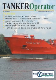
Features: - Tanker Operator
Features: - Tanker Operator
Features: - Tanker Operator

Create successful ePaper yourself
Turn your PDF publications into a flip-book with our unique Google optimized e-Paper software.
INDUSTRY - UKHO PROFILE<br />
HOs confident of having official ENCs in place<br />
Following the official launch of the<br />
Admiralty Vector Chart Service<br />
(AVCS) earlier this year, the UKHO's<br />
chief executive Mike Robinson said<br />
that the organisation was “very<br />
comfortable” with its progress.<br />
"The sales have exceeded our expectations"<br />
Robinson said. The UKHO is continuing with<br />
its policy of offering three-month trial<br />
licensing periods and thus far about 30 vessels<br />
had taken advantage of the offer. Feedback<br />
has been positive but like any new initiative,<br />
there have been some teething troubles<br />
requiring some fine tuning of the service.<br />
Negotiations are still underway with China<br />
and other countries with a view to having as<br />
many electronic navigational charts (ENCs)<br />
available as possible by the end of this year in<br />
a bid to cover most of the world's largest ports<br />
(see TANKER<strong>Operator</strong>, May, page 36).<br />
While inconsistencies in chart information<br />
are the same whether an ENC or a paper chart<br />
is being used, in the case of ENCs it becomes<br />
much more apparent to the mariner because on<br />
ECDIS adjacent ENCs are displayed together<br />
on screen, whereas paper charts are normally<br />
used one at a time. The problem is highlighted<br />
where ENCs overlap due to sensitive political<br />
boundary type issues, this affects ENCs in a<br />
number of areas around the world, although its<br />
impact on the mariner depends to some extent<br />
on which ECDIS is fitted.<br />
Another difficulty in producing a truly<br />
harmonised ENC dataset is that underlying<br />
hydrographic data could have come from<br />
surveys of different eras resulting in<br />
discontinuities at survey boundaries -<br />
especially where there is a mobile seabed.<br />
The UKHO said that it is determined to<br />
reduce the problems that inconsistency causes<br />
the mariner by working closely with other<br />
hydrographic offices (HOs) and by appropriate<br />
application of its compilation expertise.<br />
The organisation stated that the ENCs had<br />
to be at least as good as the paper charts<br />
currently used, "Users have come to expect<br />
accurate data from the UKHO", Robinson<br />
said. The UKHO is working with other (HOs)<br />
to ensure that the information issued by the<br />
Taunton-based organisation meets rigorous<br />
standards for accuracy and provides the<br />
mariner with the most appropriate<br />
navigational picture.<br />
Regarding the recent IMO NAV54<br />
recommendations; a consensus was reached on<br />
a mandatory carriage requirement for ECDIS<br />
starting in 2012; this will be put to the next<br />
Maritime Safety Committee (MSC) meeting.<br />
10<br />
The HOs believe they will have adequate ENC<br />
coverage and consistency by 2010 and that<br />
pricing levels will have reduced by then. Extra<br />
training within STCW will be needed to ensure<br />
that all navigators have the necessary skills to<br />
use ECDIS safely and effectively.<br />
The NAV54 recommendations were based<br />
around papers submitted by Norway and the<br />
UK. After much debate it was agreed tankers<br />
of over 3,000 gt and passenger vessels of over<br />
500 gt would be the first ship types to be<br />
fitted with ECDIS starting in 2012 for new<br />
hulls, with cargo vessels of over 3000 gt<br />
following in 2013. If these recommendations,<br />
which include retrofitting of existing tonnage<br />
by 2018, are adopted by MSC then this would<br />
mean around 60% take up of ECDIS across<br />
the board, Robinson thought. "ECDIS is the<br />
best method of navigation going forward. The<br />
starting gun was fired at NAV54," he added.<br />
The onus is now on HOs to produce the<br />
ENCs and ECDIS manufacturers to produce<br />
the systems. The UKHO is also looking to<br />
add layers to the ENCs so that other<br />
information that could be integrated into an<br />
ECDIS to support activities, such as passage<br />
planning and voyage execution. Digitising<br />
information, rather than relying on the paper<br />
format would provide greater flexibility in use<br />
of the data and was therefore the ultimate<br />
goal, the organisation said.<br />
Second phase<br />
The UKHO is in what it called a second phase<br />
of discussions with OEMs regarding the<br />
implementation of its plans. Given the lead<br />
times necessary it is hoped to be able to<br />
demonstrate 'front of bridge' operation<br />
sometime next year.<br />
Also under discussion at the IMO was<br />
ENavigation. This new concept could mean<br />
the provision of totally integrated services,<br />
including digitised port information running<br />
on the navigators' and masters' workstations<br />
and aimed at 'front end navigation'.<br />
One thing is certain, that when the use of<br />
ECDIS becomes mandatory in 2012 or later,<br />
depending on its adoption and ratification<br />
period, ENCs will have to be provided by<br />
Government approved HOs, so quite where<br />
this leaves the commercial vector data<br />
producers is not yet clear.<br />
However, the capacity to produce ENCs<br />
could be a problem in the near future for some<br />
nations, and so the UK, along with other states<br />
involved in hydrographic work, is offering<br />
assistance and training in producing ENCs,<br />
working through bi-lateral agreements and<br />
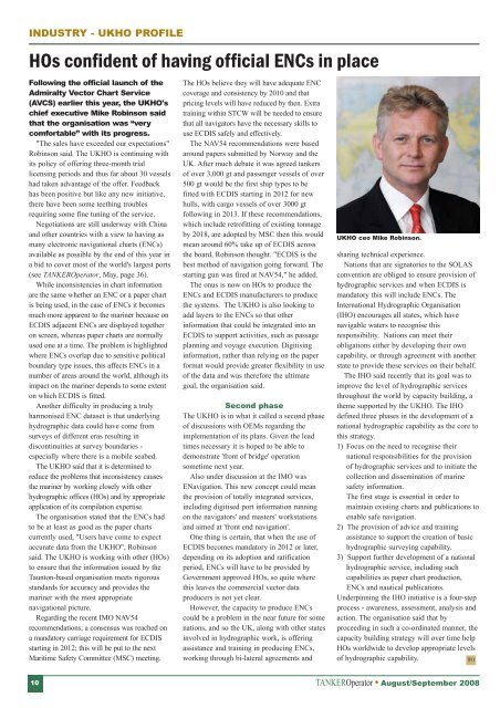
UKHO ceo Mike Robinson.<br />
sharing technical experience.<br />
Nations that are signatories to the SOLAS<br />
convention are obliged to ensure provision of<br />
hydrographic services and when ECDIS is<br />
mandatory this will include ENCs. The<br />
International Hydrographic Organisation<br />
(IHO) encourages all states, which have<br />
navigable waters to recognise this<br />
responsibility. Nations can meet their<br />
obligations either by developing their own<br />
capability, or through agreement with another<br />
state to provide these services on their behalf.<br />
The IHO said recently that its goal was to<br />
improve the level of hydrographic services<br />
throughout the world by capacity building, a<br />
theme supported by the UKHO. The IHO<br />
defined three phases in the development of a<br />
national hydrographic capability as the core to<br />
this strategy.<br />
1) Focus on the need to recognise their<br />
national responsibilities for the provision<br />
of hydrographic services and to initiate the<br />
collection and dissemination of marine<br />
safety information.<br />
The first stage is essential in order to<br />
maintain existing charts and publications to<br />
enable safe navigation.<br />
2) The provision of advice and training<br />
assistance to support the creation of basic<br />
hydrographic surveying capability.<br />
3) Support further development of a national<br />
hydrographic service, including such<br />
capabilities as paper chart production,<br />
ENCs and nautical publications.<br />
Underpinning the IHO initiative is a four-step<br />
process - awareness, assessment, analysis and<br />
action. The organisation said that by<br />
proceeding in such a co-ordinated manner, the<br />
capacity building strategy will over time help<br />
HOs worldwide to develop appropriate levels<br />
of hydrographic capability.<br />
TO<br />
TANKER<strong>Operator</strong> � August/September 2008