The pilot area of Auronzo di Cadore (Belluno) - Università Ca
The pilot area of Auronzo di Cadore (Belluno) - Università Ca
The pilot area of Auronzo di Cadore (Belluno) - Università Ca

Create successful ePaper yourself
Turn your PDF publications into a flip-book with our unique Google optimized e-Paper software.
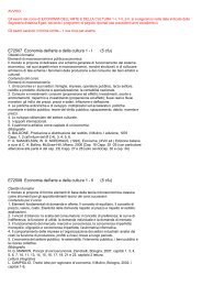
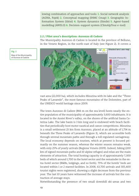
Fig. 2<br />
Map <strong>of</strong> the Municipality<br />
<strong>of</strong> <strong>Auronzo</strong> <strong>di</strong> <strong><strong>Ca</strong>dore</strong><br />
lowing combination <strong>of</strong> approaches and tools: 1. Social network analysis<br />
(AGNA, Pajek) 2. Conceptual mapping (IHMC Cmap) 3. Geographic Information<br />
System (Idrisi) 4. System dynamics (Simile) 5. Agent-based<br />
modelling (AWS1.0) 6. Decision-support system (ClimAlpTour e-tool)<br />
2.2 / Pilot <strong>area</strong>’s description: <strong>Auronzo</strong> <strong>di</strong> <strong><strong>Ca</strong>dore</strong><br />
<strong>The</strong> Municipality <strong>Auronzo</strong> <strong>di</strong> <strong><strong>Ca</strong>dore</strong> is located in the province <strong>of</strong> <strong>Belluno</strong>,<br />
in the Veneto Region, in the north-east <strong>of</strong> Italy (see Figure 2). It covers a<br />
vast <strong>area</strong> (22,000 ha), which includes Misurina with its lake and the “Three<br />
Peaks <strong>of</strong> Lavaredo”, the most famous mountains <strong>of</strong> the Dolomites, part <strong>of</strong><br />
the UNESCO world heritage since 2009.<br />
<strong>The</strong> town <strong>Auronzo</strong> <strong>di</strong> <strong><strong>Ca</strong>dore</strong> (866 m on the sea level) hosts nearly the entire<br />
population <strong>of</strong> the municipality <strong>of</strong> approximately 3,600 inhabitants. It is<br />
located in the Ansiei River’s valley, on the shores <strong>of</strong> the artificial Santa <strong>Ca</strong>terina<br />
Lake. <strong>The</strong> lake basin is 3 km long and is endowed with beach facilities<br />
that perio<strong>di</strong>cally host motor nautical and canoe competitions. Misurina<br />
is a small settlement 25 km from <strong>Auronzo</strong>, placed at an altitude <strong>of</strong> 1,754 m<br />
beneath the Three Peaks <strong>of</strong> Lavaredo (Figure 3), which are accessible both<br />
through several mountain paths and through a toll regulated carriageway.<br />
<strong>The</strong> local economy depends on tourism, which at present is focused primarily<br />
on the summer season, whereas the winter season remains weak,<br />
with only 25% <strong>of</strong> yearly arrivals (Regione Veneto 2009). Indeed, hiking (200<br />
km <strong>of</strong> signed mountain paths and 10 alpine refuges) and relax are the main<br />
elements <strong>of</strong> attraction. <strong>The</strong> total hosting capacity is <strong>of</strong> approximately 7,300<br />
beds <strong>of</strong> which around 1,700 in the hotel sector and the remainder in the extra-hotel<br />
sector (B&Bs, lodgings, and so forth). 75% <strong>of</strong> the hotels’ beds are<br />
located within 1 or 2 starred facilities. In 2008, 63,700 arrivals and 305,400<br />
tourist nights were registered, showing a slight decrease from the previous<br />
year. <strong>The</strong> last 10 years have witnessed the increase <strong>of</strong> arrivals but the contraction<br />
<strong>of</strong> average stays.<br />
Notwithstan<strong>di</strong>ng the presence <strong>of</strong> two small downhill ski-<strong>area</strong>s and two<br />
13