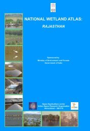
national wetland atlas assam - Ministry of Environment and Forests
national wetland atlas assam - Ministry of Environment and Forests
national wetland atlas assam - Ministry of Environment and Forests
You also want an ePaper? Increase the reach of your titles
YUMPU automatically turns print PDFs into web optimized ePapers that Google loves.
Wetl<strong>and</strong>s defined as areas <strong>of</strong> l<strong>and</strong> that are either temporarily or permanently covered by water exhibit<br />
enormous diversity according to their genesis, geographical location, water regime <strong>and</strong> chemistry. Wetl<strong>and</strong>s<br />
are one <strong>of</strong> the most productive ecosystems <strong>and</strong> play crucial role in hydrological cycle. Utility wise, <strong>wetl<strong>and</strong></strong>s<br />
directly <strong>and</strong> indirectly support millions <strong>of</strong> people in providing services such as storm <strong>and</strong> flood control, clean<br />
water supply, food, fiber <strong>and</strong> raw materials, scenic beauty, educational <strong>and</strong> recreational benefits. The<br />
Millennium Ecosystem Assessment estimates conservatively that <strong>wetl<strong>and</strong></strong>s cover seven percent <strong>of</strong> the earth’s<br />
surface <strong>and</strong> deliver 45% <strong>of</strong> the world’s natural productivity <strong>and</strong> ecosystem services. However, the very<br />
existence <strong>of</strong> these unique resources is under threat due to developmental activities, <strong>and</strong> population pressure.<br />
This calls for a long term planning for preservation <strong>and</strong> conservation <strong>of</strong> these resources. An updated <strong>and</strong><br />
accurate database that will support research <strong>and</strong> decision is the first step towards this. Use <strong>of</strong> advanced<br />
techniques like Satellite remote sensing, Geographic Information System (GIS) is now essential for accurate<br />
<strong>and</strong> timely spatial database <strong>of</strong> large areas. Space Applications Centre (ISRO) took up this challenging task<br />
under the project “NWIA” (National Wetl<strong>and</strong> Inventory <strong>and</strong> Assessment) sponsored by <strong>Ministry</strong> <strong>of</strong><br />
<strong>Environment</strong> & <strong>Forests</strong>. To account for numerous small yet important <strong>wetl<strong>and</strong></strong>s found in the country, mapping<br />
at 1:50,000 scales has been taken up. Two date IRS LISS III data acquired during pre <strong>and</strong> post monsoon<br />
season are used for inventory to account for wet <strong>and</strong> dry season hydrology <strong>of</strong> <strong>wetl<strong>and</strong></strong>s. The map outputs<br />
include the status <strong>of</strong> water spread, aquatic vegetation <strong>and</strong> turbidity. Ancillary layers like road/rail, habitations<br />
are also created. Very small <strong>wetl<strong>and</strong></strong>s below the mappable unit are also identified <strong>and</strong> shown points. The<br />
results are complied as Atlases <strong>of</strong> <strong>wetl<strong>and</strong></strong>s for states/Union Territories <strong>of</strong> India. This Atlas highlights results<br />
for a particular state/UT <strong>and</strong> hopes to improve our underst<strong>and</strong>ing <strong>of</strong> the dynamics <strong>and</strong> distribution <strong>of</strong> <strong>wetl<strong>and</strong></strong>s<br />
<strong>and</strong> their status in the area.<br />
I congratulate the team for bringing out this informative <strong>atlas</strong> <strong>and</strong> sincerely hope that this will serve as a<br />
useful source <strong>of</strong> information to researchers, planners <strong>and</strong> general public.<br />
January 25, 2010<br />
FOREWORD


