D-BAUG - Departement Bau, Umwelt und Geomatik - ETH Zürich
D-BAUG - Departement Bau, Umwelt und Geomatik - ETH Zürich
D-BAUG - Departement Bau, Umwelt und Geomatik - ETH Zürich

You also want an ePaper? Increase the reach of your titles
YUMPU automatically turns print PDFs into web optimized ePapers that Google loves.
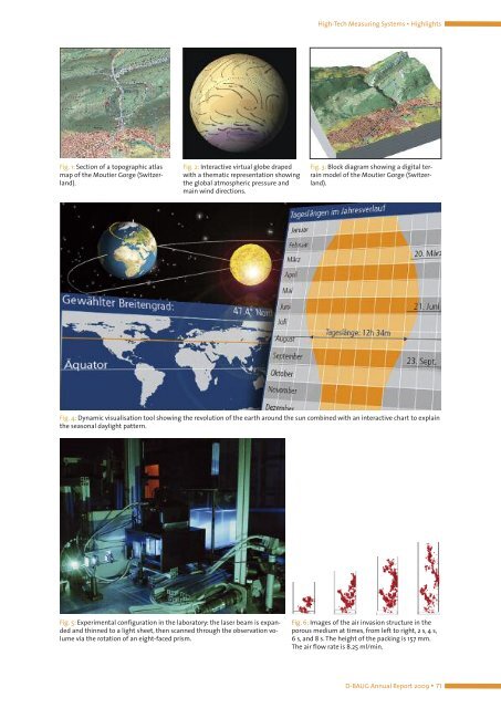
Fig. 1: Section of a topographic atlas<br />
map of the Moutier Gorge (Switzerland).<br />
Fig. 2: Interactive virtual globe draped<br />
with a thematic representation showing<br />
the global atmospheric pressure and<br />
main wind directions.<br />
High-Tech Measuring Systems ▪ Highlights<br />
Fig. 3: Block diagram showing a digital terrain<br />
model of the Moutier Gorge (Switzerland).<br />
Fig. 4: Dynamic visualisation tool showing the revolution of the earth aro<strong>und</strong> the sun combined with an interactive chart to explain<br />
the seasonal daylight pattern.<br />
Fig. 5: Experimental configuration in the laboratory: the laser beam is expanded<br />
and thinned to a light sheet, then scanned through the observation volume<br />
via the rotation of an eight-faced prism.<br />
Fig. 6: Images of the air invasion structure in the<br />
porous medium at times, from left to right, 2 s, 4 s,<br />
6 s, and 8 s. The height of the packing is 157 mm.<br />
The air flow rate is 8.25 ml/min.<br />
D-<strong>BAUG</strong> Annual Report 2009 ▪ 71