D-BAUG - Departement Bau, Umwelt und Geomatik - ETH Zürich
D-BAUG - Departement Bau, Umwelt und Geomatik - ETH Zürich
D-BAUG - Departement Bau, Umwelt und Geomatik - ETH Zürich

Create successful ePaper yourself
Turn your PDF publications into a flip-book with our unique Google optimized e-Paper software.
High-Tech Measuring Systems ▪ Highlights<br />
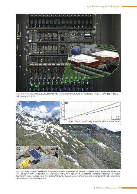
Fig. 1: Part of the new compute cluster, based on Intel new Nehalem architecture. The inset shows one blade (IBM HS22) in detail,<br />
with passive heat sinks.<br />
Fig. 2: (a) GPS test network on the Dirru rockglacier, with three permanent GPS stations. The yellow dashed line delimits the rockglacier<br />
area. (b) GPS station installed on the rockglacier, including (from right to left) GPS antenna, solar panel and instrument box containing<br />
GPS receiver and battery. (c) Time series of horizontal displacements of GPS stations DIR2 (green) and DIR3 (blue), from June<br />
12th to October 14th 2009 (4 months).<br />
D-<strong>BAUG</strong> Annual Report 2009 ▪ 73