


You also want an ePaper? Increase the reach of your titles
YUMPU automatically turns print PDFs into web optimized ePapers that Google loves.
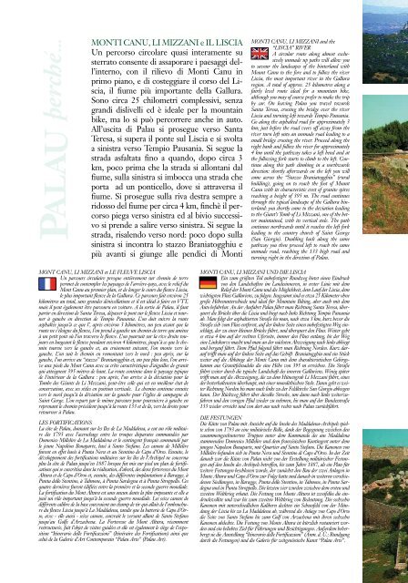
MONTI CANU, LI MIZZANI e IL LISCIA<br />
Un percorso circolare quasi interamente su<br />
sterrato consente di assaporare i paesaggi dell’interno,<br />
con il rilievo di Monti Canu in<br />
primo piano, e di costeggiare il corso del Liscia,<br />
il fiume più importante della Gallura.<br />
Sono circa 25 chilometri complessivi, senza<br />
grandi dislivelli ed è ideale per la mountain<br />
bike, ma lo si può percorrere anche in auto.<br />
All’uscita di <strong>Palau</strong> si prosegue verso Santa<br />
Teresa, si supera il ponte sul Liscia e si svolta<br />
a sinistra verso Tempio Pausania. Si segue la<br />
strada asfaltata fino a quando, dopo circa 3<br />
km, poco prima che la strada si allontani dal<br />
fiume, sulla sinistra si imbocca una strada che<br />
porta ad un ponticello, dove si attraversa il<br />
fiume. Si prosegue sulla riva destra sempre a<br />
ridosso del fiume per circa 4 km, finchè il percorso<br />
piega verso sinistra ed al bivio successivo<br />
si prende a salire verso sinistra. Si segue la<br />
strada, risalendo verso nord: poco dopo sulla<br />
sinistra si incontra lo stazzo Braniatogghiu e<br />
più avanti si giunge alle pendici di Monti<br />
MONTI CANU, LI MIZZANI and the<br />
“LISCIA” RIVER<br />
A circular route along almost exclusively<br />
unmade up paths will allow you<br />
to savour the landscapes of the hinterland with<br />
Mount Canu to the fore and to follow the river<br />
Liscia, the most important river in the Gallura<br />
region. A total of approx. 25 kilometres along a<br />
fairly level route ideal for a mountain bike,<br />
although you may of course prefer to make the trip<br />
by car. On leaving <strong>Palau</strong> you travel towards<br />
Santa Teresa, crossing the bridge over the river<br />
Liscia and turning left towards Tempio Pausania.<br />
Go along the asphalted road for approximately 3<br />
km; just before the road veers off away from the<br />
river turn left onto an unmade road leading to a<br />
small bridge crossing the river. Proceed along the<br />
right bank and follow the river for approximately<br />
4 km until the pathway takes a left bend and at<br />
the following fork starts to climb to the left. Continue<br />
along this path climbing in a northwards<br />
direction: shortly afterwards on the left you will<br />
come across the “Stazzo Braniatogghiu” (rural<br />
building), going on to reach the foot of Mount<br />
Canu with its characteristic crest of granite spires<br />
reaching a height of 395 m. The road continues<br />
through the typical landscape of the Gallura hinterland:<br />
you shortly come to the deviation leading<br />
to the Giant’s Tomb of Li Mizzani, one of the better<br />
maintained, with its vertical stele. The path<br />
continues northwards until it reaches the left fork<br />
leading to the country church of Saint George<br />
(San Giorgio). Doubling back along the same<br />
pathway you then proceed left to reach the same<br />
unmade road, reaching the 133 high road and<br />
turning right in the direction of <strong>Palau</strong>.<br />
MONT CANU, LI MIZZANI et LE FLEUVE LISCIA<br />
Un parcours circulaire presque entièrement sur chemin de terre<br />
permet de contempler les paysages de l’arrière-pays, avec le relief du<br />
Mont Canu au premier plan, et de longer le cours du fleuve Liscia,<br />
le plus important fleuve de la Gallura. Ce parcours fait environ 25<br />
kilomètres au total, sans grandes dénivellations et il est idéal à faire en VTT,<br />
mais il peut également être parcouru en voiture. A la sortie de <strong>Palau</strong>, il faut<br />
partir en direction de Santa Teresa, dépasser le pont sur le fleuve Liscia et tourner<br />
à gauche en direction de Tempio Pausania. L’on doit suivre la route<br />
asphaltée jusqu’à ce que l’, après environ 3 kilomètres, un peu avant que la<br />
route ne s’éloigne du fleuve, l’on prend à gauche un chemin de terre qui amène<br />
à un petit pont où l’on traverse le fleuve. L’on poursuit sur la rive droite toujours<br />
en longeant le fleuve pendant environ 4 kilomètres, jusqu’à ce que le chemin<br />
tourne vers la gauche et, au croisement suivant, l’on monte vers la<br />
gauche. L’on suit le chemin en remontant vers le nord : peu après, sur la<br />
gauche, l’on arrive au “stazzo” Braniatogghiu et, un peu plus loin, l’on arrive<br />
aux pieds du Mont Canu avec sa crête caractéristique d’aiguilles de granit<br />
qui atteignent 395 mètres de haut. La route continue dans le paysage typique<br />
de l’intérieur de la Gallura : peu après, l’on arrive à la déviation pour la<br />
Tombe des Géants de Li Mezzani, peut-être celle qui est en meilleur état de<br />
conservation, avec ses stèles en position verticale. Le chemin continue ensuite<br />
vers le nord jusqu’à la déviation sur la gauche pour l’église de campagne de<br />
Saint Gorge. L’on repart par le même parcours pour poursuivre à gauche en<br />
reprenant le chemin précédent jusqu’à la route 133 et de là, vers la droite pour<br />
retourner à <strong>Palau</strong>.<br />
LES FORTIFICATIONS<br />
La côte de <strong>Palau</strong>, donnant sur les Iles de La Maddalena, a eut un rôle militaire<br />
dès 1793 avec l’accrochage entre les troupes disparates commandées par<br />
Domenico Millelire de La Maddalena et le contingent français commandé par<br />
le jeune Napoléon Bonaparte, basé à Santo Stefano. Les canons de Millelire<br />
furent en effet basés à Punta Nera et au Stentino de Capo d’Orso. Ensuite, le<br />
développement des fortifications militaires sur les îles de l’Archipel ne concerna<br />
plus la côte de <strong>Palau</strong> jusqu’en 1887 lorsque fut mis sur pied un plan de fortifications<br />
qui se concrétisa dans la réalisation, d’abord, des deux forteresses du Mont<br />
Altura et de Capo d’Orso et, ensuite, des différentes implantations à Baragge, à<br />
Punta dello Stentino, à Talmone, à Punta Sardegna et à Punta Stroppello. Ces<br />
quatre dernières furent édifiées entre la première et la seconde guerre mondiale.<br />
La fortification du Mont Altura est sans aucun doute la plus imposante et elle a<br />
joué un rôle important jusqu’à la seconde guerre mondiale. Les seize canons de<br />
différents calibre de la base couvraient un champ de tir qui allait de l’embouchure<br />
du fleuve Liscia jusqu’à La Maddalena, tandis que la batterie de Capo d’Orso,<br />
avec - elle aussi - seize canons, couvrait le versant allant de Santo Stefano<br />
jusqu’au Golfe d’Arzachena. La Forteresse du Mont Altura, récemment<br />
restructurée, fait l’objet de visites guidées et elle est également le siège de l’exposition<br />
“Itinerario delle Fortificazioni” (Itinéraire des Fortifications) ainsi que<br />
celui de la Galerie d’Art Contemporain “<strong>Palau</strong> Arte” (<strong>Palau</strong> Art).<br />
MONTI CANU, LI MIZZANI UND DIE LISCIA<br />
Ein zum größten Teil unbefestigter Rundweg bietet einen Eindruck<br />
von den Landschaften im Landesinneren, in erster Linie mit dem<br />
Relief der Monti Canu und die Möglichkeit, dem Lauf der Liscia, dem<br />
wichtigsten Fluss Galluriens, zu folgen. Insgesamt sind es etwa 25 Kilometer ohne<br />
große Höhenunterschiede und ideal für Mountain Biking, aber auch mit dem<br />
Auto befahrbar. An der Ausfahrt <strong>Palau</strong> fährt man Richtung Santa Teresa, überquert<br />
die Brücke über die Liscia und biegt nach links Richtung Tempio Pausania<br />
ab. Man folgt der asphaltierten Straße bis man, nach etwa 3 km, kurz bevor die<br />
Straße sich vom Fluss entfernt, auf der linken Seite einen unbefestigten Weg einschlägt,<br />
der zu einer kleinen Brücke führt, und überquert den Fluss. Weiter geht<br />
es etwa 4 km auf der rechten Uferseite, immer den Fluss entlang, bis der Weg<br />
eine Linkskurve macht und man an der nächsten Abzweigung nach links abbiegt<br />
und bergauf fährt. Dem Pfad folgend fährt man Richtung Norden. Kurz darauf<br />
trifft man auf der linken Seite auf das Gehöft Braniatogghiu und ein Stück<br />
weiter auf die Abhänge der Monti Canu mit dem charakteristischen Gebirgskamm<br />
aus Granitfelsnadeln die eine Höhe von 395 m erreichen. Die Straße<br />
führt weiter durch die typische Landschaft des inneren Galluriens. Wenig später<br />
trifft man auf die Abzweigung, die zu dem Hünengrab Li Mezzani führt, eines<br />
der besterhaltensten überhaupt, mit einer monolithischen Stele. Dann geht es weiter<br />
Richtung Norden bis man nach links zu der Feldkirche San Giorgio abbiegen<br />
kann. Der Rückweg führt über dieselbe Strecke, um dann nach links weiterzufahren<br />
und den vorigen Pfad wieder zu nehmen, bis man auf der Bundesstraße<br />
133 wieder erreicht und von dort aus nach rechts nach <strong>Palau</strong> zurückfährt.<br />
DIE FESTUNGEN<br />
Die Küste von <strong>Palau</strong> mit Aussicht auf die Inseln des Maddalena-Archipels spielte<br />
schon von 1793 an eine militärische Rolle, dank der Begegnung zwischen den<br />
zusammengeschusterten Truppen unter dem Kommando des aus Maddalena<br />
stammenden Domenico Millelire und dem französischen Kontingent unter dem<br />
jungen Napoleon Bonaparte, mit Quartier auf Santo Stefano. Die Kanonen von<br />
Millelire befanden sich in Punta Nera und Stentino di Capo d’Orso. In der Zeit<br />
danach war die Küste von <strong>Palau</strong> nicht von der Erstellung militärischer Festungen<br />
auf den Inseln des Archipels betroffen, bis zum Jahre 1887, als ein Plan für<br />
weitere Festungen beschlossen wurde, der zunächst den Bau der zwei Anlagen in<br />
Monte Altura und Capo d’Orso zur Folge hatte und danach in weiteren verschiedenen<br />
Siedlungen, in Baragge, Punta dello Stentino, in Talmone, in Punta Sardegna<br />
und in Punta Stroppello. Die letzten vier wurden zwischen dem ersten und<br />
zweiten Weltkrieg erbaut. Die Festung von Monte Altura ist zweifellos die eindrucksvollste<br />
und war bis zum zweiten Weltkrieg von Bedeutung. Die sechzehn<br />
Kanonen mit unterschiedlichen Kalibern deckten ein Schussfeld von der Mündung<br />
der Liscia bis zu La Maddalena ab, während die Anlage von Capo d’Orso<br />
die Seite von Santo Stefano bis zum Golf von Arzachena mit ihren sechzehn<br />
Kanonen abdeckte. Die Festung von Monte Altura ist kürzlich restauriert worden<br />
und ein beliebtes Ziel für Führungen und Besichtigungen. Außerdem beherbergt<br />
sie die Ausstellung “Itinerario delle Fortificazioni” (Anm. d. Ü.: Rundgang<br />
durch die Festungen) und die Galerie für zeitgenössische Kunst “<strong>Palau</strong> Arte”.


