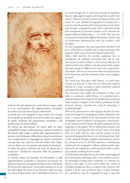
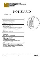
http://it.wikipedia.org/wiki/File:Da_V<strong>in</strong>ci_Vitruve_Luc_Viatour.jpgConsiderato solo <strong>in</strong> questi term<strong>in</strong>i, però, l’<strong>in</strong>tero metodoproposto d<strong>al</strong>la Descriptio potrebbe apparire <strong>al</strong>la f<strong>in</strong>e unamera esercitazione accademica, ancorché caratterizzatad<strong>al</strong>l’<strong>in</strong>novativo metodo del riporto per coord<strong>in</strong>ate polari,la cui v<strong>al</strong>idità risulterebbe, <strong>al</strong> primo acchito, confermataesclusivamente ai f<strong>in</strong>i della riproduzione fedele di una pianta;la novità <strong>in</strong>trodotta da t<strong>al</strong>e metodo non è affatto limitata<strong>al</strong>la sola replica <strong>geometrica</strong> dell’orig<strong>in</strong><strong>al</strong>e mappa rilevata,<strong>al</strong>la qu<strong>al</strong>e pur si potrebbe giungere semplicemente perlucidatura del primo <strong>modello</strong>, ma consiste nell’<strong>in</strong>troduzionedel concetto di “sc<strong>al</strong>abilità” del dato orig<strong>in</strong>ario, consentendo<strong>al</strong> cartografo di ricavare, dai medesimi dati di posizione, nschemi di impianto planimetrico simili, tutti <strong>in</strong> rapportodiverso d<strong>al</strong> primo <strong>modello</strong>, e qu<strong>in</strong>di anche d<strong>al</strong> vero, <strong>al</strong> variaredel fattore di proporzion<strong>al</strong>ità scelto per la def<strong>in</strong>izione delledistanze d<strong>al</strong>l’orig<strong>in</strong>e, cioè della sc<strong>al</strong>a di rappresentazione dellamappa.Anche se Alberti non re<strong>al</strong>izza una pianta urbana così comeoggi noi la <strong>in</strong>tendiamo, il suo metodo segna di fatto unmomento importantissimo nella storia della Cartografia,che va <strong>al</strong> di là del primato, pur non secondario, relativo<strong>al</strong>la rappresentazione urbana della “Città eterna”, perché,proprio con l’ideazione di questo metodo di posizionamentoper coord<strong>in</strong>ate polari, si propone un criterio oggettivo direstituzione grafica della pianta di una città e qu<strong>in</strong>di ripetibileanche <strong>al</strong> variare dell’artefice.Da questa esperienza si apre def<strong>in</strong>itivamente la strada dellar<strong>in</strong>ascenza cartografica, con l’affrancamento da quell’approcciofantastico o anagogico, tipico di certa <strong>cartografia</strong> mediev<strong>al</strong>e,e si segnano i prodromi di quella rivoluzione che due secolidopo avrebbe posto il problema del posizionamento <strong>al</strong> centrodella problematica cartografica.Sullo specifico piano della rappresentazione, è <strong>al</strong> contributodei nuovi topografi, pittori e m<strong>in</strong>iaturisti r<strong>in</strong>asciment<strong>al</strong>i chesi deve il raggiungimento di un ulteriore progresso per lare<strong>al</strong>izzazione di mappe dotate di sempre maggiori capacitàespressive e descrittive.A distanza di circa c<strong>in</strong>quant’anni d<strong>al</strong>la redazione dei saggi<strong>al</strong>bertiani, un’<strong>al</strong>tra figura imponente della storia della scienzae dell’arte, Leonardo da V<strong>in</strong>ci (1452 - 1519), apporta <strong>al</strong>ladiscipl<strong>in</strong>a un contributo di orig<strong>in</strong><strong>al</strong>ità senza precedenti, <strong>sulla</strong>scorta delle conoscenze della Geographia di Tolomeo e deisaggi di Leon Battista Alberti, sia nelle operazioni di disegnod<strong>al</strong> vero con strumenti prospettografici (come il “Velo”<strong>in</strong>ventato d<strong>al</strong>lo stesso Alberti per rendere controllabili d<strong>al</strong>punto di vista geometrico le vedute prospettiche), sia nelleoperazioni di rilevamento, sia nella redazione delle carte.La produzione cartografica di Leonardo si staglia millemiglia verso l’<strong>al</strong>to rispetto agli <strong>in</strong>genui ed <strong>in</strong>fantili disegni diLeonardo da V<strong>in</strong>ci, Uomo VitruvianoLeonardo da V<strong>in</strong>ci, Vitruvian Manrepresentations of the land were simplistic, we should look attwo maps of Tuscany from the XV century: the “Copia di unantico disegno rappresentante i laghi di Sesto, di Bient<strong>in</strong>a edi V<strong>al</strong>d<strong>in</strong>ievole dell’anno 1450 circa” [“Copy of an ancientmap of the lakes of Sesto, of Bient<strong>in</strong>a and of V<strong>al</strong>d<strong>in</strong>ievole-1450 approx.-”] and the “Carta trovata nell’archivio deiMonaci Cass<strong>in</strong>esi di S.Flora e Lucilla di Arezzo” [“Mapfound <strong>in</strong> the Archives of the Cass<strong>in</strong>o monks of S. Flora andLucilla near Arezzo”], <strong>in</strong> the same years.The fi rst one, without consider<strong>in</strong>g any exact metric<strong>al</strong>measurement, gives the location of build-up areas, roads,rivers, mounta<strong>in</strong>s (with their specifi c topographic<strong>al</strong> names).The second one, similarly lack<strong>in</strong>g <strong>in</strong> any geometric<strong>al</strong> l<strong>in</strong>kwith the re<strong>al</strong>ity, describes settl<strong>in</strong>gs, roads and bridges, rivers,navigable stretches of water, and land uses, with <strong>al</strong>l the namesof the places and the different roads.Most of <strong>al</strong>l, Ptolemy teaches that a portion of a spheric<strong>al</strong>surface can be represented on a plane through projections andright geographic<strong>al</strong> coord<strong>in</strong>ates. The land surveyors of the timedidn’t become immediately aware of this lesson. Therefore,there was a relevant diff erence between geographic<strong>al</strong> andchorographic<strong>al</strong> representations follow<strong>in</strong>g the Ptolemaic theoryand topographic<strong>al</strong> draw<strong>in</strong>gs where imitation still resistedaga<strong>in</strong>st geometric<strong>al</strong> rules.In his translation from Greek <strong>in</strong>to Lat<strong>in</strong> of the Ptolemy’sGeographia, Iacopo Angeli from Scarperia put a strongevidence on the revolutionary <strong>in</strong>novation <strong>in</strong>troduced by thework of the scientist from Alexandria: a demonstration of howto trace a sphere on a plane surface, ma<strong>in</strong>ta<strong>in</strong><strong>in</strong>g the “proportiocuiusque partis ad univers<strong>al</strong>e” [the proportions between thes<strong>in</strong>gle parts and the whole]. Nevertheless, only after many years,with<strong>in</strong> the cultur<strong>al</strong> context of the Renaissance, a new <strong>in</strong>teresttowards cartography grew <strong>al</strong>so among the technicians. Thatgave way to new studies, and orig<strong>in</strong>ated many cartographic<strong>al</strong>treatises.The leader of this generation of scientists was Leon BattistaAlberti. He recovered the middle-age know-how and thecontribution of the Ptolemaic Geographia <strong>in</strong> order to<strong>in</strong>troduce new theories and new methods <strong>in</strong> the cartographic<strong>al</strong>and topographic<strong>al</strong> fi elds.Two m<strong>in</strong>or works of Alberti represent the fi rst step <strong>in</strong>the cartographic<strong>al</strong> modell<strong>in</strong>g <strong>in</strong> It<strong>al</strong>y: Ex ludis rerummathematicarum, ended before 1450, and Descriptio urbisRomae, written between 1443 and 1455. Other <strong>in</strong>terest<strong>in</strong>gclues can be found <strong>in</strong> De Pictura, <strong>in</strong> De Statua, and De reaedificatoria.The fi rst of these essays conta<strong>in</strong>s, among other th<strong>in</strong>gs, a sort ofante litteram “handbook” of Topography. Parti<strong>al</strong>ly recover<strong>in</strong>ga long scholar tradition dat<strong>in</strong>g up to Euclid, <strong>in</strong> this text Alberticollects the most important mathematic tricks that can giveanswers to measurement problems that are apparently withouta solution, unless a method of <strong>in</strong>direct c<strong>al</strong>culation is applied.The problems presented by an <strong>in</strong>direct measurement of distances65
ANNO I | n. 6 | NOVEMBRE - DICEMBRE 2009territorio dei tanti agrimensori e periti del suo tempo, anchese il suo avvic<strong>in</strong>amento <strong>al</strong>la rappresentazione cartograficanon deriva certo da <strong>in</strong>tenti di tipo profession<strong>al</strong>e.Leonardo non è un cartografo <strong>in</strong> senso stretto, ma si occupadi <strong>cartografia</strong> per specifiche necessità di studio e per esigenzedi an<strong>al</strong>isi, f<strong>in</strong><strong>al</strong>izzate <strong>al</strong>la progettazione territori<strong>al</strong>e o <strong>al</strong>lapianificazione di attività belliche.Per entrare più direttamente nel merito delle sue operecartografiche bisogna prelim<strong>in</strong>armente spostare l’attenzioned<strong>al</strong> mondo delle mappe a quello della rappresentazione <strong>in</strong>gener<strong>al</strong>e, cioè del disegno e della pittura, che per Leonardo nonsono semplicemente un l<strong>in</strong>guaggio per ripetere visivamentecose già note, ma, come ha osservato Giulio Carlo Argan,“sono la chiave con cui si penetra nel mondo dei fenomeni”.È <strong>in</strong>fatti dai precetti derivanti d<strong>al</strong> Libro di pittura che sirecuperano i fondamenti <strong>in</strong>novativi della sua produzionecartografica.La formula adotta da Leonardo nel rilevamento e nellarappresentazione cartografica è s<strong>in</strong>tetizzata nel precetto cheegli stesso ferma nei suoi appunti del Manoscritto L dell’Istitutodi Francia, dove egli annota: “scorta sulle sommità e <strong>in</strong> su’ latidei colli le figure di terreni e le sue divisioni e nelle cose voltea te, f<strong>al</strong>e <strong>in</strong> propria forma” (Ms. L dell’Istituto di Francia, f. 21are solved through the use of the fi rst pr<strong>in</strong>ciple of similitudebetween right-angled triangles and through the so c<strong>al</strong>led “ruleof three”. However, the most relevant contribution of this workconsist <strong>in</strong> a new method of topographic<strong>al</strong> survey<strong>in</strong>g that ismeant to solve the question of the mutu<strong>al</strong> position on the urbansc<strong>al</strong>e through a triangulation work. Such a work had <strong>al</strong>readybeen anticipated by Giovanni Fontana <strong>in</strong> his Tractatus detrigono b<strong>al</strong>istario abbreviatus […] <strong>in</strong> 1440. This essay wasrecovered and completed by diff erent Renaissance scholars, andwas furthermore ameliorated for other fi ve centuries, untilnowadays.For this triangulation, they used a goniometer divided <strong>in</strong> 48parts, still without an <strong>al</strong>idade and a compass po<strong>in</strong>t<strong>in</strong>g to themagnetic North, and still with the help of a plumb l<strong>in</strong>e.Alberti fully describes his method, expla<strong>in</strong><strong>in</strong>g how tomanufacture the adequate <strong>in</strong>strument and, step by step,how operate <strong>in</strong> order to obta<strong>in</strong> a correct survey. Moreover, heexpla<strong>in</strong>s <strong>al</strong>l the rules to follow <strong>in</strong> the observation of the angulardirections among the diff erent sites and <strong>in</strong> their registrations.Nevertheless, there are no <strong>in</strong>structions about the representationof the dimensions and the orientation of the various polygonssurveyed.The second essay, Descriptio urbis Romae, is a much moreorig<strong>in</strong><strong>al</strong> step forward. It shows how an urban plan could besketched on a map, accord<strong>in</strong>g to polar coord<strong>in</strong>ates collectedand organised with<strong>in</strong> standard tables.The <strong>in</strong>strument that enables the technicians to draw suchtables is a protractor, c<strong>al</strong>led Orizon. It is provided with agraduated radius that is h<strong>in</strong>ged <strong>in</strong> the middle of the <strong>in</strong>strumentitself, exactly as it happens <strong>in</strong> the modern, graduated circularprotractor hav<strong>in</strong>g a pivoted arm, used for measur<strong>in</strong>g ormark<strong>in</strong>g off angles.When it has represented on a sheet of paper the plan of a townmeasured through the triangulation method expla<strong>in</strong>ed <strong>in</strong> theLudi, a surveyor establish <strong>in</strong> this representation the basis of acartographic system of reference: start<strong>in</strong>g from a centr<strong>al</strong> po<strong>in</strong>t,he can measure with the Orizon the polar coord<strong>in</strong>ates of everys<strong>in</strong>gle place on the graphic. We are t<strong>al</strong>k<strong>in</strong>g about distances andangles from a start<strong>in</strong>g po<strong>in</strong>t that can give way to the sett<strong>in</strong>gdown of a table with the name and the position of everyrepresented topographic<strong>al</strong> detail, a sort of encrypted map. Sucha table, obta<strong>in</strong>ed through a graphic<strong>al</strong> representation and notby a practic<strong>al</strong> survey on the fi eld, represents a revolutionarystep forward: the cartographer will<strong>in</strong>g to obta<strong>in</strong> another map,identic<strong>al</strong> to the orig<strong>in</strong><strong>al</strong> one, could certa<strong>in</strong>ly be able to make acopy perfectly match<strong>in</strong>g the fi rst sample.Considered from this po<strong>in</strong>t of view, the whole method suggestedby the Descriptio could appear like a mere academic exercise:the advantages of tak<strong>in</strong>g polar coord<strong>in</strong>ates as a reference areobvious at fi rst sight, as such a process <strong>al</strong>lows the creation ofa faithful reproduction from an orig<strong>in</strong><strong>al</strong> map. However, thismethod is by far more productive than a simple techniquefor a geometric<strong>al</strong> copy of a topographic<strong>al</strong> map (a copy thathttp://it.wikipedia.org/wiki/File:Leonardo_self.jpg66